Cemeteries of Faribault County
The information here is provided compliments of Diane Oldfather, Darcy Fritche, Betty Jean Sonnek, Joanne Hintz, and Tom Hintz.
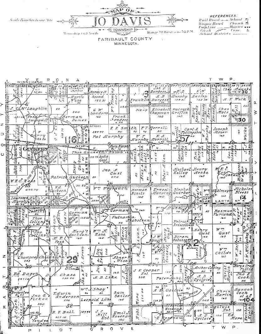
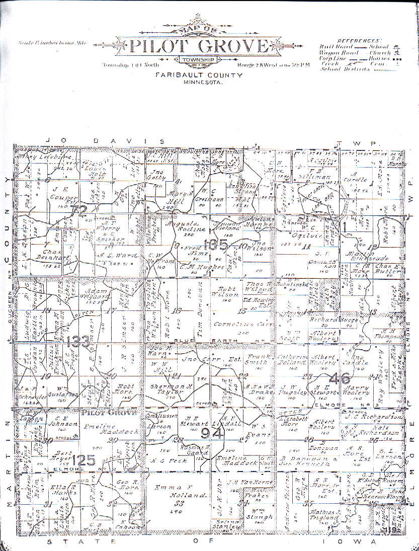
In the future I hope to have the scanned township maps showing the rough locations of the cemeteries. Index of some of the markers at the cemeteries. New cemeteries will be added constantly through out the summer of 2003. The index may not be as current as the cemetery listings on this page.
TOWNSHIPS
Other cemeteries -
Alden Township, Freeborn County, MN.
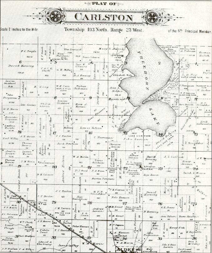
Carlston Township, Freeborn County, MN.
Freeborn Township, Freeborn County, MN.
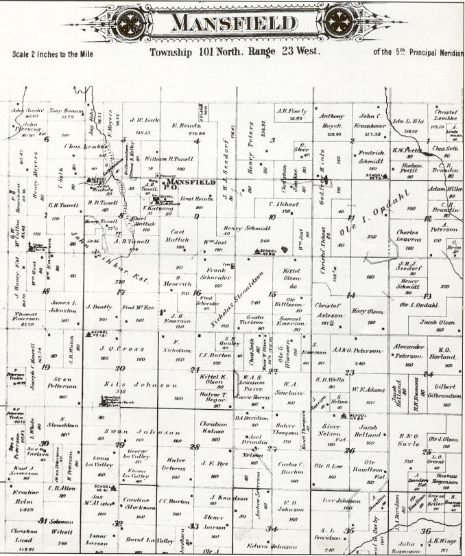
Mansfield Township, Freeborn County,
MN.
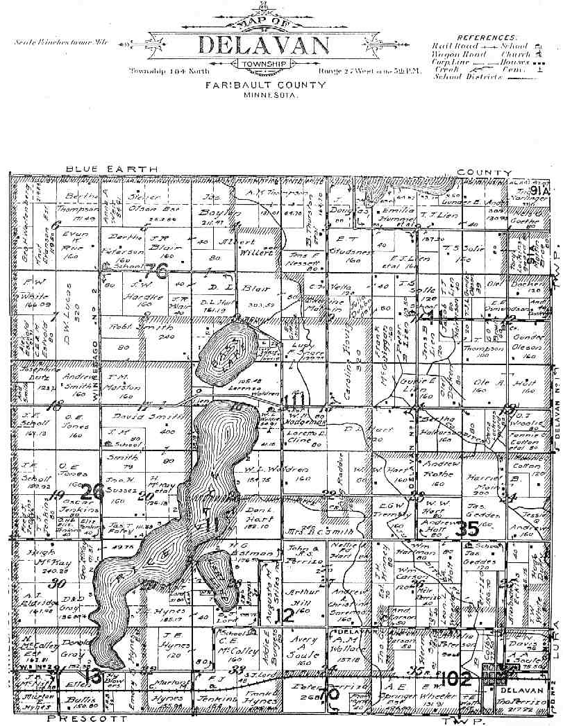
How to figure out the Federal Township and Range System.
Terms used in the Township and Range System:
Section
Basic unit of the system, a square tract of
line one mile by one mile containing 640 acres.
Township
36 sections ar ranged in a 6 by 6 array, measuring 6 miles by 6
miles. Sections are numbered beginning with the northeast-most
section, proceeding west to 6, then south along the west edge of the
township and to the east.
Range
Assigned to a township
by measuring east or west of a Principal Meridian.
Range Lines
North to south lines which mark township boundaries
Township
Lines
East to west lines which mark township boundaries
Principal Meridian
Reference or beginning point for
measuring east or west ranges.
Map
of meridians & base lines from the BLM web server
Base
line
Reference or beginning point for measuring north or
south townships.
Map
of meridians & base lines from the BLM web server
NOTE (for additional references):GNIS's list of 30 cemeteries for Faribault Co.
Feature Name
American Lutheran Church Cemetery 433209N 0934214W Kiester
Bricelyn Cemetery 433326N 0934945W Bricelyn
Brush Creek Cemetery 433843N 0934938W Brush Creek
Calvary Cemetery 434445N 0940252W Blue Earth
Clayton Cemetery 433450N 0935018W Bricelyn
Dell Cemetery 433731N 0935453W Oza Tanka Lakebed
Dodson Cemetery 433237N 0940623W Elmore
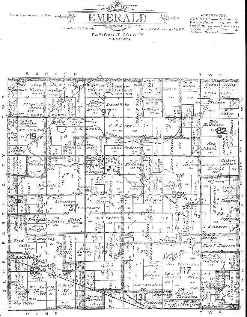
Emerald Cemetery 433522N 0935551W Frost
Fairview Cemetery 433330N 0934231W Kiester
Immanuel Cemetery 433956N 0940026W Blue Earth
King Cemetery 433932N 0940001W Blue Earth
Lura Cemetery 434726N 0935652W Easton, Lura Twnshp
North Cemetery 434721N 0941006W Winnebago
Pilot Grove Cemetery 433416N 0940852W Pilot Grove
Rice Lake Cemetery 433744N 0934340W Wells, Clark Twnshp
Rice Lake Cemetery 434627N 0940330W Delavan
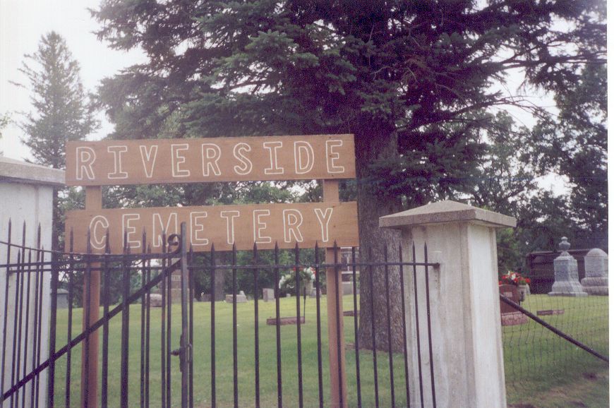
Riverside Cemetery 433753N 0940515W Blue Earth
Riverside Cemetery 434524N 0941129W Winnebago
Riverview Cemetery 433029N 0940641W Elmore
Rose Hill Cemetery 434450N 0934421W Wells, Clark Twnshp
Rose Hill Cemetery 434539N 0941107W Winnebago
Saint Casimer Cemetery 434444N 0934418W Wells, Clark Twnshp
Saint Johns Cemetery 433224N 0940138W Elmore
Saint Johns Cemetery 433626N 0934135W Kiester
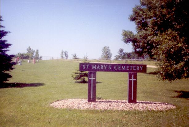
Saint Marys Cemetery 434308N 0935526W Oza Tanka Lakebed
Saint Marys Cemetery 434532N 0941131W Winnebago
Verona Cemetery 434116N 0941223W Huntley
Walnut Lake Cemetery 434145N 0934944W Brush Creek
West Verona Cemetery 434353N 0941233W Huntley
Zions Cemetery 434948N 0934604W Minnesota Lake
NOTE: Other notation of n/n/n/xxxx is Township Line/Range
Line/Section/location.
See Federal
Township and Range System to determine section and location
coordinates.
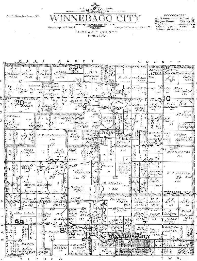
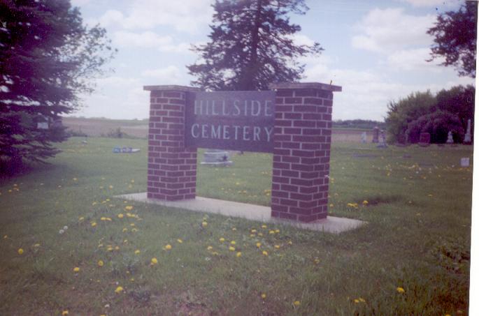
North Cemetery (a.k.a. Hillside Cemetery)
- Photo 104/28/27/NENE (SE
corner Sec 22?) 434721N 0941006W Winnebago
Location: This
cemetery is a very old one, with many stones either broken, or
illegible. If you go North on US 169 from Winnebago, it is on the
left side of the road. It is in Section 27 of Winnebago City
Township. It also used to be known as the North Cemetery.
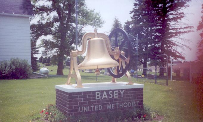
Pleasant Prairie Basey Cemetery -
Photo 104/28/07/NWNW 434958N
941446W, Winnebago City
Location: This cemetery is in Section 7
of Winnebago City Township. From Winnebago take US 169 N to Cty Rd
14. Turn left and it is quite a ways down the road on the left side
of the road, in the churchyard. The gravel road on the West side of
the church is the County Line Road.
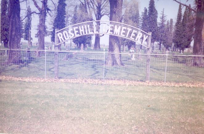
Rose Hill Cemetery - Photo
104/28/34/SWSW 434539N 0941107W Winnebago
Location: This cemetery
is on the very South West Edge of the town of Winnebago. Go north on
Hwy 169 into town, off to the left you will see the Elm Motel. At the
next road to the left (5th St SW) take the left and go one block to
the stop sign. Turn left and follow the gravel road. It is on your
right. Farther down the road are 2 more cemeteries, both in Verona
Township.
Wiltsey Cemetery (a.k.a. Maple Grove Cemetery) 104/28/21/NESW
Established: about 1860, abandoned 1899.
Riverside Cemetery A-G, H-L, M-R, S-Z (Section 4) 103/28/04/E2NE 434524N 0941129W - Photo
St Mary's Cemetery (Section 4)
103/28/04/NENE 434532N 0941131W, near Winnebago Photo
Location: This cemetery is in Section 4 of Verona Township. If
you take US 169 N into the town of Winnebago, turn left
at the
street just after the motel. Go to the stop sign and turn left
again. It is the second cemetery along this road.
Verona Cemetery - Photo
(Section 33 - the very NW corner of the section) 103/28/33/NWNW
434116N 0941223W Huntley
Location: This cemetery is in Section 33
of Verona Township. If you take US 169 S of Winnebago to the
Jct with Cty 10. Turn right and
on the second set of curves
take the gravel road to the left. It is about 4 miles down the
road on the left side of the road.
West Verona Cemetery (Section 17 - NE corner of the NE 1/4)
103/28/17/NWNW 434353N 0941233W Huntley
Description: The true
West Verona Cemetery was destroyed many many years ago (storm?), but
the citizens at the time tried to write down all the people they
could remember being buried there, and now there is just one lone
memorial stone listing all the known names/dates on that stone.
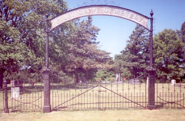
Pilot Grove Cemetery 101/28/11/NENE
433416N 0940852W Pilot Grove Photo
Location: This cemetery is in Section 11 of Pilot Grove
Township. Take US 169 N of Elmore to Cty Road 2. Turn W
and
follow it until you reach Cty Road 9. Turn N and it is
about 3 miles up the road, on the left side.
Established: In the center of the cemetery is a placque dedicated
to the people who settled on June 18, 1858, around the location
of
the cemetery. The names are: Mr/Mrs David Ogilvie, Mr/Mrs Archibald
Cardle, Mr/Mrs Andrew More, Mr/Mrs James Ogilvie.
MRS McCLURE CEMETERY Photo
This is located in Section 2 of Pilot Grove Township. Mrs Mc
Clure died in 1858.
Bass Lake Cemetery - Photo
104/27/09/SESE or NESE
Location: If you follow Cty Rd 15 N of
Delavan to Cty Rd 18. Go West until you reach the 2nd gravel road.
Turn right and it is on the right side of the road. It is next to the
Bass Lake Church, which is still in use. This cemetery had several
broken stones that I was not able to read.
East Lutheran Cemetery - Photo
104/27/12/NWSE
Location: This cemetery is in Section 12 of
Delavan Township. If you take Cty Rd 15 N out of Delavan until you
reach Cty Rd 18. Turn right unto the gravel road and go to Cty Rd 13.
Turn left and it is the first gravel road to the left. It is about
1/2 mile down the road on the left. It stands in the site where the
East Lutheran Church used to be. It was in use 1887-1964.
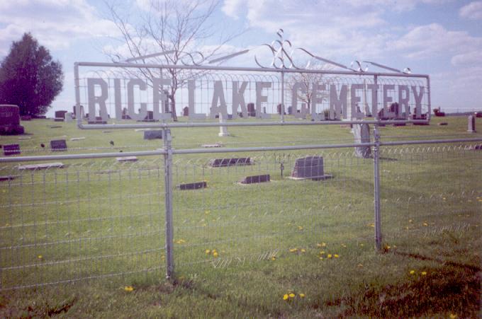
Rice Lake Cemetery (A-L) (M-Z)
- Photo 104/27/34/NENW
434627N 0940330W Delavan
Location: Follow Cty Rd 109 West of
Delavan to the Jct of Cty Rd 11. Turn right on the gravel and it is
about 2 miles up the road on the left hand side. It is in Section 34
of Delavan Township.
West Lutheran Cemetery - Photo
104/27/02/SWNW
Location: Follow Cty Rd 15 N of Delavan to Cty Rd
18. Go straight ahead on the gravel to Twp Rd 110. Turn left and it
is on the right side of the road. It is in Section 2 of Delavan
Township. It stands next to the West Lutheran Church, which is no
longer in use. I found several stones, which I believe are the old
footstones, laying flat on the ground. The ones I could read had
either nothing on them, or just the names. Most of them were blank
though.
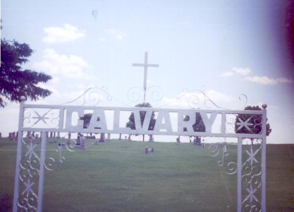
Calvary Cemetery - Photo
103/27/10/NENE
Location: This cemetery is the Catholic
Cemetery for Prescott Township. It is in Section 10. If
you take US 109 West of Delavan to the first
road to the left.
(It is only about 1/4 a mile from town.) Follow the gravel road until
you come to a T and take a right. It is on the left side of the
road.
Calvary Cemetery 102/27/16/SWSW 434445N 0940252W Blue Earth
Dell Cemetery 433731N 0935453W Oza Tanka Lakebed
Immanuel United Methodist Section 102/27/13 433956N 940026W, Blue
Earth City
Location: From Albert Lea take Cty Rd 46/16 W for
several miles. It is on the left side of the road.
Notes:
Cemetery still active. Pope has this in Emerald Twp.
Immanuel United Methodist Cemetery
(a.k.a. Emmanuel Cemetery section 18) Photo
- 102/26/18/NWNW, NW corner of the NW 1/4 433956N 0940026W Blue Earth
Location: The cemetery is just down the road from the Emmanuel
United Methodist Church. It is located along County Road 16 (old Hwy
16) in section 18 of Emerald Township.
Riverside Cemetery 102/27/17/SESE (or SW corner of Section 16) 433753N 0940515W Blue Earth
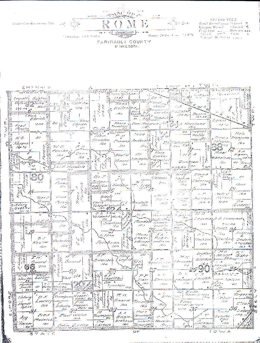
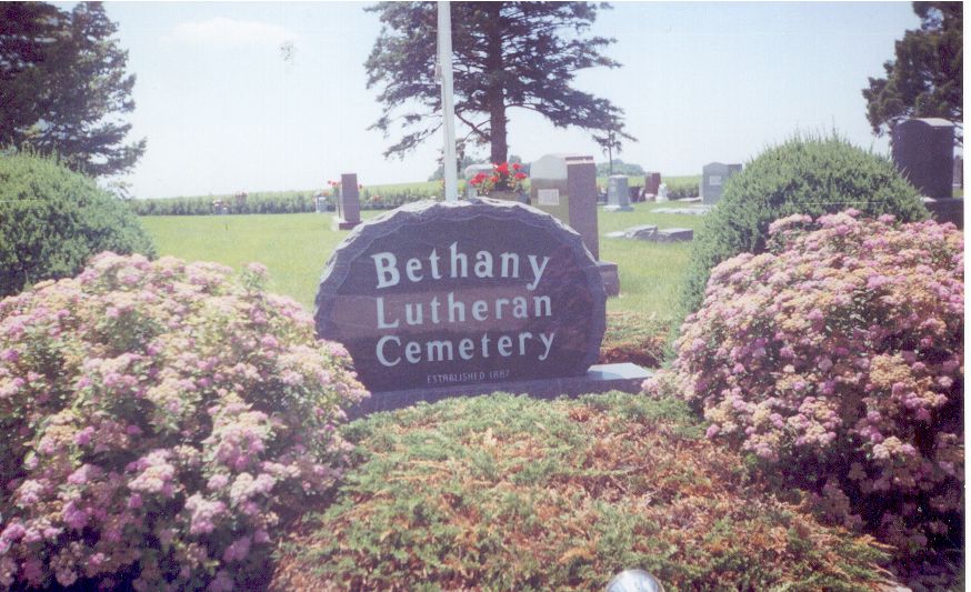
Bethany Cemetery 101/26/24/NWNW -
Photo
Location: The
cemetery is next to the Bethany Lutheran Church in section 24 of Rome
Township. If you go West from Bricelyn along Cty Rd 2, past the South
Blue Earth Church, to 490th Ave. This is the first gravel after the
church. Turn left and it is the first road to the right, 40th St.
There were several newer stones here with only names on them. Someone
has evidently replaced unreadable stones with new ones.
St Peter's Lutheran Cemetery - Photo;
near Easton 104/26/36/SWNW
A different transcription (with other
notes) is also available.
Location: This cemetery is located in section 21 of Lura
Township. It is about 1 mile North then 1 1/2 miles West of Easton.
Lura Cemetery 104/26/21/SESE 434726N
0935652W Easton
Location: This cemetery is in Section 21 of Lura
Township. From Easton take Cty Rd 109 W to Cty Rd 17 Turn North and
it is about 2 miles on the left side of the road.
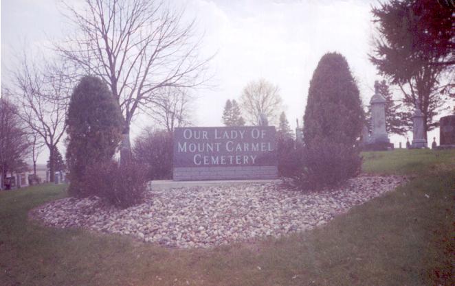
St Mary's Cemetery (a.k.a. Our Lady of
Mount Carmel or Wesners Grove) - Photo
103/26/14/SWSW 434308N 0935526W, Oza Tanka Lakebed
Location: This
cemetry is in Section 14 of Barber Township. Take Cty Rd 109 W of
Easton until you reach Cty Rd 17. Turn south and it is on the left
side of the road. It is also know as St Mary's Cemetery.
Note:
Active
Dell Cemetery 102/26/23/SWNE (or SWNW),
433731N 0935453W Oza Tanka Lakebed - Photo
Location: This cemetery is a very old one, with lots of stones
that are worn or broken. I have done the best I could with
them.
It is in Section 23 of Emerald Township. If you take
Cty Road 254 N of Frost to Cty Road 114. Turn right and it
is
on the right side of the road next to the church.
Ellingson Family Cemetery 102/26/08/NESE
Frost United Lutheran Cemetery in section 8, 433522N 0935551W Frost
United Lutheran Cemetery (a.k.a.
Emerald Cemetery) 102/26/34/SESE, Frost - Photo
Location: On the very north edge of Frost there is a gravel road
that goes about 1/2 mile to the West to the cemetery. (Section 10 or
maybe 11?)
Established:
Platted:
Immanuel Lutheran Cemetery - Photo
102/26/06/NWSW
Location: This cemetery is North of County Road 16
(old Highway 16.) Go north of the Immanuel United Methodist Church on
430th Ave you would be able to see it off on the right. It is in
section 6 of Emerald township.
King Cemetery (a.k.a. Immanuel United
Methodist) - Photo 102/26/07/NENW
433932N 0940001W Blue Earth
Location: From Albert Lea take Cty Rd
46/16 W to Cty Rd 10. Turn right and go to the first road passed I
90. Turn left and it is on the left side of the road. The cemetery is
about 1/2 mile East of the Immanuel Evangelical Church.
Established:
in 1879, closed in 1890, Inactive
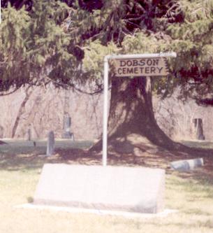
Dobson Schoolhouse Cemetery
(a.k.a. Richardson Cemetery)- Photo
101/27/17 or 20/NWNW or section 17 in the SW corner, 433237N
0940623W, near Elmore
Plaque
Photo
Location: The cemetery sits just East of where the
Dobson School used to sit. It was a school in District 17 and was
used from 1858-1953. Follow US 169 North from Elmore for about 2 mile
and you come to the first gravel road. Turn left and it is about 1
mile down the road on the right side of the road. It is in Section 17
of Elmore Township.
Hesse or Hanson Burying Grounds 101/27/12/SESE
Established:
cemetery was closed in 1886. Most of the graves were removed before
the land was reclaimed for agriculture. Photo
Riverview Cemetery A-K, L-R,
S-Z 101/27/31/SENE
433029N 0940641W Elmore Photo,
Mausoleum Photo
Location:
The cemetery is in Section 32 of Elmore Township. Take Cty Rd 9
West of Elmore for about a mile. It is in a grove of trees on
the right side of the road.
On the very West edge of the cemetery
is a solitary grave, saying "Unknown Woman, died 1915"
Someone, possibly the city, has placed an urn of flowers there.
In the middle there is also a mausoleum, with all the origional doors
and windows. I was able to look into the doors and read what
the casket covers said on them.
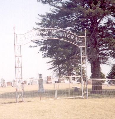
Saint John's Lutheran Cemetery -
Photo 101/27/24/NWNW 433224N
0940138W Elmore
Location: This cemetery is just down the road
from the Church. Follow US 169 North of Elmore to Cty Rd 2 it is on
the left side of the road. It is Section 24 of Elmore Township. The
cemetery is very well kept up, and I found no stones I couldn't read.
Everton Family Cemetery (a.k.a. Van
Buren Cemetery) 101/27/25/N4NW Photo
Established: This cemetery was located in Section 25 of Elmore
Township. It was used from 1871-1896, then abandoned. The land has
been reclaimed for agriculture. Everton Family Cemetery was
established by his widow on 1.9 acres of the homestead of John
Everton after his death in 1870. The land was deeded to the Everton
Cemetery Association, and its locatioin was noted on subsequent deed
transfers. However, it no longer exsits. It was plowed over by a
farmer who bought the land in 1938. A lawsuit brought by the
Faribault County Historical Society in 1978 sought to gain control of
the cemetery, but the judge ruled that it had been abandoned, and was
no longer a valid cemetery. Old timers in the area claimed that grave
markers had been used in the cement foundation of the farmer's barn,
but those claims were never proved.
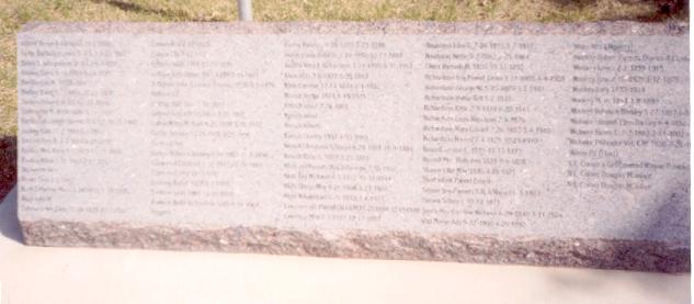
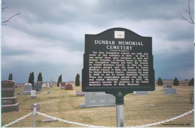
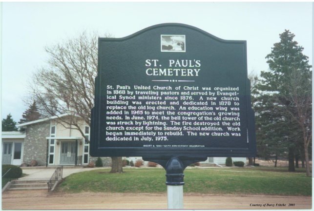
Dunbar Memorial Cemetery (a.k.a.
Zion's) - Photo 104/25/12
434948N 934604W, Minnesota Lake
Location: From Wells take Cty Rd
22W to Cty Rd 21. Turn right and follow to Cty Rd 20. Turn left, it
is on the left side of the road. Note: Active
Note: Dunbar
cemetery is southeast of Minnesota Lake. It used to have a church by
it, but it has been moved. Betty Jean Sonnek also has a copy of the
plot map for this cemetery. The original records for the church that
used to be there are at the Methodist church in Wells. St. Paul's
cemetery is right around the corner from Dunbar Cemetery. Many of the
same families are buried in both cemeteries. There is a church at
St.Paul's, but it burned I believe in 1974. All original records were
burned also. However, previous to its burning, someone had a woman
who spoke German, and knew the families, transcribe the church
records into English. These records can be found at the Kremer house
in Minnesota Lake. There is extensive info on the deaths in these
records. The other two cemeteries are next to each other in Minnesota
Lake in a very beautiful wooded area. If you plan to visit these
cemeteries, be prepared to do some rubbings as there are many old
stones that can't be read.
Established:
Platted:
Oak Grove Cemetery - Photo,
Minnesota Lake section 4 NW corner
Location: The cemetery is in
the town of Minnesota Lake . It is also considered part of Blue Earth
county, as the Town lies on the Border of Faribault and Blue Earth
county. Oak Grove is right next to Peace cemetery.
Established:
Platted:
Peace Cemetery, Minnesota Lake section
4 NE corner
Location: Peace Cemetery Minnesota Lake Township.
Peace cemetery is in the town of Minnesota Lake. It is right next to
Oak Grove cemetery and it is also considered to be part of Blue Earth
county as the town lies on the border of the two counties.
Peace Church Cemetery - Photo,
Minnesota Lake section 4
This cemetery is in section 4 of
Minnesota Lake Township. This is one of the 3 cemeteries all in the
same location. If you take Main Street E of the town of Minnesota
Lake, it is the first road to your right-on the very edge of town.
When you get into the cemetery-it is the section to your left. The
one straight ahead is St John the Baptist Catholic Cemetery, and the
one to the right is Oak Grove Cemetery. According to some records
this cemetery is actually located in Blue Earth County, which is
directly to the North. I believe Cty Rd 20 in is that county.
Established:
Platted:
Schermerhorn Cemetery -Photo,
Photo2 104/25/29/NESE
Abandoned: 1900
History: This cemetery was donated to the Methodist Church, with the deed signed June 13, 1874. It gave the Methodists 2 acres of land. Philip B-and Mary Schermerhorn were the origional owners of the property, and the ones who donated it. In the 1880's the Schermerhorn farm was sold to Hosea Quimby, who gave the South half of the cemetery to the German Evangelical Lutherans-St Peter Congregation in 1891. They built a fence to divide the two of them. In 1903 land was donated to the Lutheran's by Charles Ramspott for a new cemetery nearer to town. This cemetery was abandoned, as the Methodists were no longer around either. In 1987 some of the people of Easton restored what they could of the cemetery. They put the remaining stones on a cement slab-all in a row.
This information all comes compliments of LuAnn Schrader. She has been one of the people restoring and doing a lot of the work on the cemetery. At one time she had crayon rubbings of the stones, and lots of information. In the 1990's a house fire destroyed most of this. What is here is what she has gathered since that time. This fire not only was a tragedy for the family, but for all history.
Location: The cemetery is in Section 19 of Minnesota Lake Township. If you take Cty 21 S of Minnesota Lake to 200th ST. (the first left after the curves) Take the gravel road to the left and the cemetery sits in the middle of the farm fields off to your right about 2 miles down the road. It is on the corner of 200th ST and Cty 115. You can also follow Main Street in Easton to Ash Street (stop sign) Go right to the stop sign and the left on 4th (Cty 115) Follow the gravel road until you intersect with 200th St. It is in the field on left side of the road.
Saint John the Baptist Cemetery - Photo
of new cemetery, Photo of old
cemetery section 3 NW corner
History:
This cemetery was at one time in Blue Earth County. It was moved in
1895 and most of the stones were moved with it, but not all of them.
And only some of the bodies were moved! When I talked to the grave
diggers they said they had to probe before digging in the oldest
section to make sure no one was buried there. At the end of this list
I have added the few stones that were found in the old grave and
repaired.
Location: The new cemetery is in Section 3 of Minnesota Lake Township. You take Main Street E of Minnesota Lake to the last road to the right. When you get into the area you will see what looks like one big cemetery. In fact it is 3 cemeteries. To your left is Peace Church Cemetery. To your right is Oak Grove Cemetery. And straight ahead is the St John's Catholic Cemetery.
St. Paul's Lutheran Church Cemetery,
Minnesota Lake Township - Photo
104/25/13/NWNE
Location: Located southeast of Minnesota Lake.
Take the main road south of town towards Wells, and you will see a
sign for the church, turn left. The cemetery is across the road from
the church.
Established:
Platted:
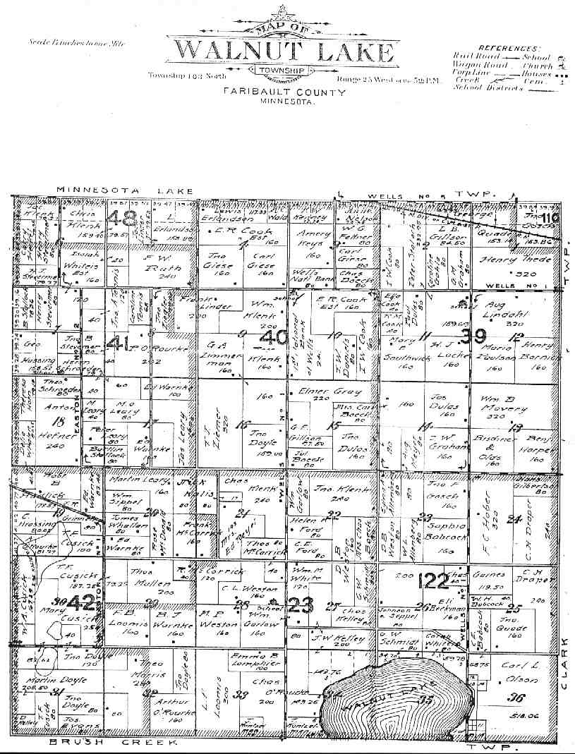
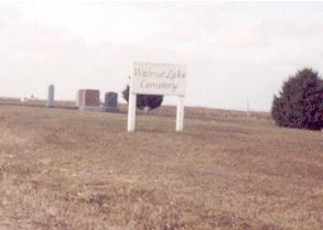
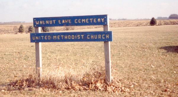
Walnut Lake Cemetery - Photo
103/25/28/SENE 434145N 0934944W
Location: The cemetery is in
section 28 of Walnut Lake Township. Turn right off County Road 16
(old Hwy 16) at the Bricelyn corner. Just after you cross over the
Interstate there is a blacktop to your left, Cty Road 21. Follow it
for about 3 miles North and the cemetery is on your left. As the
death dates range from 1866 to 1941, with most of them in the 1880's,
it is excellent condition. There were only 2 broken stones that I
couldn't read!
Walnut Lake Methodist Cemetery -
Photo 103/25/15/NWSW
Location:The cemetery is in Section 15 of Walnut Lake Township.
Turn North at the Bricelyn corner, off Cty Rd 16, go over the
interstate, and make an immediate left on to Cty Road 21. Continue on
this road, passed the Walnut Lake Cemetery for about 2 miles. It is
on your right. These are the only remaining tombstones in the middle
of the cemetery.
Note: no longer in use
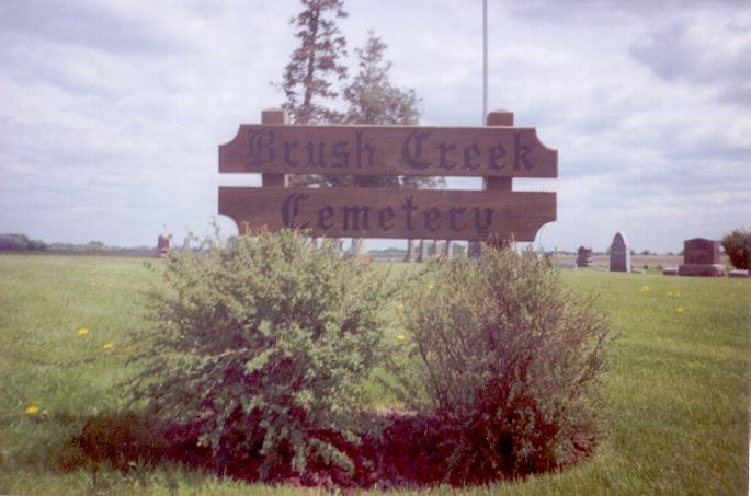
Brush Creek Cemetery -
Photo(close), Photo2
102/25/10/SWSW 433843N 0934938W Brush Creek
Location: The
cemetery sits on a hill along County Road 16 (old Hwy 16). It is
located in section 10 of Brush Creek Township.
North Blue Earth Lutheran Cemetery -
Photo 102/25/20/NENE
Location:
The cemetery is next to the North Blue Earth Church. It is south of
county road 16 (old Highway 16) about 3-4 miles. It is section 28 of
Brush Creek township.
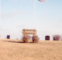
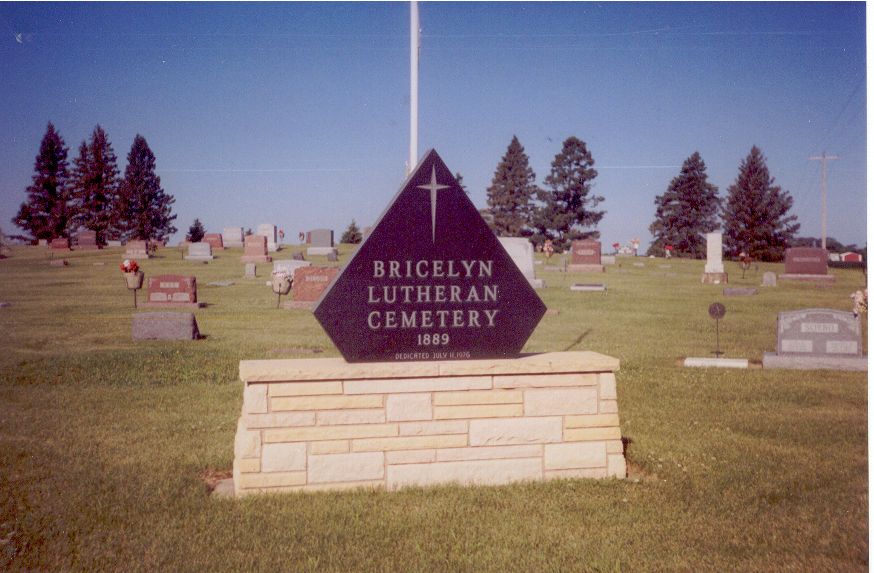
Bricelyn Cemetery 101/25/16/NENE
433326N 0934945W - Photo
Location: Bricelyn is a small town located in section 10 of
Seeley Township. The cemetery is located about 1/2 mile West of
Bricelyn. It is on the corner of Hwy 2 and 520th Ave.
Established:
Platted:
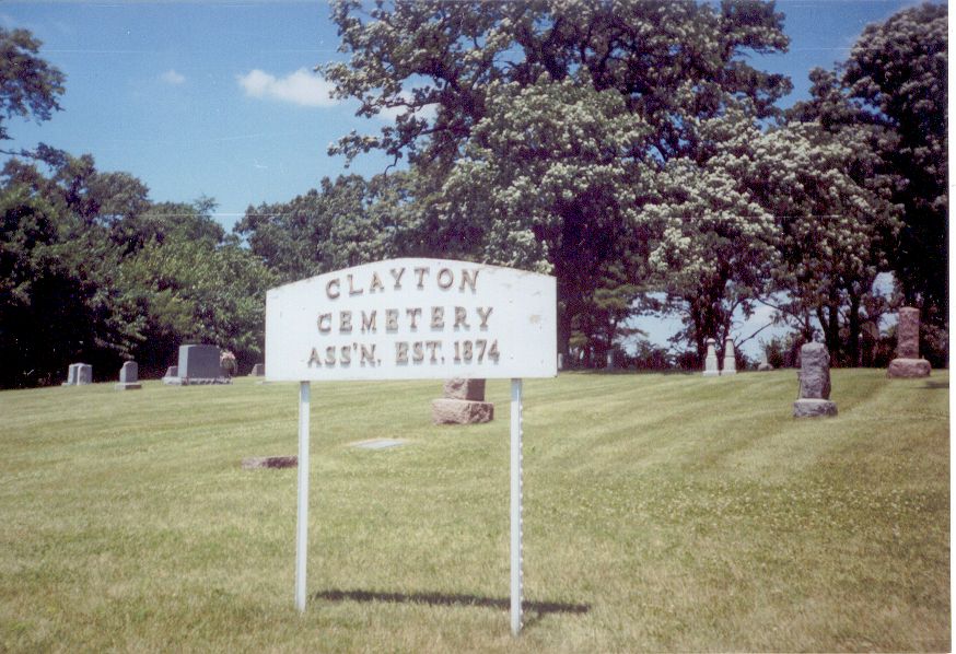
Clayton Cemetery 101/25/04/SENW
433450N 0935018W Bricelyn - Photo
Location: This cemetery is North of Bricelyn in the center of a
large group of trees. It is along a gravel road off county road 253
to the west. It is in section 4 of Seely township.
South Blue Earth Lutheran Cemetery
101/25/07/SESW - Photo
Location: This cemetery is located next to the South Blue Earth
Church. It is west of Bricelyn about 2 miles in section 9 of Seely
Township.
Established:
Platted:
Rose Hill Cemetery A - F, G
- M, N - Z - Photo
103/24/05/SESW 434450N 0934421W Wells, Clark Twnshp
Location:
From Wells take US 109 West. It is on the very edge of town on the
right side of the road. It is in Section 5 of Clark Township.
Established:
Platted:
Saint Casimer Cemetery A - L, M
- Z 103/24/08/NENW 434444N 0934418W Wells, Clark - Photo
Twnshp
Location: This cemetery is on US 109 West of the town of
Wells. It is on the very edge of town, on the left side of the road.
It is in Section 8 of Clark Township. Some of the dates were written
in another language, so I tried to copy them to the best of my
ability. I'm sure some of them are spelled wrong though.
Established:
Platted:
Rice Lake Cemetery - Photo
102/24/21/NWNW
Location: The cemetery sits high on a hill and is
surrounded by many trees. If you turn South at the exit to Wells off
County Road 16 (old Hwy 16)- instead of North into Wells-you will
pass a County Park. Keep following the gravel road for quite a while
until you come to a crossroads, then turn right and immediately left
again. If you don't like driving gravel roads, like me, you can go
down Cty Road 22 to the first road to the right. Keep following it
and it would be on your left. It is section 21 of Foster township.
United Lutheran Cemetery of Walters
(a.k.a. St. John's Cemetery) - Photo
102/24/27/SWNE 433626N 0934135W
Location: This cemetery is a
small one West of Walters on 85th Street. It is in section 27 of
Foster township.
Walters Cemetery - Photo
102/24/26/NWSE
Location: This cemetery is the community cemetery
on the West edge of Walters. It is in section 26 of Foster township.
Our Savior's Lutheran Cemetery
- Photo 101/24/22/NWSW
Location: The cemetery is located on the south east edge of the
town of Kiester. It is in section 22 of Kiester township.
American Lutheran Church Cemetery – now Our Savior's Lutheran Cemetery. Old obituaries may reference Emmanuel, St. Paul's, or Zion Swedish Lutheran churches before the church mergers. 433209N 0934214W Kiester
Fairview Cemetery 101/24/09/SESE
433330N 0934231W Kiester - Photo
Location: This cemetery is located north of Kiester, MN It is
about half way between County Road 16 (old Hwy 16) and Kiester on
County Road 22.
Other cemeteries not in Faribault Co., MN
Alden Township, Freeborn Co.
Carlston Township, Freeborn Co.
Alden Cemetery (A-N)
Alden
Cemetery (N-Z)
Location: The cemetery is on the very west
edge of Alden. If you go on Hwy 109 West to Wells it is just after
you leave the city limits, on your right. Alden is in section 34 of
Carlston Township.
Carlston Cemetery
Location: This
cemetery is mainly for the Danish population of Carlston Township. A
Danish Lutheran Church and cemetery were built about 3 miles North of
Alden, in section 22. As you go west of Alden on Hwy 109 you will see
the Alden Cemetery on your right. Turn there, go past the cemetery
for about 3 miles. Turn right onto the gravel road and the cemetery
is about 1 mile down the road. The church is no longer there, but the
cemetery is still in use.
Freeborn Township, Freeborn Co.
Freeborn Cemetery
Location:
This cemetery is in Section 25 of Freeborn Township. The first burial
was in 1858. It is on a hill on the North edge of the town of
Freeborn. If you go through the town on their main street, just
before you get to the city limits on the North there is a road to
your left. It is down this road about 1 mile.
Trenton 7th Day Baptist
Cemetery
Location: The cemetery is in Section 11 of Freeborn
Township. A church and cemetery were established before 1856 and this
cemetery about 1862. The graves were all moved to this new location.
Mansfield Township, Freeborn Co.
Lime Creek Cemetery
Location:
The Lime Creek Church and cemetery are located in section 36 in
Mansfield Township. They are along the Iowa/Minnesota border on the
Stateline road west of Emmons, MN. The church is still standing, and
in very good condition, but not in use any more.
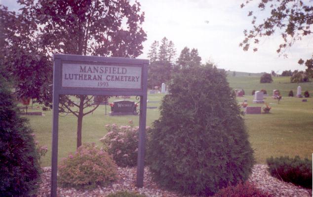
Mansfield Lutheran Cemetery
Photo
Location: The
cemetery is next to the Mansfield Lutheran Church, in the town of
Mansfield. It was organized in 1895 and continues to be in use today.
It is in section 8 of Mansfield township, Freeborn County.
Mansfield Township Cemetery
(a.k.a. Schneider Cemetery) Photo
Location: This cemetery is also commonly know as Schneider
Cemetery, as the land was bought from Frank Schneider in the 1850's.
It is in section 16 of Mansfield Township.
Swedish Lutheran Cemetery
Location: The Swedish Lutheran Church used to sit next to the
cemetery. It was later moved to Kiester, but they continued to use
the cemetery. The cemetery is in section 36 of Mansfield township.
This page was created on Saturday, 2-Nov-2002 08:44:15 CT.
This page was last modifiedThursday, 19-Apr-2012 09:22:52 MDT.
Actual mileage may vary.