
Maps
Wisconsin Digital Map Library
Map of Racine County, 1895
Kenosha and Racine Counties, WI 1901
Wisconsin Cartographers' Guild
US Genealogy Map Project: State, County, Territory Maps
American Geographical Society Collection at UW-Milwaukee
Animated map illustrating County formation in the U. S.
Map of Racine County dated 1959

The following maps of Wisconsin are online and available for download. Please note the size of the map before downloading. Slower connections may require several minutes to download a map. These are for personal genealogical use, and are not for distribution.
-
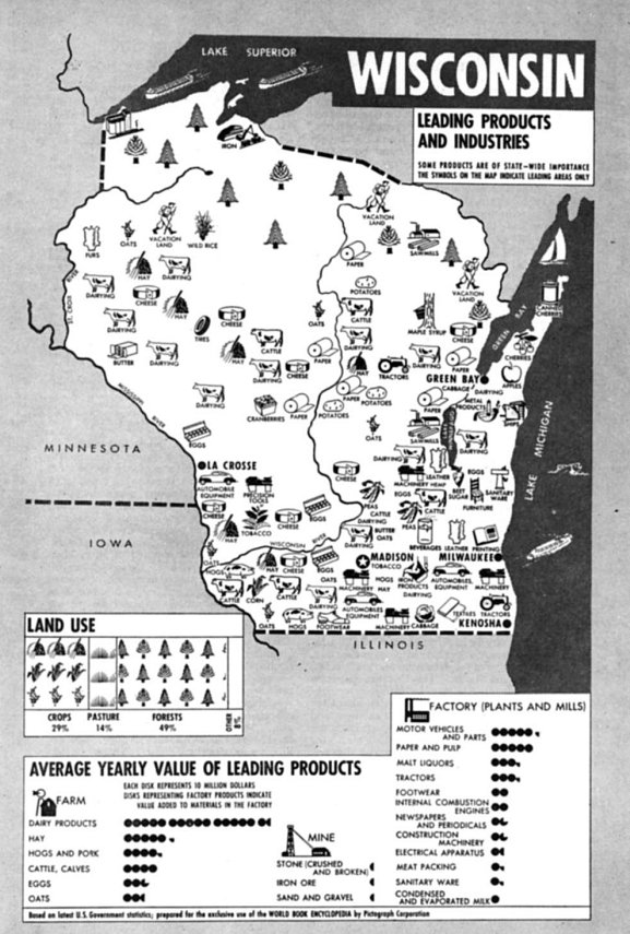
Leading Products Industries, circa 1943 (123kb)
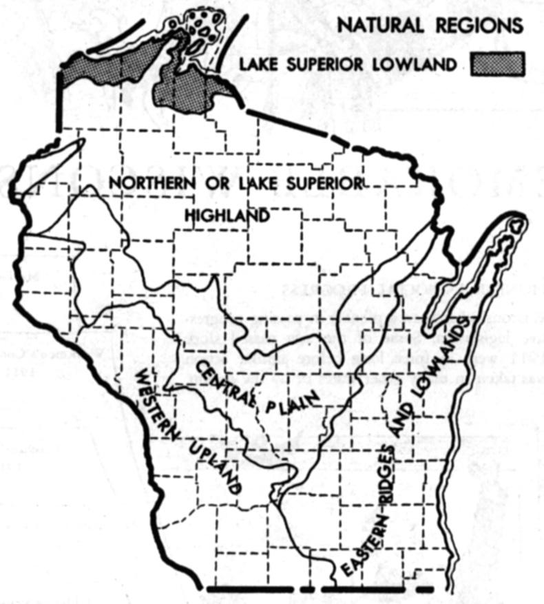
National Regions of Wisconsin, circa 1943 (85kb)
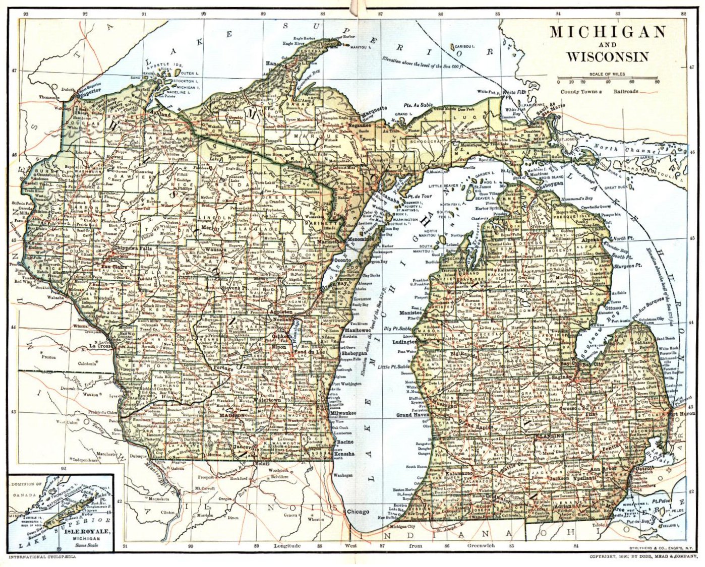
Michigan and Wisconsin, circa 1891 (565kb)
National Encyclopedia Wisconsin Map, circa 1944 (509kb)
Midwest Map, circa 1884 (462kb)
Lead Mines on the Mississippi, circa 1829 (320kb)
Wisconsin Iowa and Minnesota Territories 1832-1858 (327kb)
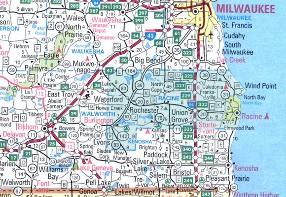
City of Racine Area, Current (61kb)
Racine County Area, Current (103kb)
Any use of the maps on these pages is the discretion of that page's owner. Please don't infringe on any copyright protections.
-
Wisconsin Maps -John Hopkins University
The Perry-Casta�eda Library Map Collection:
Michigan Territory in 1830 -Includes Wisconsin (67kb)
-
Wisconsin Gazetteer, John Warren Hunt, 1858
U.S. Census Bureau U.S. Gazetteer
USGS Geographic Names Information System
U.S. Surname Distribution
Wisconsin Maps - Exploring Wisconsin our Home
Current Satellite Map of Wisconsin (Updated every 30 minutes)
 |

|