
Maps - Township links
Map collection of the University of Wisconsin Digital Collections. This collection contains detailed plat maps of Kewaunee County for 1876 and 1912 as well as maps from adjacent counties and townships. These maps will open in a new browser window.
Kewaunee County Plat Maps 1876
Kewaunee County Plat Maps 1912
|
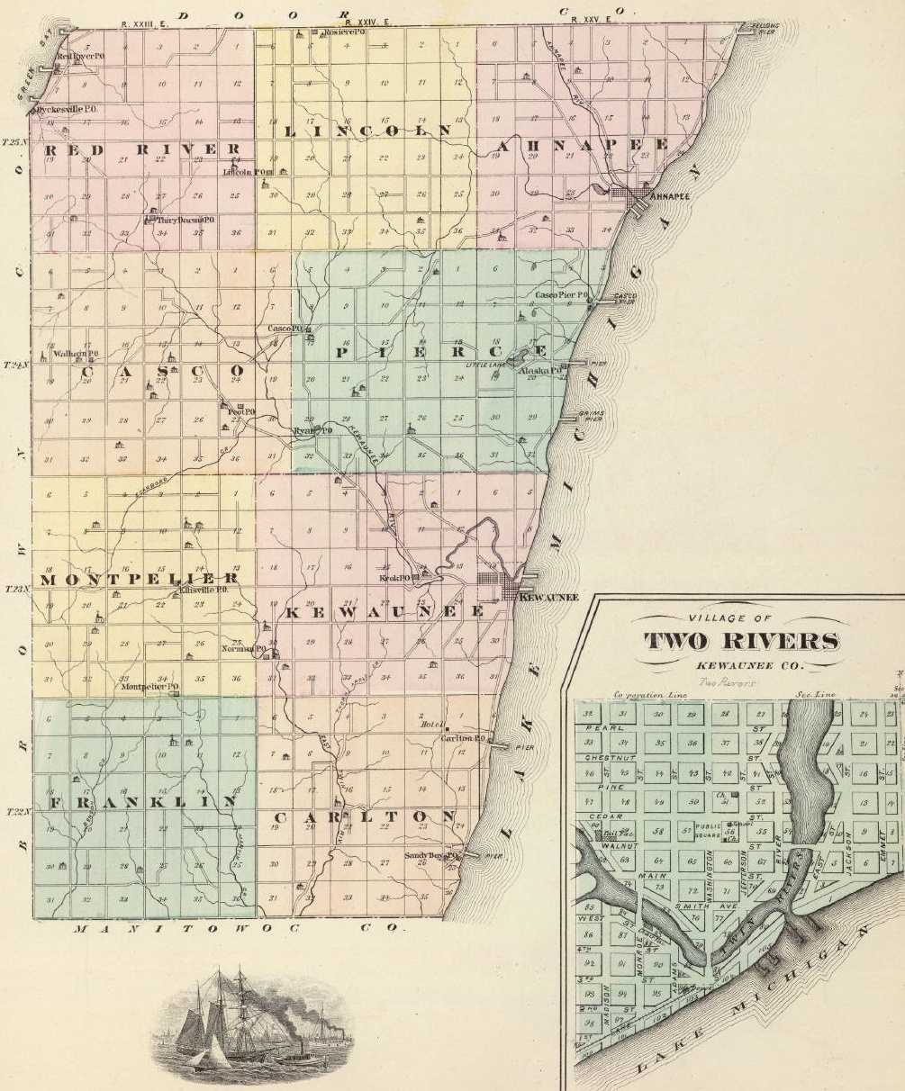
| 1876-1881 Map - This map has "Hot Links". Click on the area of the map that you are interested in. It will take you to the township page that you clicked on. Township Luxemburg was created after the date of this map |
|
| Map of Cemetery locations in Kewaunee County, Wisconsin |
 Click on this map to access the "Wisconsin Public Land Survey Records" This site contains 1834 Plat maps of each township |
 This is a sample of the 1834 plat maps available from the "Wisconsin Public Land Survey Records" for each township. Note how the Kewaunee river has changed course in 172 years. |
| TerraServer Online photographic view maps | Travel map from Wisconsin DOT for Kewaunee County |