 Maps
of Brown County,Wisconsin Maps
of Brown County,Wisconsin
Maps
of Brown County,Wisconsin Maps
of Brown County,Wisconsin Tiger Map - U.S Census Bureau Tiger Mapping Service - Brown County, Wisconsin.
Topozone Map - Topographic map of Brown County.
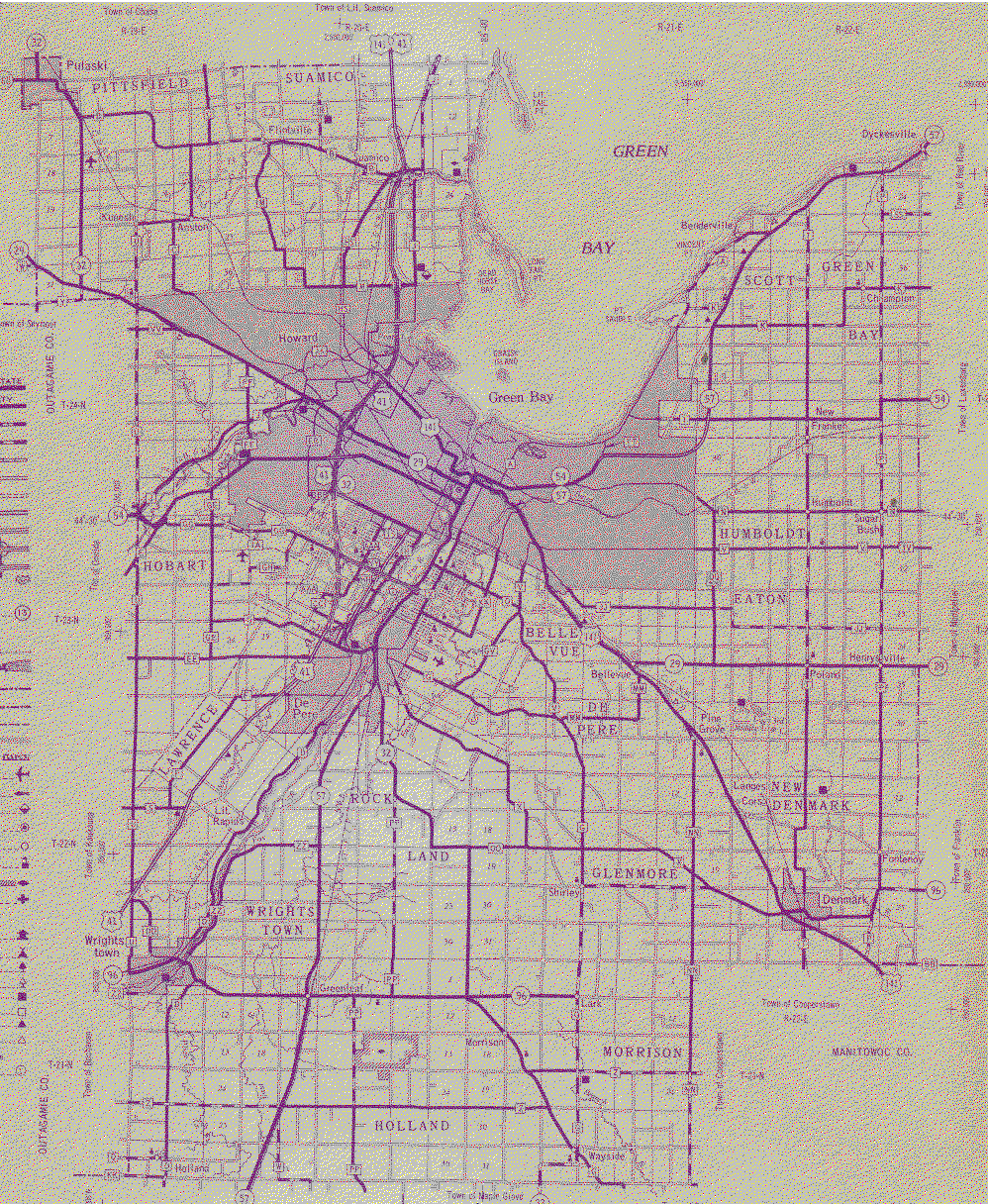
Large-GIF - Brown county as (234K) Graphics Interchange File (GIF).
USGS - Link to U.S. Geological Service - Geographic Names Information System (GNIS).
Wisconsin Maps in the Rootsweb Archive.
Plat Maps - link to The UW Digital Collections has just made new additions to *Brown, Door,
Kewaunee & Shawano Counties: Historical Atlases, Directories & Plat
Maps. *This collection of historic materials includes plat books and
atlases providing accessibility to early information about Northeastern
Wisconsin, specifically Brown, Door, Kewaunee and Shawano counties.
/Green Bay and Fort Howard Directory/ is the most recent addition to
this project, completed with Nicolet Federated Library System and funded
through a 2006 Library Services and Technology Act (LSTA) grant. The
1874 directory includes information on the early settlement of Green Bay
as well as a business and street directory.
Return to: Top-of-Page
Return to: County Page
Last updated: November 11th, 2002