
Welcome to Pecos County, Texas
�
�
�
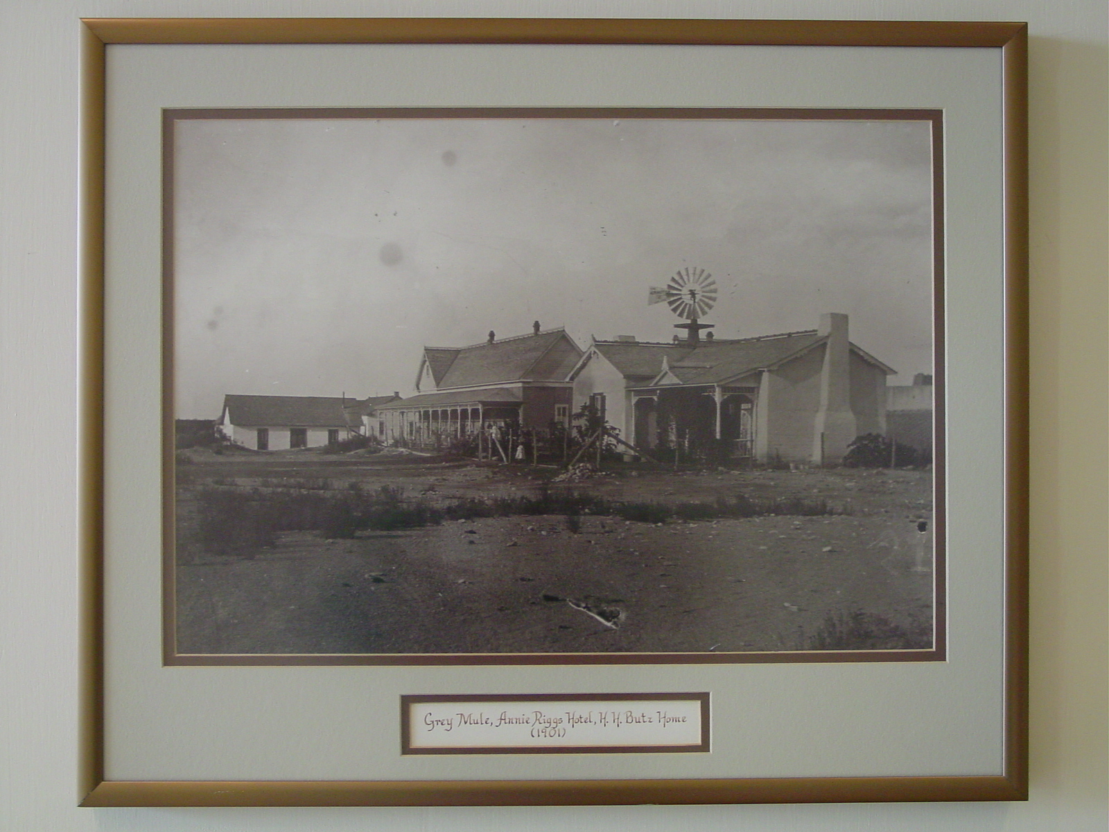
301 S Main Ft. Stockton Fort Stockton's first hotel of significance. Built 1900. Adobe, with "gingerbread" trim. Large verandas, dining room, parlors, guest rooms. Recorded Texas Historic Landmark, 1966 |
Baxter-Rixse Cemetery (Photo) Imperial Time Periods of Burials: 1860-1945 |
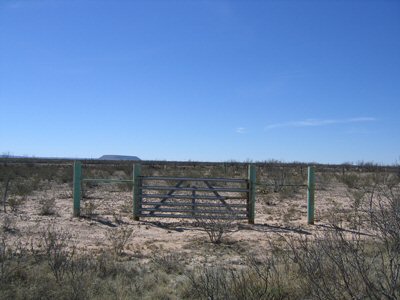
Boyd Family Cemetery (Photo) Coyanosa North from Coyanosa on FM 1776 to FM 1450. Left (west) 4.3 miles to gravel Waha Gas Plant Gate #6 on south side. South 2.1 to cemetery on east (left) side Time Periods of Burials: 1900-1945 |
Buena Vista - Old Buena Vista, Mexican American Cemetery (Photo) Imperial FM 11 SE from Imperial 5 miles to Old Girvin Hwy. Continue SE on Old Girvin Hwy (becomes gravel) .5 miles to cemetery on NE side of road Time Periods of Burials: 1860-1900, 1900-1945, 1945-1975 |
Canon Ranch Archeological District (Photo) Sheffield LISTED IN THE NATIONAL REGISTER Significant Dates: 1000 Cultural Affiliation: Paleo-Indian; Archaic; Late Prehistoric Areas of Significance: Prehistoric; Historic - Non-Aboriginal Current Function: Agriculture/Subsistence Subfunction: Animal Facility Historic Function: Domestic; Industry/Processing/Extraction; Agriculture/Subsistence Historic Subfunction: Water Works; Camp; Animal Facility; Institutional Housing Period of Significance: 5000-6999 BC; 7000-8999 BC; 1499-1000 AD; 1900-1750 AD; 9000-10999 BC; 1749-1500 AD; 1000 AD-999 BC; 1000-2999 BC; 3000-4999 BC Acreage: 160000 |
Canon Ranch Railroad Eclipse Windmill (Photo) Sheffield W of Sheffield on Canon Ranch LISTED IN THE NATIONAL REGISTER Period of Significance: 1900-1924; 1875-1899 The Canon Ranch Railroad Eclipse Windmill is located on the Charles C. Canon Ranch west of the town of Sheffield, Texas. The windmill and well are located in the corral area near the ranch headquarters. The Railroad Eclipse Windmill was made of wood, cast iron, and steel. The wheel had a total of two hundred and thirty-two wooden blades, which were bolted in sections to a wooden wheel frame. The head, or operating portion of the windmill, located at the top of the wooden tower, was made of cast iron and steel and used habitant bearings. Attached to the head were two tails, one for speed control and the other for on-off control. Both of these tails were of wood reinforced with small amounts of cast iron and steel. The original tower was replaced with a newer "telescoped" tower in 1915. This tower remains in use at the present time. The windmill continued to serve the ranch for many years, but in time it was replaced by a power pump. In the early 1960's the mill was damaged by a severe windstorm. Then in 1964, Charles C. Canon, the son of the original builder of the mill, had the windmill completely restored and placed in operating condition over the original well. At the present time the wooden parts of the mill are painted light green with black trim. The tower is painted white. The wheel of the mill is 22.5 feet in diameter. The wheel, cut-off vane, and regulator vane are composed mostly of wood with some cast iron and steel parts. The pump mechanism is likewise made of wood and cast iron. Today, an electric motor is operating the plunger of the well beneath the windmill. The windmill is in excellent operating condition and could be connected to the plunger, providing ample water for ranch and livestock use. Since the windmill has been recently restored, no further work seems to be in order except for periodic maintenance. Due to the fact that the Eclipse Windmill is in near perfect condition, it may be one of the last working large windmills that can be observed. The Canon Ranch Railroad Eclipse Windmill is one of the few operable Railroad Eclipse Windmills remaining in the United States. These windmills were the largest commercially produced windmills in the United States and were used extensively along the railway routes through the arid Southwest. The Canon Ranch Railroad Eclipse Windmill operated for many years as the primary source for water at the Canon Ranch headquarters. One of the most important engineering achievements which influenced the development of West Texas and New Mexico was the windmill. Windmills have been used in Europe since before the 12th century. However, the European windmill, often 50 to 100 feet in diameter, was too large to be successfully used and transported in the West. Daniel Halladay, a mechanic from Connecticut, is credited with the invention of the first American windmill in 1954 which proved to be a marketable product. In 1857. the U.S. Wind Engine Company was formed for manufacturing the Halladay windmill. The first windmill's came to West Texas about 1881 with the coming of the railroads. A dependable supply of good quality water was necessary for steam locomotive boiler supply. Both the Southern Pacific and Texas & Pacific Railroads made use of the windmill for water supply. These railroads used windmills made by the Eclipse Windmill Company similar to the once located at the Canon Ranch. Wind Engine Company was formed for manufacturing the Halladay windmill. In 1898 William Canon, the owner of extensive ranching interests west of the Pecos River in Texas, was determined to replace the mule-driven pump at his ranch headquarters with a wind-driven pump. He probably chose the large railroad-style Eclipse Windmill because of its ability to pump water from deep drilled wells. The model that he chose, a twenty-two and a half foot diameter windmill, was the largest ever constructed by the Eclipse Company. BIBLIOGRAPHY ON FILE IN THE NATIONAL REGISTER |
East Hill Cemetery (Photo) Fort Stockton In Fort Stockton, South on Hwy 285 to Parkview. East on Parkview 1 mile to cemetery at end of road on south side |
Spring Dr. at Rooney Park Ft. Stockton Used as a watering place and camping ground by Indians since Pre-Columbian times, the Springs were possibly visited about 1536 by Spaniard Cabeza de Vaca on his wanderings through Texas. The expedition of Juan de Mendoza, with his party of Spaniards and Jumano Indians, camped near the waters in 1684. The six major, gushing springs and the beautiful river they formed resulted from water seeping up through geological faults to the earth's surface. The reservoir which supplied them was located in the formation known as "Trinity Sand." The Springs, among the largest in all Texas, were one of the few good watering places in this arid region. They supplied Indians raiding into Mexico on the nearby Comanche war trail and also gold seekers traveling to California on the southern route, 1849 and later. Butterfield Overland Mail stage stopped here as well, and after 1859 the Springs provided water for Fort Stockton, which was founded both to protect the mail and stop the Comanche raids. The Springs began to be tapped for irrigation as early as 1875, but today irrigation projects to the north and west have reduced the underground water supply so much that the Springs no longer flow. |
Courthouse, Jail and Zero Stone James St. between Main and Nelson St. Ft. Stockton Courthouse and jail. Built 1883 of native sandstone. Nearby Zero Stone place in 1859 as first reference point of local surveys. Recorded Texas Historical Landmark, 1966 |
Callaghan and Spring Dr. Ft. Stockton F. W. Young Store and home. Built 1876 by this former post sutler at ford over Comanche Creek. Had wagon yard, corrals in rear. Recorded Texas Historic Landmark, 1966. |
610 Callaghan (corner of Callaghan & Butz St) Ft. Stockton The Pecos County commissioners authorized E. W. Bennett (1858-1933) to establish Ft. Stockton's First Telephone service in May 1909. The switchboard, operated by Bennett's daughter, Zetta, was located in a room attached to this adobe house, where the Bennetts lived. The wires connected with Ft. Stockton's 200 phone subscribers with Ozona, where Bennett's sons, John and Will, ran the family's telephone exchange. Lines were later strung to other towns, completing this vital communication link. The Ft. Stockton Exchange became part of Southwestern Bell Telephone System in 1928. |
Fort Cemetery (Photo) Walter and 8th St. (corner of Walter and 8th Sts) Ft. Stockton Burial ground for soldiers stationed at Fort Stockton and for civilians in the little town that grew up around the post. The fort was established 1859; temporarily closed 1861-1867. Troops here protected the San Antonio-San Diego mail line and quelled Indian raids into Mexico on the infamous Comanche Trail. This cemetery testifies to the hardships of frontier life: no headstone was erected for a person over 40. In 1888 (after the fort was permanently closed in 1886), remains of the 56 soldiers buried here were moved to Fort Sam Houston in San Antonio |
Site of Fort Stockton Historical Marker Main & James St. (Courthouse Grounds) Ft. Stockton Established on the Comanche Trail March 23, 1859, as a protection to the San Antonio-San Diego mail route. Named in honor of Commodore Robert Field Stockton, 1795-1866, who captured California for the United States. A stage stand on the San Diego Line, 1858-1861. Evacuated by federal troops during the civil war, reoccupied July, 1867. Permanently abandoned June 30, 1886 |
Corner of E 3rd and Rooney St. Founded in 1859, Fort Stockton was abandoned during the civil war and reestablished in 1867, when this guard house was built. Stone for the structure was quarried locally. The lumber was hauled from Indianola by Oxcart. The Guard House consisted of a room with arm and leg irons, a dungeon for solitary confinement, and quarters for guards. It was abandoned in 1886, Recorded Texas Historic Landmark, 1966. |
Fort Stockton Historic District East edge of town LISTED IN THE NATIONAL REGISTER The city of Fort Stockton is located in central Pecos County in the western part of Texas. It is strategically located at Comanche Springs, the third largest springs in Texas and a major source of water in this arid country. Although the first fort was established there in 1858, it was occupied only briefly. During the Civil War, the fort was occupied by Confederate forces and it was not until the re-occupation by Federal troops in 1868 that building was begun at the present site. The reactivating of the fort provided the impetus for the growth and development of the city itself. Final occupation, by the Army here lasted until 1886. After this time, the fort structures were moved into by the local population some were dismantled, and many disappeared. What remains today of the old fort are three officer's quarters, a stone guardhouse, and some stone foundations of what is presumed to have been barracks. Other buildings associated with the Fort Stockton Historic District were either directly related to the fort or form a part of the early frontier spirit of the town and its history. Its here defined, the Fort Stockton Historic District includes: That area within the City of Fort Stockton bounded by Water Street on the west, and running south along Water Street to Division Street. One block west on Division to Main Street and running two blocks south on Main Street to James Street. Then going east on James to Spring Drive and following Spring Drive north-northeast to Comanche Springs, around the east side of Comanche Springs west to the alley between St. Gall and Orient streets. Then north to Fifth Street; from Fifth Street the boundary runs east along Fifth to Water streets and north up Water Street to the Old Fort Cemetery and encompassing it. The irregular conformation of the district is dictated by the location of the cemetery relative to the other fort and town related structures. However, it is felt that the cemetery and the additional later structures within the district provide a continuous segment of the development of the history of the town. Those structures or areas comprising the district are the following: 1. Fort Stockton Cemetery. This area was used as the burial grounds for the troops and civilian population of the town of Fort Stockton. 2,3,4. Officer's quarters, c. 1867-68. These three buildings are three of four extant fort buildings from the second construction. They are adobe construction set on stone foundations An 1884 photographs of the officer's row indicates that little modification has taken place with the exception of some additions on Quarter's 2 and 4. 5. Barracks foundations, c. 1886-70. Two roughly rectangular and two roughly square outlines of stone foundations appear on the east side of the parade ground. An early plat of the fort clearly shows the location of the officer's quarters on the east and the enlisted barracks on the west Therefore, these structural remains are presumed to be those of barracks. 6. Guardhouse, 1886. The guardhouse, the remaining extant structure of the four dating from the second fort construction stands at the south end of the parade ground. Its construction is of dressed, hewn limestone blocks. A stone in the rear of the building (south elevation) reads: "Erected 1868 by Lieut. J. L. Humfreville." 7. St. Stephen's Episcopal Church, 1896. This small (one room) Victoria church is purported to be the oldest Protestant church west of the Pecos. It was built in Pecos, Texas, and moved to Fort Stockton in 1958 when it was scheduled to be torn down. 8. Victorian structure (former hospital). This building is located at the site of the post hospital. It is a stucco covered adobe structure with a gallery across the entire front (south) facade. 9. Store, established 1894. This store, located directly across from Comanche Springs, served Fort Stockton as well other Pecos County settlers. The original core of the structure was a rubble, stone construction. The second store is an obvious later addition. 10. Grey Mule Saloon, 1880's. This saloon, which is stucco covered adobe, was used by troopers as well as hotel guests. 11. John Young Store, established 1876. This adobe structure served as both store and residence for the former post sutler. 12. Annie Riggs Hotel, 1900. This early, frontier hotel is an interesting combination of traditional adobe construction combined with an elaboration of late Victorian wooden, milled architectural elements. A most unusual element in the building's construction are the vertical 2x4 wooden members which are let into the exterior face of the adobe walls at regular intervals. These elements serve no structural need and do not appear to have been ever used as nailing boards for any type of exterior sheathing. The wooden verandahs with turned posts, bracketed, and spandrels surround much of the structure. The verandahs combined with the decoratively shingled gable ends and scroll-work bargeboards produce a most striking contrast of rough adobe against delicate woodwork. The Annie Rigs Hotel, which is now a local museum, has remained in an unaltered state since its erection. Comanche Springs. These springs are the third largest in Texas. They have been used by prehistoric Indians, Historic Indians, and settlers. The springs were the reason for the location of Fort Stockton at this spot and the ultimate development of the city. Fort Stockton was one of several Army outposts established along the western frontier of Texas in 1858 to defend and protect the new settlers from Indian hostilities was strategically placed at Comanche Springs, a major source of water for both Indian and settler. The primary responsibility of the post was the protection of the San Antonio-San Diego stage line. The fort figured in one of the most colorful aspects of military history, U.S. Sec. of War, Jefferson Davis' camel experiment. For a brief time before the Civil War a contingent of the camel detachment was stationed at the fort. Stockton thrived until the outbreak of the Civil War when it was abandoned to the Confederate forces. In 1868 when it was reactivated, the fort had to be completely rebuilt. The extant structures of the fort and settlement are remainders of this period. Until its abandonment in 1886, the fort provided resting stop between the long haul from E1 Paso to points, south and southeast such as Forts Clark, Sam Houston, and those south Texas forts such as McKintosh and Ringgold. Along with the fort, commercial interests centered around the springs. With the abandonment of the fort, the buildings and fort area became an even more integral part of the city. Fort Stockton is unique in that a part of the city which spring alongside the fort is still extant today as well as portions for the fort itself. Fort Stockton is an excellent example of a renter settlement developing at a military outpost. Those remaining structures of the fort and early town clearly reflect the frontier history of the trans- Pecos region of Texas. BIBLIOGRAPHY ON FILE IN THE NATIONAL REGISTER |
Fort Stockton Officers' Quarters Near intersection of E. 5th and N. Williams Sts When Fort Stockton was rebuilt in 1867 to protect the route to El Paso, seven homes were erected for officers' families. Built with rock foundations and thick adobe walls, the structures faced the parade ground. Nearby were located corrals, carriage stalls, and other outbuildings. The houses were used by Officers' families until the fort closed in 1886. Three of the residences remain standing. Recorded Texas Historic Landmark, 1966 |
Fort Stockton, C.S.A. (Photo) In Front Courthouse Grounds, Corner of Nelson and James Sts. After federal evacuation at start of Civil War, occupied by 2nd Regiment Texas Mounted Rifles. On far western frontier defense line. Supply post for troops going to and from Arizona-New Mexico campaign 1861-1862, designed to make confederacy an ocean to ocean nation. At times this area was the center of Comanche and Apache activities. California union troops dominated area 1862-65. Stopover on way west for many union sympathizers and people wanting to avoid conflict of war |
Girvin Cemetery (Photo) Girvin From Hwy 67/385 & FM 11 junction in Girvin, north on FM 11 2 miles following road as it curves west to cemetery 50 yards south of road, between road and RR trac Time Periods of Burials: 1860-1900, 1900-1945 |
219 S. Main ( corner of Main and Callaghan Sts.) Ft. Stockton Part of Old Fort Stockton; built in 1880's. Hangout for cowboys and hotel guests. Later a store and post office. Recorded Texas Historic Landmark, 1966 |
Spring Dr. across from Comanche Springs in Rooney Park Ft. Stockton Built 1870's of field stone. Herman Koehler in 1884 opened saloon at one end, general store and bank at other. Later second story was added. Recorded Texas Historic Landmark, 1966 |
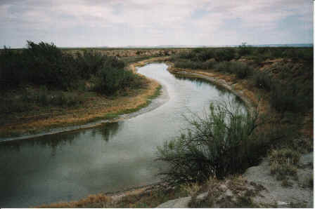
Horsehead Crossing (Photo) Girvin About 11.5 miles NW of Girvin on FM 11 (at 31�14' N, 102�29' W) The river forms the Pecos-Crane county line. It is the river crossing site on Butterfield trail, connecting frontier forts. Famed ford of the Pecos River, named for abundance of horse and mule skulls lining the banks in the 19th century. Many water-starved animals, stolen in Mexico by Indians and driven along the Comanche war trail, died after drinking too deeply from the river. After the California gold strike in 1848, Horsehead Crossing became a major landmark on the trail west, as it provided the first water for about 75 miles on the route from the east. Emigrants arriving here either turned northwest along the river or crossed and continued southwest to Comanche Springs at Fort Stockton. In 1858, the crossing became an important stop on the Butterfield Overland Mail route from St. Louis to San Francisco. An adobe stage stand was built and a ferry put into operation, but both were abandoned in 1861, when mail service was terminated. In late 1862, during the Civil War, federal forces kept a close watch at the crossing in reaction to a threatened confederate invasion. Cattle began to be trailed across the Pecos in 1864, and in 1866, Charles Goodnight and Oliver Loving blazed their famous trail, which came to this point and turned upriver. Completion of two railroads across west Texas in the early 1880s caused abandonment of the crossing.� |
Horse Head Crossing on the Pecos River Girvin From Grivin, about 11 1/2 miles NW on FM 11 to Marked CR, about 4 miles N on CR to Marker Here crossed the undated Comanche Trail from Llano Estacado to Mexico in 1850. John R. Bartlett while surveying the Mexican boundary found the crossing marked by skulls of horses; hence the name "Horse Head", the Southern Overland Mail (Butterfield), route, St. Louis to San Francisco, 1858-1861, and the road west from Fort Concho crossed here. The Goodnight-Loving trail, established in 1866 and trod by tens of thousands of Texas longhorns, came here and turned up east bank of the Pecos for Fort Summer and into Colorado |
Corner of Sherer and Nelson Sts. Ft. Stockton Oldest house. Only reminder of first Fort Stockton, founded 1859. Was part of old St. Gall townsite. Had thatched roof, adobe walls. Recorded Texas Historic Landmark, 1966 |
Near intersection of 2nd and Spring Dr. Ft. Stockton About 1910 a railroad stop named Hovey was established about 40 miles west of here on the Kansas City, Mexico, and Orient Railroad. By 1913 Hovey contained a depot, post office/general store, and several stock shipping. Hovey school was established in 1913. The first school building burned and in 1916 this schoolhouse was erected in Hovey. It served as a one-teacher seven-grade school for Anglo and Hispanic students of the rural ranch community of Hovey. After the school closed in 1938 the building served as a community center. It was moved here in 1987. |
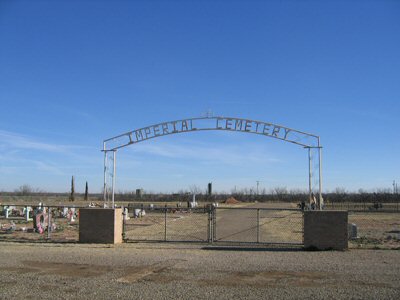
Imperial Cemetery (Photo) Imperial FM 1053 1 mile SW from Imperial to Imperial Cemetery Road. Right (NW) on Imperial Cemetery Road .5 miles to cemetery on east side |
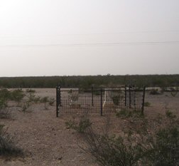
Ira G. Yates Ranch Cemetery - Unknown Mexican Worker, Old Hickox Ranch Grave (Photo) Iraan In Iraan; N on Blanton Street to 12th. Left (west) on 12th to 306. Cemetery is located 200 yards north of 12th St. on west side of fenceline on Yates Ranch Time Periods of Burials: 1900-1945 |
6th and Farr St. in front of Community Building Iraan In 1922 three local businessmen, O. W. Parker, George Thompson, and I. G. Yates, leased the drilling rights on twenty sections of ranch land to Transcontinental Oil Company. After two dry holes were drilled the I. G. Yates well No. 1 blew in on October 28, 1926. The area around ranch headquarters became a boom town. Because it was isolated, support of the increased population became difficult. Yates converted a barn into a hotel and the area became known as Red Barn Community. In April 1927 Yates commissioned H. L. George of San Angelo to survey a townsite at this location, 3 miles north of Red Barn. A contest was held to choose a name for the new town. The winner was "Iraan", submitted by C. R. Hallmark who combined the names of Ira Yates and his wife Ann. His prize was a city lot. The first business to operate in Iraan was a service station run by K. P. Looney. A Post Office was opened in 1928. A nondenominational chapel known as union church was set up from contributions by Yates and Mid-Kansas Oil Company. During the boom days of Iraan, V. T. Hamlin worked as a free-lance writer. It was here that he created the comic strip "Alley Oop" . A park honoring his cartoon characters is located in the city |
Marathon Oil Company Discovery Well Iraan On US 190/SH 349, Western edge of Iraan Opening one of greatest oil fields in the world, Mid-Kansas Oil and Gas Company (a subsidiary wholly owned by the Ohio Oil Company, whose name has now been changed to Marathon Oil Company) brought in the I. G. Yates "A" No. 1 well on October 29, 1926. The well at the shallow depth of 1,150 feet had a rated potential daily flow of 72,869 barrels. Previously oil men had said: "You won't find any oil west of the Pecos." This did not stop the work of Mid-Kansas Oil and Gas Company and its partner, Transcontinental Oil Company, later acquired by Marathon Oil Company. The strike was sensational. Scarcely more than a year later, the Yates field had 100 wells--two of which had higher yields than Yates No. 1. Under the 20,000-acres Ira G. Yates ranch and adjoining lands lay one of the largest oil reserves in the world. The many developers voluntarily adopted proration. Their plans for allocating and restricting Yates fields production were approved by the Texas Railroad Commission in 1928. This was the first complete commission in 1928. This was the first complete proration of an oil field in the state --and an important milestone in petroleum conservation. The Yates field now has 607 wells |
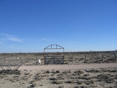
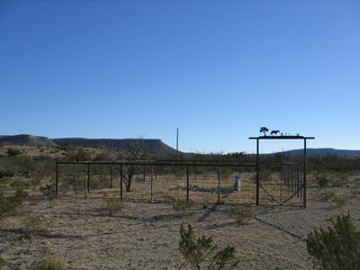
McKenzie Cemetery - Windy Mesa Ranch, Coon Drops (Photo) Bakersfield Time Periods of Burials: 1975-Date of Survey |
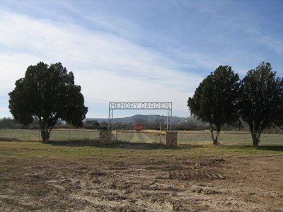
Memory Garden Cemetery (Photo) Iraan .5 miles east of Iraan on south side of Hwy 29 Time Periods of Burials: 1900-1945, 1945-1975, 1975-Date of Survey |
Oil and Gas Industry in Pecos County Ft. Stockton 1000 Railroad Avenue, Fort Stockton Chamber of Commerce Visitor Center, interior Located in the petroleum-rich Permian Basin, Pecos is one of the most prolific oil- and gas-producing counties in Texas. The petroleum business here began about 1900 with the drilling of the Turney well near an ancient "seep", a traditional local source of oil for lubricating and medicinal purposes. A short-lived boom in 1921 caused by the discovery of the "Miracle Well" heralded the arrival of the fabulous Yates oil field (1926), indicating the area's great potential oil wealth. Since that year over 710 million barrels of oil have been produced from the Yates, Fort Stockton and other county fields. The presence of natural gas, known for years, was slow to be exploited because gas was considered an undesirable by-product of the oil business. The first commercial use of gas here was inspired after it was found by workers drilling a water well, in 1925. The discovery, about 1948, of Santa Rosa field spurred exploration that brought in the Puckett field in 1952. Subsequent deep drilling tapped many extensive pools, including in 1963 the prolific Gomez Field, which had produced over 478 billion cubic feet of gas as of 1970. Today petroleum is the single most important economic asset of Pecos County |
Old First National Bank Building Second and Main Sts. Ft. Stockton Built in 1912, this structure originally housed the First National Bank of Fort Stockton. Established two years earlier, the bank failed during the years of the great depression. In 1935 the building was purchased by the Pecos County State Bank. Chartered in 1928, the financial institution was located here until 1960. The structure exhibits Neo-Classical styling and features massive doric columns that support an elaborate pediment. Recorded Texas Historic Landmark, 1983 |
.1 mile south of Hwy 385 on west side of Water Street Fort Stockton See also, Fort Cemetery |
Pecos County Historical Marker US 385, eastern edge of Fort Stockton south of IH-10 Fort Stockton Formed from Presidio County, created May 3, 1871. Organized March 9, 1875. On March 9, 1875, the following county officers were elected: George M. Frazer, Chief Justice. Cesario Torre, Commissioner. Francis Rooney, Commissioner. Hipolito Carrasco, Commissioner. Fort Stockton, County Seat. Oil was discovered in the Yates field in 1926 |
Pecos County Camptosaur Tracks Historical Marker In Ft. Stockton City Warehouse, taken down due to vandalism Fort Stockton In the arroyo southwest of this site are dinosaur tracks made 120 million years ago when area was part of sea that extended north from the Gulf of Mexico. These tracks, embedded in rocks of the Comanchean Cretaceous period, were left by a Camptosaurus dinosaur, ancestor to the better known duck-billed Trachodon. According to research, this plant-eating animal was about 20 feet long and ten feet tall. His hind legs were strong and longer than his arms which were used to grasp and tear food. His neck was short; head small; the tail long, perhaps equal in length to the body. Measurement of the exposed tracks (17 1/2 inches wide and 21 inches long) determine that this Camptosaur's stride was 5 ft. 10 inches from toe to heel; his pace, 11 ft. 8 in. The shallow sea in which this dinosaur (and other forms of animal and plant life) lived and died was gradually covered by deposits of mineral-laden earth. As this area rose and settled through hundreds of centuries, the buried organic matter was gradually converted through chemical changes to vast resources of petroleum, natural gas and sulphur. This Camptosaur's tracks remain to remind mankind of the prehistoric age in which the oil industry had its infant beginnings |
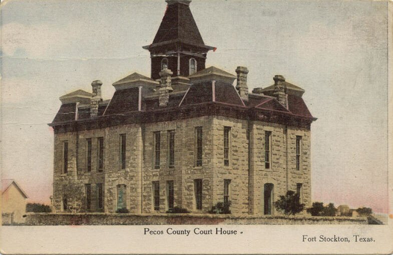
Pecos County Courthouse-1883 (Photo) Fort Stockton Building Completion Date: 1883 |
Pecos County Courthouse-1912 (Photo) Fort Stockton Building Completion Date: 1912 Central dome removed. originally built in 1883, partially demolished and remodeled in 1911-12 Historic Interior Images: Sheriff's Office 1920 ABT Pecos: A History of the Pioneer West (vol. 2), Superintendent's Office 1930 ABT Pecos: A History of the Pioneer West (vol. 1), County Judge's Office 1935 Pecos County History |
Restland Cemetery (Photo) Iraan 3.5 miles NW of Iraan on north side of Hwy 349 |
Pioneer Stagecoach Stand Operators Mr. and Mrs. Isaac J. Rude Ft. Stockton On Service Road side of I-10, about 8 miles West of Ft. Stockton On way to California from Tennessee in the 1850's Isaac J. and Sarah Isabella Rude settled in West Texas. In Davis Mountains, Rude built and operated a station for the Butterfield Overland Stage; here passengers had meals while mules were unharnessed and exchanged for a fresh team. Soon Butterfield--the pioneer passenger and mail service (1858-1861) from St. Louis to California--had Rude move here to Ft. Stockton and build another stand. In 1859, when a stop was added at Leon water hole, 5 miles west of Ft. Stockton, Rude built and ran the stand there. Food there was best on the route, said a journalist. Sarah Rude (1834-1916) carried a pistol under her apron, to protect her children. When Indians attacked the Davis Mountains stand, the men loaded guns and handed them to Mrs. Rude--a calm, sure marksman. Just over 5 ft. tall, she butchered and skinned beeves to feed her family, when her husband was away. After stages stopped operating in 1861, Isaac Rude, like others associated with the Overland Mail, joined the Confederate army. Later he became a prosperous businessman in McKinney. Born in 1829, he died in 1902 |
Saint Stephen's Episcopal Church Corner of E. 2nd and Spring Rd Ft. Stockton Episcopal Church. Oldest Protestant church in Trans-Pecos Texas. Moved to site, 1958. Contains solid ebony cross. Recorded Texas Historic Landmark, 1966 |
On SH 290 in front of community swimming pool Sheffield Spanish explorers traveled Indian trails here in the Pecos River Valley as early as 1590. Later, U.S. Cavalry, a camel train, and stage and mail lines between San Antonio and San Diego, California, used the route. Nearby Pecos Spring attracted settlers to the area in the 1880s and 90s. Families lived in tents on the north side of the creek and hauled water from the spring. About 1890 a community water well was dug. Early residents were sheep and cattle ranchers. Mail and supplies had to be brought from San Angelo and Ozona. About 1901 Will Sheffield built a grocery and dry goods store approximately one mile from the spring. A post office opened with Will Sheffield as postmaster. Since he was the first to operate a store, the settlement was named for him. A saloon was opened, and in 1901 a school was begun with sixty-four pupils. After living for several years in tents, residents began building permanent homes. Garrett Bean purchased a section of land from the state where the present townsite is located and drew off town lots in 1905. Well-known Texas Ranger Frank Hamer got his start in law enforcement here. Sheffield offers churches and a trade center for area ranches |
St. Joseph's Catholic Cemetery - St. Joseph's, St. Agnes (Photo) Hwy 285 & 385 intersection, south on 385, following 385 as it splits with Hwy 194. Follow to El Paso St. Left (east) .5 miles to cemetery on south side |
403 S Main St (Corner of James and Main St) Ft. Stockton Efforts of establish a Catholic church in the area began shortly after the Civil War when Fort Stockton was reoccupied by United States troops. The first services were conducted in 1872 by father Claude Jaillet and father Adolfo Guichon. Construction of the present church building began three years later. Located on land donated by Peter Gallagher, it was built of adobe on a stone foundation. The structure was remodeled in the 1960s. Recorded Texas Historic Landmark - 1966 |
201 W. Gallagher St (Corner of Gallagher and Nelson St) Ft. Stockton First school in area, 1883. Smaller structure served as first office for army telegraph line which arrived in 1876. Recorded Texas Historic Landmark, 1966 |
Williams, O. W. Historical Marker 100 N. Rooney St Fort Stockton Kentucky native Oscar Waldo Williams (1853-1946) graduated from Harvard with a law degree in 1876 and moved to Texas in search of a drier climate. He worked as a land surveyor as the South Plains opened for settlement and in 1884 accepted a job as deputy surveyor for Pecos County. After serving as Pecos County judge (1886-1888, 1892-1900), Williams practiced law in Fort Stockton, building an office on this site about 1915. An expert in land law and water rights, his interests and investments shifted to oil and gas leases in the region. A keen observer of events and nature, Williams also authored numerous articles on the history, folklore and natural history of the Southwest. (2001) |
�
�
�
�
�
�
�
TXGenWeb is part of the USGenWeb Project. Contact the Pecos County Coordinator, Eddie Cope, Eddie.cope@sbcglobal.net Last updated: Wednesday, January 11, 2017 11:50 AM Copyright 2009 by Eddie Cope� |
|
