 |
Maps & Places Compiled by: Paul M. Kankula NN8NN (non-copyrighted) |
|
Maps & Places Compiled by: Paul M. Kankula NN8NN (non-copyrighted) |
09 Jan 2015
General Information
American Memory Railroad Maps 1828-1900
Ancestory.com County Formation Maps & Records
Cyndi's List - Canals, Rivers & Waterways
Cyndi's List - Migration Routes, Roads & Trails
David Rumsey Map Collection - 11,000 on-line maps..!
Sanborn Fire Insurance Maps at Library of Congress
|
|
SC Department of Archives & History:
|
In 1682, after the first hard years of settlement, the Proprietors ordered three counties laid out. Berkeley County, centering around Charleston, extended from the Stono River on the south to Seewee Creek (present-day Awendaw Creek) where it emptied into Bulls Bay on the north. Craven County lay north of Berkeley, and below Berkeley, Colleton extended to the Combahee River. Later, a fourth county, Granville, was laid out between the Combahee and the Savannah rivers. |
|
|
Throughout the colonial period, the small population and its limited legal needs kept most government, records keeping, and judicial activity confined to the municipal limits of Charleston. Parishes of the established Anglican Church served as election districts, and courts with jurisdiction over the entire colony sat in Charleston. |
|
|
Georgetown extended from the North Carolina line to the Santee. Charleston lay between the Santee and the Combahee. Beaufort sat between the Combahee and the Savannah. Northwest of Georgetown was the Cheraws District, bounded on the west by Lynches River; west of the Cheraws was the large district of Camden, bounded on the west by the river system of the Santee, Congaree, and Broad; south and west of Camden, two more large districts extended to the Savannah River--Orangeburg to the south, and Ninety-Six to the north. |
|
|
The 1785 act gave the Cheraws District the counties of Chesterfield, Marlboro, and Darlington; it divided Camden District into York, Chester, Fairfield, Lancaster, Richland, Claremont, and Clarendon counties. It gave Ninety-Six District the counties of Spartanburg, Union, Laurens, Newberry, Abbeville, and Edgefield. And it divided Orangeburg District into Orange, Lewisburg, Lexington, and Winton (an early version of Barnwell) counties. |
|
|
In 1786, part of the unorganized Indian land, which had been taken from the Cherokee Indians during the American Revolution and lay northwest of Ninety-Six District, became Greenville County; in 1789, the remainder of the Indian land became Pendleton County. A few counties had been set out in the three Low Country districts of Georgetown, Charleston, and Beaufort, but there, where the old parish system was well established, the counties failed to take root. |
|
|
In 1791, the four Orangeburg counties were abolished, and two new districts were created. Washington District was formed to encompass the counties of Greenville and Pendleton. Pinckney District took York and Chester counties from Camden District, and Spartanburg and Union counties from Ninety-Six District. |
|
|
In 1791, Salem County was formed from portions of Claremont and Clarendon counties; and Kershaw County was formed from portions of Claremont, Lancaster, Fairfield, and Richland counties. |
|
|
In 1800, most of the counties were formed into districts. Washington, Pinckney Ninety-Six, Camden, and the Cheraws districts vanished, and the counties they had encompassed became districts. Claremont, Clarendon, and Salem counties became Sumter District. Marion District was formed from part of Georgetown, Colleton District from part of Charleston, and Barnwell District from part of Orangeburg. Georgetown yielded Horry District in 1801 and Williamsburg District in 1804. That same year, Lexington District was formed from Orangeburg with roughly the same territory as the old county of the same name. |
|
|
In 1826, Pendleton was divided into the two districts of Pickens and Anderson. In 1855, Clarendon District was taken from Sumter with the same boundaries as the old Clarendon County of 1785. |
|
|
The Constitution of 1868 stated that "the Judicial Districts shall hereafter be designated as Counties" and formed Oconee County from the western part of Pickens. |
|
|
In 1871, Aiken County originated from parts of Orangeburg, Edgefield, Barnwell, and Lexington. |
|
|
In 1878, Hampton County emerged from part of Beaufort; in 1882, part of Charleston became Berkeley County; and in 1888, parts of Marion, Darlington, Williamsburg, and Clarendon merged to become Florence County. In 1895, Saluda County was created from part of Edgefield. In 1897, Bamberg emerged from Barnwell; Cherokee from parts of Spartanburg, Union, and York; Dorchester from Berkeley and Colleton; and Greenwood from parts of Abbeville and Edgefield. In 1902, Lee emerged from parts of Darlington, Kershaw, and Sumter. |
|
|
Calhoun emerged in 1908, from parts of Orangeburg and Lexington; Dillon, in 1910, from Marion; Jasper, in 1912, from Beaufort and Hampton. |
|
|
McCormick emerged in 1916 from Edgefield, Abbeville, and Greenwood; and Allendale, South Carolina's last county, emerged in 1919, from Barnwell and Hampton. |
SC County Population
SC Current County Maps- SCIway.com
SC Current Maps - SC Department of Transportation Maps
SC Geographic Information System (GIS) County Mapping:
Aiken County GIS
Anderson City GIS
Anderson County Assessor
Beaufort County GIS
Berkeley County GIS
Calhoun County GIS
Charleston County GIS
Clarendon County Assessor
Colleton County Assessor
Darlington County GIS
Dorchester County GIS
Edgefield County Assessor
Fairfield County GIS
Florence County Assessor
Georgetown County GIS
Greenville County GIS
Greenwood County GIS
Horry County GIS
Lancaster County Assessor
Laurens County Assessor
Lexington County GIS
Newberry County GIS
Oconee County GIS
Orangeburg County GIS
Pickens County GIS
Richland County GIS
Rock Hill City Cemetery GIS
Spartanburg County GIS
Sumter County GIS
York County GIS
SC Historical Maps - Hopkins University
SC Historical Maps - Piedmont Historical Society
SC Historical Maps - University of GA
SC Historical Maps - University of TX
US Boundaries
US County Maps:
Alabama
Counties
Alaska
Counties
Arizona
Counties
Arkansas Counties
California Counties
Colorado Counties
Connecticut Counties
Delaware Counties
Florida
Counties
Georgia
Counties
Hawaii
Counties
Idaho
Counties
Illinois Counties
Indiana
Counties
Iowa
Counties
Kansas
Counties
Kentucky Counties
Louisiana Counties
Maine
Counties
Maryland Counties
Massachusetts Counties
Michigan Counties
Minnesota Counties
Mississippi Counties
Missouri Counties
Montana
Counties
Nebraska Counties
Nevada
Counties
New Hampshire Counties
New
Jersey Counties
New
Mexico Counties
New
York Counties
North Carolina Counties
North Dakota Counties
Ohio
Counties
Oklahoma Counties
Oregon
Counties
Pennsylvania Counties
Rhode Island Counties
South Carolina Counties
South Dakota Counties
Tennessee Counties
Texas
Counties
Utah
Counties
Vermont
Counties
Virginia Counties
Washington Counties
West Virginia Counties
Wisconsin Counties
Wyoming
Counties
US GenWeb Archives - United States Digital Map Library
Windows Live Local On-line Mapping
Yahoo Local Maps On-line Mapping
Abbeville County
>
Anderson County
Anderson County Geographic Information System Director:
Geoff Cannada, GIS Director
E-mail: [email protected]
Anderson County GIS Mapping
101 S. Main St., Room 20
Anderson, SC 29621
Phone: 864-260-1004
Fax: 864-260-4044
http://www.andersoncountysc.org/
1877 Dark Corners, Anderson County, SC
1877 Savannah Township, Anderson County, SC
1877 Varennes Township, Anderson County, SC
1877 ($3) & 1897 ($5) County Maps For Sale at Anderson Library
Assessor Records & Maps
Historic Districts:
Anderson Historic District (.pdf)
Boulevard Historic District (.pdf)
Downtown Historic District (.pdf)
Westside Historic District (.pdf)
Anderson - County Seat
Asaville
Bethany
Broadway Lake
Centerville
Craytonville
Ebenezer
First Creek
Gluck
Homeland Park
Jones Chapel
Lake Secession
Long Branch
Mount Bethel
Northlake
Sandy Springs
Snow Hill
Town WebSites:
Townships:
Anderson
Belton
Broadway
Brushy Creek
Centerville
Garvin
Dark Corner
Fort
Hall
Honea Path
Hopewell
Martin
Pendleton
Rock Mills
Savannah
Varennes
Williamston
Greenville County
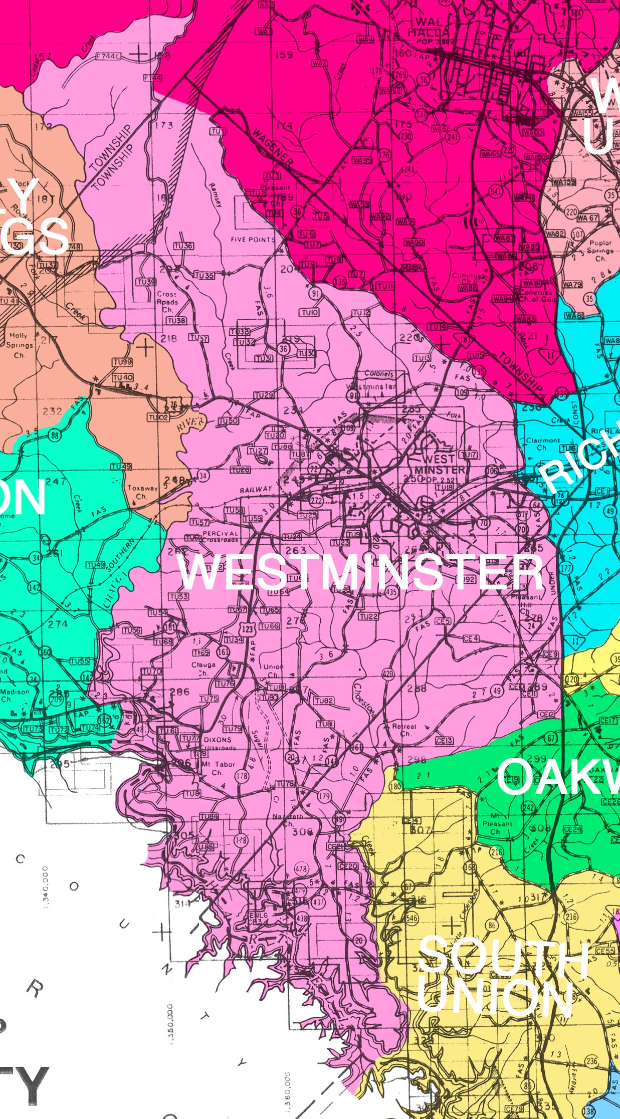
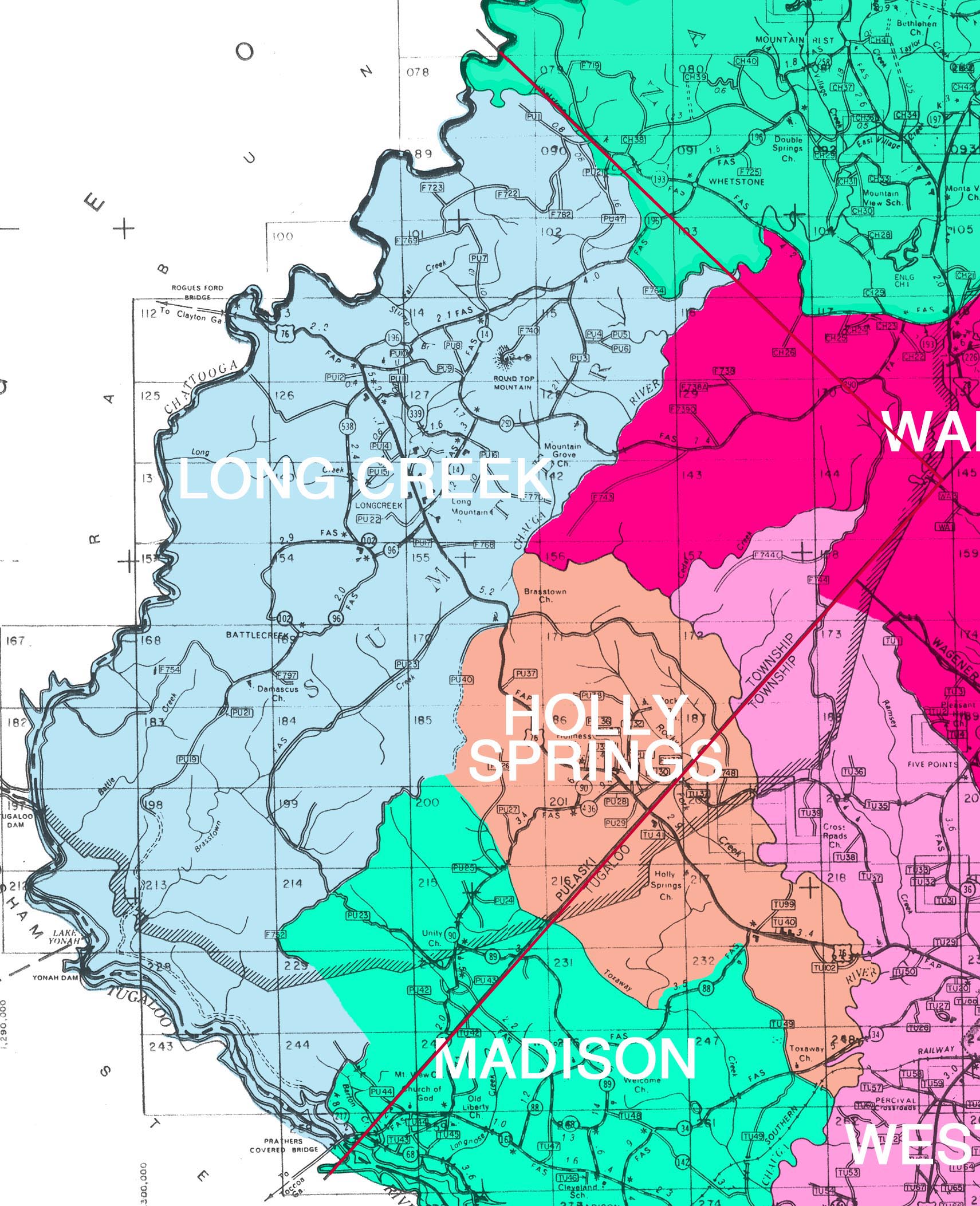
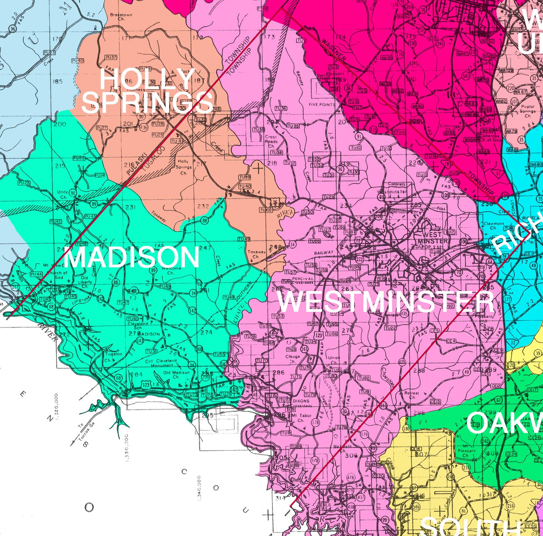
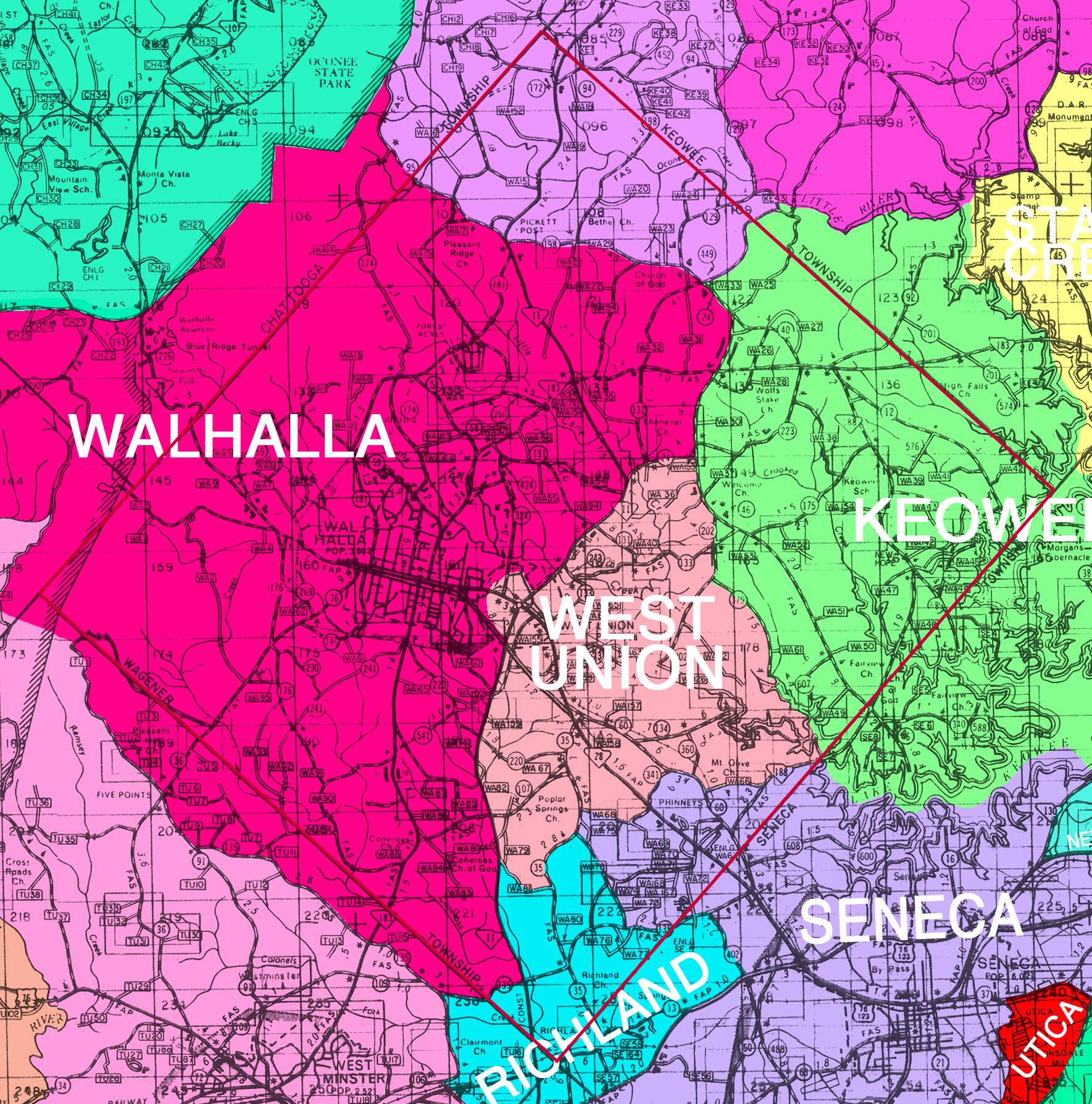
Oconee County
Oconee County Geographic Information System Director:
Mark Washington, GIS Director
E-mail: [email protected]
Oconee County Planning Department
415 S. Pine St.
Walhalla, SC 29691
Phone: 864-638-1036
Fax: 864-638-4185
http://www.oconeesc.com/planning/default.htm
http://www.oconeesc.com/gis/index.html
Chickasaw Point
Fair Play
Mayucha
Mountain Rest
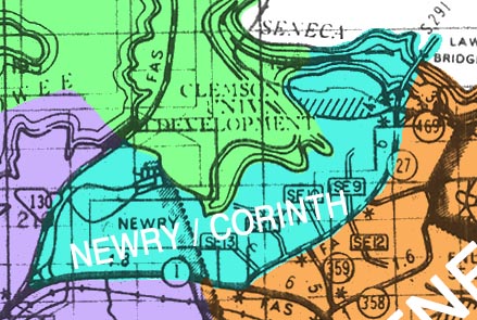
Newry
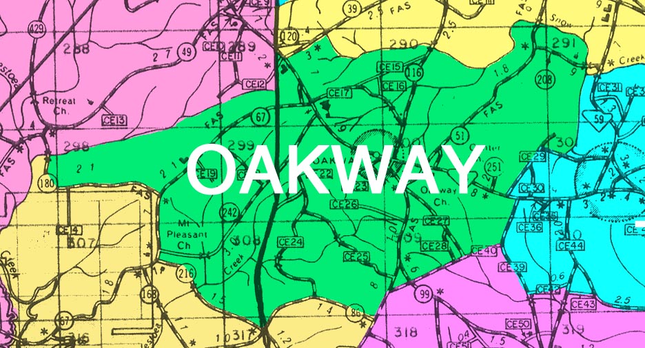
Oakway
Tamassee
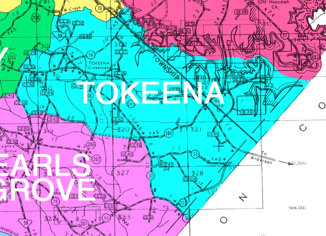
Tokeena
Utica
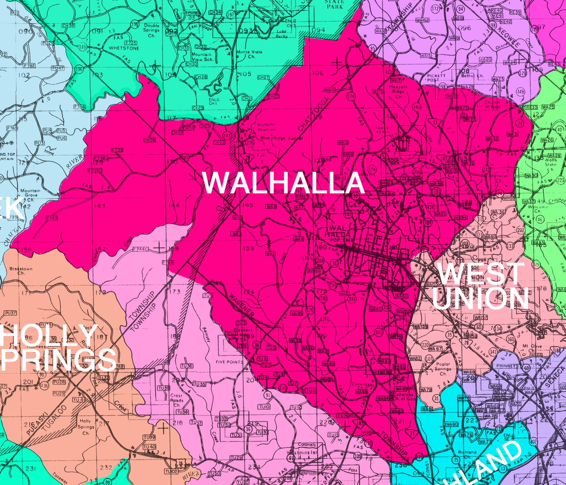
Walhalla - County Seat
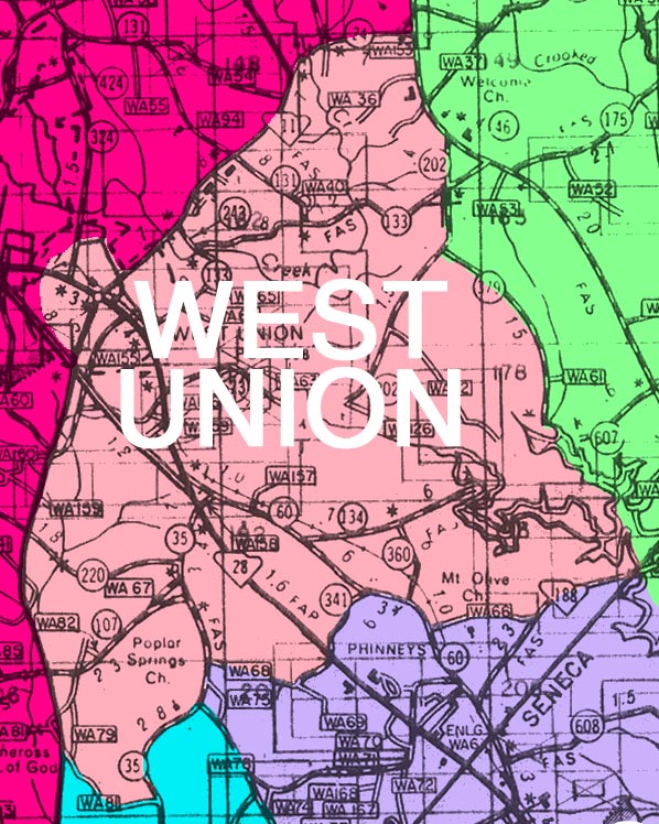
West Union
Town WebSites:
1971 FIRE DISTRICTS (submitted by Marge Peak of Walhalla) :
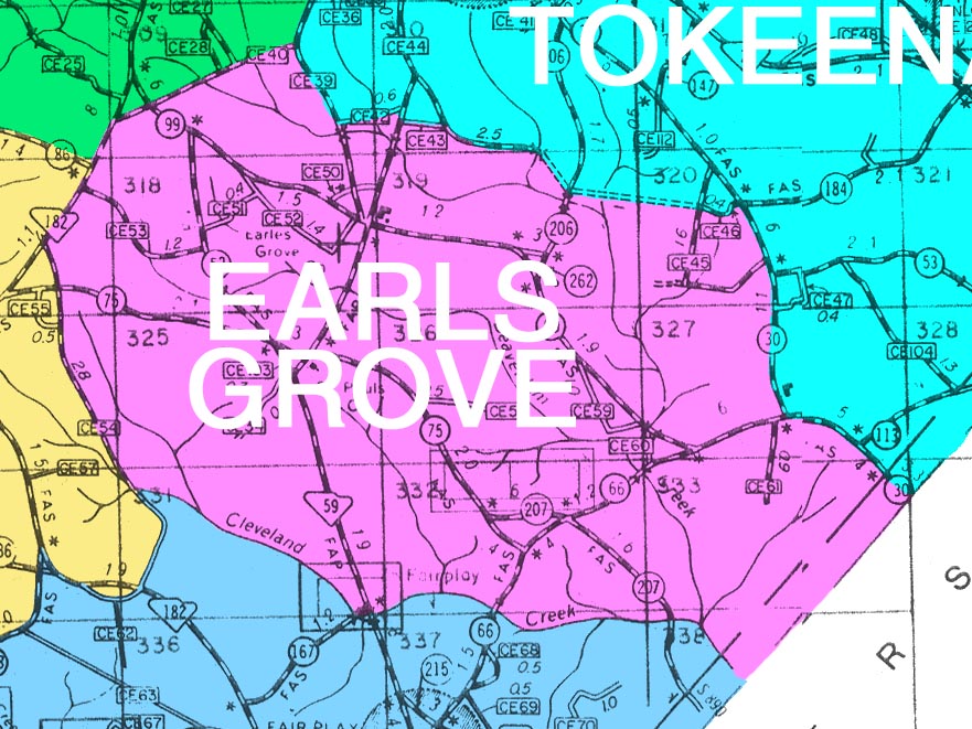
Earl's Grove M-01, 166K
Fair Play M-02, 180K
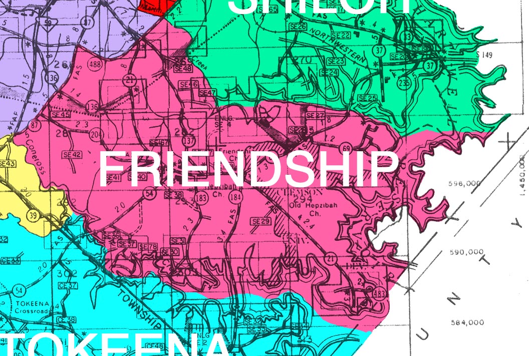
Friendship M-03, 232K
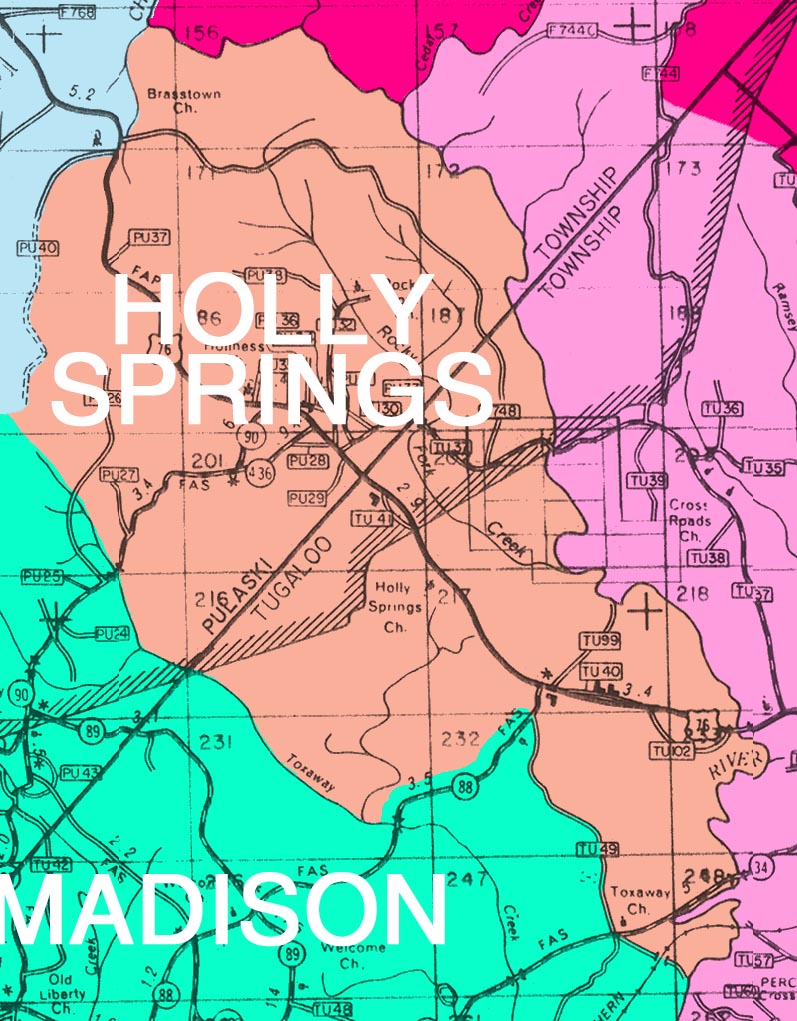
Holly Springs M-04, 187K
Keowee M-05, 352K
Long Creek M-06, 395K
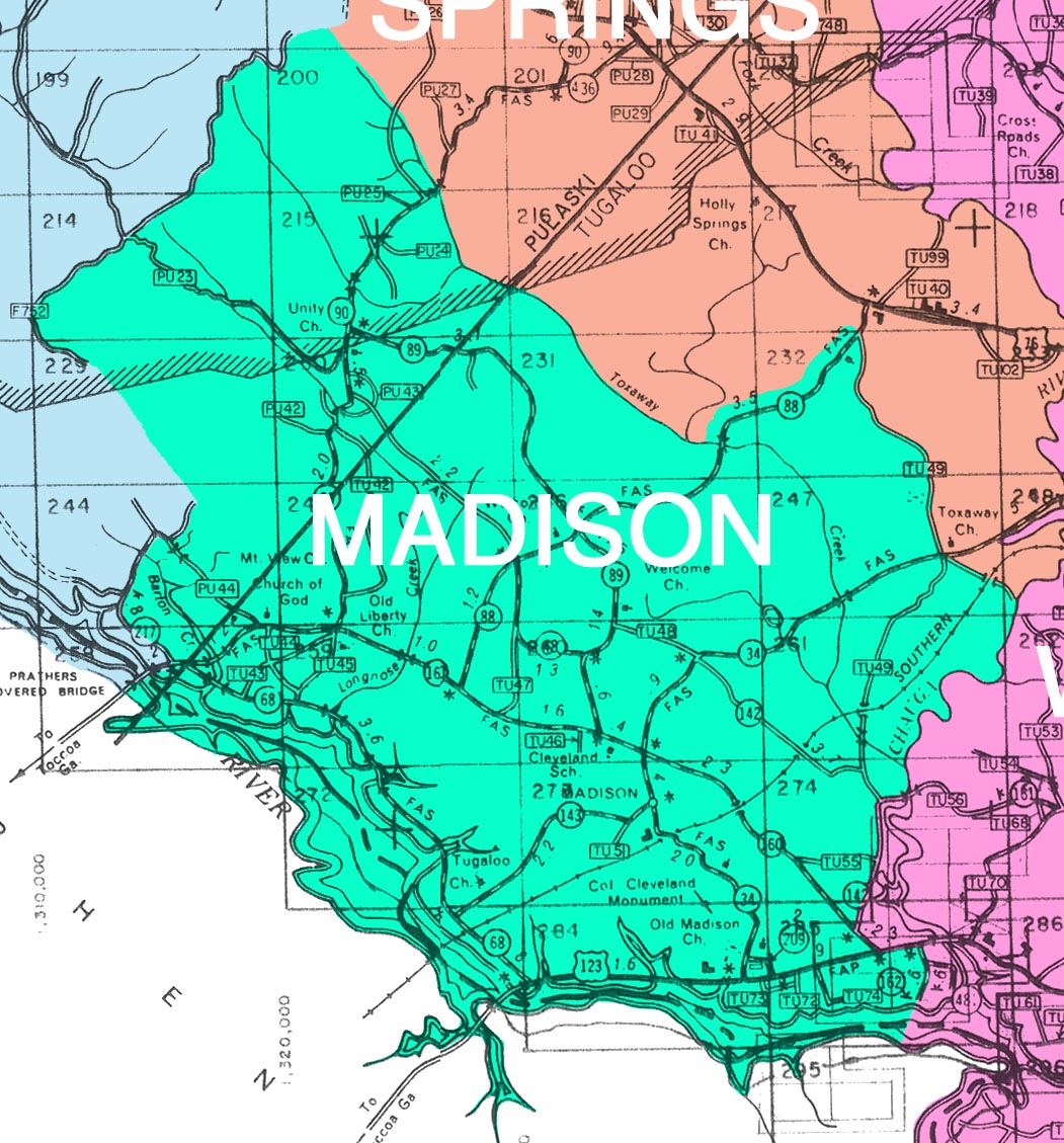
Madison M-07, 288K
Mountain Rest M-08, 364K
Newry M-09, 45K
Oakway M-10, 149K
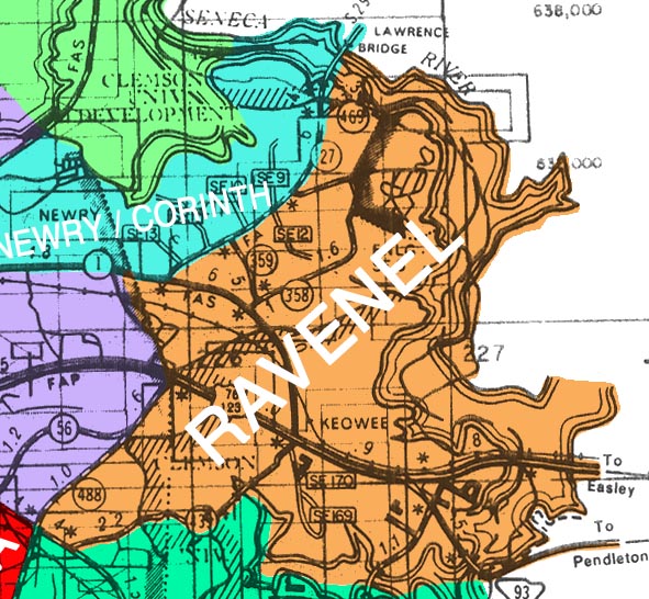
Ravenel M-11, 118K
Return M-12, 95K
Richland M-13, 150K
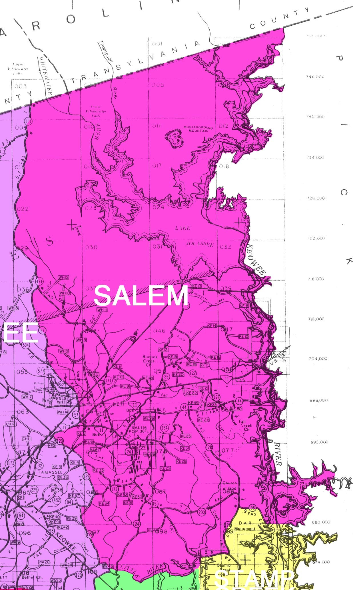
Salem M-14, 418K
Seneca M-15, 289K
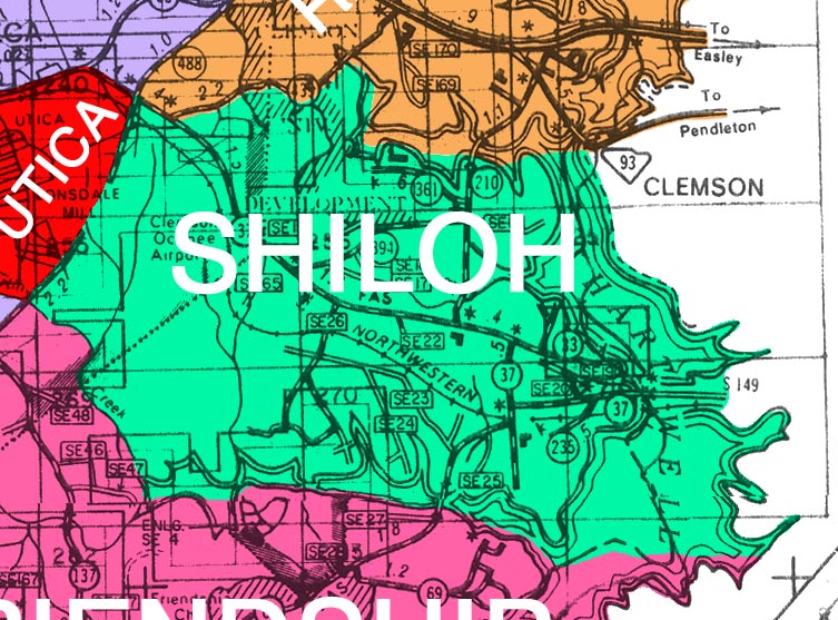
Shiloh M-16, 144K
South Union M-17, 223K
Stamp Creek M-18, 148K
Tamassee M-19, 308K
Tokeena M-20, 226K
Utica M-21, 21K
Walhalla M-22, 609K
West Union M-23, 146K
Westminster M-24, 614K
1971 TOWNSHIPS (submitted by Marge Peak of Walhalla) :
Center M-25, 523K
Chatooga M-26, 531K
Keowee M-27, 456K
Pulaski M-28, 585K
Seneca M-29, 876K
Tugaloo M-30, 690K
Wagner M-31, 766K
Whitewater M-32, 404K
Franklin County GA & SC:
Franklin County was never a part of Oconee County, South Carolina (or its predecessor counties or district). A 5000-acre tract in the fork of the Keowee and Chattooga-Tugaloo rivers at the head of the Savannah River was claimed by Georgia, because the Royal Charter fixed its boundary as the most northerly branch of the Savannah River, which was the Keowee. However, South Carolina claimed the area as well. Both states appointed three commissioners in order to meet and settle the matter. They met on 28 April 1787 and signed a document known as the Beaufort Convention. The convention fixed the Chattooga-Tugaloo River (the western branch) as the boundary, and South Carolina relinquished all claim to lands lying south and southwest of the Savannah River and to all islands in that river. Georgia already had made grants of land to settlers in the area, and South Carolina agreed to confirm the grants, provided the claimants registered them within a year.
An act approved by the Georgia legislature on 25 February 1784 created Franklin County from the northern cession of Cherokee Indian lands obtained through a treaty signed at Augusta in 1783. The Beaufort Convention allotted the territory to South Carolina on 28 April 1787. Therefore, the 5000-acre tract remained a part of Franklin County for 3 years and 2 months.
Pendleton District
David Rumsey Map Collection - 1825 Pendleton
Pendleton Boundaries 1789-1816
Pickens County
Pickens County Geographic Information System Director:
Jimmy Threatt, GIS Director
E-mail: [email protected]
Pickens County GIS Mapping
222 McDaniel Ave, B-8
Pickens, SC 29671
Phone: 864-898-5876
Fax: 864-898-5932
Arial
Dacusville
Nine Times
Norris
Oolenoy Valley
Pickens - County Seat
Pinnacle Mountain - Table Rock State Park
Pumpkintown
Rocky Bottom
Six Mile
Sunset
Table Rock Mountain - Table Rock State Park
Town WebSites:
Townships: