 |
 |
 |
|
|
|
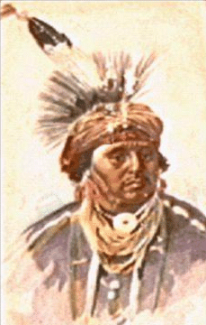
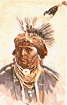
NORTH CAROLINA Bear River Indians.- A body of Indians mentioned by Lawson and associated with Algonquian tribes. They may have been a part of the Machapunga (q. v.). Rights (1947) calls them the Bear River or Bay River Indians. Lawson (1709) gives the name of their town as Raudauqua-quank and estimates the number of their fighting men at 50. Mooney (1928) places them with the Pamlico in his estimate as of the year 1600 and gives the two a population of 1,000. (See also California for another tribe of the same name.) Cape Fear Indians. - Named from Cape Fear, their native designation being unknown or indeed whether they were an independent tribe or a part of some other. Cape Fear Indians. Connections.- No words of the language of the Cape Fear Indians have been preserved, but early references clearly associate them with the eastern Siouan tribes, and they may have been a part of the Waccamaw, since Waccamaw River heads close to Cape Fear. They would then have been connected with the Siouan linguistic family and probably with the southern Atlantic division of which Catawba is the typical member. Cape Fear Indians. Location.- On Cape Fear River, as above stated. (See also South Carolina.) Cape Fear Indians. Villages. - The only village mentioned by name is Necoes, about 20 miles from the mouth of Cape Fear River, probably in Brunswick County. In 1715 five villages were reported. Cape Fear Indians. History.- While the Cape Fear Indians were probably met by several of the early voyagers, our first specific notice of them comes from the narratives of a New England colony planted on Cape Fear River in 1661. These settlers seized some of the Indian children and sent them away under pretense of instructing them in the ways of civilization and were themselves in consequence driven off. In 1663 a colony from Barbados settled here but soon left. In 1665 a third colony established itself at the mouth of Oldtown Creek in Brunswick County, on the south side of the river, on land bought from the Indians, but, though the latter were friendly, like the others this attempt at settlement was soon abandoned. They were visited by Capt. William Hilton in 1663. In 1695 they asked to be taken under the protection of Governor Archdale. The protection was granted and shortly afterward they rescued 52 passengers from a wrecked New England vessel who formed the nucleus of Christ Church Parish north of Cooper River. A few Cape Fear Indians accompanied Barnwell on his Tuscarora expedition in 1711-12. They were active in his behalf as scouts and also guarded the region around Port Royal. After the Yamasee War they were removed to South Carolina and settled inland from Charleston, probably in Williamsburg County (Milling, 1940). In the latter part of the eighteenth century, a remnant of this tribe and the Pedee lived in the Parishes of St. Stephens and St. Johns under a chief called King John. By 1808 only a half-breed woman remained of these two tribes, though others may have removed to the Catawba. Cape Fear Indians. Population.- Mooney (1928) estimates a population of 1,000 Cape Fear Indians in 1600. The census of 1715, above mentioned, gives 206. In 1808 White neighbors remembered when as many as 30 Pedee and Cape Fear Indians lived in their old territories. Catawba tribe. - This tribe occupied parts of southwestern North Carolina near Catawba River. (See Catawab, South Carolina.) Ckeraw tribe. - Significance unknown. Also called: Ani'-Suwa'li, Cherokee name; Saraw, Suali, synonyms even more common than Cheraw; Xuala, Xualla, Spanish and Portuguese forms of the word, the x being intended for sh. Ckeraw Connections.- The Cheraw are classed on circumstantial grounds in the Siouan linguistic family though no words of their tongue have been preserved. Ckeraw Location.- The earliest known location of the Cheraw appears to have been near the head of Saluda River in Pickons and Oconee Counties, S. C., whence they removed at an early date to the present Henderson, Polk, and Rutherford Counties. Ckeraw Villages. - The names given are always those of the tribe, though we have a "Lower Saura Town" and an "Upper Saura Town" on a map dating from 1760. Ckeraw History.- Mooney (1928) has shown that the Cheraw are identical with the Xuala province which De Soto entered in 1540, remaining about 4 days. They were visited by Pardo at a later date, and almost a hundred years afterward Lederer (1912) heard of them in the same region. Before 1700 they left their old country and moved to the Dan River near the southern line of Virginia, where they seem to have had no distinct settlements about 30 miles apart. About the year 1710, on account of constant Iroquois attacks, they moved southeast and joined the Keyauwee. The colonists of North Carolina, being dissatisfied at the proximity of these and other tribes, Governor Eden declared war against the Cheraw, and applied to Virginia for assistance. This Governor Spotswood refused, as he believed the Carolinians were the aggressors, but the contest was prosecuted by the latter until after the Yamasee War. During this period complaint was made that the Cheraw were responsible for most of the deprodations committed north of Santee River and they were accused of trying to draw the coast tribes into an alliance with them. It was asserted also that arms were being supplied them from Virginia. The Cheraw were then living upon the upper course of the Great Pee Dee, near the line between the two colonies and in the later Cheraw district of South Carolina. Being still subject to attack by the Iroquois, they finally- between 1726 and 1739- became incorporated with the Catawba, with whom at an earlier date they had been at enmity. In 1759 a party joined the English in their expedition against Fort Duquesne, but the last notice of them is in 1768 when the remnant was still living with the Catawba. Ckeraw Population.- During the Spanish period the Cheraw appear to have been of considerable importance but no estimate of their numbers has come down to us. Mooney (1928) gives 1,200 as a probable figure for the year 1600. The census of 1715 gives 140 men and a total of 510, probably including the Keyauwee and perhaps some other tribes. In 1768 the survivors numbered 50 to 60. Ckeraw Connection in which they have become noted.- The Cheran are famous as one of the few tribes in the Carolinas mentioned by De Soto's chroniclers which can be identified and located with fair precision. They were noted later for their persistent hostility to the English and have left their name in Suwali Gap in the Blue Ridge Mountains, N. C.; in Saura Town Mountains, Stokes County, N. C.; in the town of Cheraw, Chesterfield County, S. C.; and possibly in the Uwaharrie River and Uwaharrie Mountains of North Carolina. There is a locality named Cheraw in Otero County, Colo. Cherokee tribe. - The Cherokee lived in the mountainous parts of the State in the west North Carolina mountains. (See Tennessee.) Chowanoc tribe. - Meaning in Algonquian "(people) at the south." Chowanoc Connections.- The Chowanoc belonged to the Algonquian linguistic family and were evidently most nearly allied to the other North Carolina Algonquians. Chowanoc Location.- On Chowan River about the junction of Meherrin and Blackwater Rivers. Chowanoc Villages: Maraton, on the east bank of Chowan River in Chowan County. Ohnnoak, on the west side of Chowan River not far below Nottoway River probably in Hertford County. Catoking, (probably) near Gateville, in Gates County. Metocaum, on Chowan River in the present Bertie County. Ramushonok, apparently between the Mehemn and Nottoway Rivers in Hertford County. Chowanoc History.- In 1584-85, when first known to Europeans, the Chowanoc were the leading tribe in northeastern North Carolina. In 1663 they entered into a treaty with the English by which they submitted to the English Crown, but they violated this in 1675 and after a year of warfare were compelled to confine themselves to a reservation on Bennett's Creek which became reduced by 1707 from 12 square miles to 6. They sided with the colonists in the Tuscarora War, and at about the same time were visited by a Church of England missionary, Giles Rainsford. In 1723 a reservation of 53,000 acres was set aside for them conjointly with the Tuscarora and in 1733 they were given permission to incorporate with that tribe. They continued to decline in numbers until in 1755 Governor Dobbs stated that only 2 men and 3 women were left. Chowanoc Population.- In 1584-85 one of the Chowanoc towns, Ohanoak, was said to contain 700 warriors, and Mooney (1928) estimates their numbers at about 1,500 in 1,600. In 1707 they were reduced to one town with about 15 fighting men, but at the end of the Tuscarora War their numbers were placed at 240. In 1731 less than 20 families were reported and by 1755 only 5 individuals, as above noted. Chowanoc Connection in which they have become noted.- The Chowanoc seem to have been the most powerful Algonquian tribe south of the Powhatan. Their memory is preserved in the names of Chowan River and Chowan County, and in the designation of a small post office in the county of the name, all in North Carolina. Coree, or Coranine tribe. - Meaning unknown. Coree, or Coranine Connections.- As the final stage of the Coree existence was passed with an Algonquian tribe, some have thought that the affiliations of this people were also Algonquian. On the other hand Lawson (1960) notes that their language and that of a tribe to the north were mutually intelligible and there is reason for thinking that this northern tribe belonged to the Iroquois Confederacy. At least the Coree were closely associated in many ways with the Iroquoian Tuscarora. Coree, or Coranine Location.- On the peninsula south of Neuse River in Carteret and Craven Counties. Coree, or Coranine Villages: Coranine, probably on the coast in Carteret County. Narhantes, among the Tuscarora, 30 miles from Newbern. Raruta, probably on the coast of Carteret County, south of Neuse River. Coree, or Coranine History. - When the Coree and the Whites first met is unknown, but they appear in the records of the Raleigh colony under the name Cwarennoc. They were greatly reduced before 1696 in a war with another people. They took part with the Tuscarora in their war against the colonists, and in 1715 the remnant of them and what was left of the Machapunga were assigned a reservation on Mattamuskeet Lake in Hyde County, where they occupied one village, probably until they became extinct. A few of them appear to have remained with the Tuscarora. Coree, or Coranine Population.- The population of this tribe and the Neusiok was estimated by Mooney (1928) at 1,000 in 1600. In 1707 Lawson says they had 25 fighting men and were living in 2 villages No later enumeration is known. Coree, or Coranine Connection in which they have become noted.- Although some distance from the Coree country, Core Greek Stalion in Craven County, N. C., may perpetuate the name of the Coree. Eno tribe. - Significance unknown, but Speck suggests i'nare, "to dislike," whence, "mean," "contemptible"; yeni'nare, "People disliked," Haynokes, synonym from Yardley (1654). Eno Connections.- The Eno were probably of the Siouan linguistic stock, though, on account of certain peculiarities attributed to them, Mooney (1895) casts some doubt upon this. Their nearest relatives were the Shakori. Eno Location.- On Eno River in the present Orange and Durham Counties of North Carolina. (See also South Carolina.) Eno Villages. - The only village name recorded, distinct from that of the tribe, is Adshusheer, a town which they shared with the Shakori. It is located by Mooney (1928) near the present Hillsboro. Lawson (1860) speaks in one place as if it were a the but as there is no other mention of it, it is more likely that it was simply the name of the town which the Eno and Shakori occupied. Eno History.- The Eno are first mentioned by Governor Yeardley of Virginia, who was told that they had valiantly resisted the northward advance of the Spaniards. From this it appears possible that they had formerly lived upon the Enoree River in South Carolina, which lay on the main trail from St. Helena to the Cheraw country at the foot of the Appalachian Mountains. Lederer (1912) mentions them in 1671 and Lawson (1860) in 1701 when they and the Shakori were in the town of Adshusheer. About 1714, together with the Shakori, Tutelo, Saponi, Occaneechi, and Keyauwee, they began to move toward the Virginia settlements. In 1716 Governor Spotswood of Virginia proposed to settle the Eno, Cheraw, and Keyuawee at Eno town "on the very frontiers" of North Carolina but the project was defeated by the latter province on the ground that all three tribes were then at war with South Carolina. From the records it is not clear whether this Eno town was the old settlement or a new one nearer the Albemarle colonists. Owing to the defeat of this plan, the Eno moved into South Carolina. Presumably they finally united with the Catawba, among whom, Adair (1930) states, their dialect was still spoken in 1743. Eno Population.- Mooney (1928) estimates the combined Eno, Shakori, and Adshusheer at 1,500 in 1,600. In 1714 the Eno, Shnkori, Tutelo, Snponi. Occaneechi, and Keyauwee totaled 750. There is no other record of their numbers. Eno Connection in which they have become noted.- In marked distinction from their neighbors, the Eno had taken to A trading life. Their name was given to Eno River in Orange and Durham Counties, N. C., and perhaps to a place called Enno in the southwestern part of Wake County, and to Enoree River in South Carolina (see above), as also to a post village near the last mentioned. Hatteras tribe. - Meaning unknown. Hatteras Connections.- The Hatteras belonged to the Algonquian linguistic family. Hatteras Location.- Among the sandbanks about Cape Hatteras east of Pamlico Sound and frequenting Roanoke Island. Hatteras Village. - Sandbanks, on Hatteras Island. Hatteras History.- Lawson (1860) thought the Hatteras showed traces of White blood and therefore they may have been the Croatan Indians with whom Raleigh's colonists are supposed to have taken refuge. They disappeared soon after as a distinct tribe and united with the mainland Algonquians. In 1761, the Rev. Alex. Stewart baptized 7 Indians and mixed-blood children of the "Attamuskeet, Hatteras, and Roanoke" tribes and 2 years later he baptized 21 more. Hatteras Population.- The Hatteras population has been estimated with the Machapunga and other tribes at 1,200 in 1600; they had 16 warriors in 1701, or a total population of about 80. Hatteras Connection in which they have become noted.- The possible connection of the Hatteras with the Croatan has been mentioned and their name has become perpetuated in the dangerous cape at the angle of the outer sand islands of their old country. Keyauwee tribe. - Meaning unknown. Keyauwee Connection.- From the historical affiliations of Keyauwee, they are presumed to have been of the Siouan linguistic family. Keyauwee Location.- About the points of meeting of the present Guilford Davidson, and Randolph Counties North Carolina. (See also South Carolina.) Keyauwee Villages. - No separately named villages are known. Keyauwee History.- The Keyauwee do not appear to have been noted by white men before 1701 when Lawson (1860) found them in a palisaded village about 30 miles northeast of Yadkin River near the present Highpoint, Guilford County. At that time they were preparing to join the Saponi and Tutelo for better protection against their enemies, and, shortly afterward, together with the last mentioned tribes, the Occaneechi, and the Shakori, they moved toward the settlements about Albemarle Sound. As mentioned already, Governor Spots-wood's project to settle this tribe together with the Eno and Cheraw at Enotown on the frontier of North Carolina was foiled by the opposition of the latter colony. The Keyauwee then moved southward to the Pee Dee along with the Cheraw, and perhaps the Eno and Shakori. In the Jefferys atlas of 1761 their town appears close to the boundary line between the two Carolinas. The Keyauwee do not reappear in any of the historical records but probably united ultimately in part with the Catawba, while some of their descendants are represented among the Robeson County Indians, often miscalled Croatan. Keyauwee Population.- Mooney (1928) estimates 500 Keyauwee in 1600. In 1701 they are said to have numbered approximately as many as the Saponi, but the population of that tribe also is unknown. Shortly afterward it is stated that the Keyauwee, Tutelo, Saponi, Occaneechi, and Shakori totaled 750 souls. This is all the information that we have. Machapunga tribe. - Said to mean "bad dust," or "much dirt," in the native Algonquian language. Machapunga Connections.- The Machapunga belonged to the Algonquian linguistic stock. Machapunga Loction.- In the present Hyde County and probably also in Washington, Tyrrell, and Dare Counties, and part of Beaufort, North Carolina. Machapunga Villages. - The only village named is Mattamuskeet (probably on Mattamuskeet Lake in Hyde County). However, we should probably add Secotan on the north bank of Pamlico River in Beaufort County, and perhaps the town of the Bear River Indians (q. v.). Machapunga History.- The Machapunga seem to have embraced the larger part of the descendants of the Seeotan, who lived between Abemarle and Pamlico Sounds when the Raleigh colony was established on Roanoke Island (1585-86) though the Pamlico may also have been included under the same head. They were reduced to a single village by 1701, took part with other Indian tribes of the region in the Tuscarora War, and at its close were settled on Mattamuskeet Lake with the Coree. In 1761 a small number were still living in North Carolina, evidently at the same place, and the Rev. Alex. Stewart reported that he had baptized seven Indian and mixed-blood children belonging to the "Attamuskeet, Hatteras, and Roanoke." On a second visit 2 years later he baptized 21 more. Machapunga Population.- The Machapunga are estimated by Mooney (1928) to have numbered 1,200, including some smaller tribes, in 1600. In 1701 Lawson gives 30 warriors, probably less than 100 souls (Lawson, 1860). In 1775 there were said to be 8 to 10 on the mainland and as many more on the off-shore banks. In 1761 the number of warriors was only 7 or 8. The Bear River Indians (q. v.) may have combined with these. Machapunga Connection in, which they have become noted.- In the form Maehipongo, the name is applied to a post village in Northampton County, Va. Meherrin tribe. - This tribe extended across from Virginia into Northampton and Hertford Counties. (See Virginia.) Moratok tribe. - A place name, but the meaning otherwise unknown. Moratok Connections.- There is little doubt that the Moratok belonged to the Algonquian linguistic stock and were closely related to the other Algonquian tribes of the sound region of North Carolina. Moratok Location.- On Roanoke River and apparently on the north side, and estimated to be 160 miles up the river, though the distance is evidently reckoned from the Raleigh settlement on Roanoke Island. Moratok Villages. - The village bearing the name of the tribe is the only one known. Moratok History.- The sole mention of the Moratok is in the narratives of the Raleigh expeditions. They were first recognized as an independent tribe by Mr. Maurice Mook (1943 a). Moratok Population.- Unknown but reported as large. Natchez tribe. - Part of the Natchez Indians sought refuge with the Cherokee after their tribe had been broken up by the French, and most of them appear to have lived along Hiwassee River. They accompanied those Cherokee who moved to Oklahoma and settled on the western margin of the Cherokee Reservation, where a few of them retained their language long enough to have it recorded. (See Mississippi.) Neusiok tribe. - Probably a place name. Neusiok Connections.- The form of this name suggests that the Neusiok were of the Algonquian stock, but they may have been Iroquoian like their neighbors the Tuscarora and Coree (?). Neusiok Location. - On lower Neuse River particularly on the south side, in Craven and Cartaret Counties, North Carolina. Neusiok Villages. - Chattooka, on the site of Newbern, and Rouconk, exact location unknown. Neusiok History.- In 1584 Amadas and Barlowe heard of the Neusiok as a war with the tribes farther north. The later settlers speak of them as Neuse Indians. They dwindled away rapidly after White contact and perhaps united finally with the Tuscnrora. Neusiok Population.- With the Coree the Neusiok are estimated by Mooney (1928) at 1,000 in the year 1600. In 1709 they numbered but 15 warriors although occupying two towns. Neusiok Connection in which they have become noted.- The name Neusiok is connected with that of the River Neuse in North Carolina, and a post village. Occaneechi tribe. - When the Occaneechi lived on Roanoke River, Va., they probably ranged over into Warren, Halifax, and Northampton Counties, N. C. In 1701 they were in Orange County, N. C. (See Virginia.) Pamlico tribe. - Meaning unknown. Pamlico Connections.- The Pamlico belonged to the Algonquian linguistic stock. Pamlico Location.- On Pamlico River, North Carolina. Pamlico History.- The Pamlico are mentioned by the Raleigh colonists in 1585-86 under the name Pomouik. In 1696 they were almost destroyed by smallpox. In 1701 Lawson recorded a vocabulary from them which shows their affiliations to have been as given above (Lawson, 1860). In 1710 they lived in a single small village. They took part in the Tuscarora war, and at its close that part of the Tuscarora under treaty with the English agreed to destroy them. A remnant of the Pamlico was probably incorporated by the Tuscarora as slaves. Pamlico Population.- The Pamlico are estimated by Mooney (1928), together with "Bear River" Indians, as 1,000 in 1600. In 1710 they numbered about 75. Pamlico Connection in which they have become noted.- The Pamlico have given their name to or shared it with the largest sound in North Carolina and a North Carolina county. They are also noteworthy as having been almost if not quite the most southerly Algonquian tribe on the Atlantic seaboard, and the most southerly one from which a vocabulary has been collected. Saponi tribe. - This tribe lived on Yadkin River and in other parts of North Carolina for a certain period. (See Virginia.) Shakori tribe. - A native name but its significance unknown, though perhaps the same as Sugari, "stingy or spoiled people," or "of the river-whose-water-cannot-be drunk." Also called: Cacores, a misprint. Shakori Connections.- The Shakori belonged to the Siouan linguistic family, their closest connections being evidently with the southern division of the Siouan tribes of the East. Barnwell (1908) identified them with the Sissipahaw (q. v.). Shakori Location.- The Shakori moved so frequently and there is so much uncertainty regarding their early history, that this is hard to give, but, as they usually kept company with the Eno, tenancy of the courses of Shocco and Big Shocco Creeks in the present Vance, Warren, and Franklin Counties is perhaps the location most closely connected with them in historic times. (See South Carolina and Virginia.) Shakori History.- It is possible that tke Shakori gave their name to the province of Chicora visited by Ayllon and his companions in 1521. If so, we must suppose that they moved north later in the sixteenth century or early in the seventeenth, perhaps as a result of the Pardo expeditions. In 1650 Edward Blande and his associates found the "Nottoway and Schockoores old fields" between Meherrin and Nottonay Rivers, but the Indians were not there. In 1654 Governor Yeardley of Virginia was told by a Tuscarora Indian of an inland people called the "Cacores," probably an attempt to indicate this tribe. In 1672 Lederer found them living in a village 14 miles from that of the Eno (Lederer, 1912), and in 1701 Lawson says these two tribes (the Shakori and Eno) were in one village called Adshushecr on Eno River (Lawson, 1860). The later fortunes of the Shakori were bound up with those of the Eno (q. v.). Shakori Population.- Mooney (1928) estimates the Shakori, Eno, and "Adshusheer" at 1,500 in 1600. Shakori Connection in which they have become noted.- The two creeks, Shocco and Big Shocco, and a post office 9 miles south of Warrenton, Warren County, NC. perpetuate the name of the Shakori. If Chicora refers to the same tribe, it appears prominently in Spanish narratives of American exploration, particularly because of the information regarding Indian customs obtained by Peter Martyr from an Indian, Francisco of Chicora. Sara tribe. - see Cheraw tribe. Sissipahaw tribe. - Meaning unknown. Sissipahaw Connections.- The Sissipahaw were probably of the Siouan linguistic family though no words of their language are known. Sissipahaw Location.- The principal Sissipahaw settlement appears to have been about the present Saxapahaw on Haw River in the lower part of Alamance County, NC. (See also South Carolina.) Sissipahaw History.- The name of this tribe is possibly preserved in the Sauxpa mentioned by the Spanish officer Vandera in 1569 as a place visited by Juan Pardo. Lawson (1860) spoke of them in connection with his travels through Carolina in 1701, but he did not visit them. Barnwell (1909) identified them with the Shakori with whom they were doubtless nearly allied and of whom they may have been a branch. They united with other tribes of the region against the English in the Yamasee war of 1715, and later with other Siouan remnants probably joined the Catawba. Sissipahaw Population.- Mooney (1928) estimates the Sissipahaw at 800 in 1600. "Haw Old Fields" constituted the largest body of fertile land in the region. Sissipahaw Connections in which they have become noted.- The name Sissipahaw has been brought down to our times by Haw River and the towns of Haw River and Saxapahaw on the same, in Alamance County, N. C. Sugeree tribe. This tribe occupied parts of Mecklenburg County, NC. (See South Carolina.) Tuscarora tribe. - From their own name Ska-ru'-ren, signifying according to Hewitt (in Hodge, 1910), "hemp gatherers," and applied on account of the great use they made of Apocynum cannabinum. Also called: A-ko-t'as'-ka-ro'-ren', Mohawk name; Ani'-Skala'll, Cherokee name; A-t'as-ka-lo'-len', Oneida name; Tewohomomy (or Keew-ahomomy), Saponi name. Tuscarora Connections.- The Tuscarora belonged to the Iroquoian linguistic family. Tuscarora Location.- On the Roanoke, Tar, Pamlico, and Neuse Rivers of North Carolina. (See also Pennsylvania and New York.) Tuscarora Subdivisions. - The Tusearora should be considered a confederacy with three tribes or a tribe with three subtribes as follows: Ka'te'nu'a'ka', "People of the submerged pinetree"; Akawantca'ka', meaning doubtful; and Skaru'ren, "hemp gatheres," i. e., the Tuscarora proper. Tuscarora Villages. - The following were in North Carolina, A more precise location not being possible except in the cases specified: Annaooka; Chunaneets; Cohunche; Conauhcare; Contahnah, near the mouth of Neuse River; Cotechney, on the opposite side of Neuse River from Fort Barnwell, about the mouth of Contentnea Creek; Coram; Corutra; Harooka; Harutawaqui; Kenta; Kentanuska; Naurheghne; Neoheroka, in Greene County; Nonawharitse; Nursoorooka; Oonossoora; Tasqui, a day's journey from Cotechney on the way to Nottaway village; Tonarooka, on a branch of Neuse River between "Fort Narhantes" and Cotechney; Torhunte, on a northern affluent of Neuse River; Tosneoe; Ucouhnerunt, on Pamlico River, probably in the vicinity of Greenalle, in Pitt County; Unanauhan. Tuscarora History. - Barnwell, with 33 white men and about 500 Indians, marched against the hostiles, by direction of the colony of South Carolina, drove them from one of their towns with great loss, and invested Hencock's own town, Cotechney. But having suffered severely in two assaults upon the place and fearing lest the white captives in the hands of the Indians would be killed, he made peace and returned home. Dissatisfied with the treatment accorded him by the North Carolina authorities, however, he violated the treaty during his retreat by seizing some Indians and sending them away as slaves. This brought on the second Tuscarora War, 1712-13. South Carolina was again appealed to for assistance, and Colonel James Moore set out for the north with about 900 Indians and 33 white men, a number which was considerably swelled before he reached the seat of trouble. March 20 to 23 he stormed the palisaded town of Neoheroka, inflicting a loss upon the enemy of about 950. The Tuscarora became so terrified at this that part of them abandoned Fort Cohunche, situated at Hencock's town and started north to join their relatives, the Iroquois. This was only the beginning of the movement, bands of Tuscarora being noted at intervals as moving north or as having arrived among the Five Nations. They were adopted by the Oneida but, contrary to the general impression, were not granted coordinate rights in the League before September 1722. A part of the Tuscarora under a chief named Tom Blunt (or Blount), had, however, remained neutral. They received recognition by the government of North Carolina, and continued in their former homes under their own chiefs. In 1766, 155 removed to New York, and the 105 remaining were brought north in 1802 while a deputation of northem Tuscarora were in Carolina to obtain payment for the lands they had formerly occupied. When the Tuscarora first moved north they were settled at various places along the Susquehanna in Pennsylvania and in New York, some in the Oneida country itself. In 1875, by the treaty of Fort Herkimer, the Oneida sold to the State of New York, the lands in which their adopted children, the Tuscarora, had settled, and for a time the Tuscarora were dispersed in various settlements in New York State, and even in Pennsylvania. At the outbreak of the American Revolution, the majority of Tuscarora and Oneida espoused the cause of the colonists and in consequence they were attacked by Indians in the British interest, including even some of their Iroquois brethren, their houses were burned, their crops and other property destroyed, and they themselves scattered. A large band of them settled, however, at a place called Oyonwayea or Johnson's Landing, on Lake Ontario. Later a party from this settlement discovered a place in the northeastern part of the present Tuscarora Reservation which pleased them so much that they decided to winter there and they were presently joined by the rest of the inhabitants of Oyonwayea. At the treaty held at Genesee, September 15, 1797, between Robert Morris and the Seneca tribe, Morris reserved to the tribe, by grant, 2 square miles, covering their new settlements, and the Seneca there-upon granted them an additional square mile. As a result of their appeal to the legislature of North Carolina above mentioned, they were able to lease lands in the south, and they devoted the proceeds to the purchase of 4,329 acres adjoining their New York reserve. The Tuscarora who had sided with Great Britain were granted lands in severalty on Crand River, Ontario. Tuscarora Population.- There were 5,000 Tuscarora in 1600 according to an estimate by Mooney (1928). In 1708, Lawson gives 15 towns and 1,200 warriors (Lawson, 1860). Barnwell in 1712 estimates 1,200 to 1,400 fighting men (Barnwell, 1908); Chauvignerie in 1736, 250 warriors, not including those in North Carolina, and on the Susquehanna and Juniata Rivers (Chauvignerie, in Schoolcraft, 1851-57, vol. 3, p. 556). In 1752 the southern Tuscarora were said to number 300 men; in 1754 there were said to be 100 men and 200 women and children and these figures are repeated in 1761. In 1766 there were said to be 220 to 230 all told in the south; next year we read that 155 southern Tuscarora had removed and that 105 remained. Other estimates place the total Tuscarora population at 1,000 in 1765, 2,000 in 1778, 1,000 in 1783, and 400 in 1796. In 1885 there were 828 (evenly divided between New York and Canada). In 1909 there were 364 in New York and a year later 416 in Canada, a total of 780. In 1910, 400 were reported in the United States and in 1923, 376 in New York alone. The number in Canada is not separately given. Tuscarora Connection in which they have become noted.- This tribe is noted historically for its prominence among the peoples of eastern North Carolina, for the two wars which it waged with the colonists, and for the rather spectacular migration of the greater part to the north and its union with the Five Iroquois Nations. The name Tuscarora occurs applied to settlements in Frederick County, Md.; Craven County, North Carolina; Schuylkill County, Pennsylvania; Livingston County, N. Y.; Elko County, Nev.; and Ontario; and to a creek and mountain in Pennsylvania. Tutelo tribe. - This tribe lived for a while on the upper Yadkin and later in Bertie County, NC. (See Virginia.) Waccamaw tribe. - They probably ranged across into North Carolina from the head of Waccamaw River. (See South Carolina.) Wateree tribe. - According to Lederer (1912) they were living in 1670 on the upper Yadkin, North Carolina. (See South Carolina.) Waxhaw tribe. - They extended over into Union County from South Carolina. (See South Carolina.) Weapemeoc tribe. - Meaning unknown, but evidently a place name. Also called: Yeopim, a shortened and more usual form. Weapemeoc Connections.- The Weapemeoc were almost certainly of the Algonquian linguistic family and related to the Powhatan Indians to the north and the Chowan, Machapunga, and Pamlico to the south. Weapemeoc Location.- Most of the present Currituck, Camden, Pasquotank, and Perquimans Counties, and part of Chowan County north of Albemarle Sound. Weapemeoc Subdivisions. - In the same section in later times are given the following tribes which must be regarded as subdivisions of the Weapemeoc: Pasquotank, on Pasquotank River; Perquiman, on Perquimans River; Poteskeet, location uncertain; Yeopim, or Weapemeoc proper, on Yeopim River; Weapemeoc Villages. - Chepanoc, on Albemarle Sound in Perquimans County; Mascoming, on the north shore of Albemarle Sound, in Chownn County; Metachkwem, location unknown; Pasquenock, perhaps identical with Pasquotank, on the north shore of Albemarle Sound, perhaps in Camden County; Weapemeoc, probably in Pasquotank County. Weapemeoc History.- The Weapemeoc first appear in history in the narratives of the Raleigh colony of 1585-86. Later they are spoken of under the various subdivisional names. They parted with some of their land in 1662. In 1701, according to Lawson (1860) only 6 of the Ycopim survived though there were 40 warriors of the other subdivisions, including 10 Pasquotank and 30 Potekeet. Weapemeoc Population.- In the time of the Raleigh colony the Weapemeoc are said to have had between 700 and 800 warriors. They were estimated by Mooney (1928) at 800 in 1600. From their number as given by Lawson in 1701 Rights (1947) estimates 200 at that date. Weapemeoc Connection in which they have become noted.- In the form Yeopim the name has been preserved in that of a railroad station in Perquimans County, N. C. Woccon tribe. - Significance unknown. Woccon Connections.- The Woccon belonged to the Siouan linguistic stock, their closest relations being the Catawba. Woccon Location.- Between Neuse River and one of its affluents, perhaps about the present Goldsboro, Wayne County. Woccon Villages. - Tooptatmeer, supposed to have been in Greene County; Yupwauremau, supposed to have been in Greene County. Woccon History.- The first mention of the Woccon appears to be by Lawson writing about 1701, who recorded 150 words of their language. These show that it was nearer Catawba than any other known variety of speech. Lack of any earlier mention of such a large tribe lends strength to the theory of Dr. Douglas L. Rights that they were originally Waccamaw (q. v., under South Carolina) They took part against the Whites in the Tuscarora Wars and were probably extinguished as a tribe at that time, the remnant fleeing north with the Tuscarora, uniting with the Catawba, or combining with other Siouan remnants in the people later known as Croatan. Woccon Population.- The number of Woccon was estimated by Mooney (1928) at 600 in 1600. Lawson (1860) gives 120 warriors in 1709. Woccon Connection in which they have become noted.- The sole claim of the Woccon to distinction is from the fact that it is the only one of the southern group of eastern Siouan tribes other than the Catawba from which a vocabulary has been preserved. Yadkin tribe. - Meaning unknown. Yadkin Connections.- The Yadkin probably belonged to the Siouan linguistic family. Yadkin Location.- On Yadkin River. Yadkin History.- The Yadkin first appear in history in a letter by the Indian trader, Abraham Wood, narrating the adventures of two men, James Needham and Gabriel Arthur, whom he had sent on an exploring expedition lo the west. They passed this tribe and town, which they call "Yattken," in the summer of 1674. Lawson (1860) gives the name as Reatkin but applies it to the river, and there is no later mention of the people. Yadkin Connection in which they have become noted.- Their name Yadkin is perpetuated by the Yadkin River, Yadkin County, and the towns and villages of Yadkin College, Yadkin Falls, Yadkin Valley, and Yadkinville, all in the State of North Carolina. Yeopim tribe. - see Weapemeoc tribe. End of Indian tribes of North Carolina.
 SE. Index |
N.A. Index |
 SFA - Index |
 SFA - REF. |
 E-Mail:
Paul R. Sarrett, Jr. Auburn, CA.
E-Mail:
Paul R. Sarrett, Jr. Auburn, CA. Mar. 25, 2002