 |
 |
 |
|
|
|
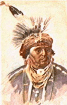
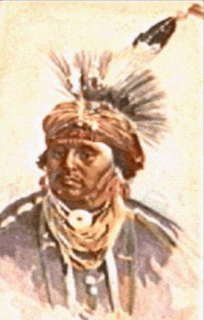
GEORGIA Apalachee tribe. - After the English and Creeks destroyed the Apalachee towns in Florida in 1704, they established a part of the tribe in a village not far below the present Augusta. GA. In 1715, when the Yamasee War broke out, these Apalachee joined the hostile Indians and went to the Chattahoochee to live near that faction of the Lower Creeks which was favorable to Spain. Soon afterward, however, the English faction gained the ascendancy among the Creeks, and the Apalachee returned to Florida (See Florida.) Apalachicola tribe. - (Creek Confederacy, Muskhoegean stock) From Hitchiti "Apalachicoli" or Muskogee "palachicolo," signifying apparently "People of the other side," with reference probably to the Apalachicola River or some nearby stream. Also called: Talwa lako or Italwa lako, "big town," name given by the Muskogee Indians; Palachicola or Parachukla, contractions of Apalachicola. Apalachicola Connections.- This was one of those tribes of the Muskhogean linguistic stock which spoke the Atsik-hata or Hitchiti language, and which included in addition the Hitchiti, Okmulgee, Oconee, Sawokli, Tamali, Mikasuki, Chiaha, and possibly the Osochi (but see Osochi). Apalachicola Location.- The earliest known home of the Apalachicola was near the river which bears their name in the center of the Lower Creek country. Later they lived for a considerable period at the point where it comes into existence through the junction of the Chattahoochee and Flint Rivers. (See also Alabama and Florida.) Apalachicola Subdivisions and Villages. - The following names of towns or tribes were given by a Tawasa Indian, Lamhatty, to Robert Beverley (1722) and may well have belonged to the Apalachicola: Auledley, Ephippick, Sonepah, and perhaps Socsooky (or Socsosky). The census of 1832 returned two distinct bodies of Indians under the synonyms Apalaechicola and Talwa lako. Apalachicola History.- According to Muskogee legend, the ancestors of the Muskogee encountered the Apalachicola in the region above indicated when they entered the country, and they were at first disposed to fight with them but soon made peace. According to one legend the Creek Confederacy came into existence as a result of this treaty. Spanish documents of the seventeenth century are the earliest in which the name appears. It is there used both as the name of a town (as early as 1675) and, in an extended sense, for all of the Lower Creeks. This fact, Muskogee tradition, and the name Talwa lako all show the early importance of the people. They were on more friendly terms with the Spaniards than the Muskogoe generally and hence were fallen upon by the Indian allies of the English and carried off, either in 1706 or 1707. They were settled on Savannah River opposite Mount Pleasant, at a place which long bore their name, but in 1716, just after the Yarnasee War, they retired into their old country and established them-selves at the junction of Chattahoochee and Flint Rivers. Later they moved higher up the Chattahoochce and lived in Russell County, Ala., remaining in the general neighborhood until they removed to new homes in the present Oklahoma in 1836-40. There they established themselves in the northern part of the Creek Reservation but presently gave up their ceremonial ground and were gradually absorbed in the mass of Indians about them. Apalachicola Population.- In 1715 just before the outbreak of the Yamasee War, there were said to be 2 settlements of this tribe with 64 warriors and a total population of 214. A Spanish census of 1738 also gave 2 settlements with 60 warriors in one and 45 in the other; a French census of 1750, more than 30 warriors; a British enumeration of 1760, 60; one of 1761, 20; an American estimate of 1792, 100 (including the Chiaha); and the United States Census of 1832, a total population of 239 in 2 settlements. Apalachicola Connection in which they have become noted.- Apalachicola River, Apalachicola Bay, and the name of the county seat of Franklin County, Fla., are derived from this tribe. The Spaniards applied their name to the Lower Creeks generally, and they were also noted as one of the tribes responsible for the formation of the Confederation. Chatot tribe. - Some of these Indians lived at times in the southwest corner of this State. (See Florida.) Ckerokee tribe. - From early times the Cherokee occupied the northern and northeastern parts of Georgia, though from certain place names it seems probable that they had been preceded in that territory by Creeks. (See Tennessee.) Chiaha tribe. - (Lower Creek Confederacy, Muskhoegean stock) Meaning unknown though it may contain a reference to mountains or highlands. (Cf. Choctaw and Alabama tcaha, Hitchiti tcaihi, "high.") Also called: Tolameco or Solameco, which probably signifies "big town," a name reported by the Spaniards. Chiaha Connections.- The Chiaha belonged to the Muskhogean linguistic stock and in later times spoke the Muskogee tongue, but there is every reason to class them in the Hitchiti group. (See Apalachicola.) Chiaha Location.- In later historic times the Chiaha were on the middle course of Chattahoochee River, but at the earliest period at which we have any knowledge of them they seem to have been divided into two bands, one on Burns Island, in the present State of Tennessee, the other in eastern Georgia near the coast. (See also South Carolina and Florida.) Chiaha Subdivisions. - The Mikasuki of northern Florida are said to have separated from these people. Chiaha Villages. - Hawkins (1848) gives the following: Aumucculle, on a creek of the same name which enters Flint River "45 miles below Timothy Barnard's."; Chiahutci, Little Chiaha, a mile and a half west of the Hitchiti town, near Auhegee Creek; Hotalgihuyana, occupied jointly with the Osochi, on the right bank of Flint River 6 miles below Kinchafoonee. Chiaha History.- Some confusion regarding this tribe has been occasioned by the fact that in the sixteenth century there appear to have been two divisions. The name first appears in the De Soto narratives applied to a "province" on an island in Tennessee River which J. Y. Brame has identified in a very satisfactory manner with Burns Island close to the Tennessee-Alabama line. They were said to be "subject to a chief of Coca," from which it may perhaps be inferred that the Creek Confederacy was already in existence. Early in 1567 Boyano, Juan Pardo's lieutenant, reached this town with a small body of soldiers and constructed a fort, Pardo joining him in September. When Pardo returned to Santa Elena shortly afterward he left a small garrison here which was later destroyed by the Indians. Possibly Chehawhaw Creek, an eastern affluent of the Coosa indicates a later location of this band. The only remaining reference which might apply to them occurs in the names of two bodies of Creeks called "Chehaw" and "Chearhaw" which appear in the census rolls of 1832-33, but they may have gotten their designations from former residences on or near the creek so called. In 1727 there was a tradition among the Cherokee that the Yamasee Indians were formerly Cherokee driven out by the Tomahitans, i. e., the Yuchi, and in this there may be some reminiscence of the fate of the Chiaha. In the Pardo narratives the name "Lameco or Solameco" is given as a synonym for the northern Chiaha, and this may have been intended for Tolameco, which would be a Creek term meaning "Chief Town." This was also the name of a large abandoned settlement near Cofitachequi on the middle course of Savannah River visited by De Soto in 1540. Since we know that Chiaha were also in this region, it is a fair supposition that this town had been occupied by people of this connection. There is a Chehaw River on the South Carolina coast between the Edisto and Combahee, and as "Chiaha" is used once as an equivalent for Kiawa, possibly the Cusabo tribe of that name may have been related. Moreover, we are informed (S. C. Docs.) that the Chiaha had their homes formerly among the Yamasee. In 1715 they withdrew to the Chattahoochee with other upper Creek towns, probably from a temporary abode on Ocmulgee River. After the Creeks moved to Oklahoma the Chiaha settled in the northeastern corner of the Creek Reservation and maintained a square ground there until after the Civil War, but they have now practically lost their identity. Some of them went to Florida and the Mikasuki are said by some Indians to have branched off from them. In the country of the western Seminole there was a square ground as late as 1929 which bore their name. Chiaha Population.- There are no figures for the northern band of Chiaha unless they could have been represented in the two towns of the 1832-33 census given above, which had total populations of 126 and 306 respectively. For the southern division a Spanish census of 1738 gives 120 warriors but this included also the Osochi and Okmulgee. In 1750 only 20 were reported, but in 1760, 160, though an estimate the following year reduces this to 120. In 1792 Marbury gives 100 Chiaha and Apalachicola, and the census of 1832-33 returned 381 of the former. In 1799 Hawkins states that there were 20 Indian families in Hotalgi-huyana, a town occupied jointly by this tribe and the Osochi, but in 1821 Young raises this to 210. He gives 670 for the Chiaha proper. Chiaha Connection in which they have become noted.- The Chiaha tribe is of some note on account of the prominence given to one branch of it in the De Soto narratives. As above mentioned, its name, spelled Chehawhaw, is applied to a stream in the northern part of Talladega County, Ala.; it is given in the form Chehaw to a post hamlet of Macon County, Ala.; to a stream in Colleton County, SC.; and also to a small place in Seminole County, Okla. Ckickasaw tribe. - A band of Chickasaw lived near Augusta from about 1723 to the opening of the American Revolution, and later they were for some time among the Lower Creeks. (See Mississippi and South Carolina.) Creeks tribe. - A part, and perhaps a large part, of the Indians who afterward constituted the Creek Confederacy were living in the sixteenth century in what the Spaniards called the province of Guale on the present Georgia coast. Some of them moved inland in consequence of difficulties with the Whites, and in the latter half of the seventeenth century most of those afterward known as Lower Creeks were upon Chattahoochee and Ocmulgee Rivers, the latter river being then called Ocheese Creek, from the Hitchiti name given to the Indians living on it. After the Yamasee War (1715) all assembled upon Chattahoochee River and continued there, part on the Georgia side of the river, part on the Alabama side, until they removed to the present Oklahoma early in the nineteenth century (see Creek Confederacy and Muskogee under Alabama). Guale tribe. - Meaning unknown, though it resembles Muskogee wnhali, "the south," but it was originally applied to St. Catherines Island, or possibly to a chief living there. Also called: Ouade, a French form of Guale; Ybaha, Yguaja, Ibaja, Iguaja, Yupaha, a Timucua name. Guale Connections.- The names of villages and the title "mico" applied to chiefs leave little doubt that these Indians belonged to the Muskhogean linguistic family. Part of them were probably true Creeks or Muskogee. (See Alabama). Their nearest, connections otherwise appear to have been with the Cusabo Indians. (See South Carolina.) Guale Location.- the Georgia coast between St. Andrews Sound and Savannah River, though the section between St. Catherines Sound and Savannah seems to have been little occupied. (See also Florida.) Guale Subdivisions. - Three rough divisions appear to be indicated by Governor Ibarra of Florida, but this is very uncertain (See below under Villages.) Guale Villages. - So far as they can be made out, the villages in each of the three groups mentioned above were as follows: Guale Northern group: Asopo, apparently a form of Ossabaw but stated to have been on St. Catherines Island; Chatufo, location unknown; Couexis, given in the French narratives as near St. Catherines; Culapala location unknown; Guale, not, it appears, on the island of that name but "on an arm of a river which is a branch of another on the north bank of the aforesaid port in Santa Elena in 32 degrees N. lat., probably on Ossabaw Island; Otapalas location unknown; Otaxe (Otashe); Posache, "in the island of Guale."; Tolomato, said to have been on the mainland 2 leagues from St. Catherines Island and near the bar of Sapello; Uchilape, "near Tolomato."; Uculegue location unknown; Unallapa location unknown; Yfusinique, evidently on the mainland; Yoa, said to have been 2 leagues up a river emptying into an arm of the sea back of Sapello and St. Catherines Sound. Guale Central group: Aleguifa, near Tulufina; Chucalagaite, near Tulufina; Epogache, near Espogue; Espogue, not more than 6 leagues from Talaxe; Fasquiche, near Espogue; Sapala, evidently on or near Sapello Island; Sotequa unknown; Tapala unknown; Tulufina, probably on the mainland; Tupiqui, probably the original of the name Tybee, but this town was very much farther south; Utine unknown. Guale Southern group: Aluque location unknown; Asao, probably on St. Simons Island; Cascangue, which seems to have been reckoned as Timucua at times and hence may have been near the Timucua border; Falquiche, location unknown; Fuloplata, possibly a man's name; Hinafasque, location unknown; Hocaesle, location unknown; Talaxe, probably on St. Simons Island or on the Altamaha River, both of which were known by the name Talaxe; Tufulo, location unknown; Tuque, location unknown; Yfulo, location unknown; To the above must be added the following town names which cannot be allocated in any of the preceding divisions: Alpatopo; Aytoohuco; Ayul; Olatachahane, perhaps a chief's name; Olatapotoque, given as a town, but perhaps a chief's name Olataylitaba, perhaps two names run together, Olata and Litabi; Olocalpa; Sulopacaques; Tamufa; Yumunapa. Guale History.- The last settlement of the Ayllon colony in 1526 was on or near the Guale country, as the name Gualdape suggests. When the French Huguenot colony was at Port Royal, S. C., in 1562, they heard of a chief called Ouade and visited him several times for provisions. After the Spaniards had driven the French from Florida, they continued north to Guale and the Cusnbo territory to expel several Frenchmen who had taken refuge there. In 1569 missionary work was undertaken by the Jesuits simultaneously among the Cusabo and Guale Indians and one of the missionaries, Domingo Augustin, wrote a grammar of the Guale language. But the spiritual labors of the missionaries proved unavailing, and they soon abandoned the country. In 1573 missionary work was resumed by the Franciscans and was increasingly successful when in 1597 there was a general insurrection in which all of the missionaries but one were killed. The governor of Florida shortly afterward burned very many of the Guale towns with their granaries, thereby reducing most of the Indians to submission, and by 1601 the rebellion was over. Missionary work was resumed soon afterward and continued uninterruptedly, in spite of sporadic insurrections in 1608 and 1645 and attacks of northern Indians in 1661, 1680, nnd even earlier. However, as a result of these attacks those of the Guale Indians who did not escape inland moved, or were moved, in 1686, to the islands of San Pedro, Santa Maria, and San Juan north of St. Augustine. Later another island called Santa Cruz was substituted for San Pedro. The Quaker, Dickenson, who was shipwrecked on the east coast of Florida in 1699, visited these missions on his way north. At the time of the removal some Guale Indians appear to have gone to South Carolina, and in 1702 a general insurrection of the remainder took place, and they joined their kinsmen on the outskirts of that colony under the leadership of the Yamasee. A few may have remained in Florida. In any event, all except those who had fled to the Creeks were united after the outbreak of the Yamasee in 1715 and continued to live in the neighborhood of St. Augustine until their virtual extinction. In 1726 there were two missions near St. Augustine occupied by Indians of the "Iguaja nation," i. e., Guale, but that is the last we hear of them under any name but that of the Yamasee (q. v.). Guale Population.- Mooney (1928), who was not aware of the distinction to be drawn between the Guale Indians and the Yamasee, gives an estimate of 2,000 Guale in the year 1650. For the two tribes this is probably too low. The Guale alone, before they had been depleted by White contact and Indian invasions from the north, might well have numbered 4,000, but some of these were later added to the Creeks. In 1602 the missionaries claimed that there were more than 1,200 Christians in the Guale province, and in 1670 the English estimated that the Spanish missions contained about 700 men. The first accurate census of the Yamasee and Gunle Indians together, made in 1715, perhaps omitting some few of the latter still in Florida, gives 413 men and a total population of 1,215. Guale Connection in which they have become noted.- Aside from the abortive missionary undertakings of The friars who accompanied Coronado, and a short missionary experience among the Calusa, the provinces of Guale and Orista (Cusabo) were the first north of Mexico in which regular missionary work was undertaken, and the grammar of the Guale language by Domingo Augustin was the first of any language in that region to be compiled. Hitchiti tribe. - Perhaps from Atcik-hata, a term formerly applied to all of the Indians who spoke the Hitchiti language, and is said to refer to the heap of white ashes piled up close to the ceremonial ground. Also called: At-pasha-shliha, Koasati name, meaning "mean people." Hitchiti Connections.- The Hitchiti belonged to the Muskhogean linguistic family and were considered the mother town of the Atcik-hata group. (See Apalachicola.) Hitchiti Location.- The Hitchiti are often associated with a location in the present Chattahoochee County, Ga., but at an earlier period were on the lower course of the Ocmulgee River. (See also Florida and Oklahoma.) Hitchiti Villages. - Hihnje, location unknown; Hitchitoochee, on Flint River below its junction with Kinchafoonee Creek; Tuttallosee, on a creek of the same name, 20 miles west from Hitchitoochee. Hitchiti History.- The Hitchiti are identifiable with the Ocute of De Soto's chroniclers, who were on or near the Ocmulgee River. Early English maps show their town on the site of the present Macon, Ga., but after 1715 they moved to the Chattahoochee, settling first in Henry County, Ala., but later at the site above mentioned in Chattahoochee County, Ga. From this place they moved to Oklahoma, where they gradually merged with the rest of the Indians of the Creek Confederacy. Hitchiti Population.- The population of the Hitchiti is usually given in conjunction with that of the other confederate tribes. The following separate estimates of the effective male Hitchiti population are recorded: 1738, 60; 1750, 15; 1760, 50; 1761, 40; 1772, 90; in 1832 the entire population was 381. Hitchiti Connection in which they have become noted.- In early days, as above mentioned, the Hitchiti were prominent as the leaders in that group of tribes or towns among the Lower Creeks speaking a language distinct from Muskogee. Hichita, McIntosh County, Okla., preserves the name. Kasihta tribe. - One of the most important divisions of the Muskogee, possibly identical with the Cofitachequi of the De Soto narratives. (See Muskogee under Alabama.) Oconee tribe. - Name Significance unknown. Oconee Connections.- The Oconee belonged to the Muskhogean linguistic stock, and the Atcik-hata group. (See Apalachicola.) Oconee Location.- Just below the Rock Landing on Oconee River, Ga. (But see also Florida.) Oconee History.- Early documents reveal at least two bodies of Indians bearing the name Oconee and probably related. One was on or near the coast of Georgia and seems later to have moved into the Apalachee country and to have become fused with the Apalachee tribe before the end of the seventeenth century. The other was at the point above indicated, on Oconee River. About 1685 they were on Chattahoochee River, whence they moved to the Rock Landing. A more northerly location for at least part of the tribe may be indicated in the name of a Cherokee town, though that may have been derived from a Cherokee word as Mooney supposed. About 1716 they moved to the east bank of the Chattahoochee in Stewart County, Ga., and a few years later part went to the Alachua Plains, in the present Alachua County, Fla., where they became the nucleus of the Seminole Nation and furnished the chief to that people until the end of the Seminole war. Most of them were then taken to Oklahoma, but they had already lost their identity. Oconee Population.- The following estimates of effective Oconee men in the Creek Nation are preserved: 1738, 50; 1750, 30; 1760, 50; 1761, 50. In 1675 there were about 200 Indians at the Apalachee Mission of San Francisco de Oconi. Oconee Connection in which they have become noted.- The name Oconee is perpetuated in the Oconee River, the town of Oconee, Oconee Mills, and Oconee Siding, all in Georgia, but not necessarily in the name of Oconee County, S. C., which is of Cherokee origin, although there may be some more remote relationship. There is a place of the name in Shelby County, Ill. Okmulgee tribe. - Signifying in the Hitchiti language, "where water boils up" and referring probably to the big springs in Butts County, Ga., called Indian Springs. Also called: Waiki lako, "Big Spring," Muskogee name. Okmulgee Connections.- The Okmulgee belonged to the Muskhogean linguistic stock and the Atsik-hata group. (See Apalachicola under Georgia.) Okmulgee Location.- In the great bend of the Chattahoochee River, Russell County, Ala.; earlier, about the present Macon, Ga. (See also Alabama and Oklahoma.) Okmulgee History.- The Okmulgee probably separated from the Hitchiti or one of their cognate towns when these towns were on Ocmulgee River and settled at the point above indicated, where they became closely associated with the Chiaha and Osochi. They went west with the other Creeks and reestablished themselves in the most northeastern part of the allotted territory, where they gradually lost their identity. Although small in numbers, they gave the prominent Perryman family to the Creek Nation and its well-known head chief, Pleasant Porter. Okmulgee Population.- A French census of about 1750 states that there were rather more than 20 effective men among the Okmulgee, and the British census of 1760 gives 30. Young, quoted by Morse, estimates a total population of 220 in 1822. There are few other enumerations separate from the general census of the Creeks. Okmulgee Connection in which they have become noted.- The name of the city of Okmulgee and that of Ocmulgee River were derived independently from the springs above mentioned. The name Okmulgee given to the later capital of the Creek Nation in what is now Oklahoma was, however, taken from the tribe under consideration. It has now become a flourishing oil city. Osochi tribe. - A division of the Lower Creeks which lived for a time in southwestern Georgia. (See Alabama.) Sawokli tribe. - A division of the Creeks belonging to the group of towns that spoke the Hitchiti language. (See Alabama.) Shawnee tribe. - The Shawnee band which settled near Augusta concerns South Carolina and Georgia almost equally. Their history has already been given in treating the tribes of the former State. (See also Tennessee.) Tamathli tribe. - The name is possibly related to that of a Creek clan with the Hitchiti plural ending, in which case it would refer to "flying creatures," such as birds. Tamathli Connections.- Tamathli belonged to the Atsik-hata group in the Creek Confederation. Tamathli Location.- The historic seats of the Tamathli were in southwestern Georgia and neighboring parts of Florida. Tamathli History.- It is believed that we have our first mention of the Tamathli in the Toa or Toalli of the De Soto narratives. When De Soto passed through Georgia in 1540, it is believed that this tribe was living at Pine Island in Daugherty County. They may have been connected with the Altamaha Yamasee living between Ocmulgee and Oconee Rivers whose name sometimes appears in the form Tama. They afterward drifted into Florida and were established in a mission called La Purificacion de la Tama on January 27, 1675, by Bishop Calderon of Cuba, in the Apalachee country 1 league from San Luis. In a mission list dated 1680 appears the name of another mission, Nuestra Sehora de la Candelaria de la Tama. The Tamathli suffered the same fate as the Apalachee in general when the latter were attacked by Moore in 1704. At least part of these Indians afterward moved to the neighborhood of St. Augustine, where another mission was established for them, but this was attacked by the Creeks on November 1, 1725, while mass was being celebrated. Many Indians were killed and the remainder moved to other missions. In 1738 we hear of a "Tamaxle nuevo," as the northernmost Lower Creek settlement and a southern division called "Old Tamathle," and are informed that "in the town of Tamasle in Apalachee [i. e., Old Tamathle] there were some Catholic and pagan families." We hear again of these Tamathli Indians from Benjamin Hawkins (1848), writing in 1799, who sets them down as one of the tribes entering into the formation of the Florida Seminole. A town of the same name also appears in the Cherokee country "on Valley River, a few miles above Murphy, about the present Tomatola, in Cherokee County, N.C." The name cannot be interpreted in Cherokee and there may once have been a northern division of the Tamathli. Tamathli Population.- The Spanish census dated 1738 enters Old Tamathli, with 12 men, and New Tamathli with 26, but the latter probably was in the main a Sawokli settlement. The French estimate of 1750 entered only the former town with 10 men. In Young's enumeration of Seminole towns (in Morse, 1822) this is given a total population of 220. Timucua tribe. - One contact between the Timucua Indians and Georgia is mentioned later in connection with the Osochi. When the Spaniards first came in contact with them, the Timucua occupied not merely northern and central Florida but Cumberland Island and a part of the adjacent mainland. The Timucua evidently withdrew from this territory as a result of pressure exerted by northern Indians in the latter part of the seventeenth century or the very beginning of the eighteenth. (See Utina under Florida.) Yamasee tribe. - Meaning unknown, though it has been interpreted by Muskogee yamasi, "gentle." The form given in some early writings, Yamiscaron, may have been derived from a Siouan dialect or from Timucua. Yamasee Connections.- The Yamasee town and chief names indicate plainly that they spoke a Muskhogean dialect and tradition affirms that it was connected most closely with Hitchiti, a contention which may be considered probable. Yamasee Location.- The earliest references that we have place the Yamasee on Ocmulgee River not far above its junction with the Oconee. They seem to have ranged or extended northeastward of these rivers to or even slightly beyond the Savannah, but always inland. (See also Florida, Alabama, South Carolina.) Yamasee Subdivisions and Villages. - Immediately before the outbreak of the Yamasee War there were the following: Yamasee Upper Towns: Huspaw, near Huspaw Creek between Combahee River and the Whale Branch; Pocotaligo, near Pocotaligo River; Sadkeche, probably near Salkehatchie, a hamlet at the Atlantic Coast Line crossing of the Combahee River; Tomatly, in the neighborhood of Tomatly, Beaufort County, S.C.; Yoa, near Huspaw. Yamasee Lower Towns: Altamaha, location unknown; Chasee, location unknown; Oketee, probably near one of the places so called on New River, in Jasper and Beaufort Counties, S.C.; Poeasabo; Tulafina (?), perhaps near Tulsfinny Creek, an estuary of the Coosawhatchie River in Jasper County. Other possible Yamasee settlements were Dawfuskee, Ilcombe, and Peterba. Yamasee History.- The first reference to the Yamasee appears to be a mention of their name in the form Yamiscaron as that of a province with which Francisco of Chicora was acquainted in 1521. The "Province of Altamaha" mentioned by De Soto's chronicler Ranjel in 1540 probably included at least a part of the Yamasee people. For a hundred years afterward the tribe remained practically unnoticed except for a brief visit by a Spanish soldier and two missionaries in 1597, but in 1633 they are reported to have asked for missionaries, and in 1639 peace is said to have been made between the allied Chatot, Lower Creeks, and Yamasee and the Apalachee. In 1675 Bishop Calderon of Cuba founded two missions in the Apalachee country which were occupied by Yamasee or their near relatives. The same year there were three Yamasee missions on the Atlantic coast but one of these may have been occupied by Tamathli. Later they moved nearer St. Augustine but in the winter of 1684-85 some act of the Spanish governor offended them and they removed to South Carolina, where the English gave them lands on the west side of Savannah River near its mouth. Some of these Indians were probably from the old Guale province, but the Yamasee now took the lead. Eighty-seven warriors of this nation took part in Barnwell's expedition against the Tuscarora (see North Carolina). In 1715 they rose in rebellion against the English and killed two or three hundred settlers but were defeated by Governor Craven and took refuge in Florida, where, until the cession of Florida to Great Britain. the Yamasee continued as allies of the Spaniards. Meanwhile their numbers fell off steadily. Some remained in the neighborhood of the St. Johns River until the outbreak of the Seminole War. The Oklawaha band of Seminole is said to have been descended from them. Another band accompanied the Apalachee to Pensacola and Mobile, and we find them located near those two places on various charts. They may be identical with those who, shortly afterward, appear among the Upper Creeks on certain maps, though this is the only testimony we have of their presence there. At any rate, these latter are probably the Yamasee found among the Lower Creeks in the nineteenth century and last heard of among the Seminole of west Florida. Of some historical importance is a small band of these Indians who seem to have lived with the Apalachicola for a time, after the Yamasee War, and in 1730 settled on the site of what is now Savannah under the name of Yamacraw. There the Georgia colonists found them three years later, and the relations between the two peoples were most amicable. The name Yamacraw was probably derived from that of a Florida mission, Nombre de Dios de Amacarisse, where some of the Yamnsee once lived. Ultimately these Yamacraw are believed to have retired among the Creeks and later may have gone to Florida. Yamasee Population.- It is impossible to separate distinctly the true Yamasee from the Guale Indians. Mooney (1928) gives an estimate of 2,000 in 1650, probably too low. A mission list compiled by Gov. Salazar of Florida in 1675 gives 1,190 Yamasee and Tama. In 1708 the two tribes, united under the name Yamasee, were thought to have 500 men capable of bearing arms. In 1715 a rather careful census gives 413 men and a total population of 1,215. Lists dating from 1726 and 1728 give 313 and 144 respectively in the missions about St. Augustine. A fairly satisfactory Spanish census, taken in 1736, indicates that there were then in the neighborhood of St. Augustine more than 360 Yamasee and Indians of Guale. This does not include the Yamasee near Pensacola and Mobile, those in the Creek Nation, or the Yamacraw. In 1761 a body of Yamasee containing 20 men was living near St. Augustine, but by that time the tribe had probably scattered widely. In 1821 the "Emusas" on Chattahoochee River numbered 20 souls. Yamasee Connection in which they have become noted.- The Yamasee are famous particularly on account of the Yamasee War, which marked an epoch in Indian and White history in the Southeast. At the end of the seventeenth century a certain stroke was used in paddling canoes along the coast of Georgia, South Carolina, and Florida, which was called the "Yamasee stroke." A small town in Beaufort County, S. C., is called "Yemasee," a variant of this name. Yuch tribe. - Name Significance unknown, but perhaps, as suggested by Speck (1909), from a native word meaning "those far away," or "at a distance," though it is also possible that it is a variant of Ochesee or Ocheese, which was applied by the Hitchiti and their allies to Indians speaking languages different from their own. Also called: Ani'-Yu'tsi, Cherokee name; Chiska, probably a Muskogee translation of the name of one of their bands; Hughchee, an early synonym; Round town people, a name given by the early English colonists; Rickohockans, signifying "cavelanders" (Hewitt, in Hodge, 1907), perhaps an early name for a part of them; Tahogalewi, abbreviated to Hogologe, name given them by the Delaware and other Algonquian people; Tamahita, so called by some Indians, perhaps some of the eastern Siouans; Tsoyaha, "People of the sun," their own name, or at least the name of one band; Westo, perhaps a name applied to them by the Cusabo Indians of South Carolina though the identification is not beyond question. Yuchi Connections.- The Yuchi constituted a linguistic stock, the Uchean, distinct from all others, though structurally their speech bears a certain resemblance to the languages of the Muskhogean and Siouan families. Yuchi Location.- The earliest known location of the Yuchi was in eastern Tennessee, perhaps near Manchester, but some of them extended still farther east, while others were as far west as Muscle Shoals. On archeological grounds Prof. T. M. N. Lewis believes that one main center of the Yuchi was on Hiwassee River. We find settlements laid down on the maps as far north as Green River, Kentucky. In later times a part settled in West Florida, near the present Eucheeanna, and another part on Savannah and Ogeechee Rivers. (See also Alabama, Florida, Oklahoma, Tennessee, and South Carolina.) Yuchi Subdivisions. - There appear to have been three principal bands in historic times: one on Tennessee River, one in West Florida, and one on Savannah River, but only a suggestion of native band names has survived. Recently Wagner has heard of at least three subdivisional names, including the Tsoyaha, or "Sun People" and the Root People. Yuchi Villages. - Most of their settlements are given the name of the tribe, Yuchi, or one of its synonyms. In early times they occupied a town in eastern Tennessee called by the Cherokee Tsistu'yl, "Rabbit place," on the north bank of Hiwassee River at the entrance of Chestua Creek in Polk County, Tenn., and at one time also that of Hiwassee, or Euphasee, at the Savannah Ford of Hiwassee River. The Savannah River band had villages at Mount Pleasant, probably in Screven County, Ga., near the mouth of Brier Creek, 2 miles below Silver Bluff on Savannah River in Barnwell County; and one on Ogeechee River bearing the name of that stream, though that was itself perhaps one form of the name Yuchi. Hawkins (1848) mentions former villages at Ponpon and Saltketchers in South Carolina, but these probably belonged to the Yamasee. The following Yuchi settlements were established after the tribe united with the Lower Creeks: Arkansaw River, in Oklahoma; Big Pond Town, Polecat Creek, and Sand Creek, in and near Creek County, Okla; Blackjack Town; Deep Fork Creek, Okla; Duck Creek Town; Intatchkalgi, on Opilthlako Creek 28 miles above its junction with Flint River, probably in Schley County, Ga; Padshilaika, at the junction of Patchilaika Creek with Flint River, Macon County, Ga; Red Fork, location uncertain; Snake Creek, location uncertain; Spring Garden Town, above Lake George, Fla; Tokogalgi, on Kinchafoonee Creek, an affluent of Flint River, Ga. Yuchi History.- The chroniclers of the De Soto expedition mention the Yuchi under the name Chisca, at one or more points in what is now Tennessee. In 1567 Boyano, an officer under Juan Pardo, had two desperate encounters with these Indians somewhere in the highlands of Tennessee or North Carolina, and, according to his own story, destroyed great numbers of them. In 1670 Lederer (1912) heard of people called Rickohockans living in the mountains who may have been Yuchi, and two white men sent from Virginia by Abraham Wood visited a Yuchi town on a head stream of the Tennessee in 1674. About this time also, English explorers and settlers in South Carolina were told of a warlike tribe called Westo (probably a division of Yuchi) who had struck terror into all of the coast Indians, and hostilities later broke out between them and the colonists. At this juncture, however, a band of Shawnee made war upon the Westo and drove them from the Savannah. For a time they seem to have given themselves up to a roving life, and some of them went so far inland that they encountered La Salle and settled near Fort St. Louis, near the present Utica, Ill. Later some were located among the Creeks on Ocmulgee River, and they removed with them to the Chattahoochee in 1715. Another band of Yuchi came to live on Savannah River about 20 miles above Augusta, probably after the expulsion of the Westo. They were often called Hogologe. In 1716 they also moved to the Chattahoochee but for a time occupied a town distinct from that of the other Yuchi. It was probably this band which settled near the Shawnee on Tallapoosa River and finally united with them. Still later occurred a third influx of Yuchi who occupied the Savannah between Silver Bluff and Ebenezer Creek. In 1729 a Kasihta chief named Captain Ellick married three Yuchi women and persuaded some of the Yuchi Indians to move over among the Lower Creeks, but Governor Oglethorpe of Georgia guaranteed them their rights to their old land until after 1740, and the final removal did not, in fact, take place until 1751. A still earlier invasion of southern territories by Yuchi is noted by one of the governors of Florida in a letter dated 1639. These invaders proved a constant source of annoyance to the Spaniards. Finally they established themselves in West Florida not far from the Choctawhatchee River, where they were attacked by an allied Spanish and Apalachee expedition in 1677 and suffered severely. They continued to live in the same region, however, until some time before 1761 when they moved to the Upper Creeks and settled near the Tukabahchee. Eucheeanna in Walton County, Fla. seems to preserve their name. A certain number of Yuchi remained in the neighborhood of Tennessee River, and at one time they were about Muscle Shoals. They also occupied a town in the Cherokee country, called by the latter tribe Tsistu'yl, and Hiwassee at Savannah Ford. In 1714, the former was cut off by the Cherokee in revenge for the murder of a member of their tribe, instigated by two English traders. Later tradition affirms that the surviving Yuchi fled to Florida, but many of them certainly remained in the Cherokee country for a long time afterward, and probably eventually migrated west with their hosts. A small band of Yuchi joined the Seminole just before the outbreak of the Seminole War. They appear first in West Florida, near the Mikasuki but later had a town at Spring Garden in Volusia County. Their presence is indicated down to the end of the war in the Peninsula, when they appear to have gone west, probably reuniting with the remainder of the tribe. The Yuchi who stayed with the Creeks accompanied them west and settled in one body in the northwestern part of the old Creek Nation, in Creek County, Okla. Yuchi Population.- For the year 1650 Mooney (1928) makes an estimate of 1,500 for the Yuchi in Georgia, Alabama, and Tennessee, but this does not include the "Westo," for whom, with the Stono, he allows 1,600. The colonial census of 1715 gives 2 Yuchi towns with 130 men and 400 souls, but this probably takes into consideration only 1 band out of 3 or 4. In 1730 the band still on Tennessee River was supposed to contain about 150 men. In 1760, 50 men are reported in the Lower Creek town and 15 in one among the Upper Creeks. In 1777 Bartram (1792) estimated the number of Yuchi warriors in the lower town at 500 and their total population as between 1,000 and 1,500. In 1792 Marburg (1792) reports 300 men, or a population of over 1,000, and Hawkins in 1799 says the Lower Creek Yuchi claimed 250 men. According to the census of 1832-33 there were 1,139 in 2 towns known to have been occupied by Indians of this connection. In 1909 Speck stated that the whole number of Yuchi could "hardly exceed five hundred," but the official report for 1910 gives only 78. That, however, must have been an underestimate as the census of 1930 reported 216. Owing to the number of Yuchi bands, their frequent changes in location, and the various terms applied to them, an exact estimate of their numbers at any period is very difficult. In the first half of the sixteenth century they may well have numbered more than 5,000. Yuchi Connection in which they have become noted.- The Yuchi have attained an altogether false reputation as the supposed aborigines of the Gulf region. They were also noted for the uniqueness of their language among the Southeastern tongues. The name is preserved in Euchee, a posthamlet of Meigs County, Tenn.; Eucheeanna, a post village of Walton County, Fla.; Euchee (or Uchee) Creek, Russell County, Ala.; Uchee, a post station of Russell County, Ala.; Uchee Creek, Columbia County, Ga.; and an island in Savannah River near the mouth of the latter. Yufera tribe. (See Florida.) End of GEORGIA Indian Tribes.
 SE. Index |
N.A. Index |
 SFA - Index |
 SFA - REF. |
 E-Mail:
Paul R. Sarrett, Jr. Auburn, CA.
E-Mail:
Paul R. Sarrett, Jr. Auburn, CA. Mar. 25, 2002