
|


|
|
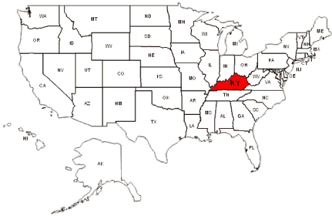
Capital: Frankfort, KY. 15th State in 1792
|
 Barren Co., KY.
was created in 1799 from the larger Green & Warren
Co's. The County Seat is Glasglow, KY 42141. It is located in the
Southcentral part of the State: Bounded by Hart Co. on the North
Metcalfe Co. on the East; Allen & Monroe Co's on the South; with
Warren & Edmonson Co's on the West. (First Census 1810)
1895 Barren Co., Map!
Barren Co., KY.
was created in 1799 from the larger Green & Warren
Co's. The County Seat is Glasglow, KY 42141. It is located in the
Southcentral part of the State: Bounded by Hart Co. on the North
Metcalfe Co. on the East; Allen & Monroe Co's on the South; with
Warren & Edmonson Co's on the West. (First Census 1810)
1895 Barren Co., Map!
| ||||||||||||
| SERRETTE of France | Chap. | FName | LName | b. - d. | Married | From | ||||||
| 1. | Benjamin | SERRETT | c1795-1840 | m. c1823 KY. to Elizabeth H. CRABTREE?, 3Ch. | Montgomery Co., IL. | |||||||
| Second Generation! Children of Benjamin & Elizabeth (CRABTREE) SERRETTE | ||||||||||||
| 2.1 | Joseph C. | SERRETT | c1824-1900 | m. 04 May 1856, IL. to Loucinda N. COLE, 5Ch. | Wayne Co., MO. | 2.2 | Sarah E. | SERRETT | c1826-18?? | Not Traced! | Montgomery Co., IL. | 2.3 | John | SERRETT | c1829-18?? | Not Traced! | Montgomery Co., IL. | 2.4 | 3rd Son | SERRETT | c1830-18?? | Not Traced! | Unknown Co, TN | 2.5 | John I.C. | SERRETT | c1831-18?? | Not Traced! | Unknown Co, TN |
![]()
 Caldwell Co., KY
was created in 1809, from the larger Livington
Co. The County Seat is Princeton, KY. 42445. It is located in the
Western part of the State. Bounded by: Crittenden & Hopkins Co's
on the North; Christian Co. on the East; Trigg Co., on the South;
With Lyon Co. on the West.
Caldwell Co., KY
was created in 1809, from the larger Livington
Co. The County Seat is Princeton, KY. 42445. It is located in the
Western part of the State. Bounded by: Crittenden & Hopkins Co's
on the North; Christian Co. on the East; Trigg Co., on the South;
With Lyon Co. on the West.
 1895 Caldwell Co., Map! 1895 Caldwell Co., Map!
| ||||||||||||
| Chap. | FName | LName | b. - d. | Married | From | 1. | ||||||
![]()
|
Calloway Co., KY. was created in 1821,
from the larger Hickman Co.
The County Seat is <---
Murray, KY. 42071. It is located the Western
tip of the State; Bounded by:
<---
Marshall Co. on the North;
Trigg Co., KY. on the Northeast;
Stewart Co., TN. on the Southeast;
Henry Co., TN. on the South; and
<---
Graves Co., KY. on the West. (First Census, 1830; County Clerk has m., land rec. since 1821) <---
1895 Calloway Co., Map!
<---
County Stats from Wikipedia, (the free encyclopedia)
| ||||||||||||
| Chap. | FName | LName | b. - d. | Married | From | |||||||
![]()
 Clay Co., KY. was created in 1807,
from the larger Madison, Floyd, and Knox Co.'s.
The County Seat is Grayson, KY. 41143. It is located in the Southeast part of the State;
Bounded by Jackson & Owsley Co.'s on the North;
Leslie Co. on the East;
Knox Co. on the South; with
Laurel Co. on the West.
(First Census, 1810, County Clerk has m. records since 1807, Clerk
Circuit Court has pro, rec, wills, Frankfort, has b. & d. records)1895 Clay Co., Map!
Clay Co., KY. was created in 1807,
from the larger Madison, Floyd, and Knox Co.'s.
The County Seat is Grayson, KY. 41143. It is located in the Southeast part of the State;
Bounded by Jackson & Owsley Co.'s on the North;
Leslie Co. on the East;
Knox Co. on the South; with
Laurel Co. on the West.
(First Census, 1810, County Clerk has m. records since 1807, Clerk
Circuit Court has pro, rec, wills, Frankfort, has b. & d. records)1895 Clay Co., Map!
| ||||||||||||
| Chap. | FName | LName | b. - d. | Married | From | |||||||
![]()
|
Clinton Co., KY. was created in 1836,
from the larger Wayne and Cumberland Co.'s.
The County Seat is Albany, KY. 42604.
It is located in the Southernly part of the State, on the Tennessee State border. Bounded by:
Russell Co., on the North;
Wayne Co. on the East;
Pickett Co., Tennessee on the South; with
Cumberland Co. on the West.
(First Census, 1840, County Clerk has m., Deeds, Will's from 1865
1895 Clay Co., Map!
County Stats from Wikipedia,(the free encyclopedia)
| ||||||||||||
| Chap. | FName | LName | b. - d. | Married | From | |||||||
![]()
Cumberland Co., KY. was created in 1799,
from the larger <---
Green Co.
The County Seat is
<---
Burkesville, KY. 42717. It is located in the
Southcentral part of the State. It is Bounded by: Metcalf, Adair
& Russell Co's on the North;
<---
Clinton Co. on the East;
Clay Co., Tennessee on the South; Monroe Co., on the West. Census start with 1810.1895 Cumberland Co., Map!
County Stats from Wikipedia,(the free encyclopedia)


|
| Town | Zip | Town | Zip | Town | Zip |
| AMANDAVILLE | 42711 | BAKERTON | 42711 | BOW | 42714 | BURKESVILLE, (Co. Seat) | 42717 | CLOYDS LANDING | 42752 | DUBRE | 42731 | DUFF | 42759 | ELLINGTON | 42752 | FROGUE | 42714 | GREEN GROVE | 42714 | GUTHRIES RIDGE | 42752 | HICKORY GROVE | 42752 | HOBART | 42714 | JUDIO | 42752 | KETTLE | 42752 | LITTRELL | 42752 | MARROWBONE | 42759 | MODOC | 42714 | PEYTONSBURG | 42768 | WATERVIEW | 42786 |
| Fifth Generation! 2nd s/o Isom Wm. SARRETT & Elizabeth VERNON, of Grayson & Carroll Co.'s, VA. | ||||||||||||
| Chap. | FName | LName | b. - d. | Married | From | |||||||
| 5.01.4.03. | William P. | SARRETT | c1840-1920 | m. c1965 KY Nancy A. BLANKENSHIP?, 10Ch. | Grayson Co., VA. | Sixth Generation! 2nd s/o William P. SURRATT & Nancy A. BLANKENSHIP, of Grayson Co., VA. | ||||||
| 5.01.4.03.10. | Granvill A. | SURRATT | *1891-1969 | m. c1914 KY. Mary B. CLAYWELL, 9Ch. | Cumberland Co., KY. | |||||||
![]()
|
Fayette Co., KY. was created in 1780,
from (286 Sq.Miles) the larger Kentucky Co. of Virginia; The County Seat is
<---
Lexington, KY. 40507. This was one of the original three counties formed when Kentucky County, Virginia was divided by the Virginia Act in 1780 (the other two were being Jefferson and Lincoln counties). Fayette County included area north and east of the Kentucky River, 37 present-day counties, and parts of 7 others.
It was reduced to its present boundaries in 1799
Located in the Northcentral part of the State. Bounded by
Scott Co. on the North; Bourbon Co. on the Northeast;
Clark Co. on the East; Madison Co. on the South; Jessamine
Co. on the Southwest; with Woodford Co. on the West.
1895 Fayette Co., Map!
County Stats from Wikipedia,(the free encyclopedia)
| Third Generation! 3rd s/o Joseph,2 & Mary (Unknown) SARRATT, of Prince George's Co., MD. | |||||||||||
| Chap. | FName | LName | b. - d. | Married | From | |||||||
| 1.3.3 | William,1 | SURRATT | c1755-1830 | m. c1787 NC. Martha Unk., 12 Ch. | Prince George's Co., MD. | |||||||
![]()
|
Floyd Co., KY. was created in 1800,
from (395 Sq.Miles) the larger Fleming, Mason, and Montgomery Co.'s
On December 13, 1799, the Kentucky General Assembly passed legislation to form Floyd County as the 40th county of Kentucky.
The county was made from parts of Fleming, Montgomery, and Mason County, Kentucky. The legislation became effective on June 1, 1800.
The county was named for James John.
The County Seat is
<---
Prestonsburg, KY. 41653.
Located in the Eastern part of the State. Bounded by
Johnson County (north)
Martin County (northeast)
Pike County (east)
Knott County (southwest)
Magoffin County (northwest)
(First Census 1810; County Clerk has m. & Land records from 1800.
The first court house burned down on April 8, 1808, destroying all the early records, so the earliest records of government activity come from the year 1808.
[per "The Kentucky Encyclodpedia" by: John E. Kleber (University Press of Kentucky), p. 330])
1895 Fayette Co., Map!
County Stats from Wikipedia,(the free encyclopedia)
|
![]()
 Graves Co., KY.
was created in 1824, from larger Hickman Co.
The County Seat is Mayfield, KY. 42066. It is located in the
the far Western part of the State. Bounded by: McCracken Co.
on the North; Marshall Co. on the Northeast; Calloway Co.
on the Southeast; Weakley & Henry Co.'s Tennneese on the South;
with Carlisle & Hickman Co.'s KY on the West.
(First Census 1830, Frankfort, KY. has b. d.; County Clerk has
m. rec from 1888.)1895 Graves Co., Map!
Graves Co., KY.
was created in 1824, from larger Hickman Co.
The County Seat is Mayfield, KY. 42066. It is located in the
the far Western part of the State. Bounded by: McCracken Co.
on the North; Marshall Co. on the Northeast; Calloway Co.
on the Southeast; Weakley & Henry Co.'s Tennneese on the South;
with Carlisle & Hickman Co.'s KY on the West.
(First Census 1830, Frankfort, KY. has b. d.; County Clerk has
m. rec from 1888.)1895 Graves Co., Map!
|
| SFA Census | 1830 | 1840 | 1850 | 1860 | 1870 | 1880 | 1900 | 1910 | 1920 | 1930 |
| Fifth Generation! 2nd s/o John, 4 & 1st Wife (Unknown) SARRATT of Bridgewater Plantation, Prince George's Co., MD. | |||||
| Chap. | FName | LName | b. - d. | Married | From |
| 1.2.2.01.08. | Allen,5 | SARRATT | *1807-1837 | m. c1734 SC. Elizabeth BOLTON, 7 Ch. | Rowan Co., NC. |
![]()
 Green Co., KY.
was created in 1793 from the larger
Lincoln & Nelson Co's. The County Seat is Greensburg, KY. 42743.
It is located in the Central part of the State; It is bounded
by Larue Co. on the North; Taylor Co. on the East; Metcalf &
Adair Co's on the South; With
Barren Co., on the West. (Census start with 1810.1895 Green Co., Map!
Green Co., KY.
was created in 1793 from the larger
Lincoln & Nelson Co's. The County Seat is Greensburg, KY. 42743.
It is located in the Central part of the State; It is bounded
by Larue Co. on the North; Taylor Co. on the East; Metcalf &
Adair Co's on the South; With
Barren Co., on the West. (Census start with 1810.1895 Green Co., Map!
| ||||||||||||
| Chap. | FName | LName | b. - d. | Married | From | |||||||
![]()
|
Harlan Co., KY.
was created in 1819 from (468 Sq.Miles) the larger Knox Co.
The County Seat is
<---
Harlan, KY. 40831. Harlan is located at 36�50' 29" N 83�19' 12" W (GPS Map Coord: 36.841487, -83.320066)
It is located in the Southeastern part of the State;
along the Virginia State line. It is bounded by:
Perry County (north)
Letcher County (northeast)
Wise County, Virginia (east)
Lee County, Virginia (southeast)
Bell County (southwest)
Leslie County (northwest)
(First Census, 1820; Co. Clerk has m. & Land rec from 1820;
Clerk Circuit Court has div & Civil Court rec.)<---
1895 County Co., Map!
<---
See: County Stats from Wikipedia, (the free encyclopedia)
| Fifth Generation! 2nd s/o Granvill H. SURRETT & 2nd Wife Lucinda SCOTT, of Roane Co., TN. | |||||||||||
| Chap. | FName | LName | b. - d. | Married | From | |||||||
| 5.01.4.03.12 | Willie B. | SURRETT | 1895-1971 | m. c1918 TN. Hazel ROBERTS, 8Ch. | Roane Co., TN. | |||||||
![]()
|
Johnson Co., KY.
was created on 24 Feb 1843 from (264 Sq.Miles) the larger Floyd,
Morgan, & Lawrence Co.'s
<---
Paintsville, KY. 41240. serves as the county seat of Johnson County.
It is located along the mouth of Paint Creek at the Levisa Fork of the Big Sandy River. Originally called Paint Lick Station, the town was established in 1834, after being laid out in 1826. Paint Lick Station was referred to in military dispatches as early as 1780. Paint Creek and Paintsville were named in reference to drawings found on trees, believed to be drawn by Native Americans. It is believed that the post office was originally known as Paint Creek, but was renamed Paintsville before 1843. The founder of the town is acknowledged to be William Henry Dixon
It is located in the Central Eastern part of the State; It is bounded by:
Lawrence County (north)
Martin County (east)
Floyd County (south)
Magoffin County (southwest)
Morgan County (northwest)
(First Census, 1850; )<---
1895 County Co., Map!
<---
See: County Stats from Wikipedia, (the free encyclopedia)<---
Flat Gap, ky. 41219 is an unincorporated community in Johnson County, Kentucky The community was named after the "flat gap" formed at the divide between the Lower Laurel and Mudlick Creeks. Flat Gap's first post office was established on February 26, 1873, with Henry JAYNE as postmaster. |
|
Lawrence Co., KY.
was created in 1822 from (420 Sq.Miles) the larger Floyd,
and Greenup, Co.'s
<---
Louisa, KY. 41230. It is located in the Central Eastern part of the State; It is bounded by:
Carter County (Northwest)
Boyd County (North)
Wayne County, West Virginia (East)
Martin County (Southeast)
Johnson County (South)
Morgan County (Southwest)
Elliott County (West)
(First Census, 1840; County Clerk has m., Probate, & Land records from 1825;
Clerk Circuit Court has Div. Records)
<---
1895 County Co., Map!
<---
See: County Stats from Wikipedia, (the free encyclopedia)<---
Blaine, Kentucky - Is a city in Lawrence County.
It was originally settled circa 1800 and was established as a local trade center circa 1882.
The post office has been in operation since at least May 10, 1828, with the first postmaster
being Neri Swetnam. Although the city was incorporated as Blaine on March 10, 1886, it was
alternatively known as "Blainetown" or the "Mouth of Hood" for the remainder of
the 19th century.
<---See: Google.com Map! GPS Coordinates: Latitude: 38.028081, Longitude: -82.843094 |
![]()
 Lincoln Co., KY.
was created in 1780, from the old "Kentucky Co."
of Virginia. The County Seat is Stanford, KY. 40484. It is located
in the center part of the State. Bordered by: Garrard Co., on the
Northeast; Rockcastle on the East; Pulaski Co., on the Southeast;
Casey Co. on the Southwest; and Boyle Co. on the Northwest.
(First Census, 1810, County Clerk has records since 1792)
1895 Lincoln Co., Map!
Lincoln Co., KY.
was created in 1780, from the old "Kentucky Co."
of Virginia. The County Seat is Stanford, KY. 40484. It is located
in the center part of the State. Bordered by: Garrard Co., on the
Northeast; Rockcastle on the East; Pulaski Co., on the Southeast;
Casey Co. on the Southwest; and Boyle Co. on the Northwest.
(First Census, 1810, County Clerk has records since 1792)
1895 Lincoln Co., Map!
| First Generation! Son of | |||||||||||
| Chap. | FName | LName | b. - d. | Married | From | |||||||
![]()
|
Marshall Co., KY.
was created (340 Sq. Miles) in 1842, from the larger <---
Callaway County.
The first settlement was around 1818, when the area was bought from Native Americans as part of the Jackson Purchase. Marshall County was named in honor of Chief Justice John Marshall, who had died not long before the founding of the county.
The County Seat is <---
Benton, KY. 42025. Is located in the Western tip of the State. Bounded by:
Livingston Co. on the North;
Lyon Co. on the Northeast;
Trigg Co. on the Southeast;
<---
Calloway Co., on the South;
<---
Graves Co., on the Southwest; and
<---
McCraken Co., on the Northwest.
(First Census, 1850, County Clerk has m. & land Rec. from 1848)<---
1895 Marshall Co., Map!
<---
County Stats from Wikipedia, (the free encyclopedia)
| ||||||||||||
|
Fifth Generation!
<---
(1st s/o Hillery,1 & Lucy (Vernon) Serrett) of Clinton Co., IL. | ||||||||||||
| Chap. | FName | LName | b. - d. | Married | From | |||||||
| 1.3.3.01.3. | William P. | SERRAT | c1824-1888 | m. 24 Jul 1849 E. "Betsy" FRAZEE, 2Ch. | Calloway Co., KY | |||||||
![]()
 Rowan Co., Kentuckywas created in 1856
from the larger Fleming & Morgan Co.'s
The County Seat is Morehead, KY 40351. It is located in the
Northeast part of the State: Bounded by
Fleming Co., on the Northwest;
Lewis Co., on the Northeast;
Carter Co. on the East (North);
Elliott Co. on the East (South);
Morgan Co., on the South; with
Menifee Co., KY. on on the West (South);
Bath Co., on the East (North)
(Census start 1860, Co. Clerk has m., Probate & Land rec from 1890; Clerk of Curict Court has Div. rec;
County Judge has Civil Court rec)
1895 Rowan Co., Map!
Rowan Co., Kentuckywas created in 1856
from the larger Fleming & Morgan Co.'s
The County Seat is Morehead, KY 40351. It is located in the
Northeast part of the State: Bounded by
Fleming Co., on the Northwest;
Lewis Co., on the Northeast;
Carter Co. on the East (North);
Elliott Co. on the East (South);
Morgan Co., on the South; with
Menifee Co., KY. on on the West (South);
Bath Co., on the East (North)
(Census start 1860, Co. Clerk has m., Probate & Land rec from 1890; Clerk of Curict Court has Div. rec;
County Judge has Civil Court rec)
1895 Rowan Co., Map!
| ||||||||||||
| Sixth Generation! (2nd s/o Peter & Isabella (Harrison) SERRATT) of Randolph Co., NC. k.i.a. "Civil War" | ||||||||||||
| Chap. | FName | LName | b. - d. | Married | From | |||||||
| 1.2.5.5.5.7 | John M. | SURRATT | *1860-1920 | m. c1892 KY. Adie CAREY, 2Ch. | Grayson Co., VA | |||||||
![]()
 Simpson Co., Kentuckywas created in 1819
from the larger Allen, Logan & Warren Co.'s
The County Seat is Franklin, KY 42134. It is located in the
Southcentral part of the State: Bounded by
Logan & Warren Co.'s on the North;
Allen Co. on the East;
Tennessee State line on South; (Robertson & Summer TN Co.s) with
Logan Co., KY. on on the West.
(Census start 1820, Co. Clerk has m., from 1892, Court House Fire!)
1895 Simpson Co., Map!
Simpson Co., Kentuckywas created in 1819
from the larger Allen, Logan & Warren Co.'s
The County Seat is Franklin, KY 42134. It is located in the
Southcentral part of the State: Bounded by
Logan & Warren Co.'s on the North;
Allen Co. on the East;
Tennessee State line on South; (Robertson & Summer TN Co.s) with
Logan Co., KY. on on the West.
(Census start 1820, Co. Clerk has m., from 1892, Court House Fire!)
1895 Simpson Co., Map!
| ||||||||||||
| Sixth Generation! (1st s/o James,4 & Nancy (CAMPBELL) SERRETT) of Onslow Co., NC. to Campbell Co., TN. | ||||||||||||
| Chap. | FName | LName | b. - d. | Married | From | |||||||
| 2-1.2.2.1.4.2. | John L. | SERRETT | c1819-1880 | m. *1842 TN. Mary E. MASON, 6Ch. | Campbell Co., TN | |||||||
|
Taylor Co., Kentuckywas created in 1848
[277 Sq. Miles] from the larger Green County.
The County Seat is
<---
Campbellsville, KY 42718. It is located in the
Southern central part of the State: Bounded by
Larue Co. on the Northwest;
Marion Co., on the Northeast;
Casey Co. on the East;
Adair Co., on the South; with
<---
Green Co., on on the West.
(Census start 1850, County Clerk has m., Div., Probate, Civil Court, Land rec., Wills)
(46.6 miles North of Burkesville, Cumberland Co., KY.)
<---1895 Taylor Co., Map!
<---See: County Stats from Wikipedia, (the free encyclopedia)
|
![]()
 Warren Co., KY. was created in 1797,
from the larger Logan Co.
The County Seat is Bowling Green, KY. 42101. It is located in
the South Central part of the State. Bounded by:
Edmonson Co. on the Northeast;
Barren Co., on the East;
Allen Co. on the Southeast;
Simpson Co., on the South;
Logan Co. on the Southwest; and
Butler Co., on the Northwest.
(First Census, 1810, County Clerk, has m. rec from 1800, Land
Rec from 1797.)
1895 Warren Co., Map!
Warren Co., KY. was created in 1797,
from the larger Logan Co.
The County Seat is Bowling Green, KY. 42101. It is located in
the South Central part of the State. Bounded by:
Edmonson Co. on the Northeast;
Barren Co., on the East;
Allen Co. on the Southeast;
Simpson Co., on the South;
Logan Co. on the Southwest; and
Butler Co., on the Northwest.
(First Census, 1810, County Clerk, has m. rec from 1800, Land
Rec from 1797.)
1895 Warren Co., Map!
| ||||||||||||
| Generation! | ||||||||||||
| Chap. | FName | LName | b. - d. | Married | From | 9.a | John | SARRAT | c1779 | a21y on Tax Roll | Warren Co. | |
| 9.b | John | SARRAT | c1779 | a33y War 1812, 3rd Ky. Regt. | Lt. Allen's Mtd Regt. | |||||||
![]()
 Wayne Co., KY. was created in 1801,
from the larger Polaski & Cumberland Co's.
The County Seat is Monticello, KY. 42633.
It is located in the Southcentral part of the state, on the
TN./KY state line. It is Bounded by:
Russell and Pulaski Co's on the North; McCreary Co. on the East;
With Pickett Co., TN. on the South; and Clinton Co., KY on the West.,br>
1895 Wayne Co., Map!
Wayne Co., KY. was created in 1801,
from the larger Polaski & Cumberland Co's.
The County Seat is Monticello, KY. 42633.
It is located in the Southcentral part of the state, on the
TN./KY state line. It is Bounded by:
Russell and Pulaski Co's on the North; McCreary Co. on the East;
With Pickett Co., TN. on the South; and Clinton Co., KY on the West.,br>
1895 Wayne Co., Map!
| Unknown? Generation! Dau of Unknown Parents of France? | |||||||||||
| Chap. | FName | LName | b. - d. | Married | From | |||||||
| . | Sally | SARRETTE | c1781-18?? | m. *1802 KY. Peter TROXELL, ?Ch. | France? | |||||||
 Webster Co., KY. was created in 1860,
from the larger Hopkins, Union, & Henderson Co's.
The County Seat is Dixon, KY. 42409.
It is located in the Western part of the state,
It is Bounded by:
Union Co. on the Northwest; Henderson Co. on the Northeast;
McClean Co. on the East;
Hopkins Co., on the South; and Crittenden Co., KY on the West.
(First Census, 1870, Co. Clerk had m., Land rec from 1860)
1895 Webster Co., Map!
Webster Co., KY. was created in 1860,
from the larger Hopkins, Union, & Henderson Co's.
The County Seat is Dixon, KY. 42409.
It is located in the Western part of the state,
It is Bounded by:
Union Co. on the Northwest; Henderson Co. on the Northeast;
McClean Co. on the East;
Hopkins Co., on the South; and Crittenden Co., KY on the West.
(First Census, 1870, Co. Clerk had m., Land rec from 1860)
1895 Webster Co., Map!
| Unknown? Generation! Son of Unknown Virginia Parents? | |||||||||||
| Chap. | FName | LName | b. - d. | Married | From | |||||||
| 1. | Frank | SARRETT | c1867-19?? | m. *18?? KY. A. "Rettia" HILL, ?Ch. | Unknown Co., VA. | |||||||
![]()
 These records are part of the "Genealogy Computer Package" *** PC-PROFILE *** Volume - II.
Sarratt/Sarrett/Surratt Family Profile©
Compiled and self Published in Oct. 31, 1989 by Paul R. Sarrett, Jr. with
the assistance of my late mother
Mrs. M. Lucille (WILSON) SARRETT (1917-1987)
These 1989 "Work-Books" were compiled by listing the various families, born, married, died, and a history of that family branch.
In 1996 I started "Up-Loading" this material on the now called SFA© Series...prs
These records are part of the "Genealogy Computer Package" *** PC-PROFILE *** Volume - II.
Sarratt/Sarrett/Surratt Family Profile©
Compiled and self Published in Oct. 31, 1989 by Paul R. Sarrett, Jr. with
the assistance of my late mother
Mrs. M. Lucille (WILSON) SARRETT (1917-1987)
These 1989 "Work-Books" were compiled by listing the various families, born, married, died, and a history of that family branch.
In 1996 I started "Up-Loading" this material on the now called SFA© Series...prs
|
 Paul R. Sarrett, Jr., President of SFA©
  Jan 29, 2011;