
You are here: Rootsweb > USGenWeb > PAGenWeb > Mifflin > Maps
Mifflin County Genealogy Project
Maps and Links to Maps
HIGHWAY / ROAD MAPS
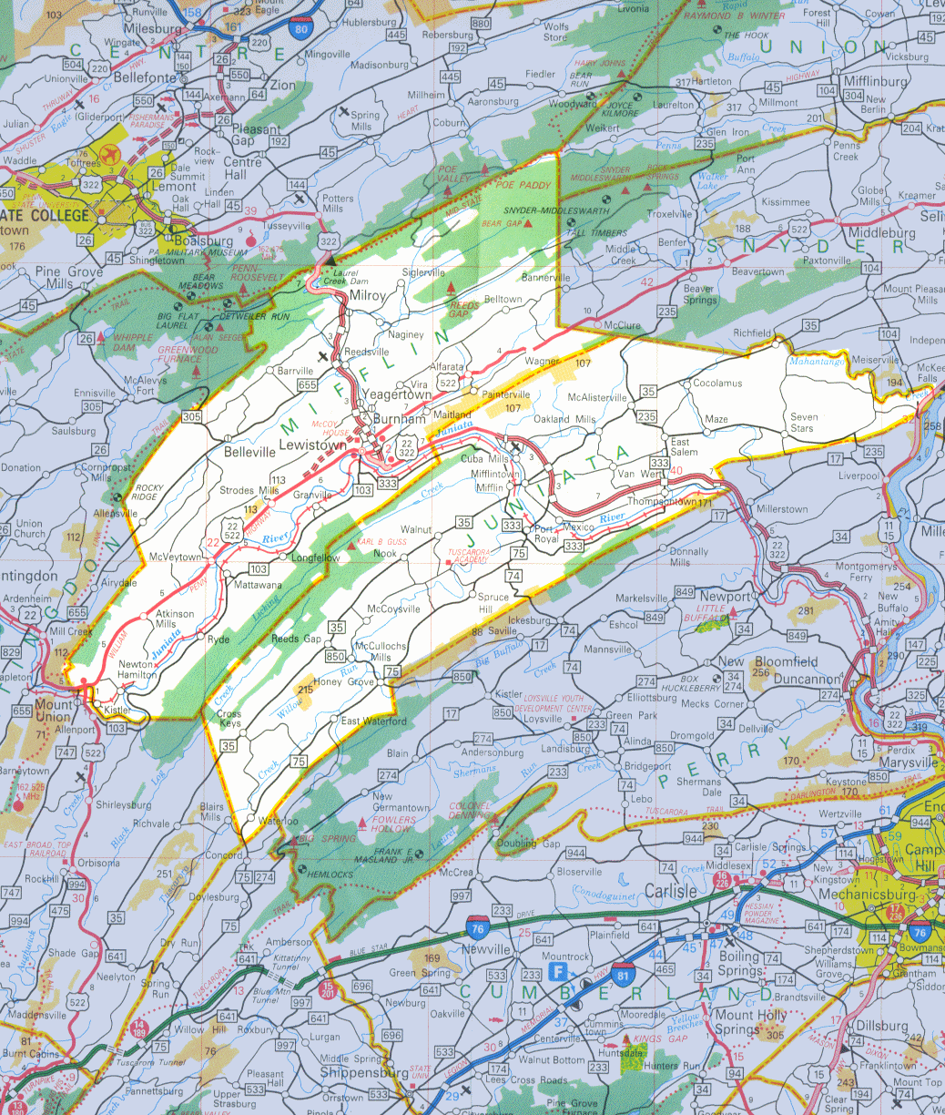
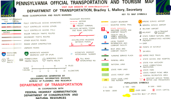
Official Pennsylvania State Transportation & Tourism Map :
2002 Central Pennsylvania and Key
HISTORIC MAPS
Main Indian Paths and Migration Trails in PA
Animated Map Showing Migration Patterns and Timeline of Settlement in the US
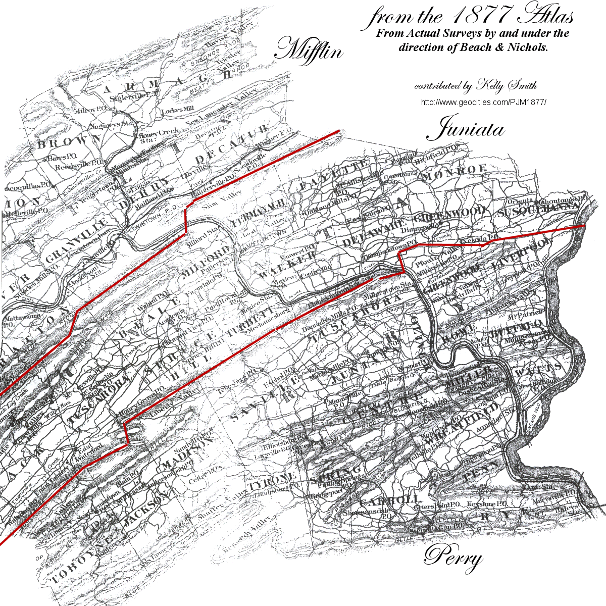
1877 Atlas of Mifflin, Juniata & Perry Counties
Partial Map of Mifflin, Juniata & Perry Counties from Beach & Nichols 1877 Atlas
Mifflin County 1895 U.S. Atlas
PAGENWEB MAP
Click to visit Mifflin PAGenWeb or PAGenWeb counties surrounding Mifflin.

TOPOGRAPHICAL MAP
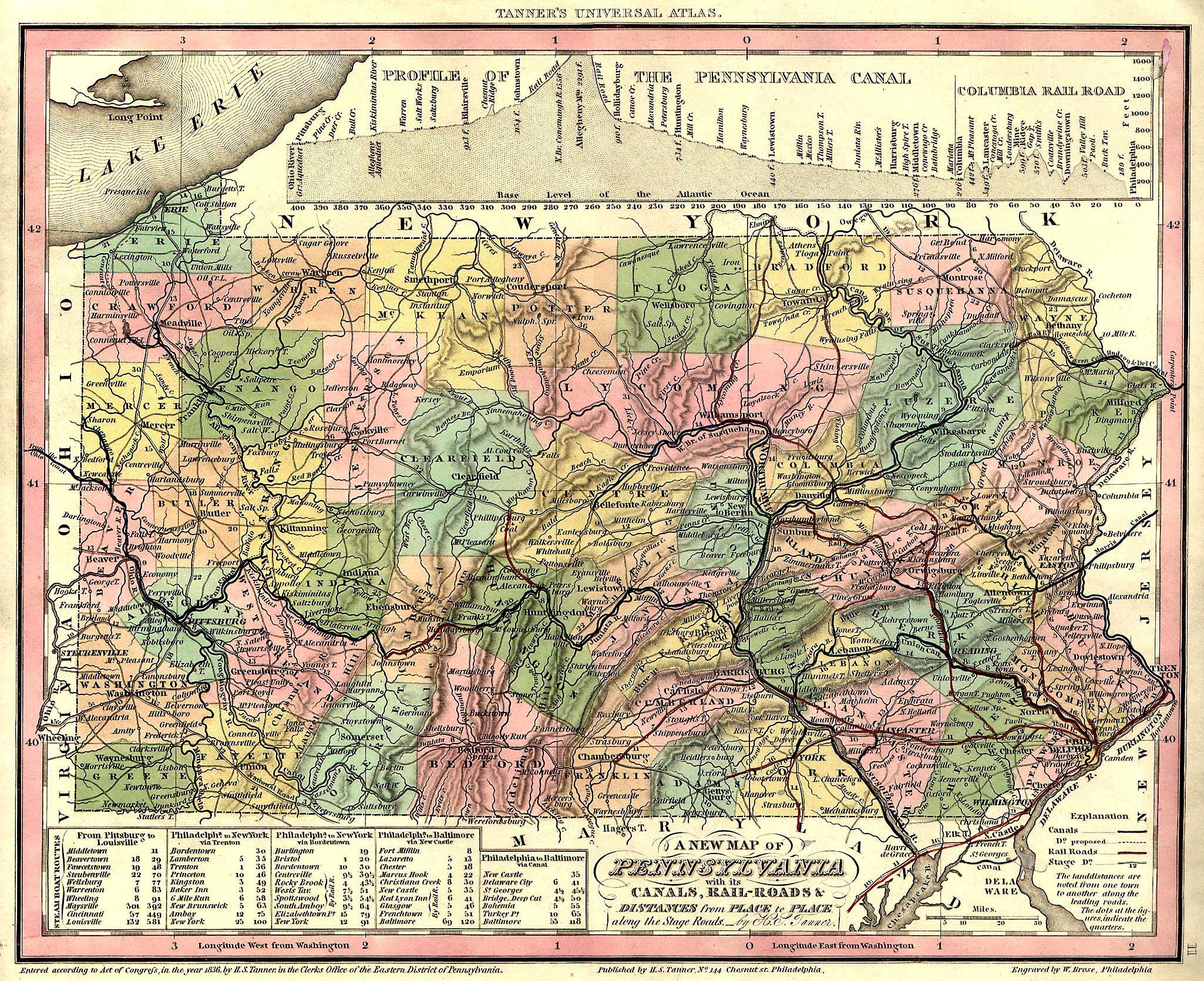
1836 Topographical Map, Showing Topography, Canals & Railway Lines
Topozone Map of the McVeytown Quadrangle
PA Department of Conservation and Natural Resources Maps
Southwest of the Juniata River: Tuscarora State Forest
Northeast of the Juniata River: Rothrock State Forest
TOURISM MAP
Click on Location/Description/Maps on the left navigation bar
TOWNSHIP MAPS
Mifflin County ~ USGenWeb Digital Map Library
MAP SOURCES
Mifflin County Government Map and Data Sales Department


Josie Baughman, Mifflin PAGenWeb County Coordinator
Copyright 2004-2008, Individual file contributors. All rights reserved.