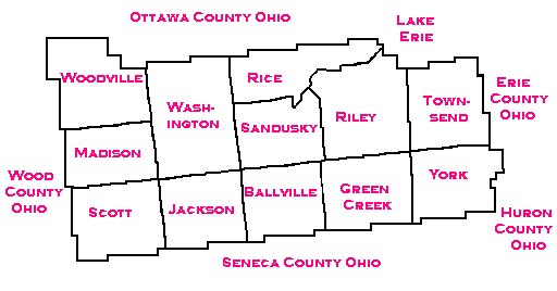
Welcome to Sandusky County Ohio Township Maps
Sandusky County is located in the north western section of the state of Ohio. It is bounded by: Ottawa county and Lake Erie to the North; Erie County to the North East and East; Huron County to the East and South East; and Seneca County to the South; with Wood County to the West. The following is a map from 1895. If you click on it you will see a larger version and you will need to use your back arrow to get back to this page.
Map modified with permission of Ray Sterner from
http://fermi.jhuapl.edu/states
|