

The following links have been graciously provided by William Hecht. Bill has spent considerable time scanning and preparing these maps for use. Visit Bill's main site, http://freepages.genealogy.rootsweb.com/~springport/ for more Finger Lakes maps and pictures.
Some files may be slow to load but they are worth the wait! Many of them show property owners names.
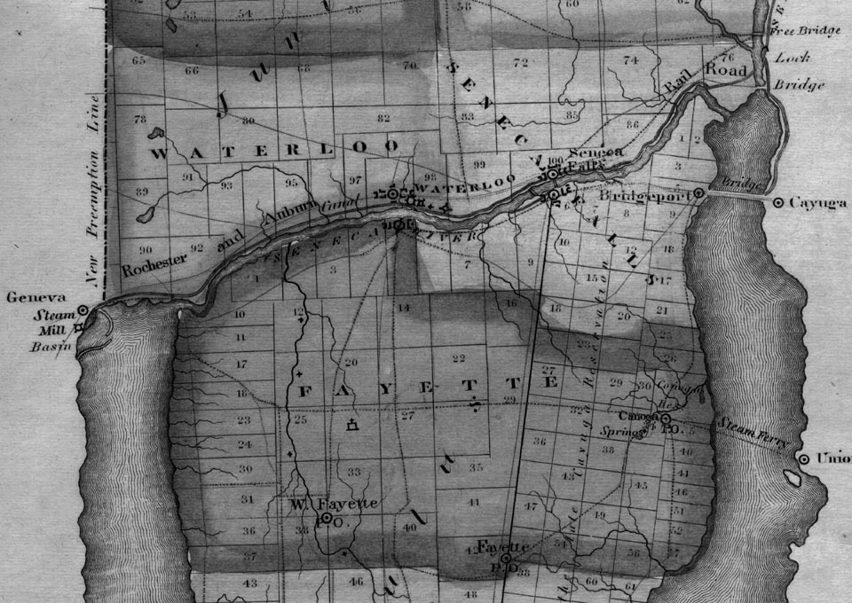
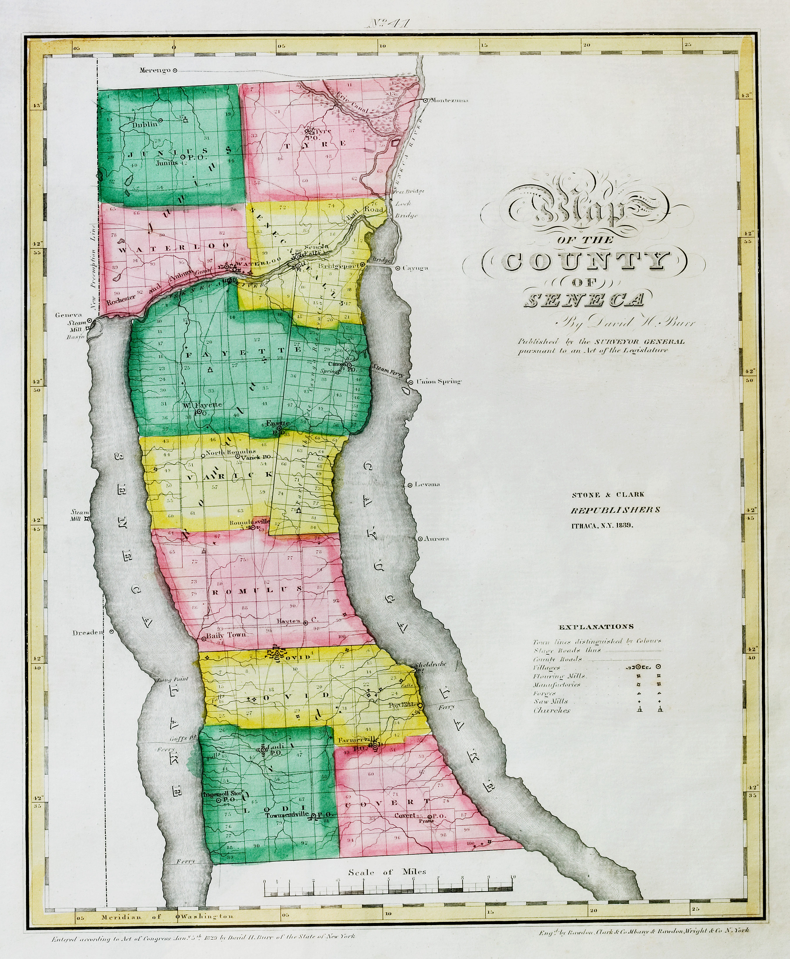
1839 map of Waterloo, Seneca Falls and Fayette
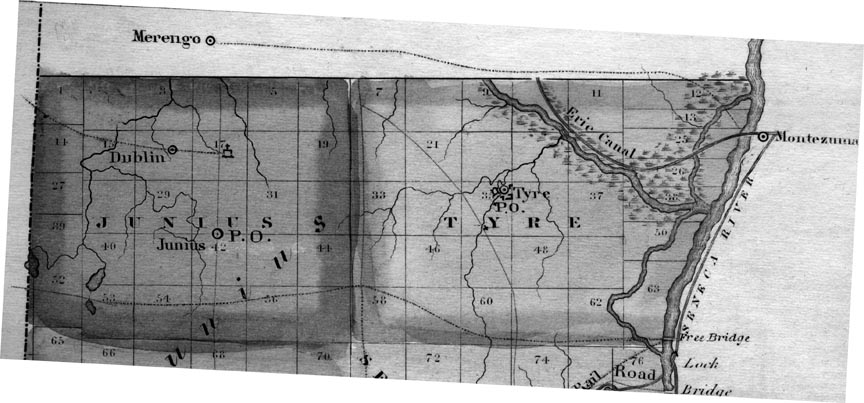
1839 Map of northern Seneca Co. Towns of Junius and Tyre
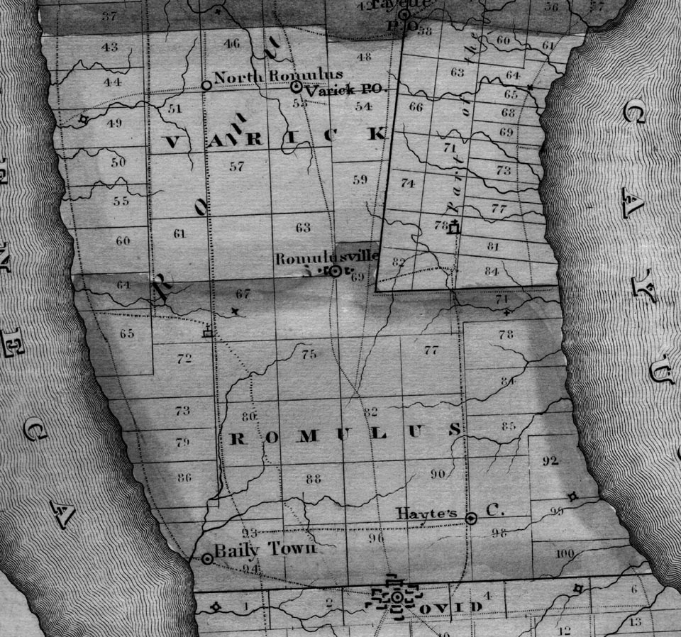
1839 Map of middle Seneca Co Towns of Varick and Romulus
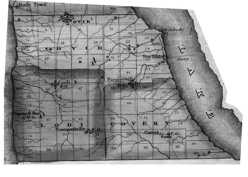
1839 Map of southern Seneca Co Towns of Ovid, Lodi, and Covert
1839 reprint of the 1829 Burr Atlas map updated to show rail roads for Waterloo, Seneca Falls and Fayette
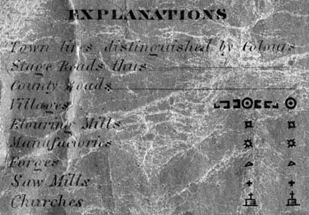
1838 Map Legend for map symbols
A colorized version of the 1839 Burr Atlas map as listed above.
1859 Cayuga / Seneca County, NY Land Ownership Wall Map .
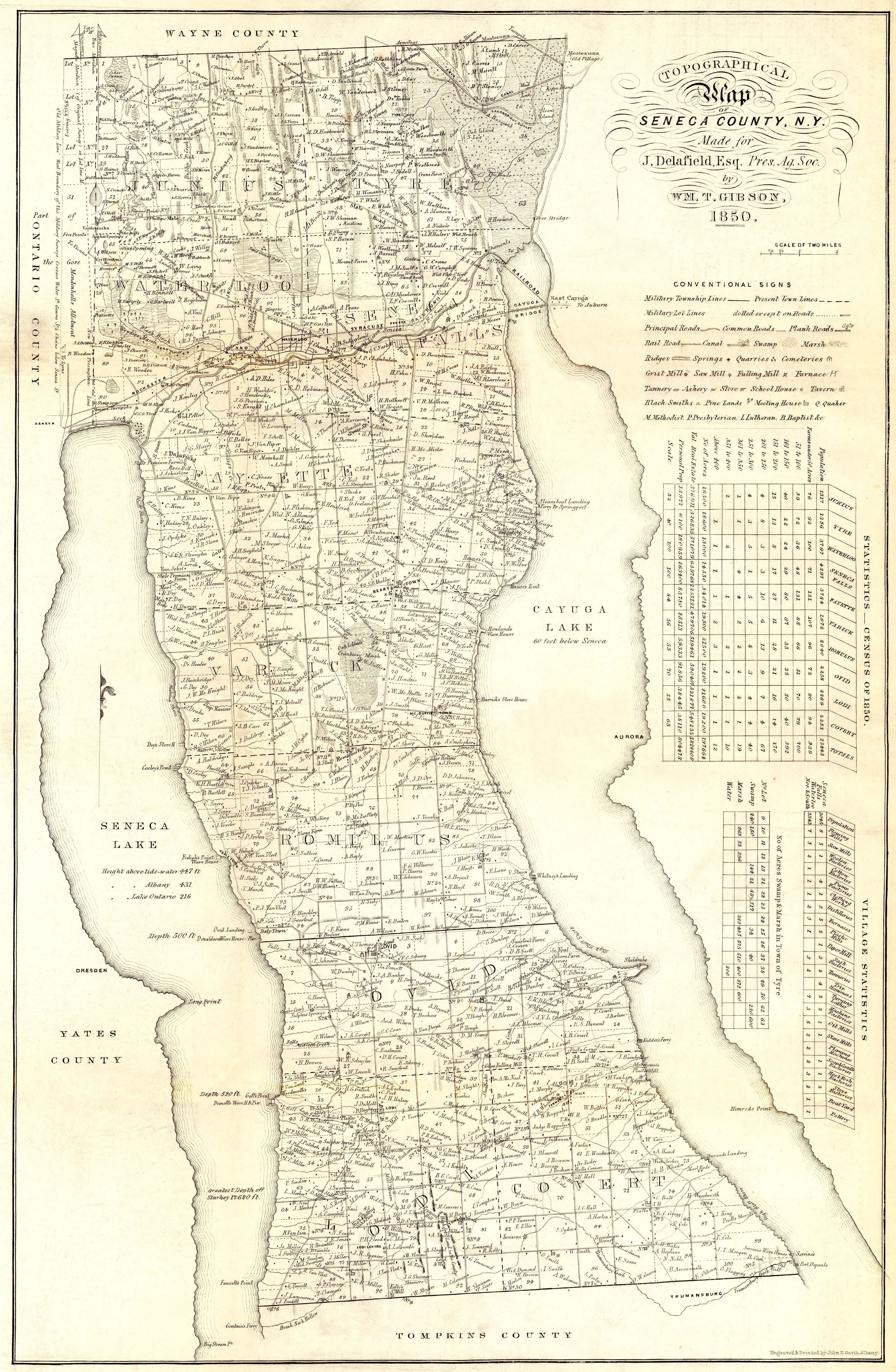
MR. DELAFIELD'S SURVEY OF SENECA COUNTY.
Back to Seneca County NYGenWeb
© 2006 Diane Lerch Kurtz