| Maps of Fultonville Over the past two centuries, over a dozen maps have been made of the village of Fultonville. I have obtained one original and many reproductions. The process of getting the large maps into .jpeg files is very time consuming. Many more maps shall be added in the near future. Please use citation under each map when sourcing. |
1834
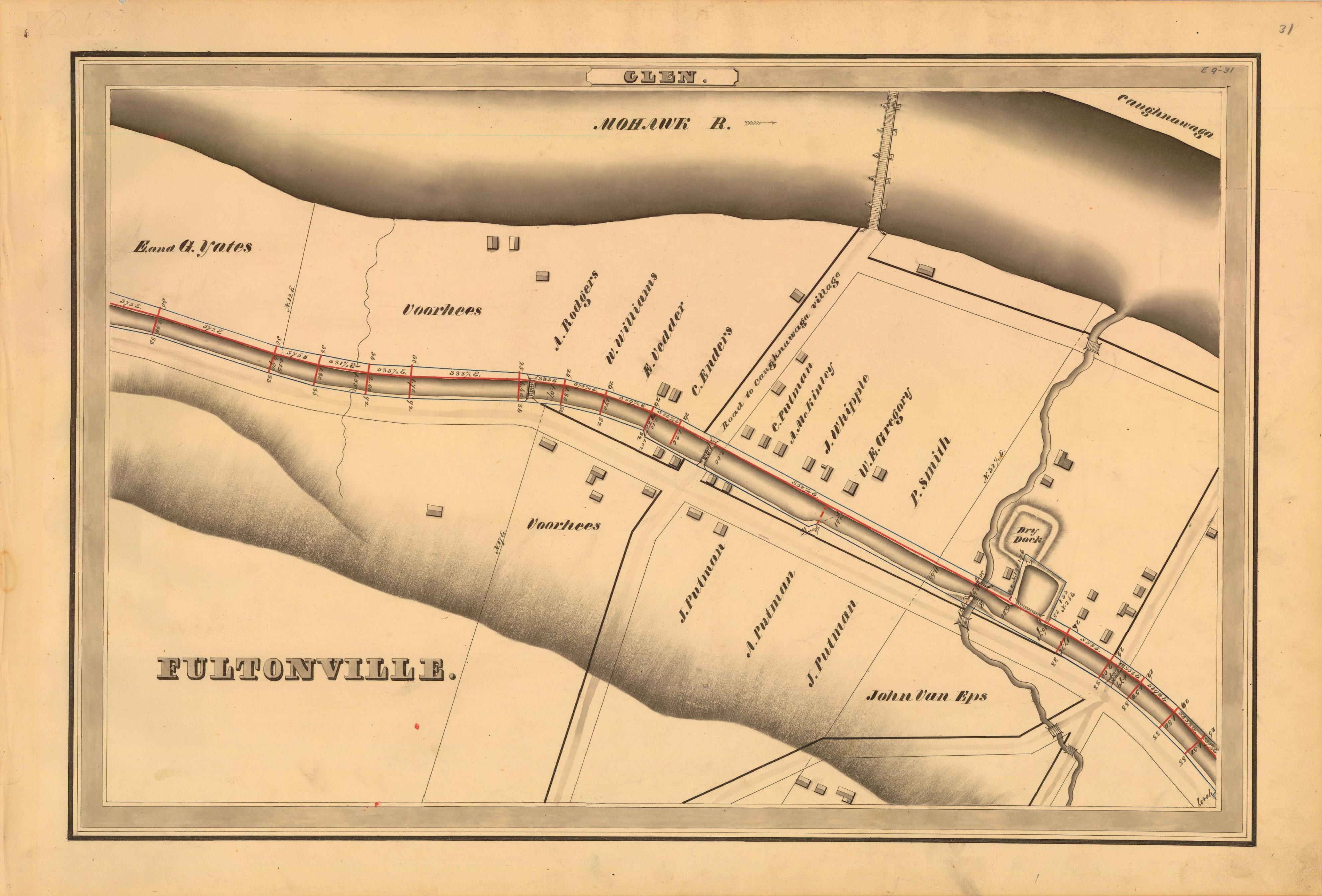
Erie Canal Survey, Glen showing Fultonville and Road to Caughnawaga Village.
Home
© 2009 Ryan Weitz