|
|
This page is always "in progress" status.
There are over two hundred known cemeteries in Warren County. Very few of which are online. Below is what I have found on other websites, and GNIS maps to the locations, and we have few cemetery listings at this time on this site and only two in the Warren County GenWeb Archives. Those marked with ** have listings, the others are maps to the location
I am actively soliciting cemetery listings, from one listing to an entire cemetery.
| Archer Cemetery | no map- no listings- Located in Elkhorn Twp N of Truesdale | |
| BearCreek Cemetery | ** map | (Actual Cemetery name is unknown) African American Cemetery bordering the Montgomery County line |
| Begeman Cemetery | map | |
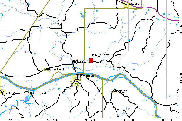
| Bridgeport Cemetery | map only |
listings needed |
| "David Bryan" Cemetery | near Marthasville- this is the cemetery where Daniel and Rebecca Bryan Boone were first buried. | |
| Camp Branch Cemetery | ** map | old listing, ( needs updating) Lee photos contributed by Danette Duckworth |
| Camp Ground Cemetery | **map | Located about a mile east of Jonesburg on the south side of Old Hy 40. |
| Carter, Henry Cemetery | ||
| Central Grove Cemetery | map only | |
| Coleman Cemetery | ** & gnis map | onsite County Route "B" Warren County, Missouri |
| Concord Hill Cemetery New Cemetery | new photos photos provided as a courtesy by Dennis Hellebusch who
is descendant of the families of: Hellebusch,
Glosemeyer, Koch, Boemker, Struckhoft, Nauber, Suhre from
the Treloar, Holstein, Peers, Concord Hill, Dutzow &
Marthasville. |
|
| Concord Hill, old Cemetery | New album coming soon Alpabetical listing now online and photos provided as a courtesy by Dennis Hellebusch who is descendant of the families of: Hellebusch, Glosemeyer, Koch, Boemker, Struckhoft, Nauber, Suhre from the Treloar, Holstein, Peers, Concord Hill, Dutzow & Marthasville. | |
| Corder Family Cemetery | ||
| Dutzow Cemetery | new photos 12/21/04 photos provided as a courtesy by Dennis Hellebusch descendant of the families of: Hellebusch, Glosemeyer, Koch, Boemker, Struckhoft, Nauber, Suhre | |
| Edwards Cemetery | ||
| Emmanuel Cemetery | map only | listings needed |
| Engel Cemetery | **&map | Located in Little Lost Creek State Forest south of Pendelton |
| Foster Cemetery | map only | listings needed |
| Garrett Cemetery | Located in SE Camp Branch Twp near Palmyra Church | |
| German Evangelical Church & Evangelical and Reformed Church | SEE MARTHASVILLE UCC | |
| Griswold Cemetery | ||
| Haase Cemetery | ||
| Hays, Absalom Cemetery | ||
| Hochfeld Evangelical Church/Cemetery | South of Warrenton about 7 miles | |
| Holy Rosary Cemetery | Coming soon a few images only | |
| Holstein Cemetery may also be known as Lehmberg Cem. |
photos provided as a courtesy by Dennis Hellebusch descendant of the families of: Hellebusch, Glosemeyer, Koch, Boemker, Struckhoft, Nauber, Suhre | |
| Hughes Children | undisclosed location on private land | |
| Immanuel/Immanuels United Church of Christ | at Holstein - Photos and data provided by Jane Denny | |
| Indian Camp Cemetery | or Vahle -It is located in Township 48 North, Range 1 West, on the Section line between sections 29 & 32 Information from Dorris Keeven-Franke | |
| Indian Cemetery (historical) | no map or information Located in SE Charrette Twp Named for an Indian settlement once in this area | |
| Kent, Issac | ** | Just north of Warrenton, Missouri north of Interstate highway 70 on highway 47, a right turn on Dogwood Dr. runs into Isaac Dr. which is a suburban residential development on what was the old Isaac Kent homestead…" The cemetery is on the property of Mr. Greg Costello, who is working on its restoration with Kent descendants. |
| Kennedy Cemetery | ** | 1 mile east of Wright City, then south 1/4 mile on the Troy-Dutzow Rd., northwest of the site of Fort Kennedy. Enclosed by concrete wall with wire gate. |
| Kidder Cemetery | ||
| Kimmich Cemetery | ||
| Kite Cemetery | ||
| Lamme Family Cemetery | Located
on what was the William Lamme farm, Lamme Lane near
Marthasville, Warren County (Formerly Montgomery County), Missouri This is at Margy Miles' wonderful site, browse the rest of it too. |
|
| Lippstadt Cemetery new | Warrenton, MO | |
| Loutre Cemetery | from GNIS- near "Case", historical no location | |
| Loutre Island Cemetery | See page for directions | |
| Marthasville City Cemetery | ** | off site- partial listing of Boone or names related to Boone Families. |
| Marthasville St.Pauls UCC | THE OLD CEMETARY RECORDS OF ST. PAULS UCC CHURCH OF MARTHASVILLE, MO. (aka: German Evangelical Church & Evangelical and Reformed Church, from handwritten notes by Ralph Gregory, March 1983 | |
| Metcall Cemetery | ||
| Millers Cemetery | ||
| Mount Airy Cemetery | ||
| Mount Zion Cemetery new | Hy K, O'Fallon | |
| Oak Grove Cemetery | ||
| Old Wyattom Cemetery | Located in NW Charrette Twp, NW of Hopewell--Burial place of Cpt J Wyatt, buried in 1855.--also known as Wyatt Home Cemetery | |
| Painter Cemetery | ||
| Pin Oak Cemetery | map | Located in west central Camp Branch Twp at Pin Oak Church |
| Pinckney Cemetery | map | Near Pinckney- map of Pinckney only |
| Pitts Cemetery | ||
| Pleasant View Cemetery | ||
| Price Cemetery | ||
| Prichett Cemetery | ||
| Pringle Cemetery | need exact location of this cemetery | |
| Rattle Cemetery | ||
| Ray Cemetery | ||
| Saint Johns Cemetery | ||
| Scachse Cemetery | ||
| Shelton Cemetery Partial Listing |
** | Shelton Cemetery is located in Twsp 47N-R2W-S17 (just west of Hy 47, east of Rte. W. north of I70 at Warrenton) new |
| Smith Creek Cemetery | ||
| Vahle Cemetery | or Indian Camp see Indian Camp | |
| " New" Warrenton City Cemetery | ** | listings on site and at the Archives Old City Cemetery (historical) Located at Warrenton and abandoned in 1920. |
| Waller, Joseph Cemetery | ||
| Winter Cemetery |
photos |
on Rte. U south of Warrenton 4-5 miles |
| Wright Cemetery | map only |
South of Jonesburg, Montgomery County, in the northwest corner of Bridgeport Township, Warren County that borders Montgomery Co. See township map |
| Wright City Cemetery | partial list | "north side of I-70 at the Methodist Church " |
| Zoar Cemetery | Highway J north out of Wright City and go about 4 1/2 miles and turn to Zoar Church Road. Zoar Church and cemetery close to this intersection. |
New off
site Website found-
Missouri Pioneer Cemeteries
Currently under construction this website will become the
outstanding center of information about cemeteries
for Central Missouri. No cemetery listings.
"a website dedicated to locating, protecting, and preserving
the long forgotten family cemeteries of the following counties of
Central Missouri:
Audrain, Boone, Callaway, Cole, Cooper, Gasconade, Howard,
Maries, Miller, Moniteau, Monroe, Montgomery, Morgan, Osage, and
Randolph. On this website we will be discussing a multitude of
ways and technologies that may be employed to further this goal
and provide the basis that hopefully change the attitudes and
legal climate to provide restoration and protection to these
hidden and forgotten family burial sites."
