Caldwell County Maps
![]()
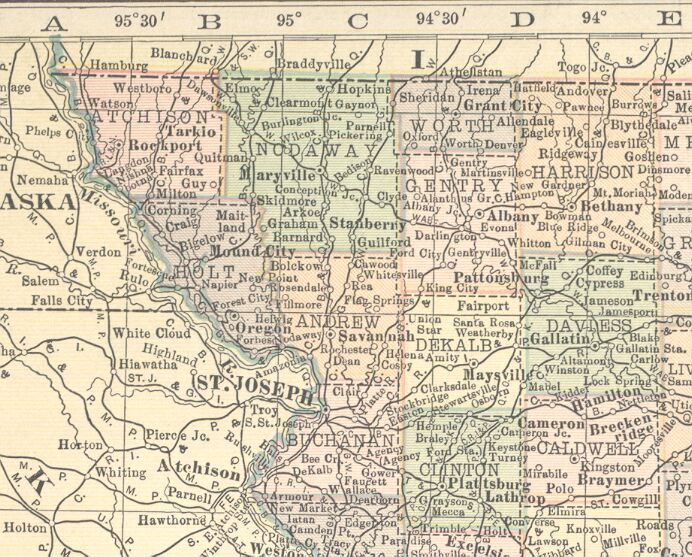
Caldwell County Maps - 1897
The USGenWeb Archive
Missouri Map Project has completed adding maps of Caldwell County for
1897 to the Missouri Maps website.
Our thanks to Mary Hudson, the
Missouri Map File Manager, for sharing this information.
The USGenWeb Archives Digital Map Library -
Missouri Maps Index
Caldwell
County
1897 Plat Maps Towns
![]()
Caldwell County - 1914
Source: 1914
County
Maps by State
Comments from source:
"This is from a book found while tearing down an old shed. There was no
cover, and the last page was missing, which I believe was Nevada and
Washington. The maps are dated 1910-1914. That is why I called them
1914 maps, that's when it ended. The name at the top says Atlas of the
World."
Note: Permission from Janie Edwards was given to use maps from her
webpage on USGenWeb Project pages.
(Click the picture for a larger view.)
![]()
This page was last updated January 6, 2011.