Kansas History and Heritage Project-Labette County
Labette County Maps
When you reach an image, left-click on your mouse to enlarge the map.
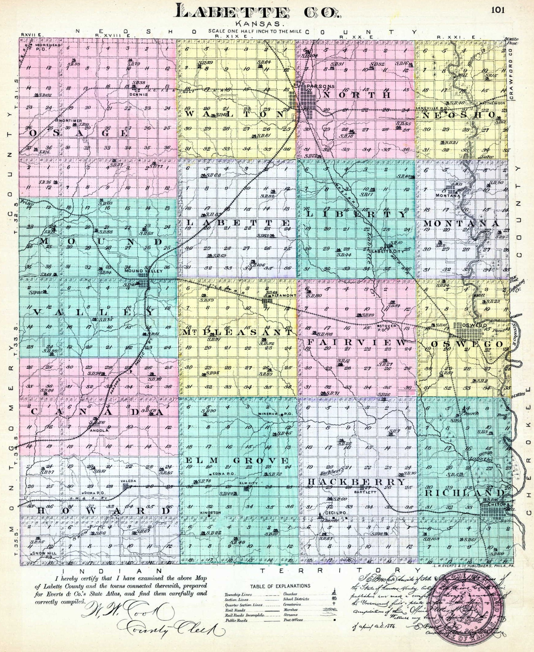
1887 LABETTE COUNTY MAP
1887 Outline Map
1906 LABETTE COUNTY PLAT MAPS
County Outline
Township Plats
Canada Twp.
Elm Grove Twp.
Fairview Twp.
Hackberry Twp.
Howard Twp.
Labette Twp.
Liberty Twp.
Montana Twp.
Mound Valley Twp. includes plat of the town of Mound Valley
Neosho Twp.
North Twp.
Osage Twp. includes plats of the towns of Bartlett and Edna
Oswego Twp.
Richland Twp.
Mount Pleasant Twp.
Walton Twp.
Town Plats
Town plat of Altamont
Town plats of Chetopa, Dennis and Labette City
Town plat of Oswego
Town plat of east Parsons
Towns plat of west Parsons
Return to Labette Co. KHHP
This website created September 18, 2011 by Sheryl McClure.
� 2011 Kansas History and Heritage Project