 |
 |
 |
|

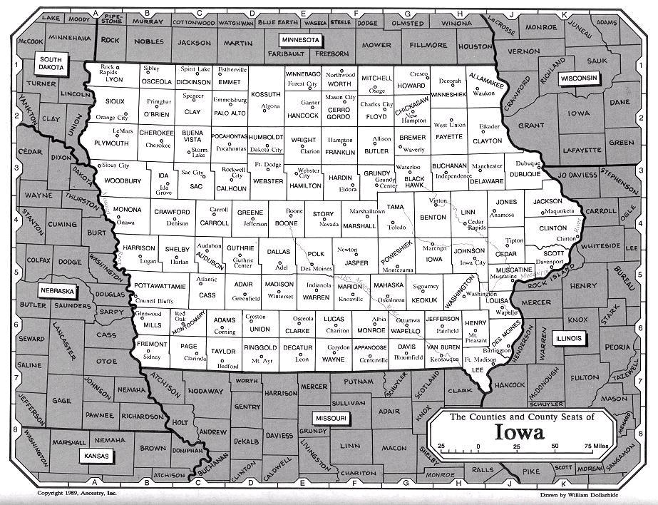
 Page Co., Iowa was created in 1847,
from the larger Pottawattamie Co. It is named in honor of Captain John Page of the 4th U.S. Infantry, who was mortally wounded in the battle of Palo Alto.
The County Seat is:
Page Co., Iowa was created in 1847,
from the larger Pottawattamie Co. It is named in honor of Captain John Page of the 4th U.S. Infantry, who was mortally wounded in the battle of Palo Alto.
The County Seat is:
 <---
Clarinda, IA. 51632.
Located in the Southwestern part of the State,
along the Missouri border.
Bounded by
<---
Montgomery Co., on the North;
<---
Taylor Co. on the East;
<---
Atchison Co., MO. on the Southwest;
<---
Nodaway Co., MO. on the Southeast; with
<---
Fremont Co., on the West. <---
Clarinda, IA. 51632.
Located in the Southwestern part of the State,
along the Missouri border.
Bounded by
<---
Montgomery Co., on the North;
<---
Taylor Co. on the East;
<---
Atchison Co., MO. on the Southwest;
<---
Nodaway Co., MO. on the Southeast; with
<---
Fremont Co., on the West.(First Census, 1850; Clerk Dist. Court has b. rec, m., d. Div., rec.; Pro. Civil Court Land rec.
<---See: County Stats from Wikipedia, (the free encyclopedia)
<---See: Google.com GPS Map! Coordinates: Latitude: 40.739454�N, Longitude: -95.038004�W |
|
The events leading upto the organization of Page County, Iowa, have
their roots in several land laws passed by the young United States. The
original Land Ordinance adopted by Congress in 1785 called for surveys
of six-mile square tpwnships, with subdivisions into sections of one
mile square, based on an east- west geographical line. These "Public
Lands" were offered for sale at public auctions, by the new states,
with half of the land being sold in townships, and half in sections,
at a minimum price of one dollar per acre. The Northwest Land Ordinance
of Ohio, in 1787 (2nd Land Act) was the first "Territory"
outside of the original 13 colonies. This consited all the land Northwest
of the Mississippi River. Revolutionary "Land Bounties would amount
to 1/7th. of the total, and in each Township, four sections were to
be reserved for the disposal of Congress, and Section 16, would always
be used for the maintenance of the public schools.
 Fig. 3.3.1 Iowa Territory (1838-1846) The third Land Act of 1796, also established the Federal Office of Surveyor General, directed that "Public Lands" offered for sale under the act were to be advertised in at least one newspaper in each of the states and territories two months prior to the sale, and requiring the purchase of 640 acres at $2.00 per acre, with only one year to complete the payment. By 1800, it was obvious that the 3rd. act of 1796 was unsuccessful in getting land into the hands of settlers, because of the 640 acres. Only some 50,000 acres had been sold in the Ohio Northwest Territory, only a small portion of the land, with most of the purchase being made by speculators. The "HARRISON Land Act of 1800" (fourth land act) extended the terms of credit from one year to four years, and allowed the purchase of 320 acres instead of 640 acres. District Land Offices were established under the direction of an officer called a "Register", to be appointed by the President. Public auctions were to be held for three weeks in the Spring of 1801, at each office in the Ohio Northwest Territory, after which unsold land could be sold at private sales. ALBERT GALLATIN took over operation of the Treasury Department in 1801, and it was he who defined the authority of the "District Land Officers". At first, it was thought that the offices of Register and Receiver were to be of little sigificance. No salary had been set by Congress, and the only compensation was to be a small percentage of the sales and modest fees for services. These officers had to supply their own offices and equipment. Later, when their duties grew beyond the expected bounds, these officers complained and ALBERT GALLATIN persuaded Congress to authorize an annual salary of $500, plus their commission on the sales. As it happaned, the offices of Register and Receiver were vital and complex. The Register was in charge of plats, and had to identify each tract after it was sold and mark was taken. The Receiver had charge of the funds received in payment for the public lands. In a credit system with its interest charges and discounts, the calculation of the accounts was a burdensome and exacting chore. The Secretary of the Treasury had decided that the Receiver must accept any partial payment for lands, however small, greatly complicating the calculation of interest and discount, and increasing the number of payments to be calculated. The mass of records of these first "Public Land Sales" led to the establishment in 1812 of the "General Land Office", as a unit of the Treasury Department. In 1849, the General Land Office became part of the newly created "Department of the Interior", which still administers its operation today.
Outside of a few explorers and priests passing by on the Mississippi and some fur trappers along the river, no white man came to the Iowa area until about 1788. Before Iowa became a territory in its own name in 1838, it had been part of the Missouri Territory, 1812 to 1821; Unorganized Territory 1821 to 1834; Part of the Michigan Territory, 1834 to 1836; and part of the Wisconsin Territory, 1836 to 1838. About 1833, the territory of Iowa had a large influx of white settlers after a treaty with some of the numerous Indian tribes inhabiting the country. Early in the fall of 1836, government surveyors marked off public lands into townships six mile squares, and into 640 acres sections. After recieving indepnedent territoral status, 1838, President VanBUREN appointed ROBERT LUCAS as Iowa Territory Governor. In his first message to the Legistrive Assembly, declared that the priviledges, rights, and immunities of the Ohio Northwest Land Ordinance of 1787 also applied to the Territory of Iowa. According to this decree, once the population of an area reached 5,000 the residents were organize among themselves and elected an assembly representative of the whole territory as well as a non-voting delegate to Congress. Then when the territory achieved a population of 60,000 it could become a state of the Union on equal basis with those states already established. As a Territory in 1838, Iowa was guaranteed religious freedom, civil liberties, exclusion of slavery, and the establishment of free public education, and most important was "Public Land Sales". The Iowa Territory eventually had nine "Public Land Offices" the earliest opening in Nov. of 1838 in Burlington, (Des Moines County) and Dubuque, (Dubuque County); In Sep. 1853 was Council Bluffs, (Pottawattamie County); The last closing in Des Moines, (Polk County in 1910. Their were over 20,000 settlers who were in Iowa Territory prior to the first land sales and thus had no legal title to their claims. To prevent speculators and late comers from buying such improved lands at land office auctions, the settlers and speculators formed "Claim Clubs" to rig the auctions on grounds of first settlement. A total of five Counties were formed in the Iowa Territory about 1836, three counties were formed from the Wisconsin Territory; DES MONIES, DUBUQUE, and HENRY. One county POLK was formed from INDIAN LAND PURCHASE. Later that year (1836) VAN BUREN was formed from DES MONIES County. The next year a total of nine (total of 14) counties were formed (1837), five more counties were formed from the Wisconsin Territory; JACKSON, JONES, LINN, SCOTT, and WASHINGTON. Dubuque County was re-formed and CLAYTON and DELAWARE were formed. Des Moines was re-formed a second time and LOUISA and MUSCATINE were formed. Two more counties were formed in 1838 (total of 16), CEDAR County was formed from the Wisconsin Territory and JOHNSON County was formed from the 3rd revision of Des Moines County. By 1839 (total of 18) brought CLINTON County from the 3rd. revised Dubuque County, and JEFFERSON County was formed from Indian Land Purchase. For the next 4 years no new counties were formed until 1843 (total 20) when BLACK HAWK County was formed from the 1st. revised Delaware County and LEE County was formed from the 4th revised Des Moines County. In 1844 (total 24) a total of four new counties were formed, DAVIS County was formed from the 1st. revised Van Buren County; KEOKUK County from 1st. revised Washington County; MAHASKA County from Fox County, Wisconsin and part of Indian Land Purchase; WAPELLO County was formed from Indian Land Purchase. In 1845 (total 27) three more counties were formed; JASPER County was formed from the 1st revised Mahaska County; MARION County from the 2nd revised Washington County; MONROE County from the 1st. revised Wapello County. About 1840 although there were some 43,122 white settlers residing in 27 Counties, in the Iowa Territory, a recommendation for statehood was turned down by a vote 2,907 to 937. By 1846, these same people voted in favor of statehood, ending eight years (1838-1846) of vigorous debate over the territory's official boundaries. By 1846 four more counties were formed; APPANOOSE County which was formed from the 1st revised Davis County; BENTON County was formed from as a new county from Indian Land Purchase; BOONE and WARREN Counties were formed from the 1st. revised Polk County. When Iowa was admitted to the Union in 1846, their were 31 Counties in the Iowa Territory prior to state-hood. Five more Counties will be formed from Indian Land Purchase, to a total of 99 counties which will be formed from the existing larger Counties. In 1847 the State-hood of Iowa consisted of 33 Counties with the forming of two additional counties which were formed from existing counties; DALLAS County was formed from the 2nd. revised Polk County; IOWA County was formed from the 3rd. revised Washington County. In 1848 the State-hood of Iowa consisted of 36 Counties with the forming of three additional counties which two were formed from existing counties; BUCHANAN County from 2nd. revised Delaware County; POWESHIEK County from 1st. revised Musquaka County; and a large county called POTTAWATTAMIE County from Indian Land Purchase, which will later be broken down to six addition counties. In 1849 the State-hood of Iowa consisted of 38 Counties with the forming of two additional counties which were formed from existing counties; LUCAS County from 1st. revised Monroe County; and MARSHALL County from 1st. revised Jasper County. In 1850 the State-hood of Iowa consisted of 45 counties with the forming of seven additional counties which were formed from existing counties; CLARKE County from 1st. revised Lucas County; DECATUR and WAYNE Counties from the 1st. revised Appanooes County; FREMONT and PAGE County from the 1st. revised Pottawattamie County; FAYETTE County from the 1st. revised Clayton County; and MADISON County from the 4th. revised Polk County. In 1851 the State-hood of Iowa consisted of 52 Counties with the forming of five additional counties which were formed from existing counties; ALLAMAKEE County from the 2nd. revised Clayton County; GUTHRIE County from the 1st. revised Jackson County; MILLS County from the 3rd. revised Pottawattamie County; MONTGOMERY County from the 1st. revised Pope County; and TAYLOR County from the 1st. revised Page County; two new counties BREMER and WINNESHIEK Counties from Indian Land Purchase. In 1852 the State-hood of Iowa consisted of 54 Counties with the forming of two additional counties which were formed from existing counties; TAMA County, part from 1st. revised Boone and part from 1st. revised Benton Counties; WEBSTER County from *Yell and *Risley Counties (*Now known as HAMILTON County, Iowa). In 1853 the State-hood of Iowa consisted of 62 Counties with the forming of eight additional counties which were formed from existing counties; CASS and HARRISON Counties from the 4th. revised Pottawattamie County; ADAIR and SHELBY Counties from 1st. revised Cass County; ADAMS County from the 1st. revised Taylor County; BUTLER County part from the 1st. revised Buchanan and part from the 2nd. revised Black Hawk Counties; STORY County part from the 2nd. revised Jasper County, part from the 6th. revised Polk County, part from the 2nd. revised Boone County. In 1854 the State-hood of Iowa consisted of 67 Counties with the forming of three additional counties which were formed from existing counties; CARROLL County from the 1st. revised Gurthrie County; GREENE County from the 1st. revised Dallas County; MONONA County from the 1st. revised Harriason County; Two new counties FLOYD and MITCHELL Counties from the CHICKASAW Indian Land Purchase; In 1855 the State-hood of Iowa consisted of 78 Counties with the forming of eleven additional counties which were formed from existing counties; AUDUBON County part from 3rd. revised Cass County, part from the 3rd. revised Black Hawk County; CALHOUN County formerly Fox County; CERRO GORDO County from the 1st. revised Floyd County; CHICKSAW County from the 1st. revised Fayette County; CRAWFORD County from the 1st. revised Shelby County; FRANKLIN County from the 1st. revised Chicksaw County; HOWARD County part from the 2nd. revised Chicksaw County and part from the 2nd. revised Floyd County; KOSSUTH County from the 1st. revised Webster County; RINGOLD County from the 2nd. revised Taylor County; UNION County from the 1st. revised Clarke County; WRIGHT County from the 2nd. revised Webster County. In 1856 the State-hood of Iowa consisted of 80 Counties with the forming of two additional counties which were formed from existing counties; GRUNDY County from the 3rd. revised Black Hawk County; HAMILTON County from the 3rd. revised Webster County. In 1857 the State-hood of Iowa consisted of 88 Counties with the forming of seven additional counties which were formed from existing counties; CHEROKEE County from the 1st. revised Crawford County; DICKINSON and WINNEBAGO Counties from the 1st. revised Kossuth County; HANCOCK County from the 1st. revised Wright County; HUMBOLDT County from the 4th. revised Webster County; SAC County from the 1st. revised Greene County; WORTH County from the 1st. revised Mitchell County; One new County from the Indian Land Purchase, WOODBURY County. In 1858 the State-hood of Iowa consisted of 91 Counties with the forming of two additional counties which were formed from existing counties; IDA County from the 1st. revised Cherokee County; PALO ALTO County from 3rd. revised Kossuth County; The Last new county from the Indian Land Purchase was CLAY County. In 1859 the State-hood of Iowa consisted of 94 Counties with the forming of three additional counties which were formed from existing counties; BUENA VISTA County part from 1st. revised Sac County, and part from the 1st. revised Clay County; EMMETT County part from the 4th. revised Kossuth County and part from the 1st. revised Dickinson County; POCAHONTAS County part from the 1st. revised Humboldt County and part from the 2nd. revised Greene County. In 1860 the State-hood of Iowa consisted of 96 Counties with the forming of two additional counties which were formed from existing counties; O'BRIEN County from the 2nd. revised Cherokee County; SIOUX County from the 1st. and only revision of Plymouth County. From 1860 to 1872, some 12 years no new county was formed. The State-hood of Iowa consisted of 99 Counties with the forming of last three additional counties which were formed from one existing county of Woodbury, which were LYON, OSCEOLA, and PLYMOUTH Counties.
PAGE COUNTY, IOWA - TOWNSHIPS: As settlers began travel westward from the Northeast part of Iowa, some four years (1846) after Iowa became a state, Page County was formed about 1850, from the County of Pottawattamie. Page County was named in honor of a Mexican War officer Captain Page, who was killed in the line of duty. The next year Page County in 1851 was revised and Taylor County was created.  Fig. 3.3.2 Page Co. with two Twp. (1850-1858) For the town-sites the mayor and council were vital necessity. Government for rural areas was organized in townships. It is believed that many years before Page was formed in 1850 their was two townships in Page County area "Buchanan" Twp. of some 91,178.88 acres and in the North part "Nodaway" Twp. of some 217,482.01 acres. The seperation line of North and South was along Section 19 of Twp. 68 - North, Range 36,37,38,and 39 West. In researching a "Township" it is necessary to note what period of time you are look for, because due to the several re-alignment of the Township, a person may have been in three or four different Townships with never moving once.
 Fig. 3.3.3 Page Co. with 8 Townships. Sep. 01, 1858
See Section 3.5
 Fig. 3.3.4 Page Co. Townships. WITH 15 CREATION DATES
| |||||||||||||||||||||||||||||||||||||||||||||

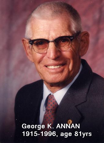 These records are dedicated to one of my best friends, my Uncle:
George K. ANNAN, 1915-1996, age 81yrs
These records are dedicated to one of my best friends, my Uncle:
George K. ANNAN, 1915-1996, age 81yrsI Compiled and self Published some various Towns & Townships Maps records in Jun. 28, 1986. Uncle George, would tutor me for hours, on the struture of Townships, we would visit various historical sites in Page County and he would explain to me a lot of his first had experiance. Uncle George, grew up in rual area of Yorktown, Page Co., Iowa. He was a large land owner, and Farmer, and was Commissioner on the Page County Soil Conservation District for over 30 years; Director of the Iowa Association of Soil Conservation District Commissioners; Served on the State Soil Conservation Committee; Member of the Lions Club of Clarinda, Iowa; Was a 4-H leader for many years; Helped organize the Lincoln Leaders Boys 4-H Club. Received many awards as a commissioner, Outstanding Commissioner for Region VII in 1960; Watershed Achievement Award in 1979; Emmett ZOLLARS Award in 1974; Page Co., Goodyear Tire & Rubber Co. Award in 1976; just to name a few. ....by Paul R. Sarrett, Jr. |
 |
E-Mail: Paul R. Sarrett, Jr., Auburn, CA. [email protected] Friends of Page County, President |
 Oct 01, 2003;
Jul 20, 2007;
Aug 04, 2009;
Oct 01, 2003;
Jul 20, 2007;
Aug 04, 2009;