The importance of Militia Districts -
Their use today is significantly different than in the past. Today's use
is basically just for voting districts and precinct purposes.
In your research for your ancestors in viewing census records you will find that
in census
records forward from 1850 at the top of the census report there are either a
name or a
number. This information is the "Militia District" that your ancestor
lived in. Don't however
be fooled by this knowledge if for instance on the following years census the
person's
Militia District changed, they may not have moved from their home from previous
year,
the District Name, however, may have changed.
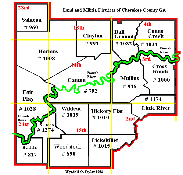
As you can see from the map above the following are the Militia Districts for
Cherokee:
792 - Canton
817 - Bells
818 - Mullins (Includes Buffington and Macedonia Communities)
890 - Woodstock
960 - Salacoa
971 - Clayton
1000- Cross Roads (Free Home Community)
1008- Harbins (Waleska Area)
1010- Hickory Flat
1015- Lickskillet
1019- Wildcat (Holly Springs Area)
1028- Fair Play (Sutallee Community)
1031- Conns Creek
1032- Ball Ground
1174- Little River
1279- Sixes