
Ravine Road Locale, Mansfield, CT
A talk, given at the Mansfld. Hist. Soc. Meeting, Jan. 8. 1965 by Anne Gauger
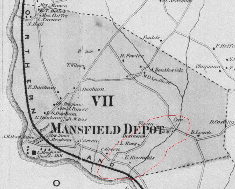
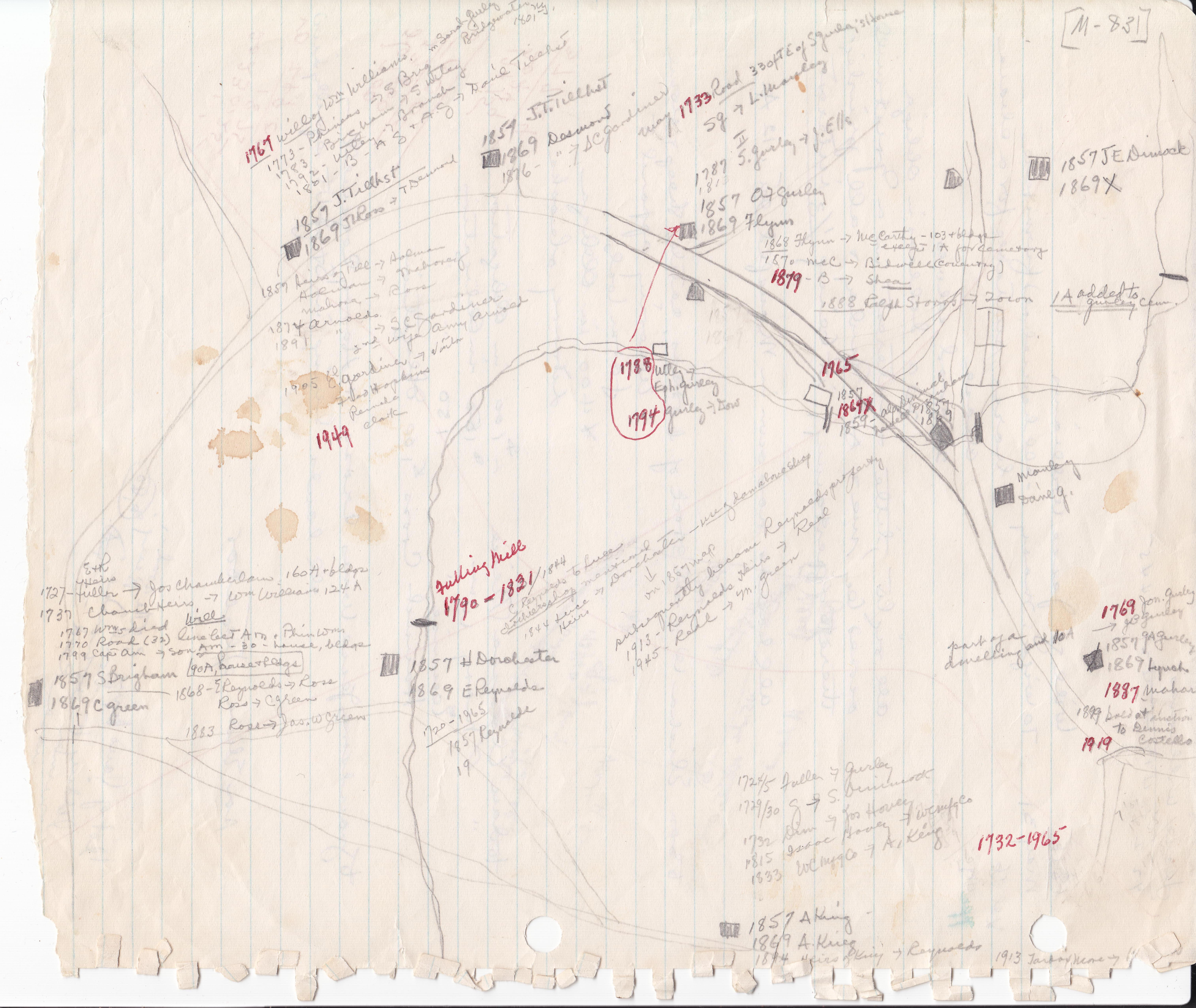
In 1788 Ephraim Gurley bought about 3 Acres of land (see map) right here on the Ravine Road. One acre, with a dwelling, was north of the road, and about two acres with a barn was south of the road and extended down to the brook, If you are on Ravine Road, especially if you are going east, you can plainly see the stone wall which was his boundary. He set up the Ironworks about here (#2 on map.) There must have been a dam (now gone) because there is a reference to the Ironworks Pond, and before that a reference to Capt. Samuel (II) Gurley's "watering place."
Continued in paper... 
As for where the Gurleys came from: -- Samuel Gurley came to the Ravine In 1724, at the age of 35 with an established family of five children, He had grown up in Coventry, reached manhood, and married Experience Rust In 1712. The Coventry land Records show that he had accumulated a large property there and elsewhere in Tolland. His two sons were boys of 6 and 8p the only boys in a family of eight girls, Jonathan and Samuel II. When Samuel died In 1760, he left nothing but money, having disposed of his Real Estate between his sons, each child receiving a substantial sum. Samuel was not a poor man.
Jonathan, the first son, built this house, probably when he married in 1737 (#14 on the map); he was still living in it in 1769, when he sold 10 acres around the pond to his son Jacob Baker, and split the house kitty-corner down the middle. Jonathan's sons, for the most part, stayed in the vicinity and settled. One, the Rev. Ebenezer, went to Vermont, where he died.
Samuel's sons, on the other hands married in town and had children born here, but eventually moved on. One, the Rev. John, became pastor of the Methodist Church In Lebanon, and died at age 29. His son John studied Law, was appointed by President Jefferson as District Attorney of the Louisiana Territory, was killed in a duel In New Orleans, where he made his home. The third John, also followed the low and held responsible and Important positions with the Government. These Gurleys formed the southern branch of the family. Samuel's son lsrael, some time after marrying and apparently leaving his wife and their three children in Connecticut meanwhile, also went to Vermont and died and is buried with his cousin, the Rev. Ebenezer Gurley, in Guilford. Phineas and Zenas migrated to New York State.
The next generation went off in all directions, and it is impossible to follow them all, To name but a few states - Maine, Vermont, Massachusetts, New York, Maryland, Michigan, Iowa, Ohio, - and eventually Oregon - gives a brief example of one family's contribution to the settlement of this country.
But Samuel Gurley, and his wife, his two sons and their wives, and many of their children lie buried in the Gurley burying ground.
The paper, as a PDF file is available here.
Two version of a survey submitted to the Historic American Buildings Survey Inventory.

Around 1978 a survey was made, resulting in 322 sheets of information on individual houses.
None
None at this time.
In 1869 an atlas of Tolland County was published by O. W. Gray. It includes a map of Mansfield. The Committee used this map as the basis of its work for many years.

Other Maps
Ms Gauger made two maps. One is included in the 1965 Presentation. It referes to the places in the talk. The other is this extensive Working Copy.
Additional Variant Names
Ravine, Pink Ravine, Green Ravine
This file was created: 08 Dec 2009 by Patrick McGlamery
This file was updated: 08 Dec 2009 by Patrick McGlamery