
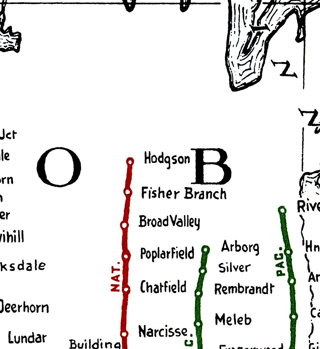
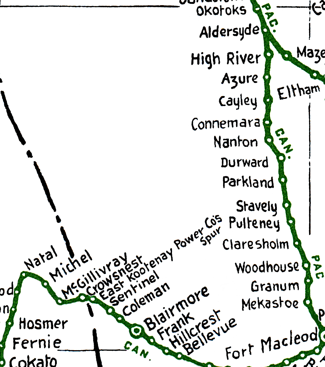
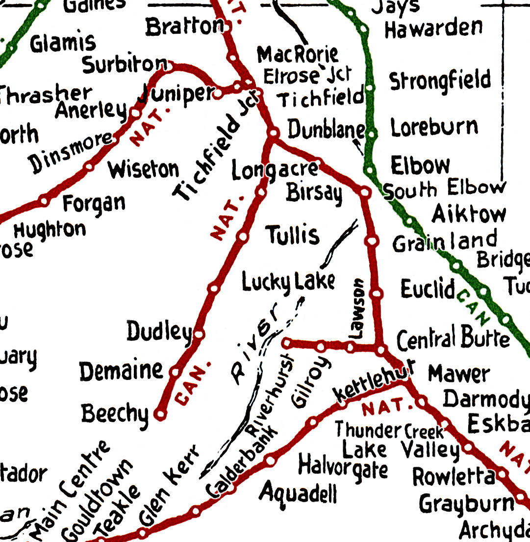
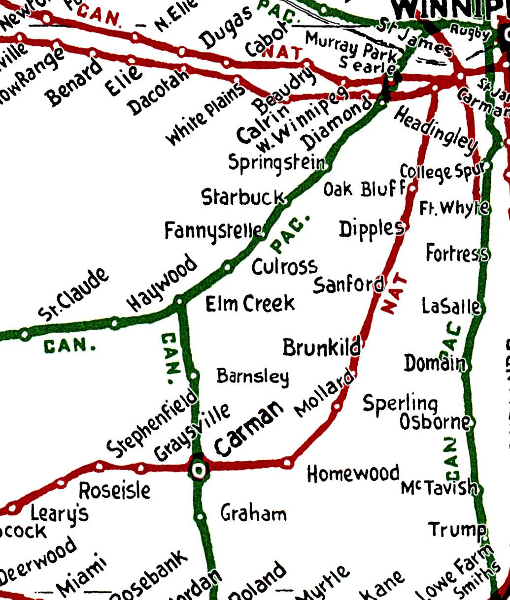
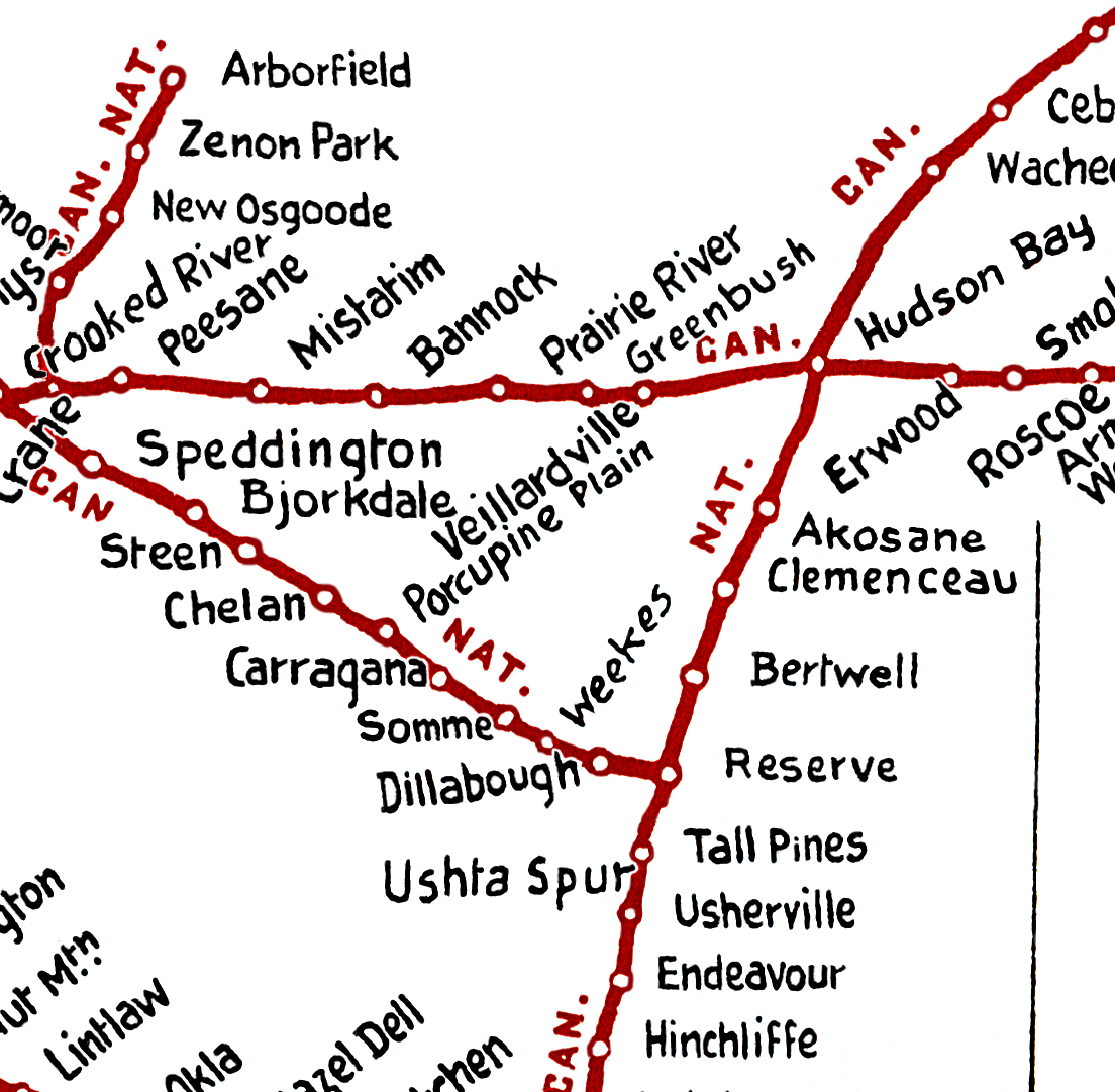
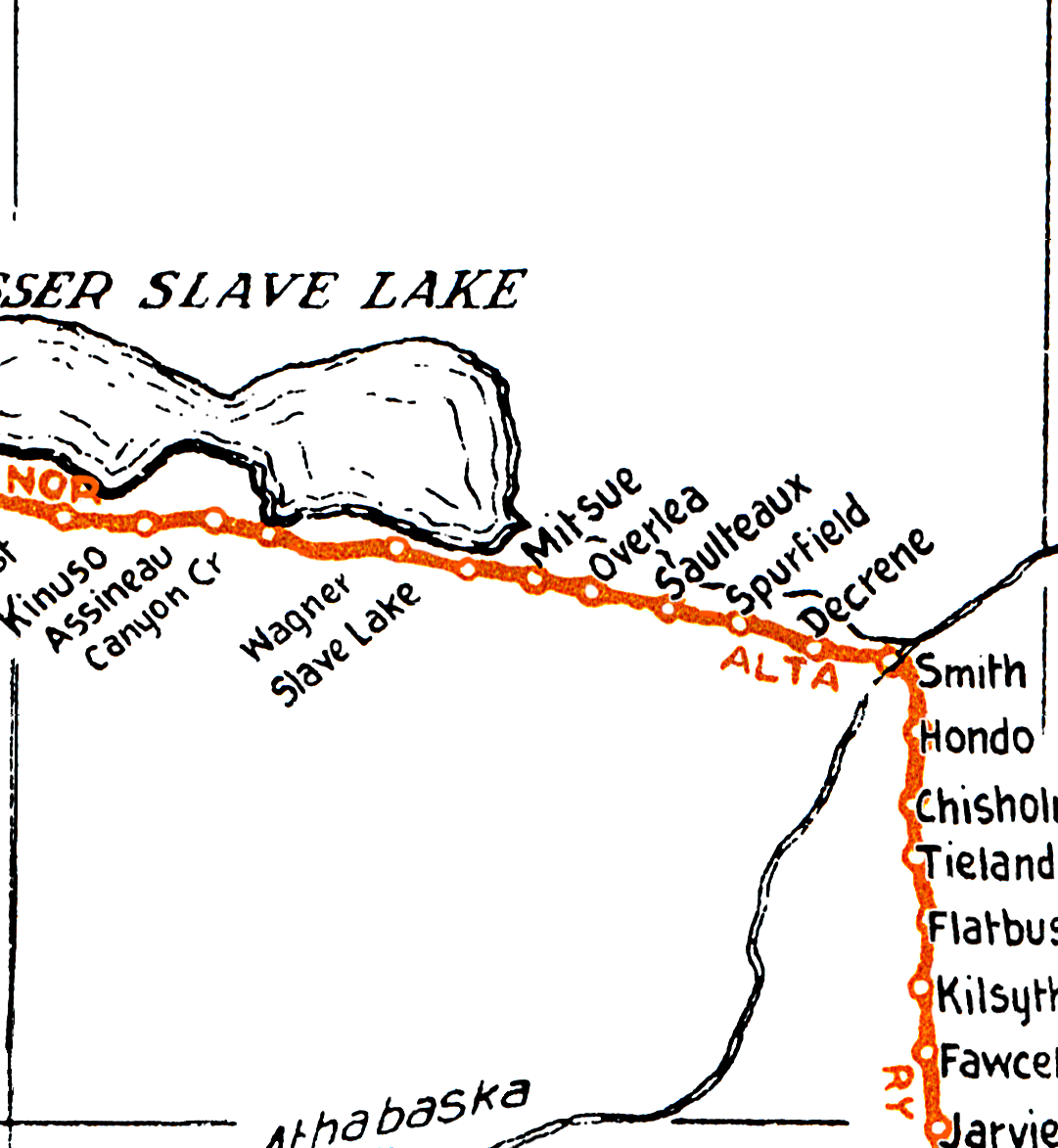
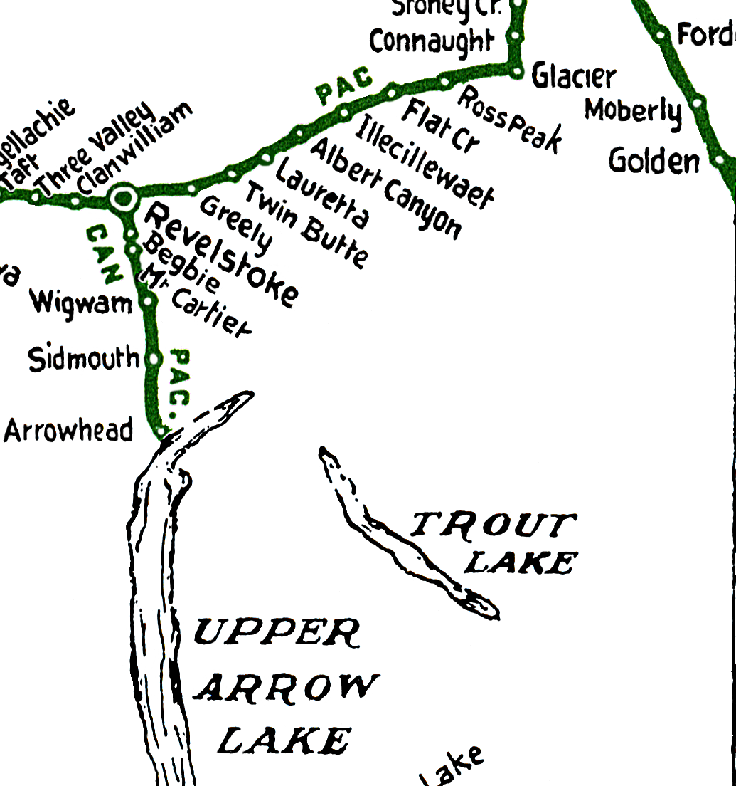
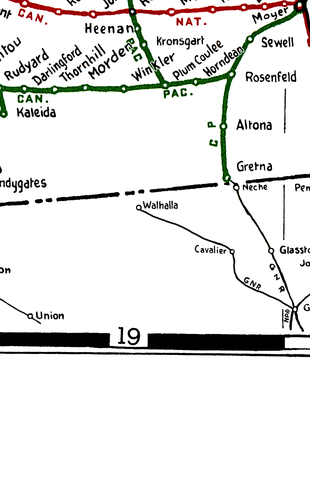
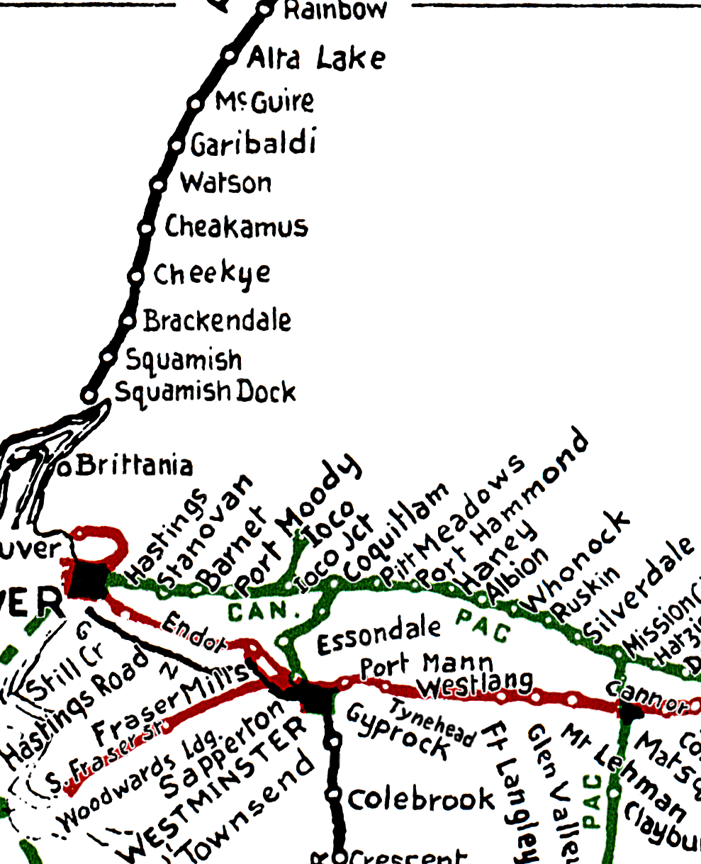
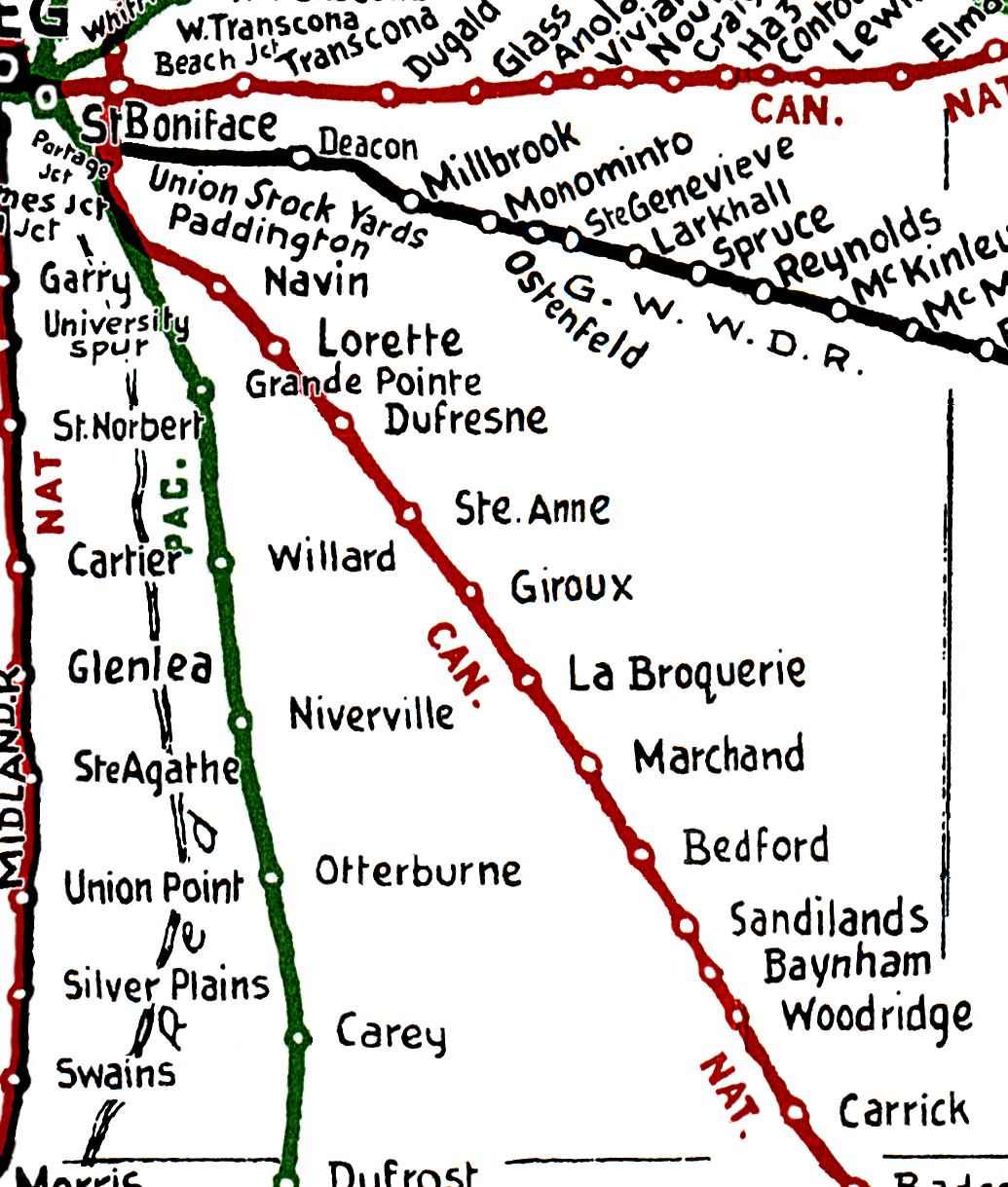
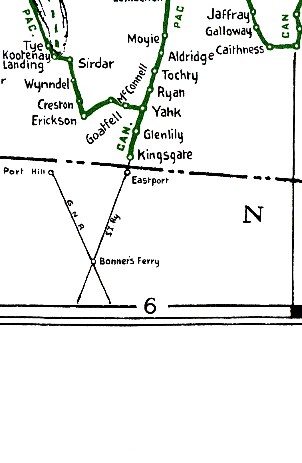
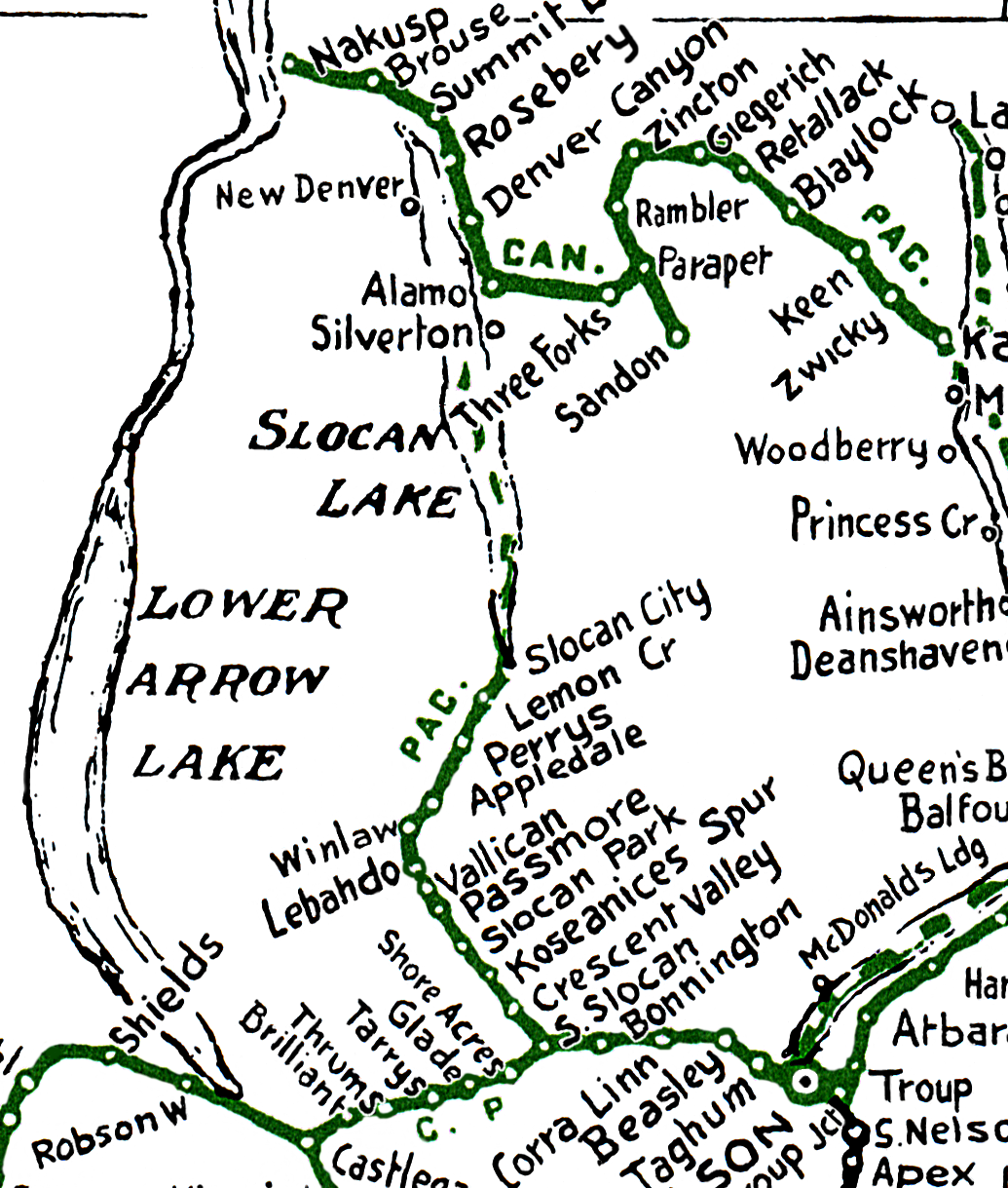
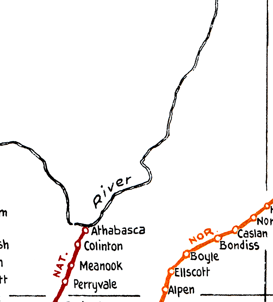
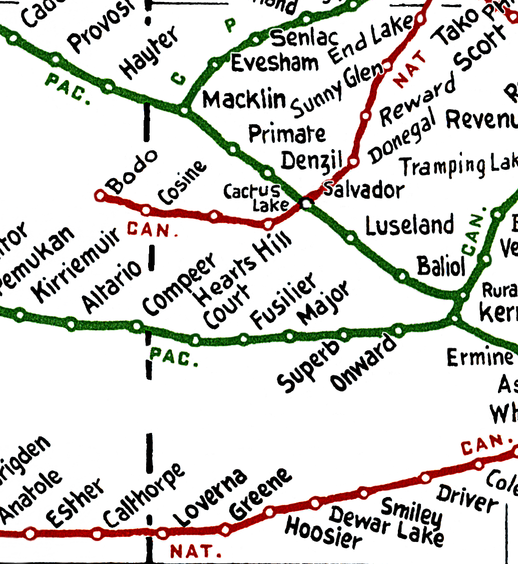
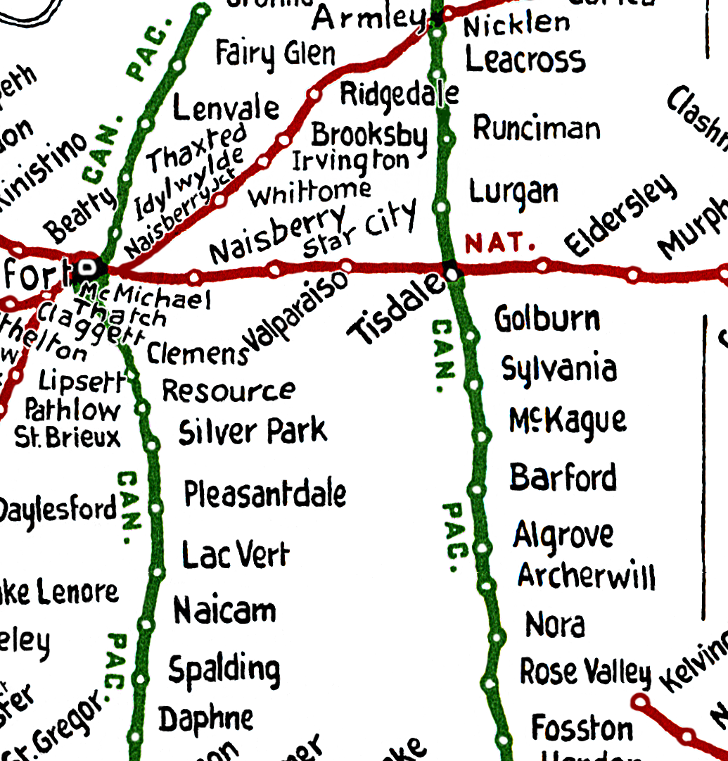
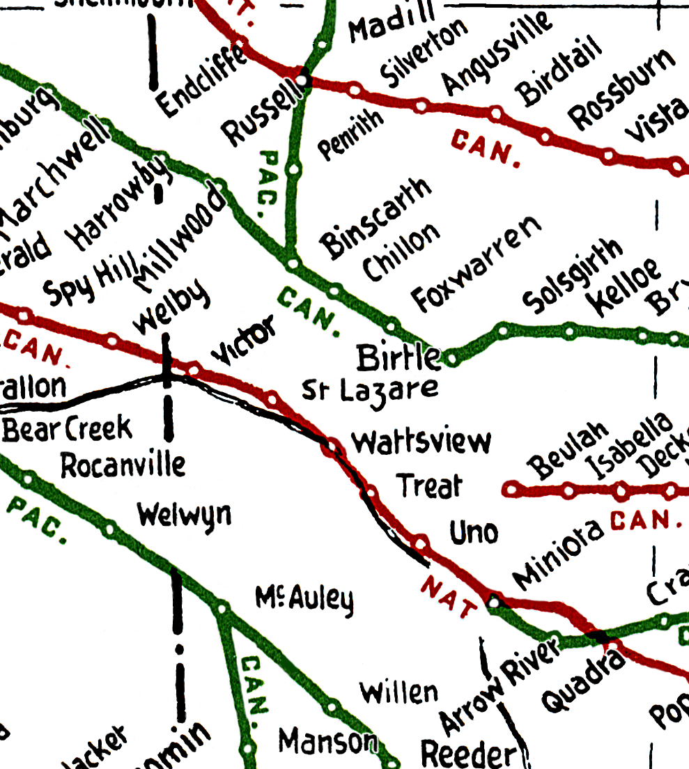
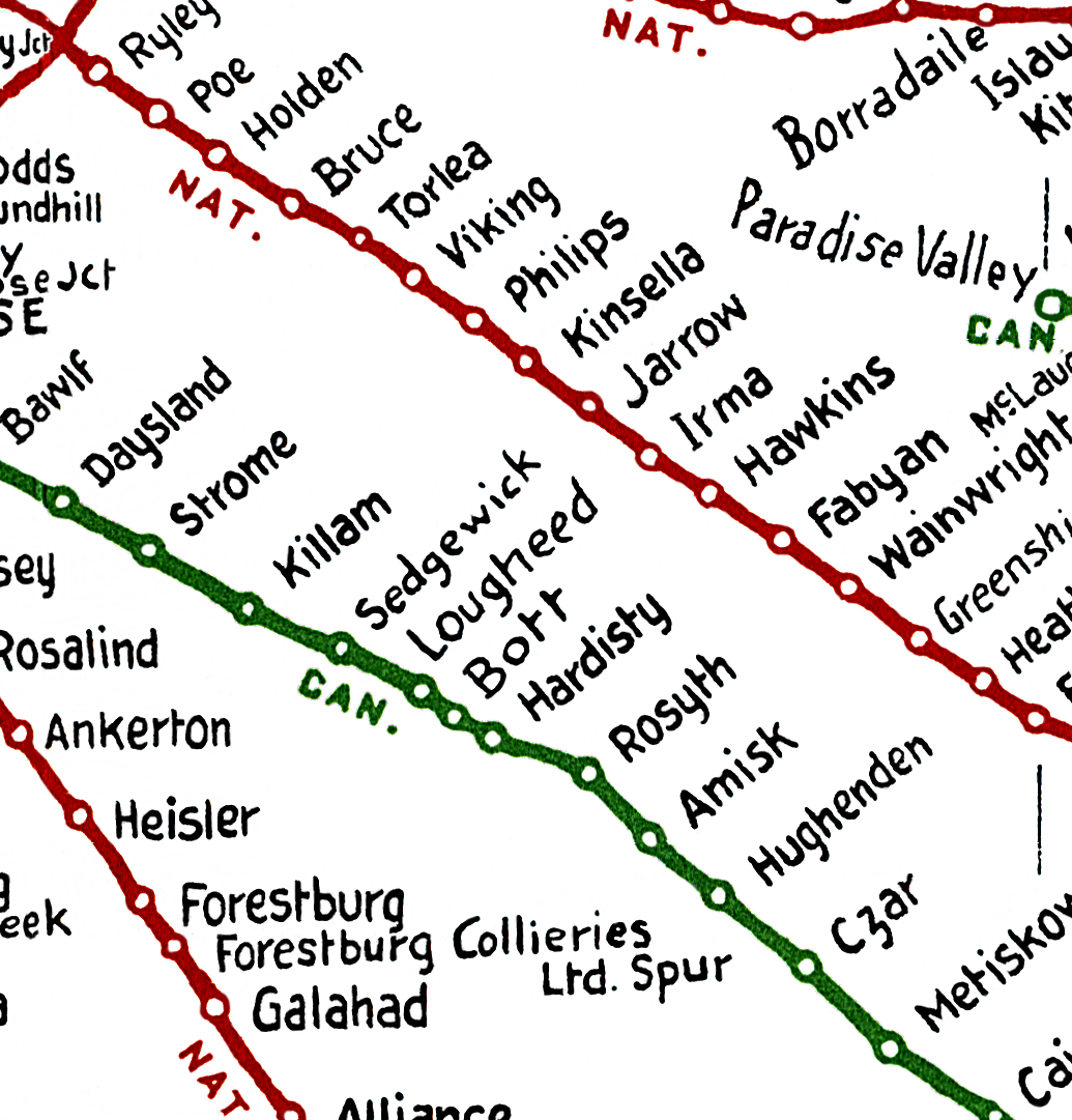
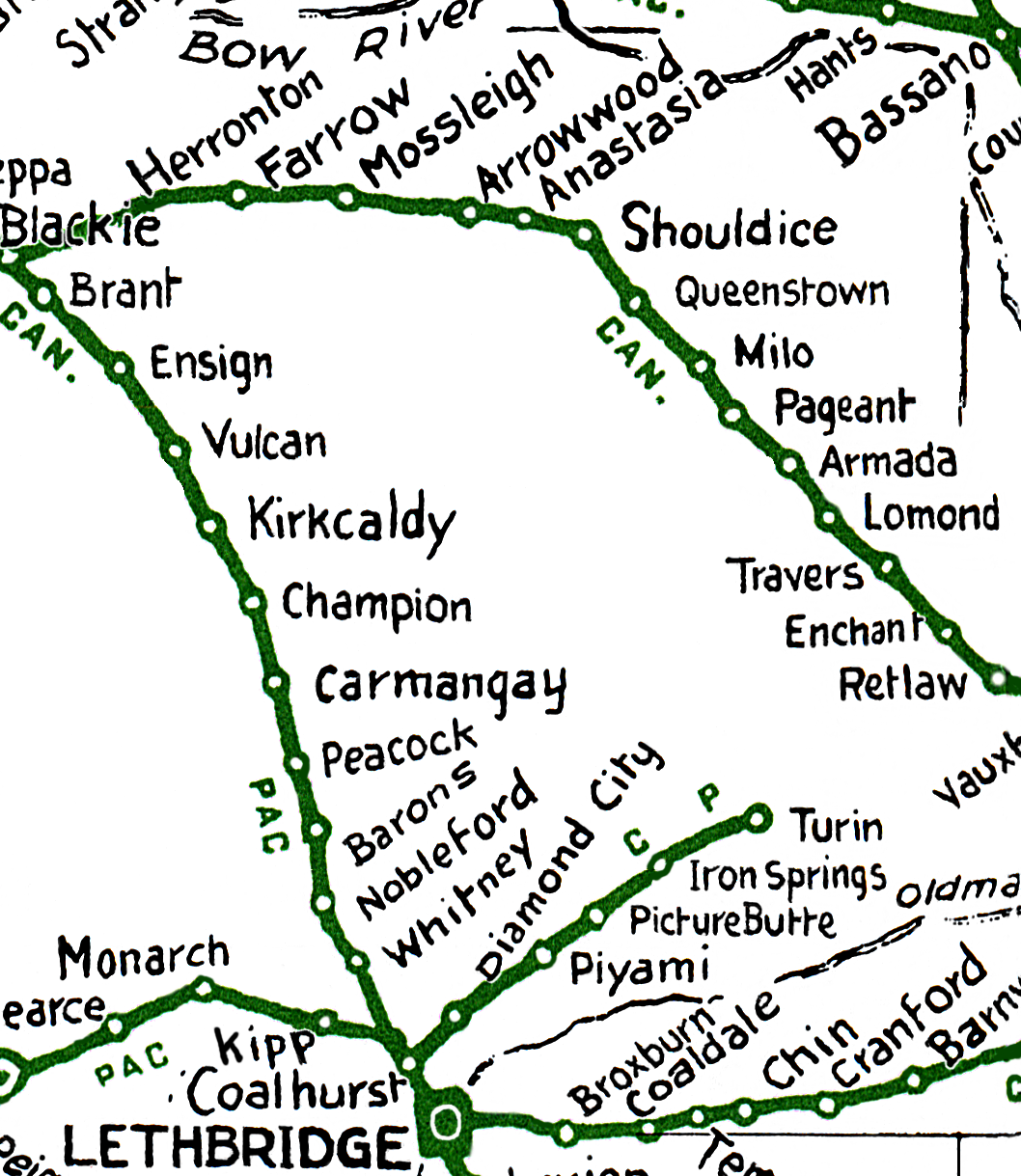
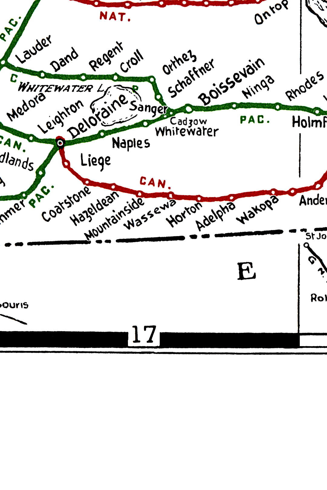
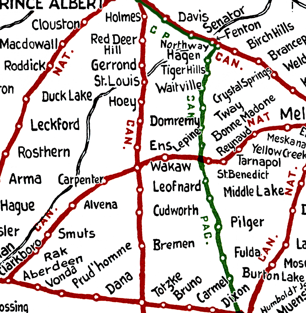
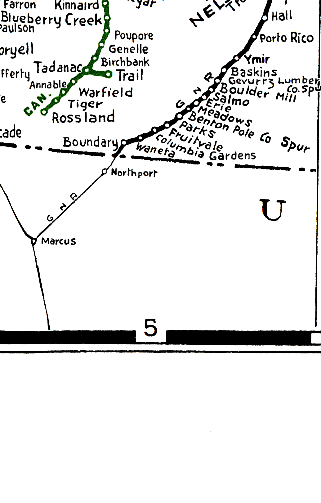
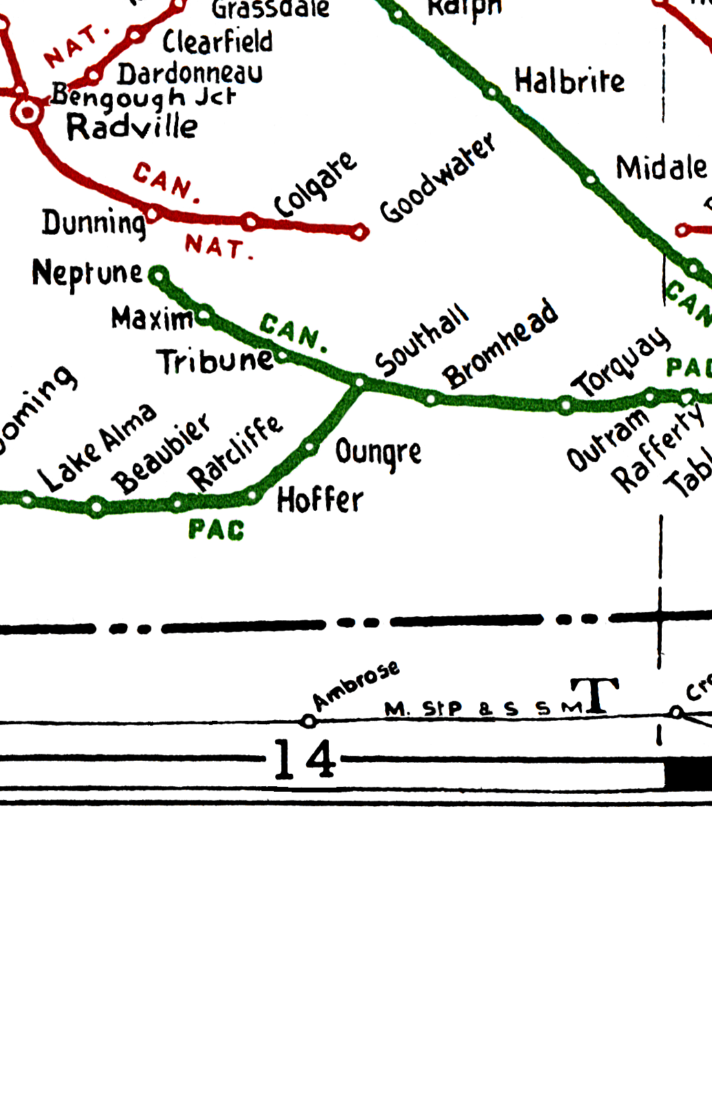
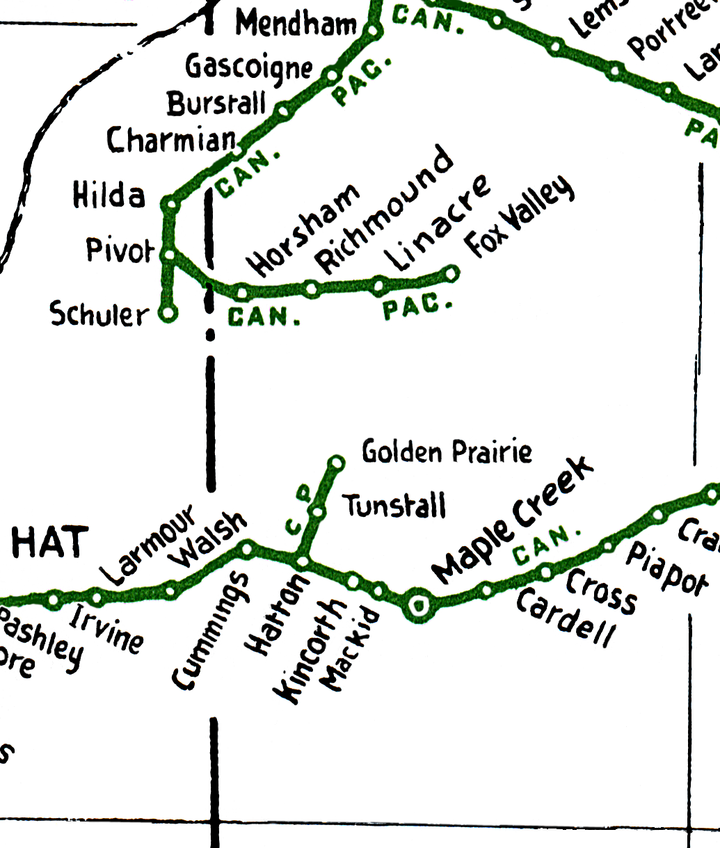
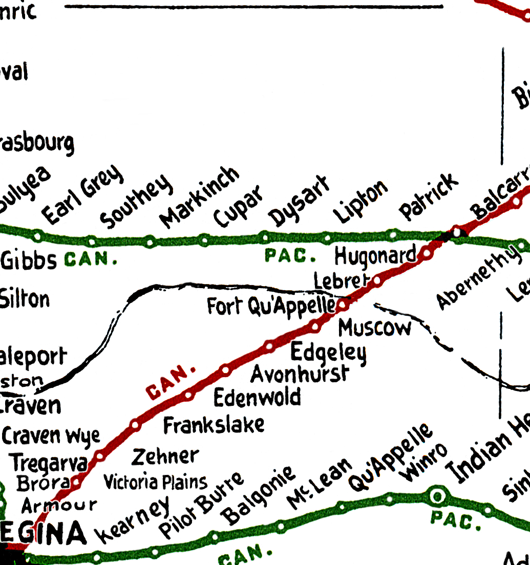
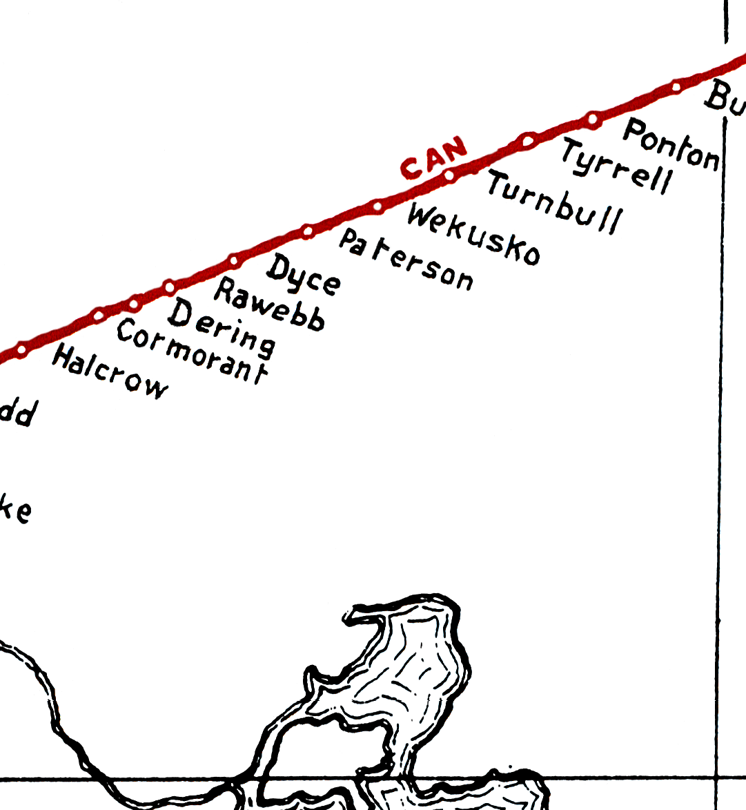
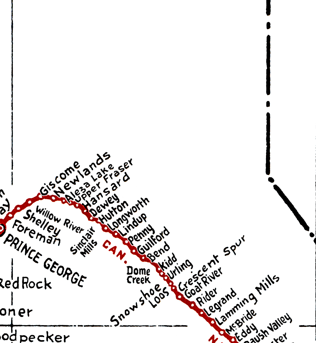
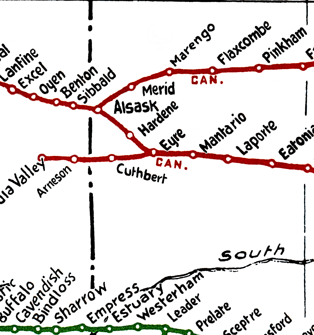
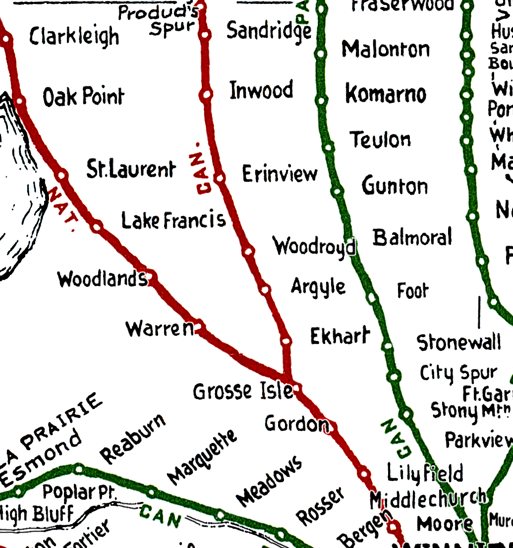
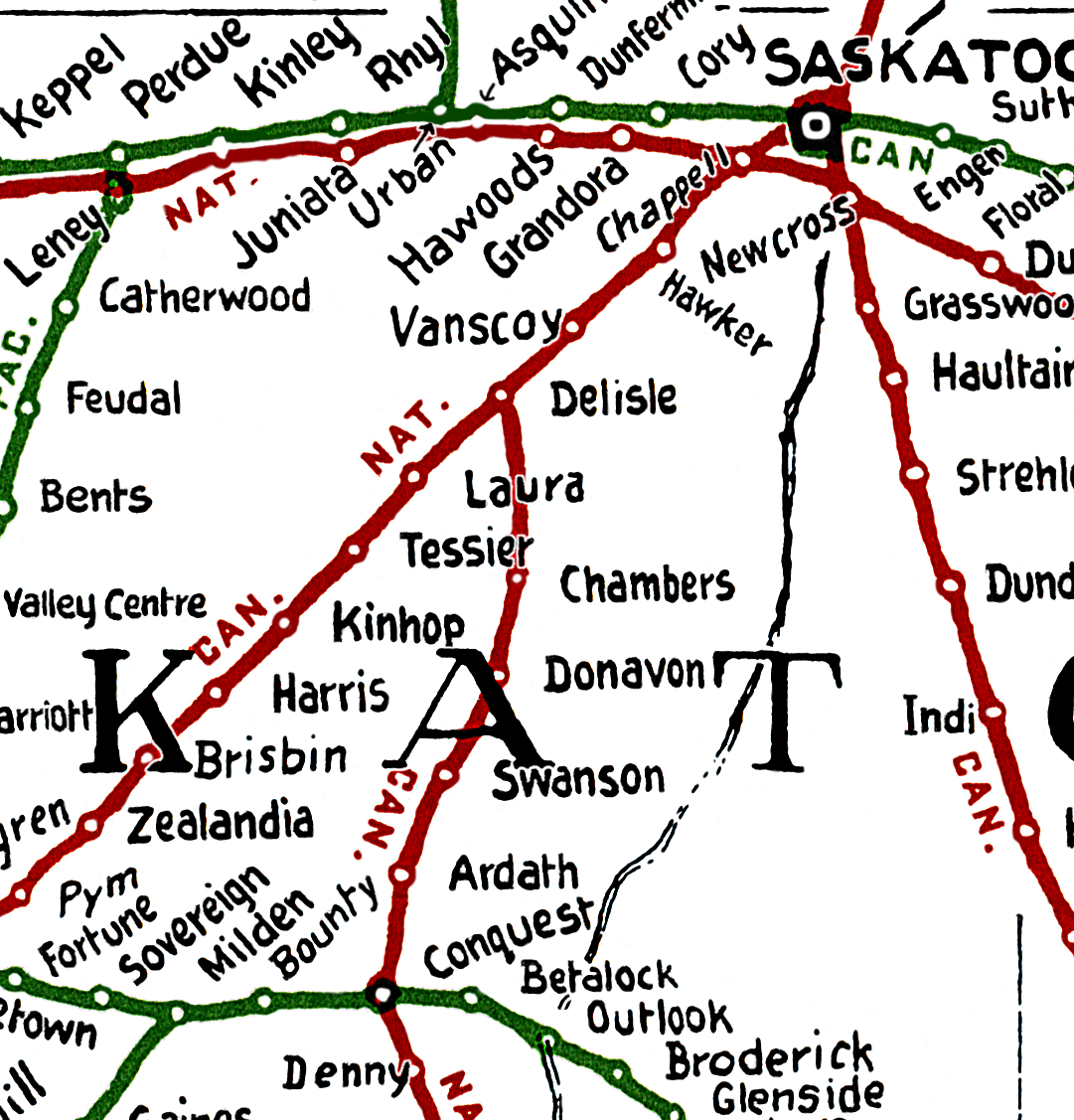
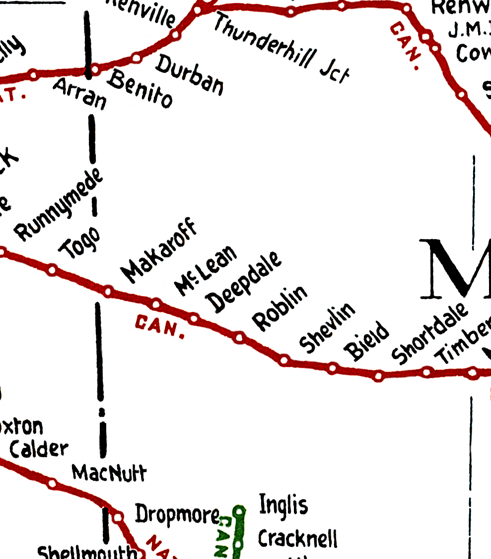
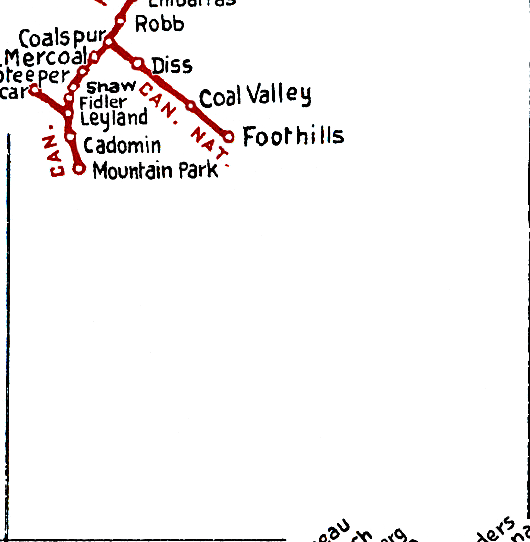
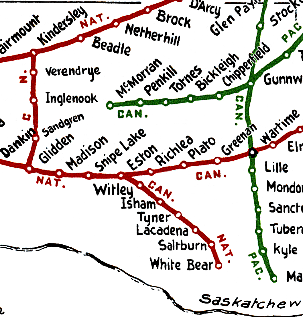
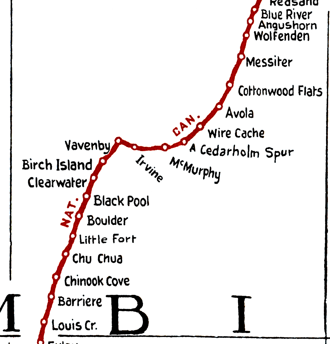
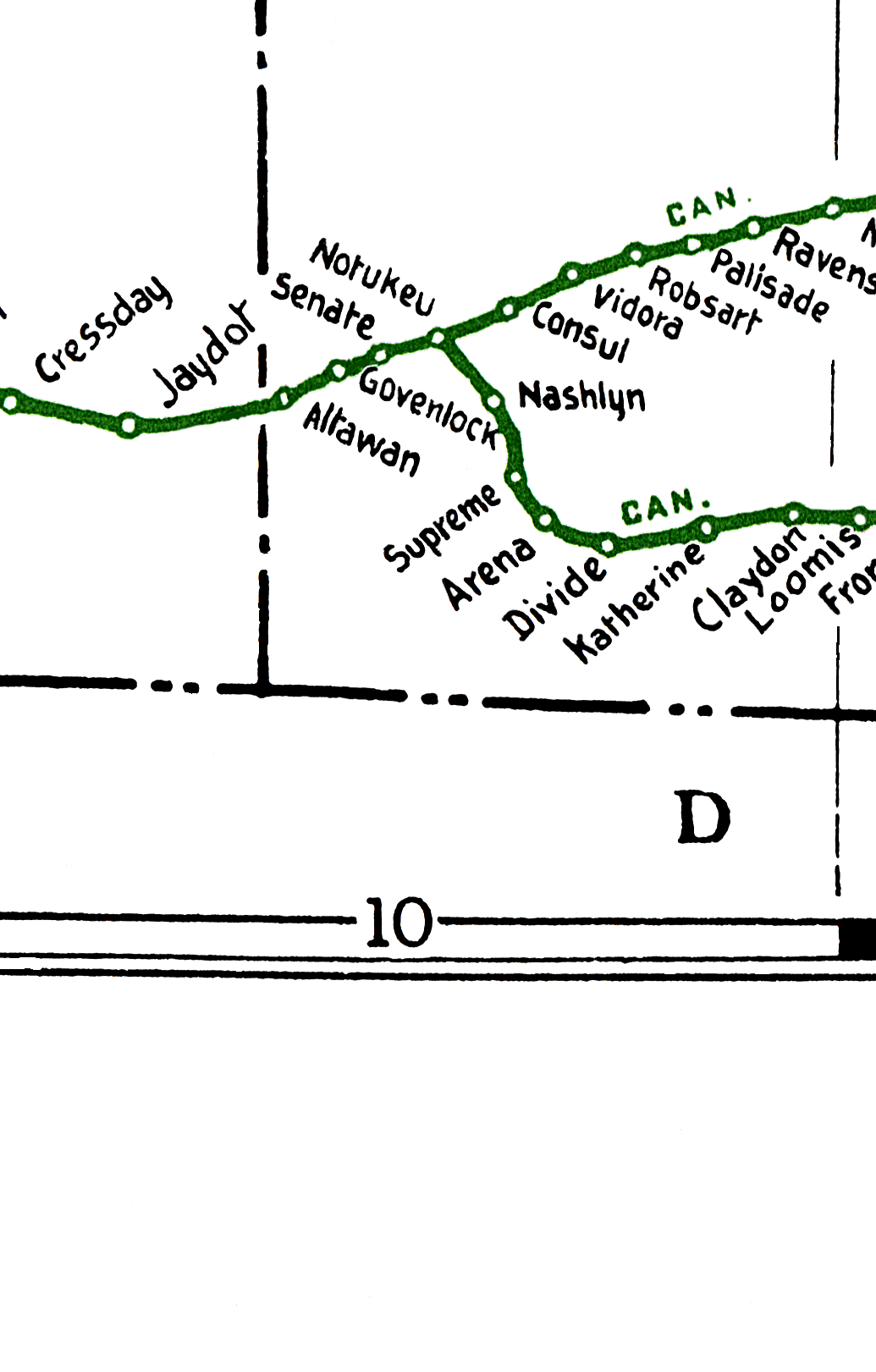
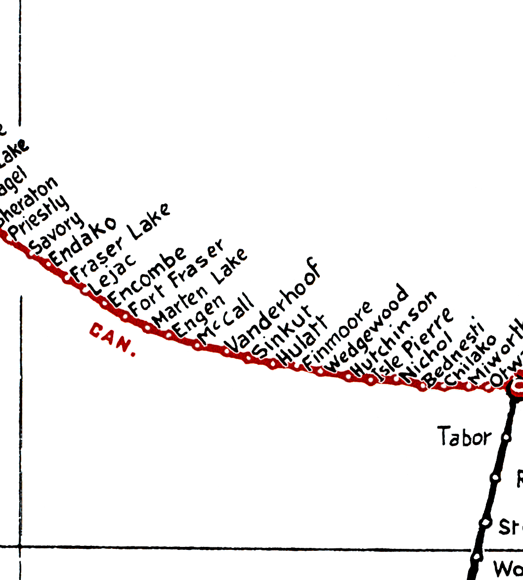
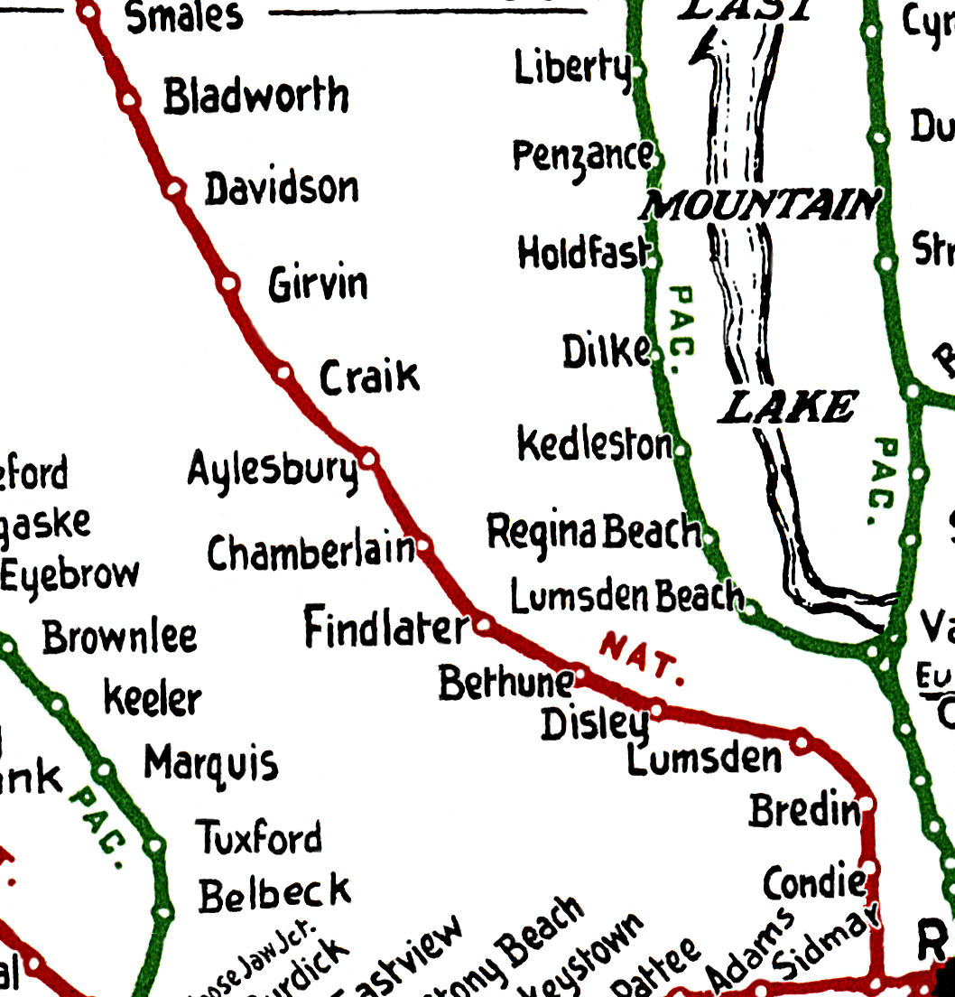
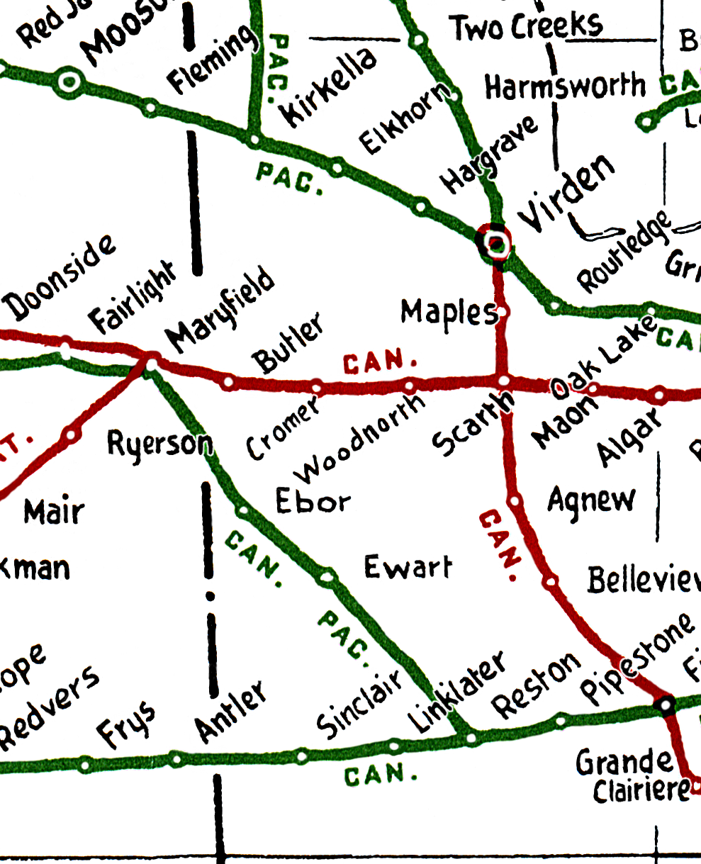
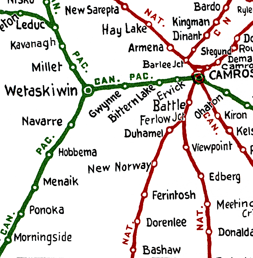
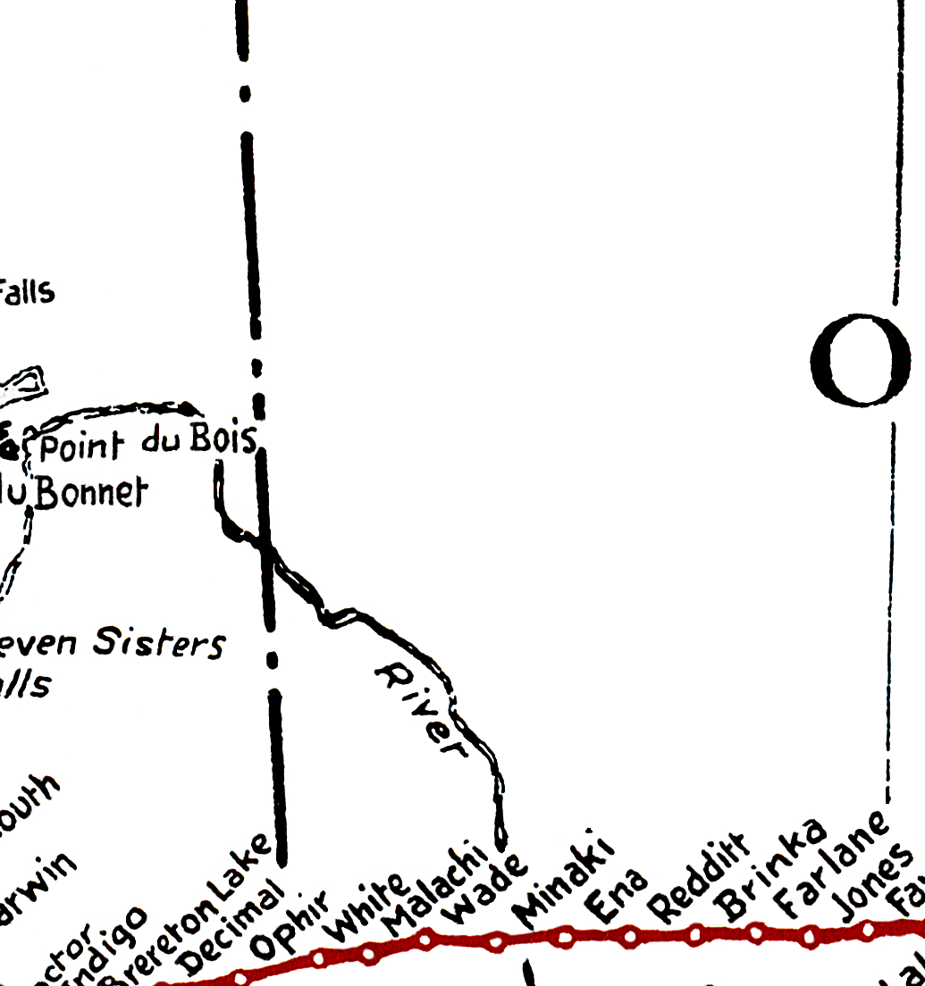
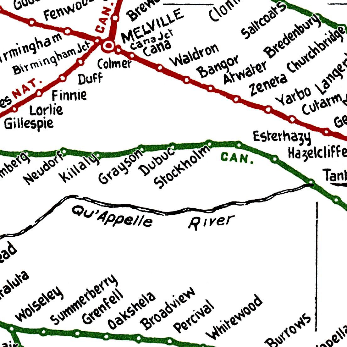
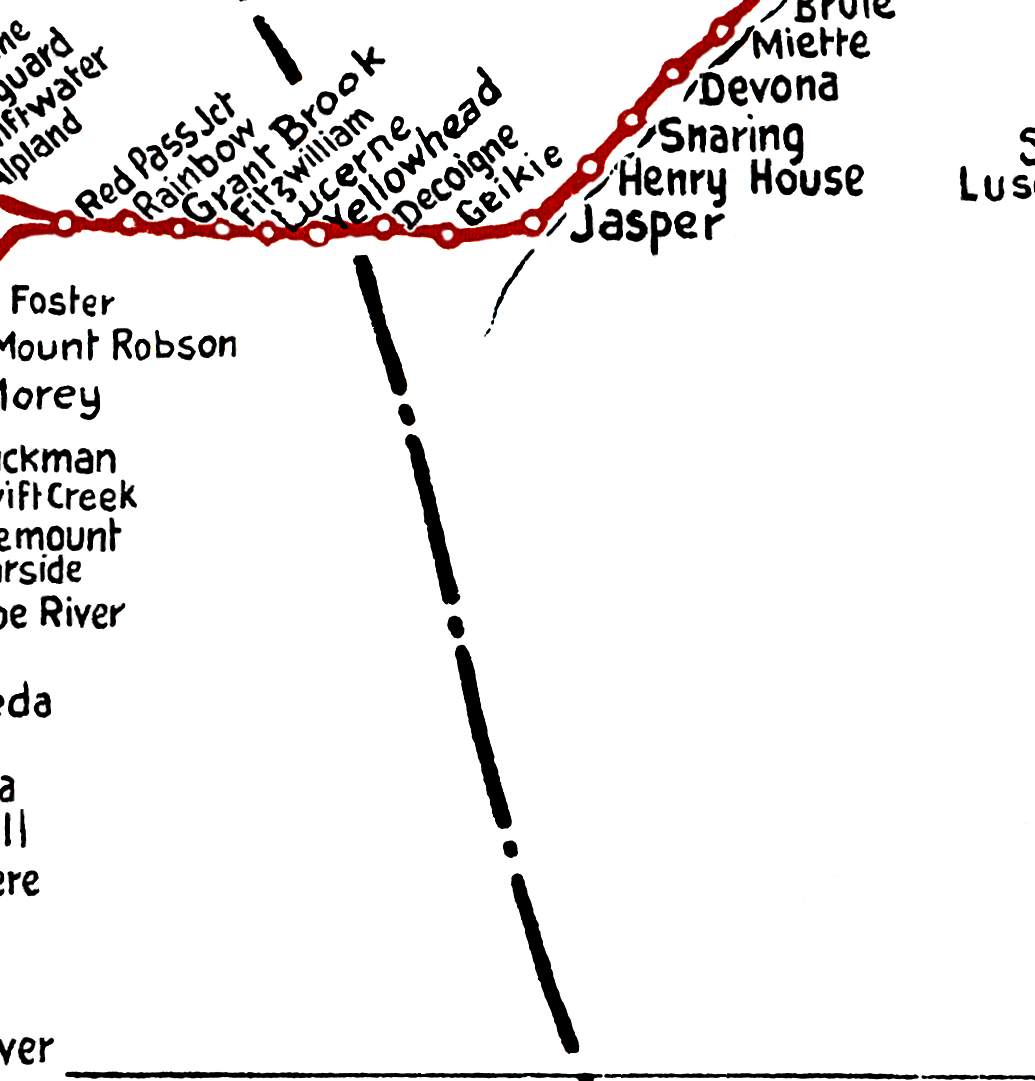
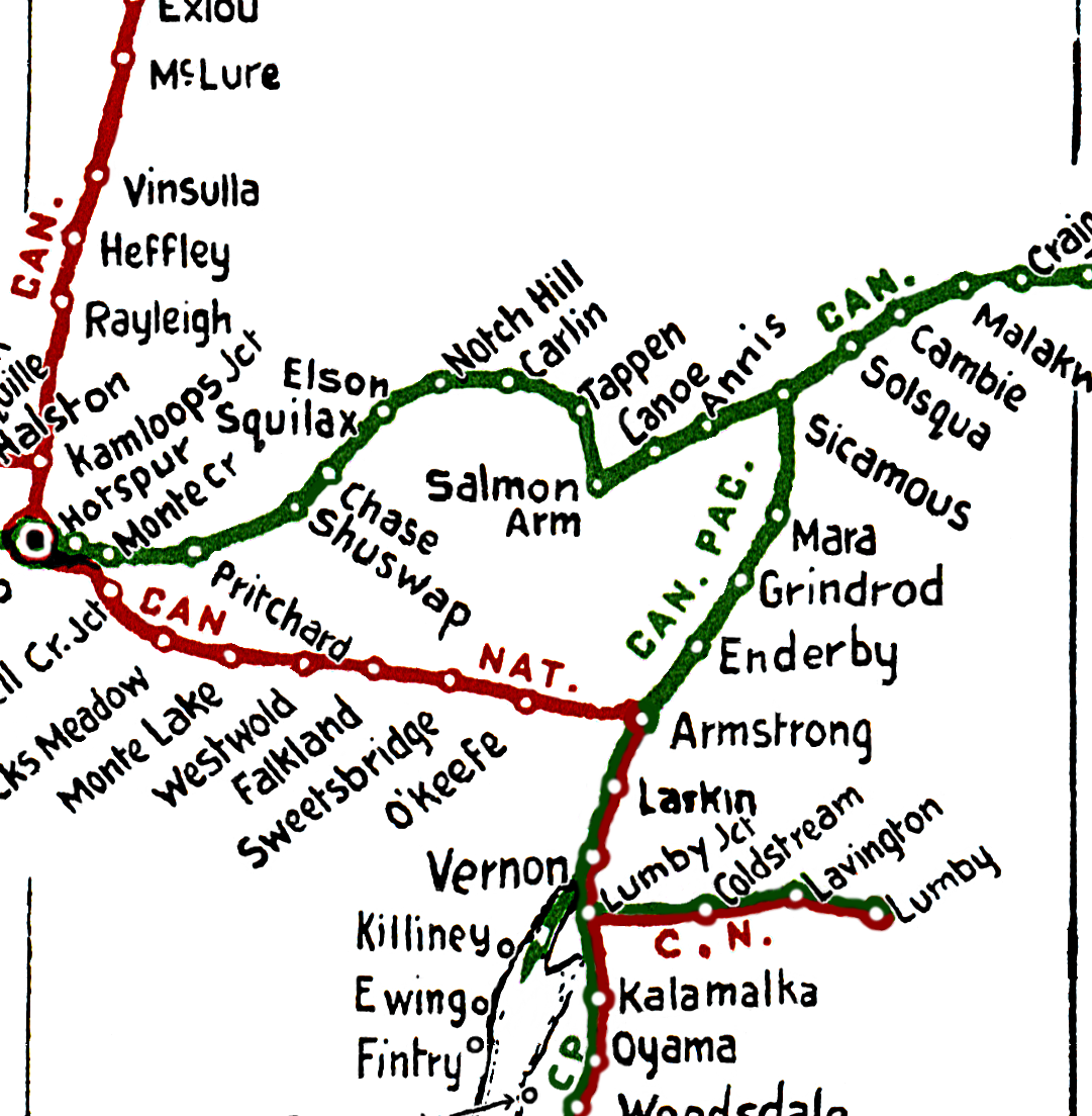
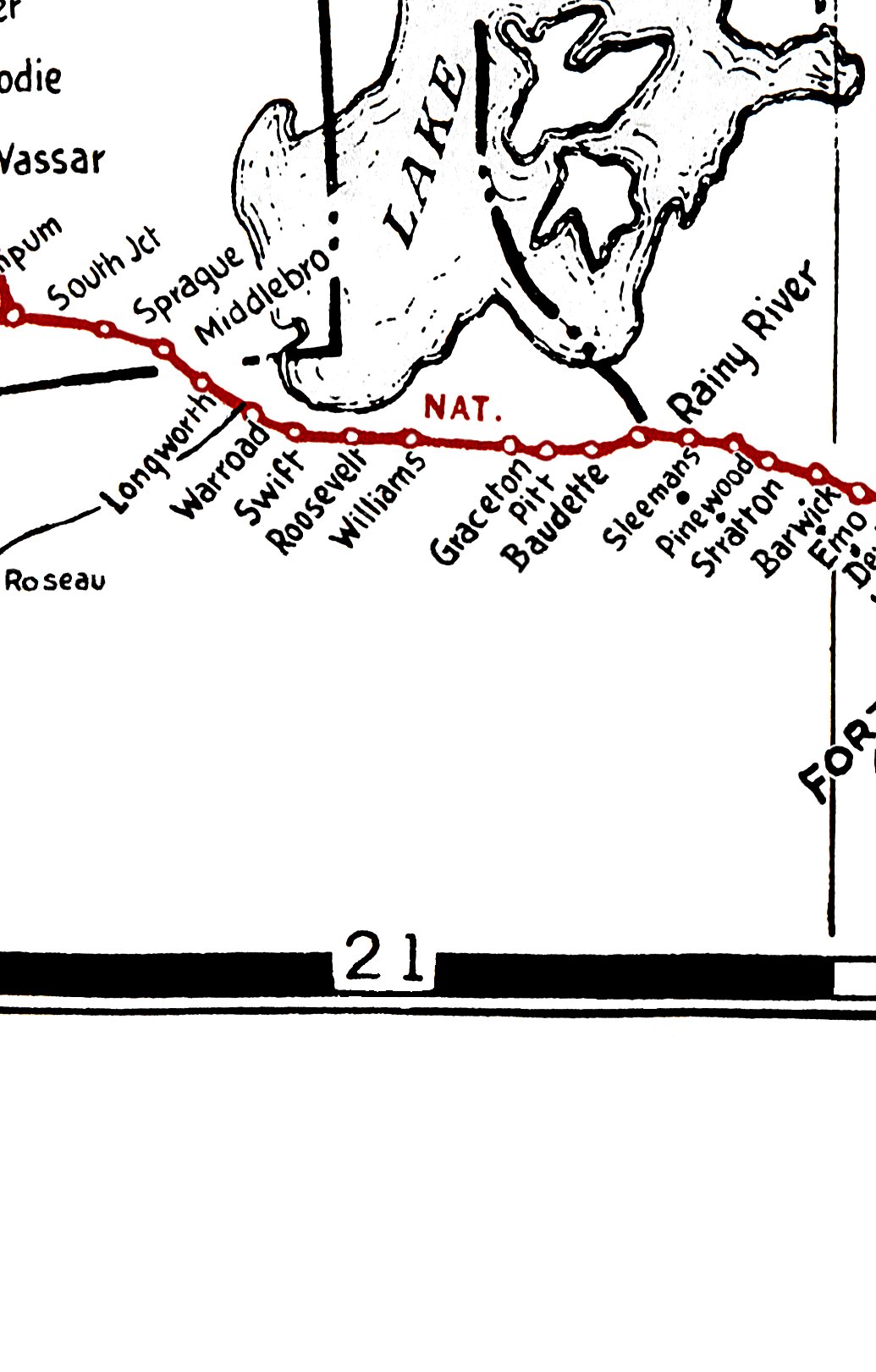
Canadian National Railways Western Lines Map
The area covered is from Port Arthur/Fort William and Churchill to Prince Rupert and Vancouver Island- town names and locations as after 1954showing Canadian National Railways lines in Western Canada from August 1954, Western Canada British Columbia, Alberta, Saskatchewan, Manitoba and a portion of Ontario.
Not only were the the Canadian National lines shown, but also Canadian Pacific, Greater Winnipeg Water District, Northern Alberta, Pacific Great Eastern, Midland Railway of Manitoba
(joint Great Northern and Northern Pacific) and Great Northern (in BC).
All these lines have probably 95%+ of the points on each line shown
Alphabetical Western Canada Listing: |
||||||||||||
A |
B |
C |
D |
E |
F |
G |
H |
I |
J |
K |
L |
M |
N |
O |
P |
Q |
R |
S |
T |
U |
V |
W |
X |
Y |
Z |
| BC | AB | SK | MB | ON | MN | Western Canada placenames beginning with the letter above and each letter leads to its alphabetical listing. | ||||||
| Complete placenames in single listing | Index Canadian National Railways Western Lines Map | |||||||||||
| Note: The "Map Key" link opens the entire map with every segment, and centres on the section labelled. The other link; "Open Small Image" does not open the large map, just the one segment of the map with the given coordinates. The actual size of the original map was 41.48" x 17", however the map is placed online in segments 1,380 x 1,702 pixels ranging in size from 17 kb to 947 kb Read Me File | |||
| Placename | Open small image (Image name) | Map Key (Map Coordinates) | Province |
F | |||
| Fabyan | 3_9 | D-9 | Alta |
| Fairfax | 7_17 | H-17 | Man |
| Fairford | 4_18 | E-18 | Man |
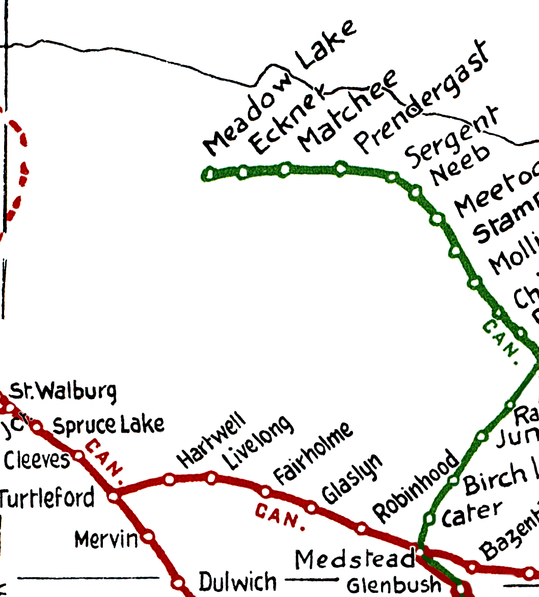
| Fairholme | 2_11 | C-11 | Sask |
| Fairlight | 6_16 | G-16 | Sask |
| Fairmont Hot Springs | 6_6 | G-6 | BC |
| Fairmount | 5_11 | F-11 | Sask |
| Fairview | 0-5 | A-5 | Alta |
| Fairview | 6_18 | G-18 | Man |
| Fairy Glen | 3_14 | D-14 | Sask |
| Falher | 1_6 | B-6 | Alta |
| Falkland | 5_4 | F-4 | BC |
| Fallis | 2_7 | C-7 | Alta |
| Fallison | 7_18 | H-18 | Man |
| Falls Creek | 6_3 | G-3 | BC |
| Fanny Bay | 6_1 | G-1 | BC |
| Fannystelle | 6_19 | G-19 | Man |
| Farlane | 5_21 | F-21 | Ont |
| Farrant | 4_8 | E-8 | Alta |
| Farrington | 7_22 | H-22 | Ont |
| Farron | 7_5 | H-5 | BC |
| Farrow | 6_8 | G-8 | Alta |
| Fassiferne | 6_6 | G-6 | BC |
| Faulder | 6_4 | G-4 | BC |
| Faulkner | 4_18 | E-18 | Man |
| Faust | 1_6 | B-6 | Alta |
| Favel | 5_22 | F-22 | Ont |
| Fawcett | 1_7 | B-7 | Alta |
| Fay Lake | 1_16 | B-16 | Man |
| Federal | 4_9 | E-9 | Alta |
| Fedorah | 2_8 | C-8 | Alta |
| Fenn | 4_8 | E-8 | Alta |
| Fenton | 3_13 | D-13 | Sask |
| Fenwood | 5_15 | F-15 | Sask |
| Ferintosh | 3_8 | D-8 | Alta |
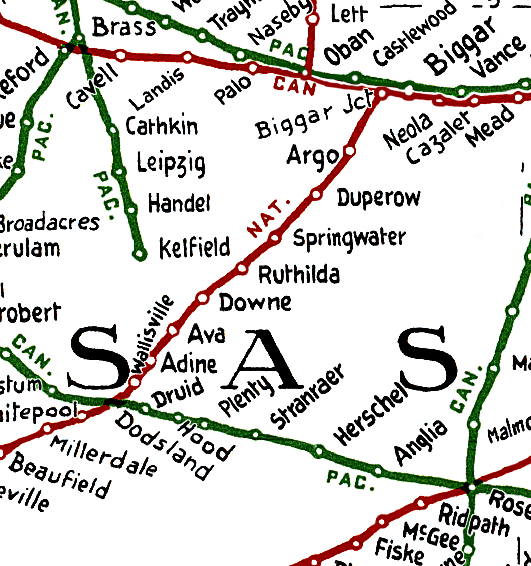
| Ferland | 7_12 | H-12 | Sask |
| Ferlow Junction | 3_8 | D-8 | Alta |
| Fernie | 6_7 | G-7 | BC |
| Ferrier | 4_7 | E-7 | Alta |
| Fertile | 7_16 | H-16 | Sask |
| Feudal | 4_12 | E-12 | Sask |
| Fidler | 3_6 | D-6 | Alta |
| Field | 5_6 | F-6 | BC |
| Fielding | 3_12 | D-12 | Sask |
| Fife | 7_4 | H-4 | BC |
| Fife Lake | 7_13 | H-13 | Sask |
| Fillmore | 6_14 | G-14 | Sask |
| Fincastle | 6_9 | G-9 | Alta |
| Findlater | 5_13 | F-13 | Sask |
| Findlay | 6_17 | G-17 | Man |
| Finger | 2_16 | C-16 | Man |
| Finmark | 7_22 | H-23 | Ont |
| Finmoore | 2_3 | C-3 | BC |
| Finnegan | 5_9 | F-9 | Alta |
| Finnie | 5_15 | F-15 | Sask |
| Fintry | 5_4 | F-4 | BC |
| Fir | 6_6 | G-6 | BC |
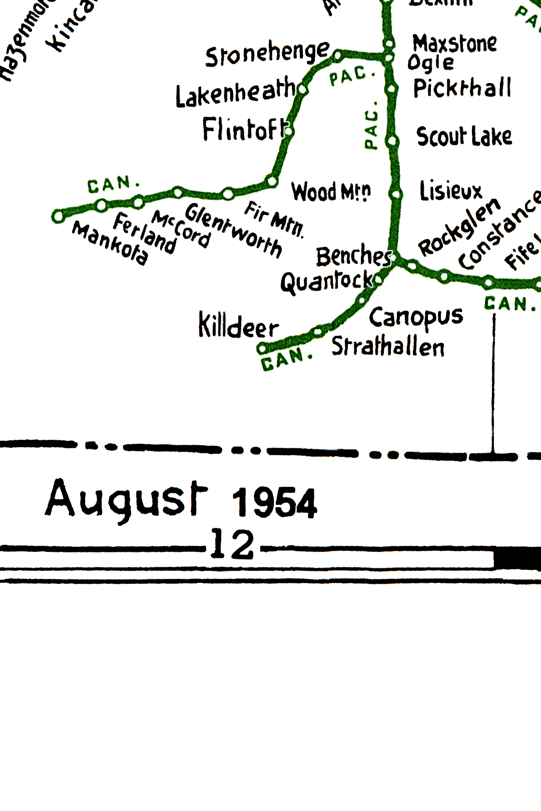
| Fir Mountain | 7_12 | H-12 | Sask |
| Firdale | 5_18 | F-18 | Man |
| Fisher Branch | 4_19 | E-19 | Man |
| Fisherman | 7_4 | H-4 | BC |
| Fishing Lake | 4_14 | E-14 | Sask |
| Fishing River | 4_17 | E-17 | Man |
| Fiske | 4_11 | E-11 | Sask |
| Fitzallen | 2_9 | C-9 | Alta |
| Fitzmaurice | 4_15 | E-15 | Sask |
| Fitzwilliam | 3_5 | D-5 | BC |
| Flanders | 7_22 | H-22 | Ont |
| Flat Creek | 5_5 | F-5 | BC |
| Flatbush | 1_7 | B-7 | Alta |
| Flaxcombe | 5_10 | F-10 | Sask |
| Fleet | 4_9 | E-9 | Alta |
| Fleming | 6_16 | G-16 | Sask |
| Flett | 7_22 | H-23 | Ont |
| Flin Flon | 2_16 | C-16 | Man |
| Flintoft | 7_12 | H-12 | Sask |
| Floods | 6_3 | G-3 | BC |
| Floors | 5_17 | F-17 | Man |
| Floral | 4_13 | E-13 | Sask |
| Flying U | 4_3 | E-3 | BC |
| Foam Lake | 4_14 | E-14 | Sask |
| Fonehill | 4_15 | E-15 | Sask |
| Fonehill Junction | 4_15 | E-15 | Sask |
| Foot | 5_19 | F-19 | Man |
| Foothills | 3_6 | D-6 | Alta |
| Forde | 5_5 | F-5 | BC |
| Foreman | 2_4 | C-4 | BC |
| Foremost | 7_9 | H-9 | Alta |
| Forestburg Collieries Ltd Spur | 3_9 | D-9 | Alta |
| Forestburg | 3_9 | D-9 | Alta |
| Forestdale | 2_2 | C-2 | BC |
| Forgan | 5_12 | F-12 | Sask |
| Forget | 6_15 | G-15 | Sask |
| Fork River | 4_17 | E-17 | Man |
| Forrest | 5_17 | F-17 | Man |
| Forrest Transfer | 5_17 | F-17 | Man |
| Forshee | 3_7 | D-7 | Alta |
| Forslund | 4_13 | E-13 | Sask |
| Fort Frances | 7_22 | H-22 | Ont |
| Fort Fraser | 2_3 | C-3 | BC |
| Fort Garry | 5_20 | F-20 | Man |
| Fort Kent | 2_9 | C-9 | Alta |
| Fort Langley | 6_2 | G-2 | BC |
| Fort Macleod | 6_8 | G-8 | Alta |
| Fort Qu'Appelle | 5_14 | F-14 | Sask |
| Fort Saskatchewan | 2_8 | C-8 | Alta |
| Fort Steele | 6_6 | G-6 | BC |
| Fort Whyte | 6_20 | G-20 | Man |
| Fort William | 7_22 | H-23 | Ont |
| Forth | 4_7 | E-7 | Alta |
| Fortier | 5_19 | F-19 | Man |
| Fortress | 6_20 | G-20 | Man |
| Fortune | 4_12 | E-12 | Sask |
| Forward | 7_14 | H-14 | Sask |
| Fosston | 3_14 | D-14 | Sask |
| Foster | 3_4 | D-4 | BC |
| Fosterton | 6_11 | G-11 | Sask |
| Fountain | 5_3 | F-3 | BC |
| Fowler | 5_22 | F-23 | Ont |
| Fox Valley | 6_10 | G-10 | Sask |
| Foxford | 2_14 | C-14 | Sask |
| Foxwarren | 5_16 | F-16 | Man |
| Franchere | 2_9 | C-9 | Alta |
| Francis | 6_14 | G-14 | Sask |
| Frank | 6_7 | G-7 | Alta |
| Franklin | 5_17 | F-17 | Man |
| Frankslake | 5_14 | F-14 | Sask |
| Fraser Lake | 2_3 | C-3 | BC |
| Fraser Mills | 6_2 | G-2 | BC |
| Fraserwood | 5_19 | F-19 | Man |
| Fraspur | 3_7 | D-7 | Alta |
| Fredensthal | 7_20 | H-20 | Man |
| Frederick | 5_3 | F-3 | BC |
| Freemont | 3_10 | D-10 | Sask |
| Fremantle | 6_15 | G-15 | Sask |
| Frenchman Butte | 2_10 | C-10 | Sask |
| Freshford | 2_16 | C-16 | Man |
| Friend | 6_11 | G-11 | Sask |
| Frobisher | 7_15 | H-15 | Sask |
| Frontier | 7_11 | H-11 | Sask |
| Froude | 6_14 | G-14 | Sask |
| Fruitvale | 7_5 | H-5 | BC |
| Frys | 6_16 | G-16 | Sask |
| Fulda | 3_13 | D-13 | Sask |
| Fulton | 5_18 | F-18 | Man |
| Furness | 3_10 | D-10 | Sask |
| Fusilier | 4_10 | E-10 | Sask |
|
Copyright: Wednesday, April 17, 2024 Email: [email protected] Webmaster Julia Adamson Sign Guestbook View Guestbook Thank you for stopping by # URL: sites.rootsweb.com/~canmaps/RailwayMap/index.html We encourage links to this page. This web site was made with possible with the original scan and original map creation from Larry Walton. It is the intention of this site to make Western Canada British Columbia, Alberta, Saskatchewan, Manitoba - The area covered is from Port Arthur/Fort William and Churchill to Prince Rupert and Vancouver Island- town names and locations as after 1954 available to persons with a historical or genealogical interest in this area. There are no service charges or fees for use of this map service, and use of this site constitutes your acceptance of these Conditions of Use. This page is dedicated to the free sharing of this Western Canada historical data for personal use. Any further use of these maps would require permission from the contributor Larry Walton as per copyright laws in Canada. Dedication Webmaster: NEW EMAIL [email protected] OR Julia Adamson [email protected] |