RRC seeks sink hole volunteers
THE ODESSA AMERICAN
By Julie Breaux
Odessa American
Several oil companies say they are ready and willing to contribute manpower and money to study two menacing sink holes in Winkler County. Still, it takes a village to save us from sink holes, an official with the Texas Railroad Commission says.
The village envisioned by Steve Seni, the Railroad Commissions assistant director of environmental services, must be inhabited by petroleum engineers, geologists, geophysicists and skilled technicians. Senis goal is to organize a group of scientists to conduct a regional, up-to-date survey of Winkler Countys two sink holes.
Seni has received commitments from a number of scientists who have agreed to volunteer their time. Seni said he hopes to have a full slate of experts in place by the end of the year.
Seni said he believes oil and gas producers should bear the bulk of the costs of a study because their production and distribution infrastructure is most immediately threatened by the sink holes.
Theyre the ones who should be funding a study to understand the cause of this problem and to make sure any actions they take dont make the problem worse, Seni said. It would be nice to have information that might indicate the risk of future sink holes.
Seni said he would also like to locate the paper trail leading to the history of production of the Hendrick oil and gas field, the site of Wink Sink Nos. 1 and 2.
Little is known about the sink holes because the ground immediately surrounding them is unstable.
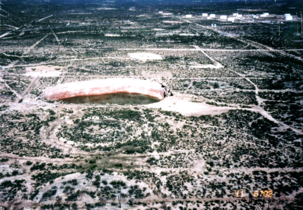
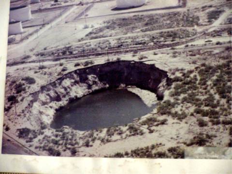
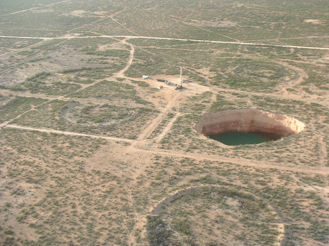
What is known is that Wink Sink 1 formed in the 1980s a few miles northeast of the small town of Wink; its diameter is about 350 feet. The second sink hole is nearly three times the size of the first hole about 900 feet in diameter. It formed a few years ago about one mile south of the first sink hole, and it continues to grow, said independent oil man John Bell of Kermit, who maintains the chain-link fence surrounding the first sink hole.
Its really a massive hole, Bell said. Its no longer a sink hole. Its a small lake.
The second hole has swallowed up, among other things, two fences that were erected around it when it was still growing.
The first sink hole has destroyed petroleum pipelines and wellbores, said Bob Trentham, director of the Center for Energy and Economic Diversification.
A large crude-oil storage tank located several hundred yards from Wink Sink 1 is also starting to lean toward the hole.
Bell was able to convince the producer of a well south of the first sink hole to permanently halt production. Bell feared if the ground around the well tears off into the hole, oil and brine from the reservoir will contaminate the groundwater and perhaps the aquifer, both of which Wink and nearby Kermit rely on for water.
Seni, too, is concerned about the potential for contamination of freshwater supplies in Winkler County.
Think of the hole. Where it originally formed, and again, we dont know where, all the way to the surface theres now a pipe about the diameter of the sink hole.
The sink hole is filled with brecchia, or an unsorted jumble of angular, porous rock that fell into the sink hole as it collapsed from the bottom up.
What that is risking is
you may interconnect aquifers that, in their natural state, were separated by impermeable units, Seni said. Its a risk. We dont know what the risk is yet.
The risk of freshwater contamination and even greater property destruction than has already occurred compelled Seni to organize an industrial consortium of volunteers to find the cause of sink holes.
There are several theories circulating as to the cause.
Some think the removal of oil and water from deep below the earths surface for the past 80 years is causing the ground to collapse today.
Others believe leaking casing from water-supply wells dissolved portions of a subterranean layer of salt, causing caverns to form. The weight of the upper layers caused the cavern roof to collapse over and over again until the final cave-in at ground level.
Until a scientific study of the sink holes is done, Seni said he will remain a sink-hole agnostic accepting no theory as proof of cause.
Im open to any suggestion, but I want to see the data, and thats expensive to acquire, Seni said.
Seni said he thinks it will cost the consortium about $10,000 to $20,000 to begin preparing to conduct current seismic and satellite-mapping surveys of Winkler Countys sink holes