
 In the summer of '99, I had the opportunity to travel to Schenectady and explore some Truax-related sites. I had read about the Old Truax burial ground near the Isaac J. Truax tavern between Schenectady and Albany, and even though none of my direct ancestors were buried there, I thought it might be an interesting place to visit.
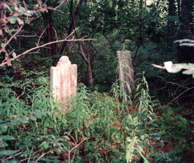
The burial ground is literally in the middle of the woods, and I had some trouble finding the place (to say the least). It was well worth the effort, though. These are the oldest gravestones I've seen so far in North America (the oldest is from 1802, which is practically pre-historic for an Ontario girl like me), and their remote location makes it a wonderful place to commune with one's ancestors.
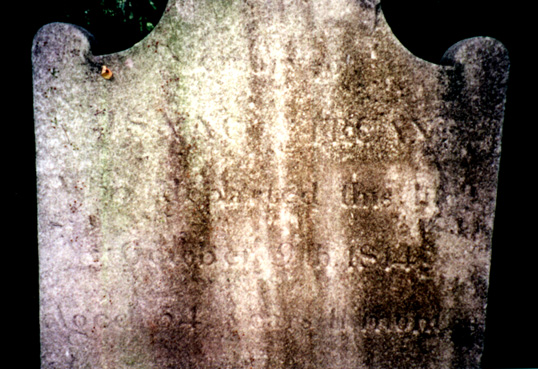
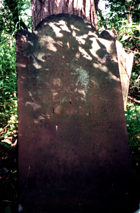
There are only four stones visible at the site. The gravestone of Isaac J. Truax, tavernkeeper (1726-1808) is very badly worn and completely illegible at this point, although it's identity was established many years ago. The stone of his wife, Maria Wyngaard (1729-1802) is of a different material and in much better condition. It was probably buried at some point, as it is currently leaning against a tree. Their son Isaac Truax (1759-1814) is buried next to his father, and his stone is still standing and in moderately good shape. The fourth stone belongs to Isaac Jr's son, John Schoolcraft Truax (1798-1811), and is in very good condition as it is partly buried and appears to have been recently uncovered.
Photos:
There is a fairly distinct path leading from the road into the woods. Follow the path until you come to a fork. Take the left fork and continue along the path. This will lead you towards the edge of a field on your left, which you will be walking more or less parallel to. The path becomes less distinct as you walk, and ahead you will eventually see an area of sort of marshy scrub. I'm not sure how else to describe it, but it is visibly different from the rest of the woods. Once you come within sight of this area, you will see a denser area of woods slightly behind you to your right. Leave the path and circle around the north edge of these denser woods. The gravestones are in there, but are difficult to see through the brush, so keep a sharp eye out. And don't get lost!

 Jennifer Smith