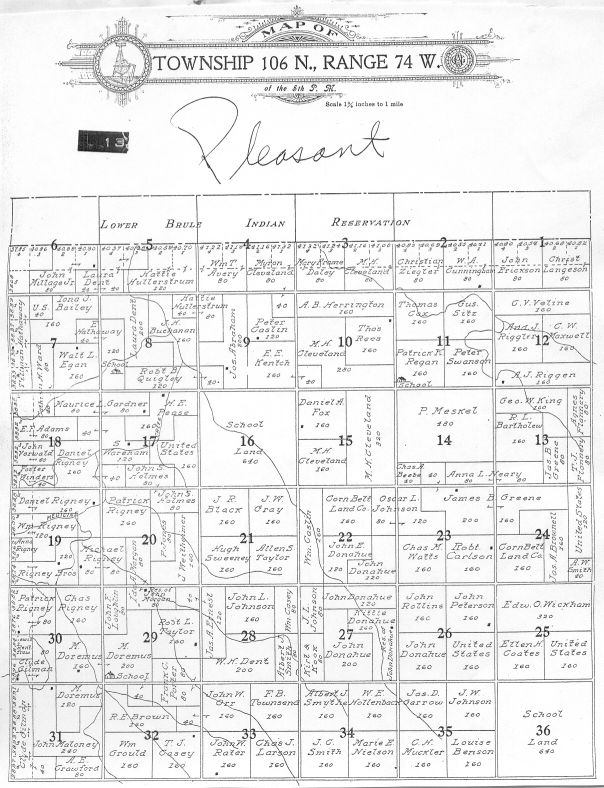
1911 Lyman County Landowners and Townships
Landowners and legal descriptions as found in the 1911 Lyman County Atlas
Includes Twp maps 1971 records Iona landowners 1900-1901 Scroll down
Restored Sunday, May 15, 2011
LANDOWNERS
Restored Sunday, May 15, 2011
A Ba-Bl Bo-By C D E F G Ha-He Hi-Hy I-J K L Ma-Mc Me-My N-O P-Q R Sa-Se Sh-Sq St-Sz T U-V W-Z
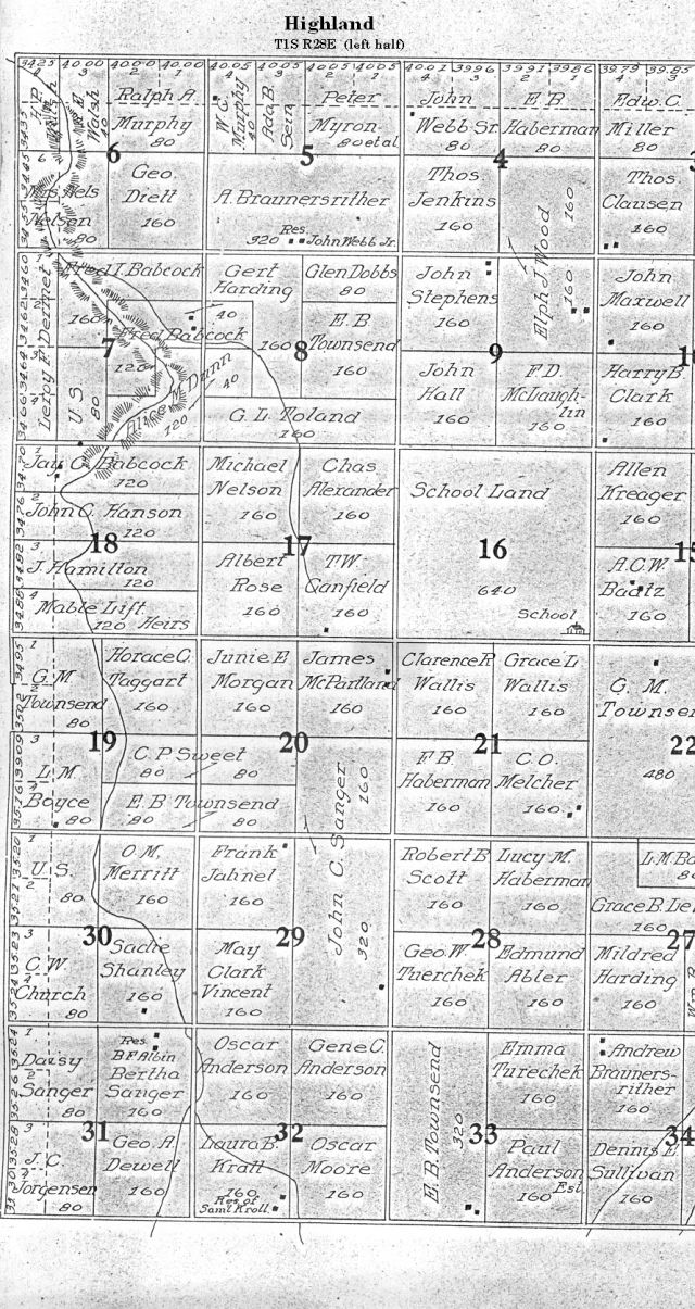
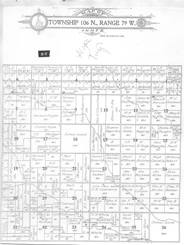
Township atlas shows townships, range numbers and the landowners' names. FYI, Lyman County was divided and the west half became Jones County in January of 1917, but the original data remains in the pages of the 1911 atlas.
|
|
|
|


TWPS AND LEGAL DESCRIPTIONS
Note: When you click on a Twp to view a map (below) and it is too
small to read, click on BACK then re-click the Twp link. That should give you
the option to enlarge (the orange square will pop up in the lower right-hand
corner of the map).
|
TOWNSHIP NAME |
TOWNSHIP NUMBER |
RANGE |
|
* Represents that portion of Lyman County that was separated into Jones County in 1917 |
||
|
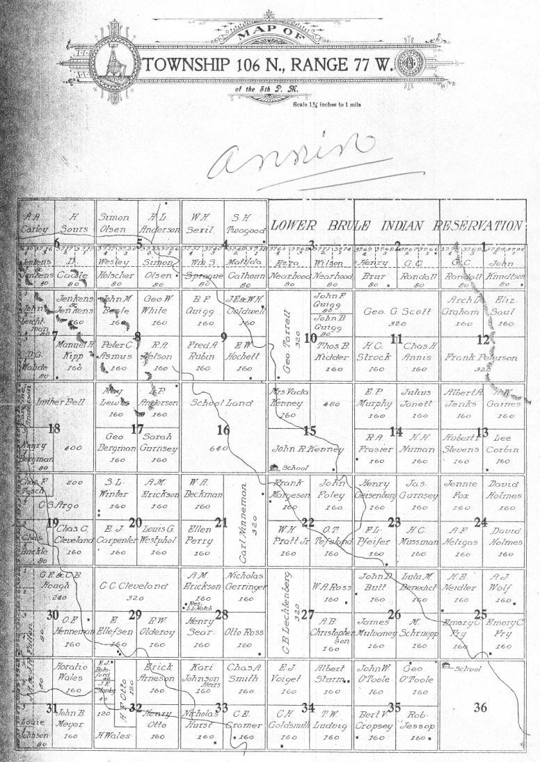
106N |
77W |
|
|
108N |
77W |
|
|
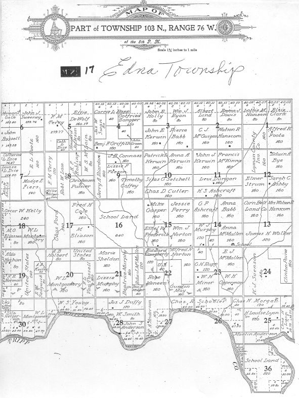
104-103N |
74W |
|
|
Banner * |
2N |
29E |
|
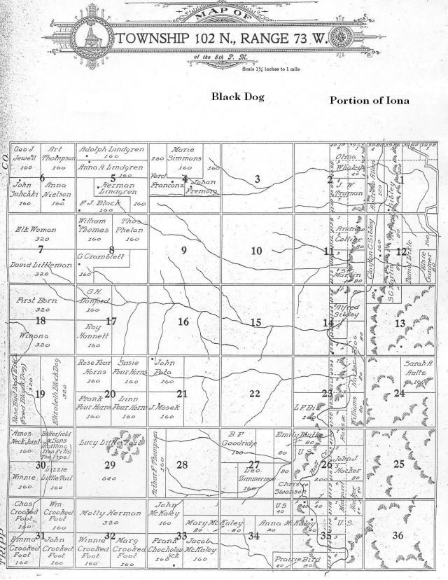
Blackdog with a portion of Iona |
102N |
73W |
| Bovine * |
2N |
27E |
|
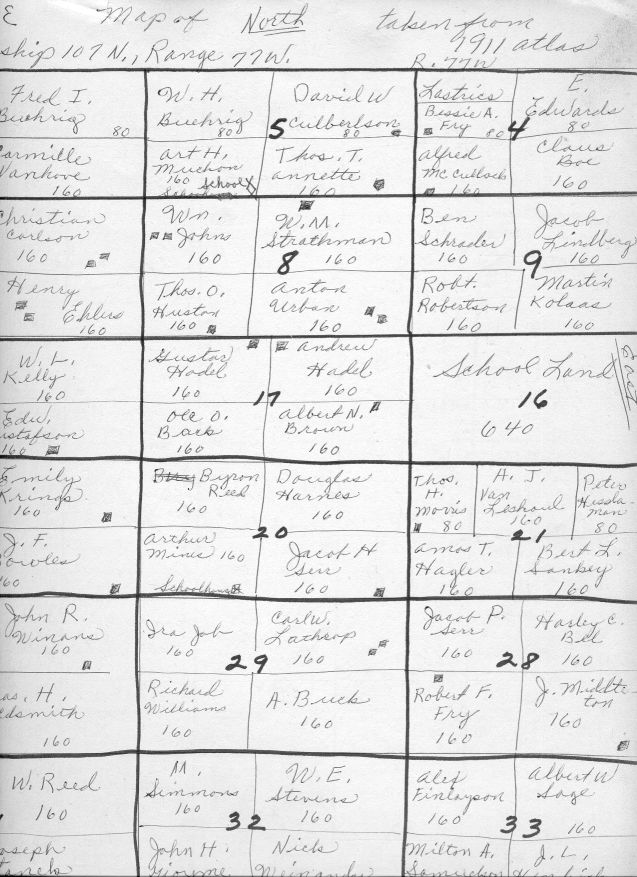
107N |
77W |
|
|
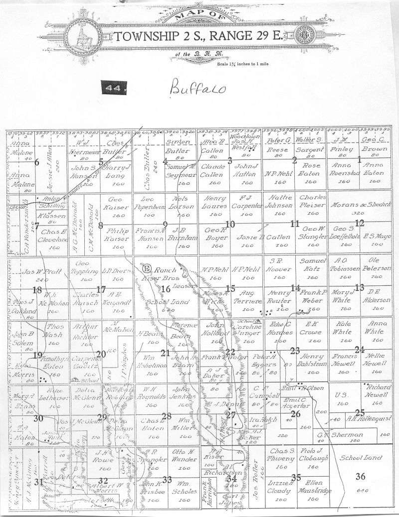
Buffalo * |
2S |
29E |
|
104N |
73W |
|
|
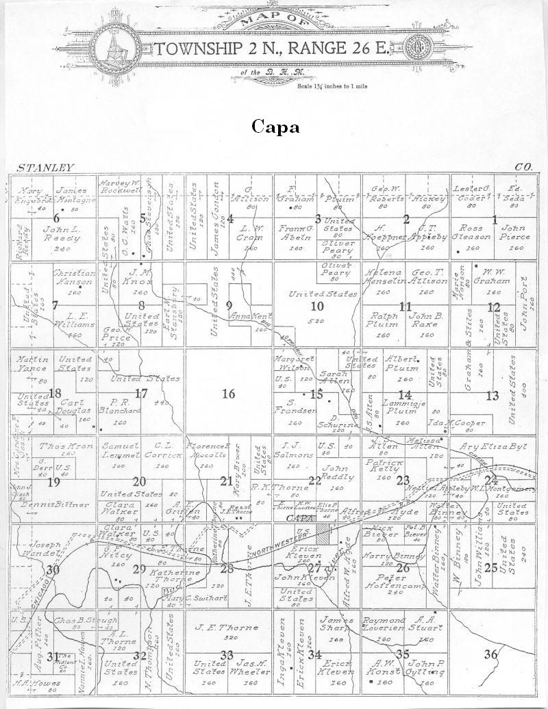
Capa * |
2N |
26E |
|
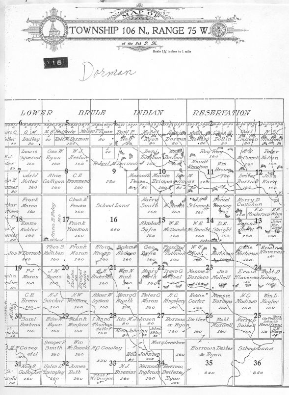
106N |
75W |
|
|
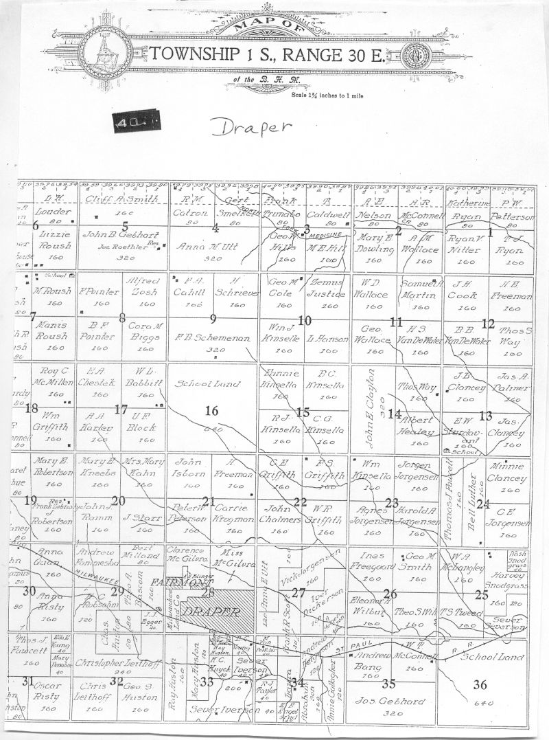
Draper * |
1S |
30E |
|
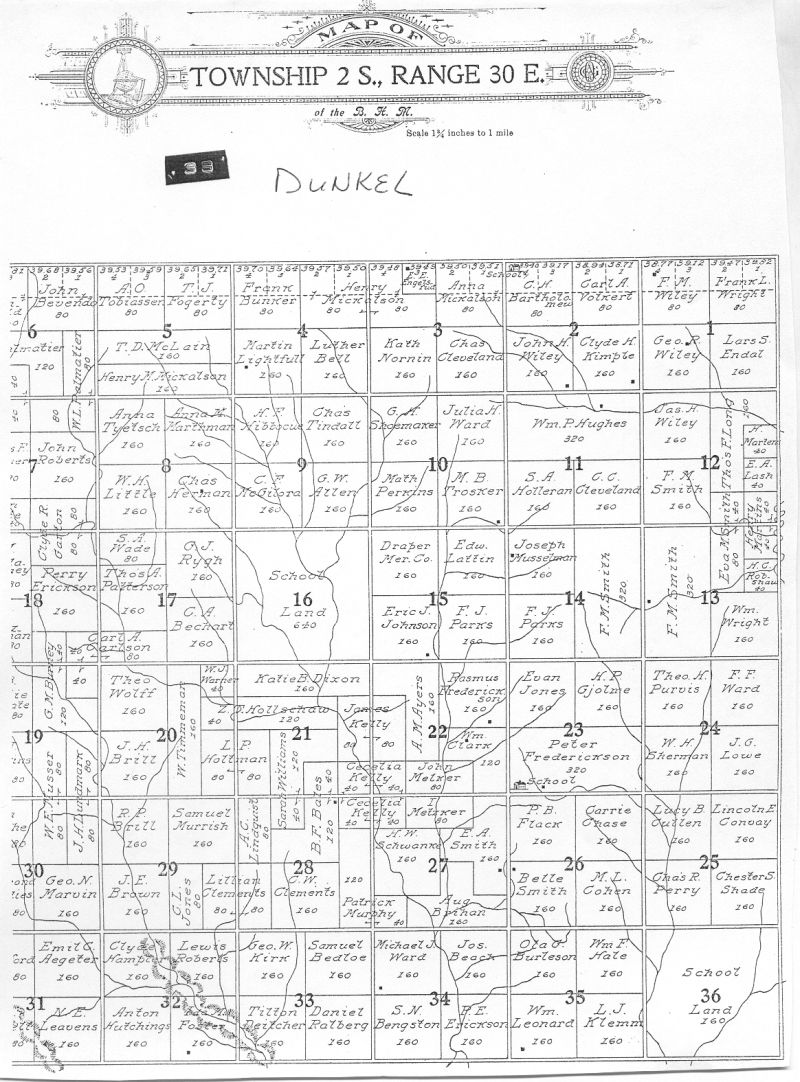
Dunkel * |
2S |
30E |
|
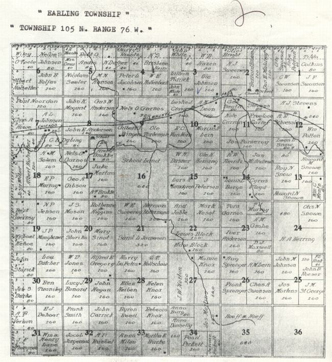
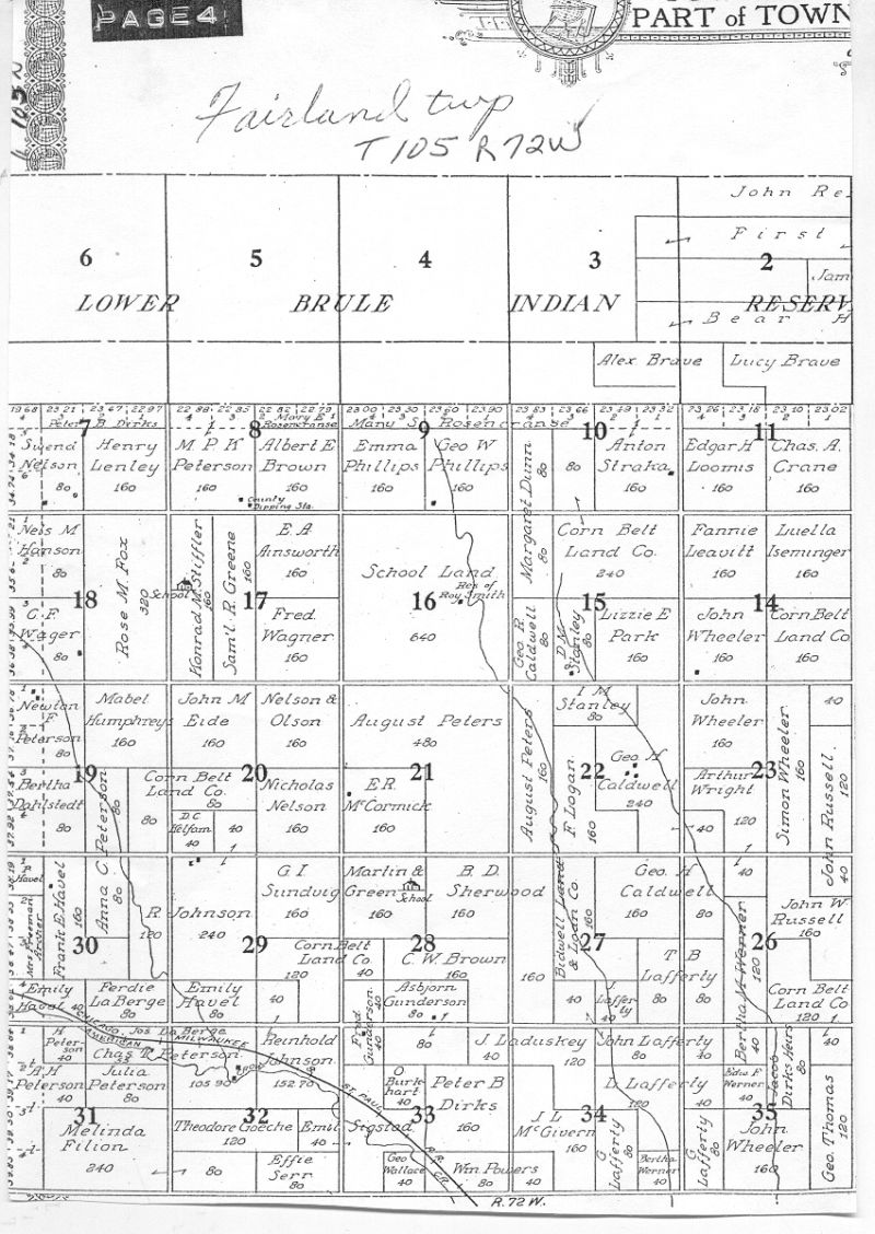
105N |
76W |
|
|
103N |
76W |
|
|
105N |
71W |
|
|
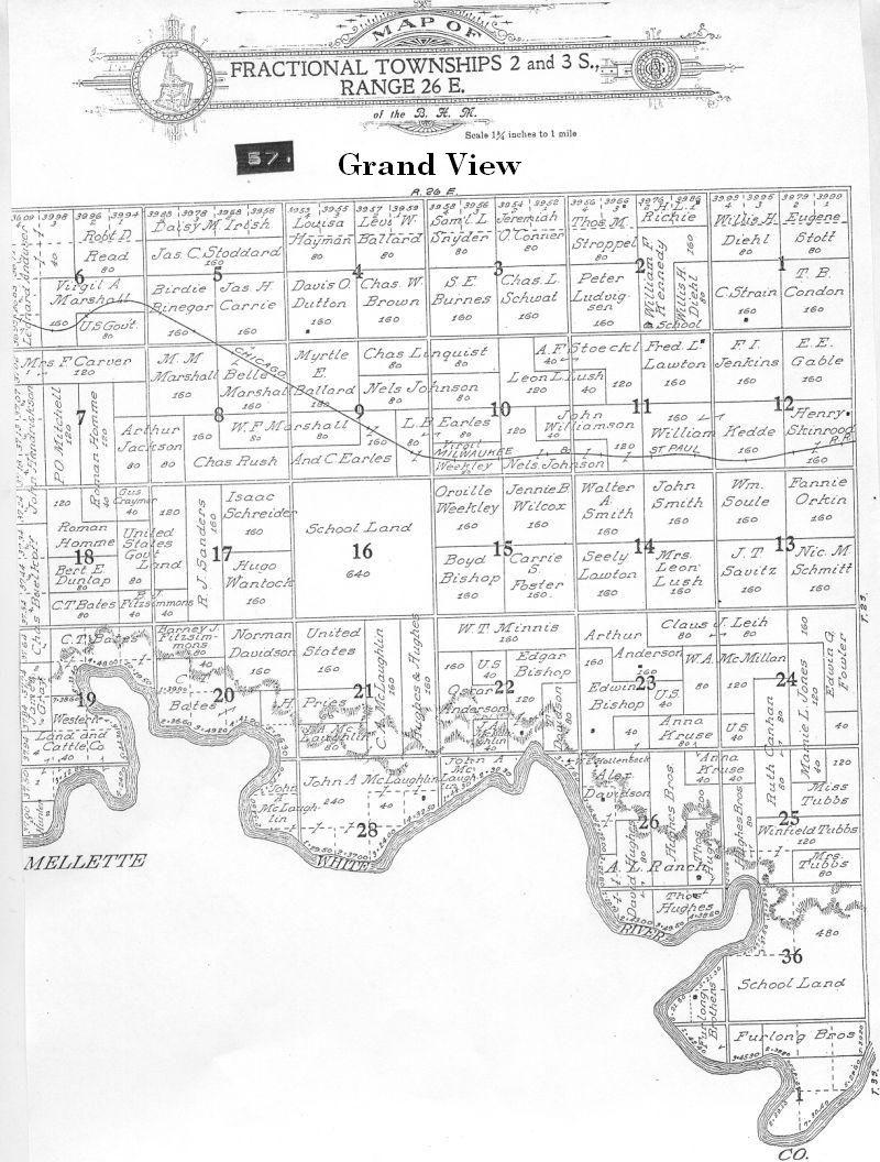
2S |
26E |
|
|
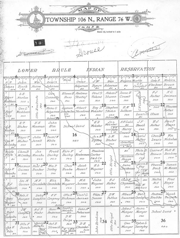
106N |
76W |
|
|
1S |
28E |
|
|
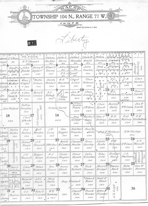
104N |
78W |
|
|
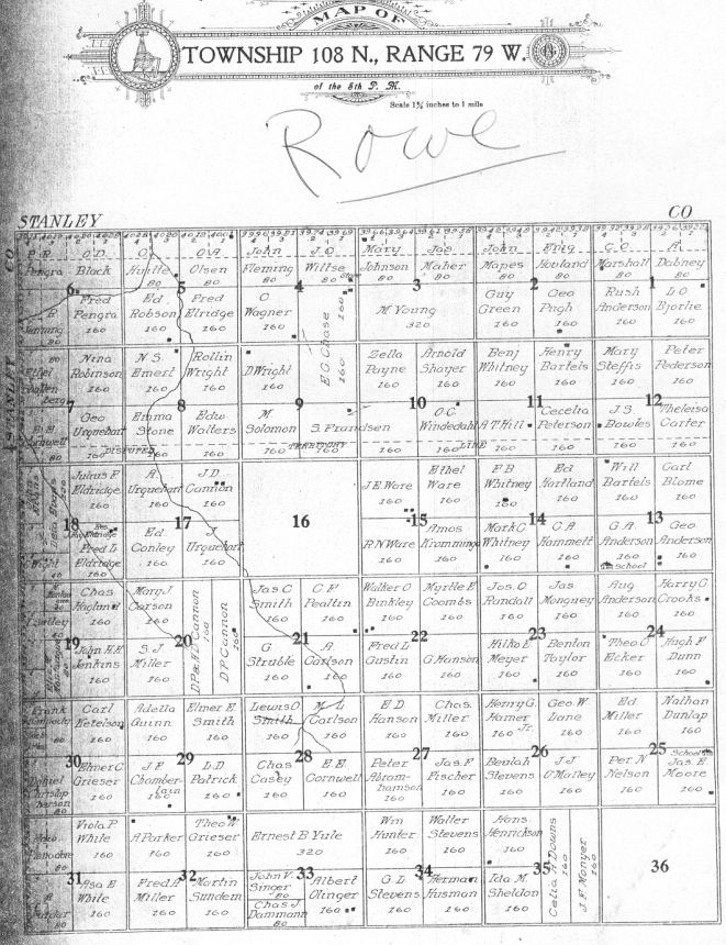
106N |
79W |
|
|
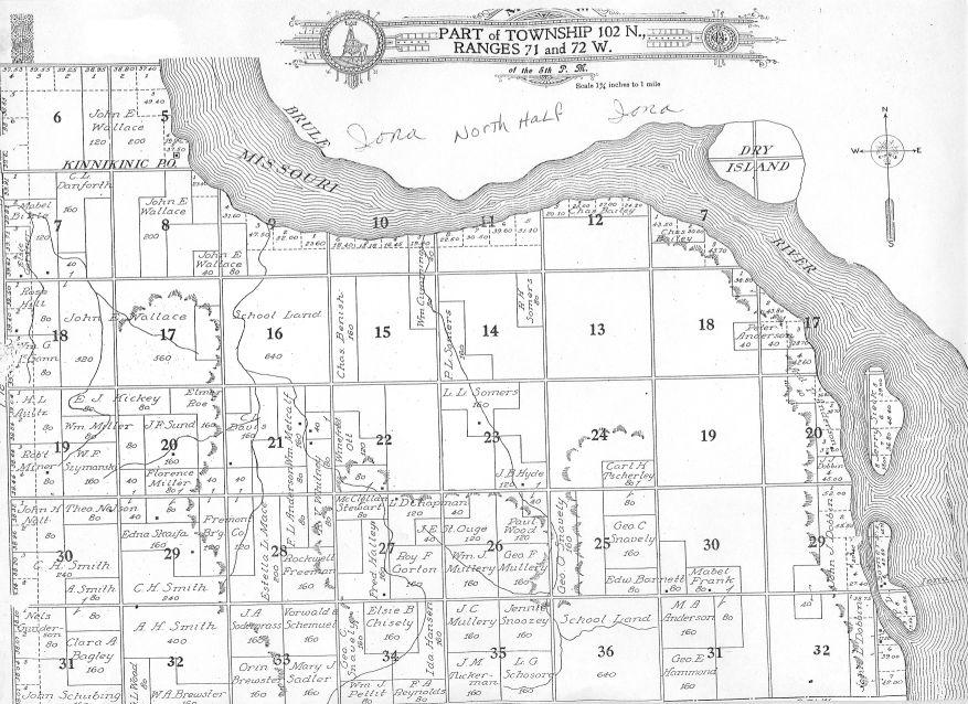
Iona north |
102N |
73-72-71W |
|
Iona south |
101N |
72W |
| Iona & Black Dog |
102N |
73W |
|
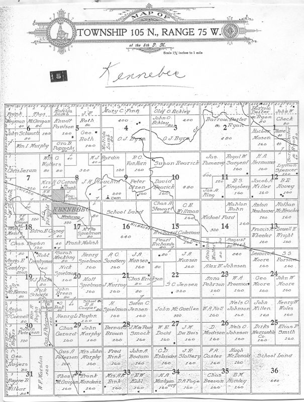
105N |
75W |
|
| Kennebec townsite | ||
| Kolls * |
1N |
29E |
|
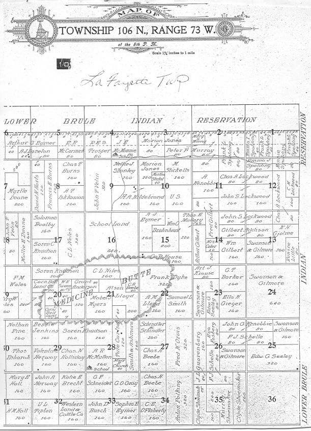
106N |
73W |
|
|
104N |
77W |
|
|
Lincoln * |
1S |
29E |
|
Lower Brule Reservation |
107-108N |
76W |
|
Reservation |
107-108N |
75W |
|
Reservation |
107-108N |
74W |
|
Reservation |
107N |
73W |
|
Reservation |
106-107N |
72W |
|
Reservation |
106-107N |
71W |
|
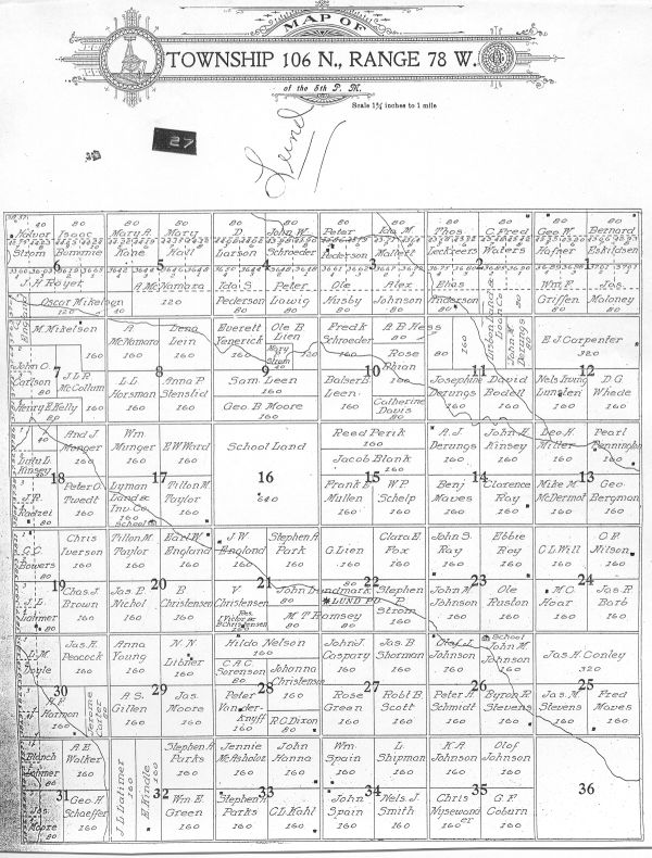
106N |
78W |
|
|
108N |
78W |
|
|
105N |
78W |
|
|
101N |
73W |
|
|
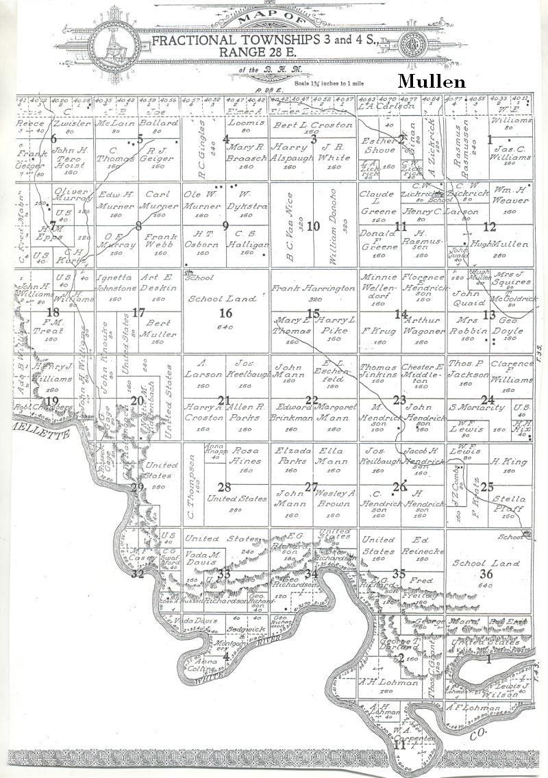
Mullen * |
3S |
28E |
|
Murdo * |
2S |
28E |
|
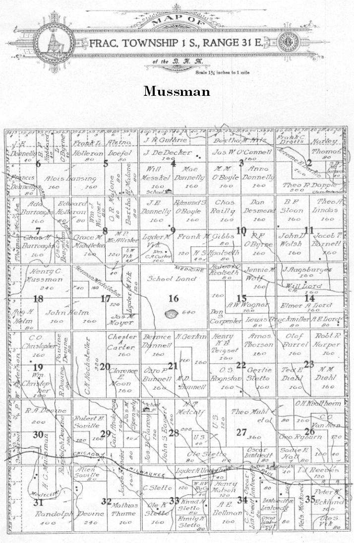
Mussman * |
1S |
31E |
|
Oacoma north portion |
105N |
71W |
|
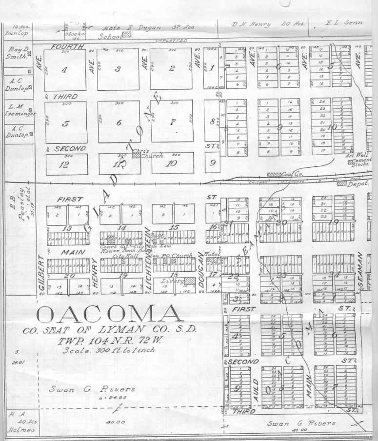
Oacoma townsite |
104N |
72W |
|
Oacoma center portion |
104N |
71 & 72W |
|
Oacoma south portion (part Iona) |
103N |
72W |
|
2S |
27E |
|
|
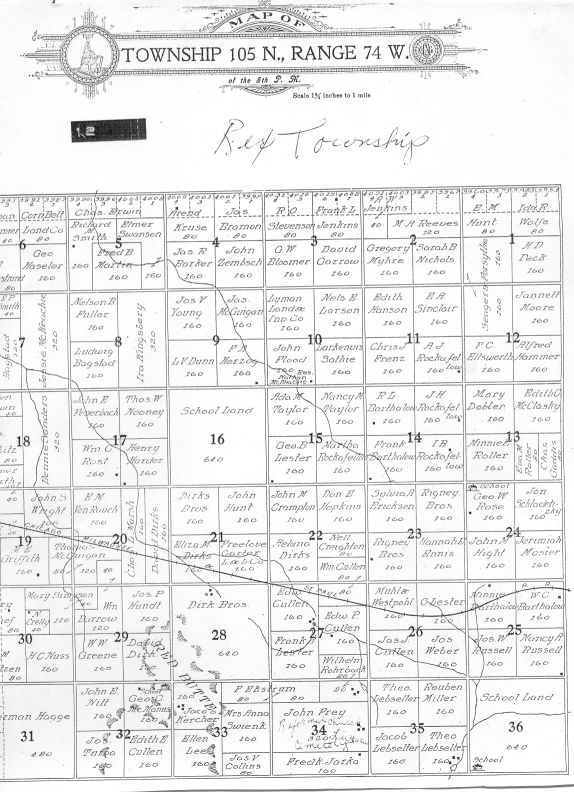
106N |
74W |
|
|
103N |
78W |
|
|
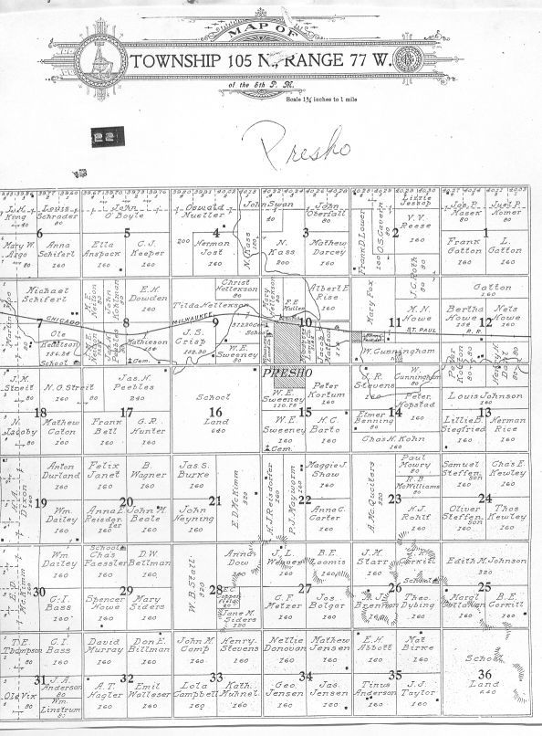
105N |
77W |
|
|
Reliance town site |
105N |
73W |
| Reliance | 105N | 73W |
|
105N |
74W |
|
|
1N |
31E |
|
|
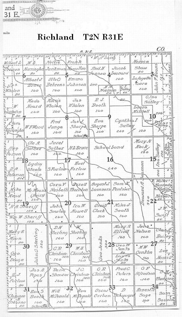
Richland * |
2N |
31E |
|
104N |
76W |
|
|
108N |
79W |
|
|
Scovil * |
1S |
26E |
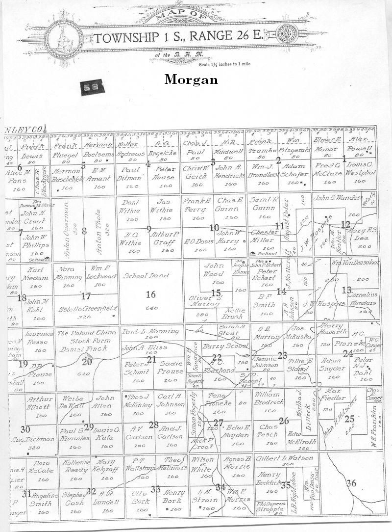
| Morgan * | 1S | 27E |
|
104N |
79W |
|
|
1N |
26E |
|
|
107N |
79W |
|
|
103N |
77W |
|
|
107N |
77W |
|
|
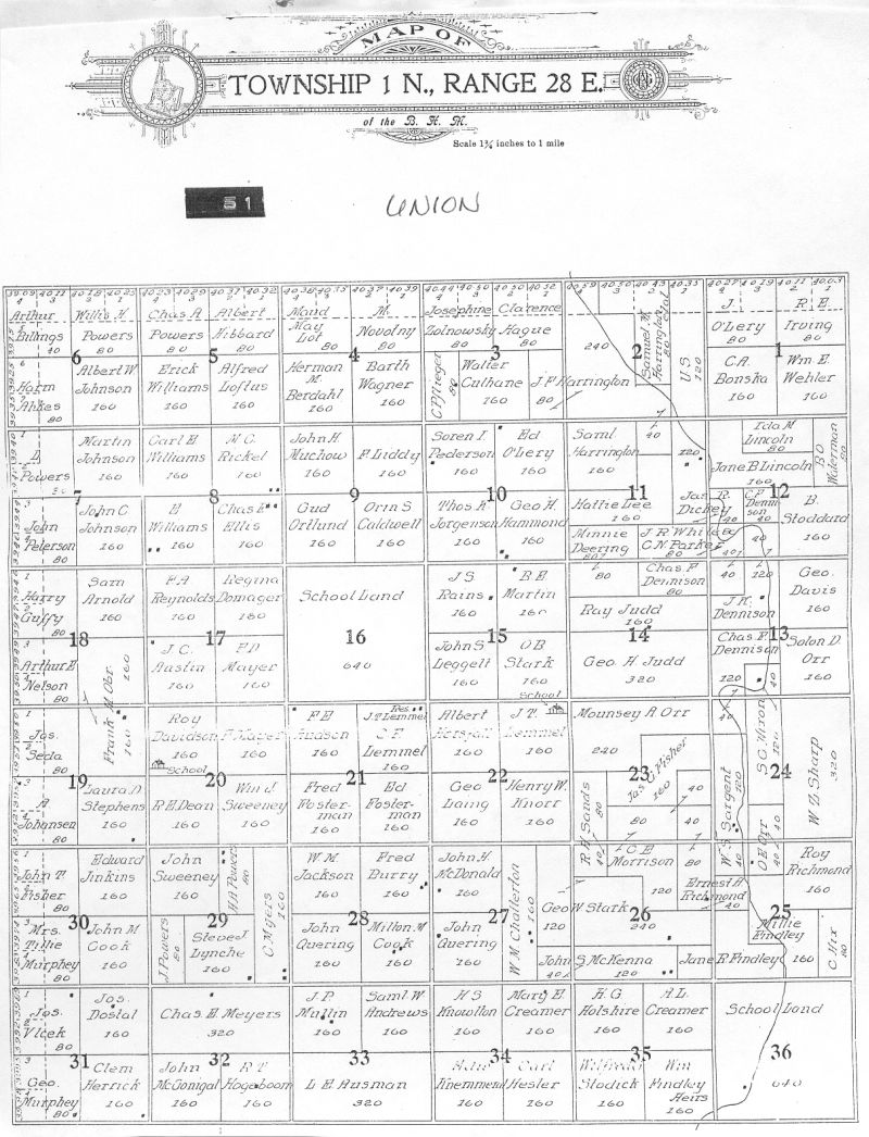
Union * |
1N |
28E |
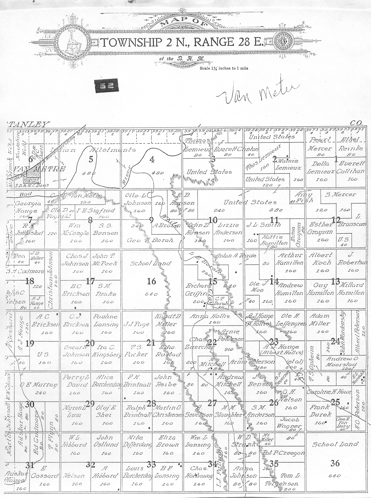
|
2N |
28E |
|
|
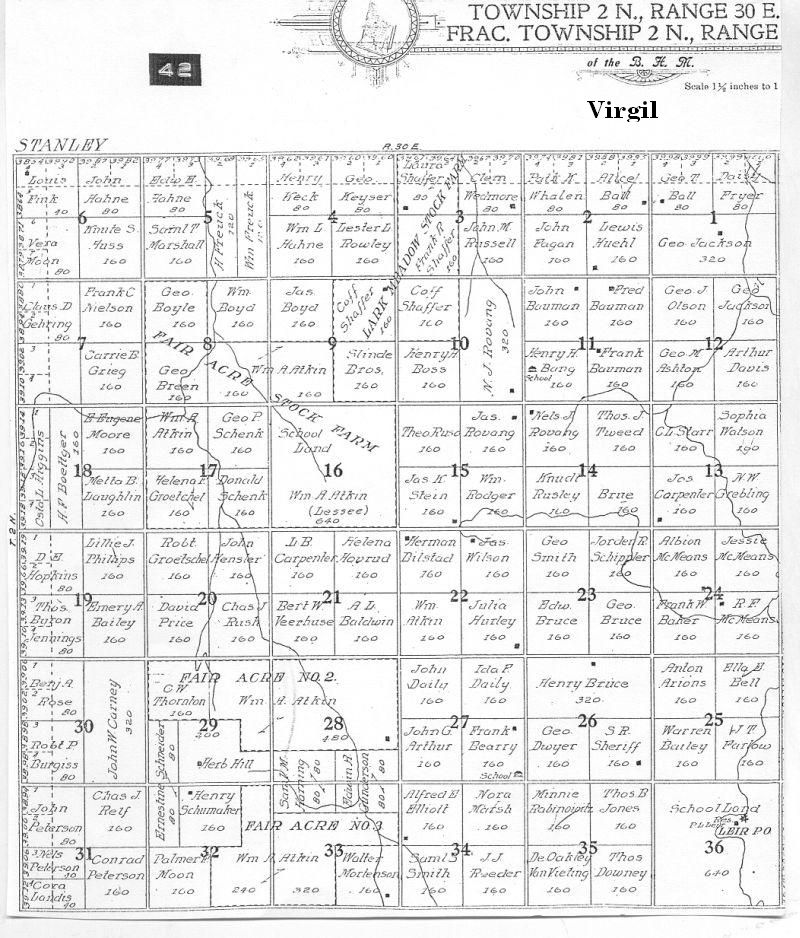
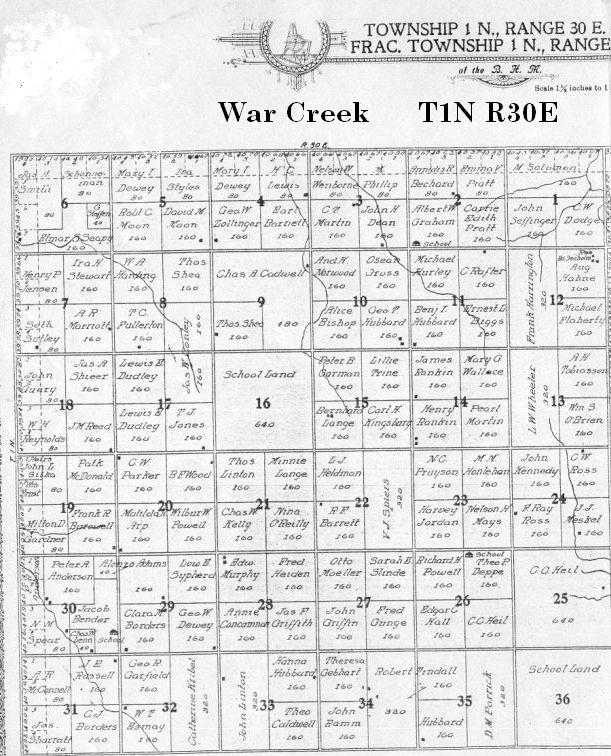
Virgil * |
1N |
30E |
|
105N |
79W |
|
|
2N |
30E |
|
|
1N |
27E |
|
|
Westover * |
3S |
29E |
|
104N |
75W |
|
|
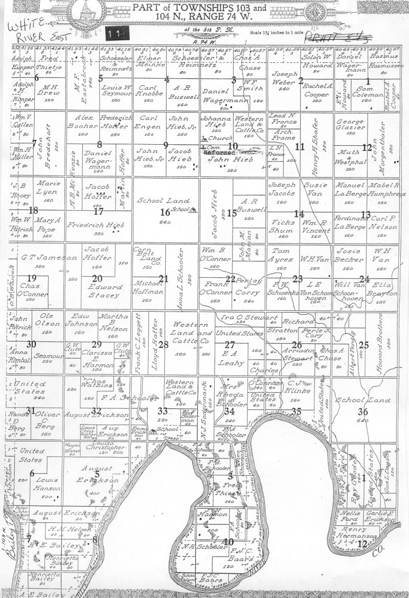
White River (east) |
103N |
75W |
|
1 and 2S |
31E |
|
|
Williams Creek S * |
3S |
31E |
|
Zickrick * |
3S |
30E |
Lyman County Townships and Landowners, 1971
![]() Iona
Landowners 1900-1901 ... Submitted 2006, by Kathy Winter, Iona. Thanks,
Kathy
Iona
Landowners 1900-1901 ... Submitted 2006, by Kathy Winter, Iona. Thanks,
Kathy