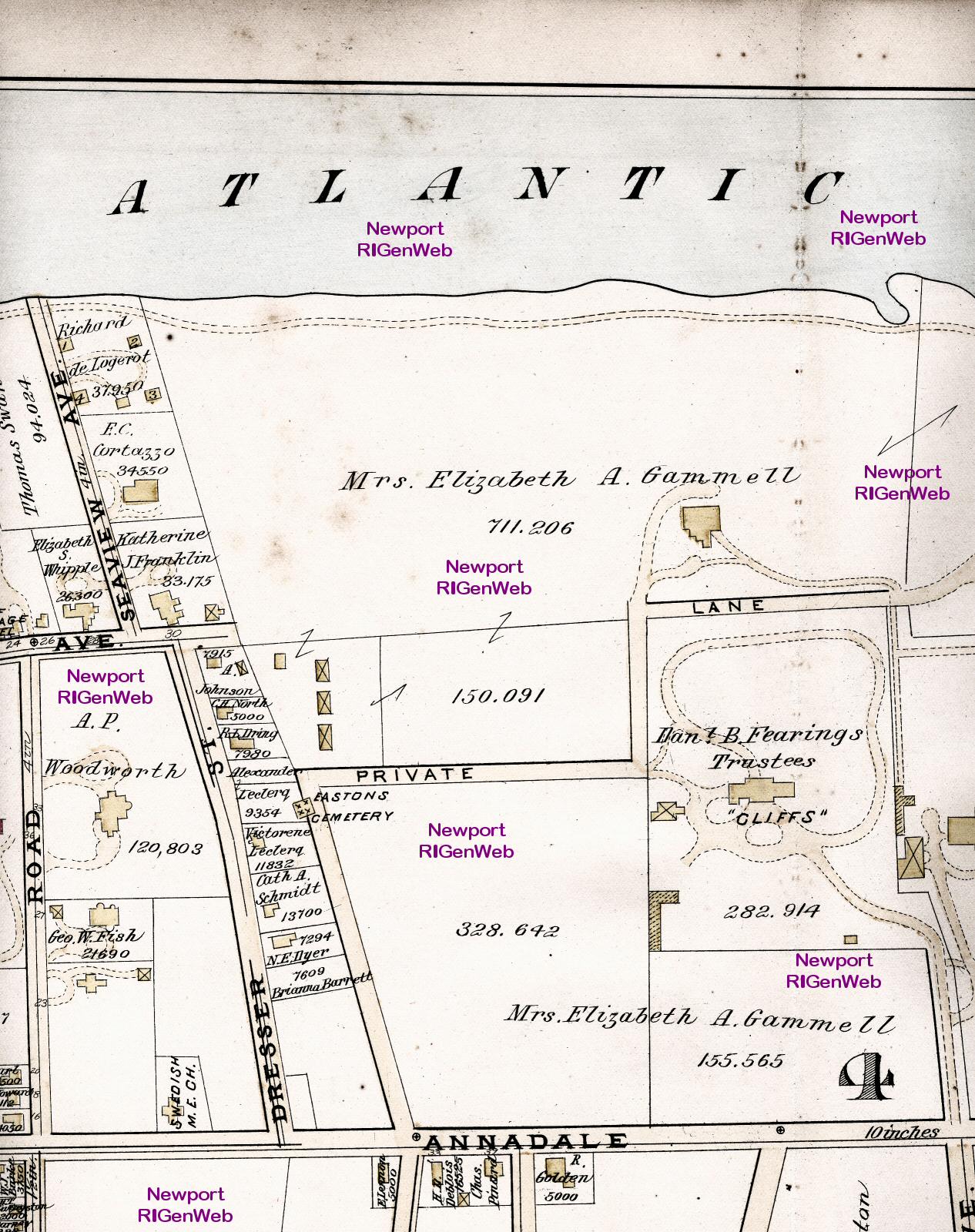
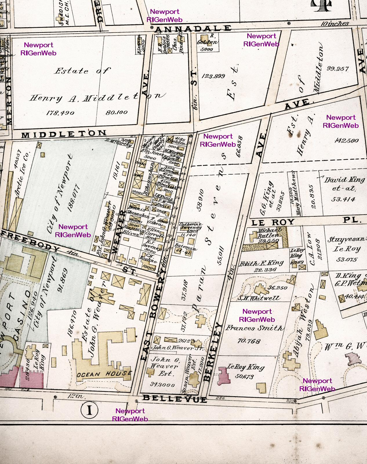
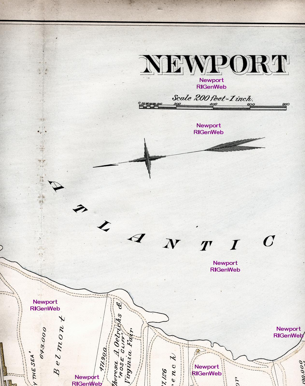
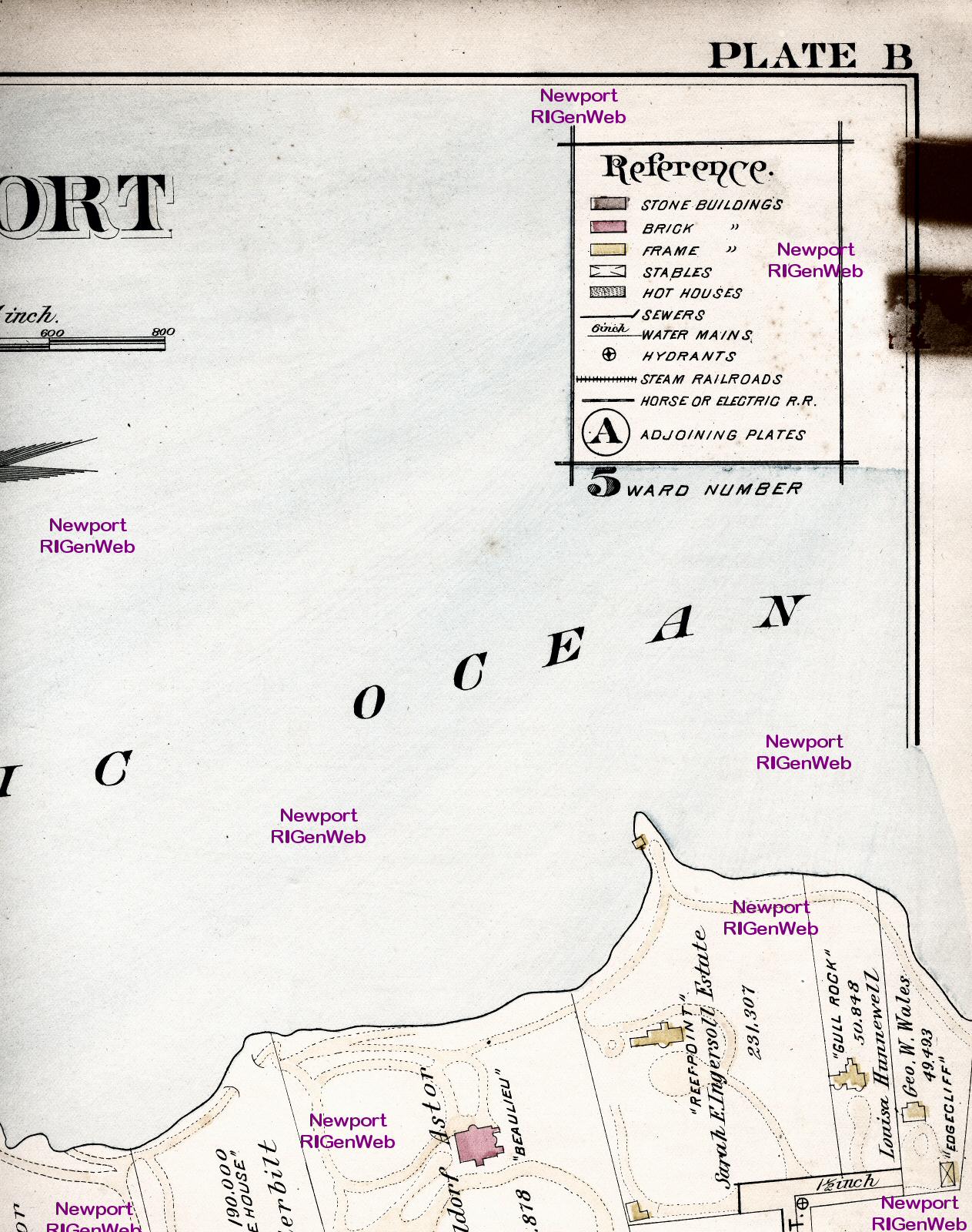
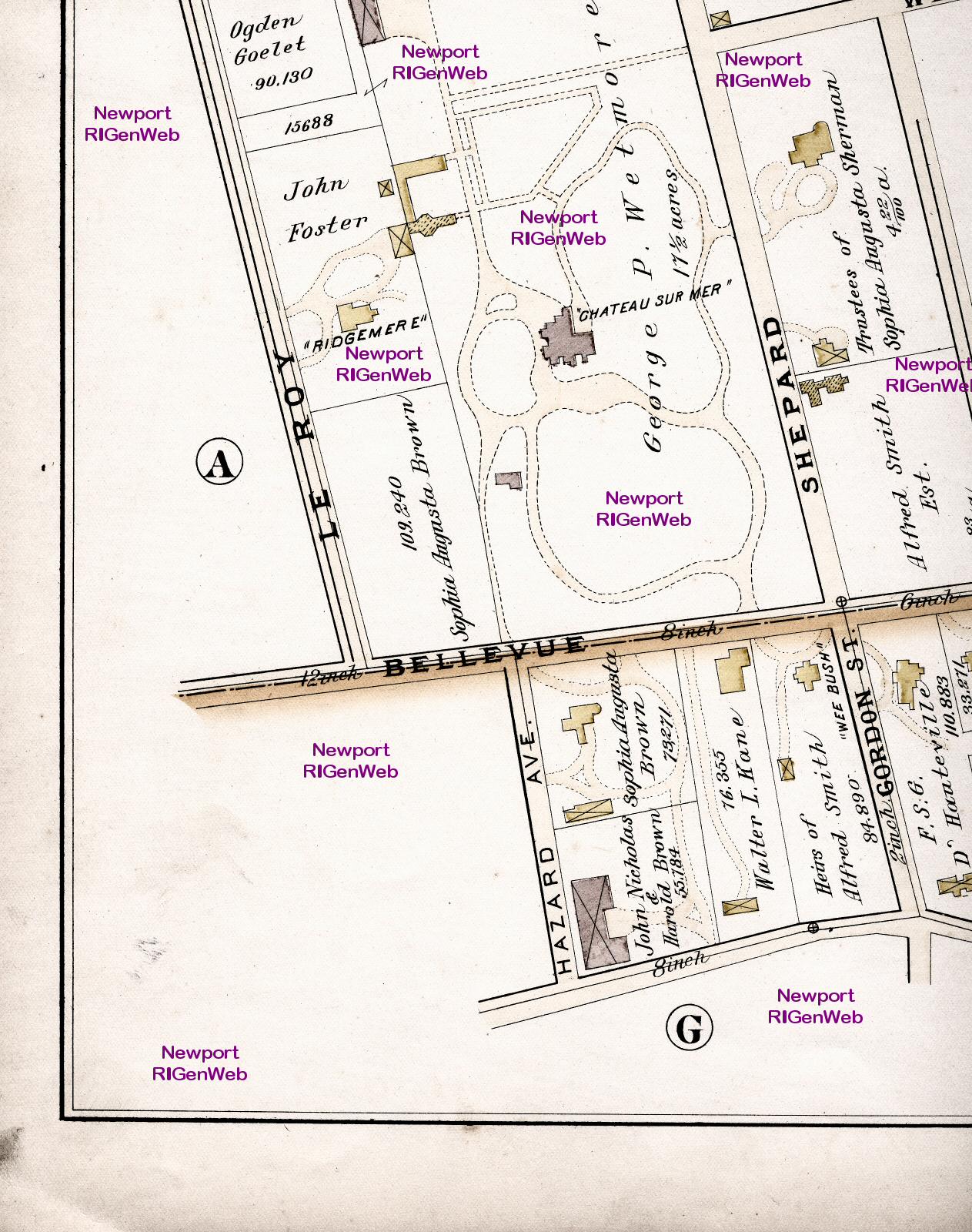
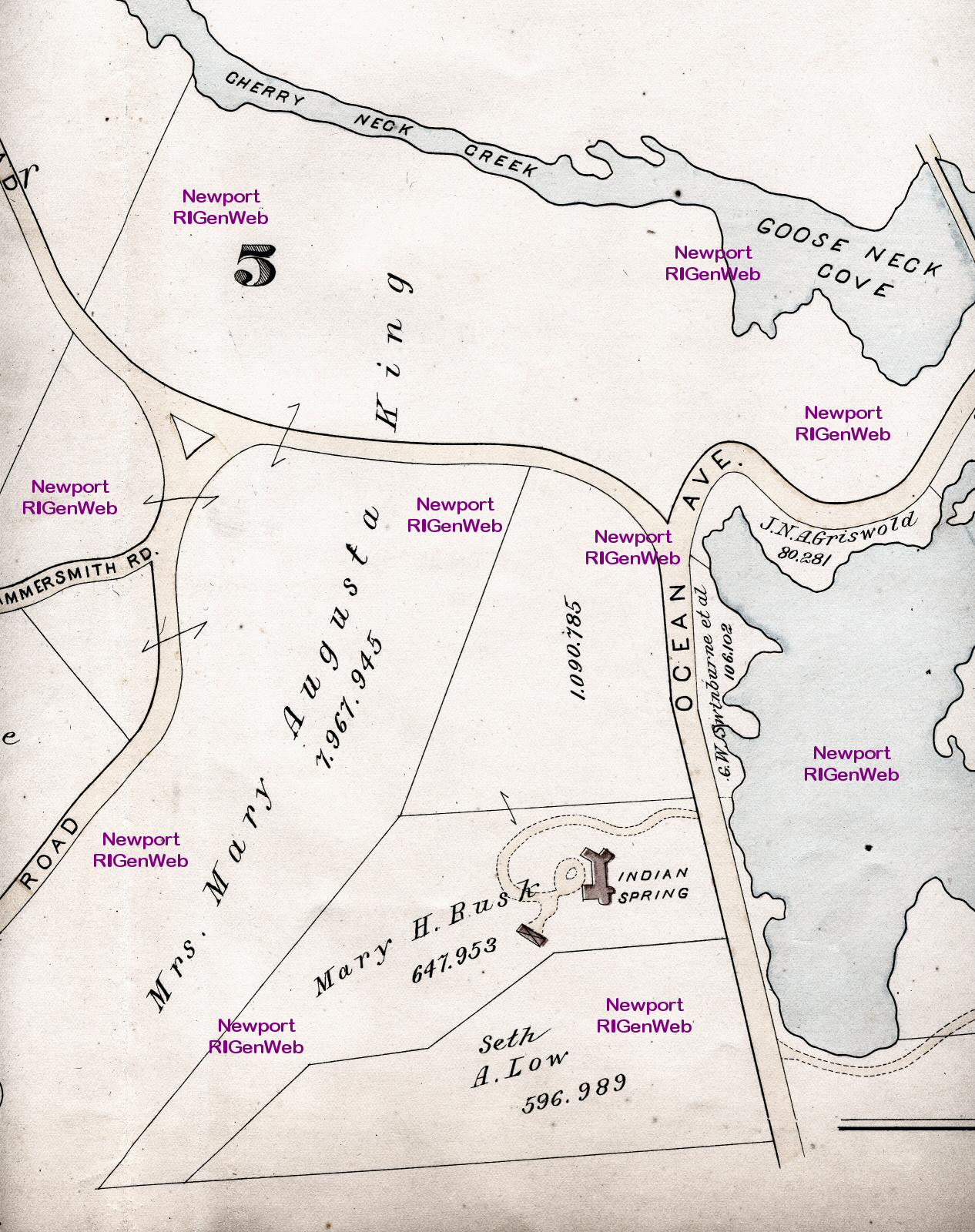
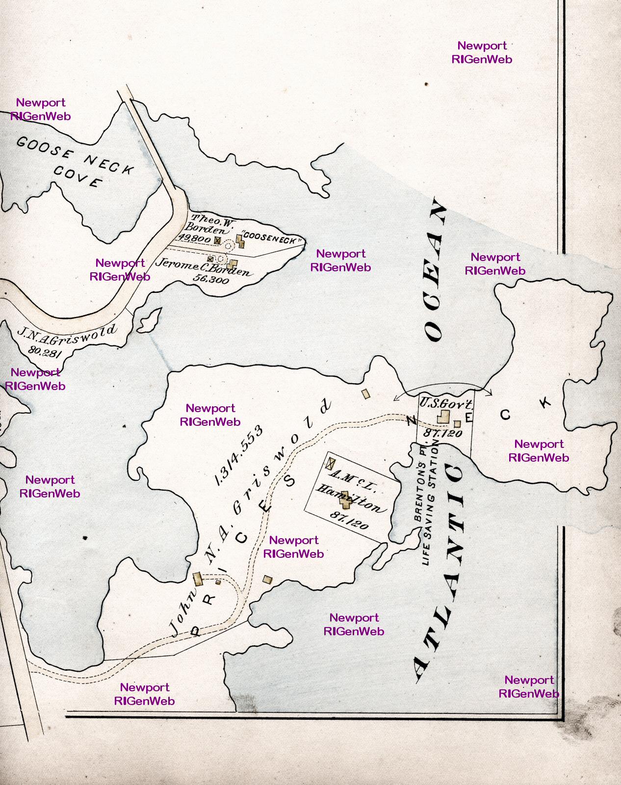
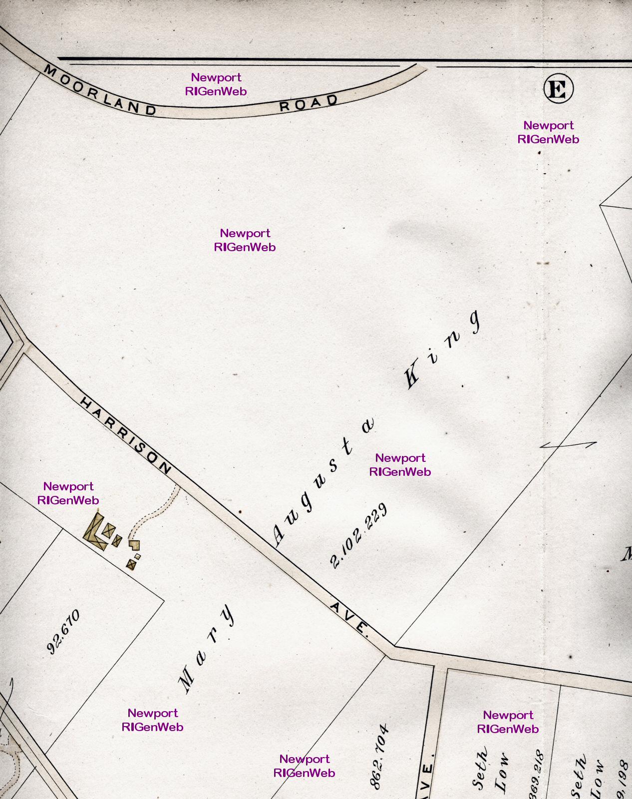
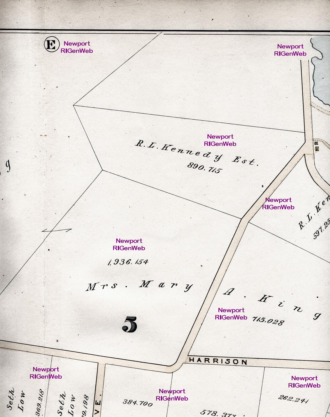
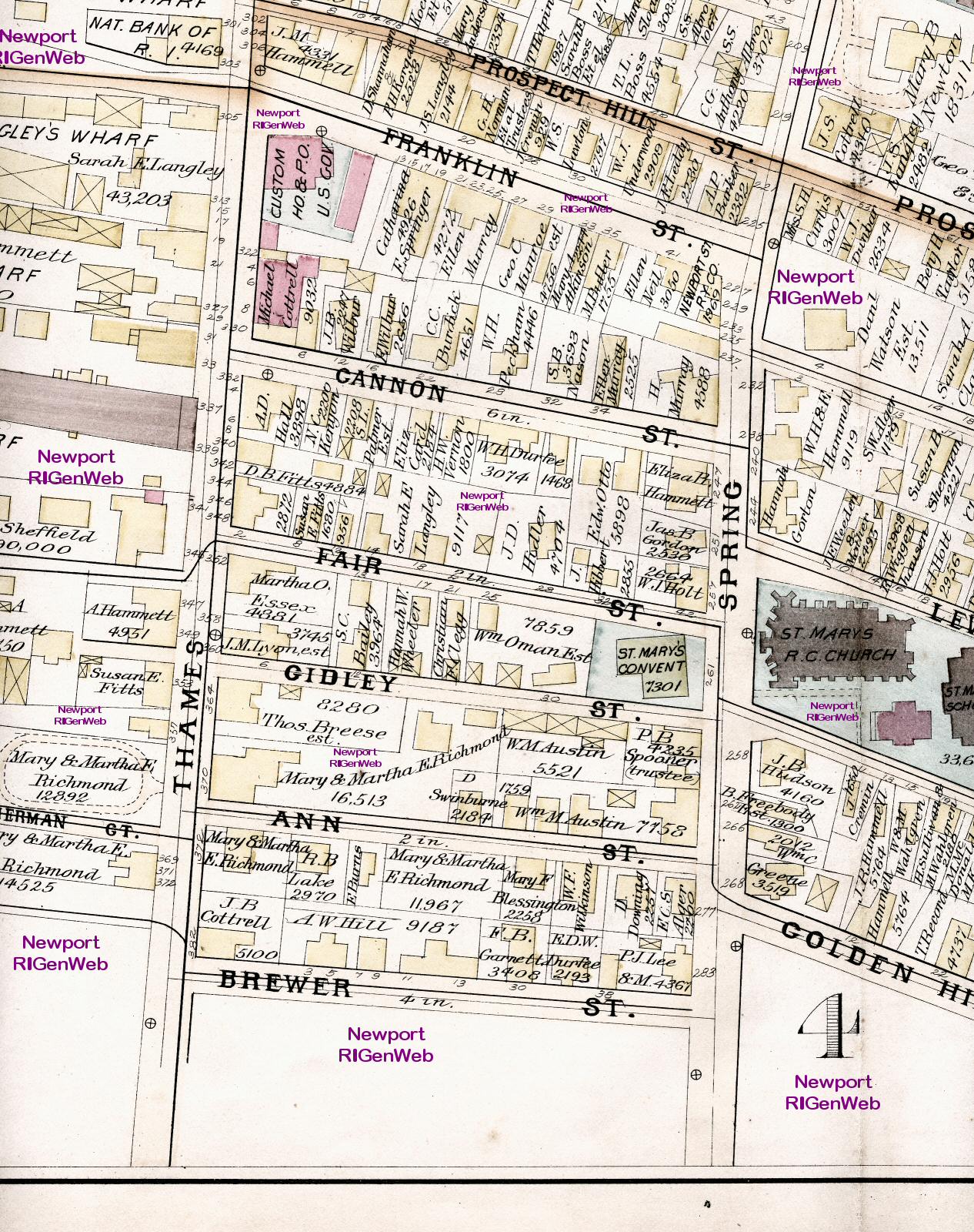
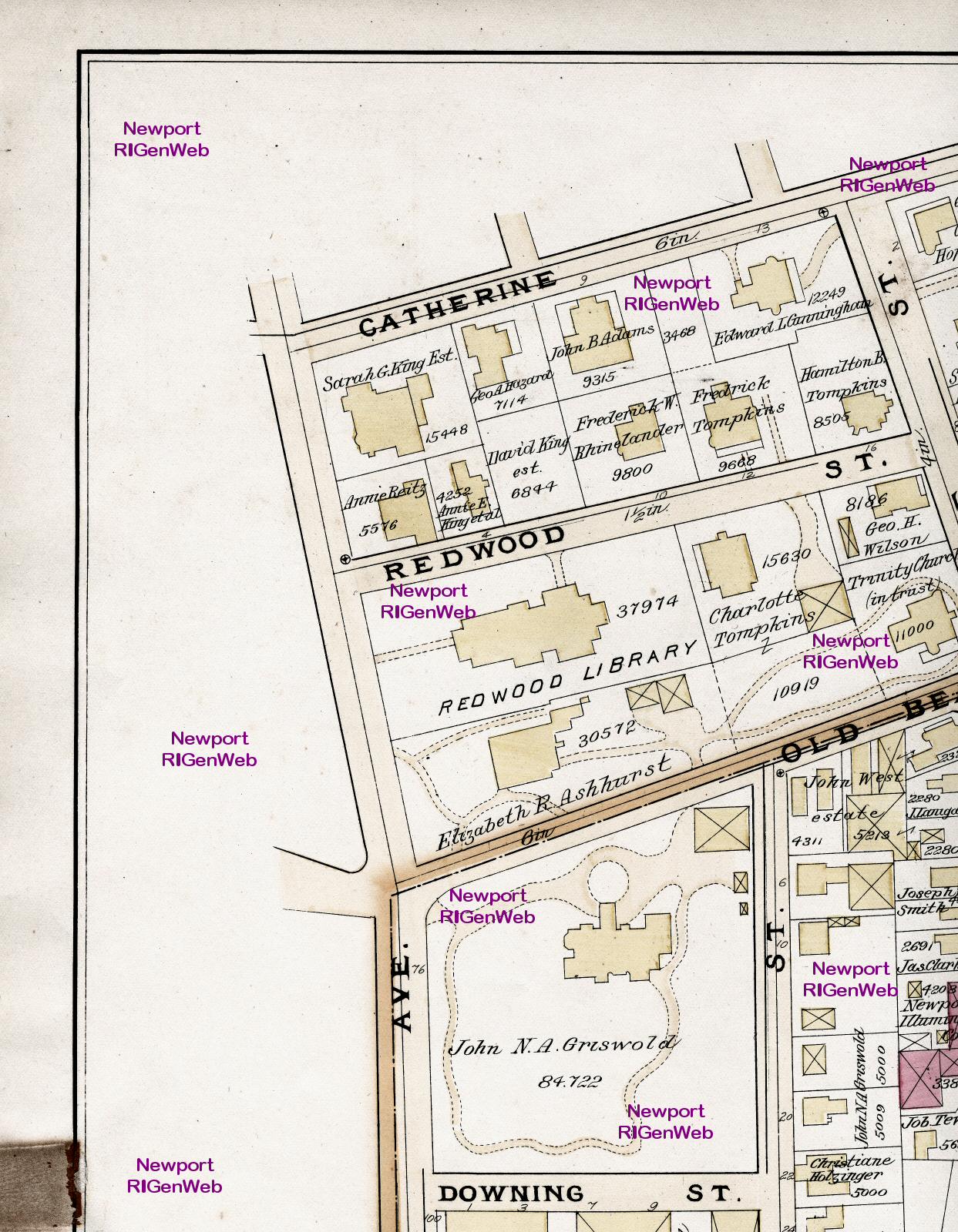
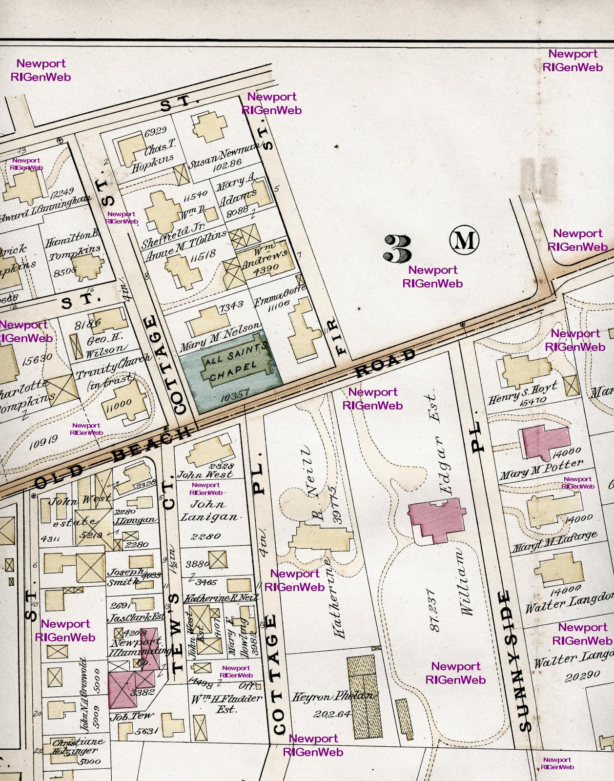
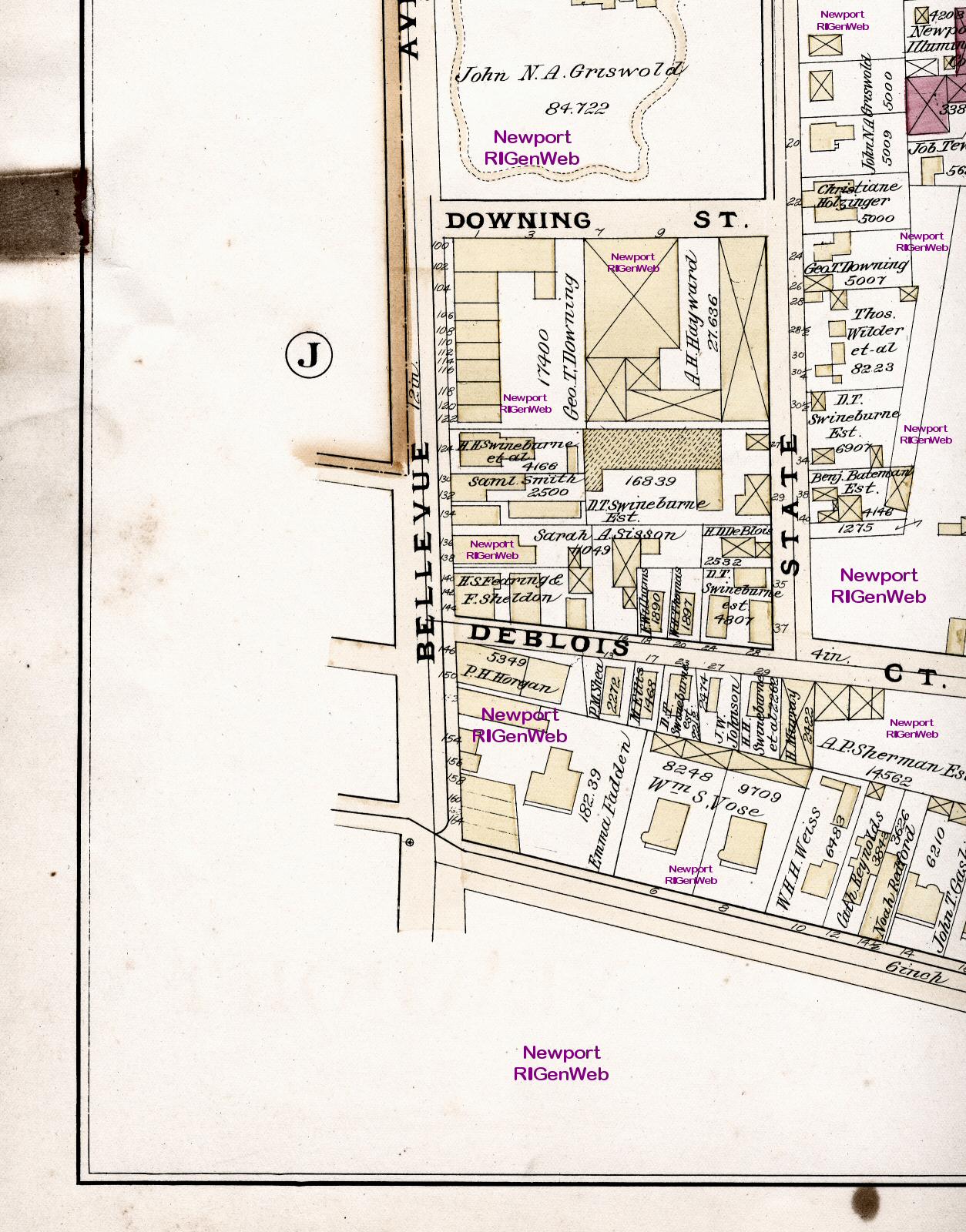
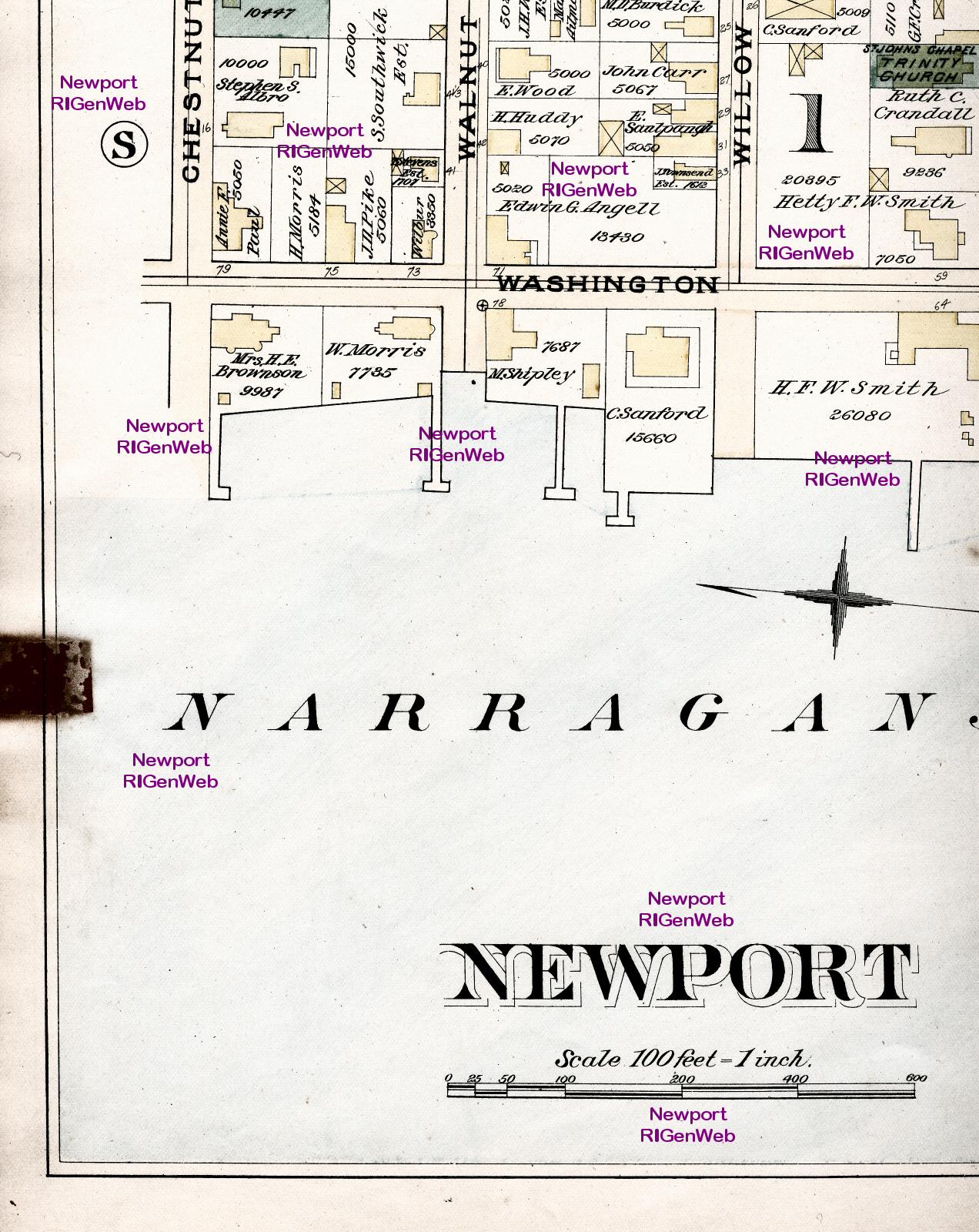
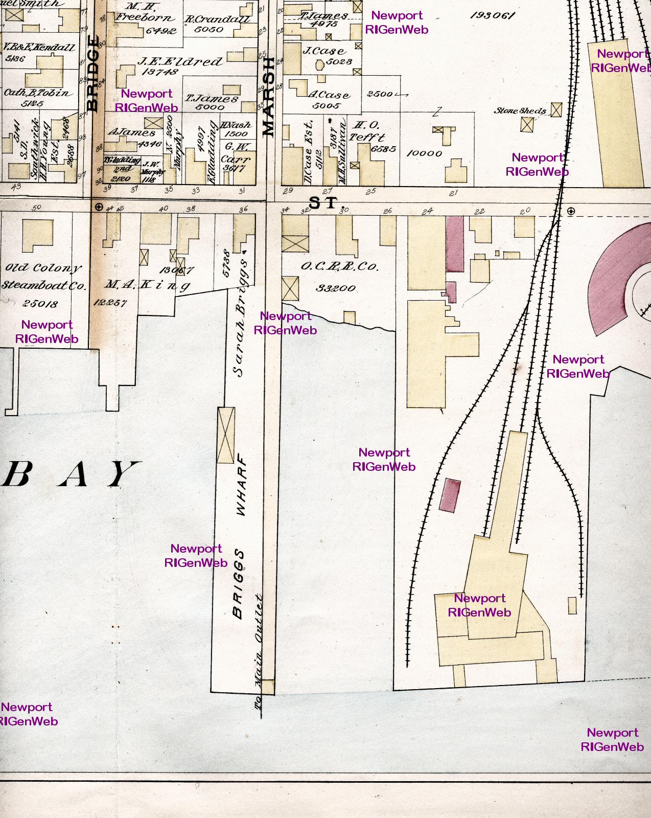
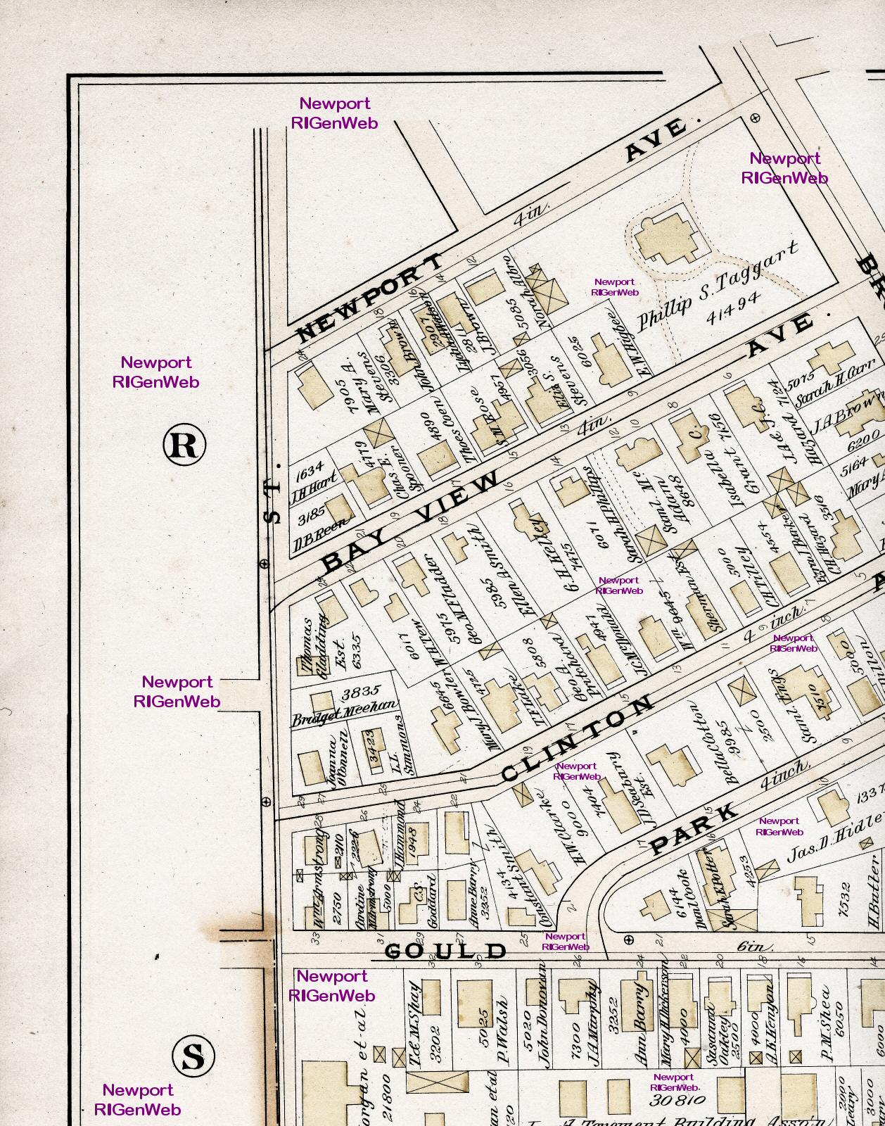
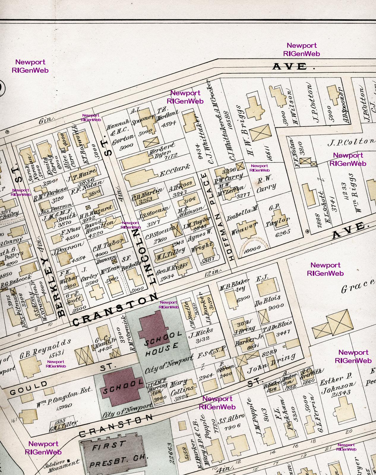
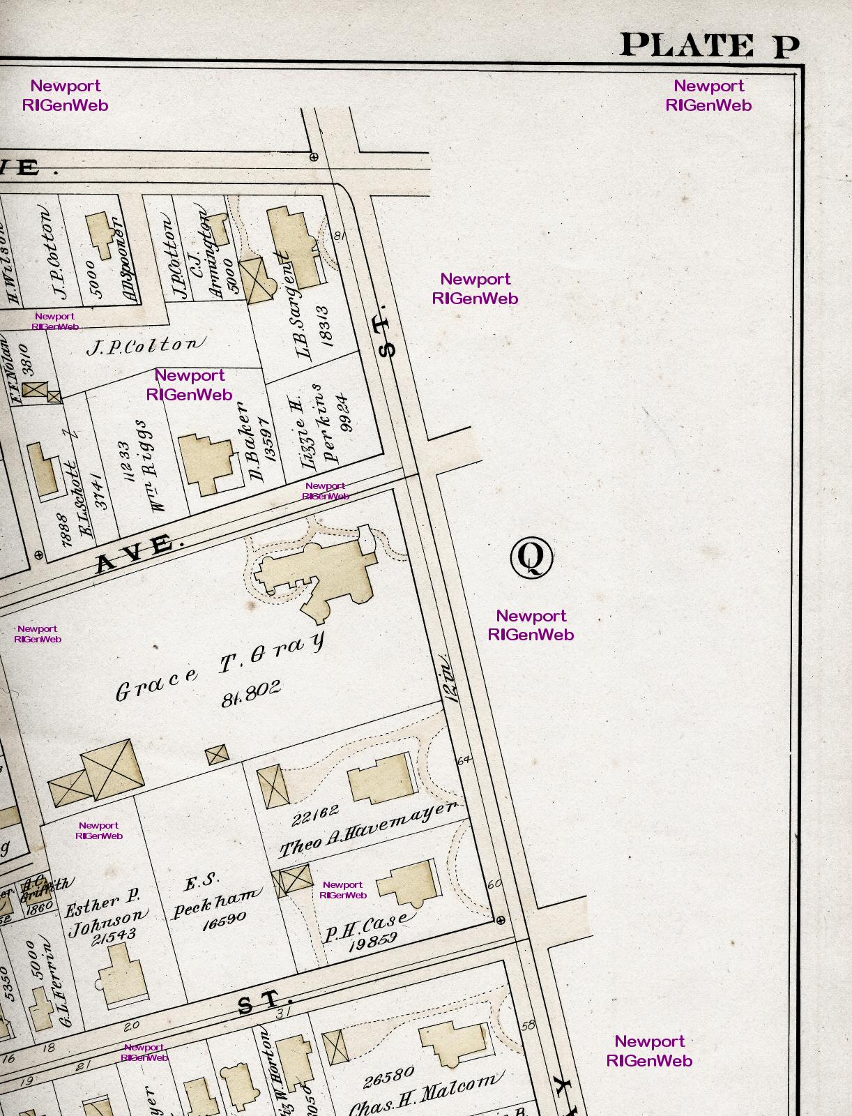
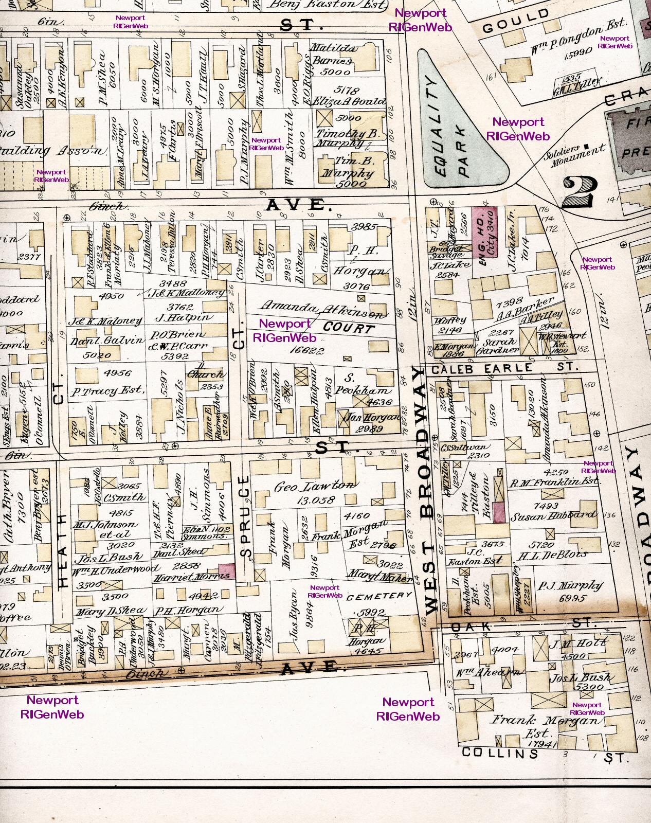
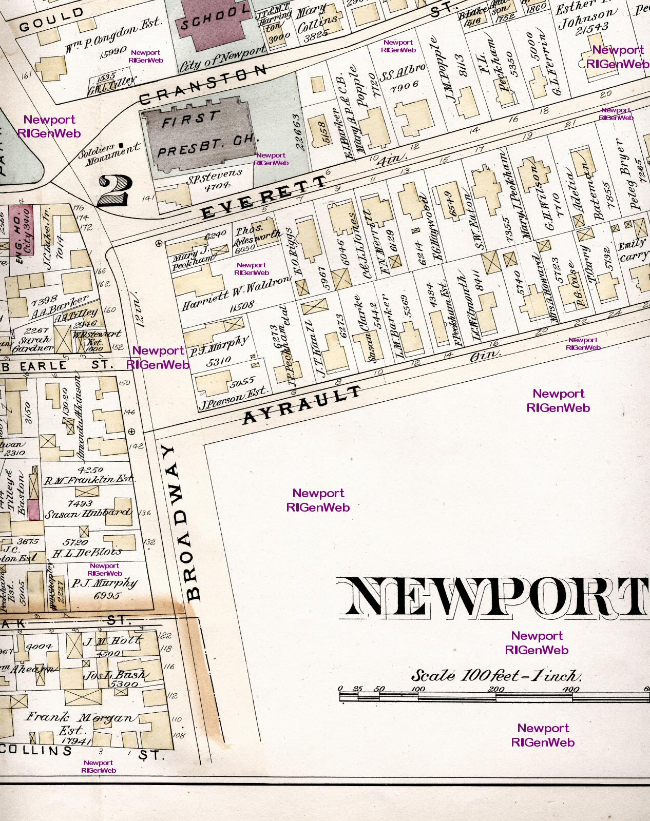
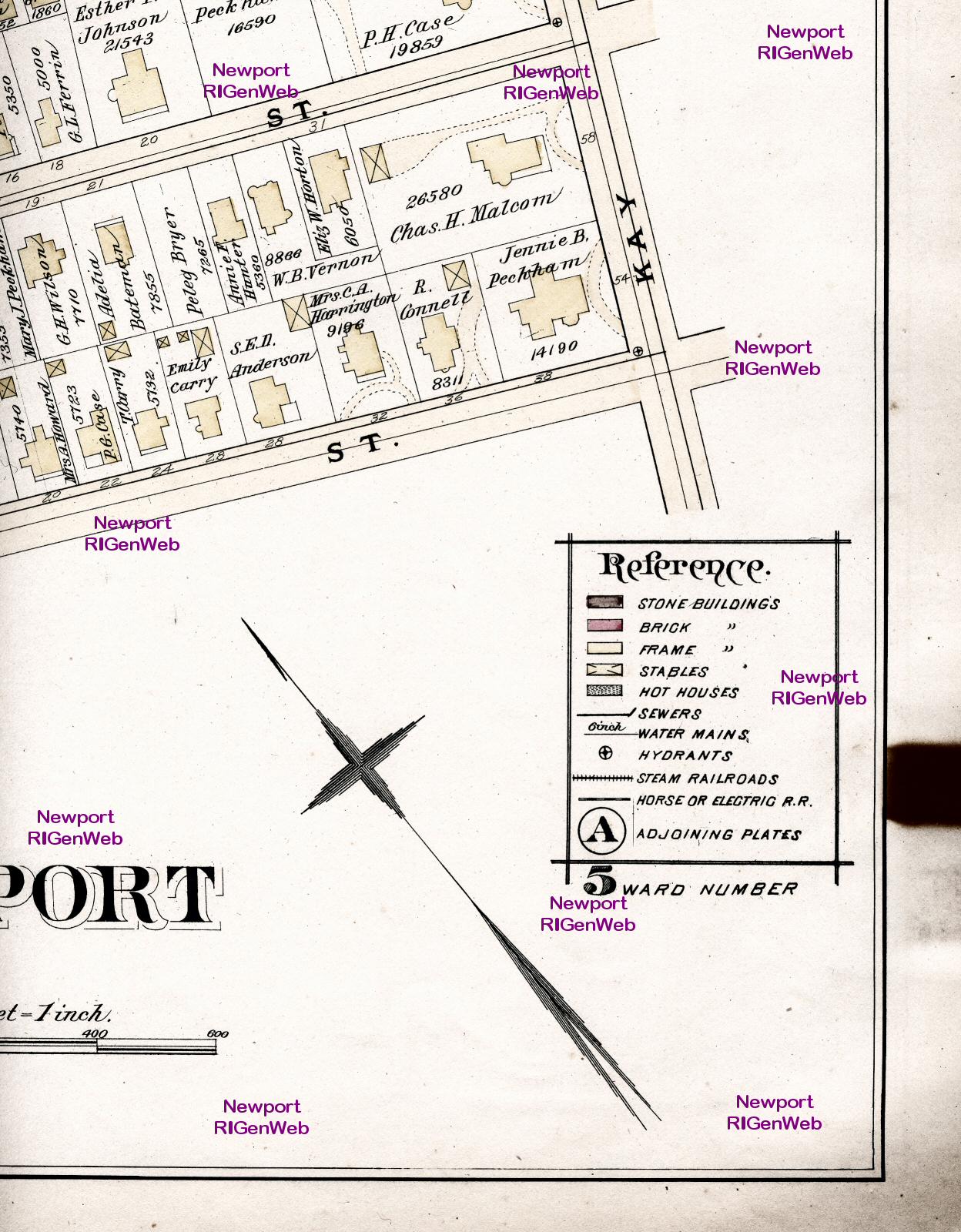
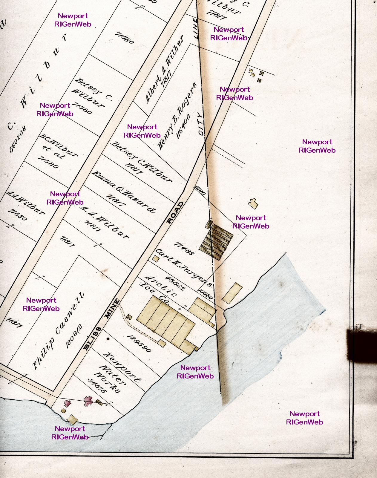
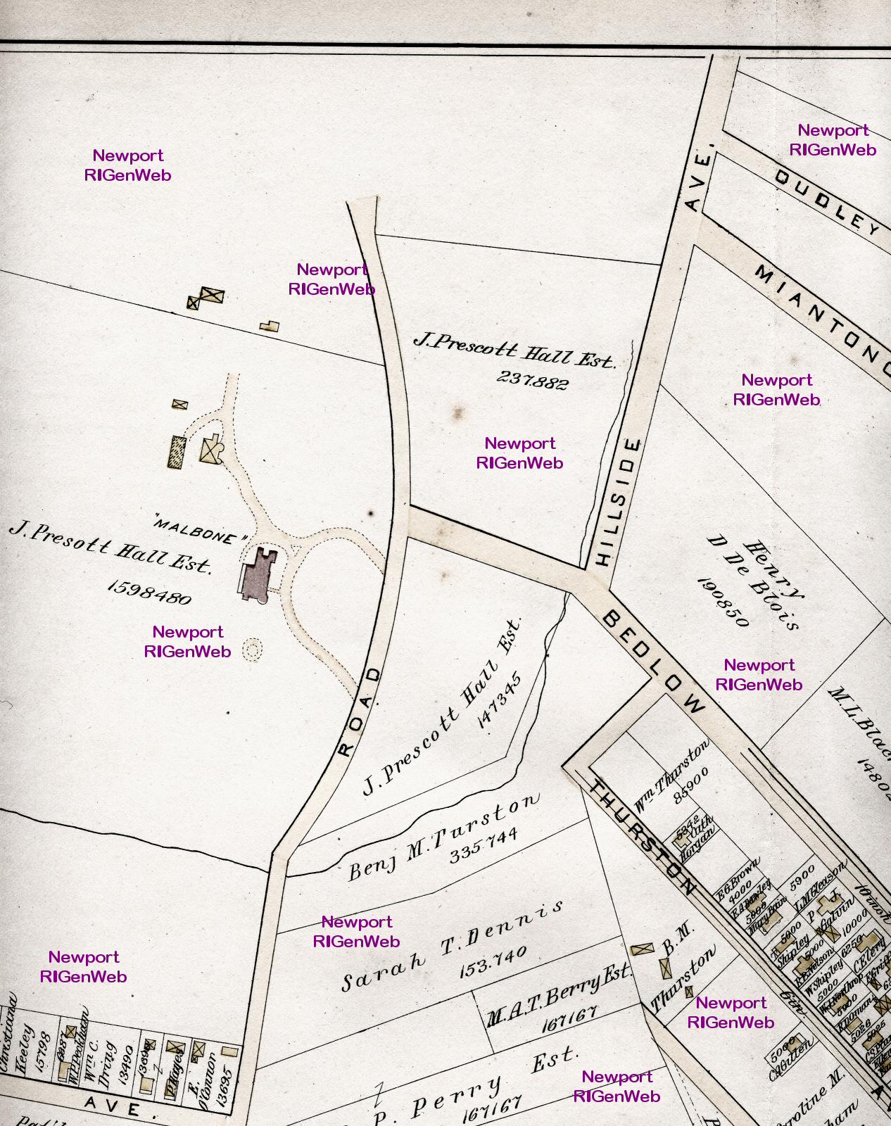
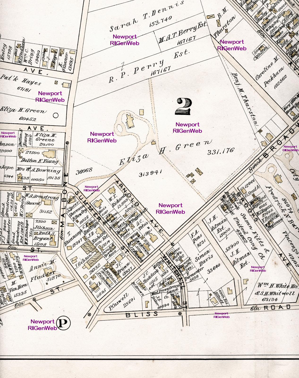
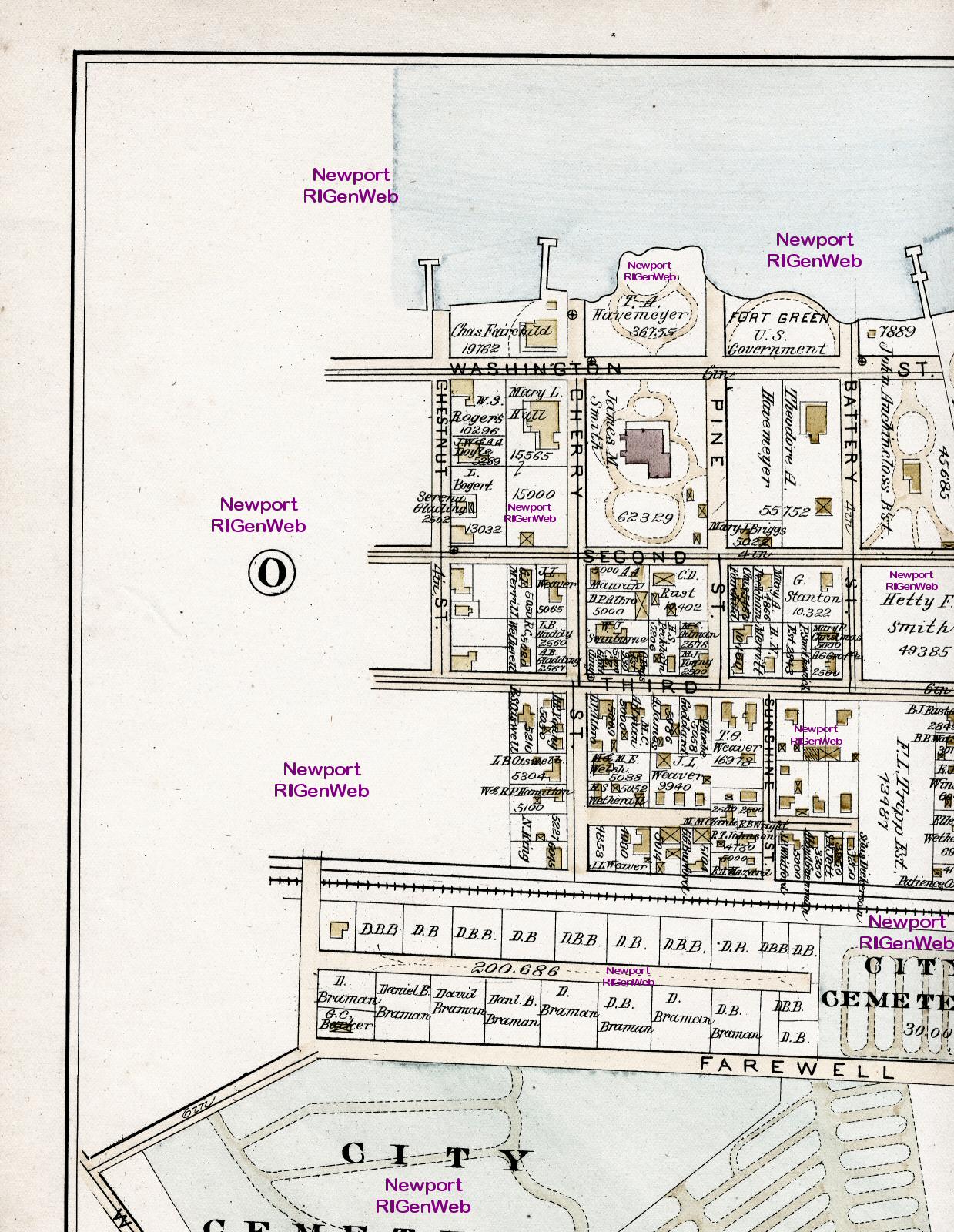
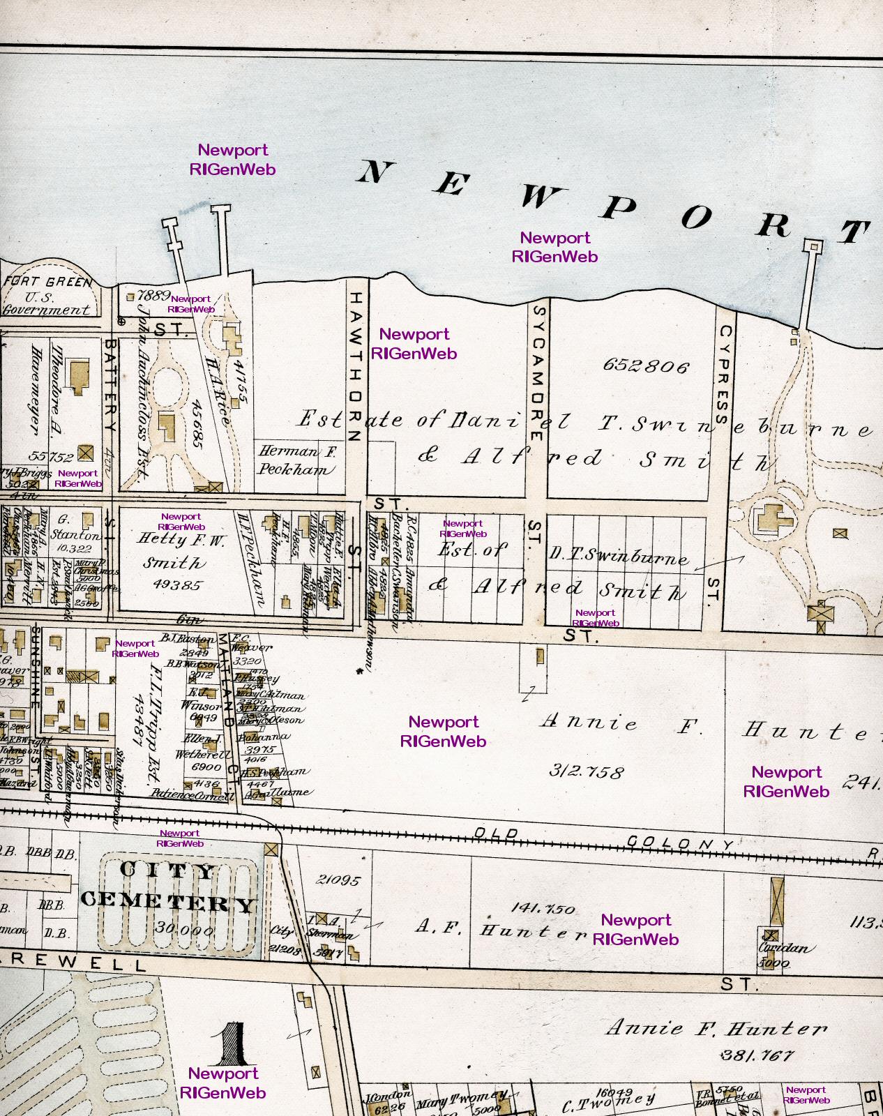
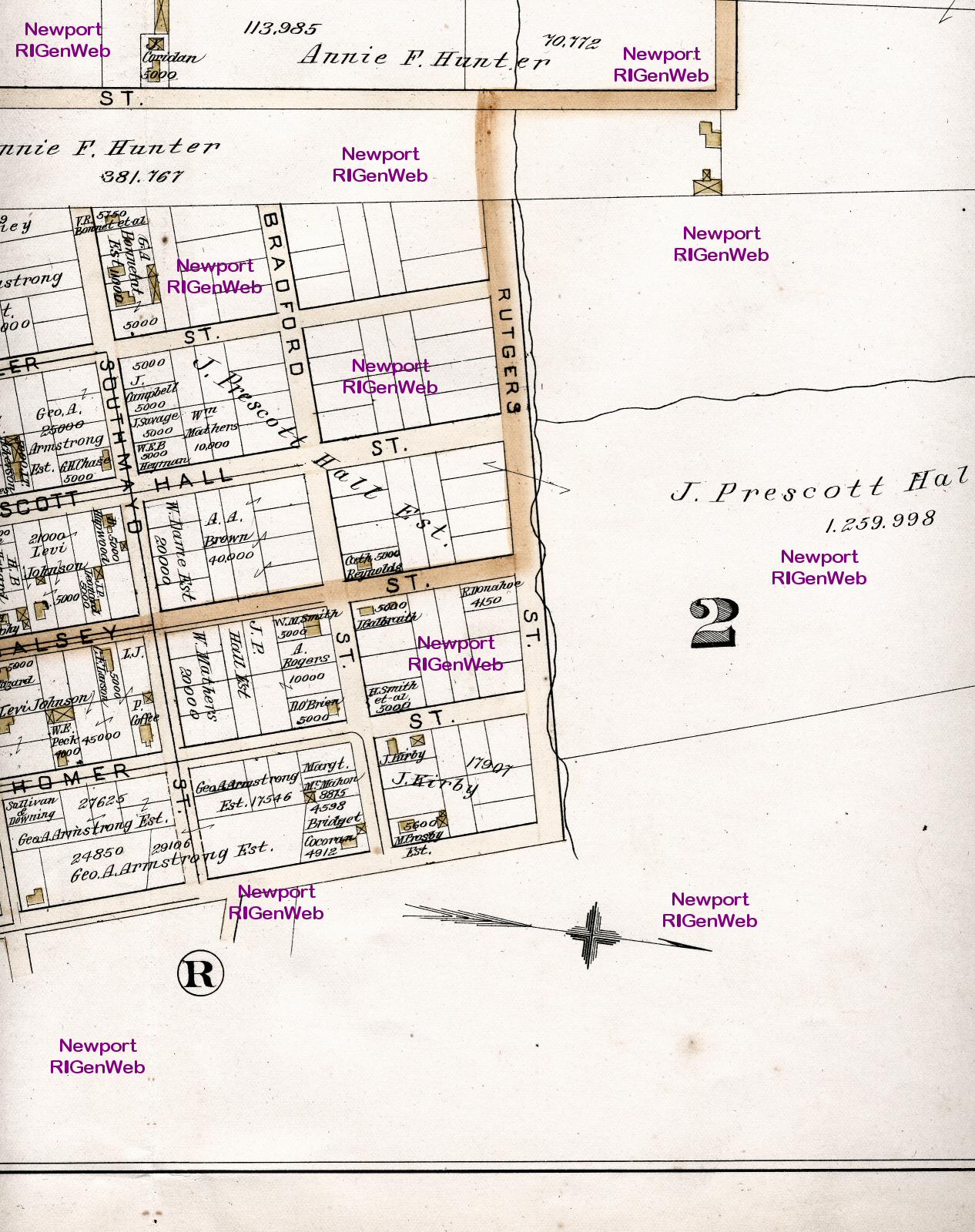
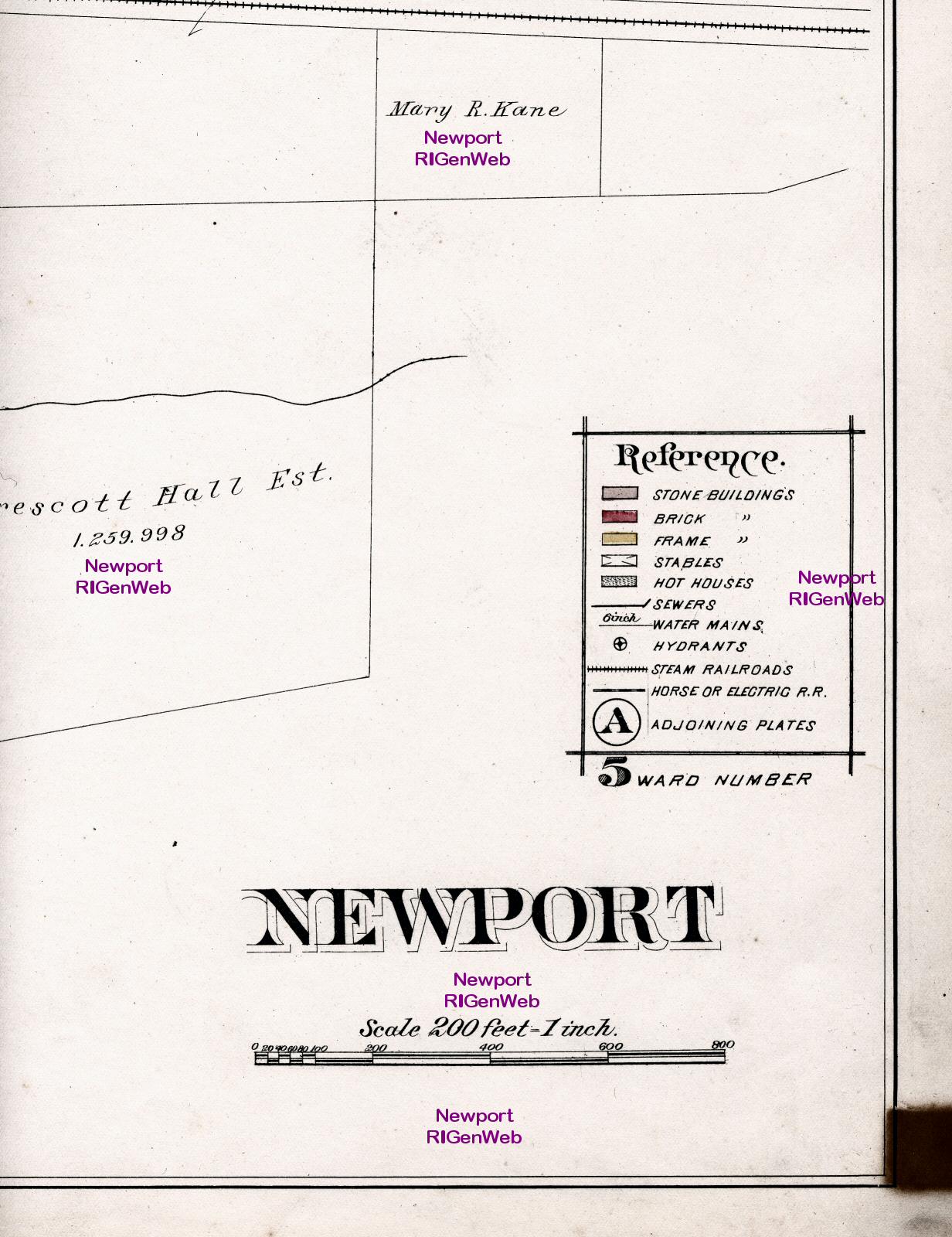
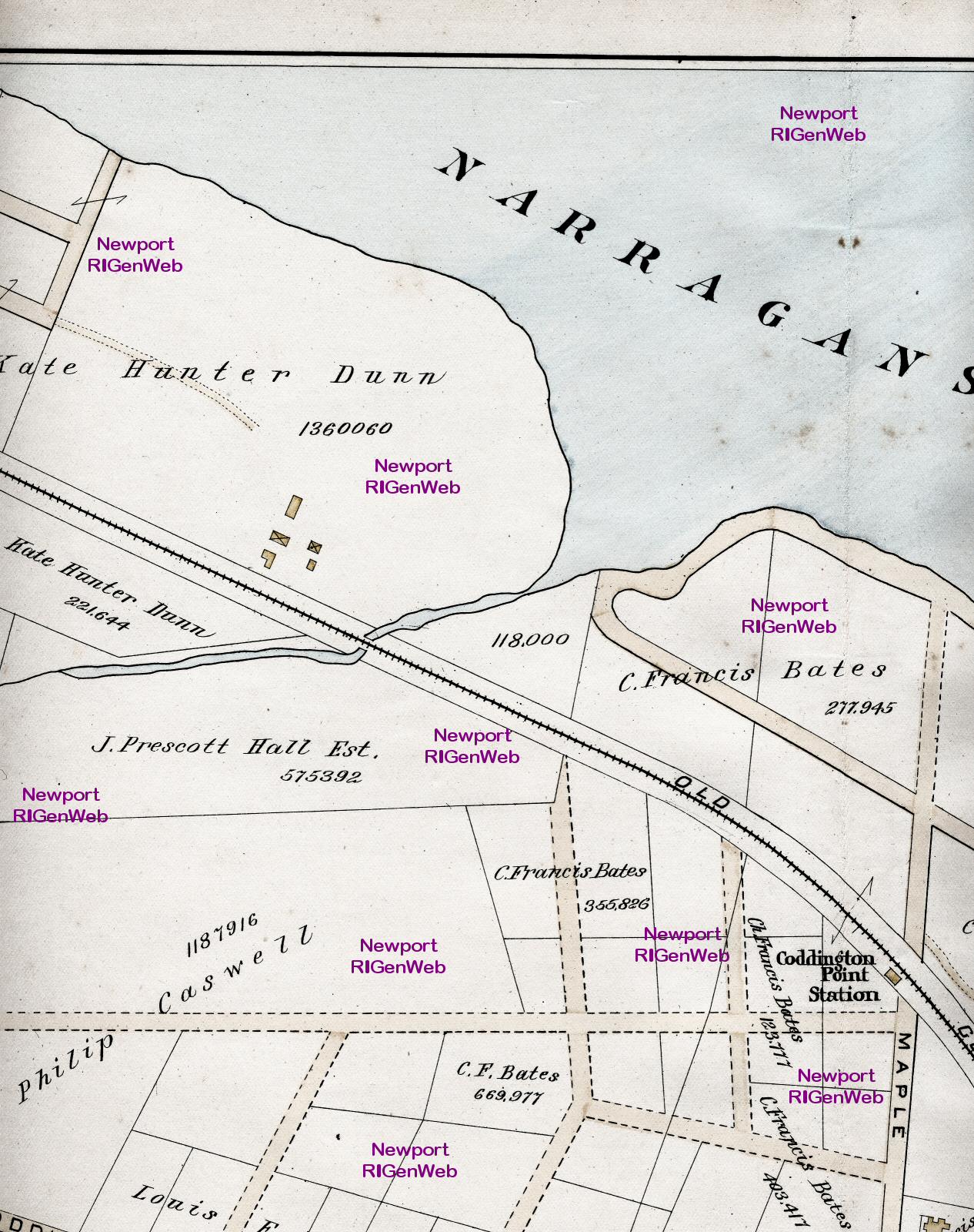
1893 Atlas of the City of Newport, 2

Click the image to enlarge

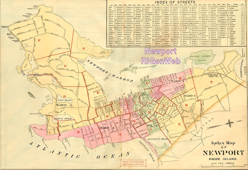
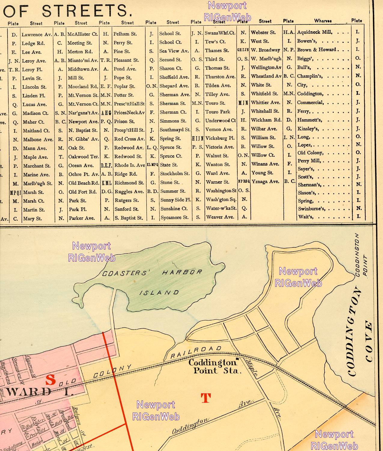
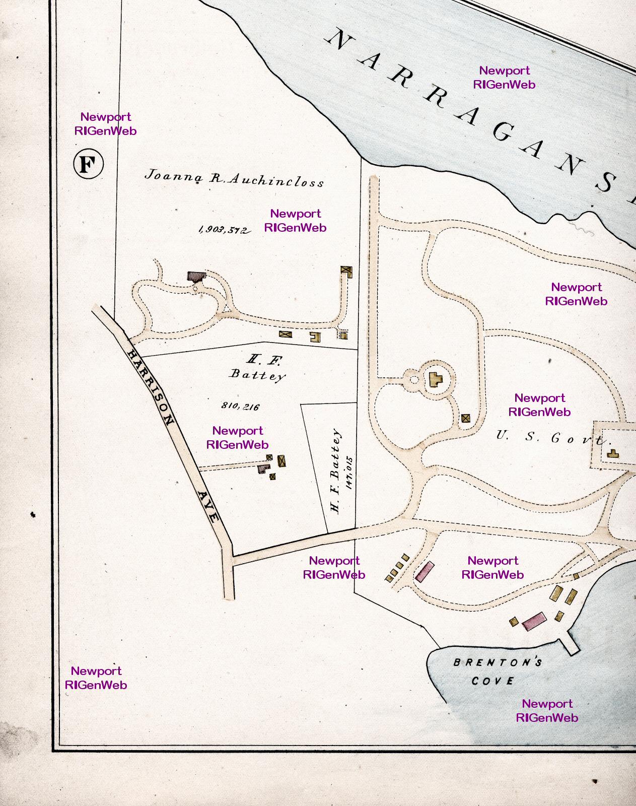
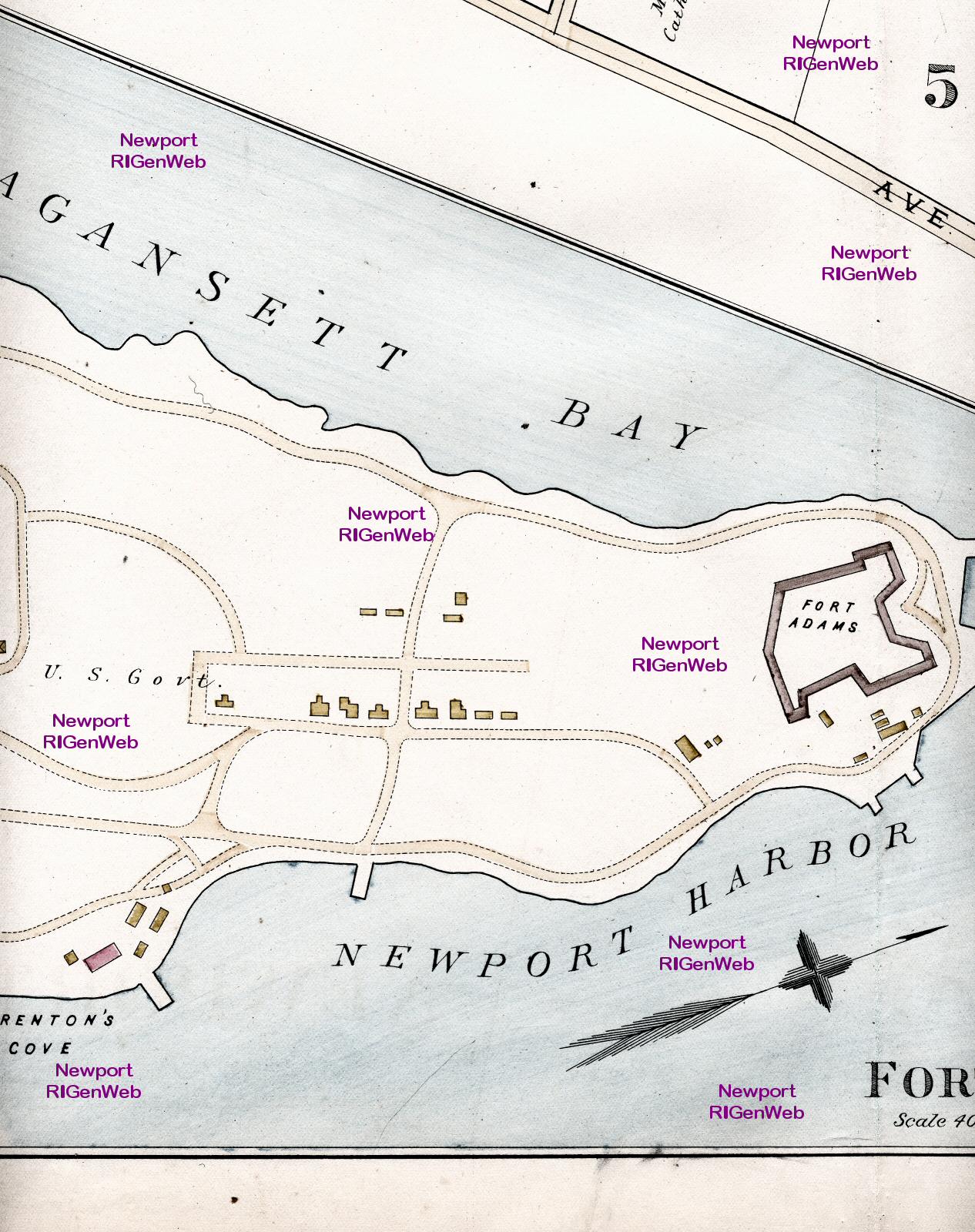
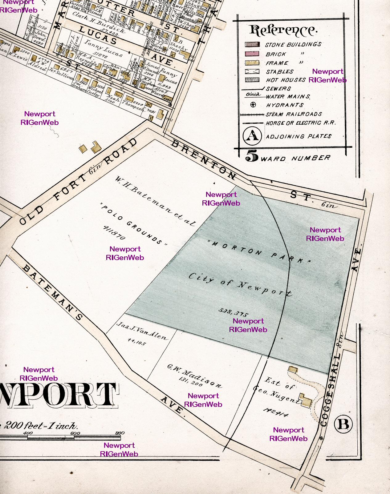
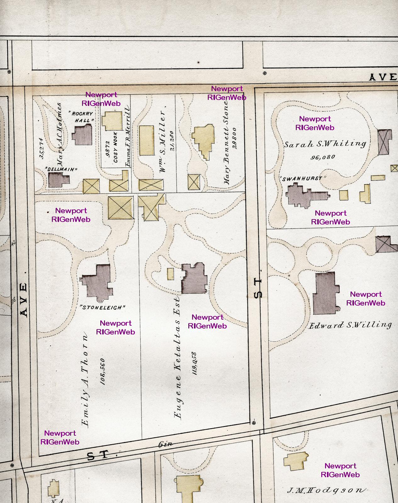
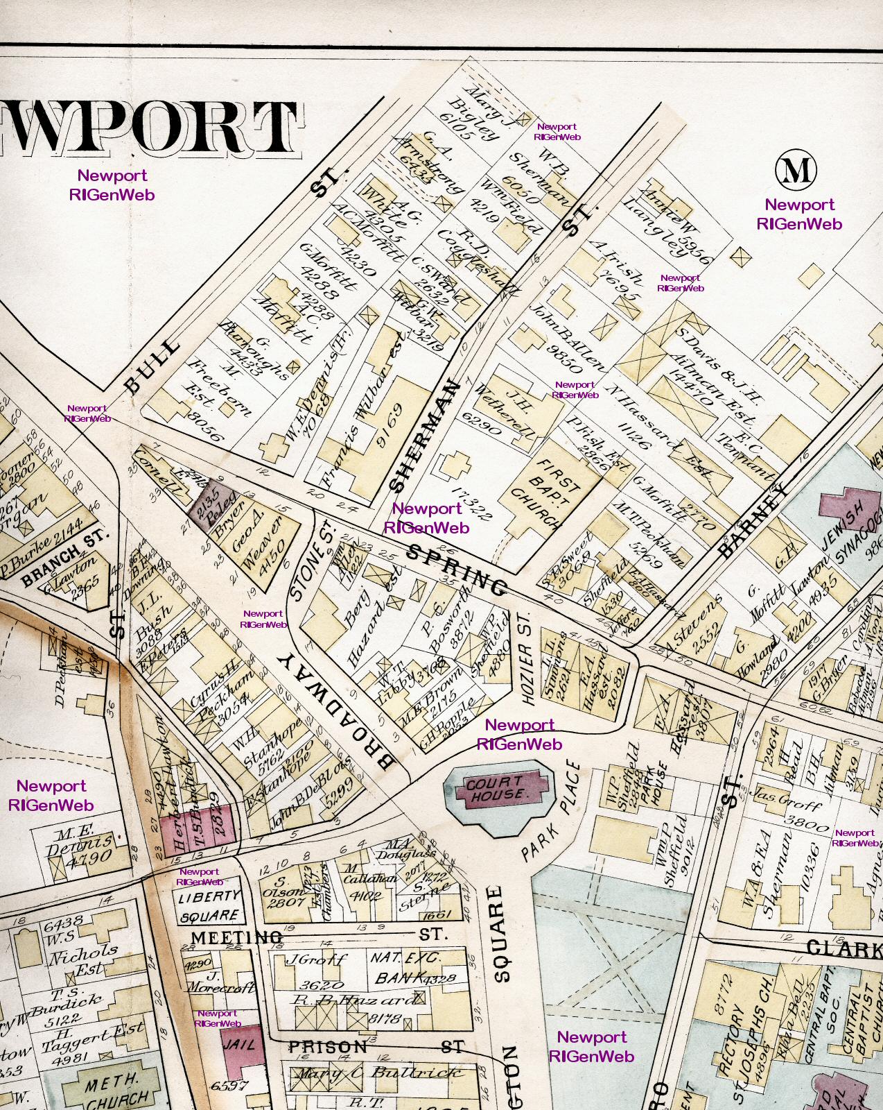
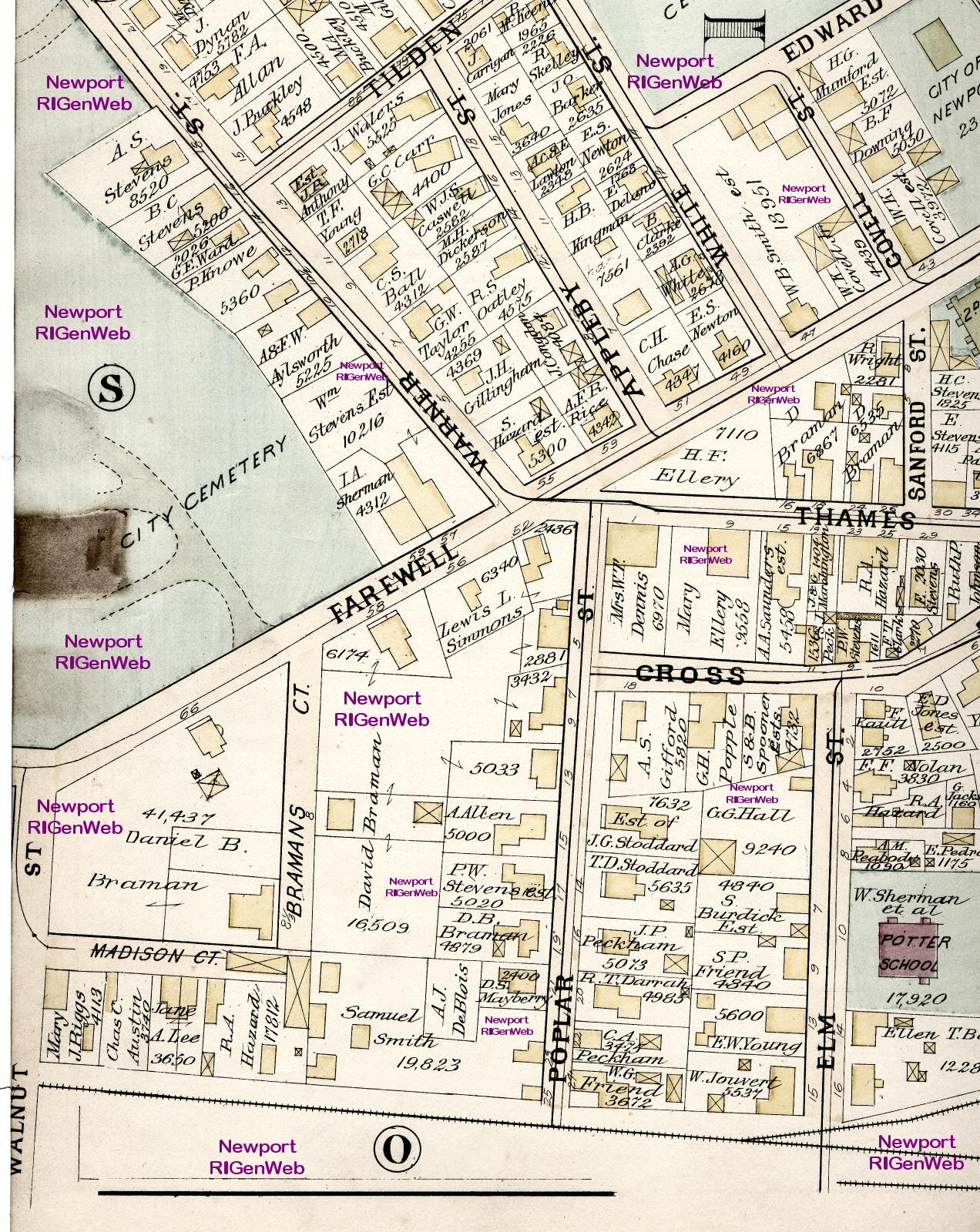
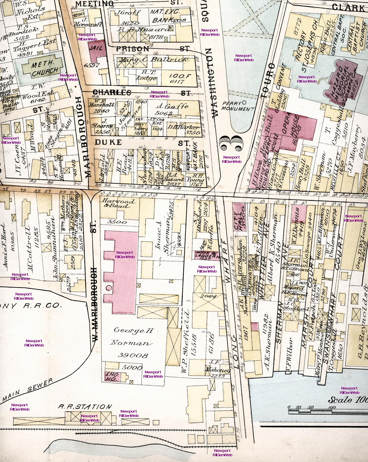
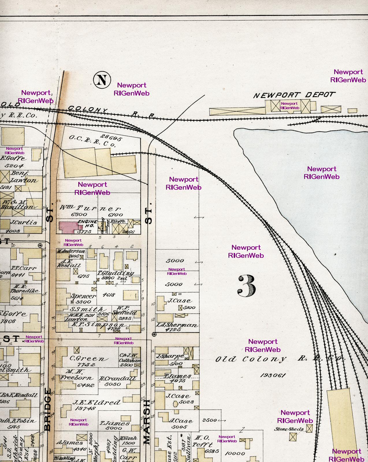
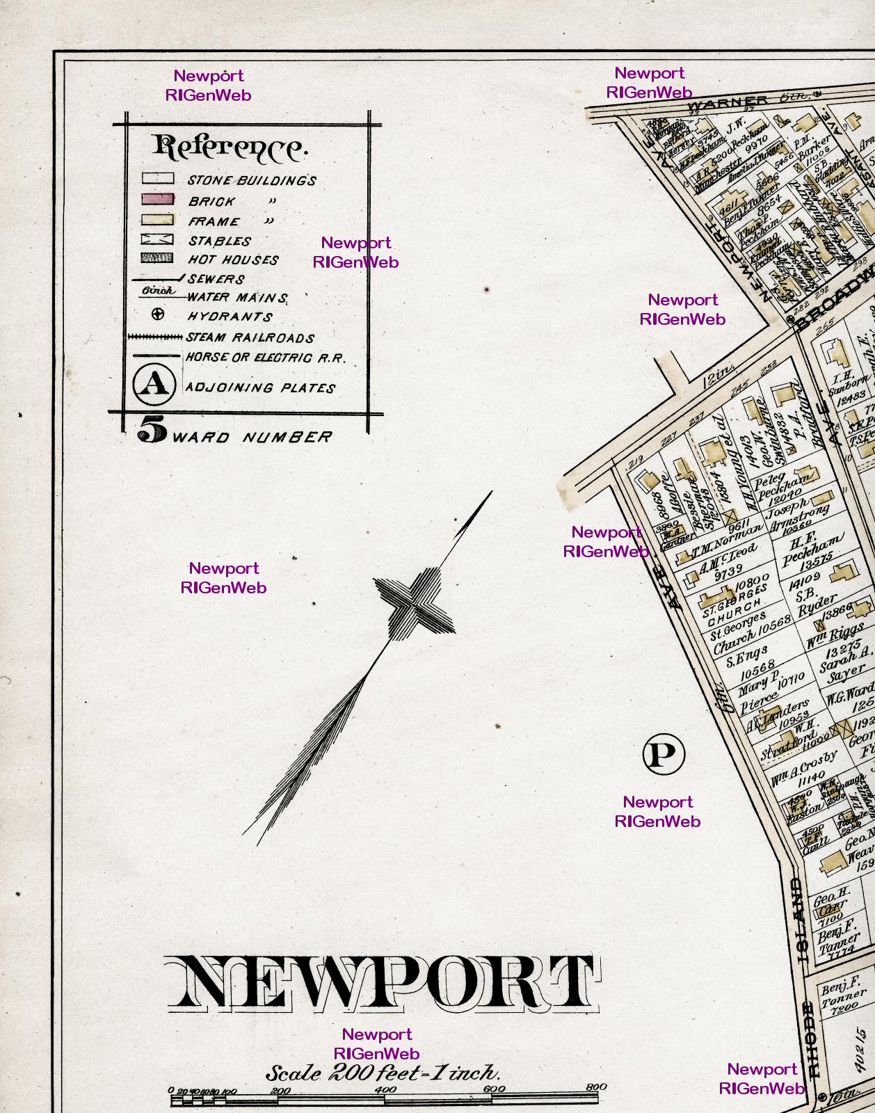
Above is the index map for the rest of the maps. It is sectioned in
this view approximately where the enlargements are split. However, the
enlarged scans overlap. These sections are very large (300 to 400 kb) so
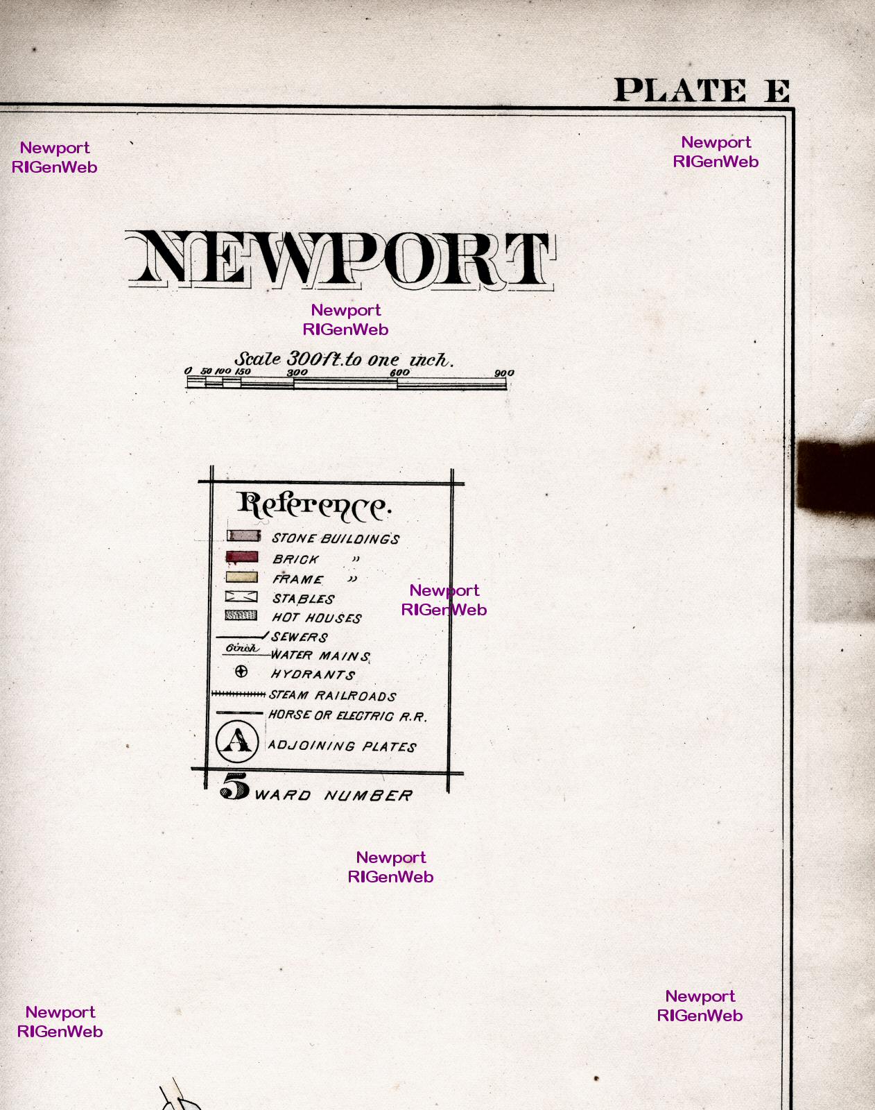
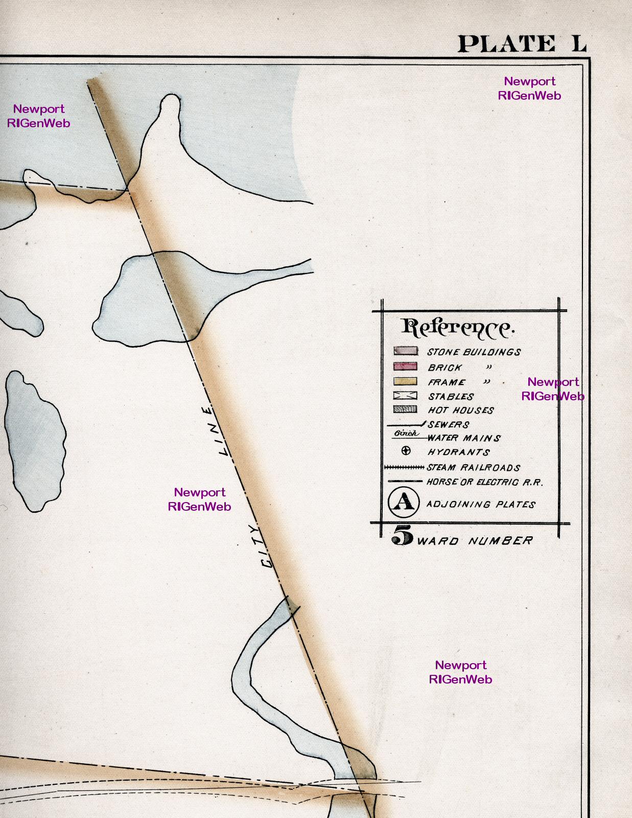
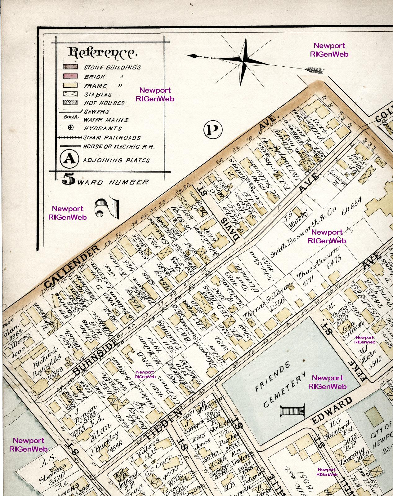
you can read the street names. The RED
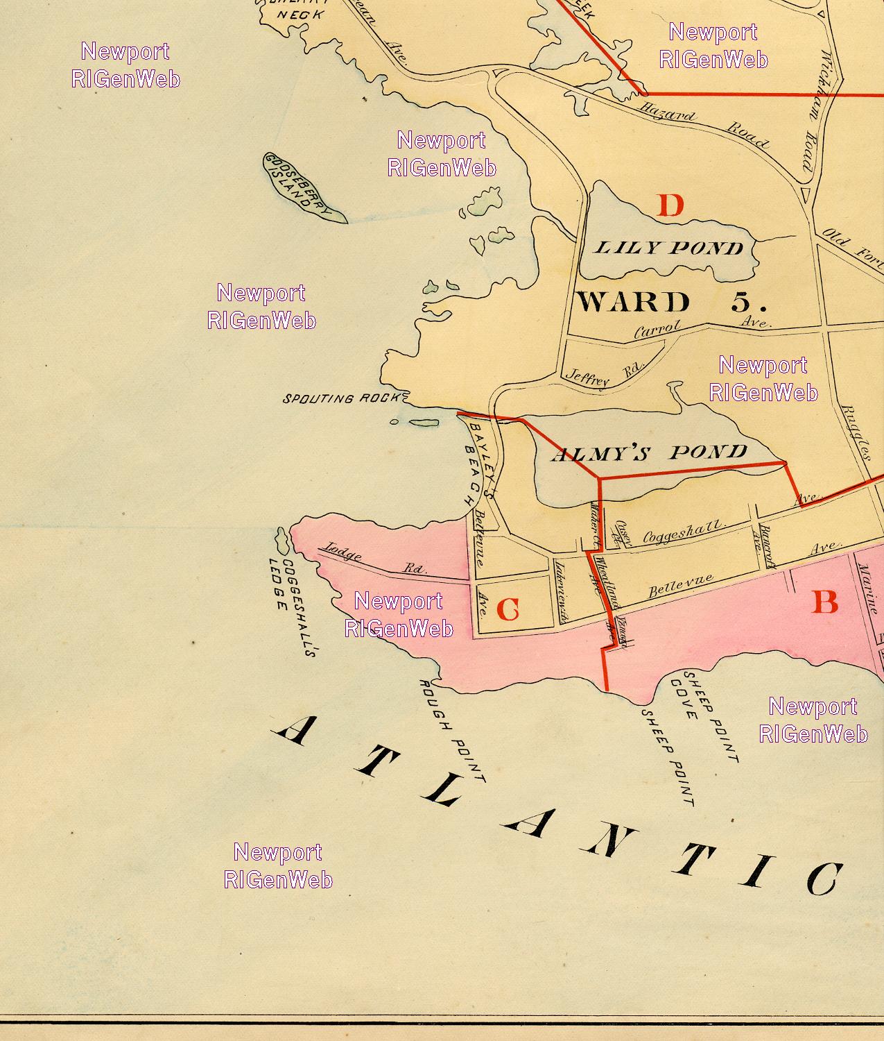
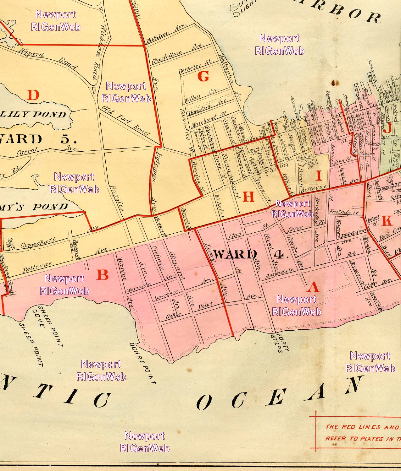
letters and outlines are the keys to the plates in the atlas. Also shown
are the Wards of Newport.
| Index 1 | Index
2 | Index 3 | Index
4 | Index 5 | Index
6 | Index 6 | Index
7 | Index 8 |
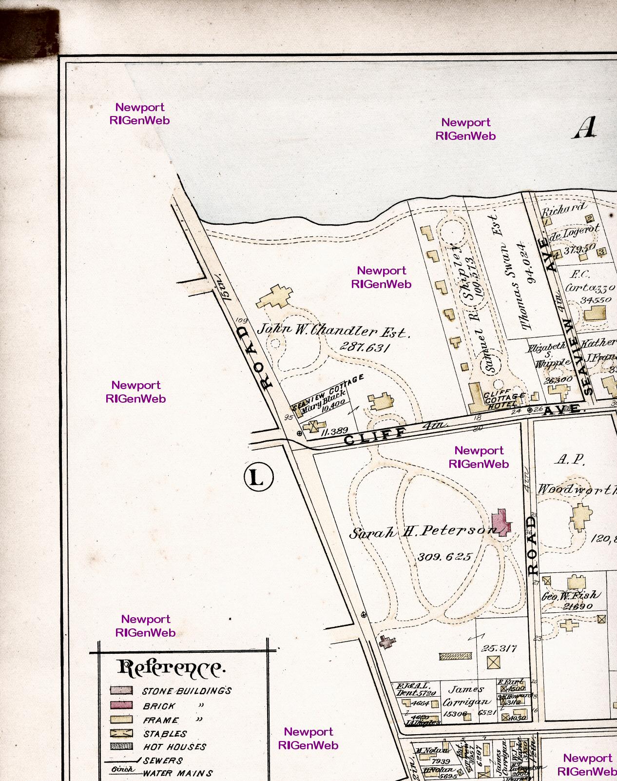
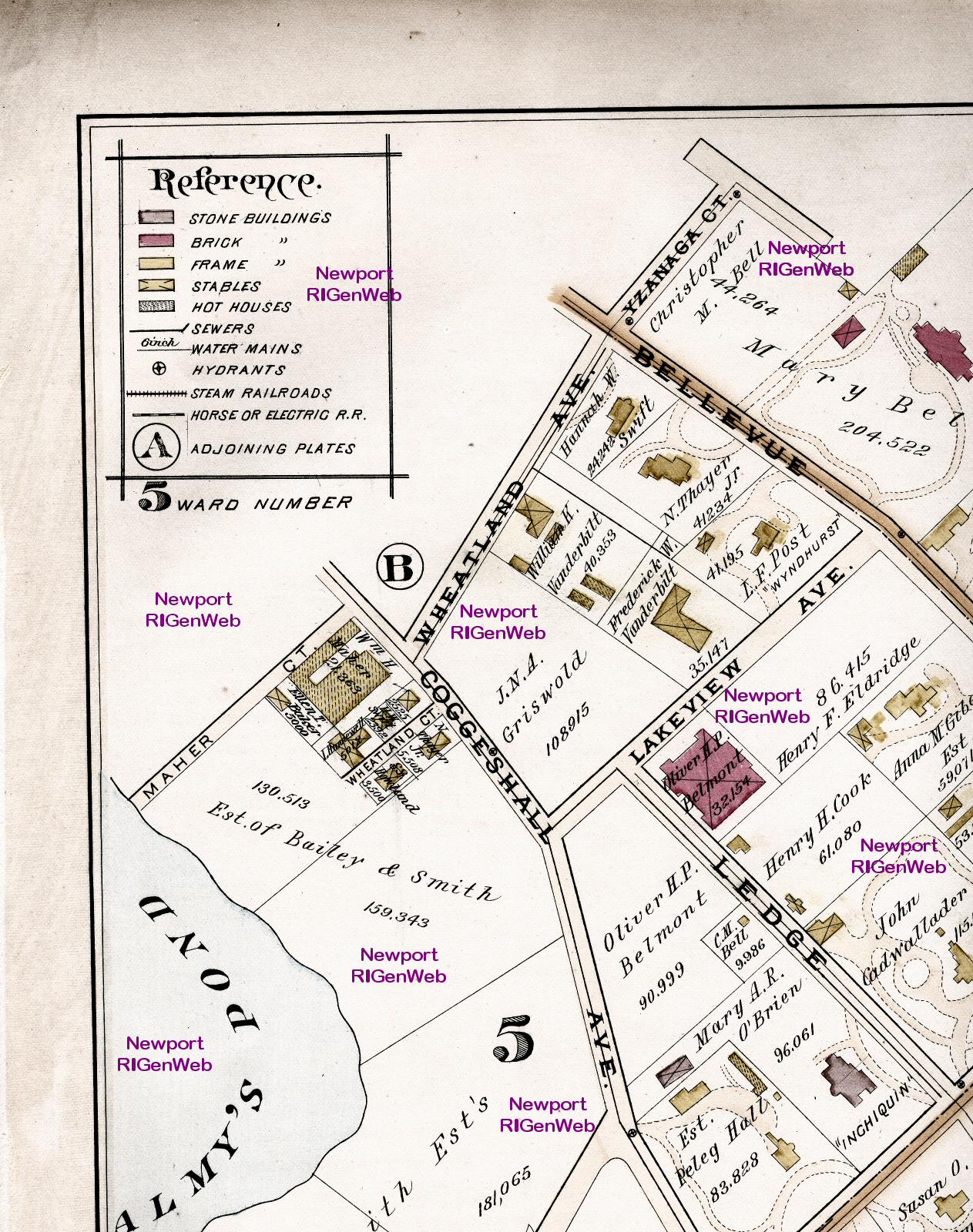
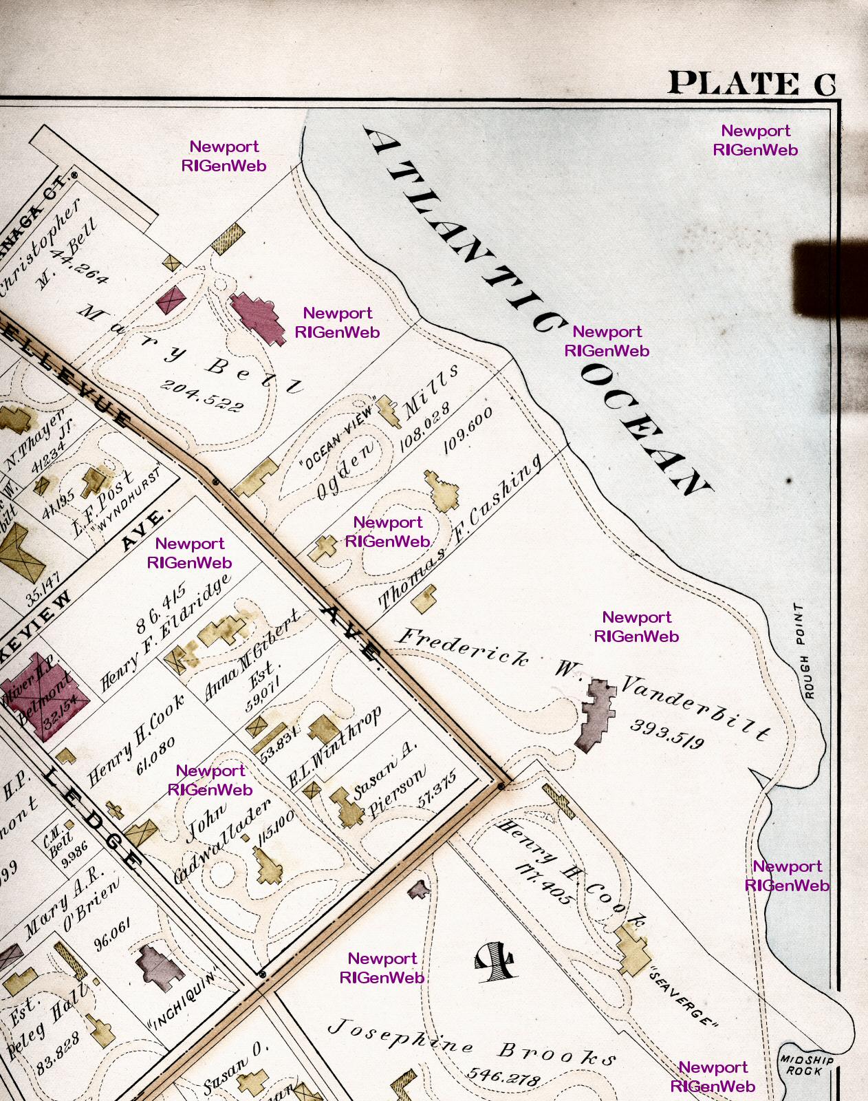
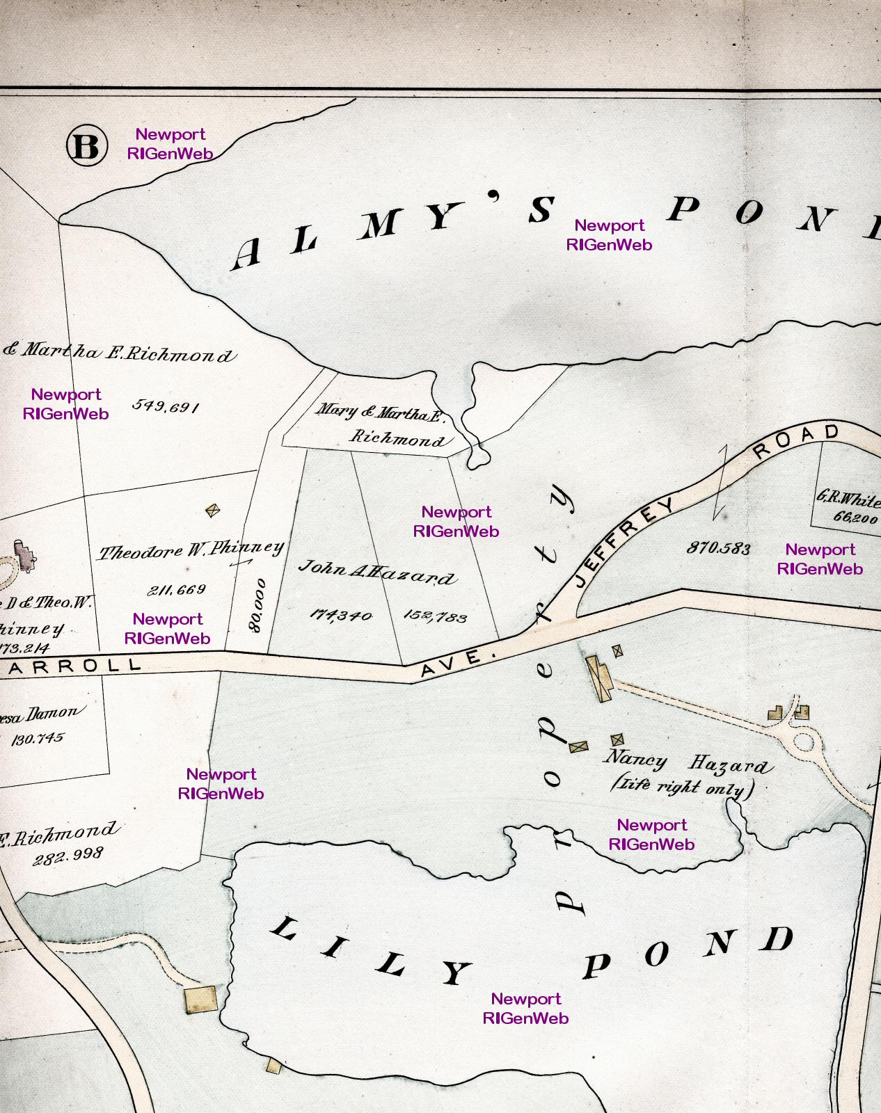
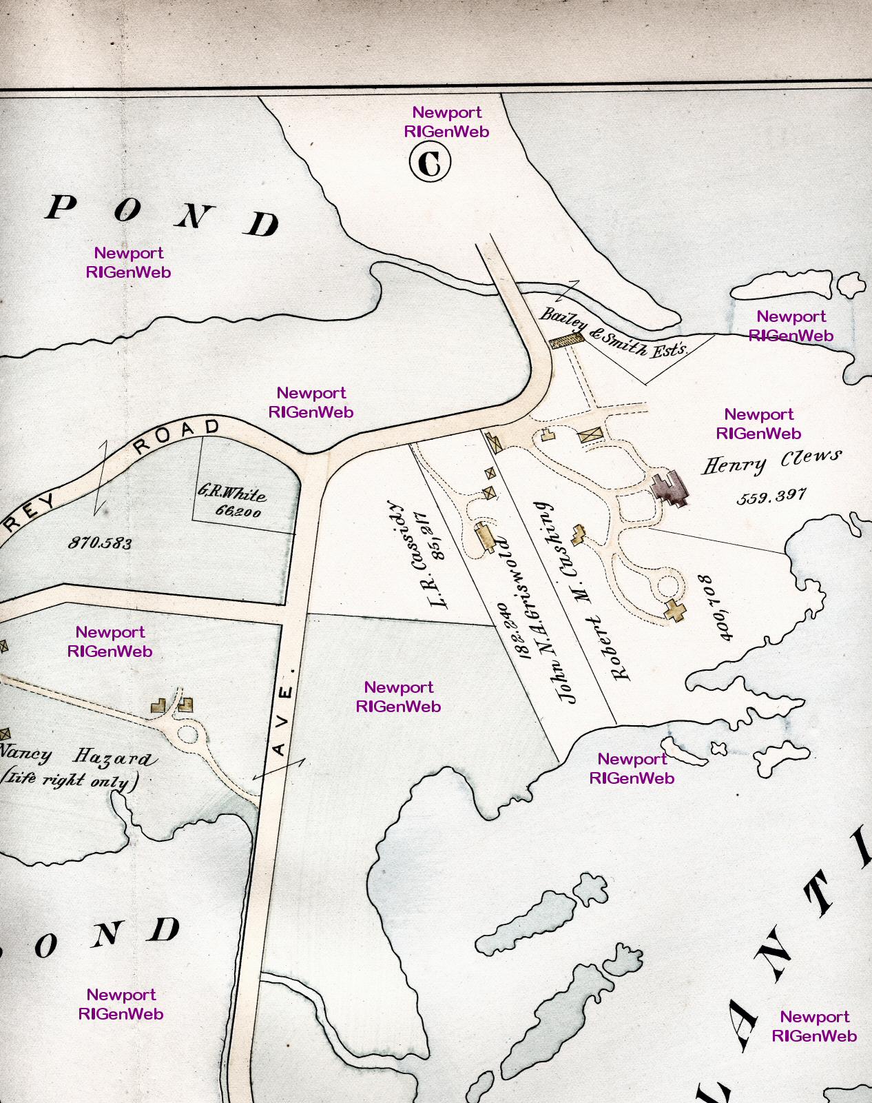
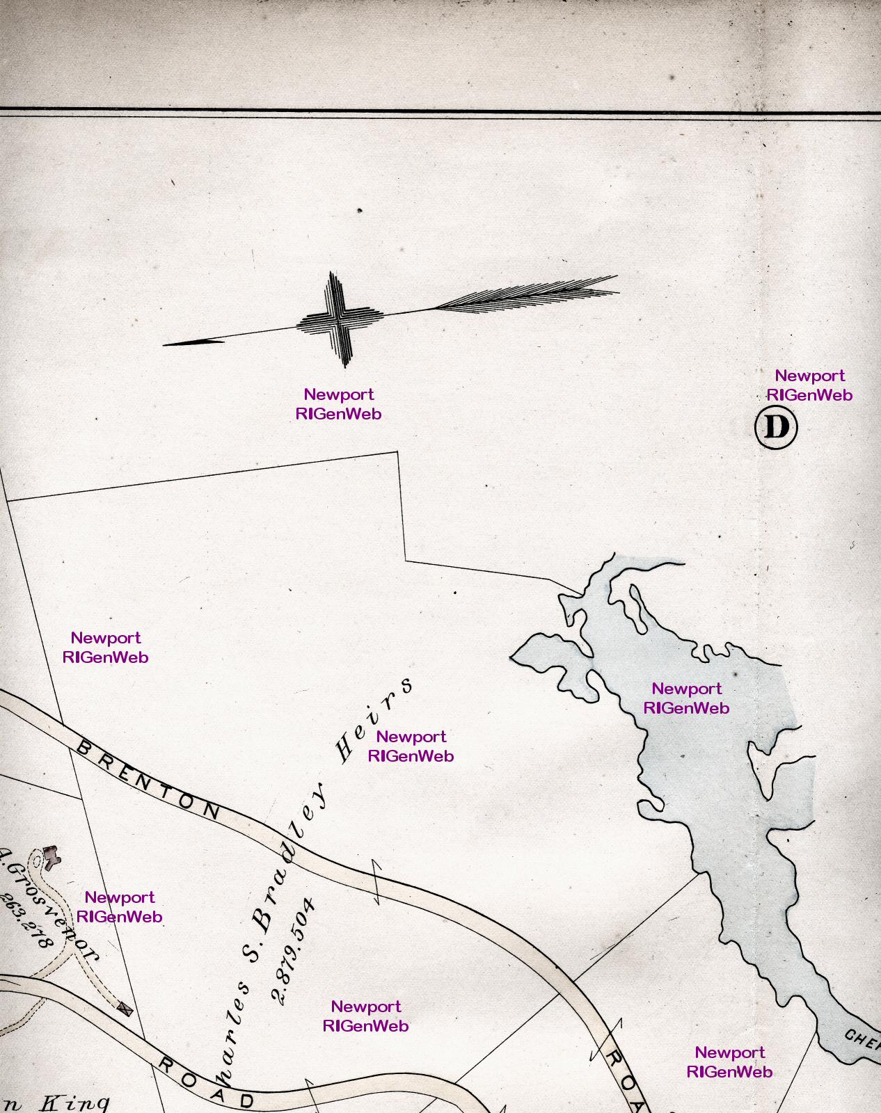
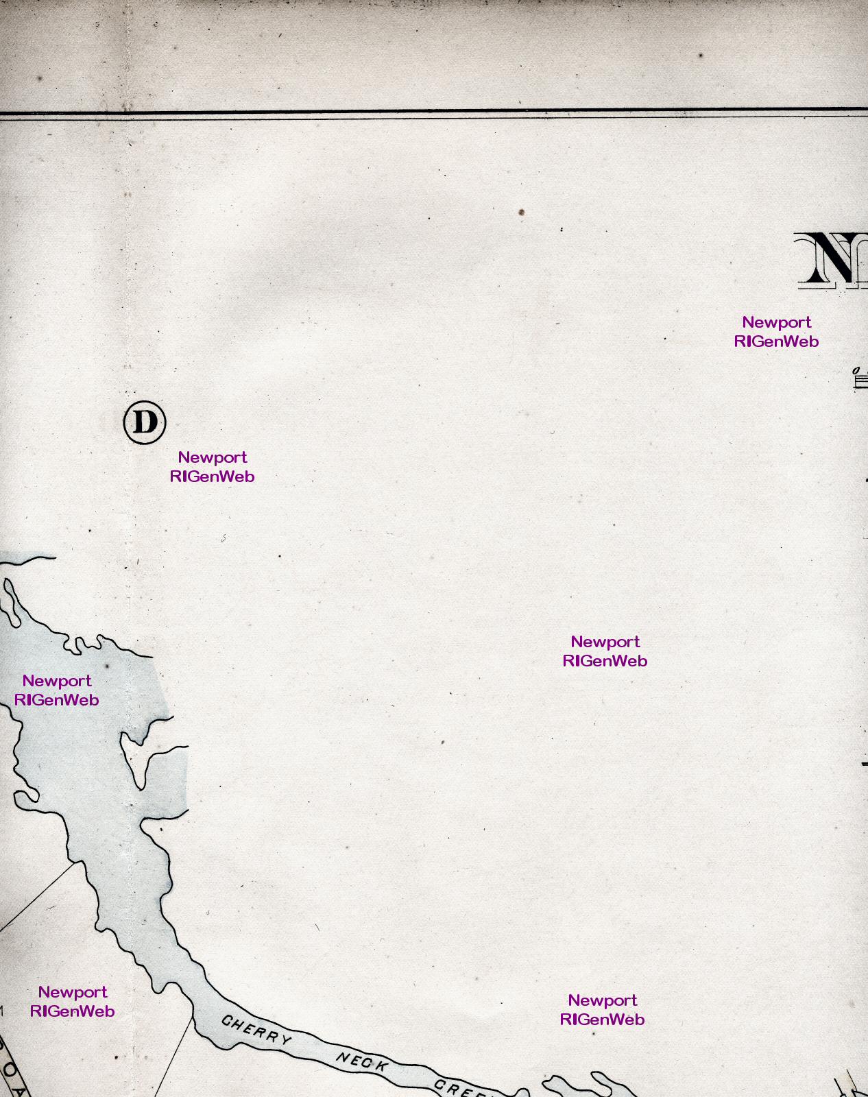
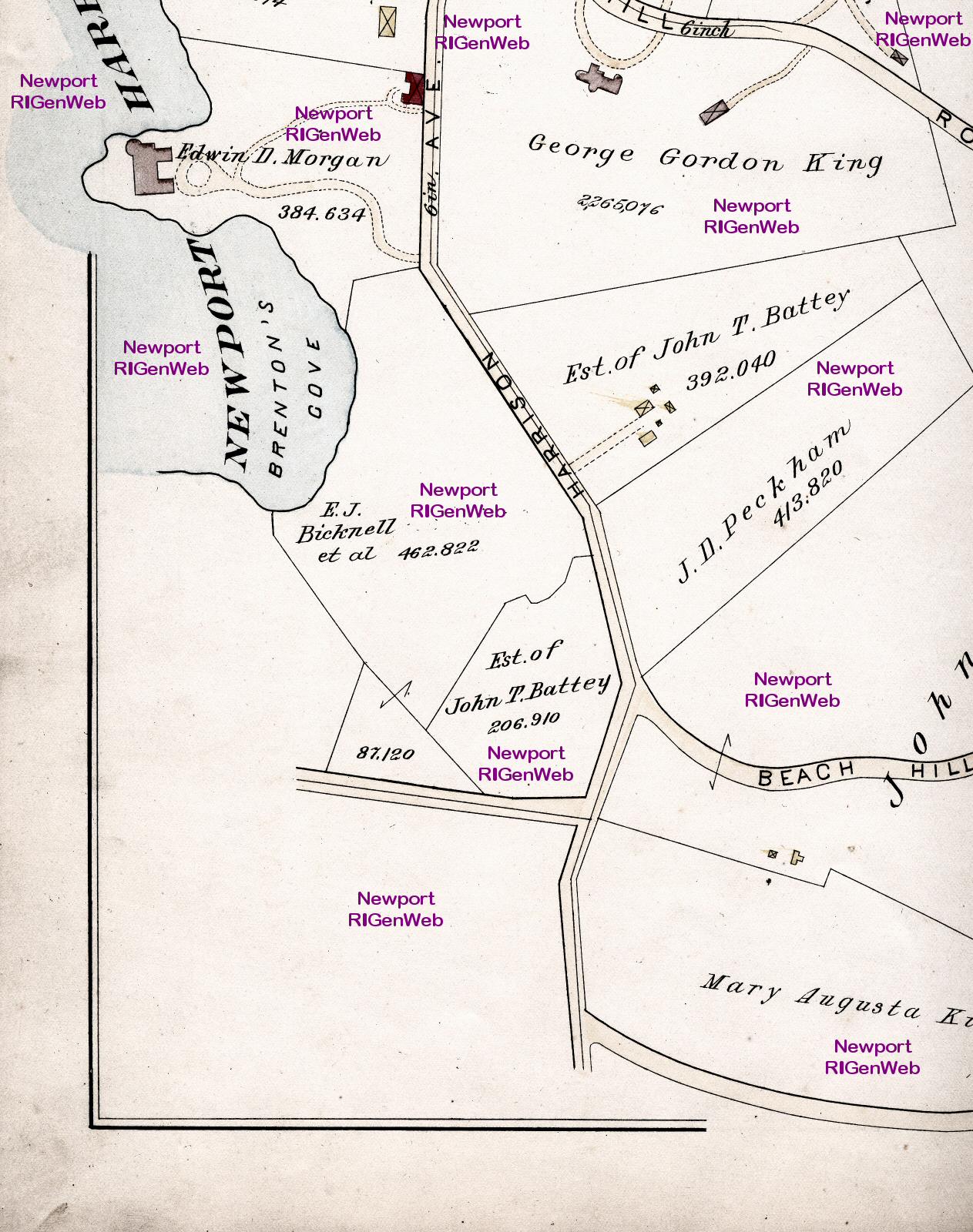
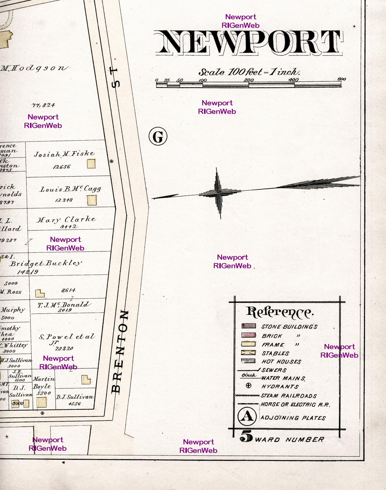
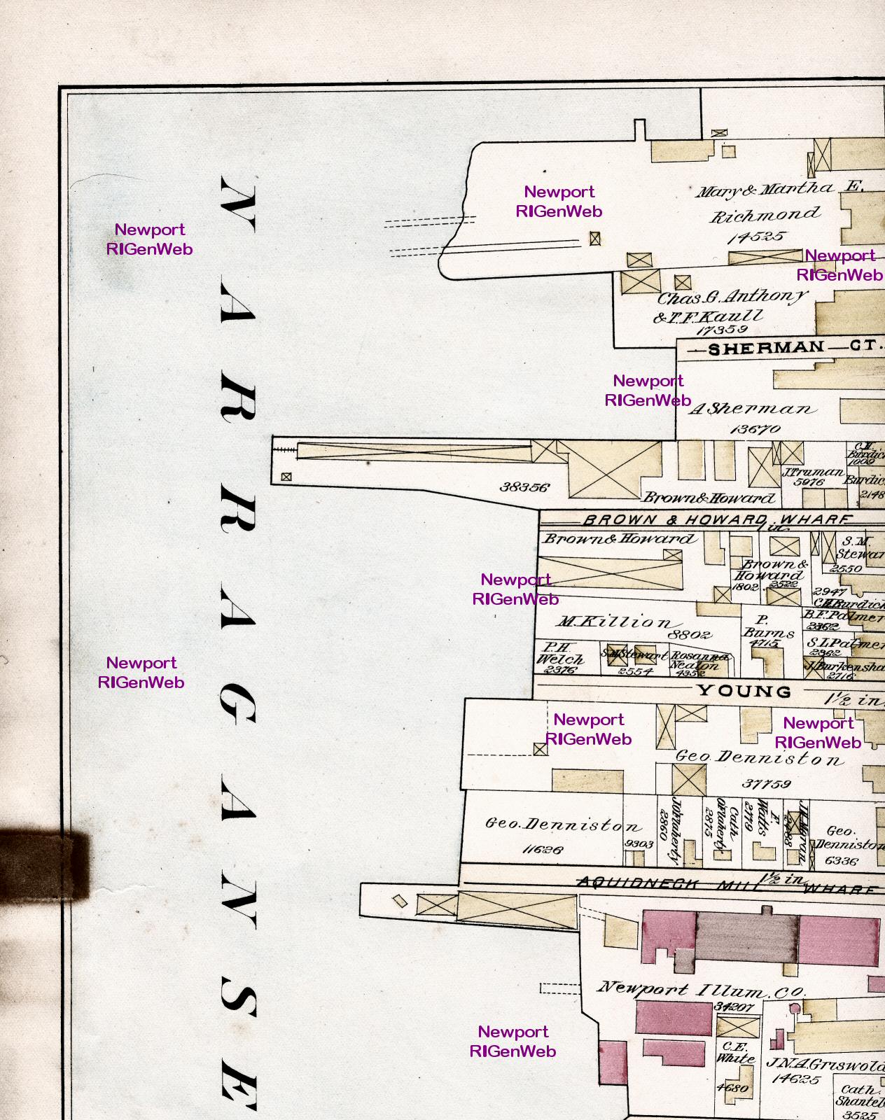
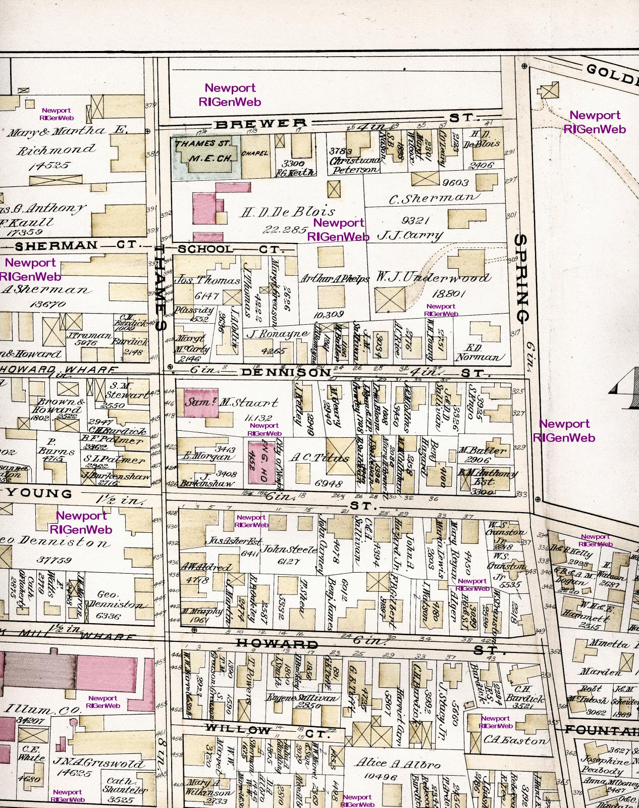
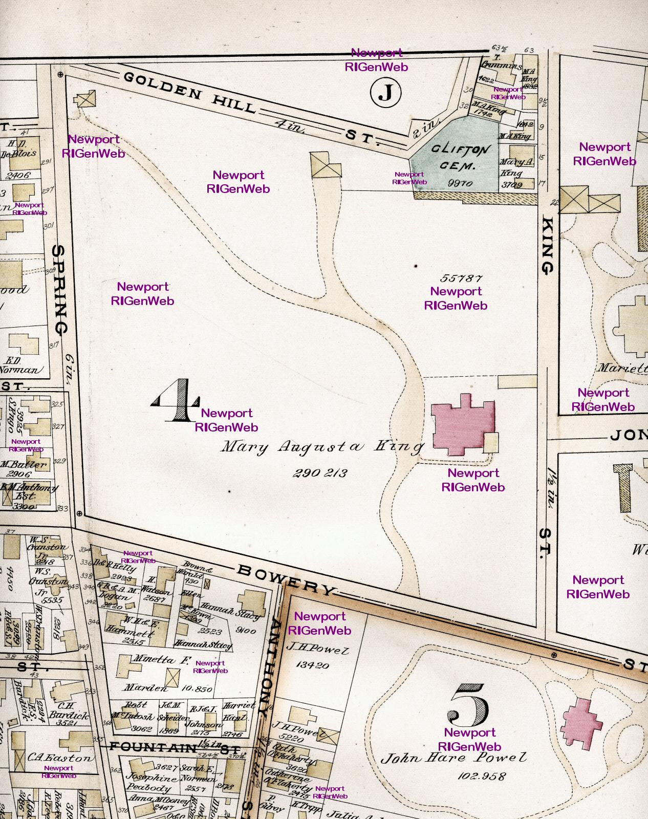
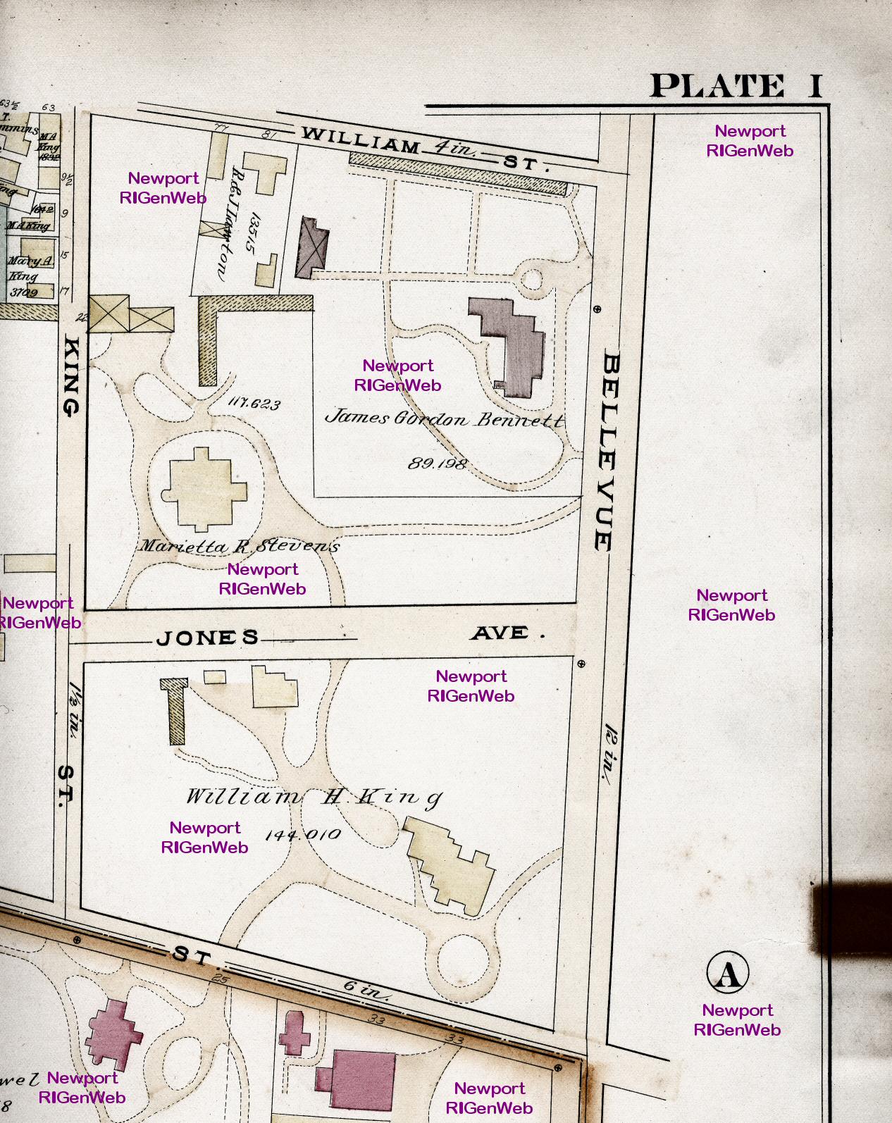
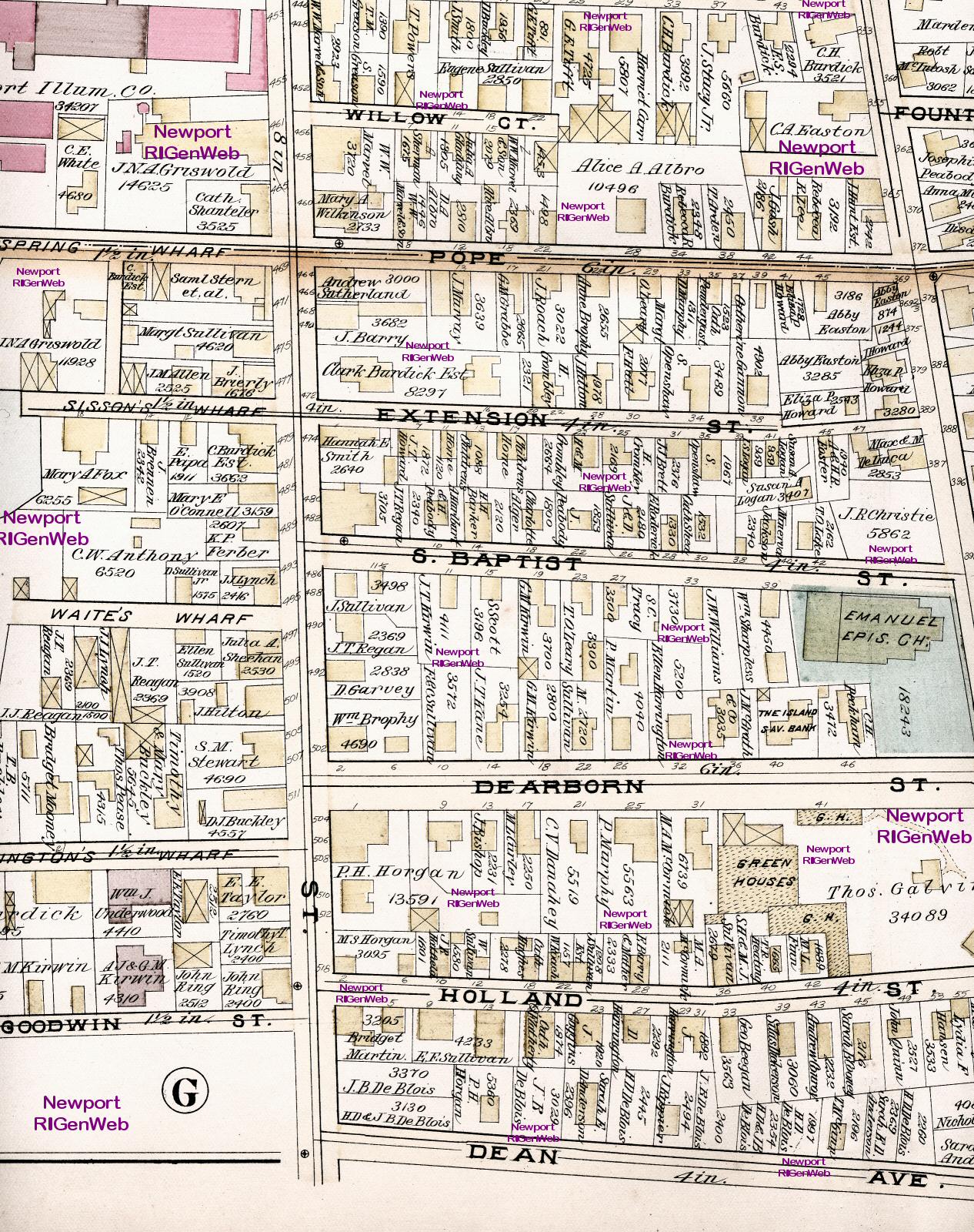
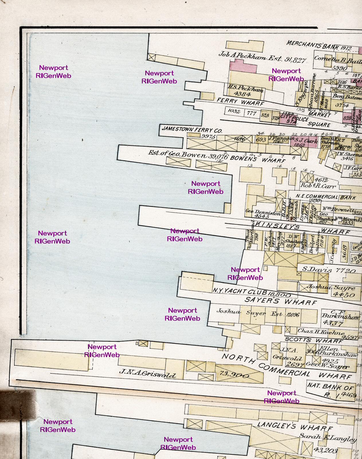
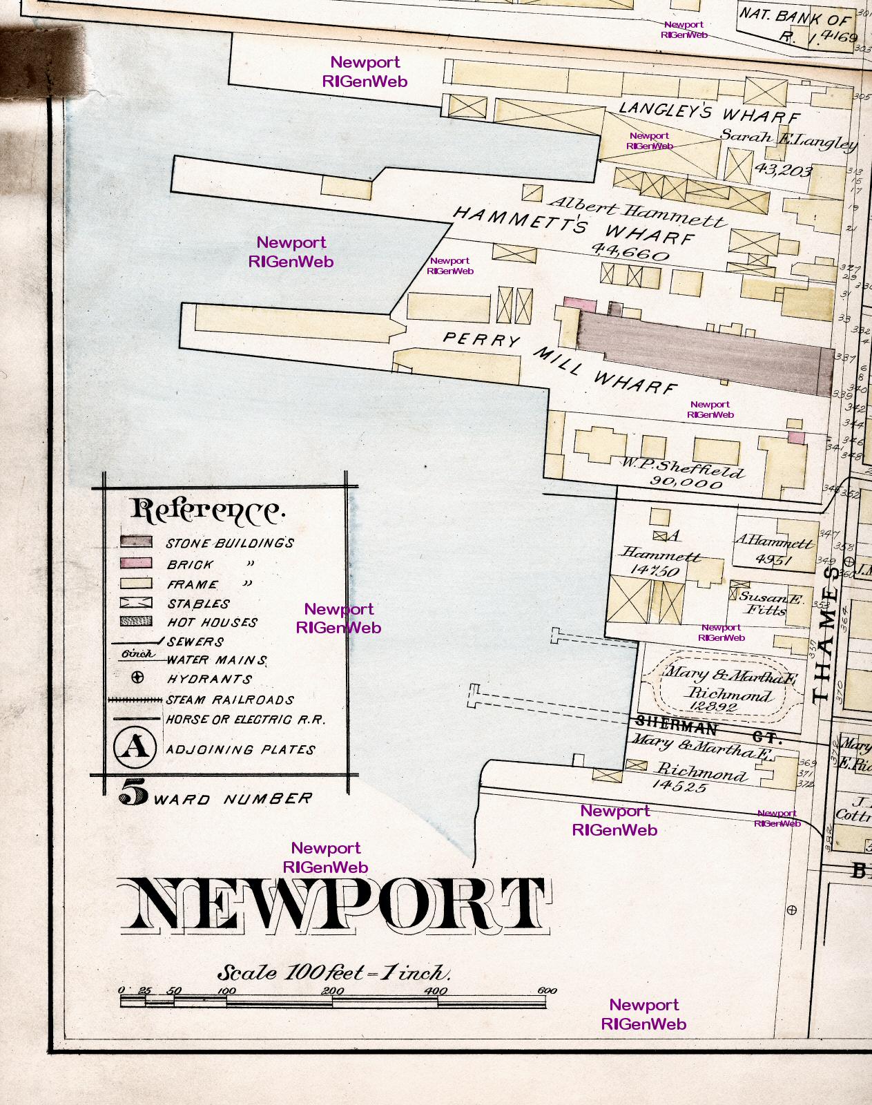
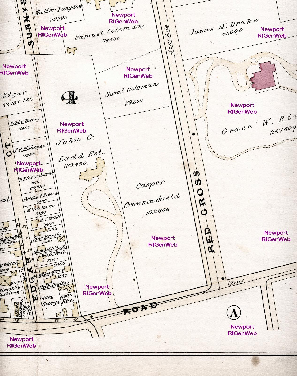
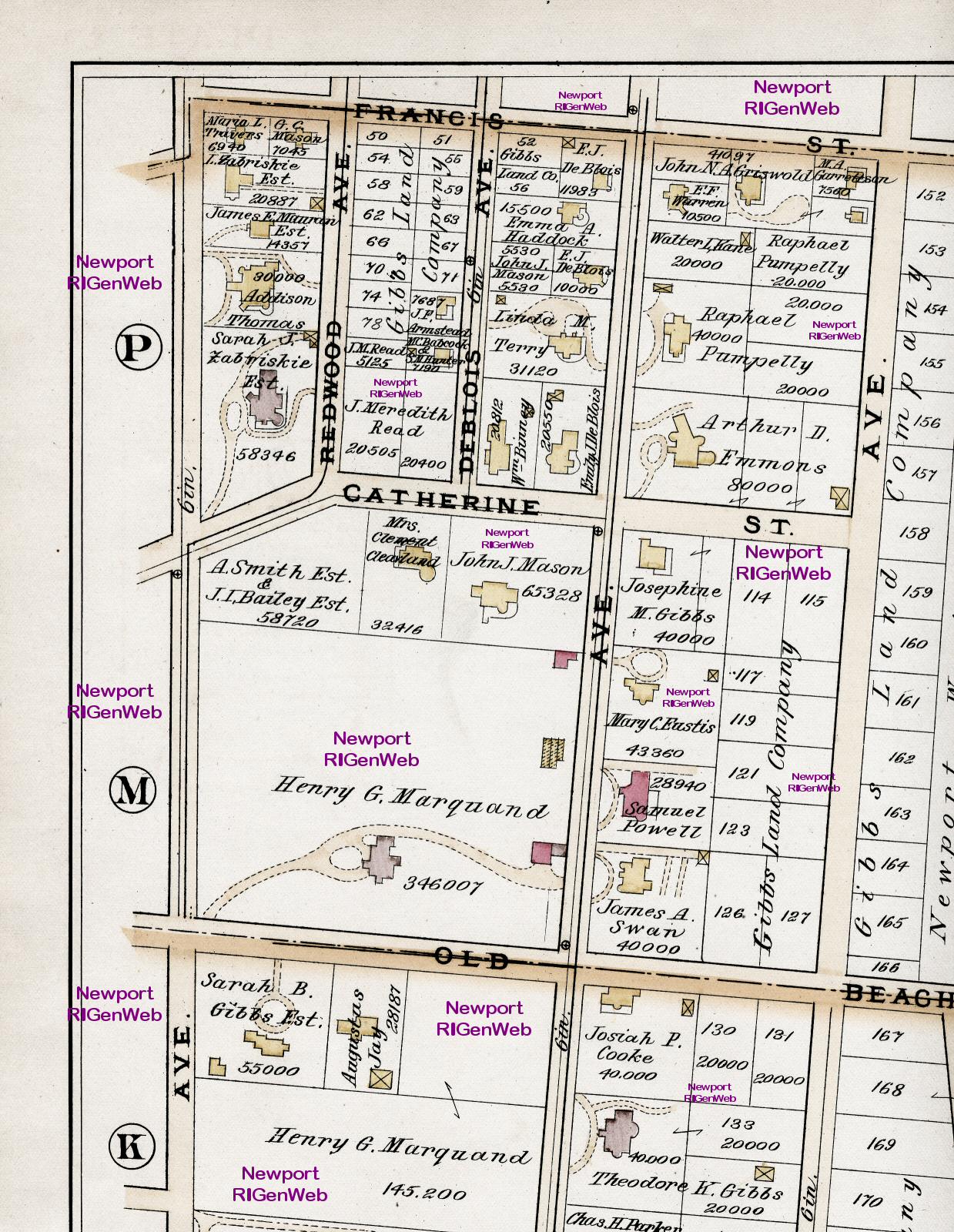
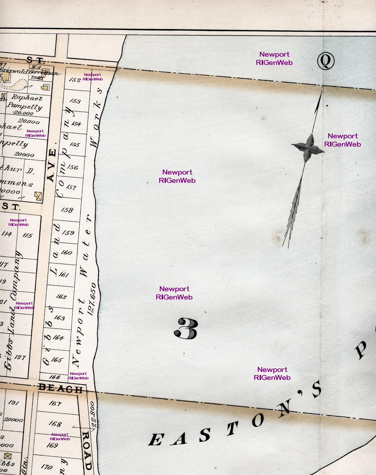
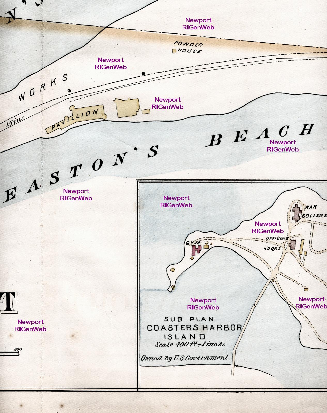
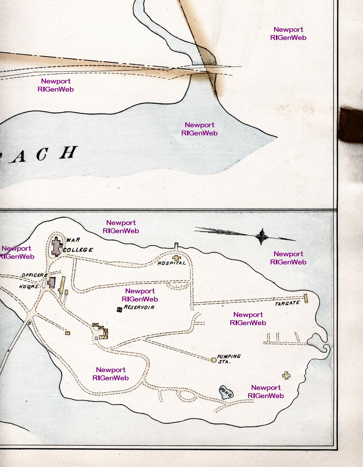
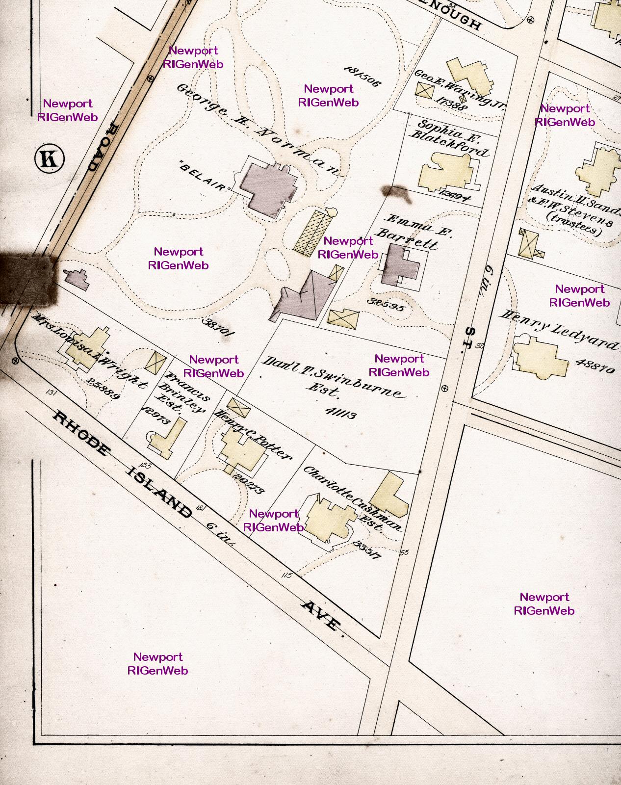
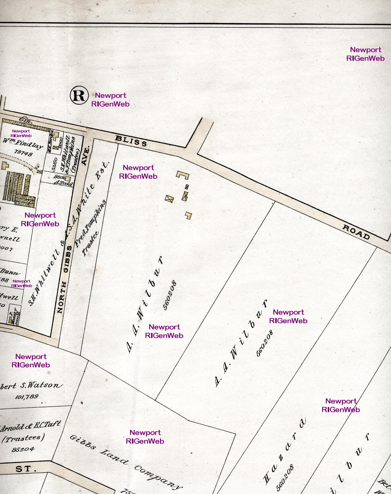
The individual plates of the atlas are scanned in the same
pattern as the index page for a total of eight scans per plate. The one
exception is plate C, which is half the size. Scan sizes run from 300 kb
to about 650 kb, depending upon the colors. Although the scans are all
done at the same resolution, the scale of the maps is not consistent from
plate to plate, so you will not be able to paste sections together.
These are configured for viewing on your computer. If
the image fits the screen in Internet Explorer, click on the image and
then click on the square icon in the lower right corner to expand it to
full size. For printing, save and use an imaging program.
Links to Scans of Individual
Plates
| A | B | C | D
| E | F | G | H
| I | J | K | L
| M | N | O | P
| Q | R | S | T
| Middletown & Portsmouth |
Plate A: Top row: section
1; section 2; section
3; section 4;
Bottom row: section 5; section
6; section 7; section
8
Plate B: Top row: section
1; section 2; section
3; section 4;
Bottom row: section 5; section
6; section 7; section
8
Plate C: Top row: section
1; section 2;
Bottom row: section 3; section
4
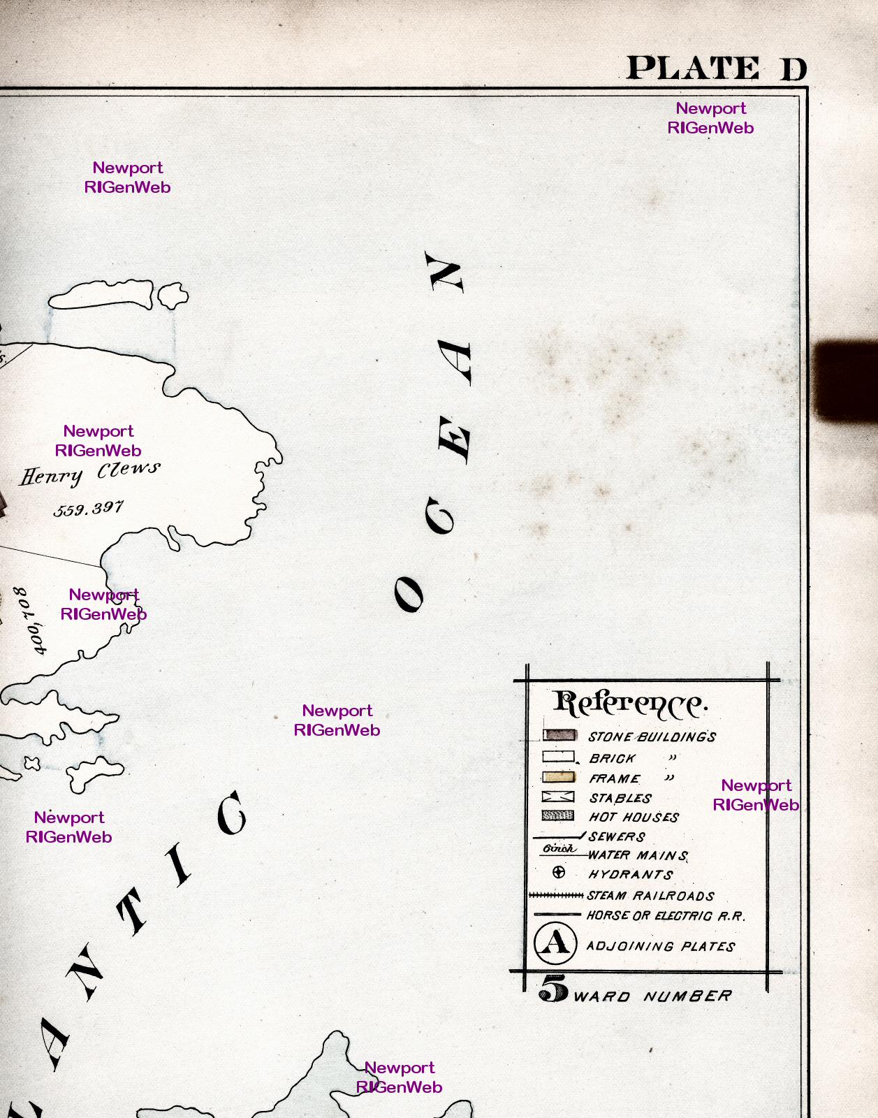
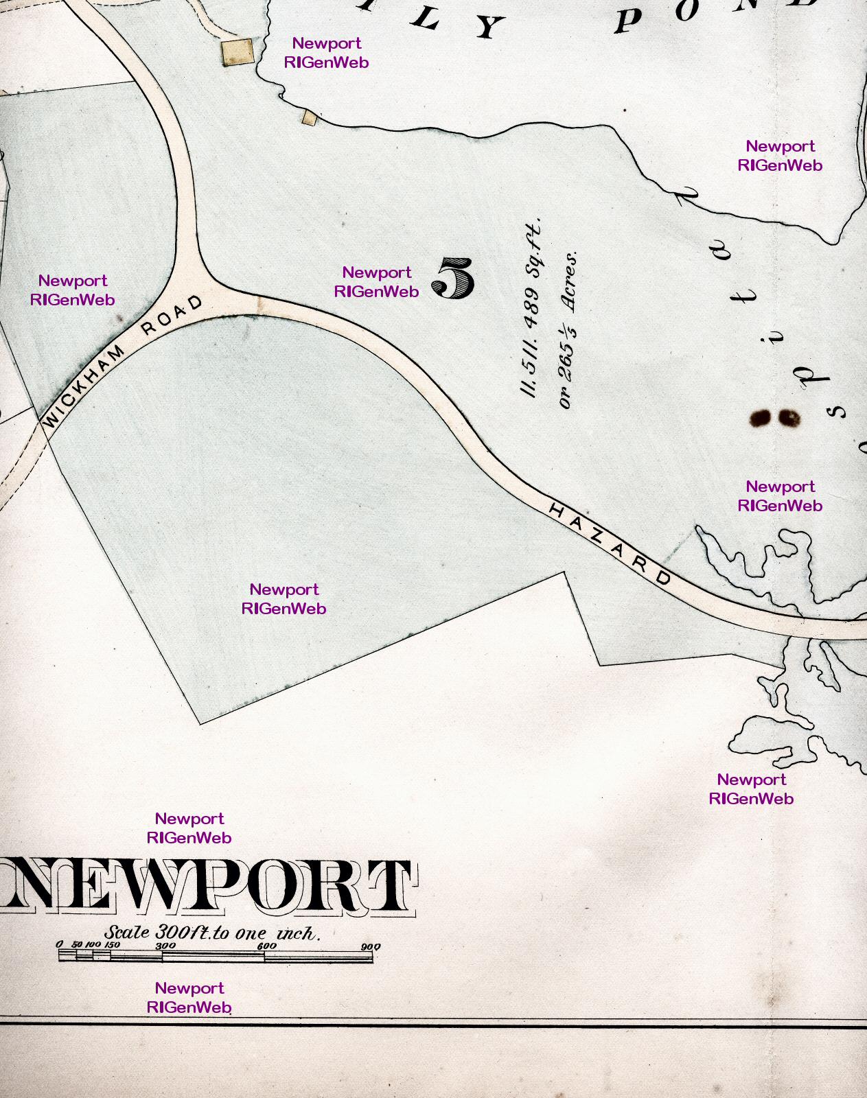
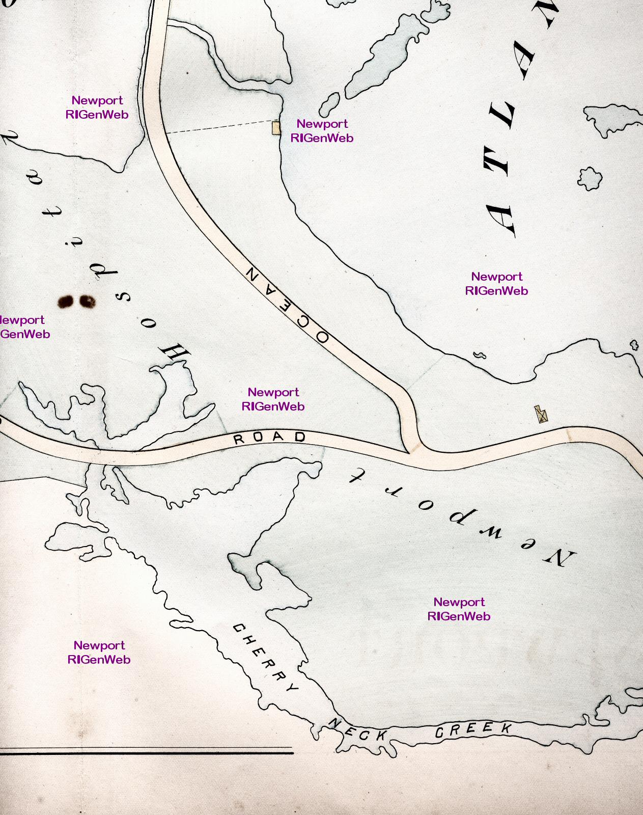
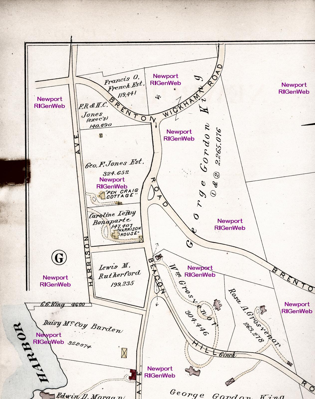
Plate D: Top row: section
1; section 2; section
3; section 4;
Bottom row: section 5; section
6; section 7; section
8
Plate E: Top row: section
1; section 2; section
3; section 4;
Bottom row: section 5; section
6; section 7; section
8
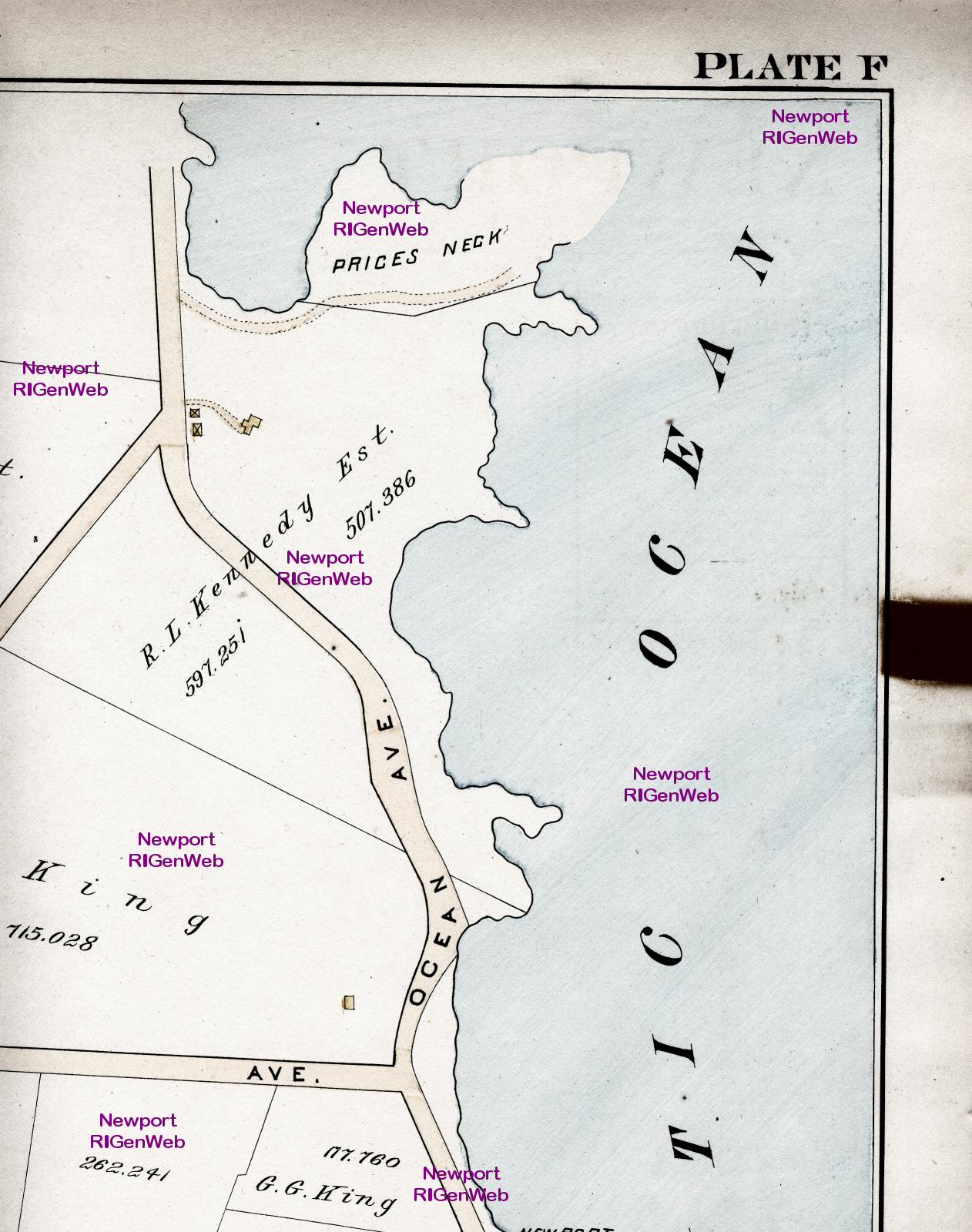
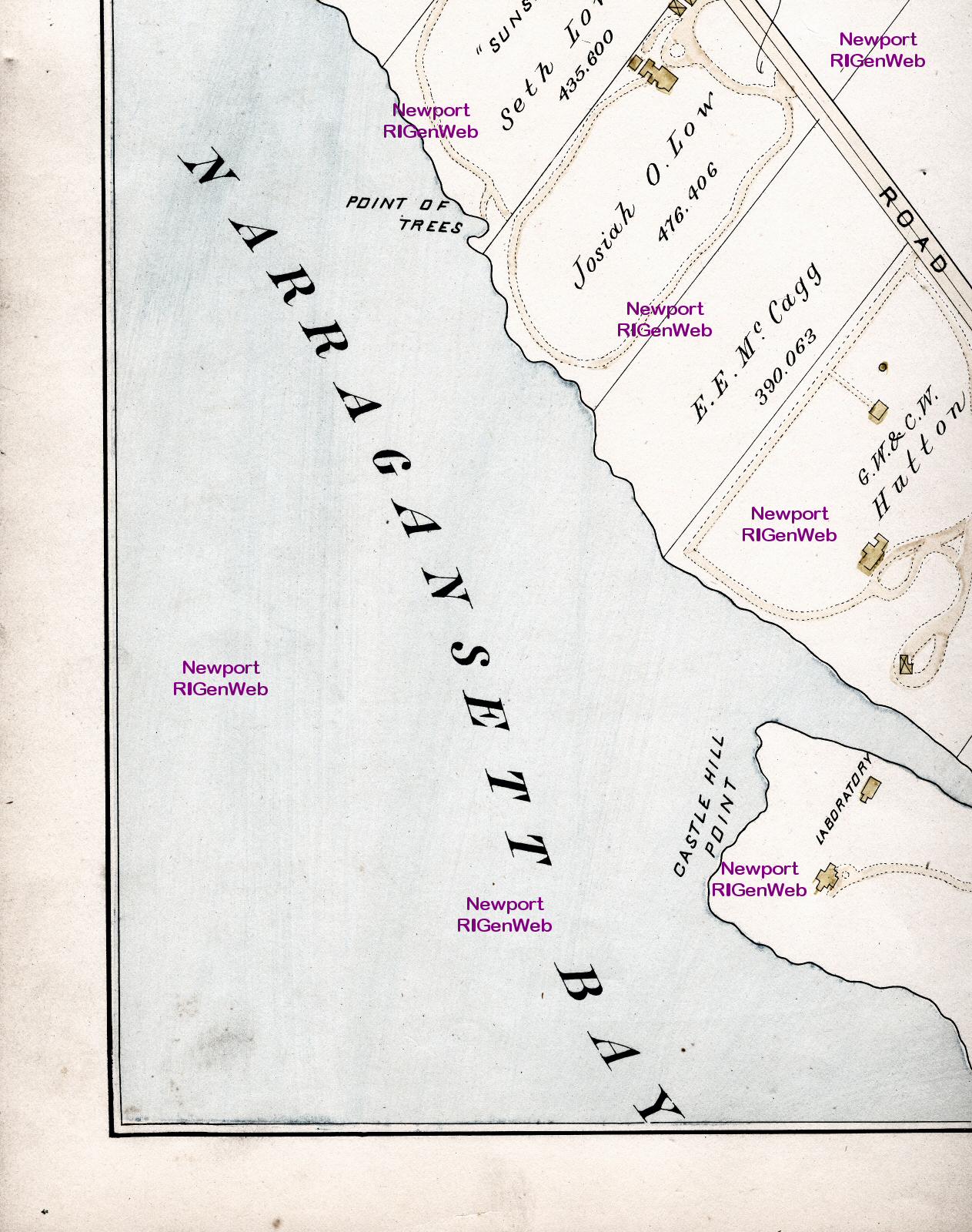
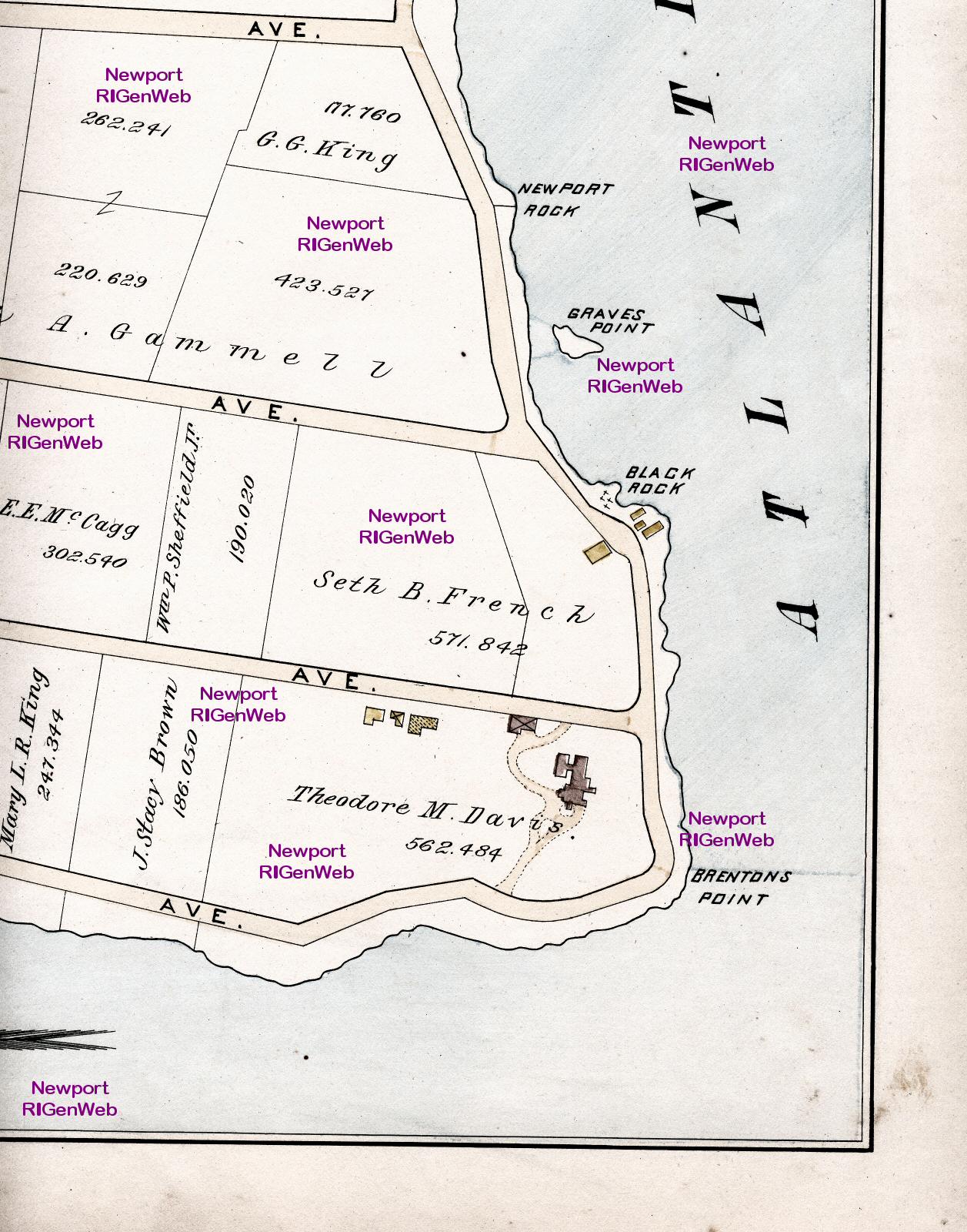
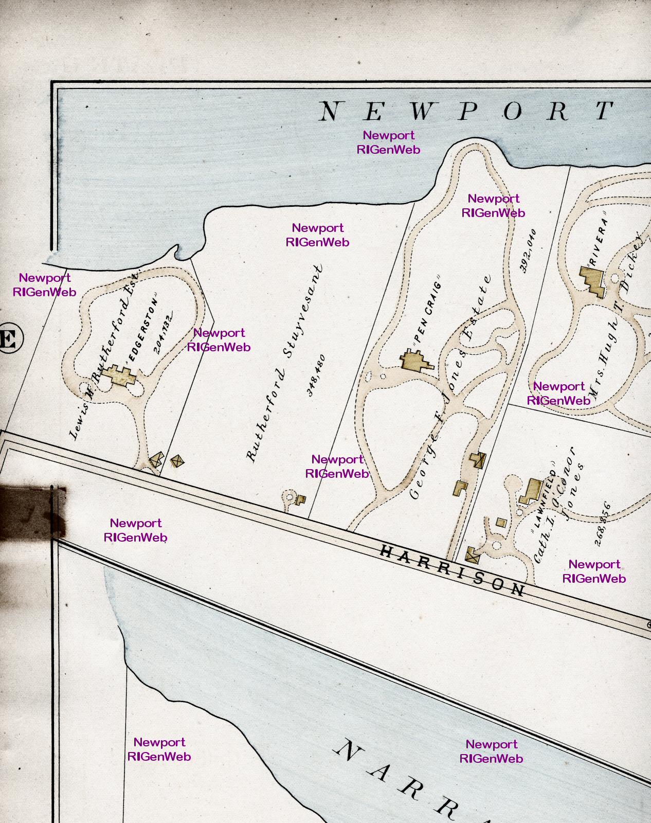
Plate F: Top row: section
1; section 2; section
3; section 4;
Bottom row: section 5; section
6; section 7; section
8
Plate G: Top row: section
1; section 2; section
3; section 4;
Bottom row: section 5; section
6; section 7; section
8
Plate H: Top row: section
1; section 2; section
3; section 4;
Bottom row: section 5; section
6; section 7; section
8
Plate I: Top row: section
1; section 2; section
3; section 4;
Bottom row: section 5; section
6; section 7; section
8
Plate J: Top row: section
1; section 2; section
3; section 4;
Bottom row: section 5; section
6; section 7; section
8
Plate K: Top row: section
1; section 2; section
3; section 4;
Bottom row: section 5; section
6; section 7; section
8
Plate L: Top row: section
1; section 2; section
3; section 4;
Bottom row: section 5; section
6; section 7; section
8
Plate M: Top row: section
1; section 2; section
3; section 4;
Bottom row: section 5; section
6; section 7; section
8
Plate N: Top row: section
1; section 2; section
3; section 4;
Bottom row: section 5; section
6; section 7; section
8
Plate O: Top row: section
1; section 2; section
3; section 4;
Bottom row: section 5; section
6; section 7; section
8
Plate P: Top row: section
1; section 2; section
3; section 4;
Bottom row: section 5; section
6; section 7; section
8
Plate Q: Top row: section
1; section 2; section
3; section 4;
Bottom row: section 5; section
6; section 7; section
8
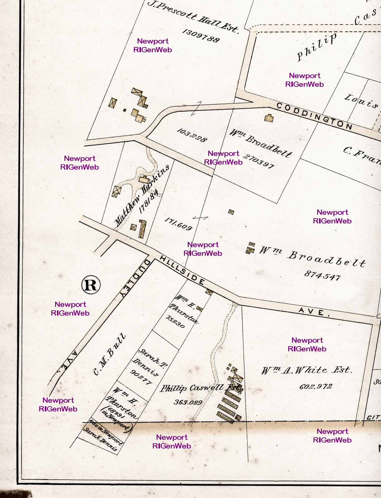
Plate R: Top row: section
1; section 2; section
3; section 4;
Bottom row: section 5; section
6; section 7; section
8
Plate S: Top row: section
1; section 2; section
3; section 4;
Bottom row: section 5; section
6; section 7; section
8
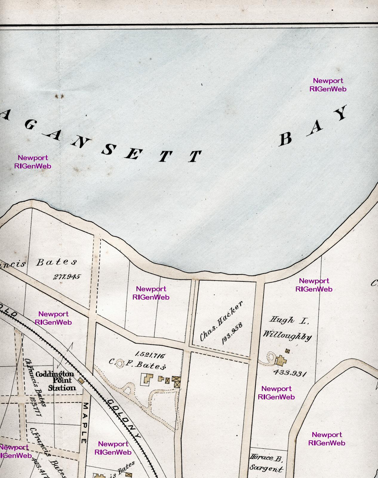
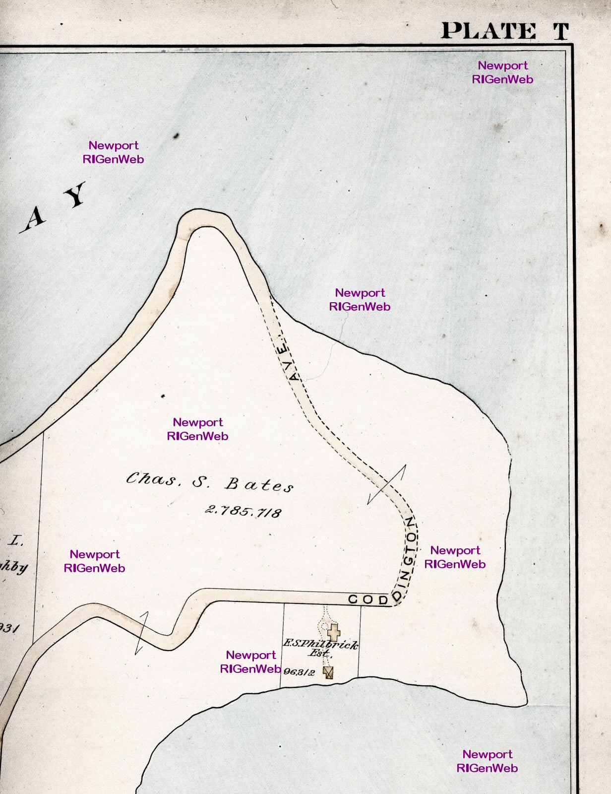
Plate T: Top row: section
1; section 2; section
3; section 4;
Bottom row: section 5; section
6; section 7; section
8
Map scans copyrighted by Susan
White Pieroth, 2002-3. These maps are made available to the public for
non-commercial purposes. If you wish to incorporate this document, or any
scanned image, into any published work (including an internet page), you
must first obtain permission from the Newport
County RIGenWeb Project Coordinator.
To the 1893 Middletown and
Portsmouth Map
Back to the Map Index Page
To 1873 Harper's Panoramic
Sketch of Newport
 Return to Newport County Rhode Island Home Page
https://sites.rootsweb.com/~rinewpor/maps/