List of Somerset County Township Maps
Each map is named for the principal township or borough within the area of the map. The list below shows
the additional boroughs within each map area. For a partial list of cemeteries, go to this USGS
site and fill in the STATE NAME, FEATURE TYPE and COUNTY.
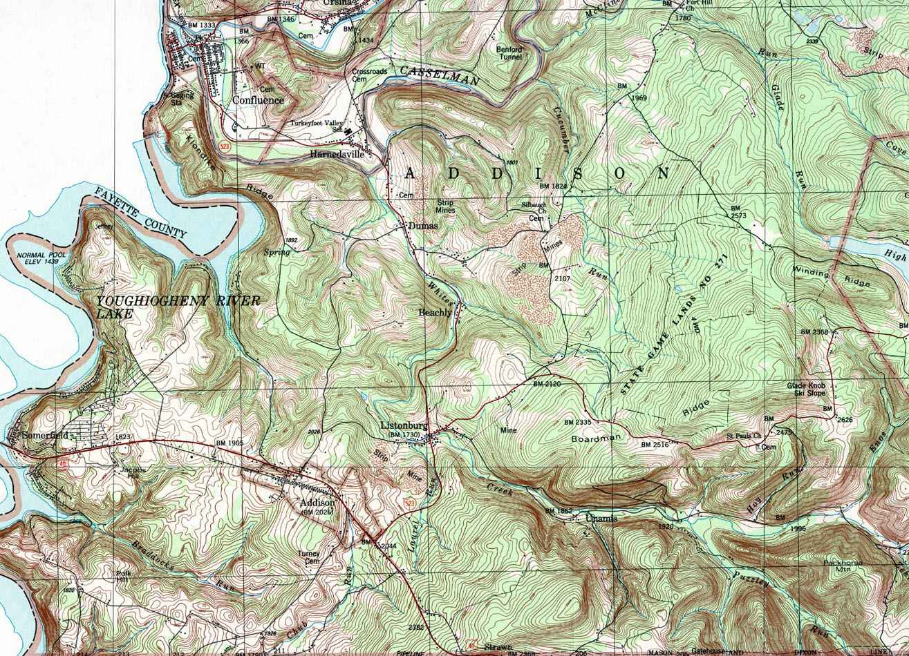
- Addison, Addison, Beachly, Dumas, Gatehouse, Glade Knob, Listonburg, Somerfield, Strawn, Unamis
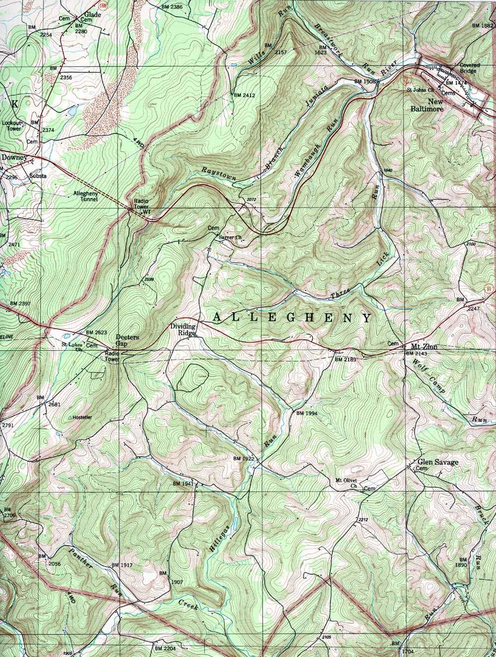
- Allegheny, Deeters Gap, Dividing Ridge, Glen Savage, Mt Zion, New Baltimore
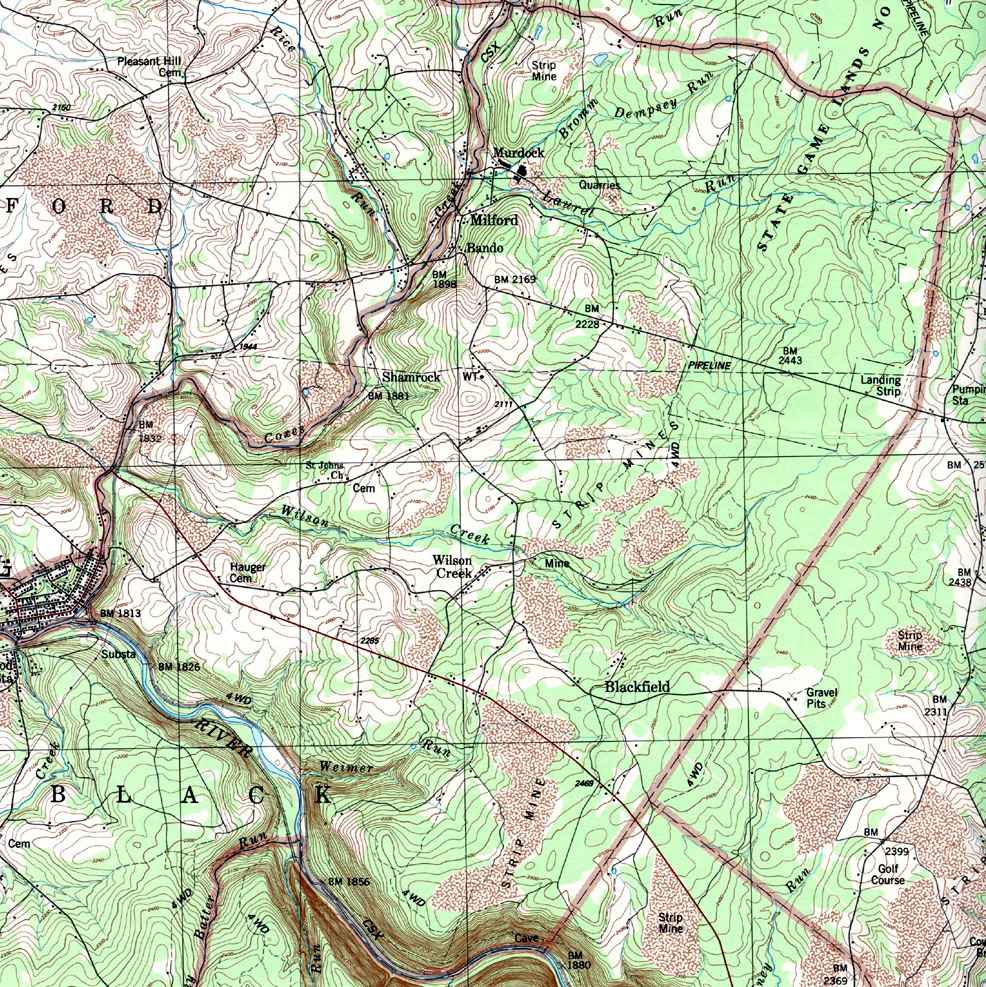
- Black (north), Bando, Blackfield, Milford, Murdock, Shamrock, Wilson Creek
- Black (south), Markleton, Rockwood Sta
- Brothersvalley (east), Berlin, Brotherton, Goodtown, Hays Mill, Macdonaldton, Niver Junction, Salco, Shaft
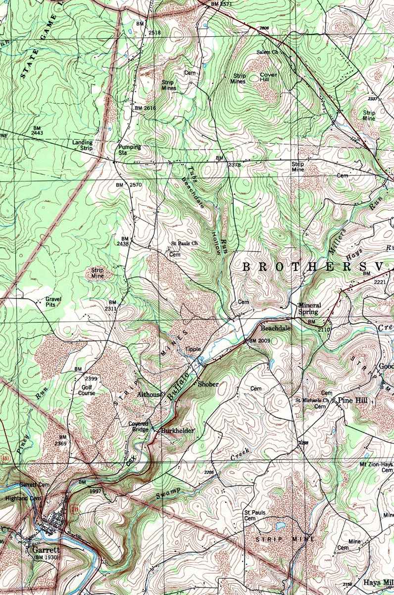
- Brothersvalley (west), Althouse, Beachdale, Burkhelder, Covered Bridge, Mineral Spring, Pine Hill, Shober
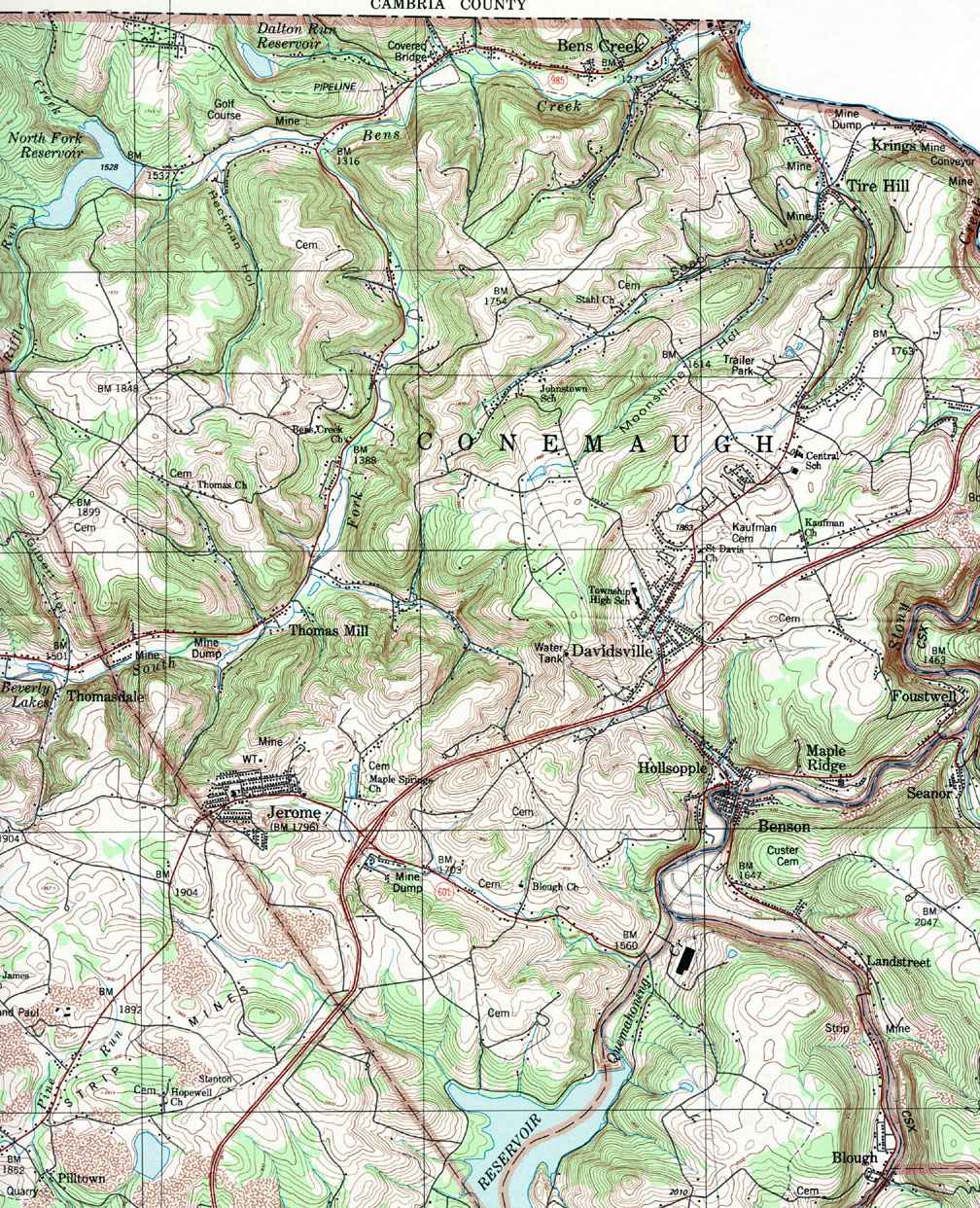
- Conemaugh, Bens Creek, Davidsville, Foustwell, Hollsopple, Jerome, Krings, Maple Ridge, Thomas Mill, Tire Hill
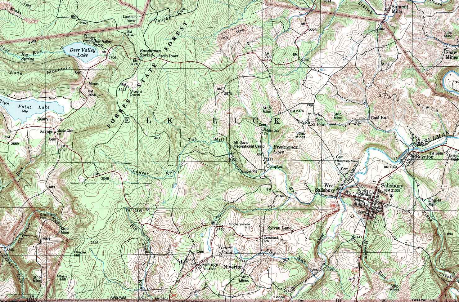
- Elk Lick, Boynton, Coal Run, Compton, Engles Mill, Maust Hill, Niverton, St Paul, Salisbury, Savage, Springs, Sylvan Lane, West Salisbury
- Fairhope (and Northampton), Bittners Mill, Covered Bridge, Fairhope, Williams
- Greenville (and Larimer), Pocahontas, Warrens Mill
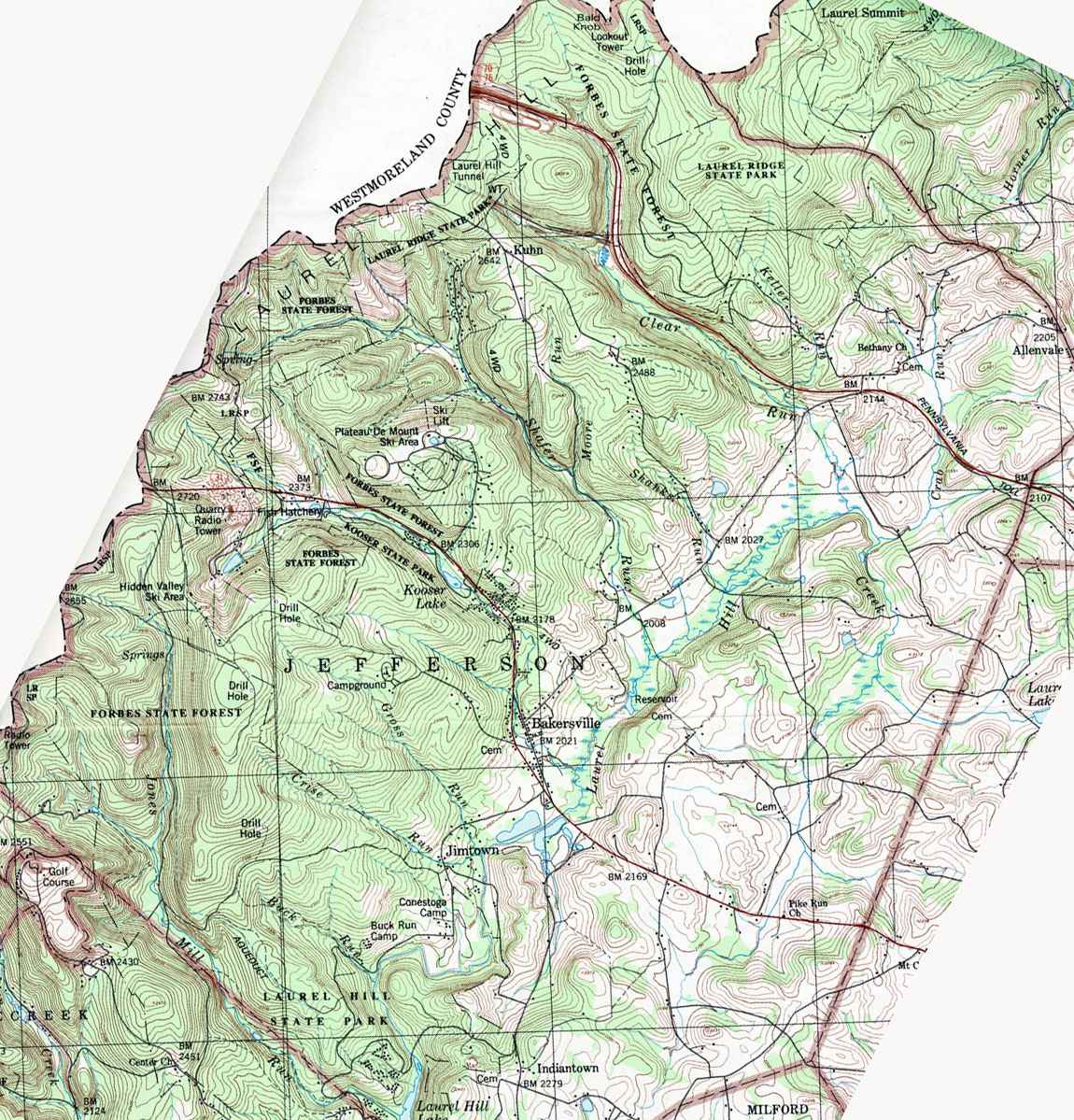
- Jefferson, Allenvale, Bakersville, Indiantown, Jimtown, Kuhn
- Jenner, Acosta, Ankeny, Boswell, Coal Junction, Ferrellton, Forwardstown, Glessner, Gray, Jenners, Jennerstown, Jenners Crossroads, Klines Mill, Laurel Mountain Village, Meadowdale, Randolph, Thomasdale
- Larimer (and Greenville), Callimont, Deal, Keystone, Sand Patch, Wittenberg
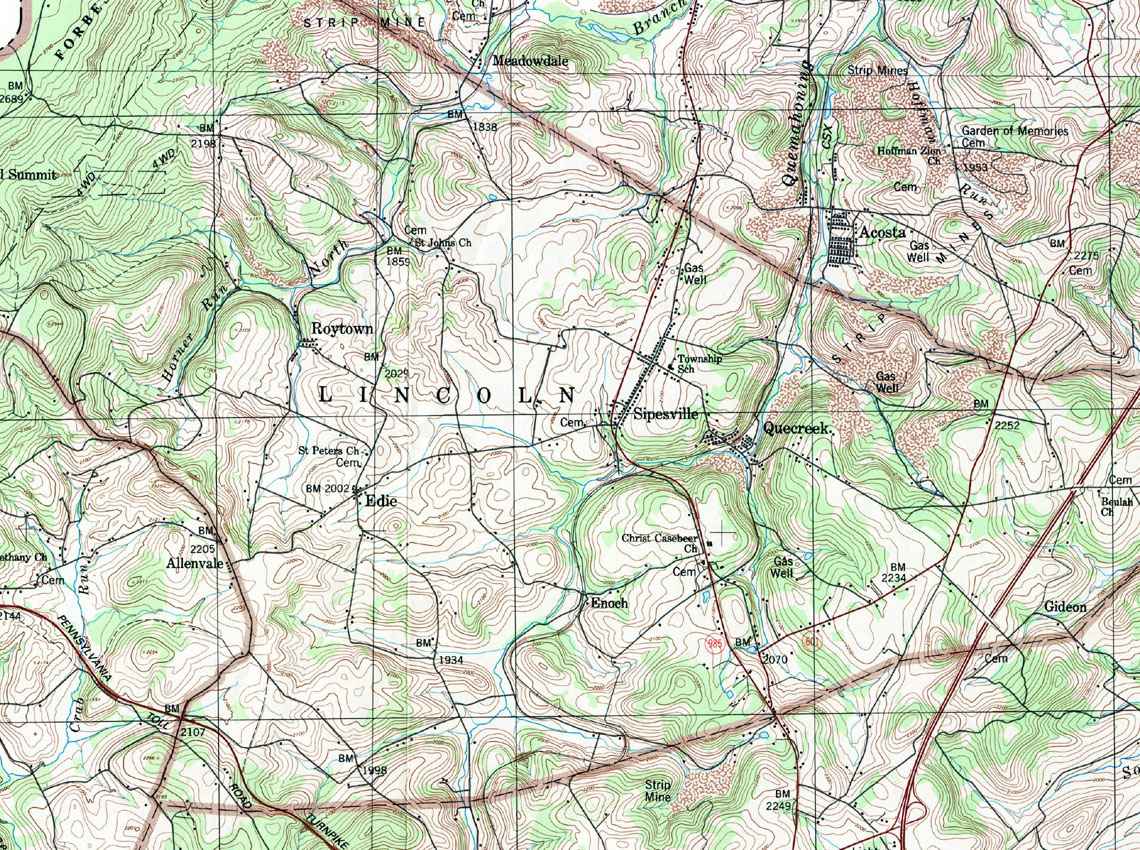
- Lincoln, Edie, Enoch, Gideon, Laurel Summit, Quecreek, Roytown, Sipesville
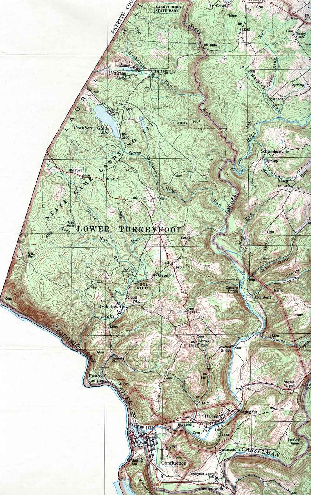
- Lower Turkeyfoot, Confluence, Draketown, Harnedsville, Humbert, Huston, Ursina
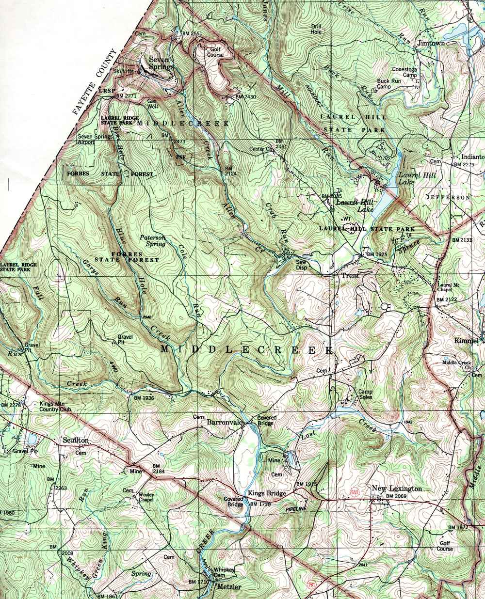
- Middlecreek, Barronvale, Kings Bridge, New Lexington, Seven Springs, Trent
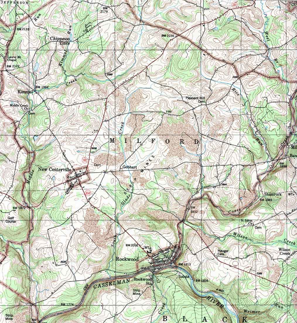
- Milford, Gebhart, Kimmel, New Centerville, Rockwood
- Northampton (and Fairhope), Glencoe, Foley, Johnsburg, Mance, Philson
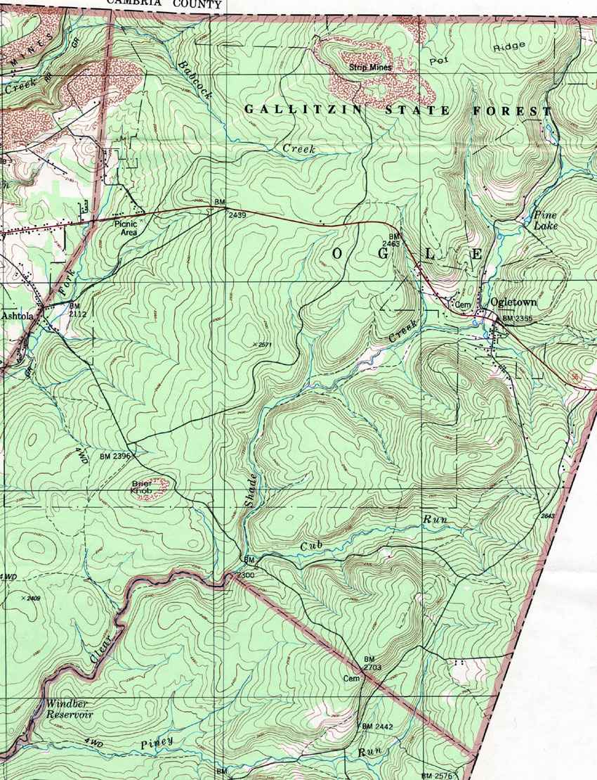
- Ogle, Ogletown
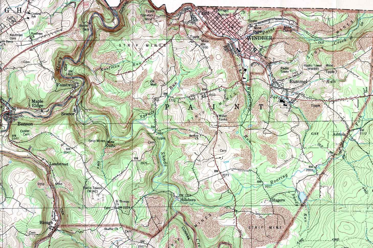
- Paint, Ashtola, Benson, Hagero, Hillsboro, Landstreet, Paint, Rummel, Seanor, Windber
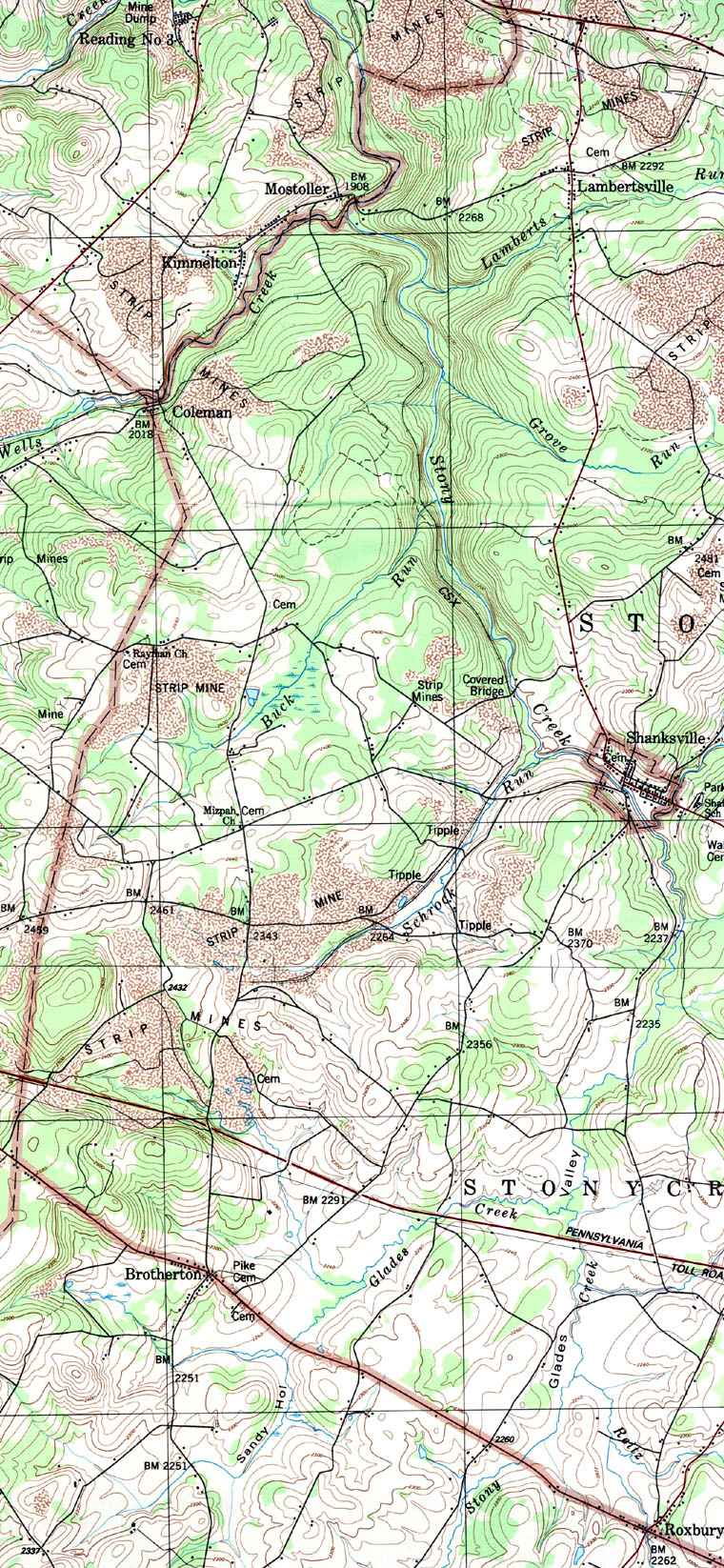
- Quemahoning, Blough, Kantner, Kimmelton, Mostoller, Ralphton, Reading No 3, Stone Bridge, Stoystown
- Shade (west), Forward, Hooversville, Old Shade Furnace, Rowena, Wilber
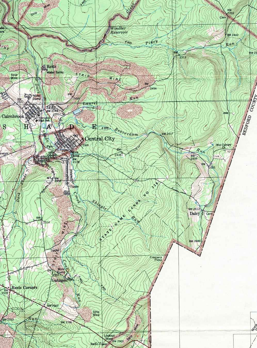
- Shade (east), Cairnbrook, Central City, Daley, Gahagen, Reels Corners, Reitz
- Somerset, Friedens, Geiger, Husband, Lavansville, Listie, Roberts, Somerset, Summit Sta, Wells Creek, Zimmerman
- Stoney Creek (west), Coleman, Lambertsville
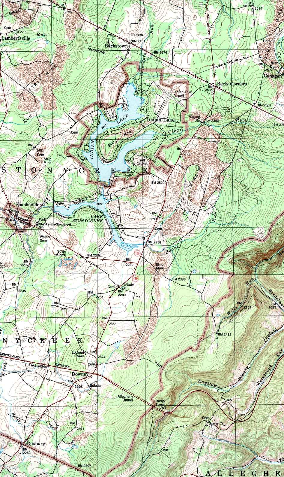
- Stoney Creek (east), Buckstown, Glade, Indian Lake, Roxbury, Shanksville
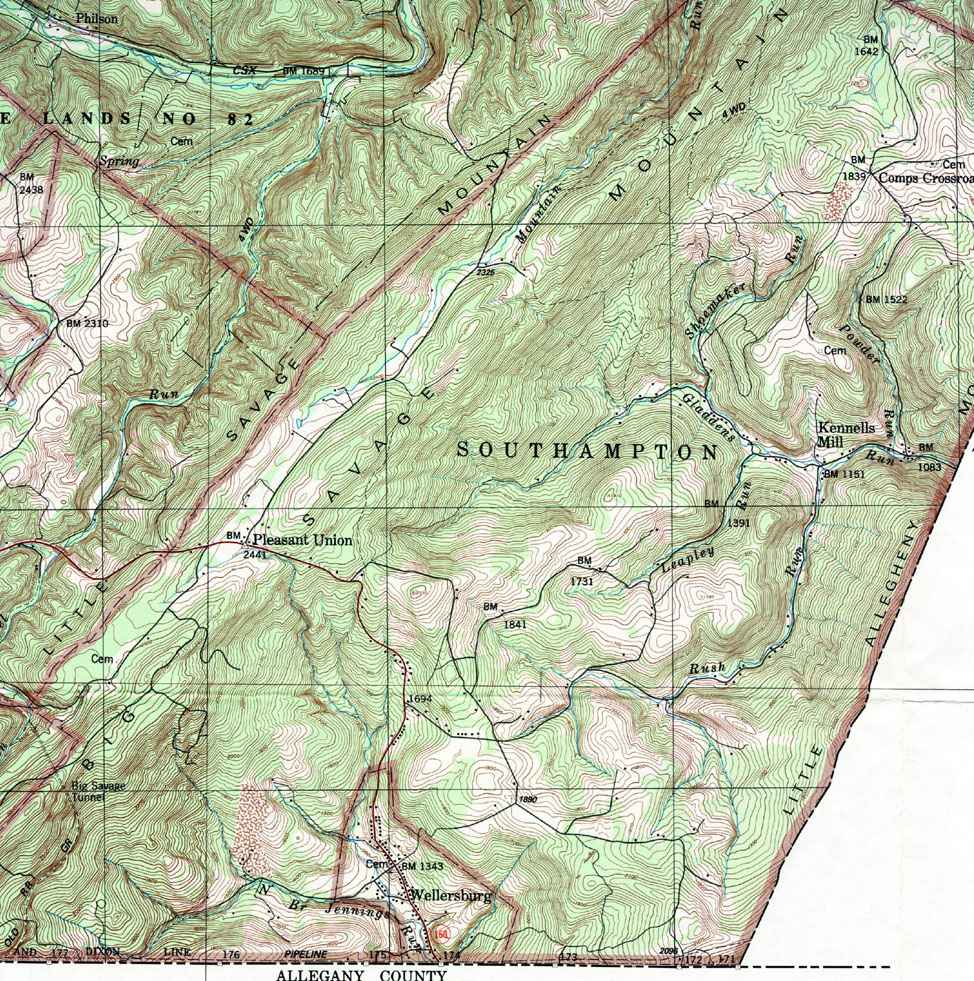
- Southampton, Comps Crossroads, Kennells Mill, Pleasant Union, Wellersburg
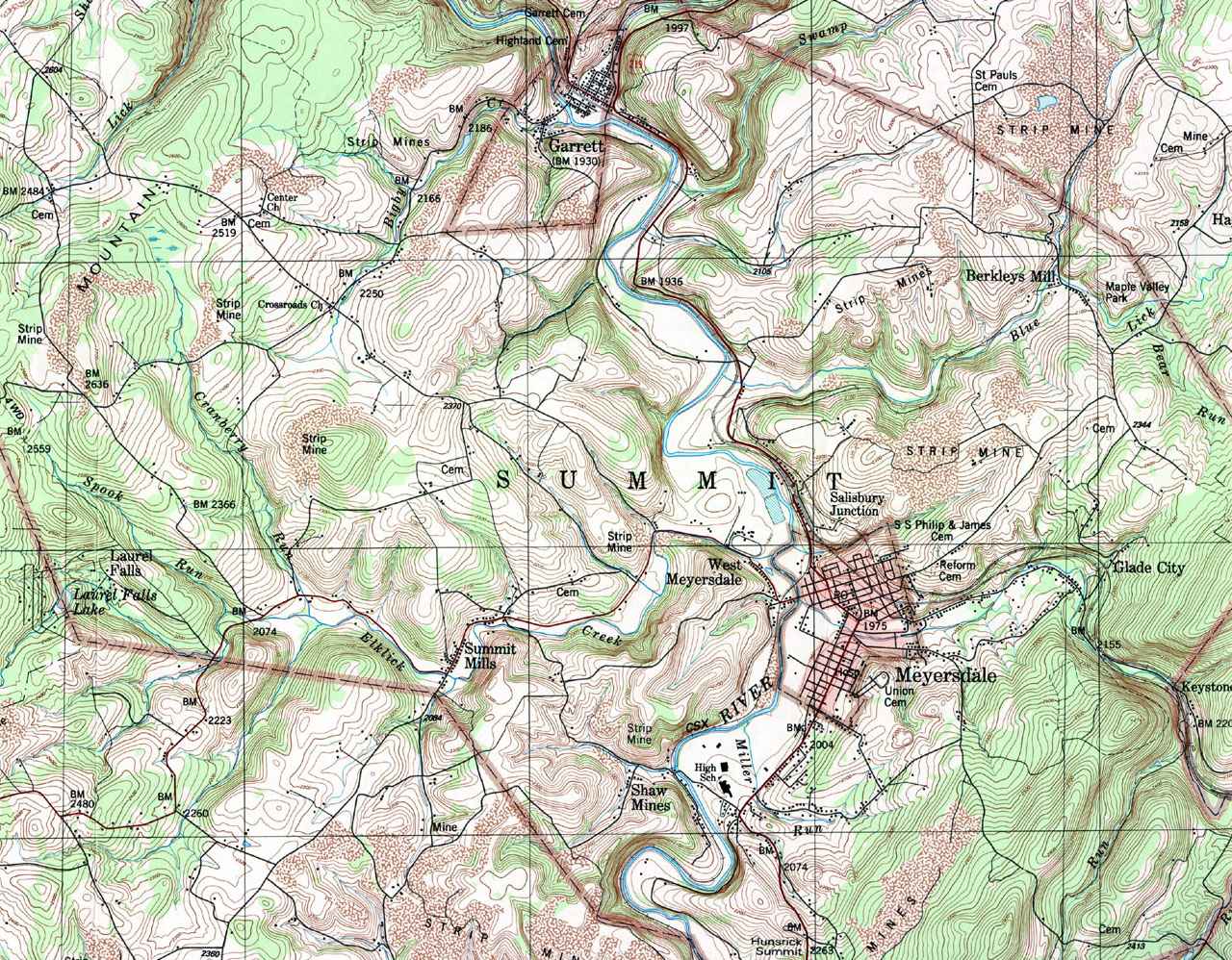
- Summit, Berkleys Mill, Garrett, Glade City, Laurel Falls, Meyersdale, Salisbury Junction, Shaw Mines, Summit Mills, West Meyersdale
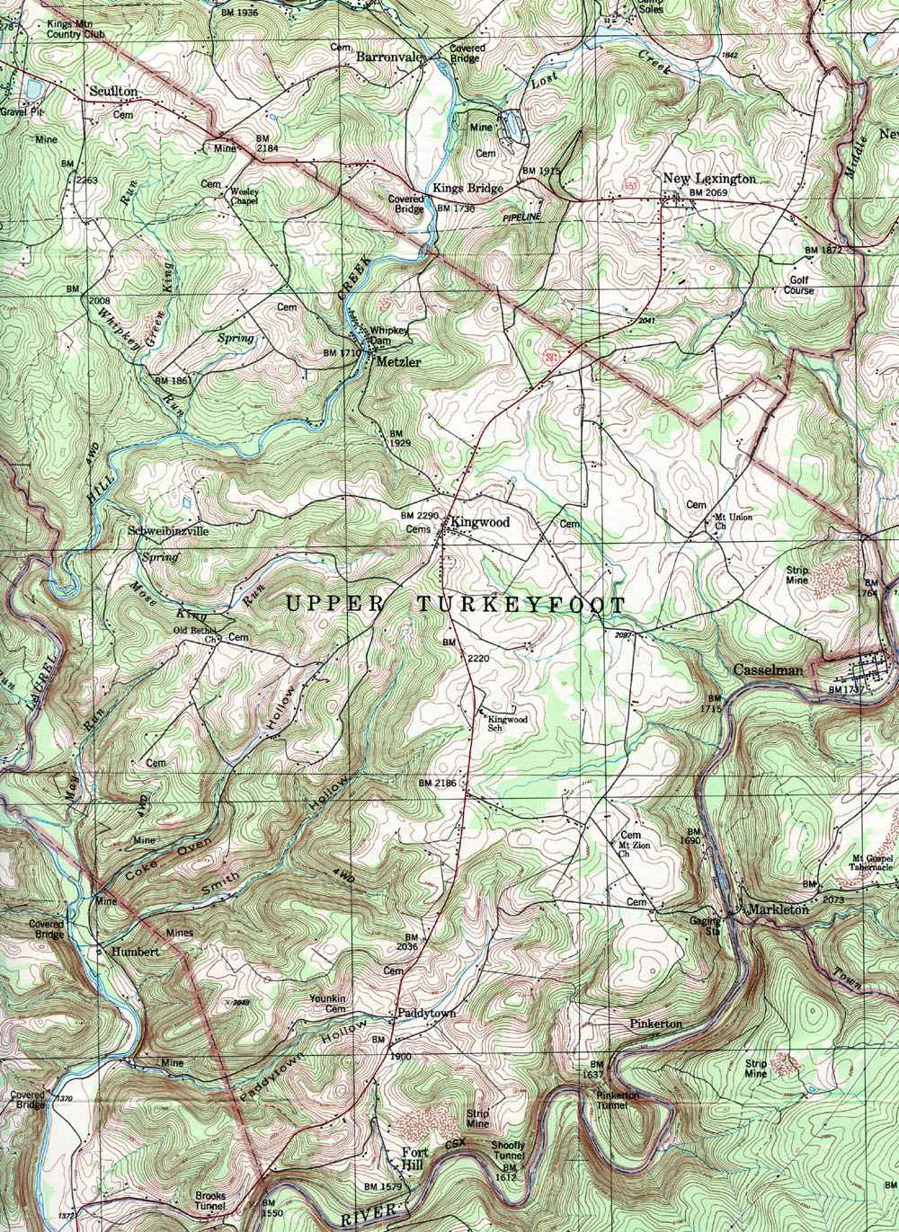
- Upper Turkeyfoot, Casselman, Fort Hill, Kingwood, Metzler, Paddytown, Pinkerton, Schweibinzville, Sculton
|

