
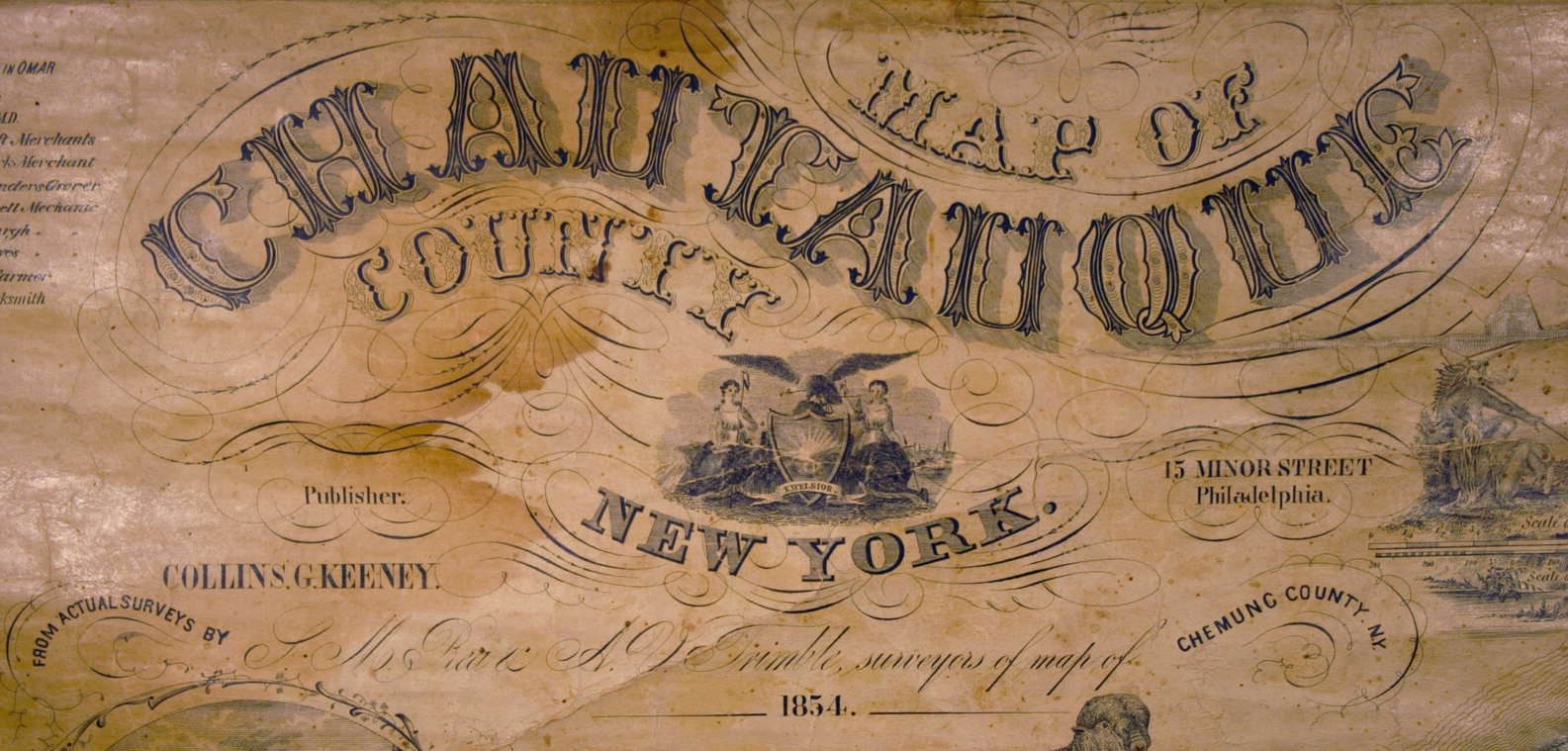
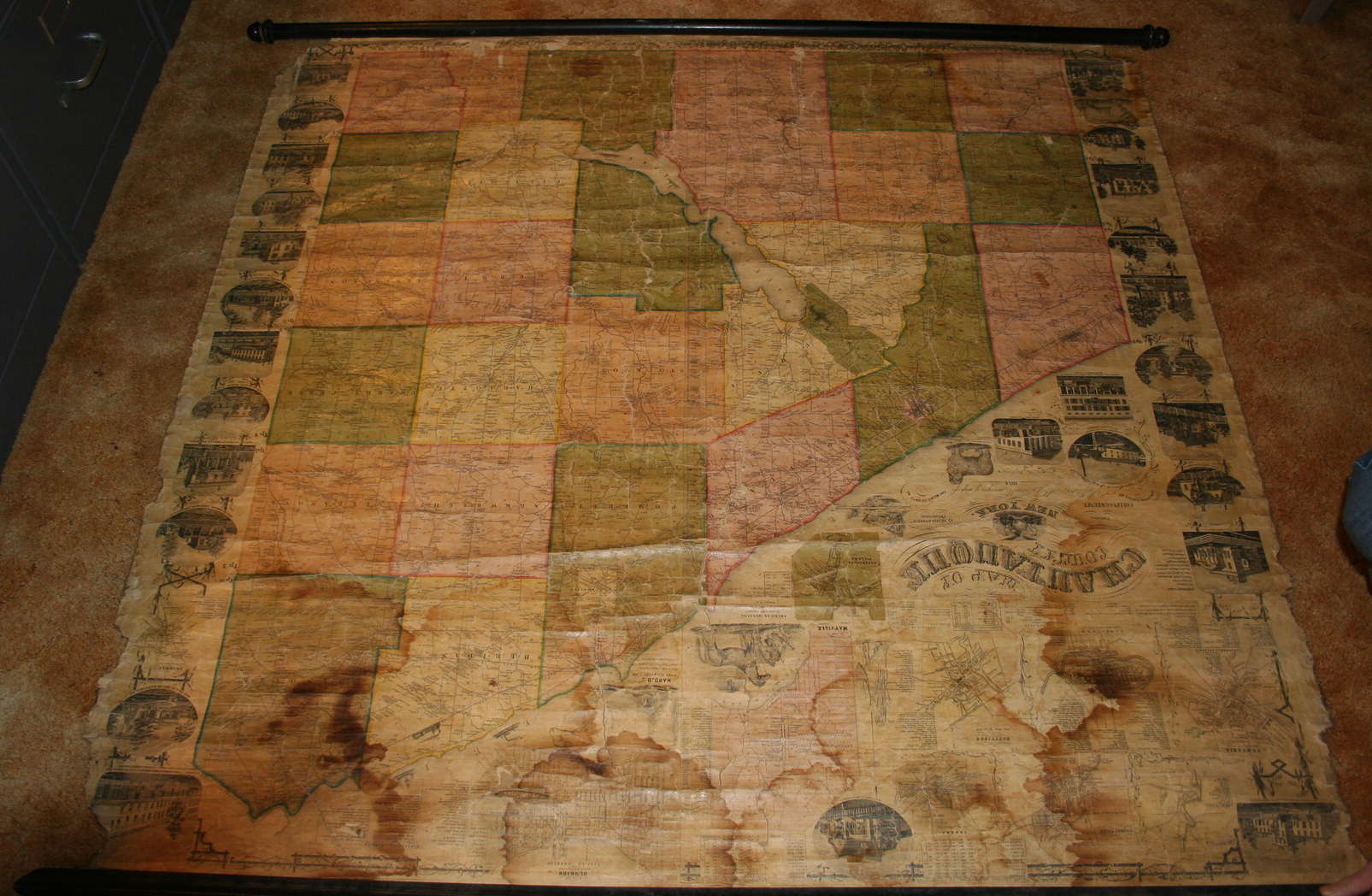
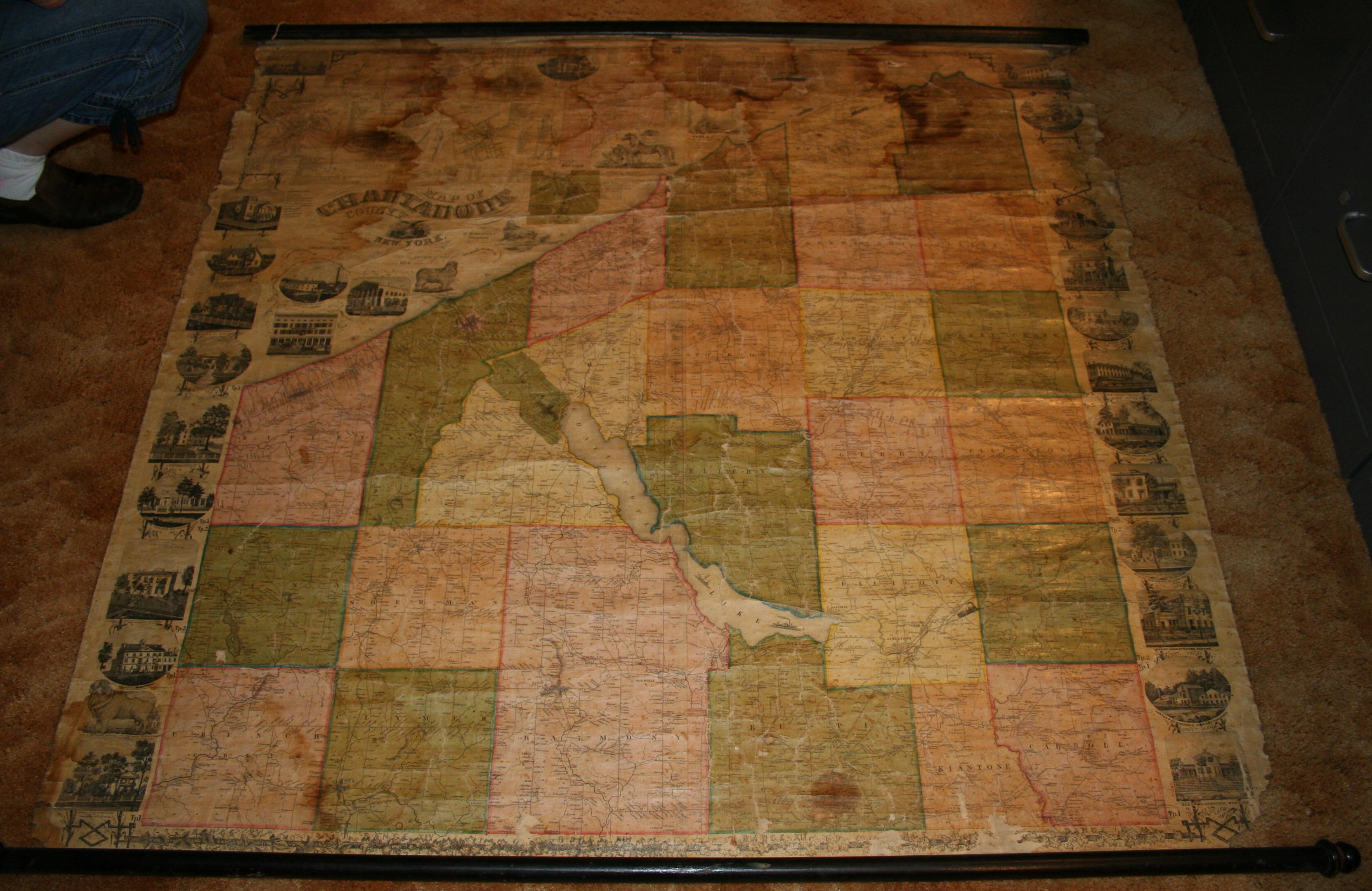
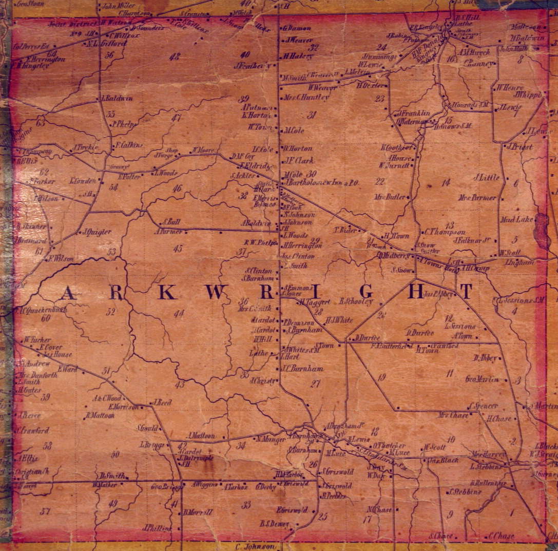
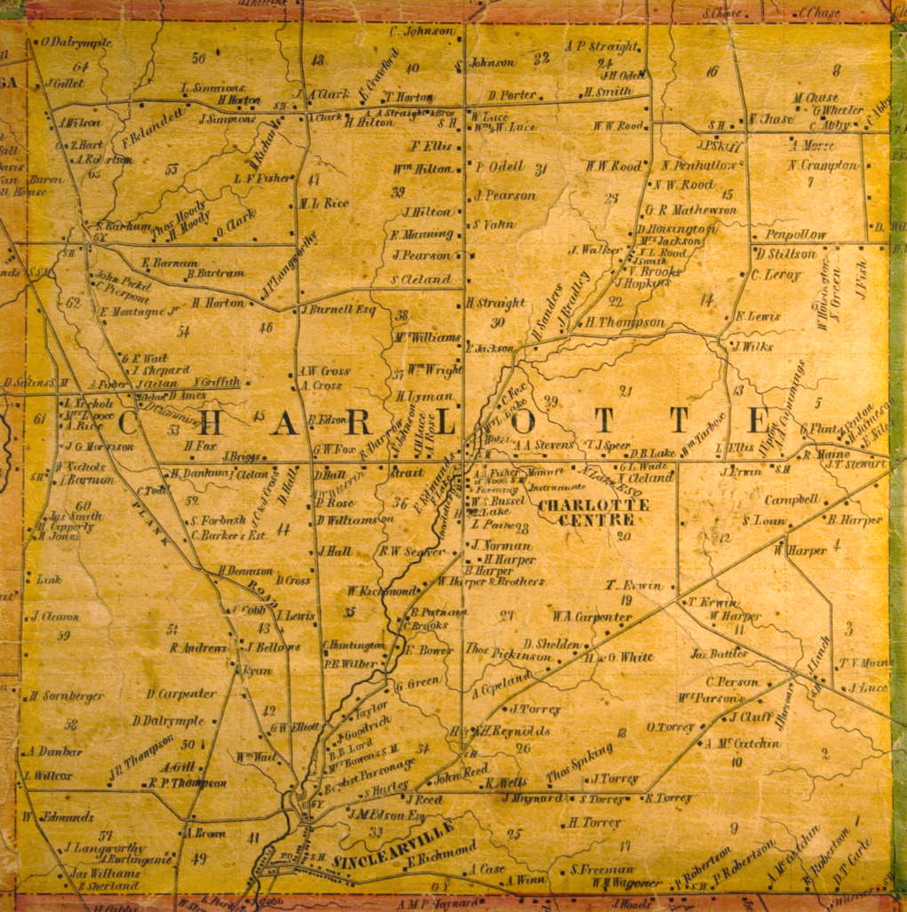
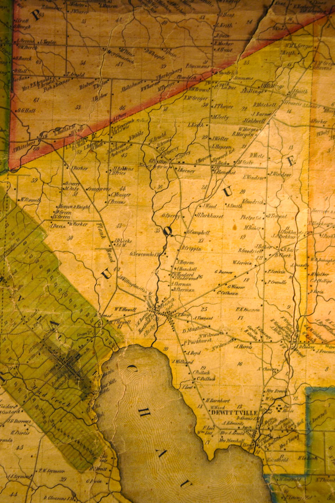
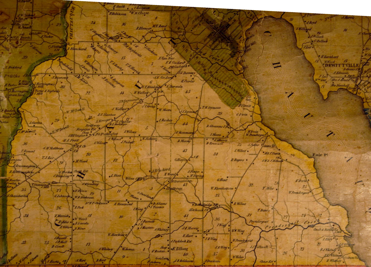
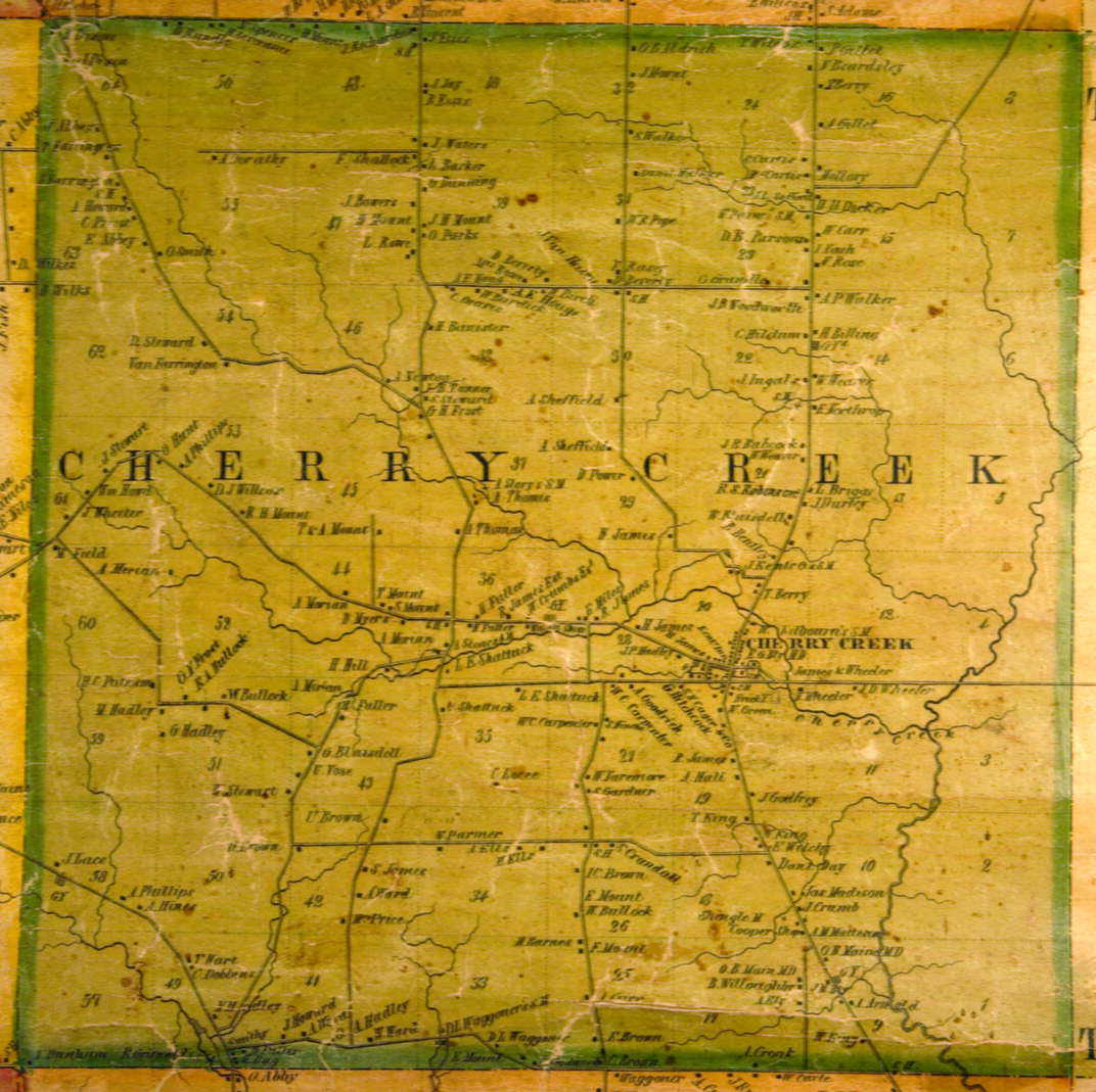
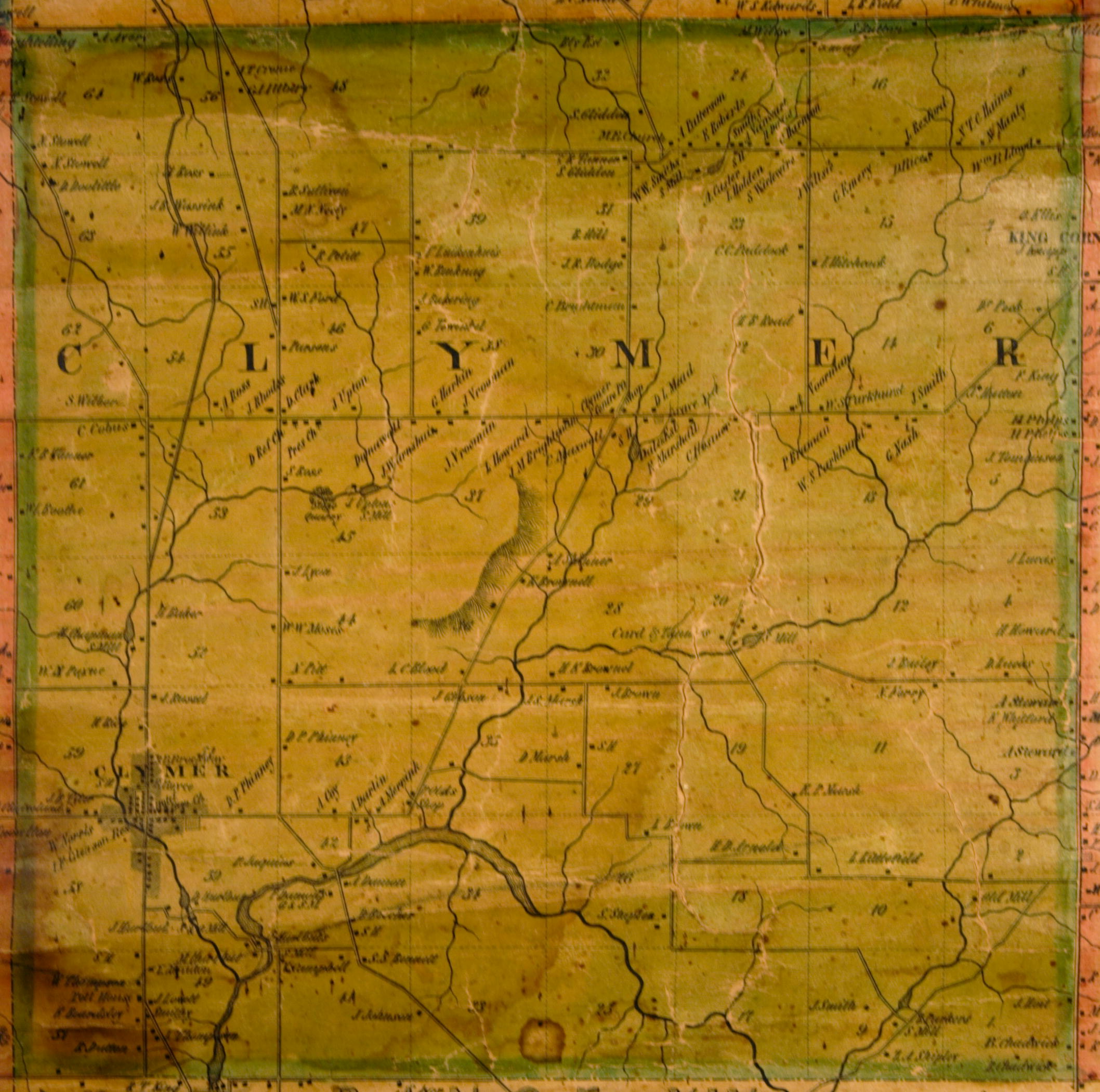
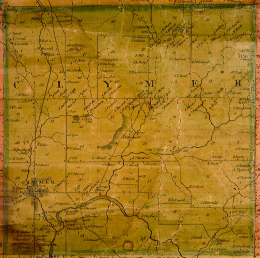
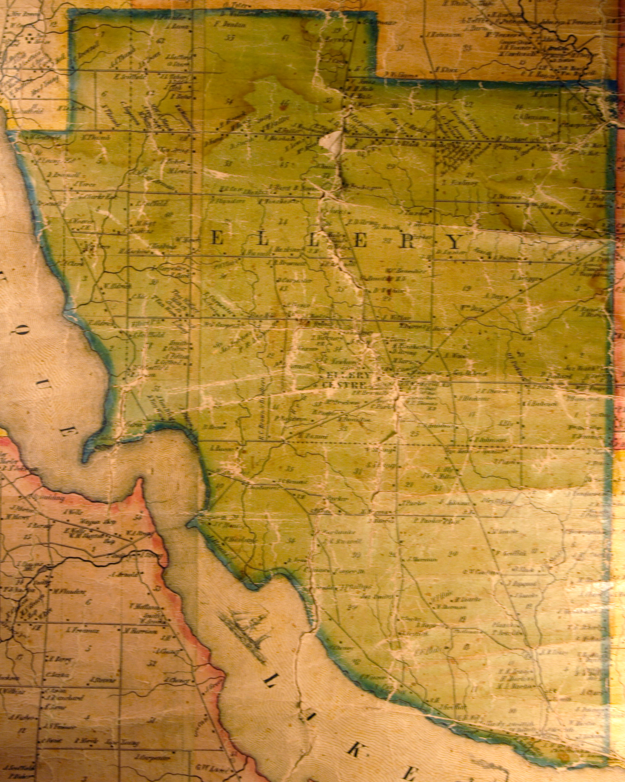
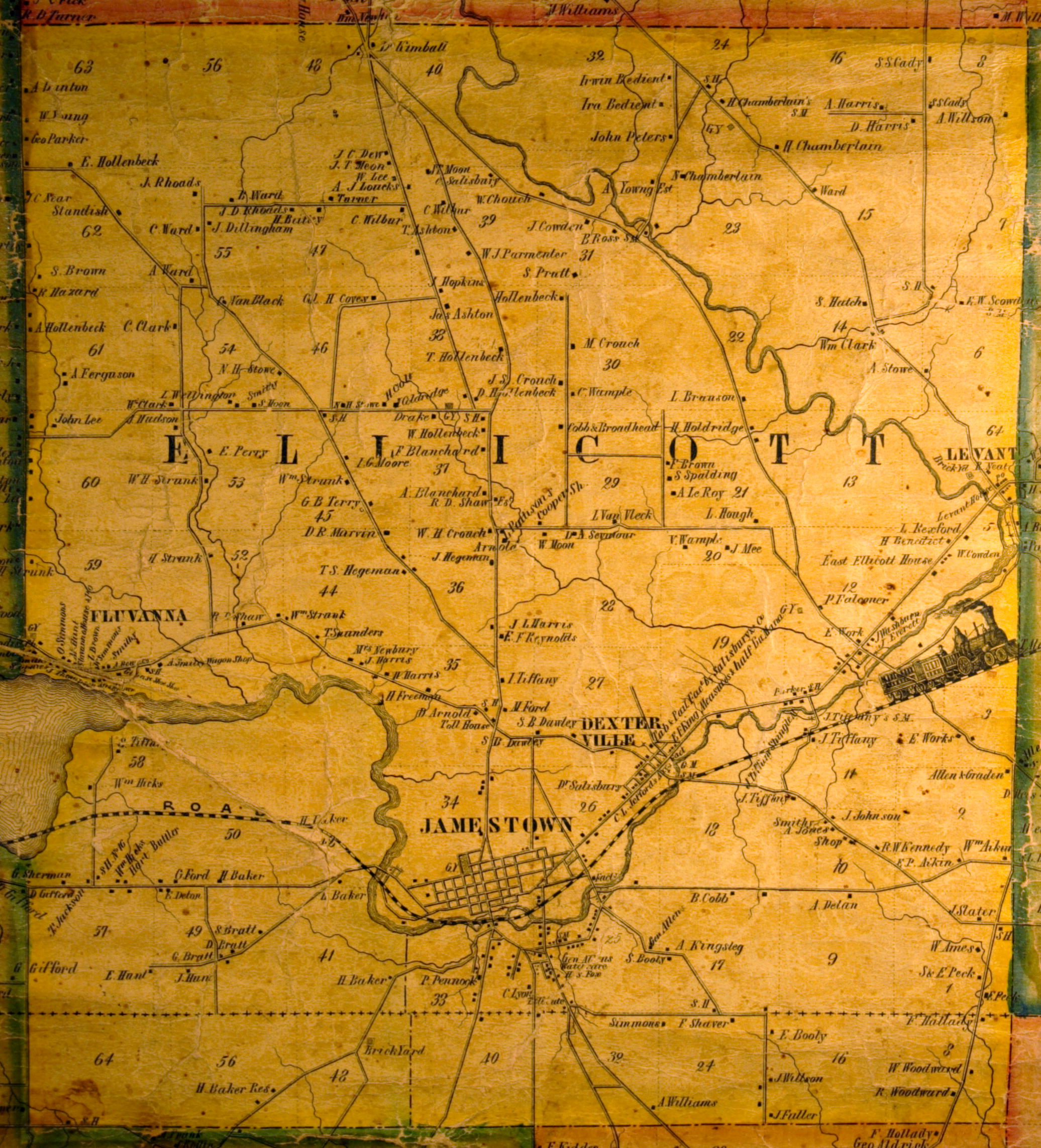
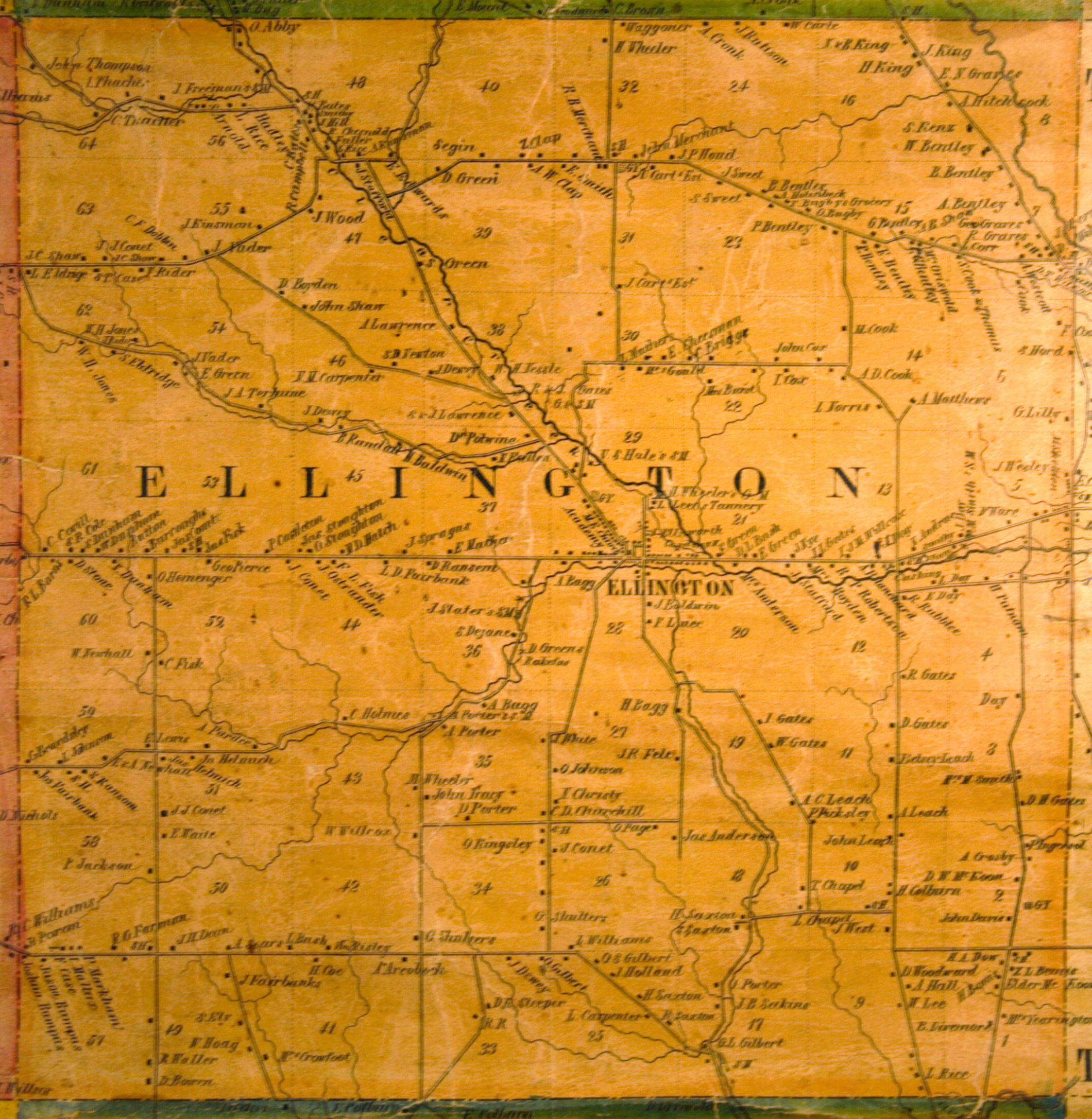
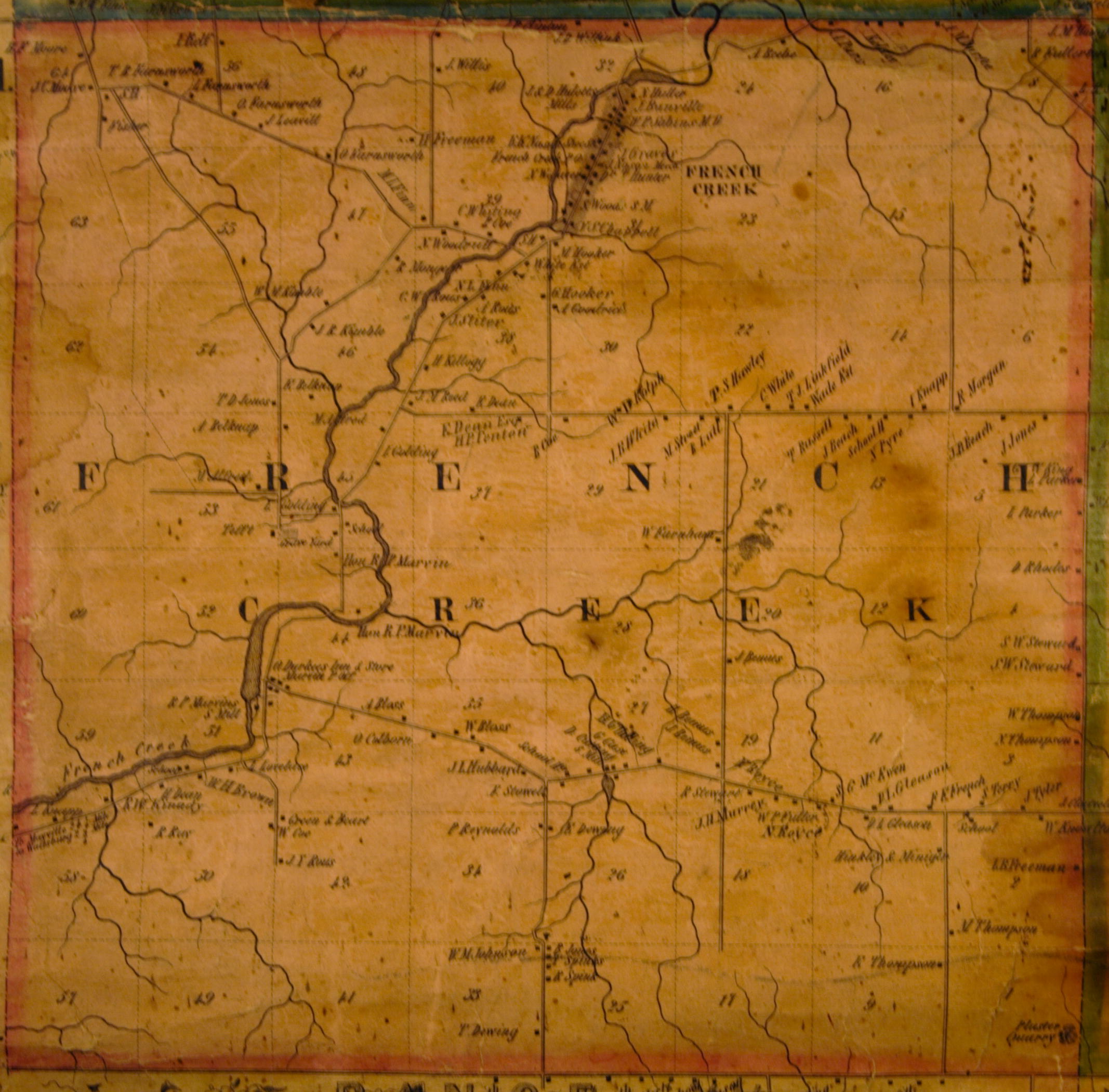
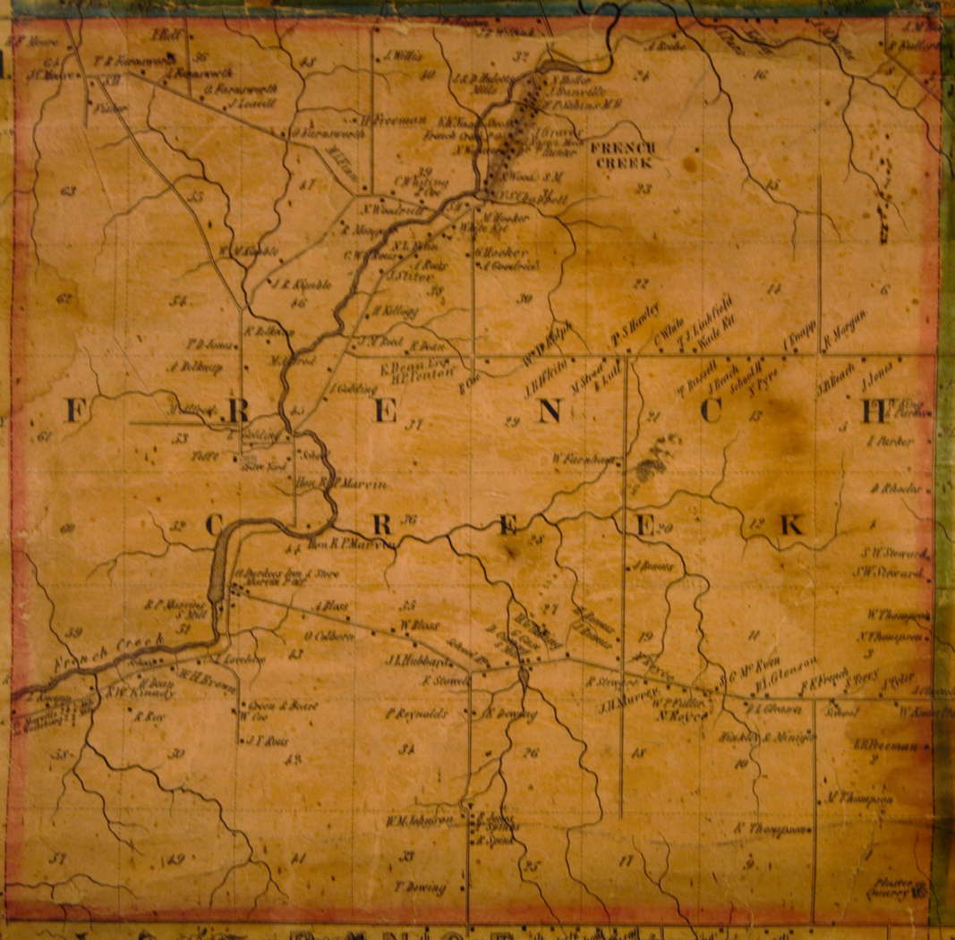
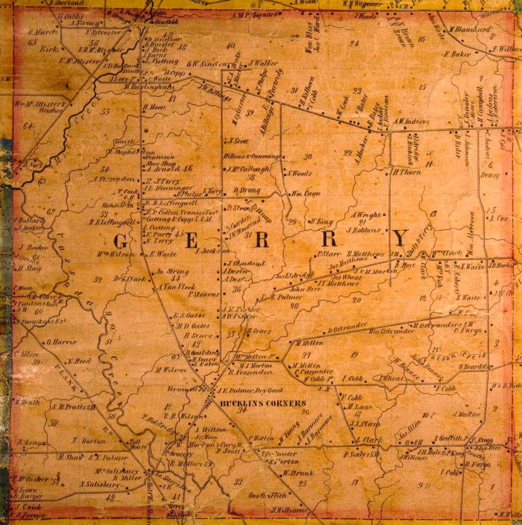
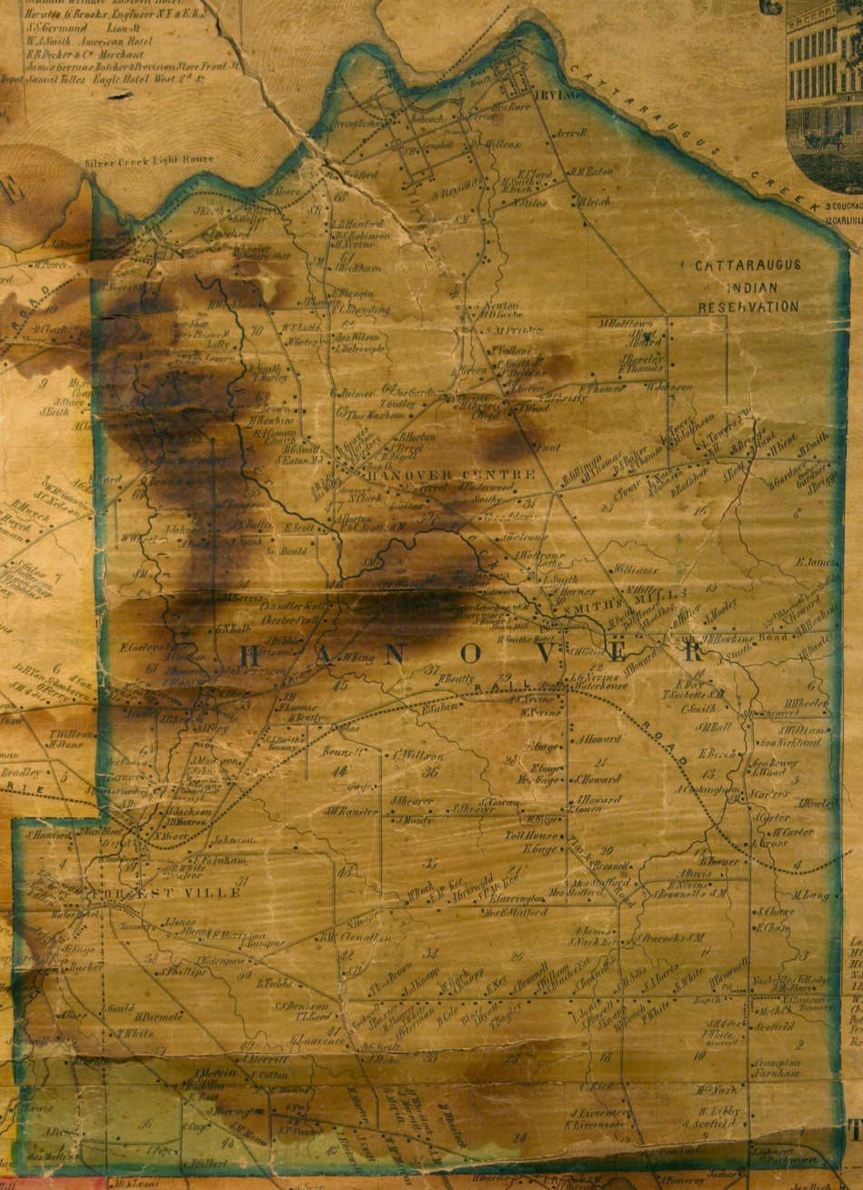
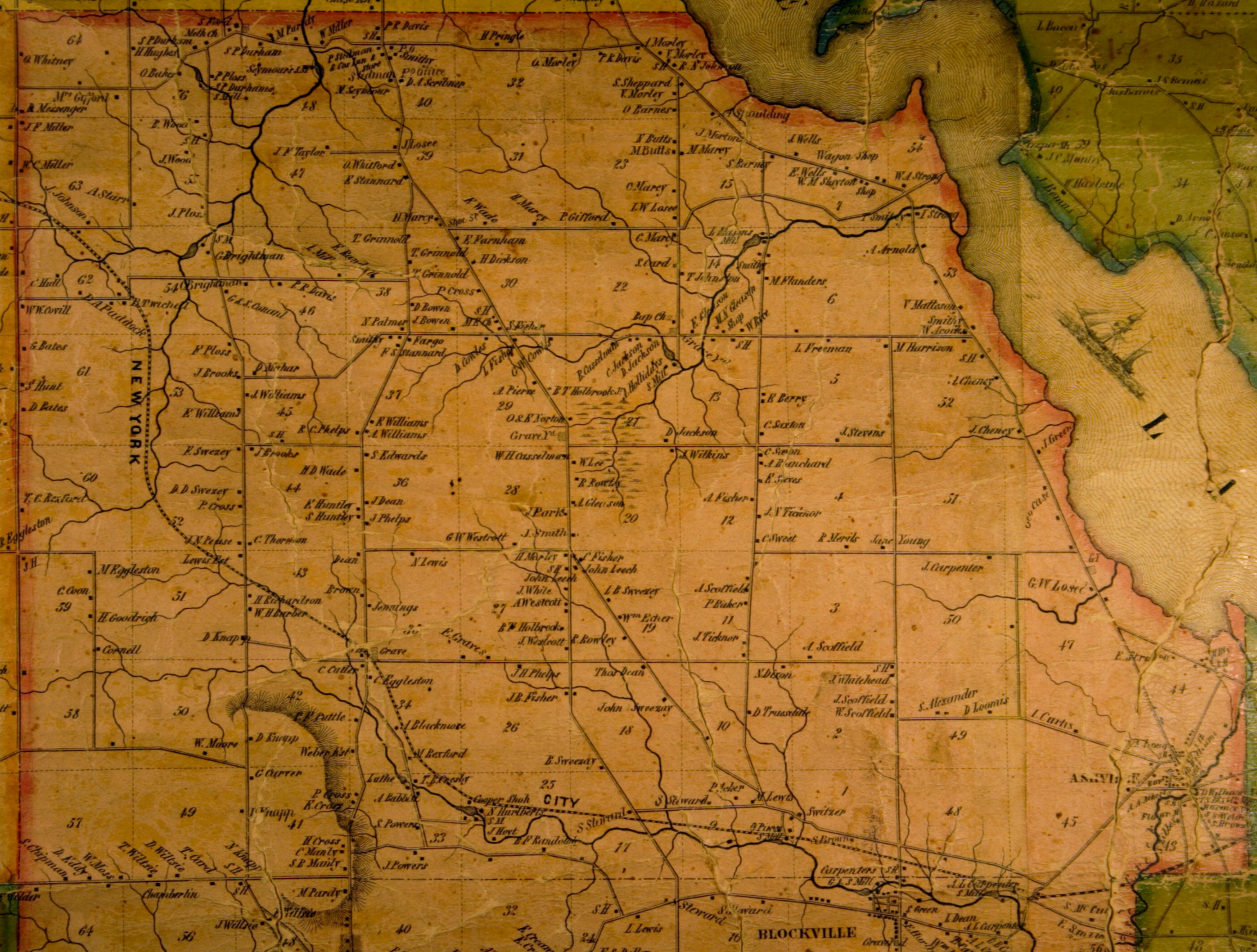
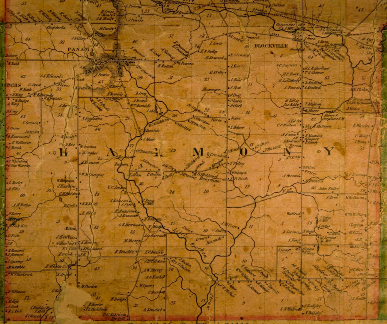
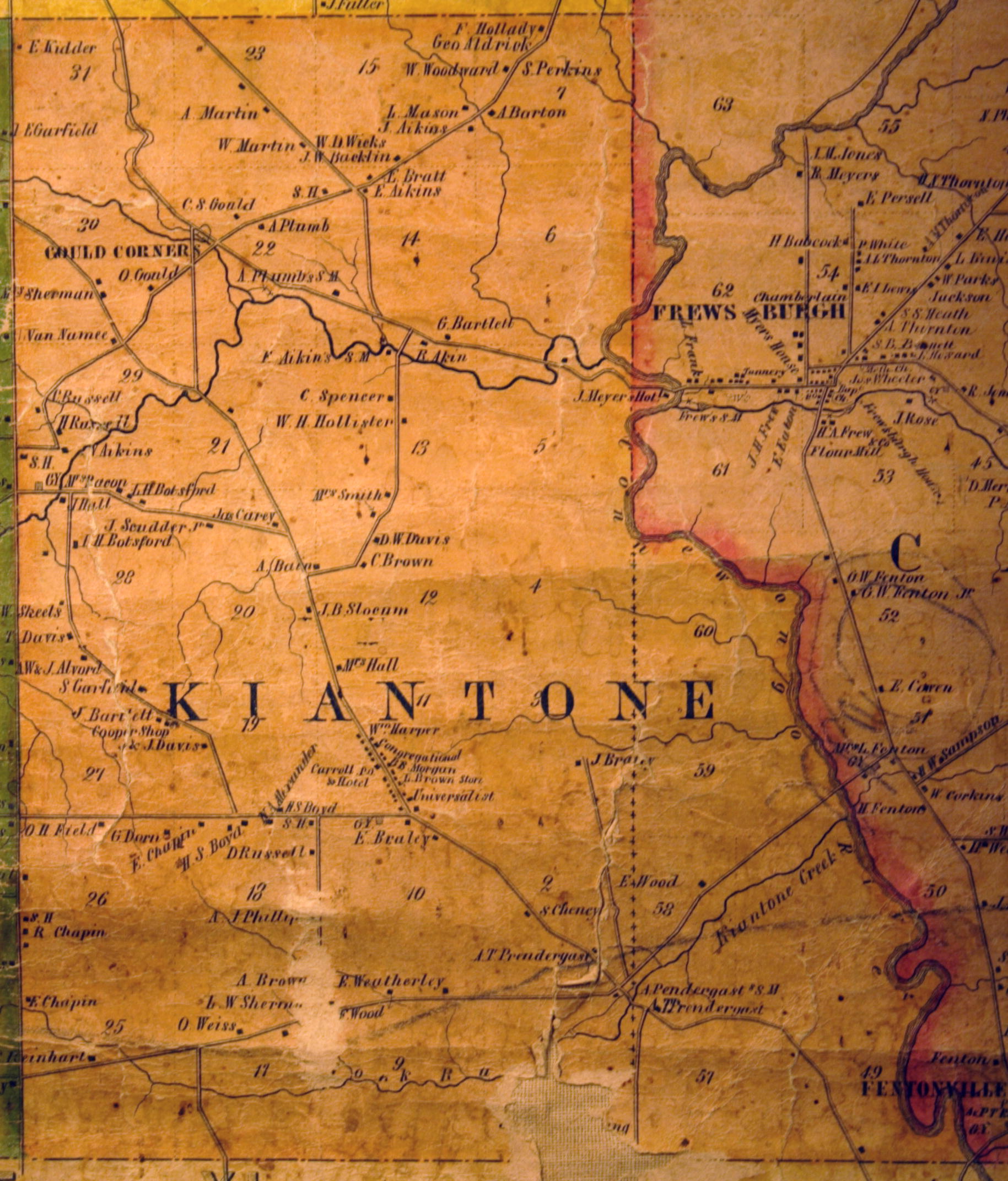
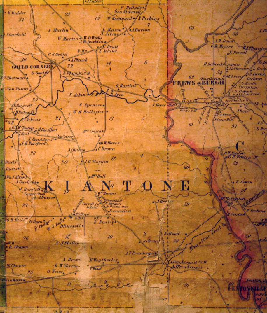
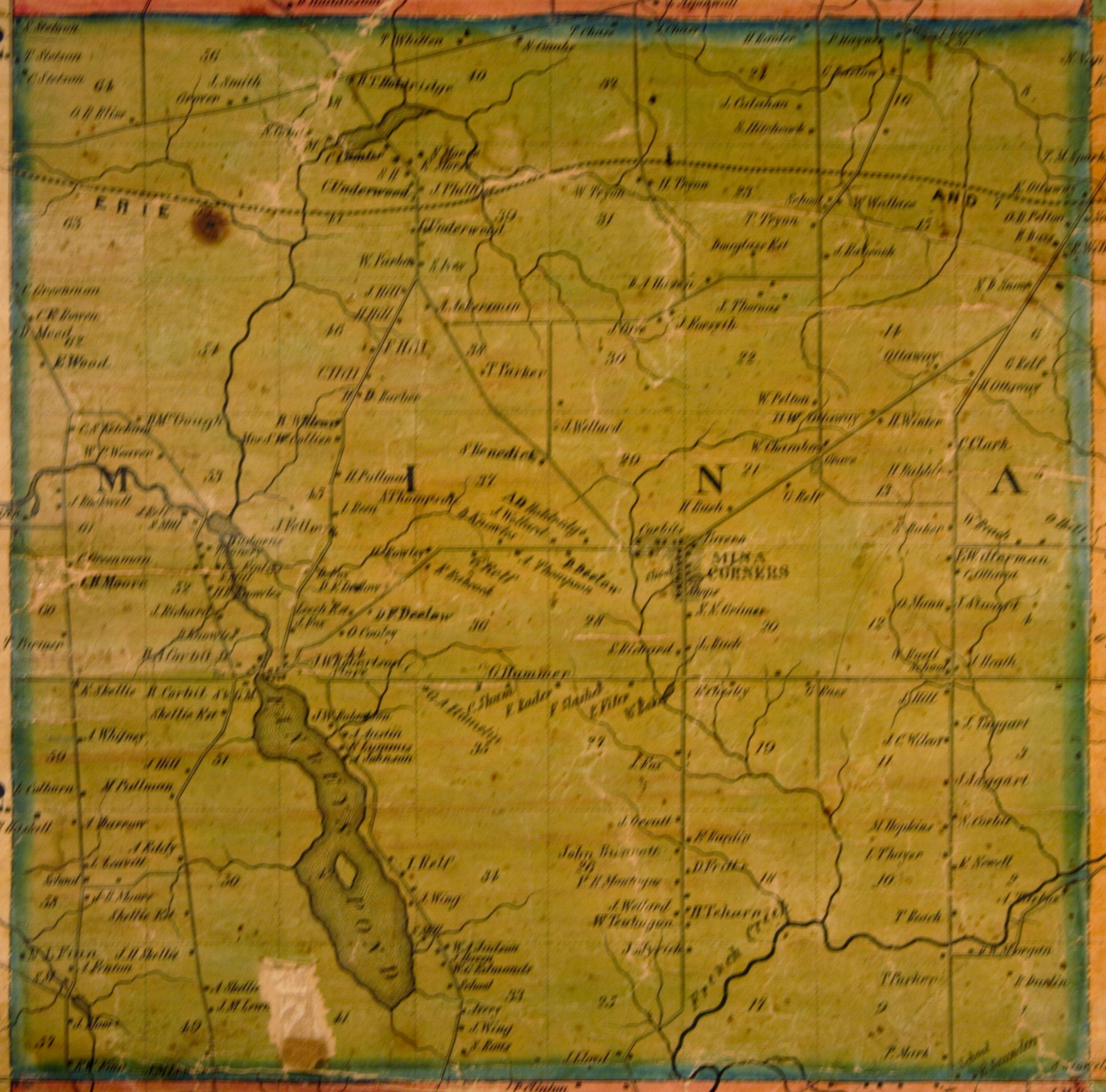
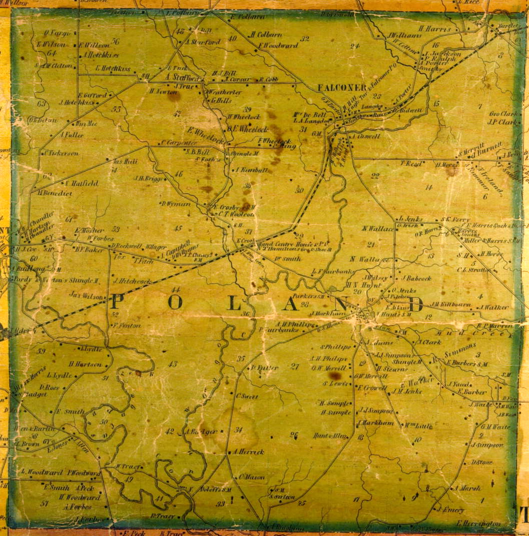
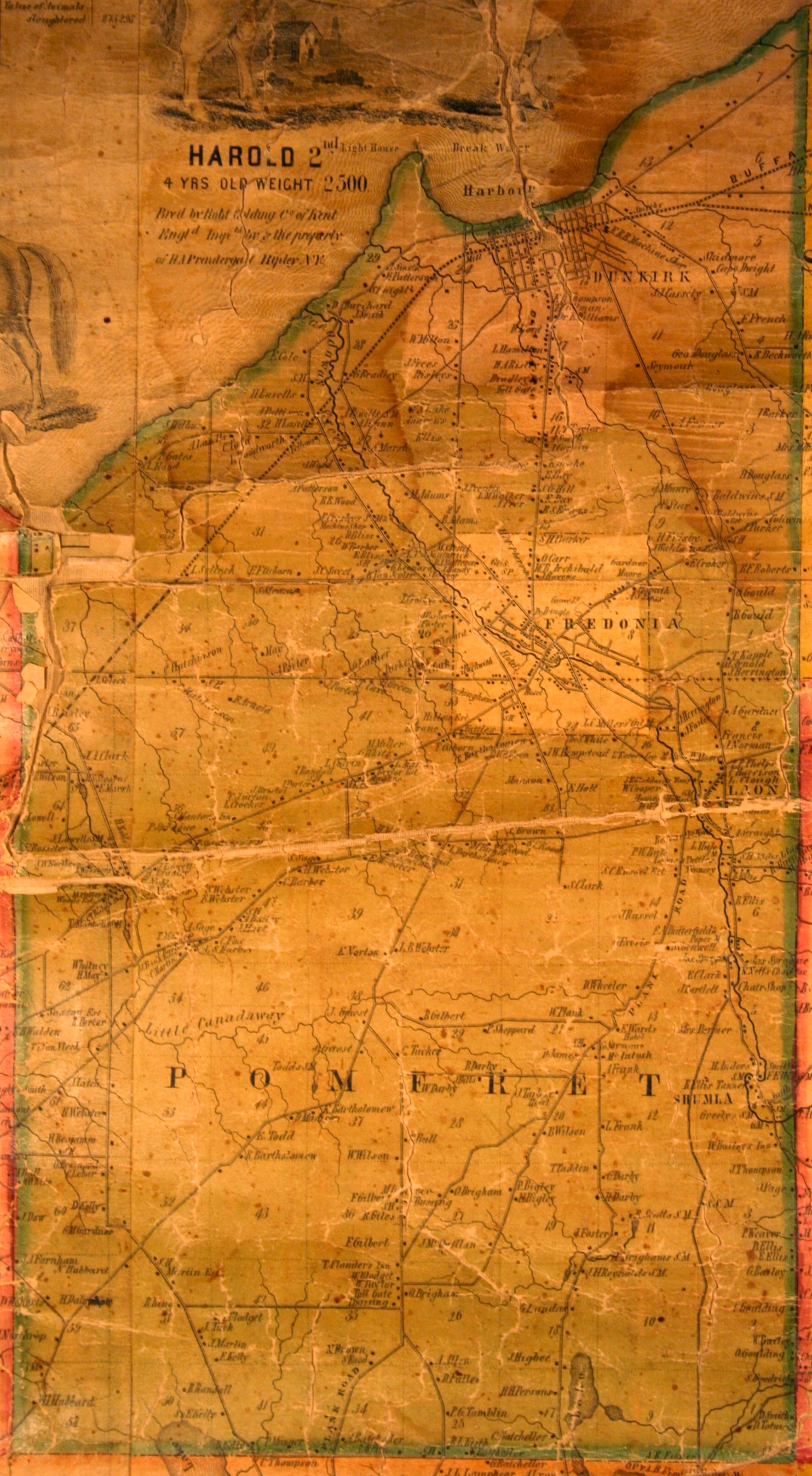
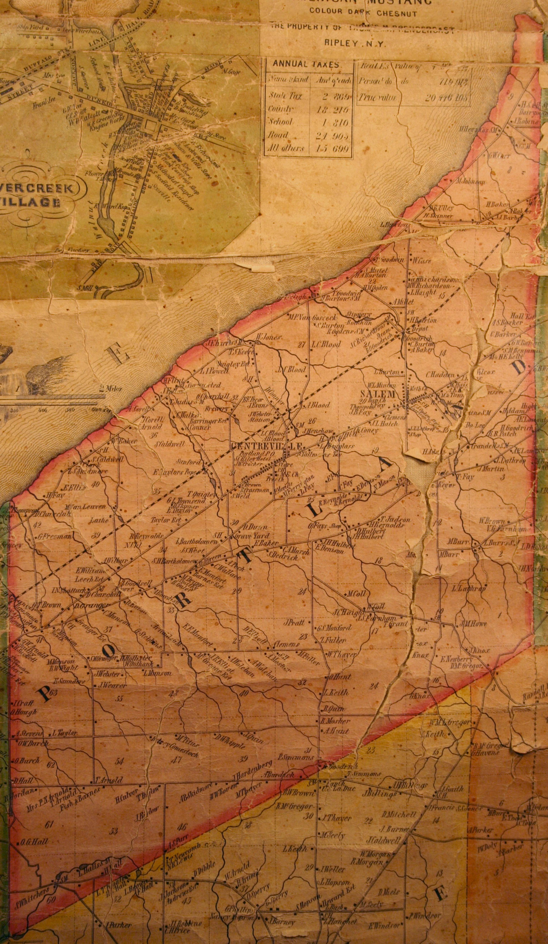
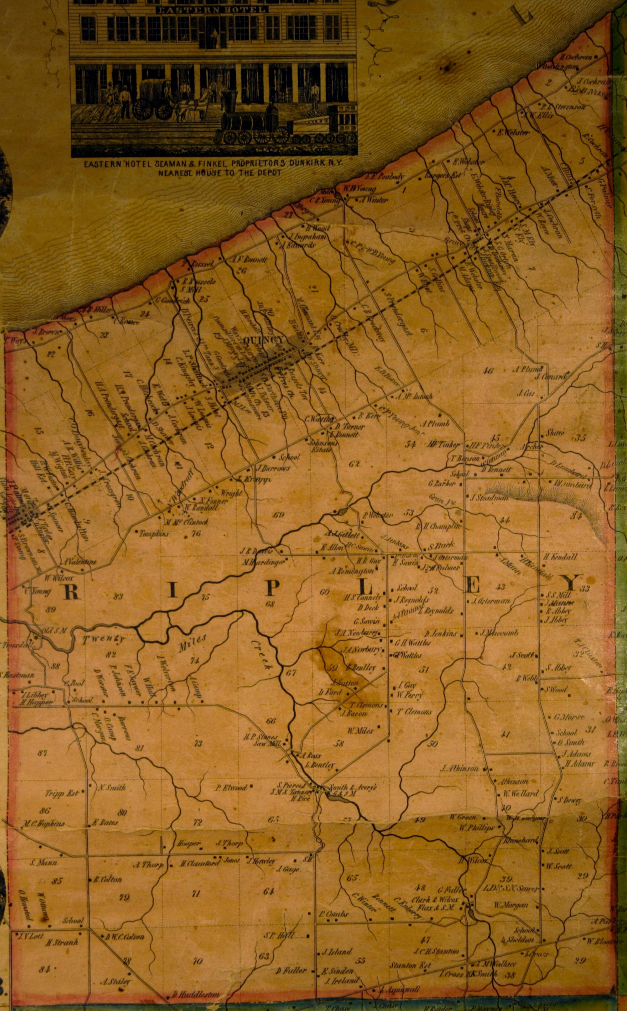
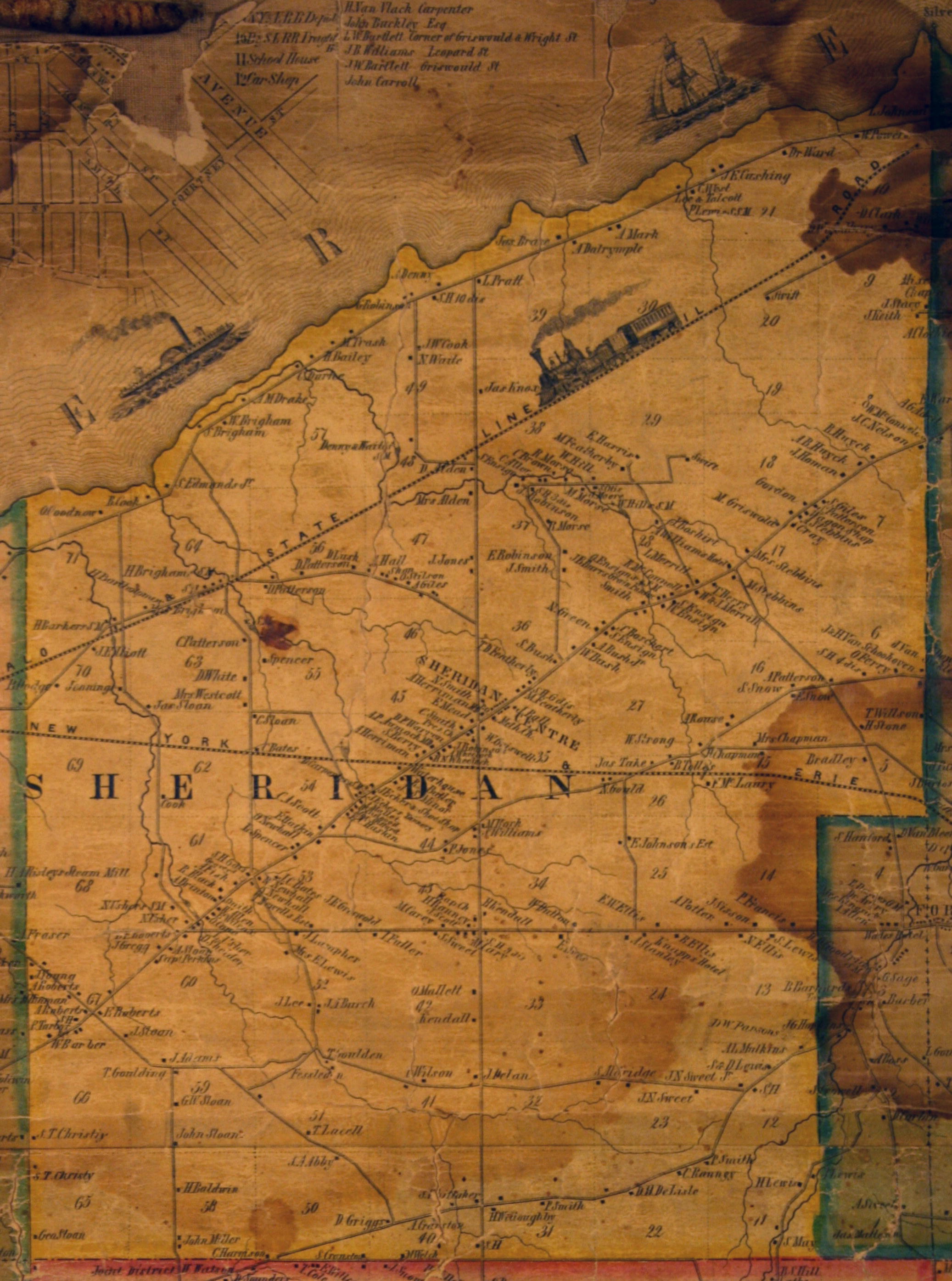
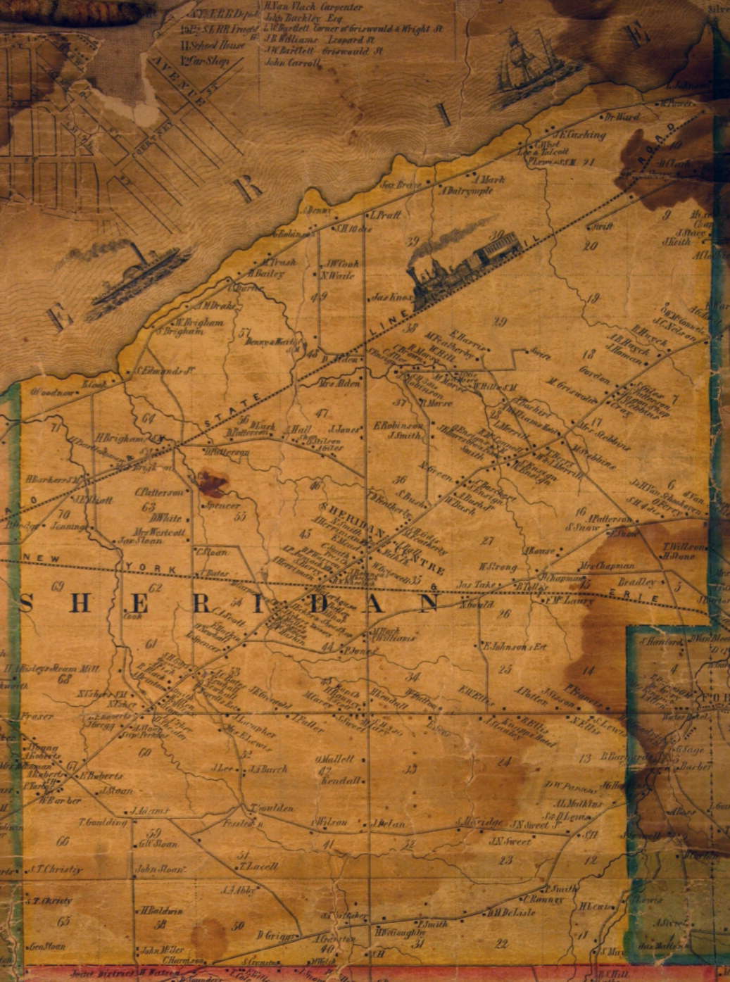
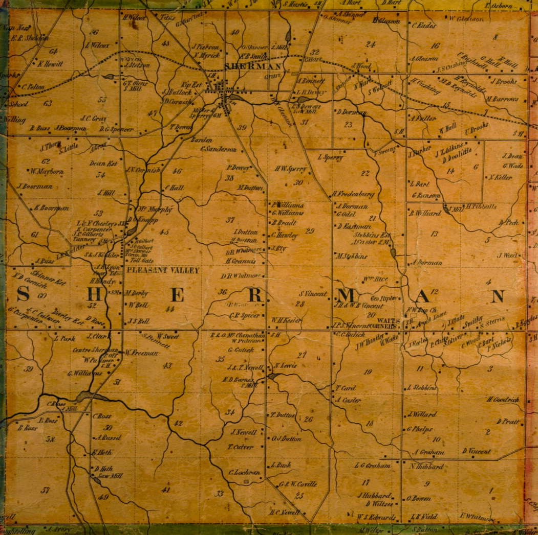
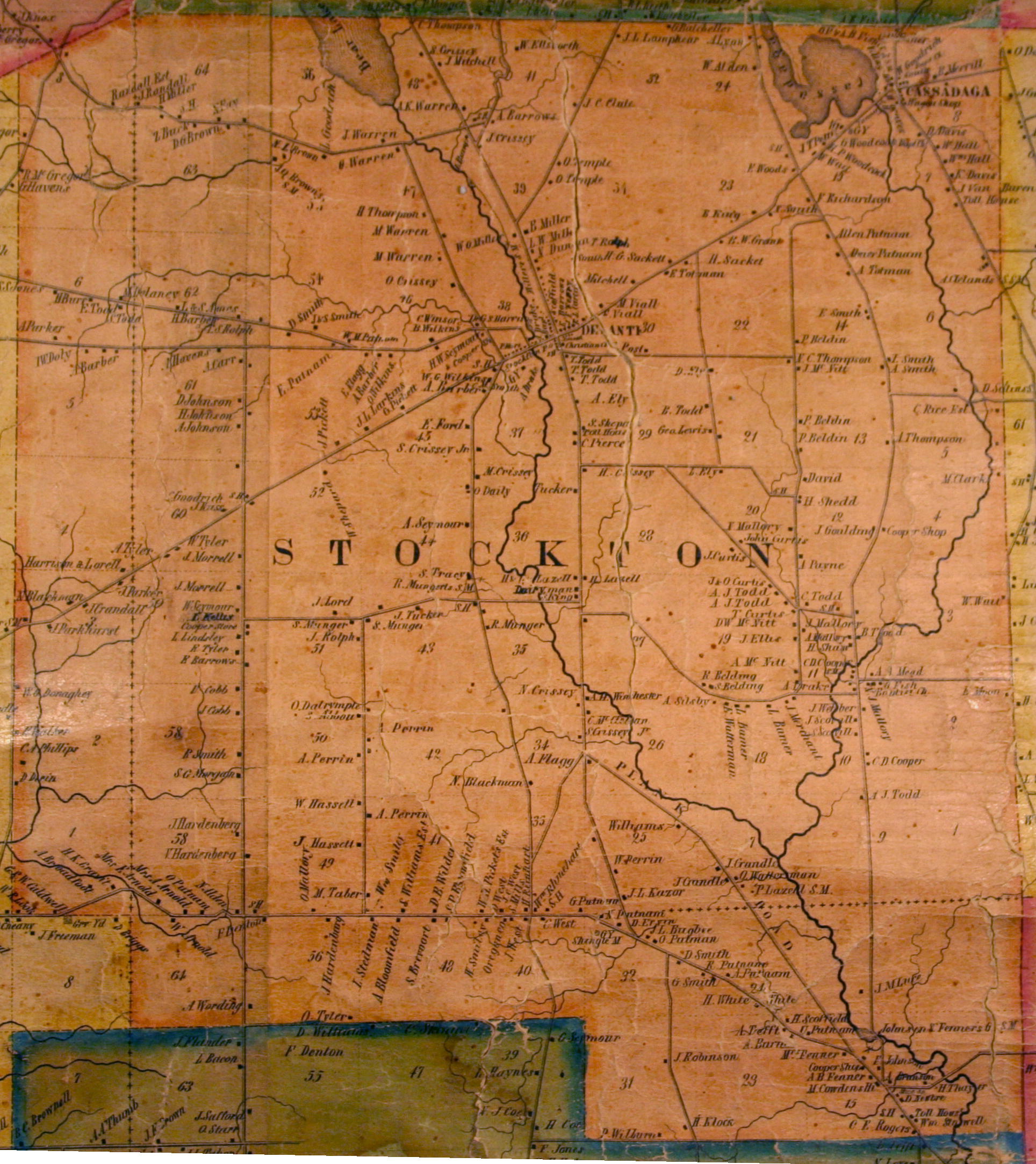
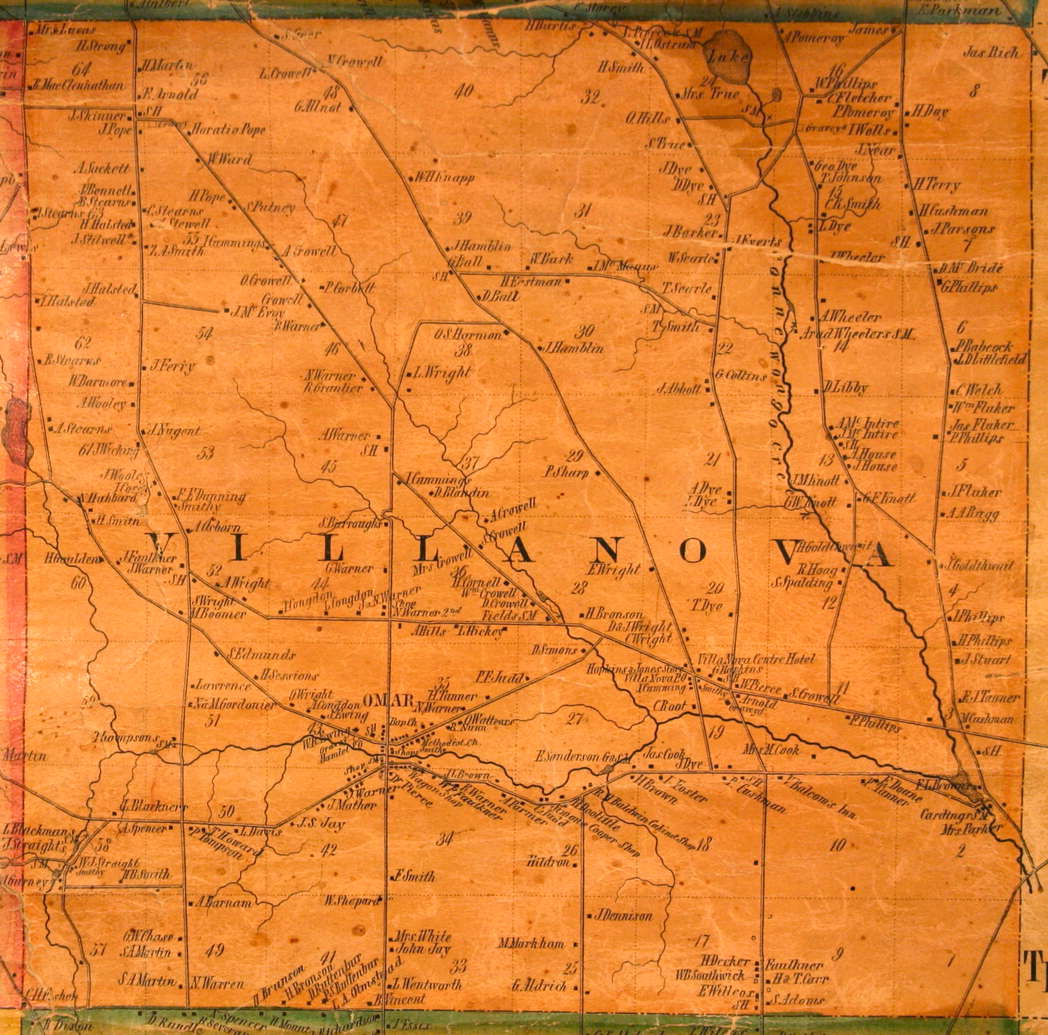
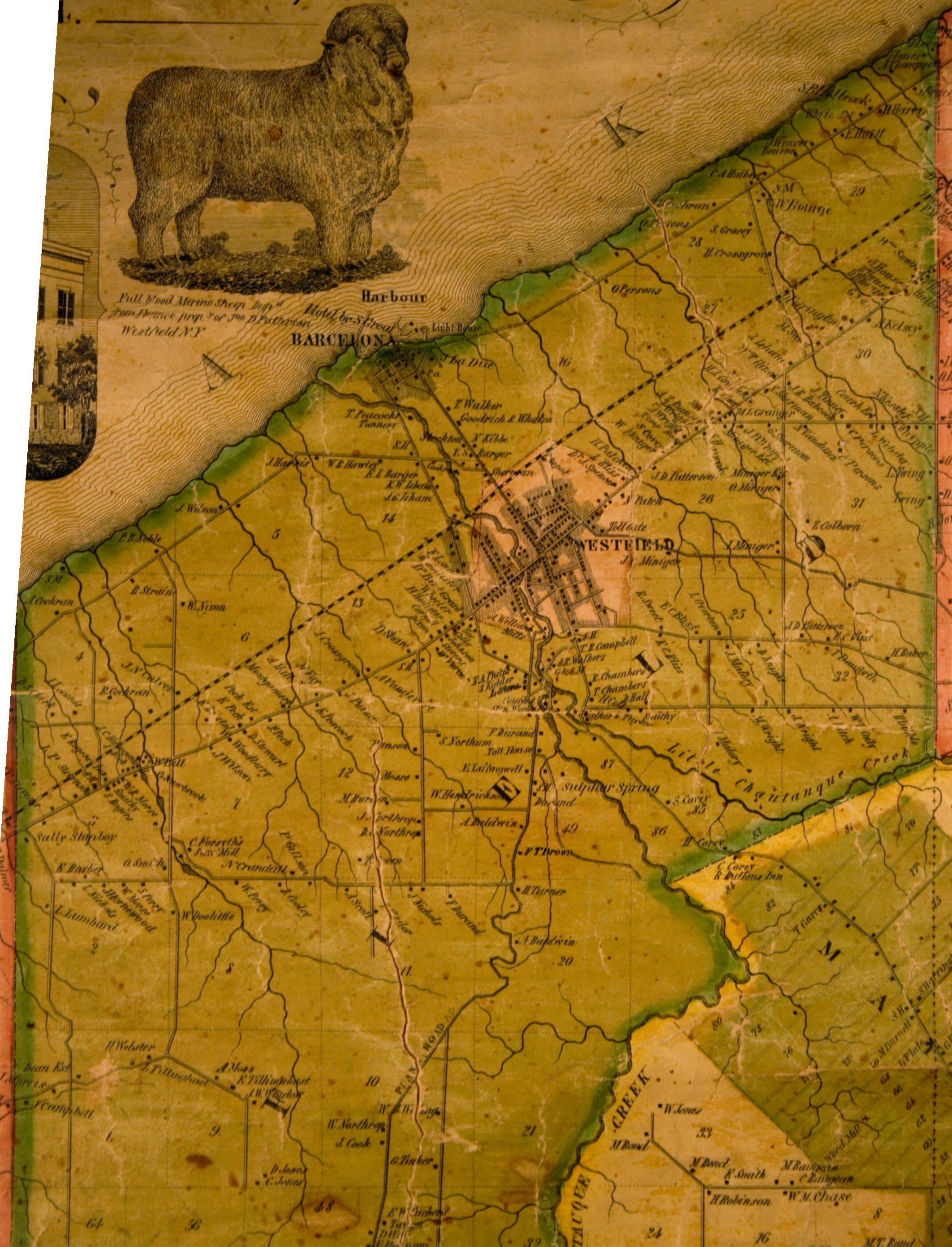
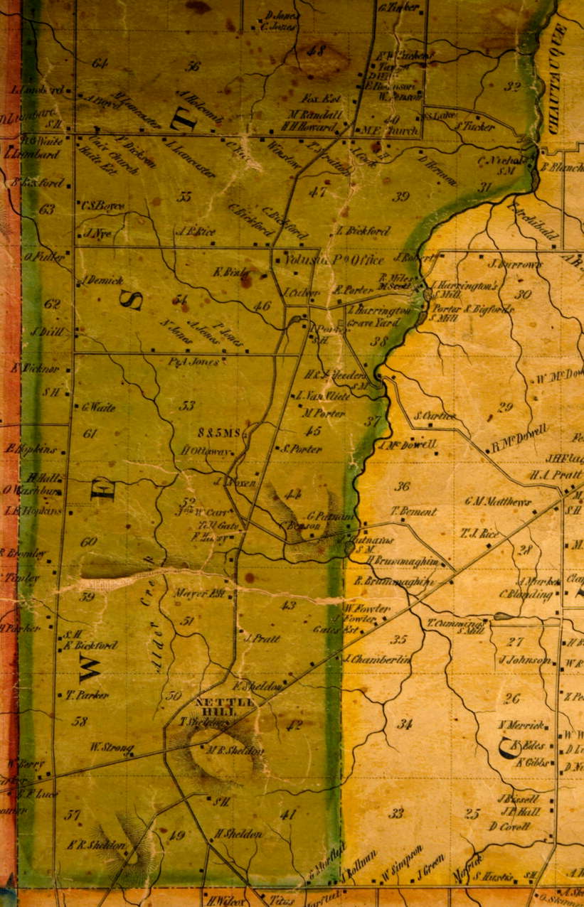
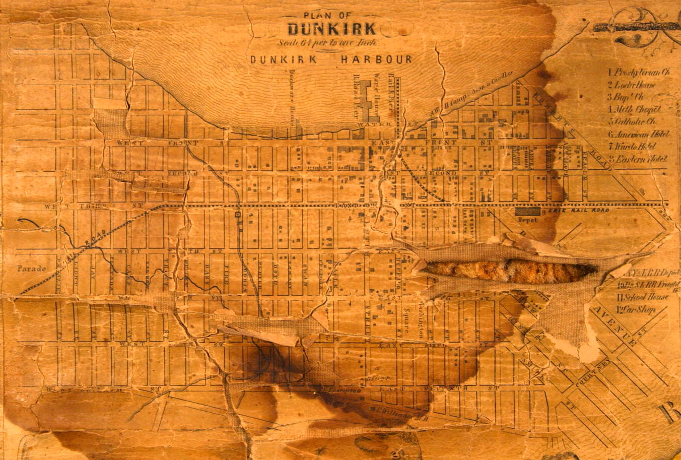
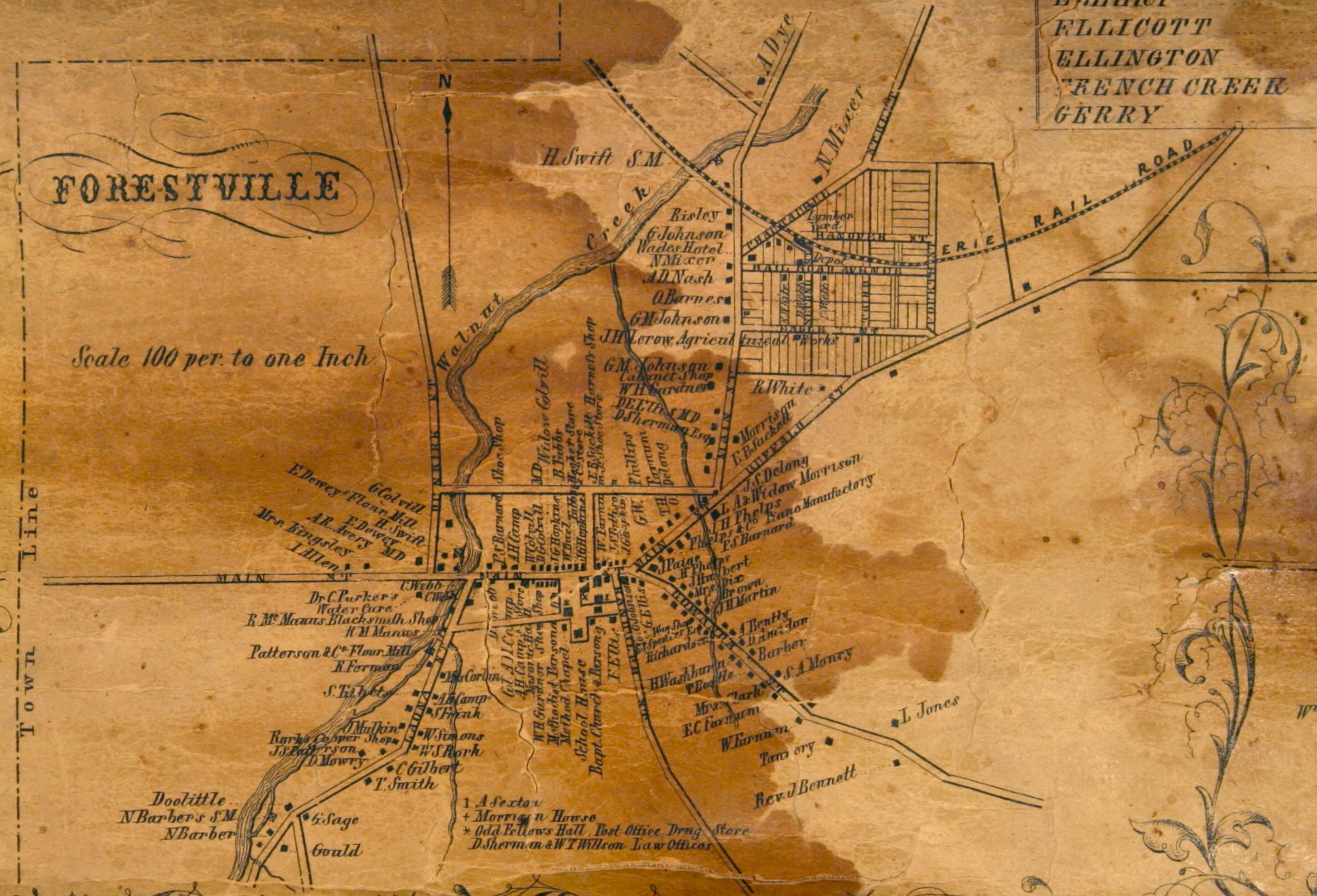
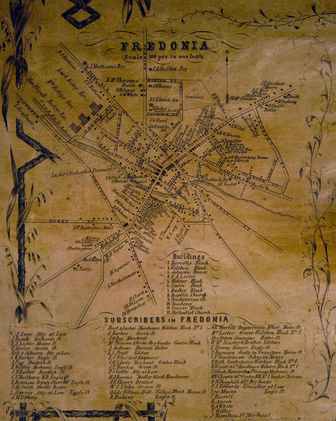
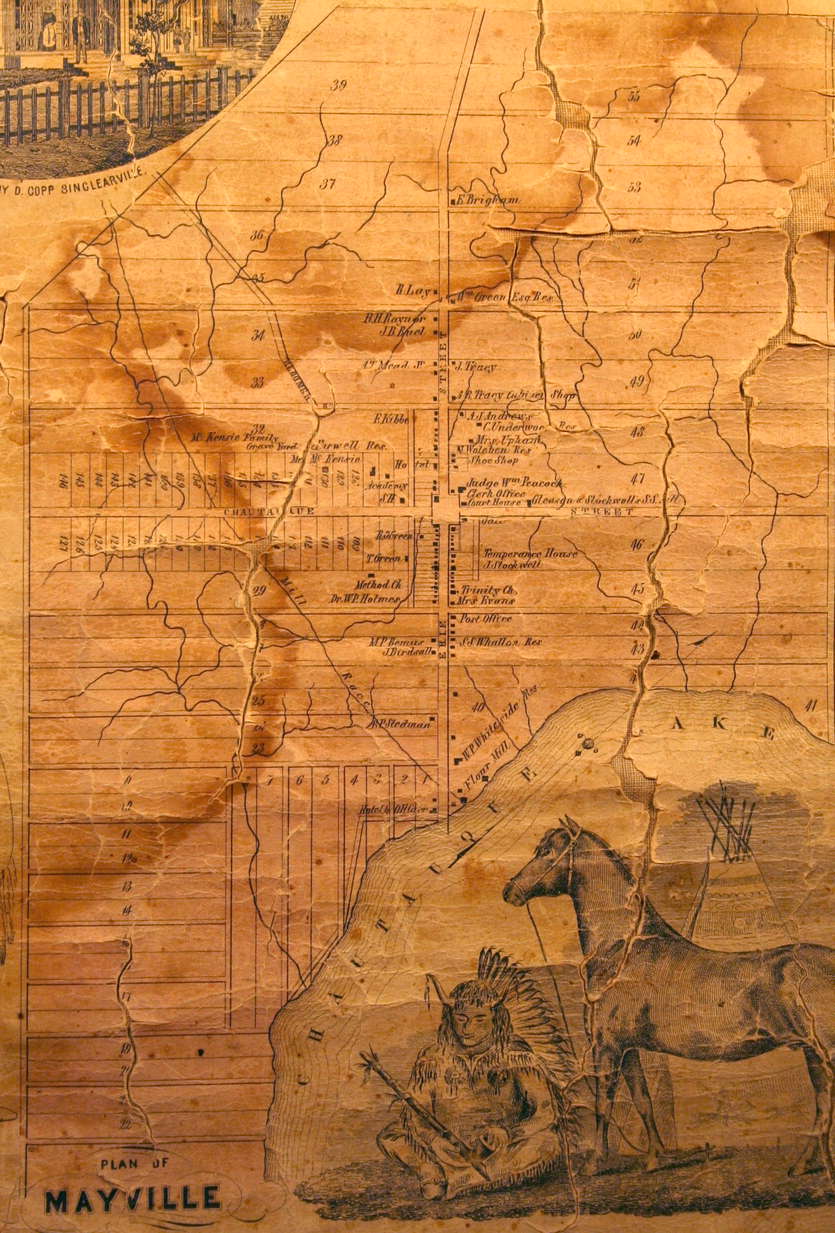
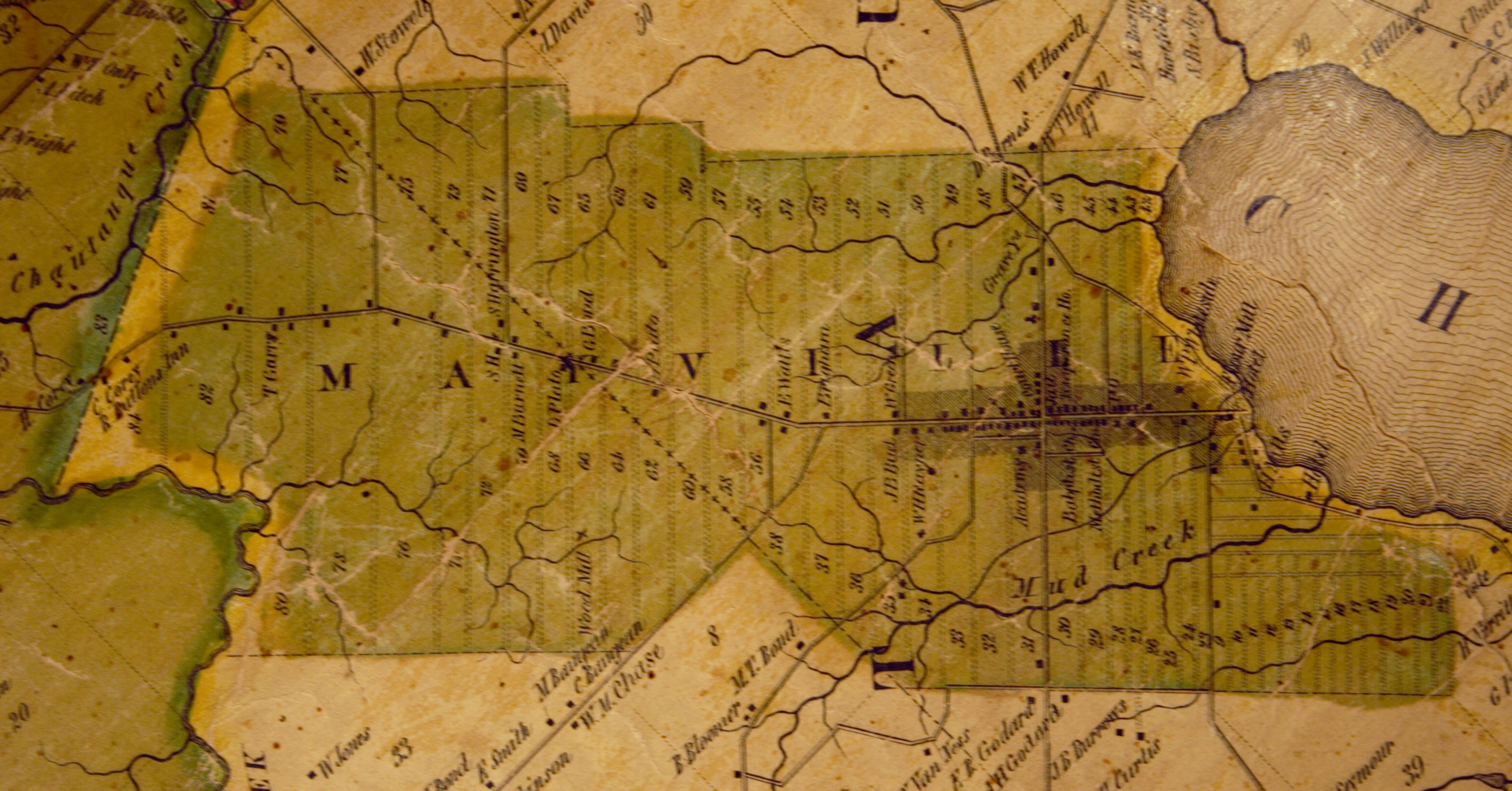
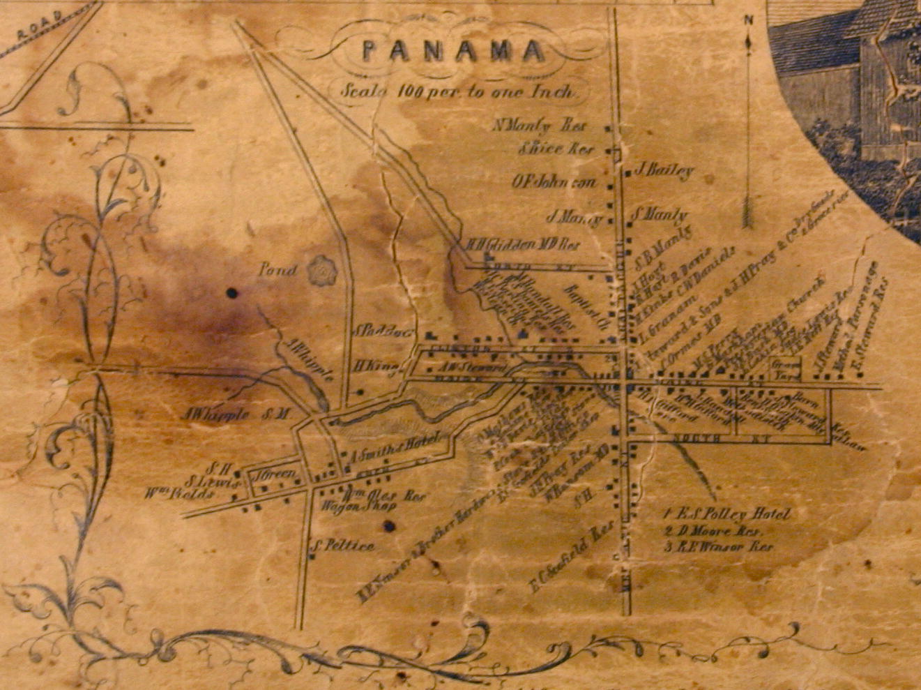
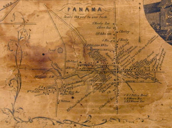
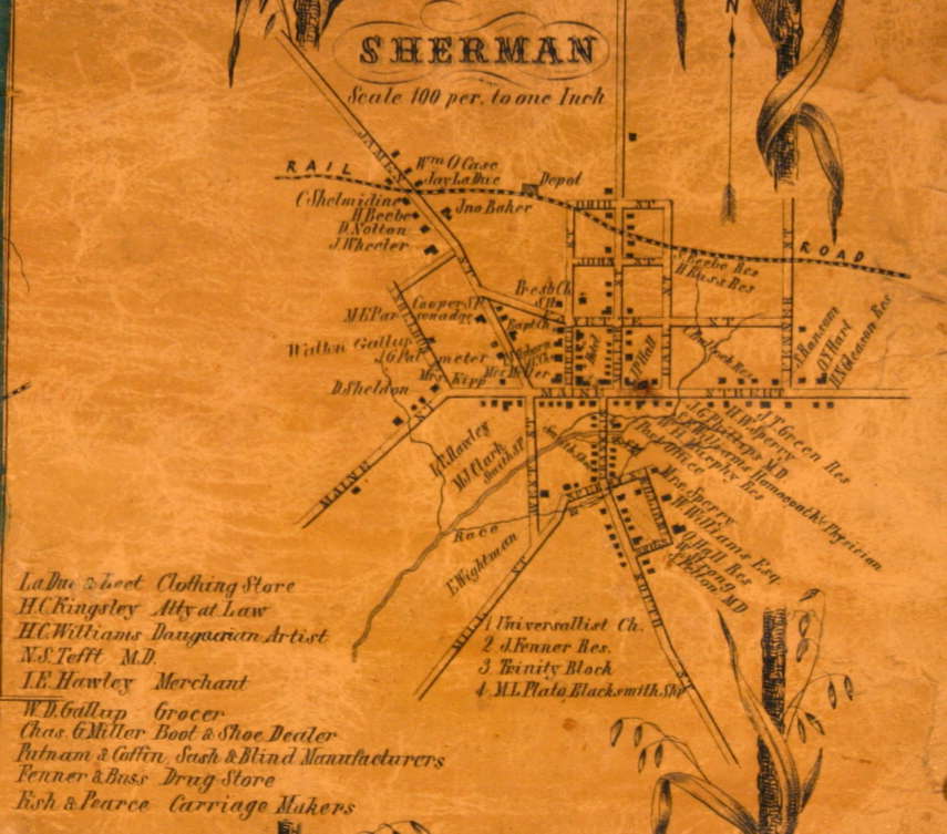
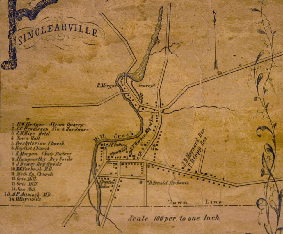
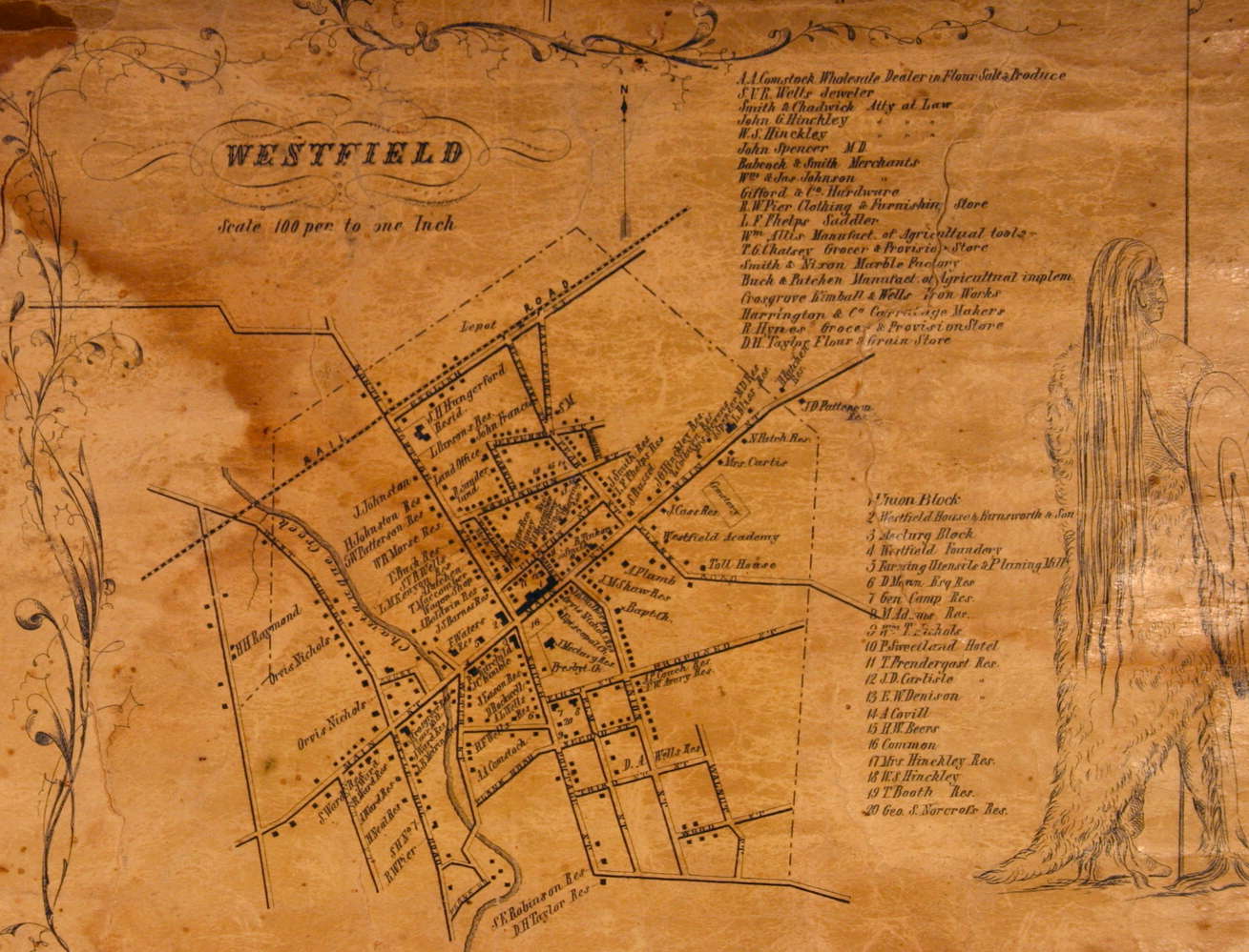
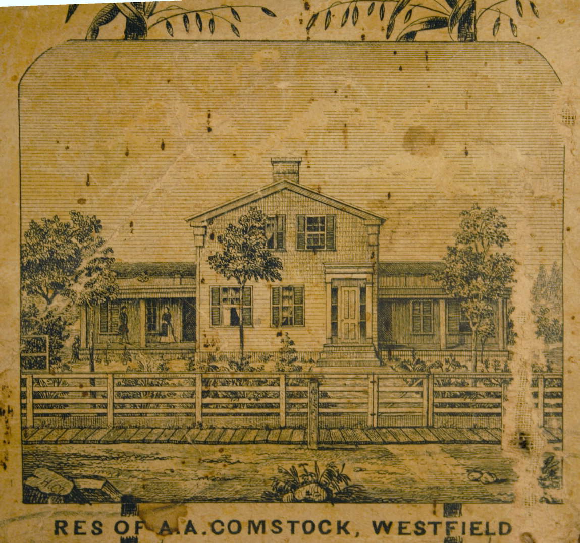
This map of Chautauqua county was contributed by Attorney Frank Della Posta to be photographed and made available on the internet. The map is a significant historical document because of the variety and detail of information it contains, such as: outlines of townships, roads, and streams; locations and descriptions of structures and owner's names; county and township statistics; village maps; and subscriber lists. Included in this posting is a description and history of the map.
Other copies of the map exist, e.g., in the Court Room of the Pomfret Town Hall, McClurg Museum in Westfield, and Fenton Museum in Jamestown.
|
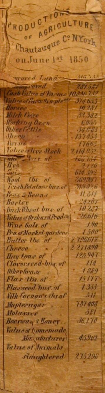
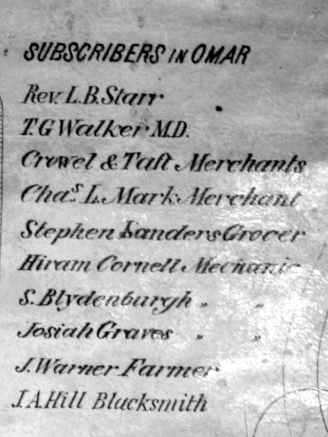
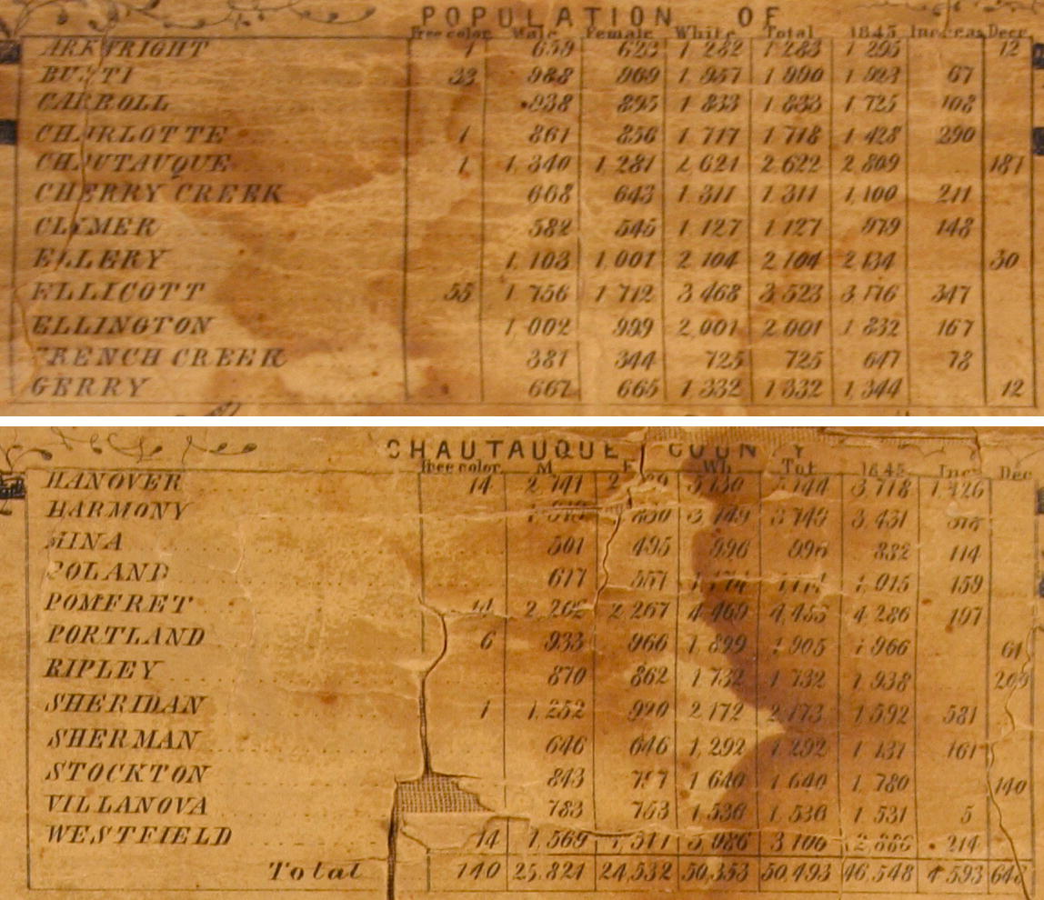
Lists and statistics |
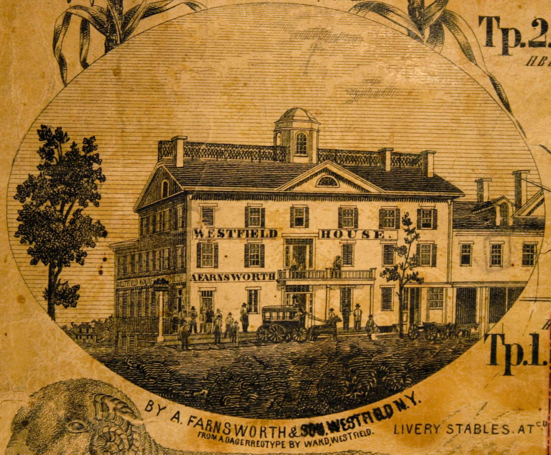
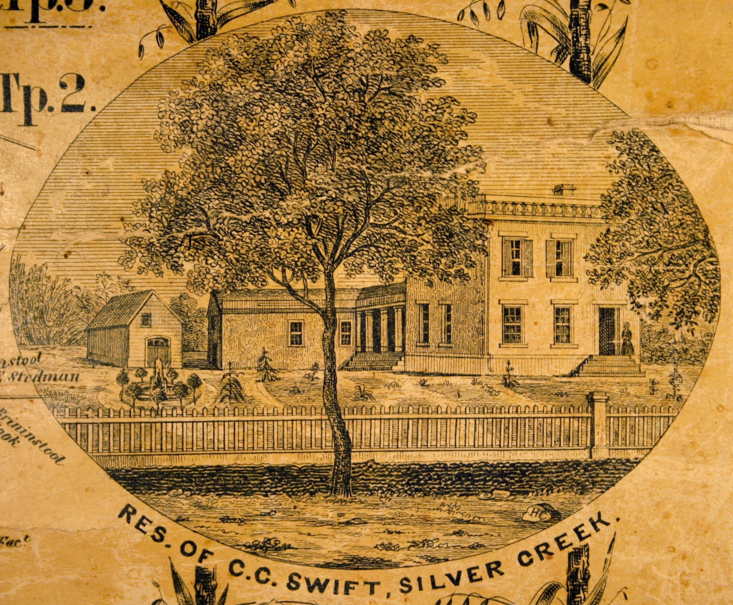
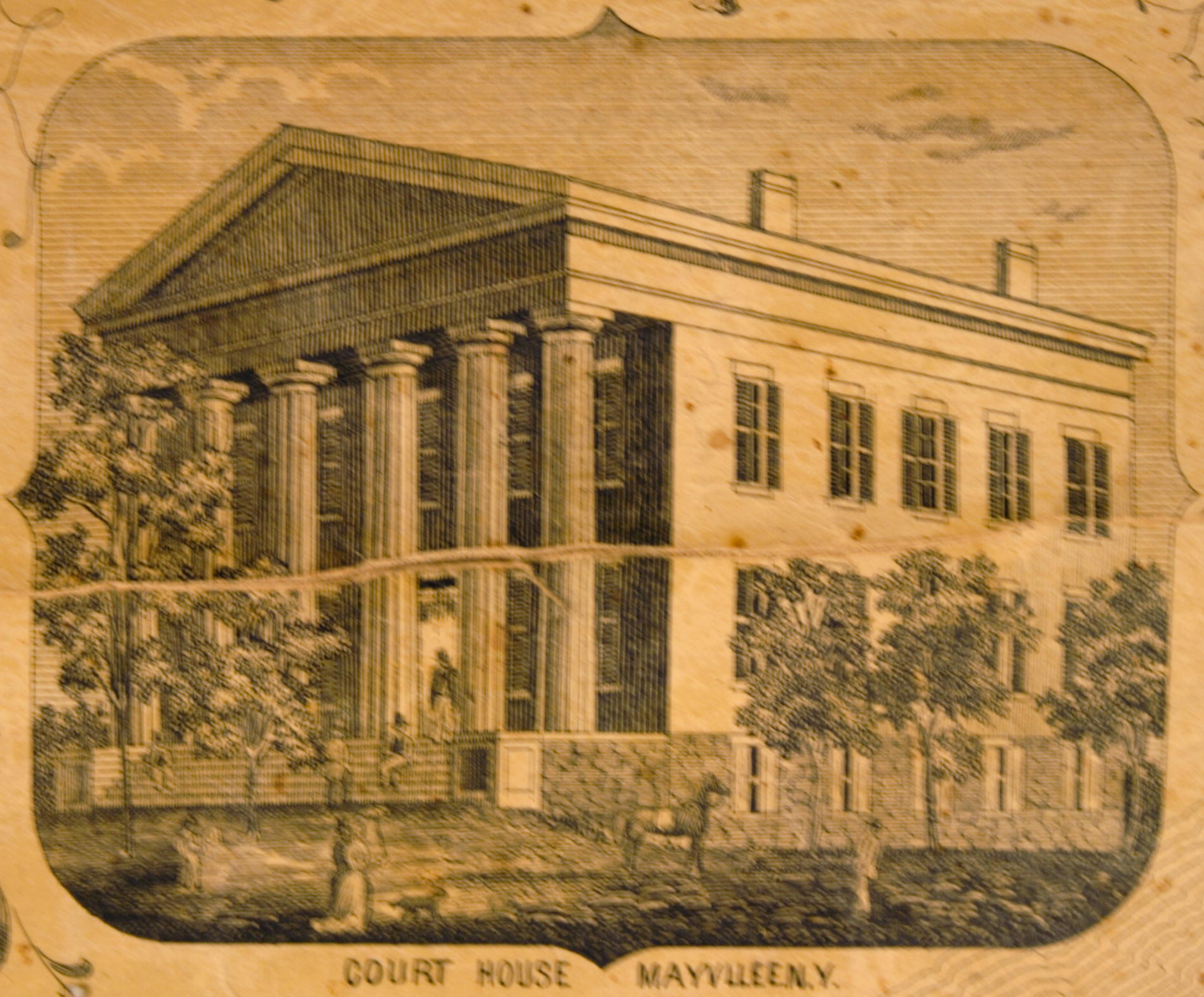
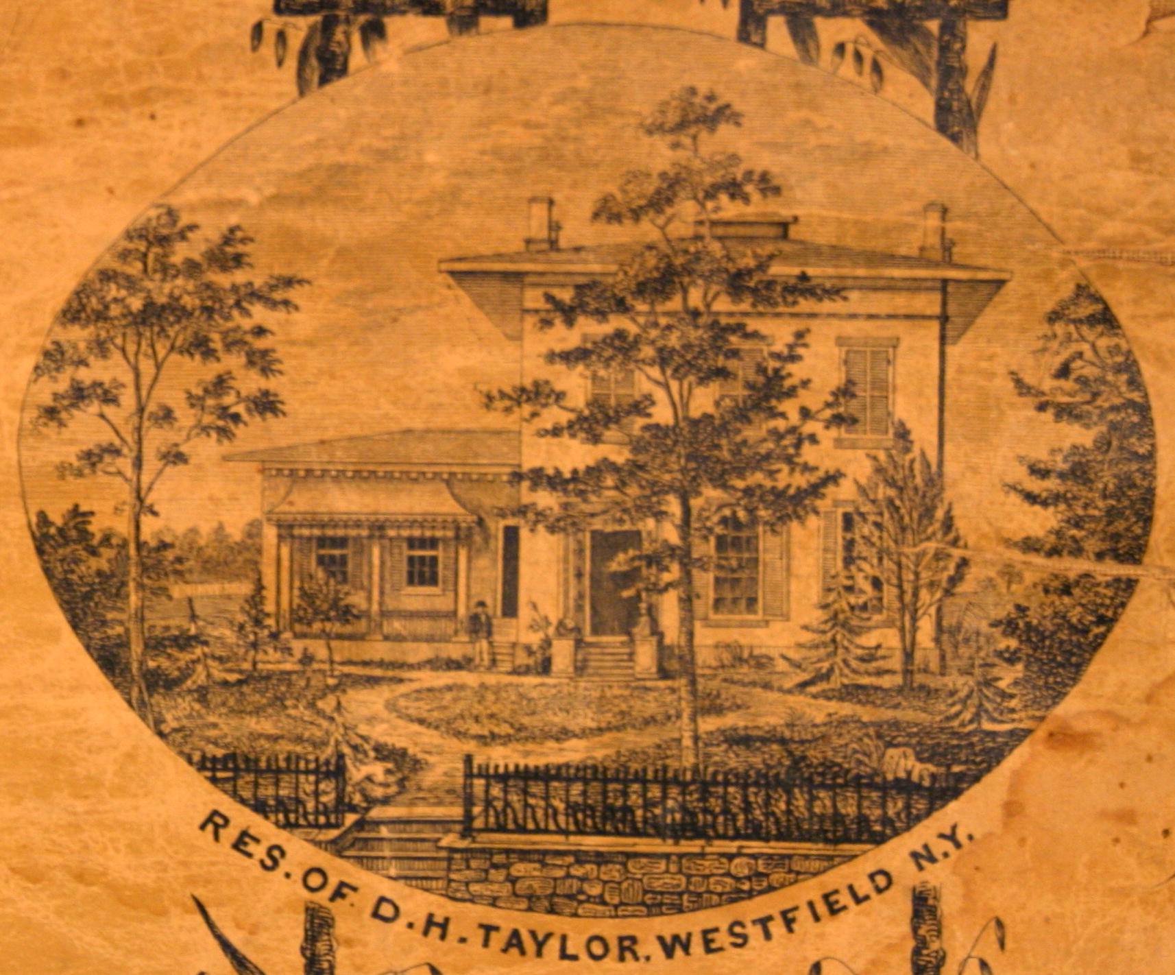
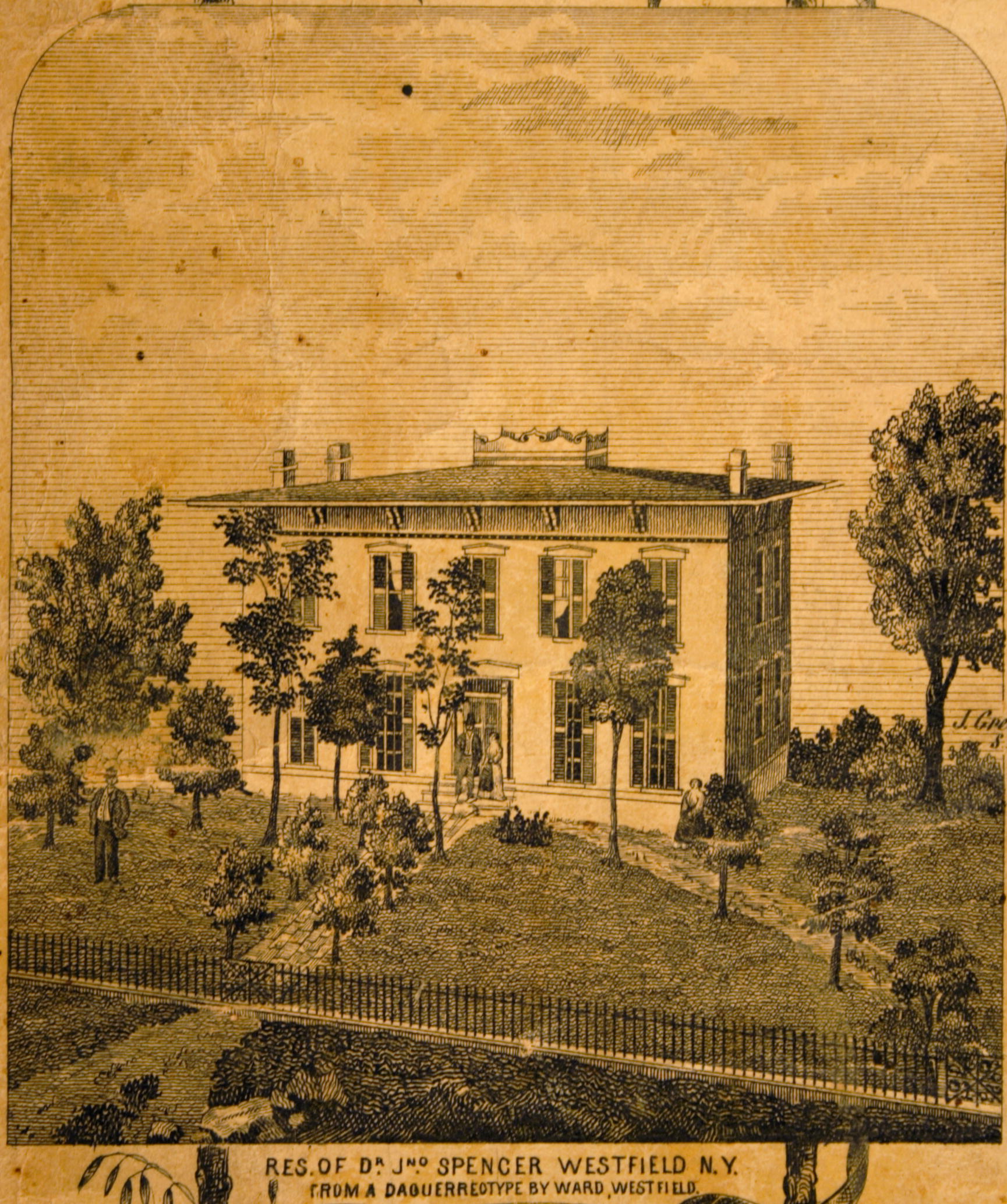
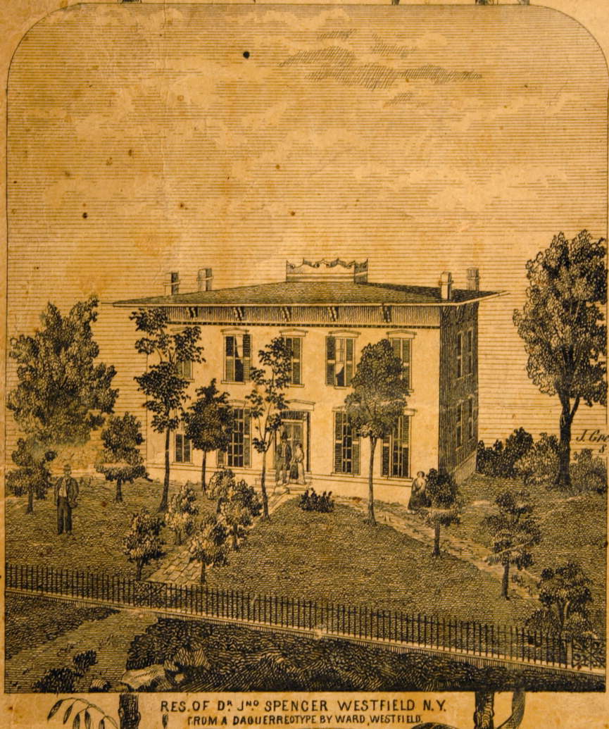
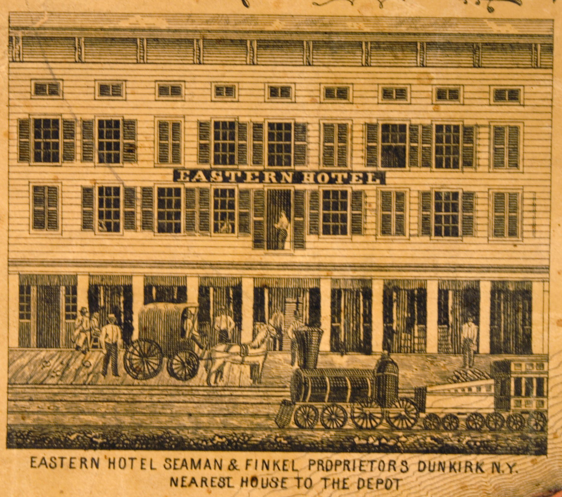
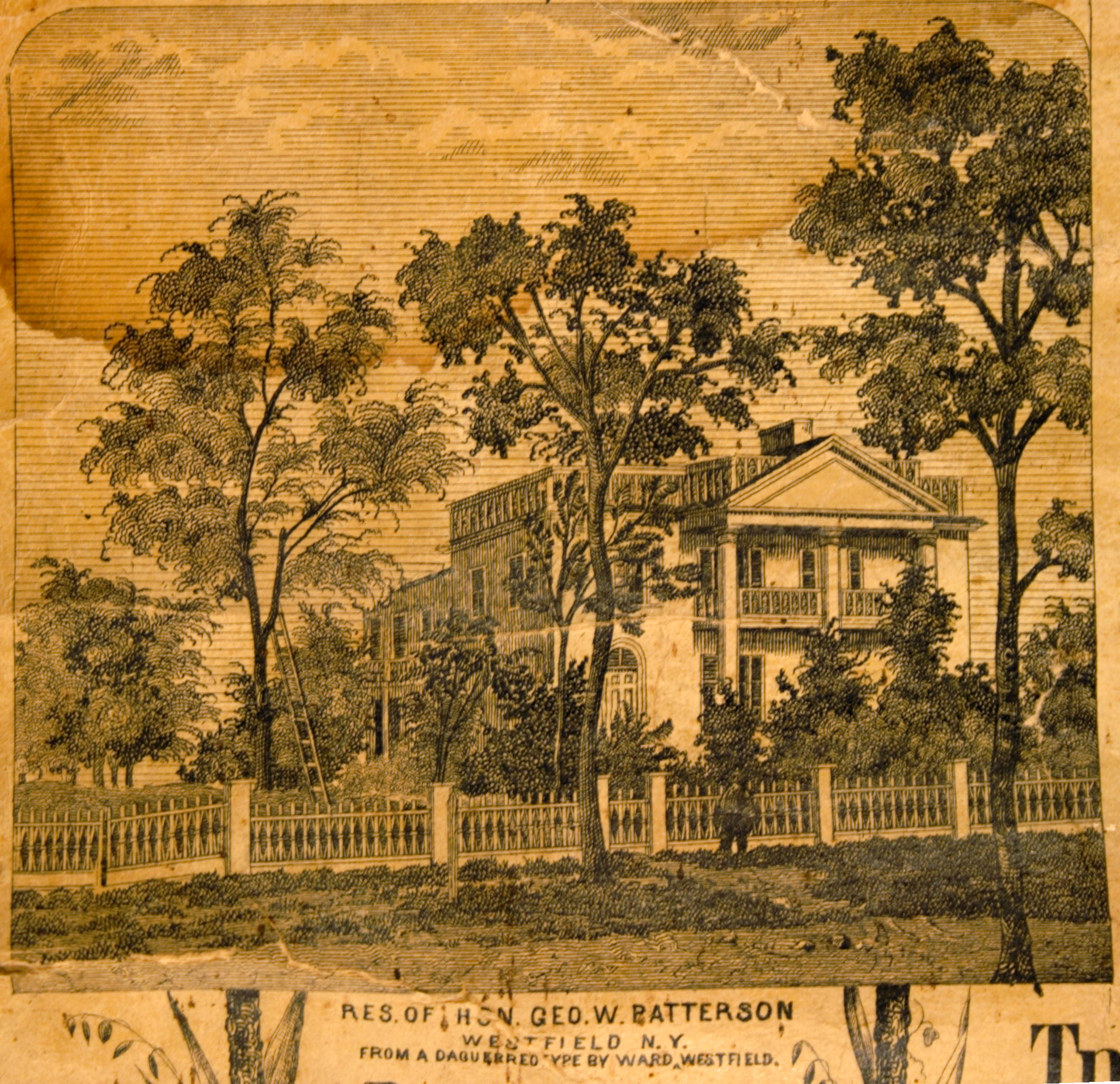
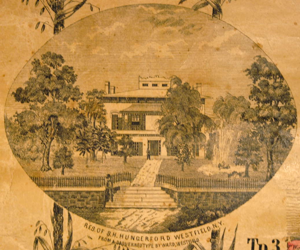
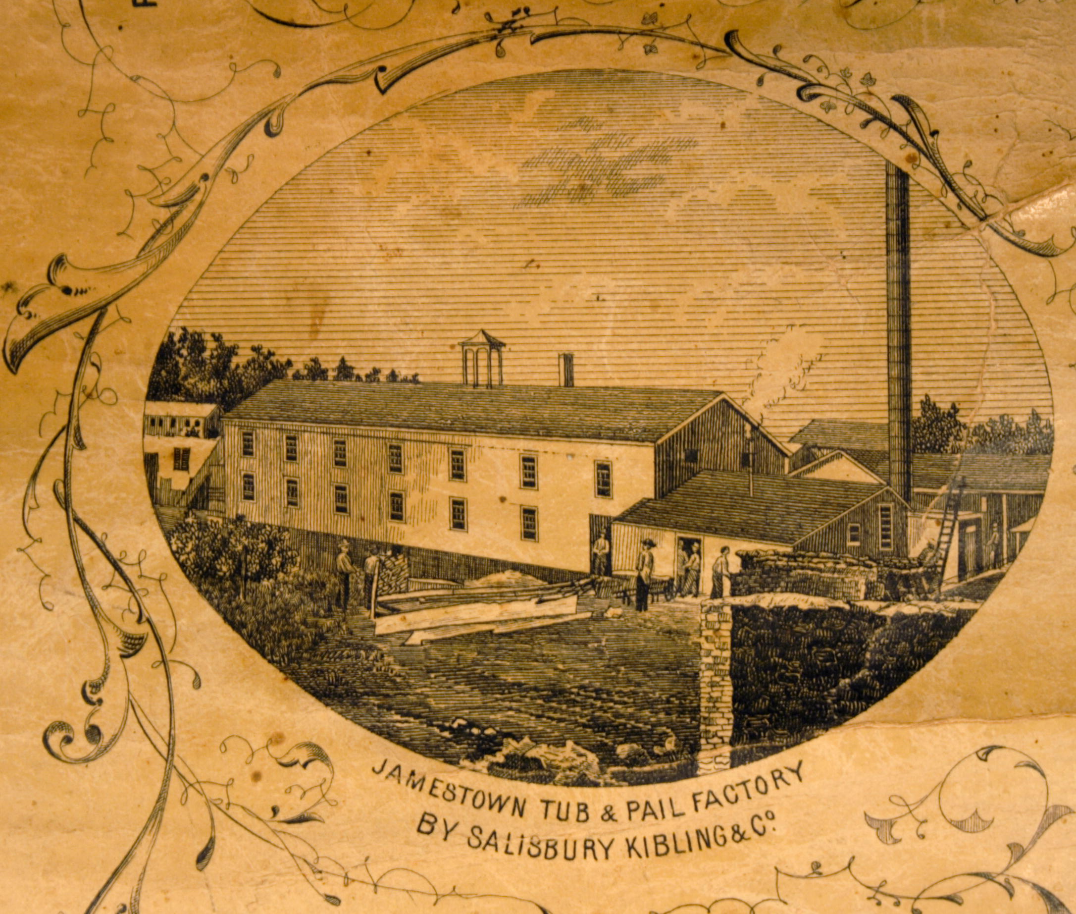
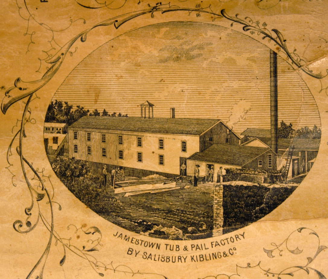
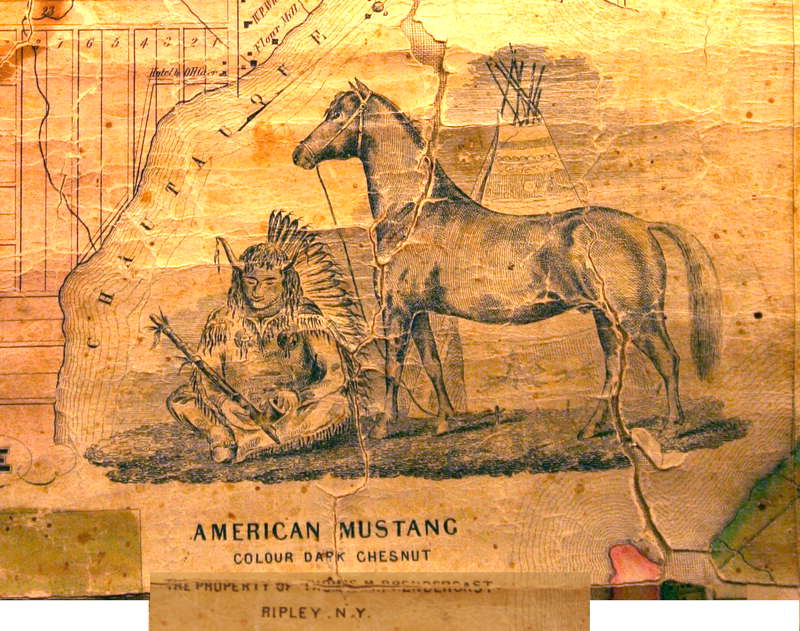
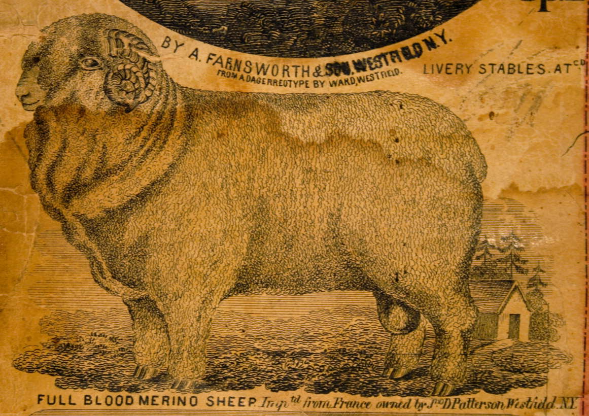
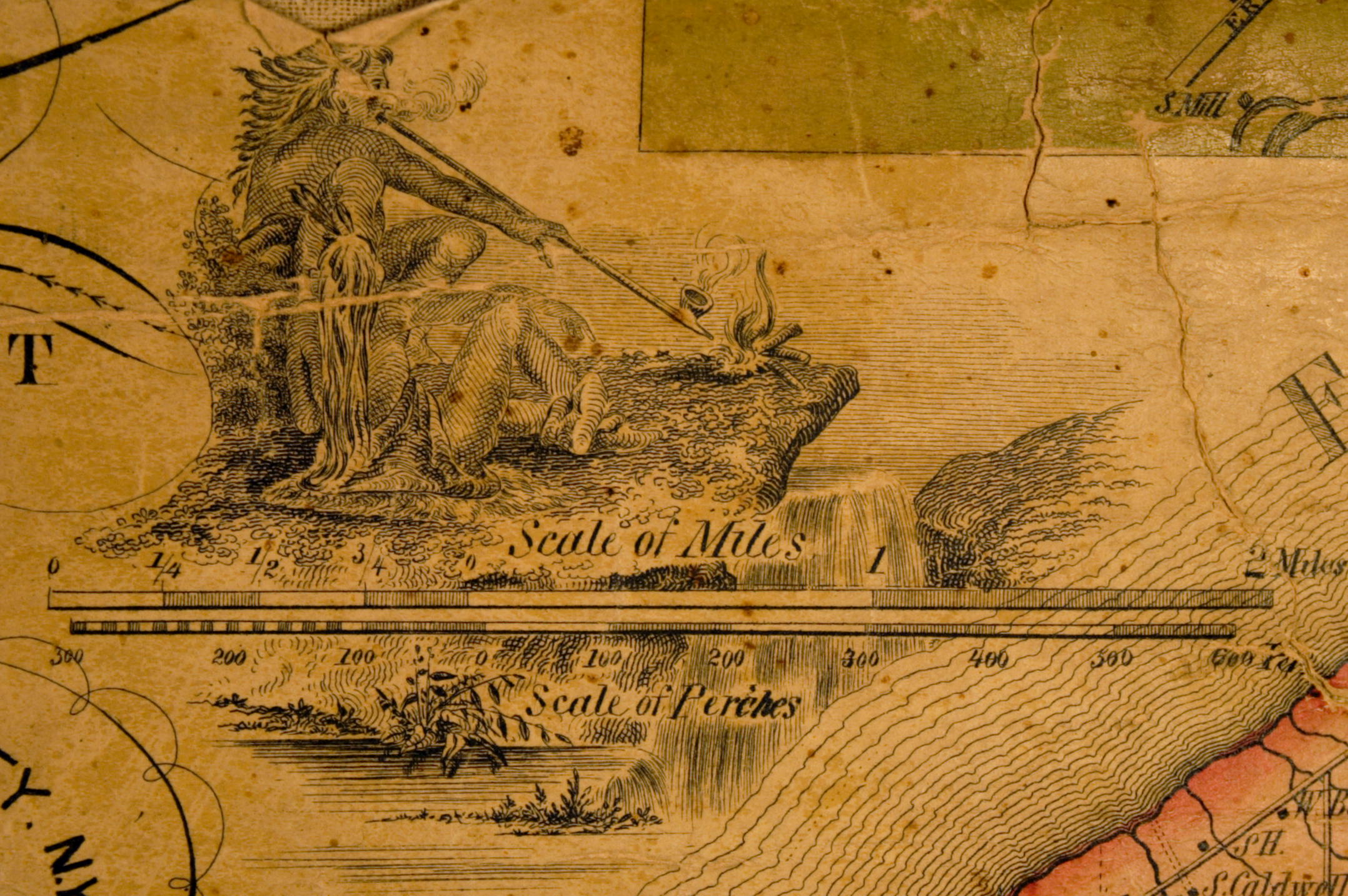
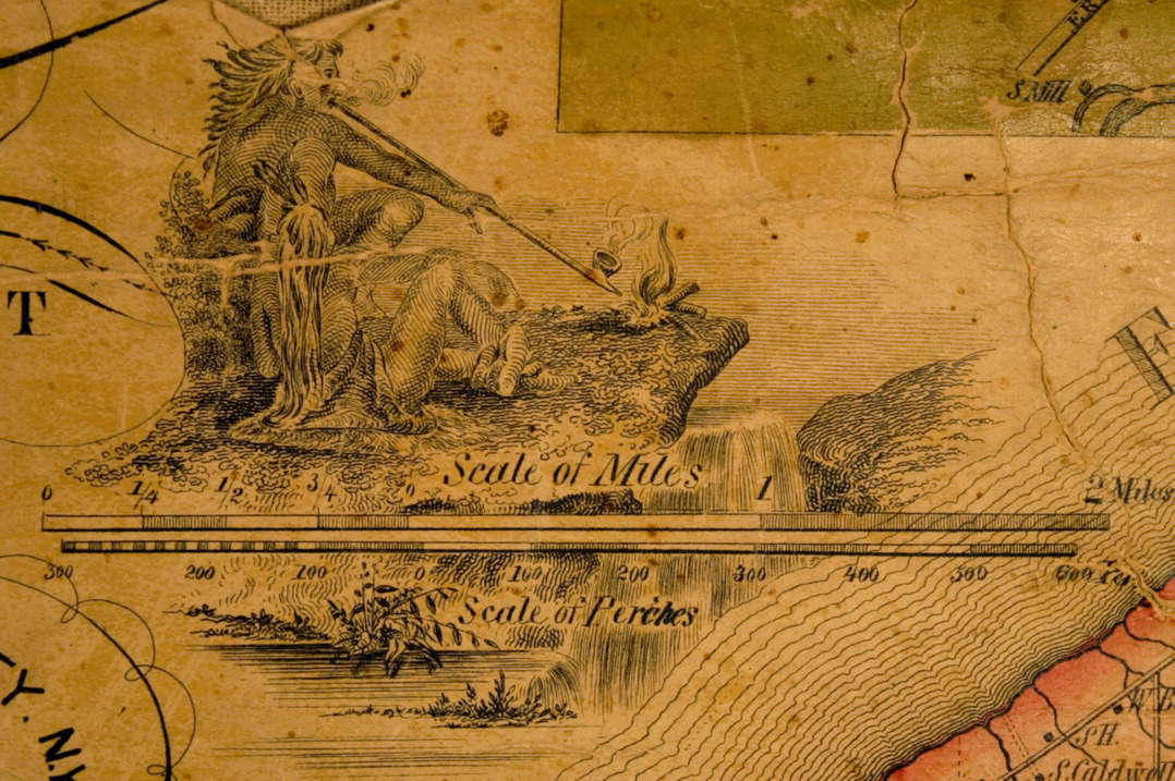
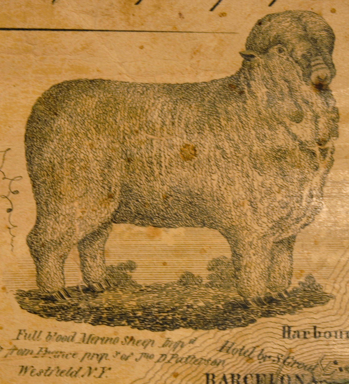
Illustrations |