 Warren County, New JerseyMaps, Atlases, Iconography |
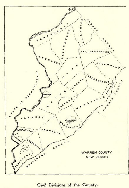
Warren County Boroughs, Towns, and Townships
 |
|
Boroughs: Alpha & Washington Towns: Belvidere & Hackettstown Townships: Allamuchy, Blairstown, Franklin,
Frelingheysen, Greenwich, Hardwick, Harmony, Hope, Independence,
Knowlton, Liberty, Lopatcong, Mansfield, Oxford, Pahaquarry,
Pohatcong, Washington & White |
 Beers, F. W.
"County Atlas of Warren, New Jersey" (New York: F.W. Beers & Co.,
1871).
Beers, F. W.
"County Atlas of Warren, New Jersey" (New York: F.W. Beers & Co.,
1871).
Beers, F. W.
"County Atlas of Warren, New Jersey" (New York: F.W. Beers & Co.,
1874) reprinted by Harmony Press, 1983.
County:
Warren County, NJ 1895 large image file
Historical Warren County Maps -- Rutgers University
Warren
County Map -- Warren County Cultural and Heritage Commission
New Jersey Environmental Digital Library -- Warren
County
New Jersey, 1795 -- Samuel Lewis
Local:
Easton, PA. and Phillipsburg, NJ, 1900
Thank you to John K. Matthews for requesting this Warren
County maps page
[ Return to Warren County NJGenWeb Table of Contents ]
This WebPage was last updated on -- Tuesday, 08-May-2012 11:11:58 MDT