
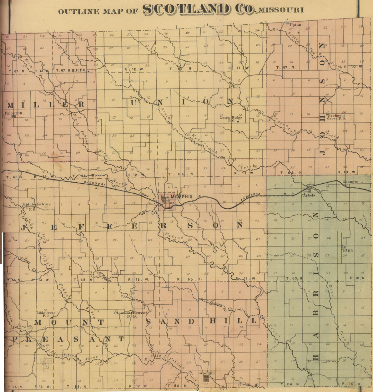
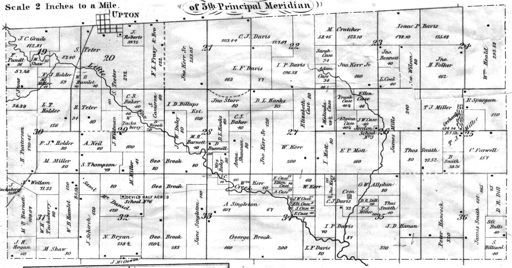
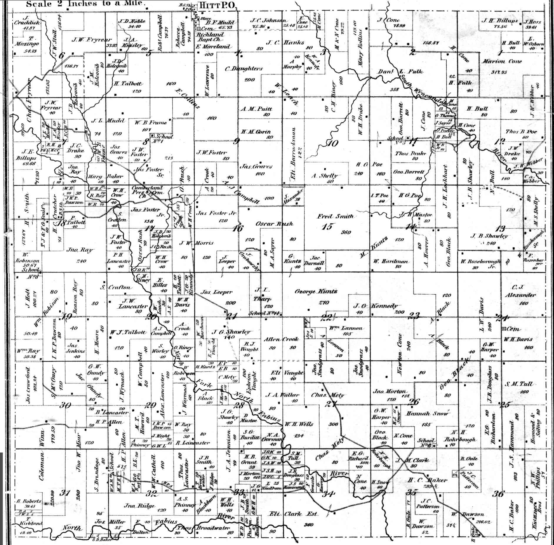
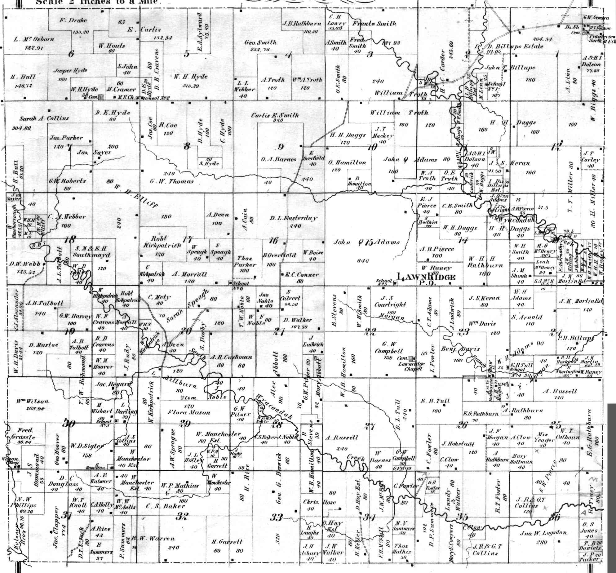
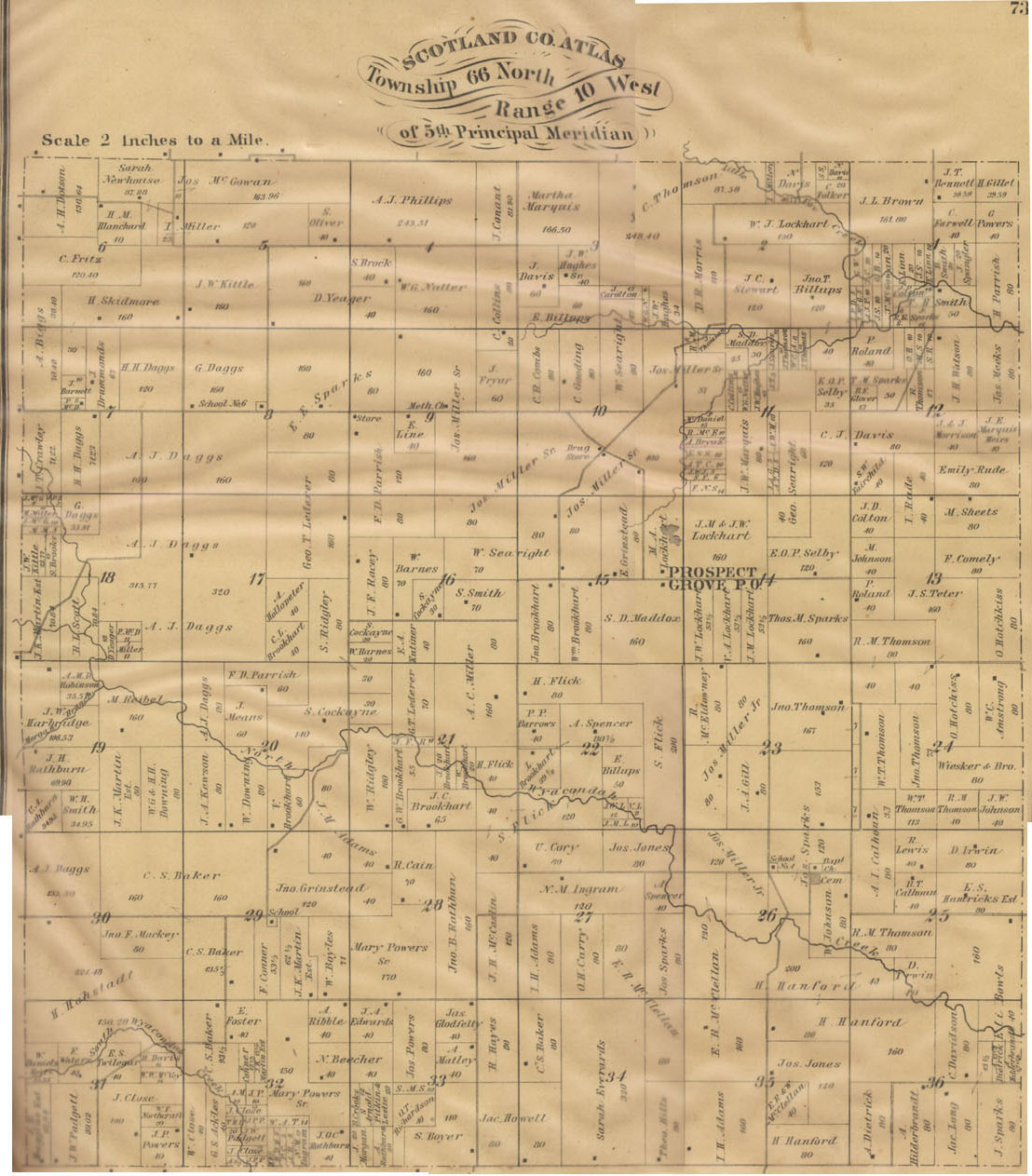
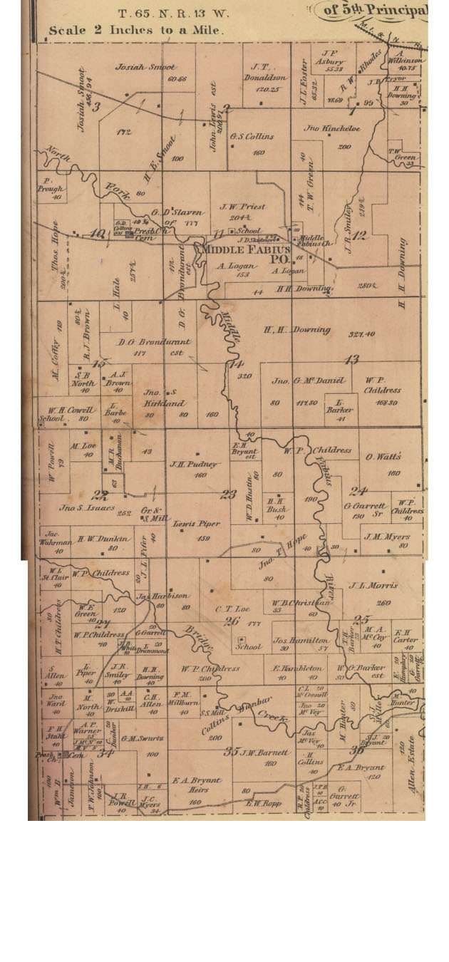
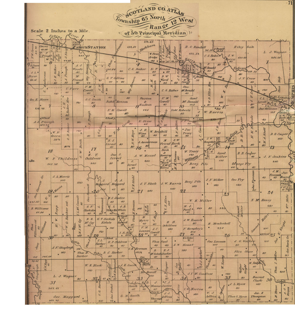
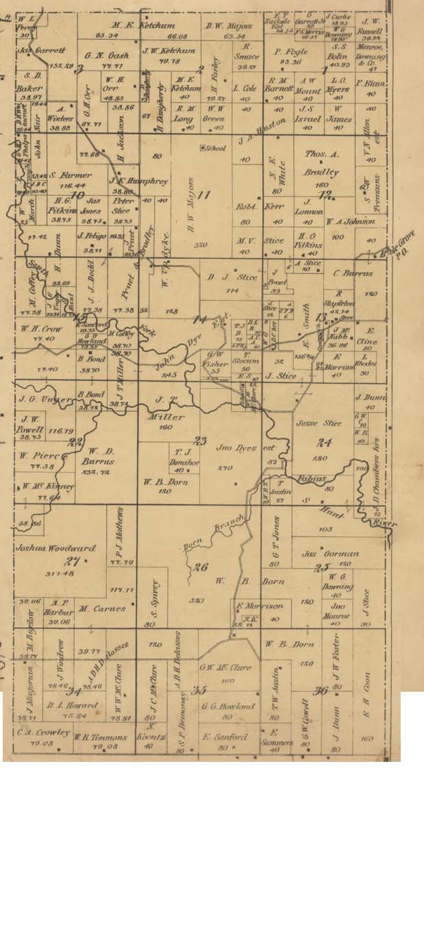
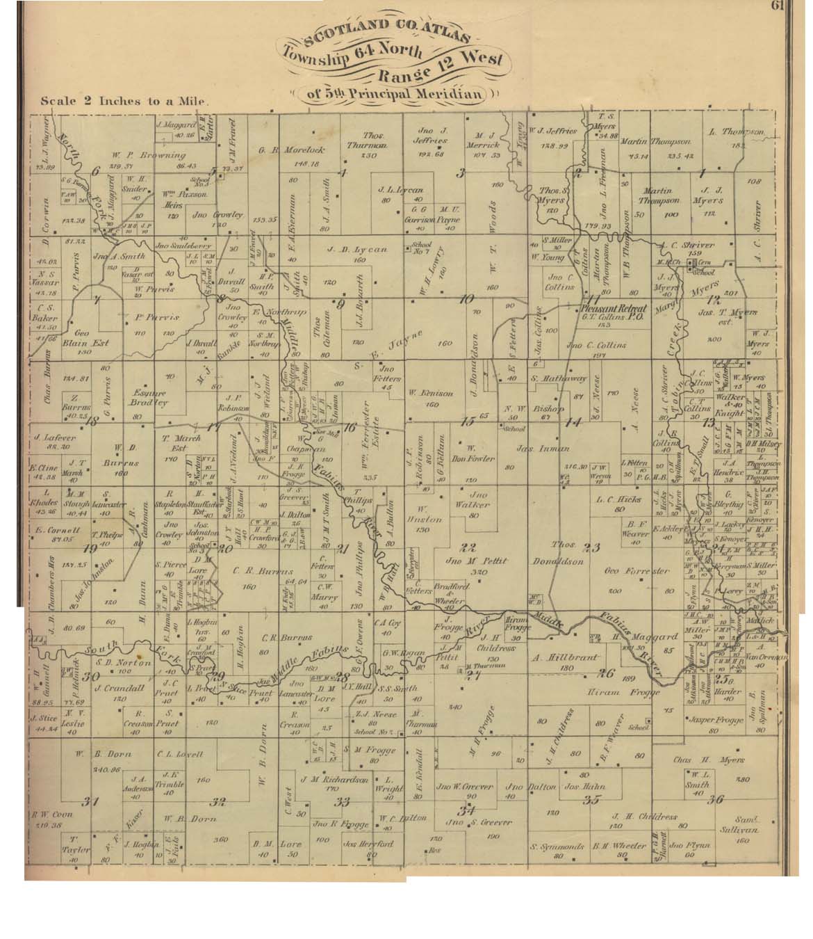
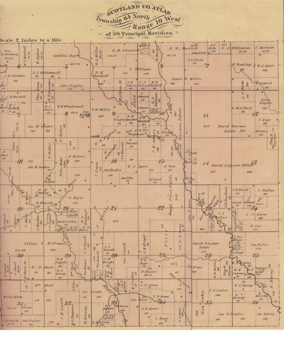
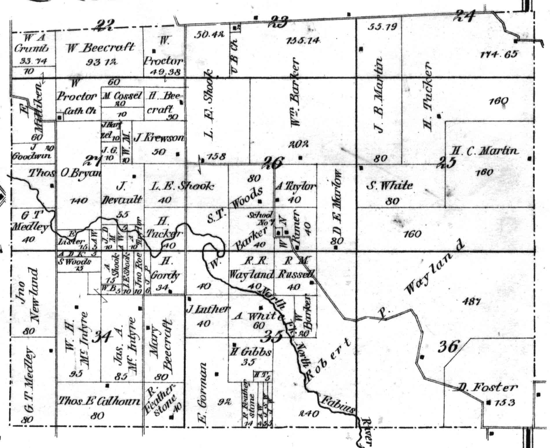
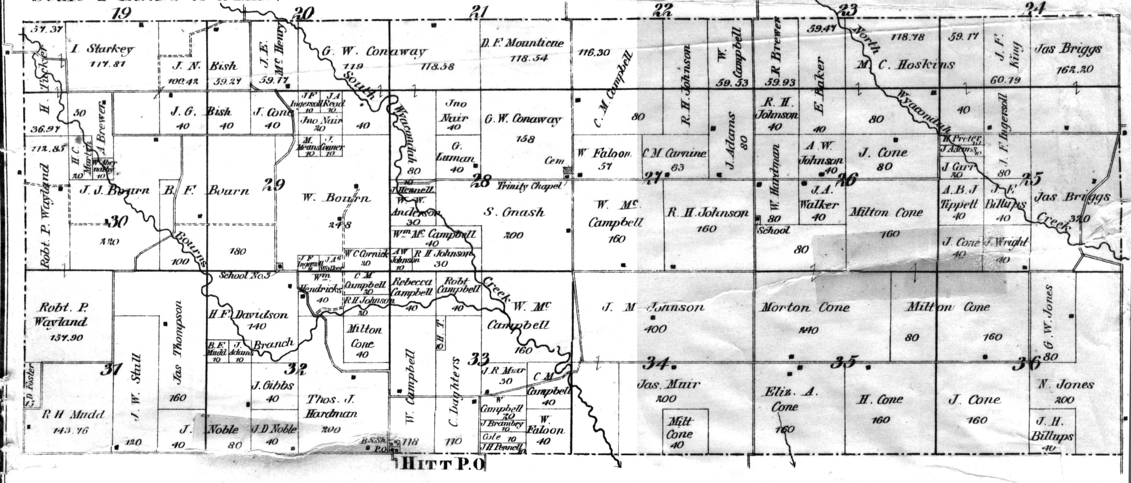
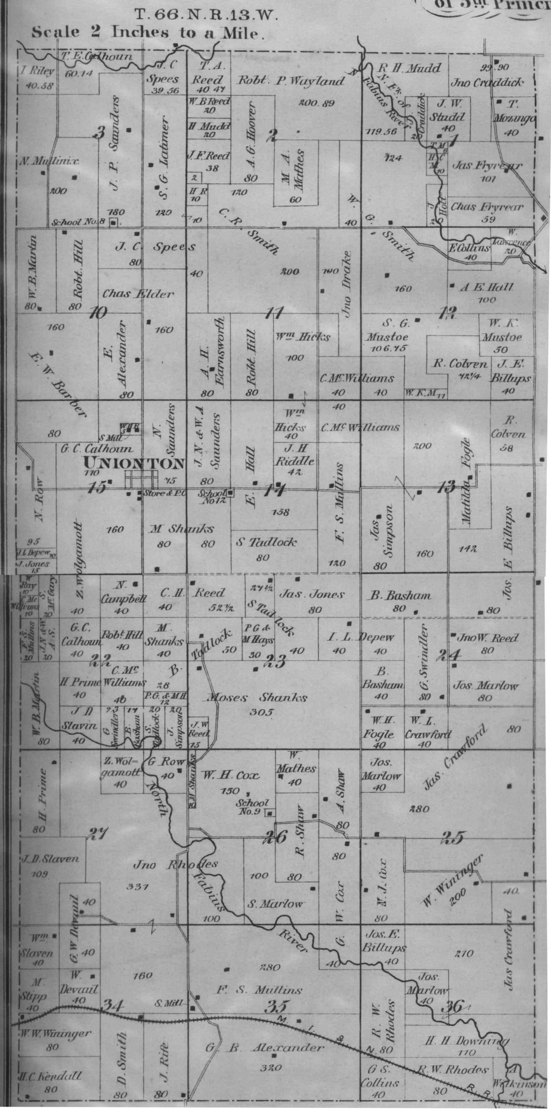
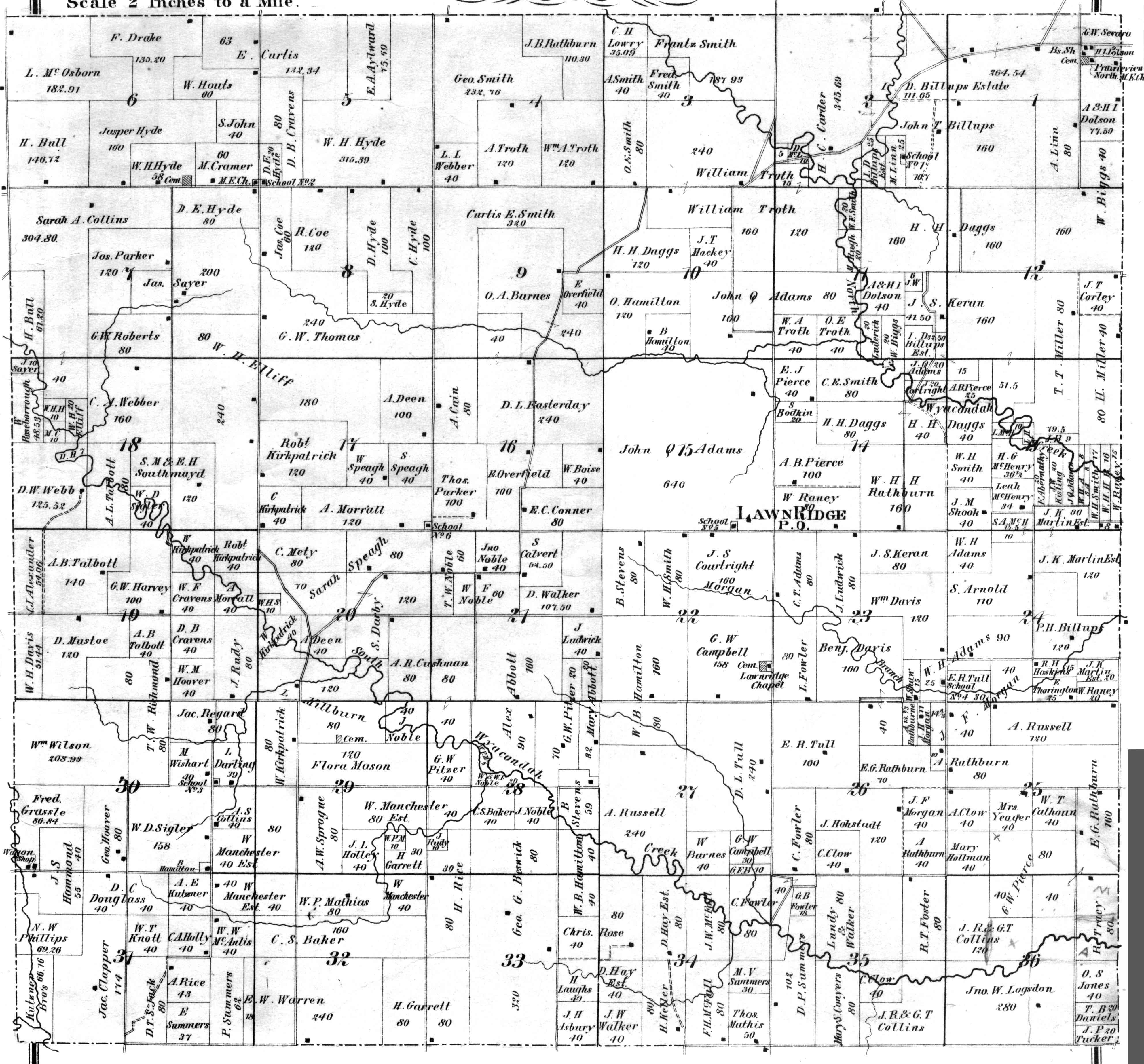
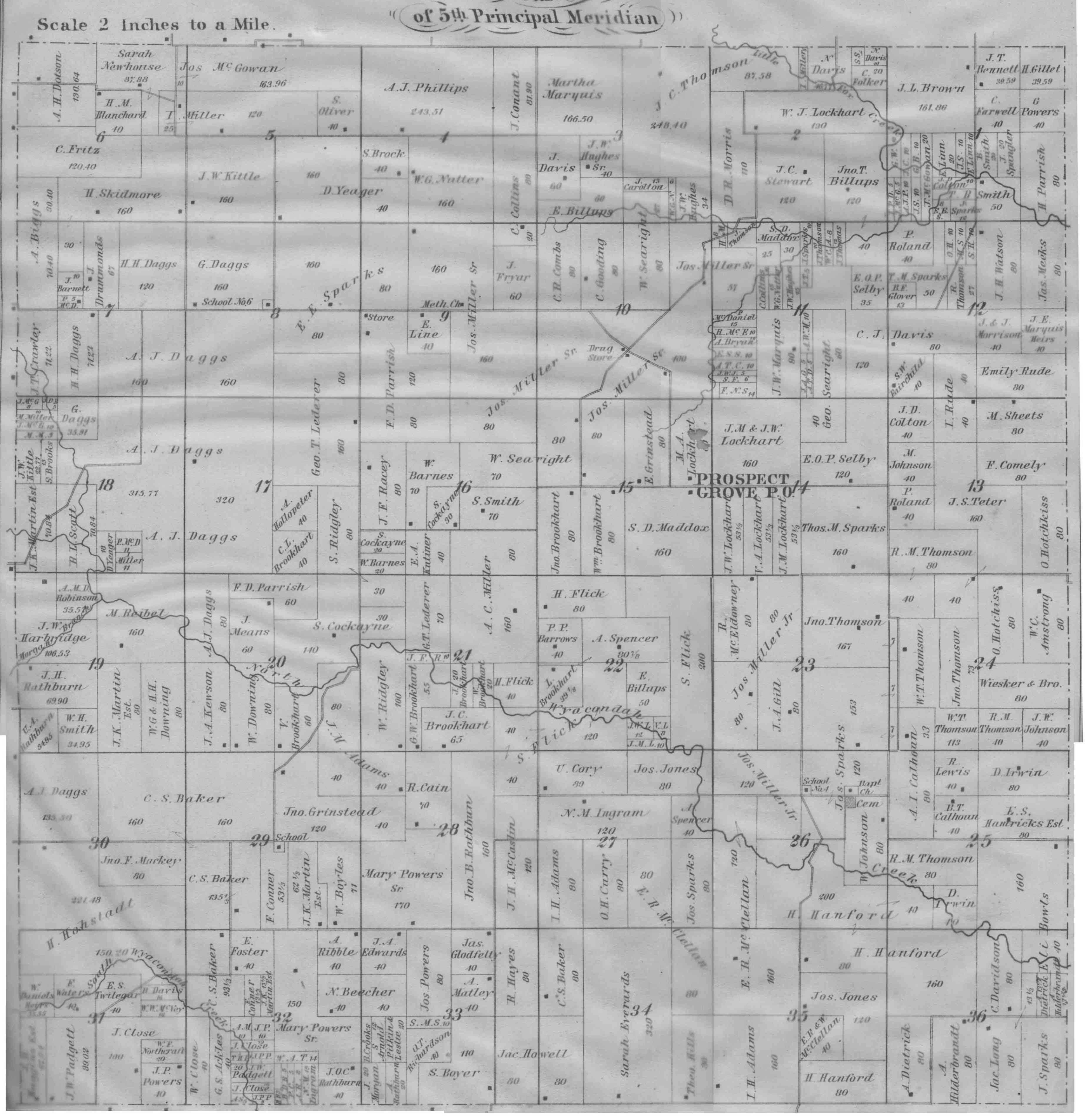
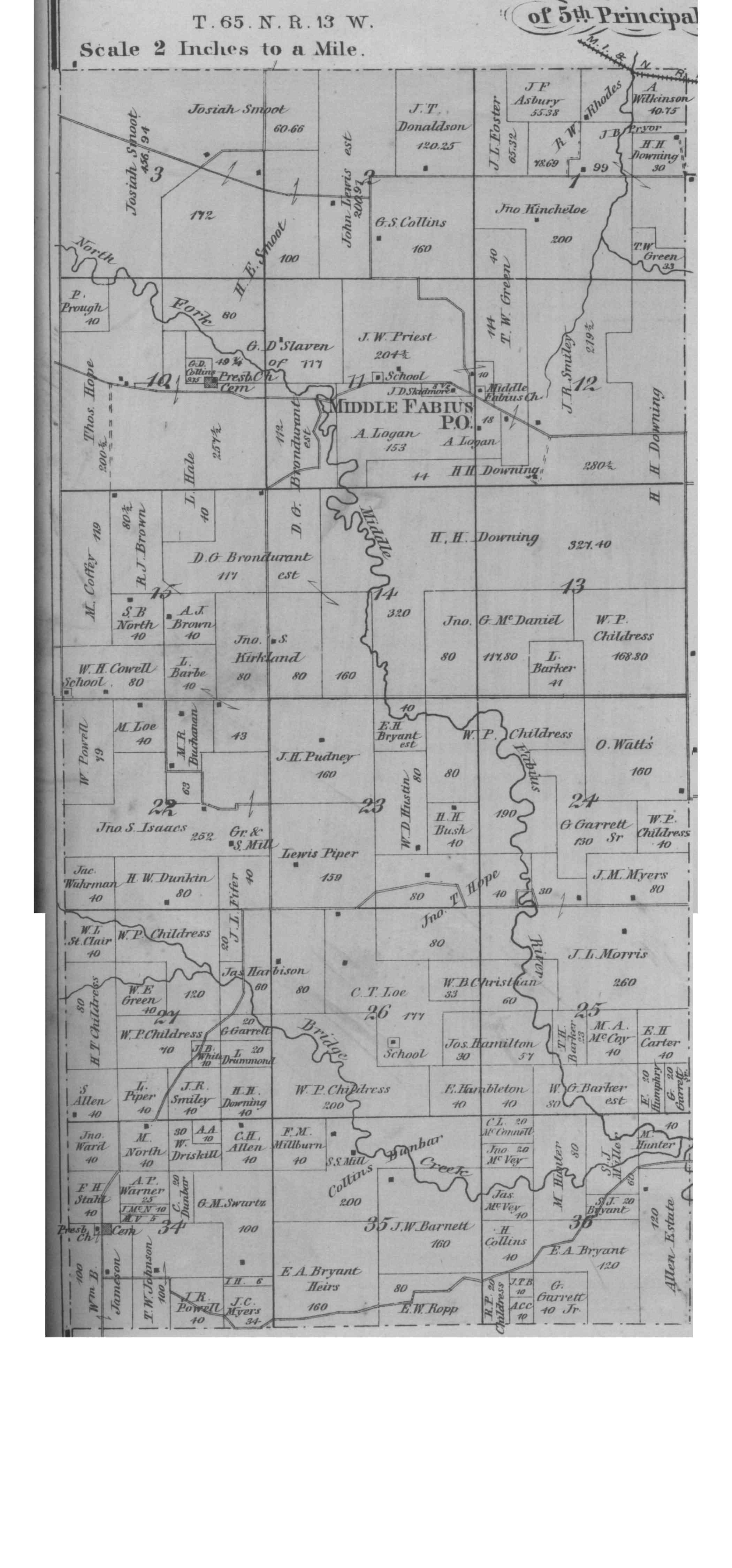
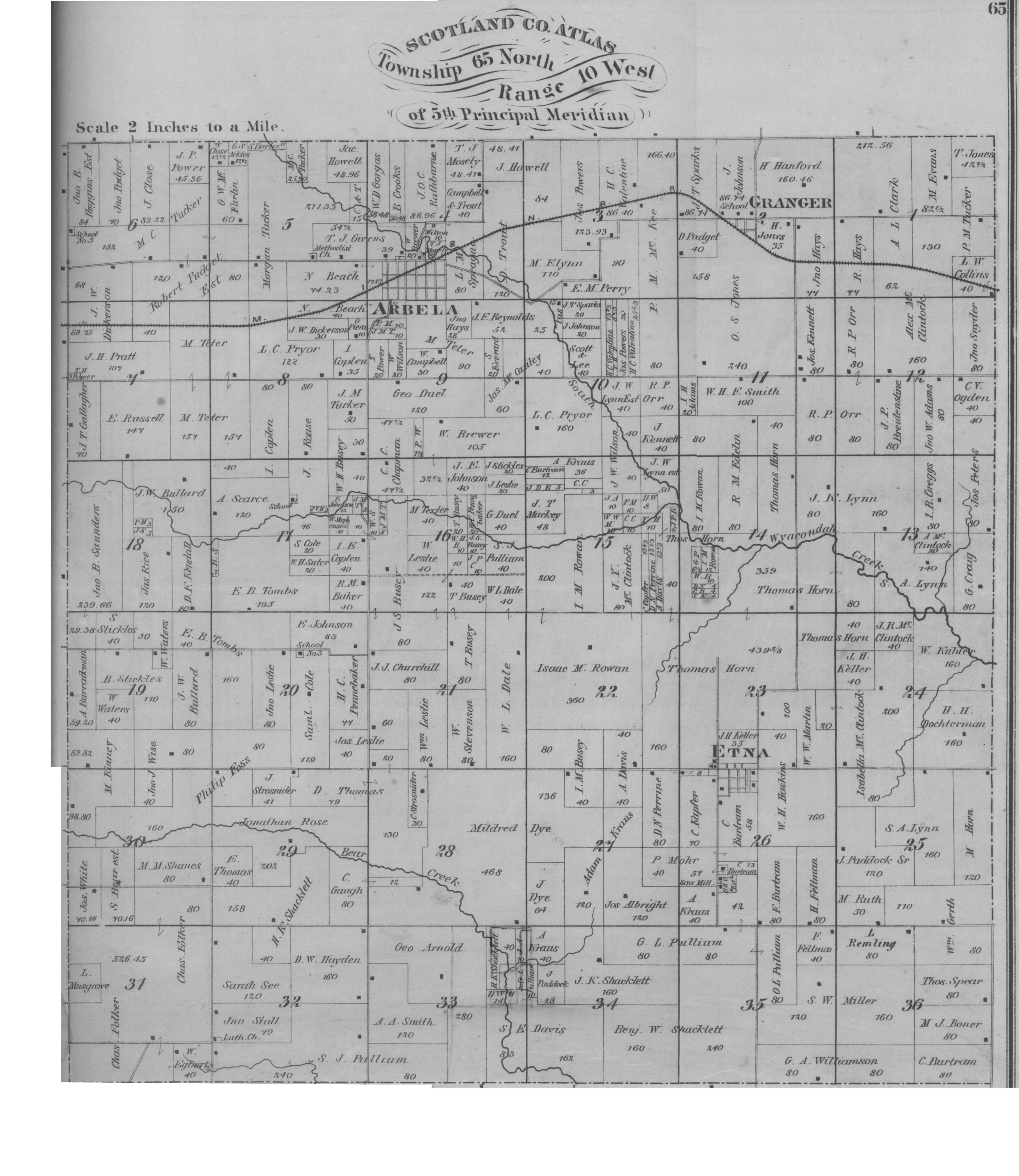
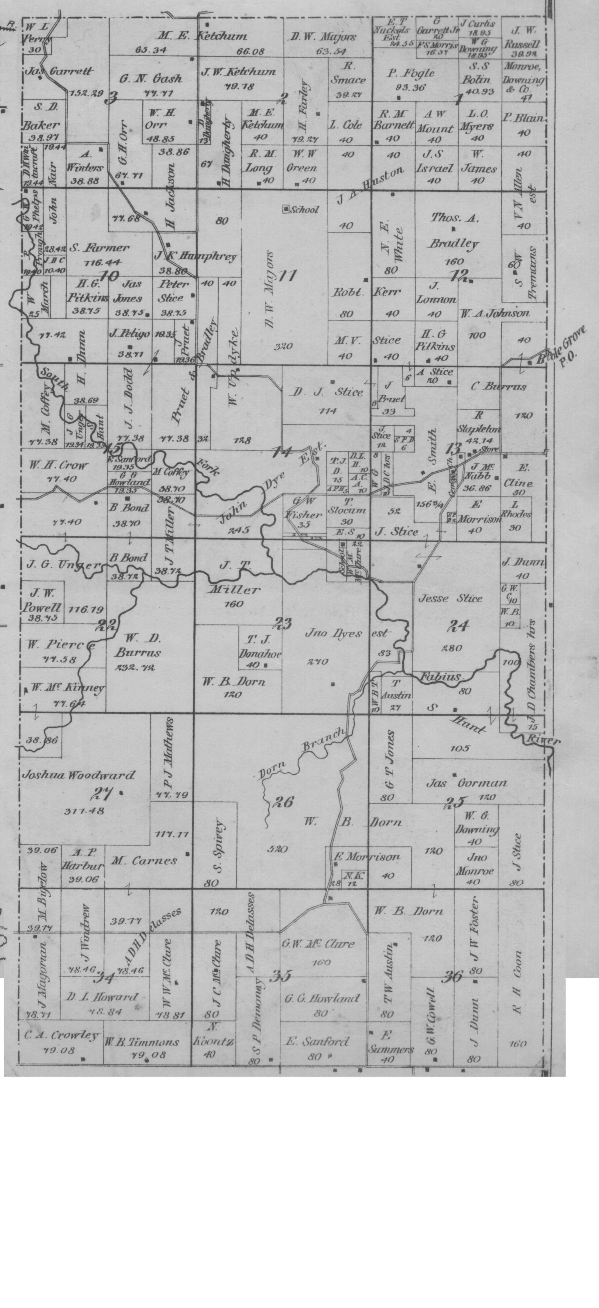
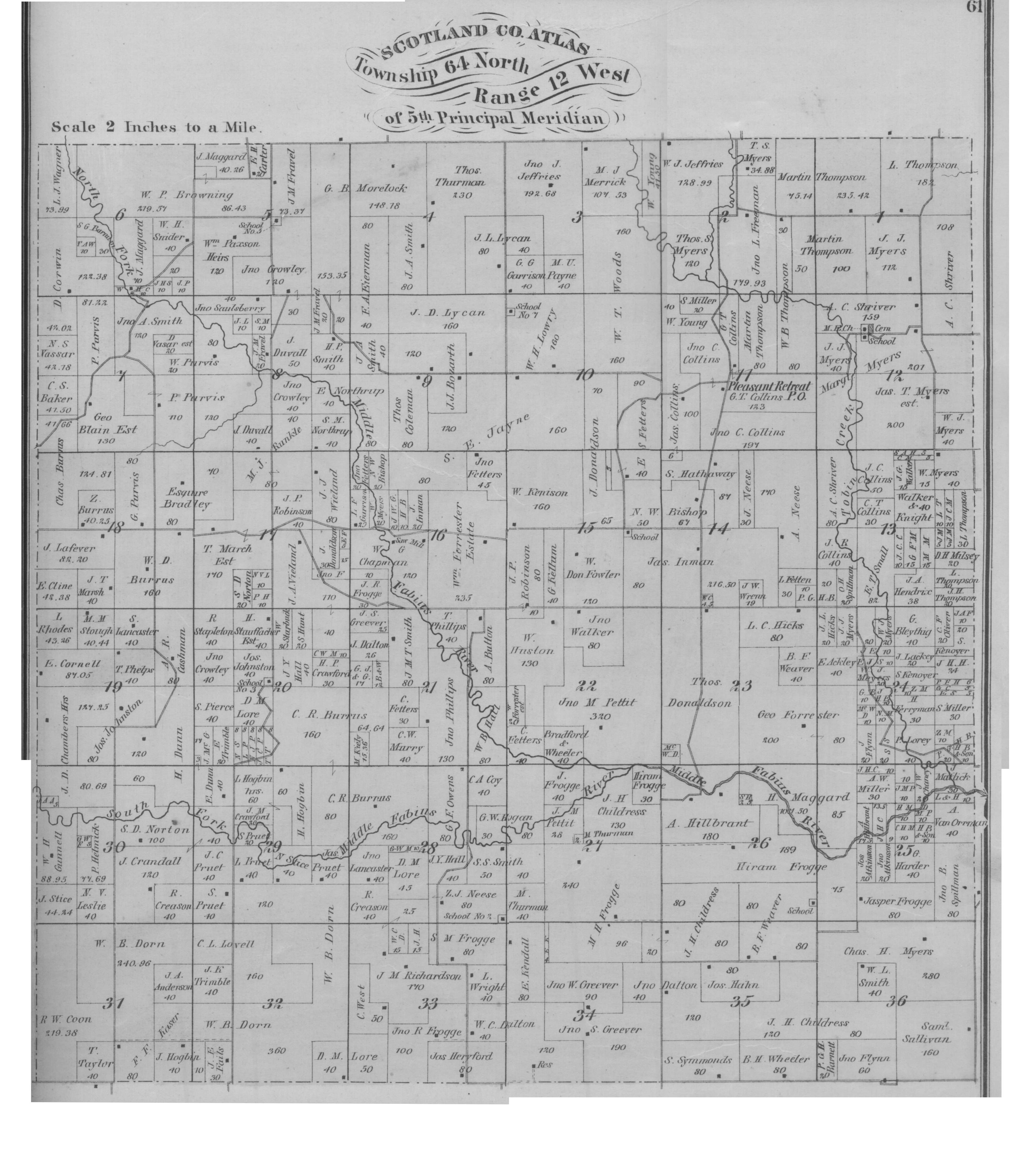
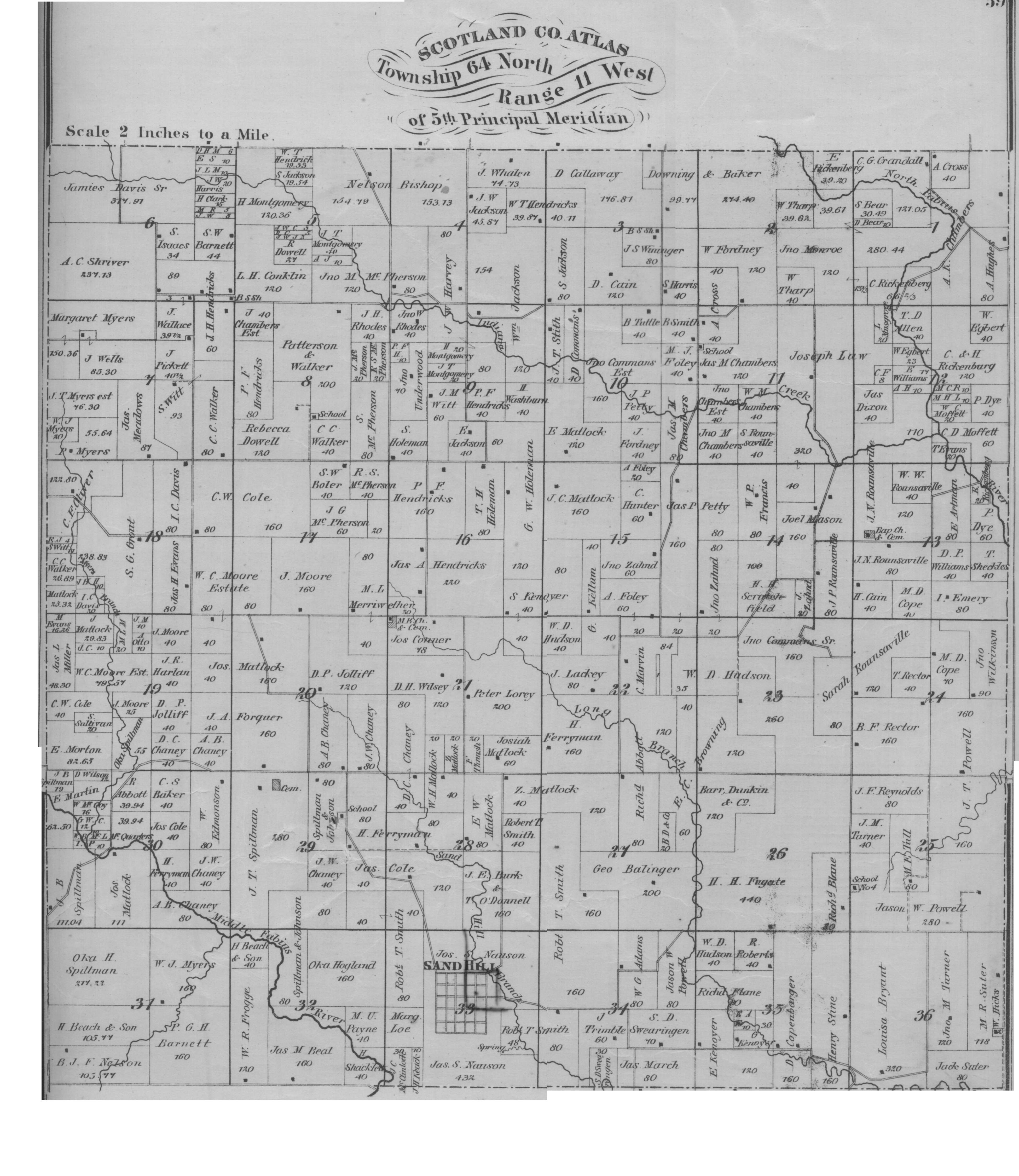
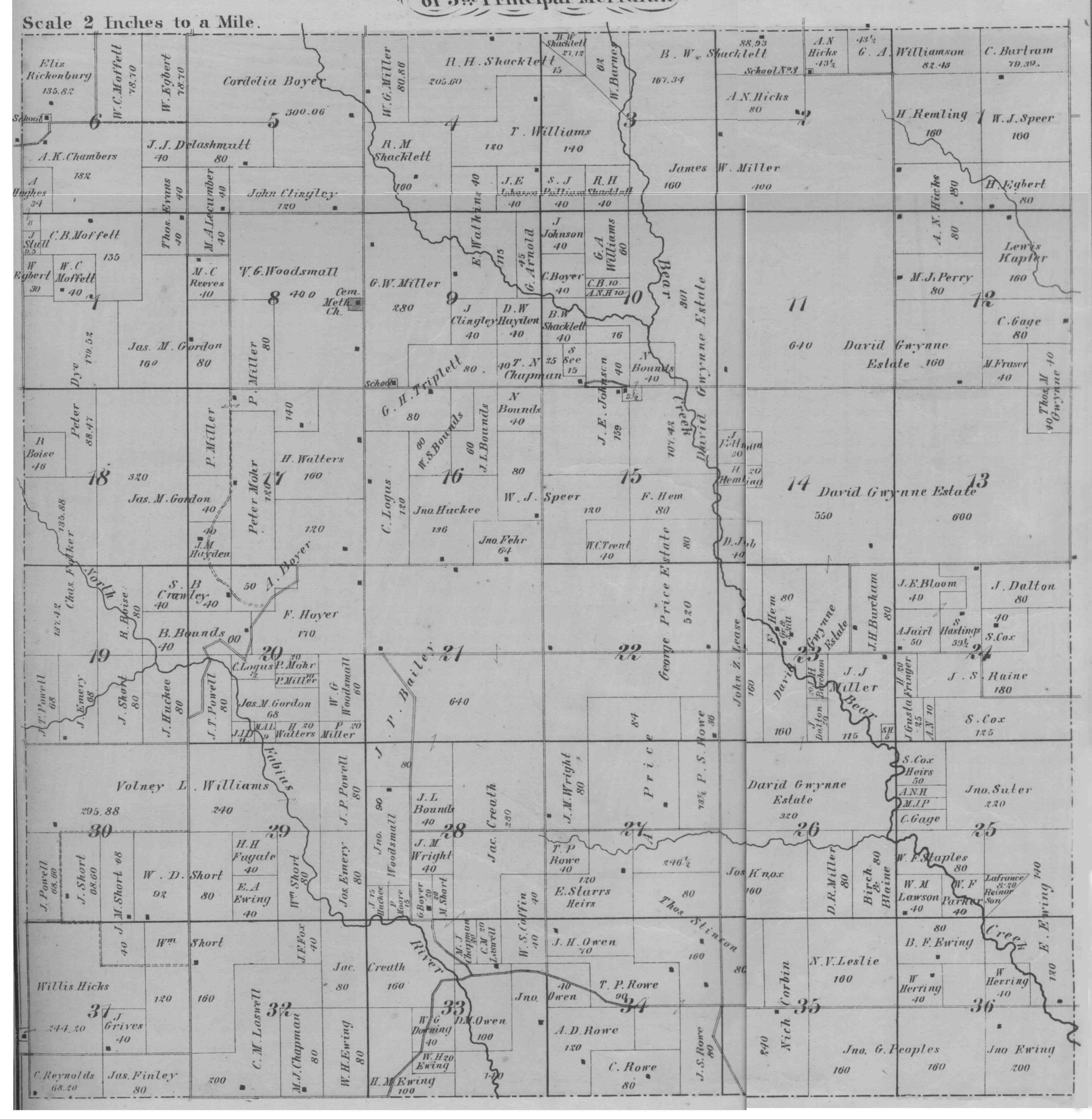
Plat maps show all the land of the county, as well as the owner of the land. It is assumed that this map was prepared about 1876 from the legal ownership of land as shown in the official real estate records for Scotland County, Missouri. In addition to the maps themselves, plat maps provide interesting facts and this map is no exception. In the map book, Judge John C. Collins wrote a "Historical Text":
"Scotland County was organized in the early part of the year 1841, out of territory formerly belonging to the Counties of Clarke and Lewis, for civil and military purposes. It had a territorial existence of seven years, during which time it was the headquarters of Keokuk, and Indian Chief, and his tribe with some whites living in the south part."
The thumbnail maps shown below are arranged so that, if put together, they would represent all of Scotland County, Missouri.
The top map is of the entire county. Feel free to browse all the maps, but if you know where your ancestors lived, look at this map first. Identify that part of the county you are most interested in.
You can then identify the numbered map you should examine next, from the Township and Range lines shown on the county map. The numbered maps which follow the county map are arranged such that the upper left hand map (Map 1), represents the northwest corner of the county, and the lower right map (Map 16), represents the southeast corner of the county.
Place your cursor over any one thumbnail maps and click, you will be taken to the corresponding full scale map. A larger version of the same map is available just below the thumbnail by clicking on the word "Here".
Note: These maps are likely larger than your screen. I'm sorry about that, but when I tried to reduce them to screen size, they were simply not readable.
If you are interested in understanding how this survey stuff works, take a look at this page. I think it will help you understand plats.
A great Surname index has been created by Jim Thomas and can be found by clicking on the index link directly below: Surname Index Here
|
|
|
|
|
|
|
|
|
|
|
|
|
|
|
|
Page last updated November 29, 2000


