
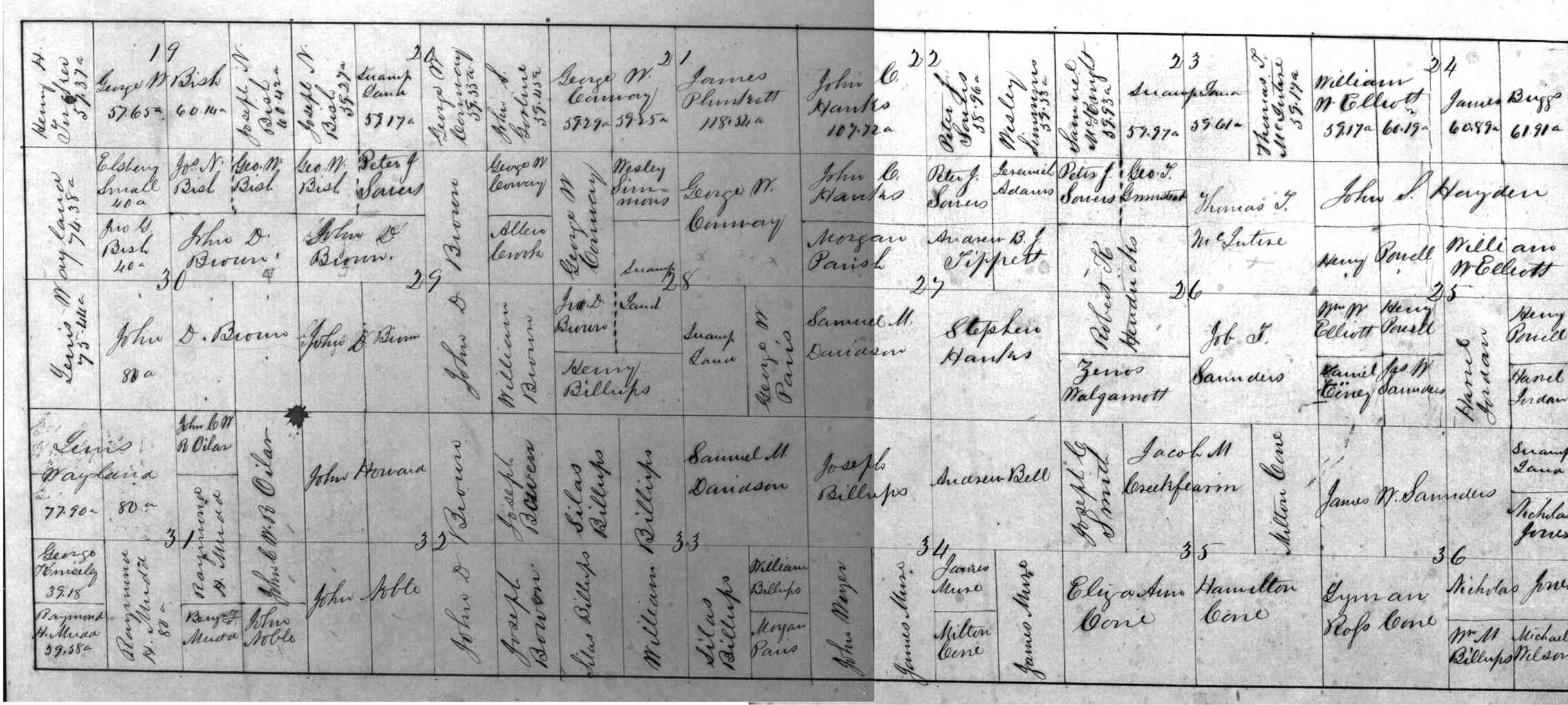
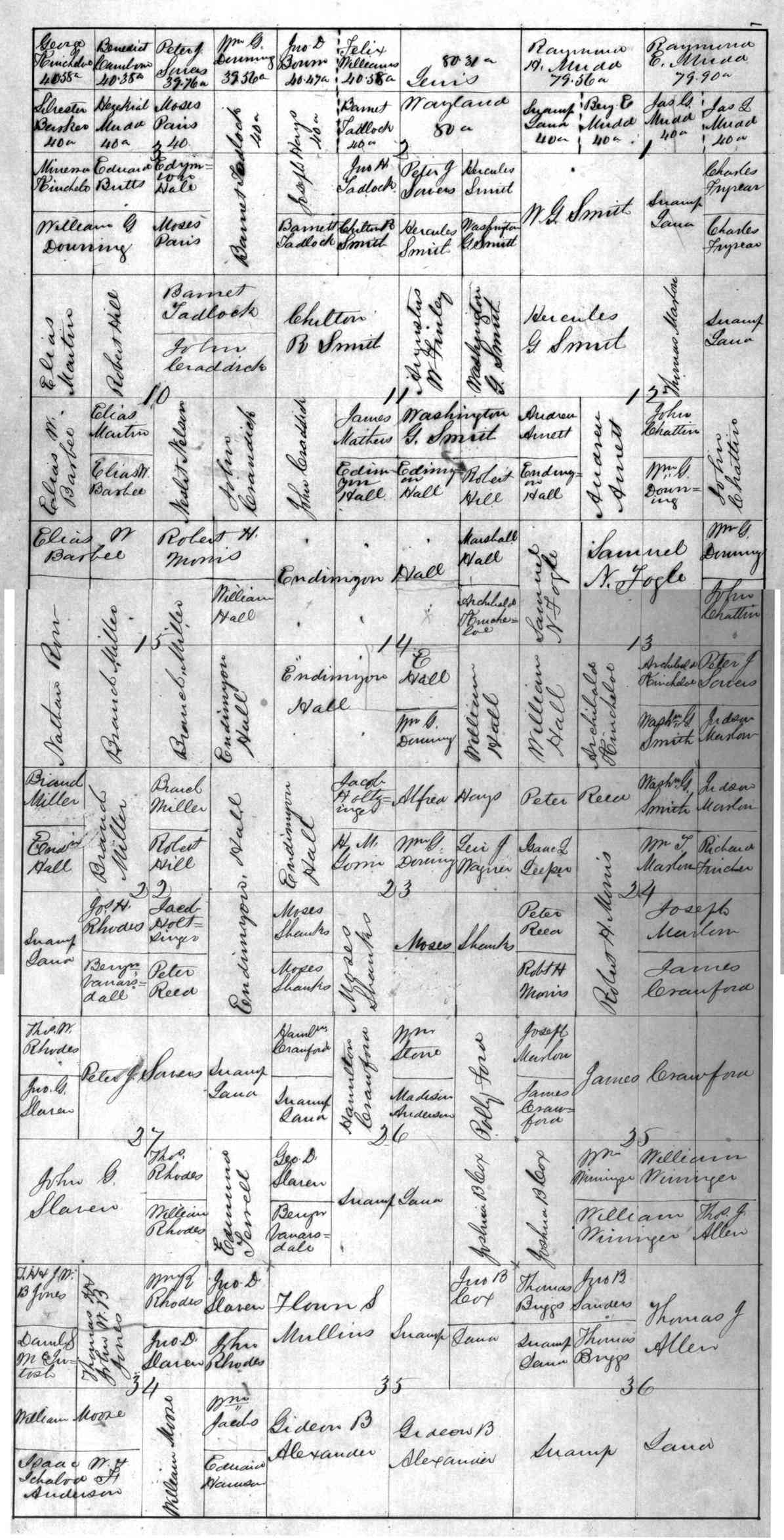
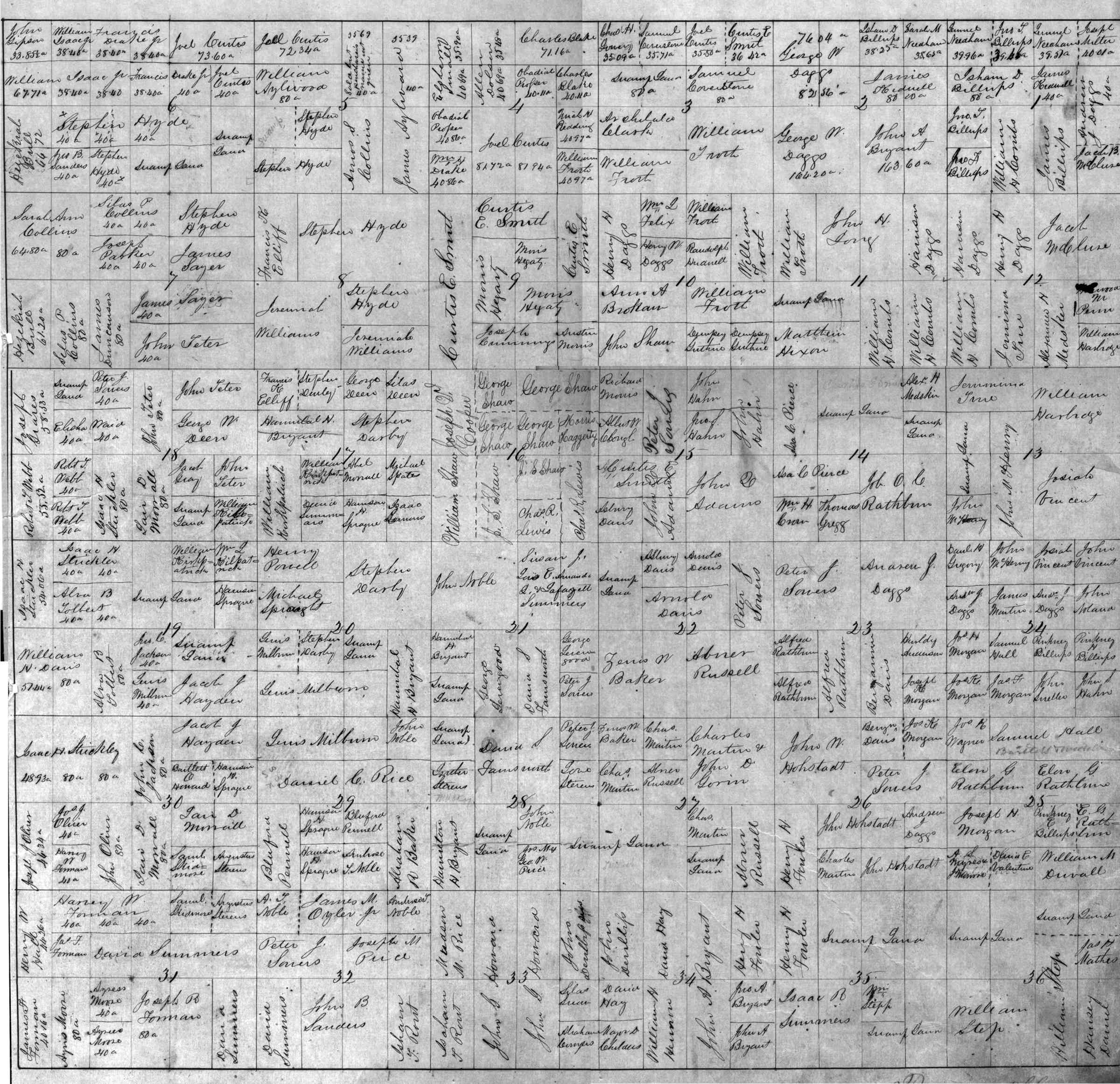
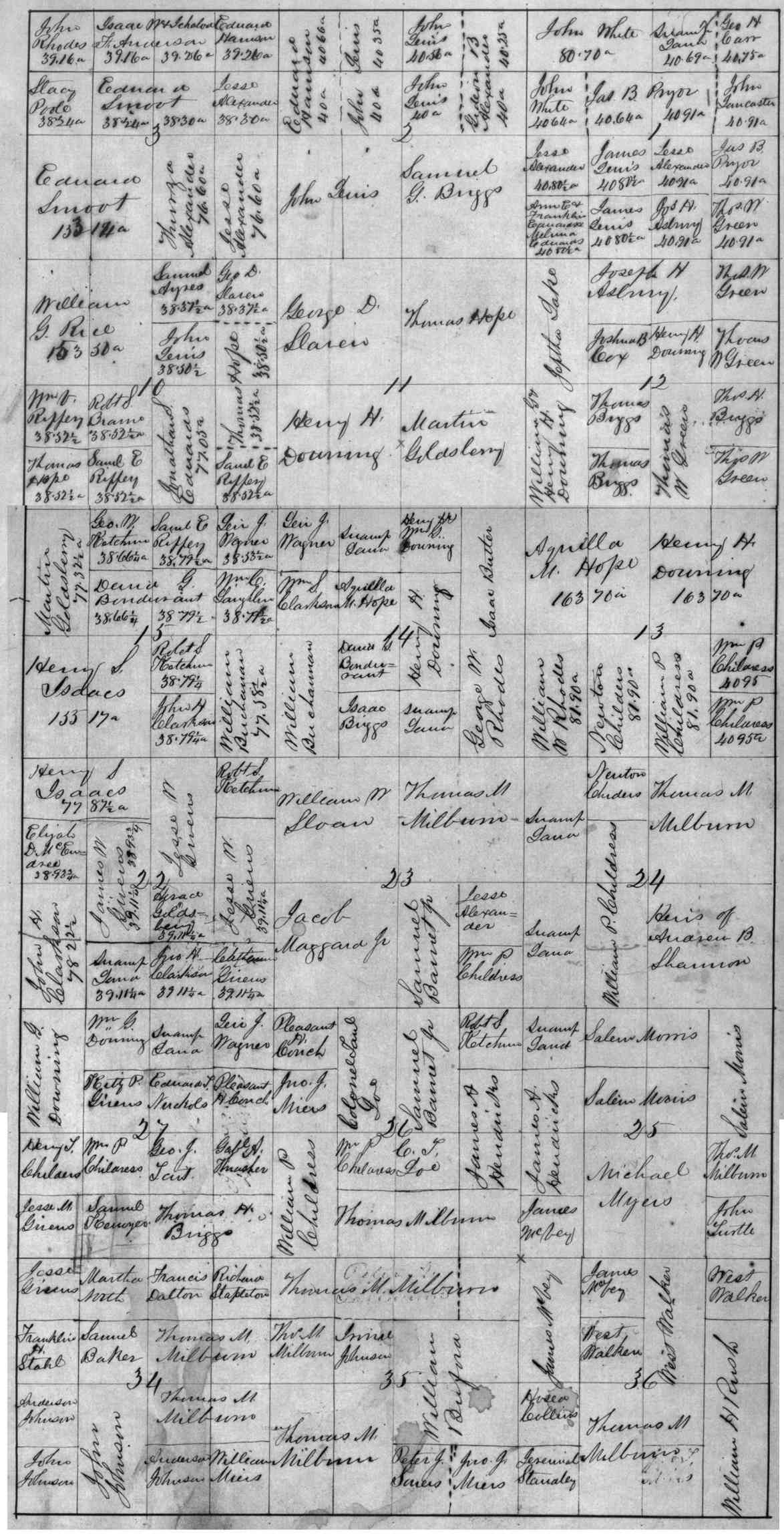
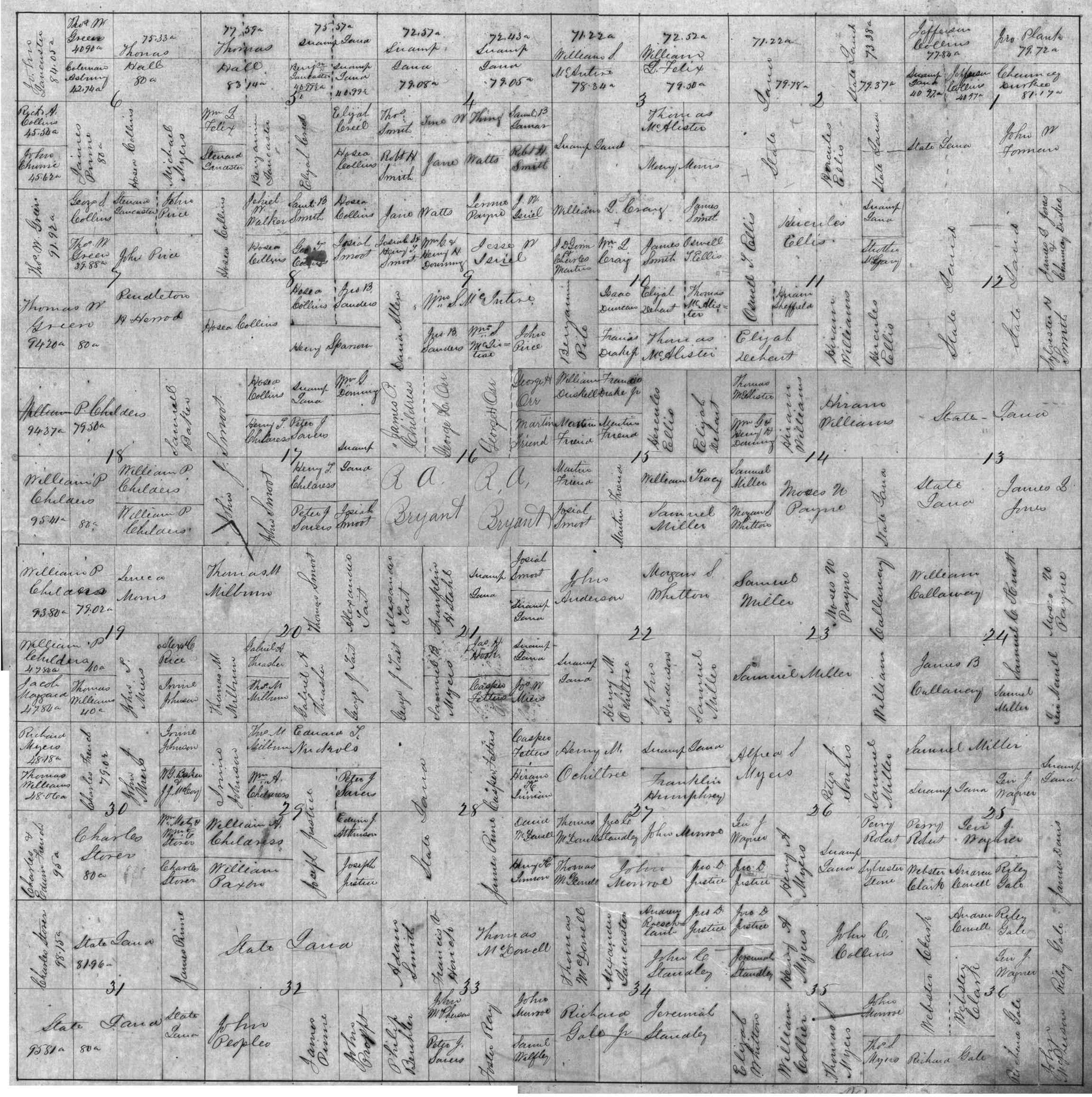
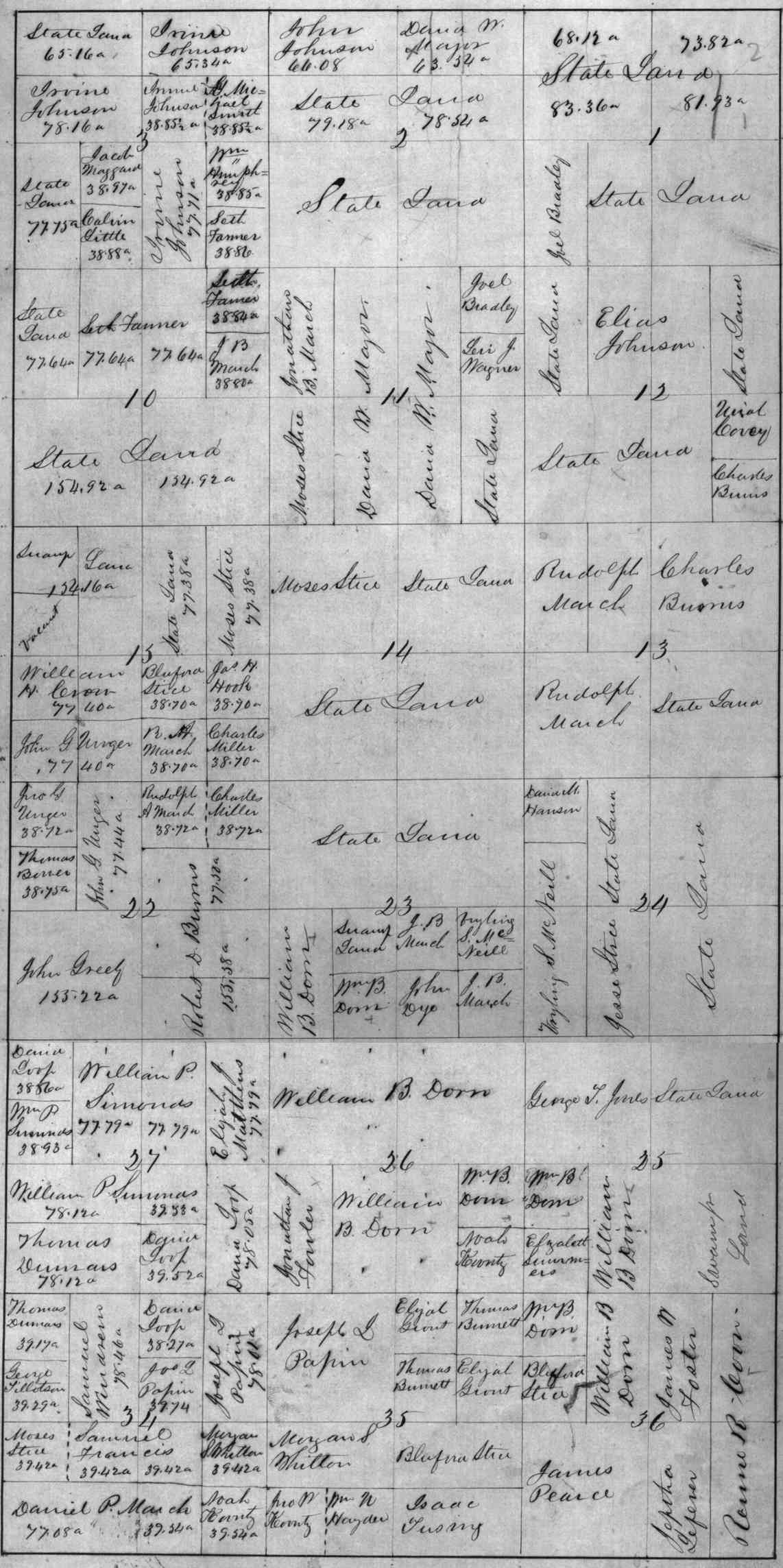
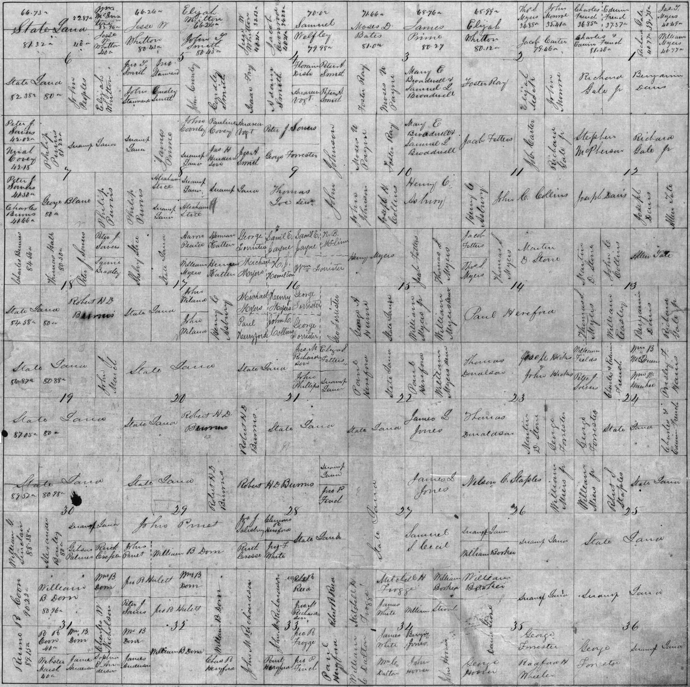
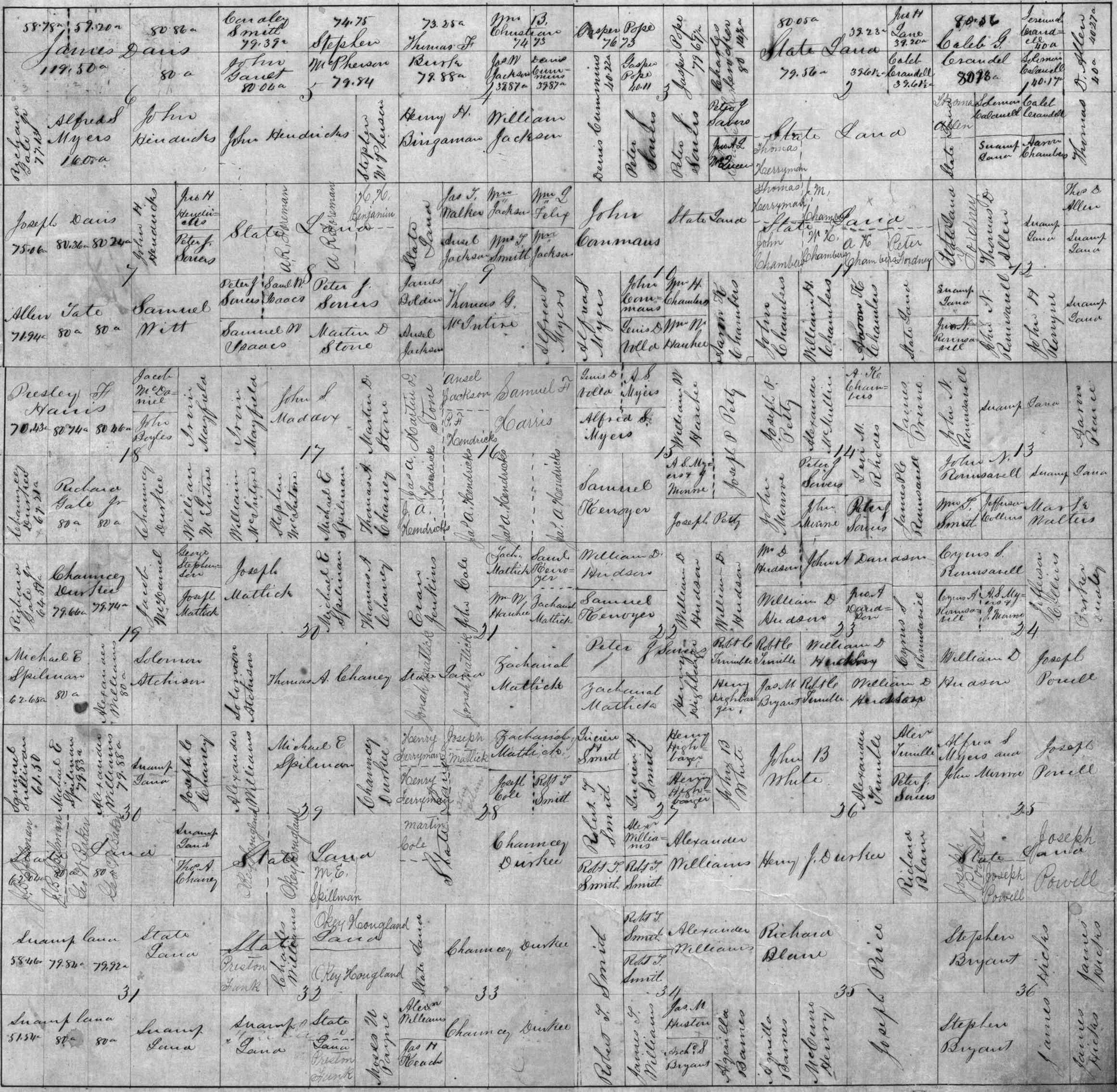
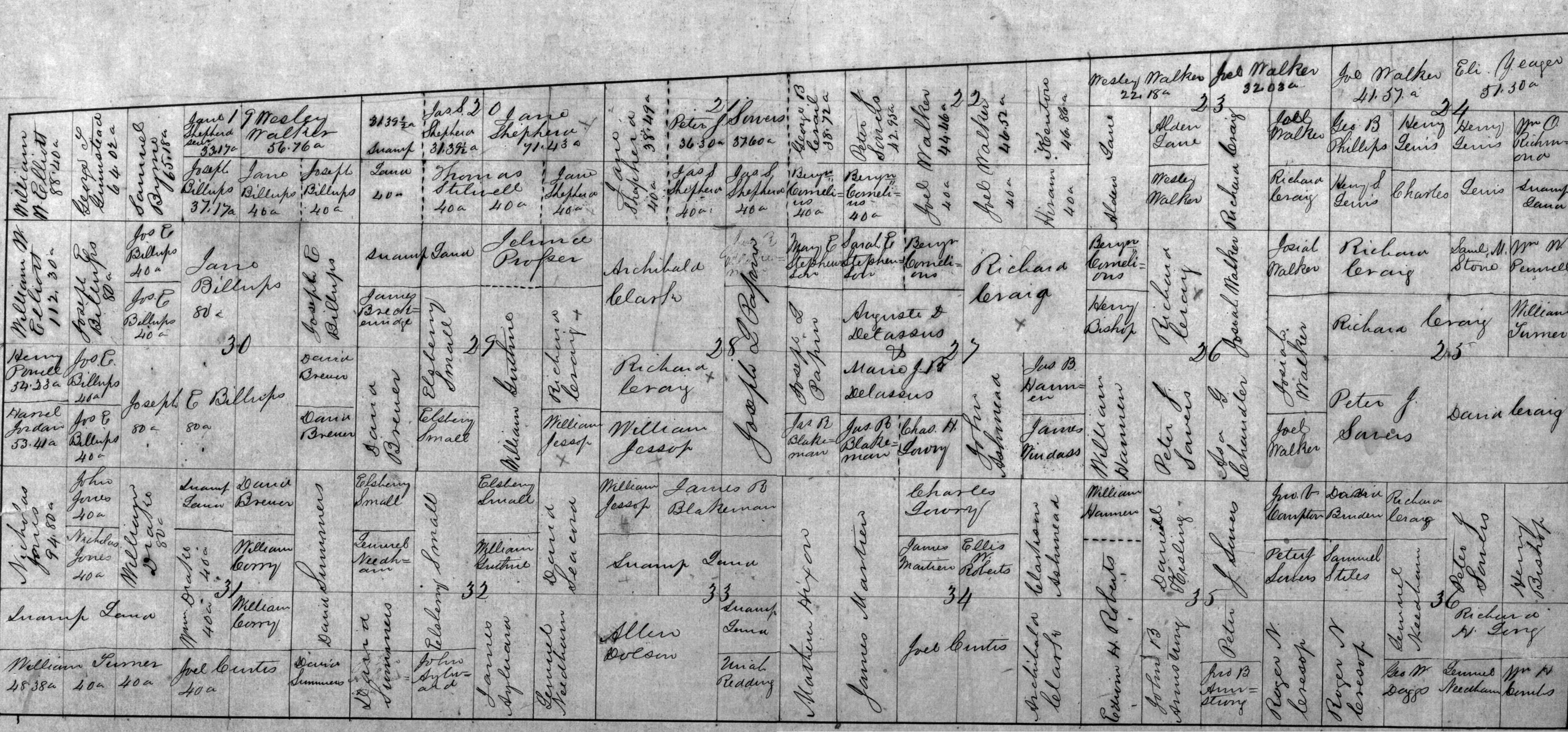
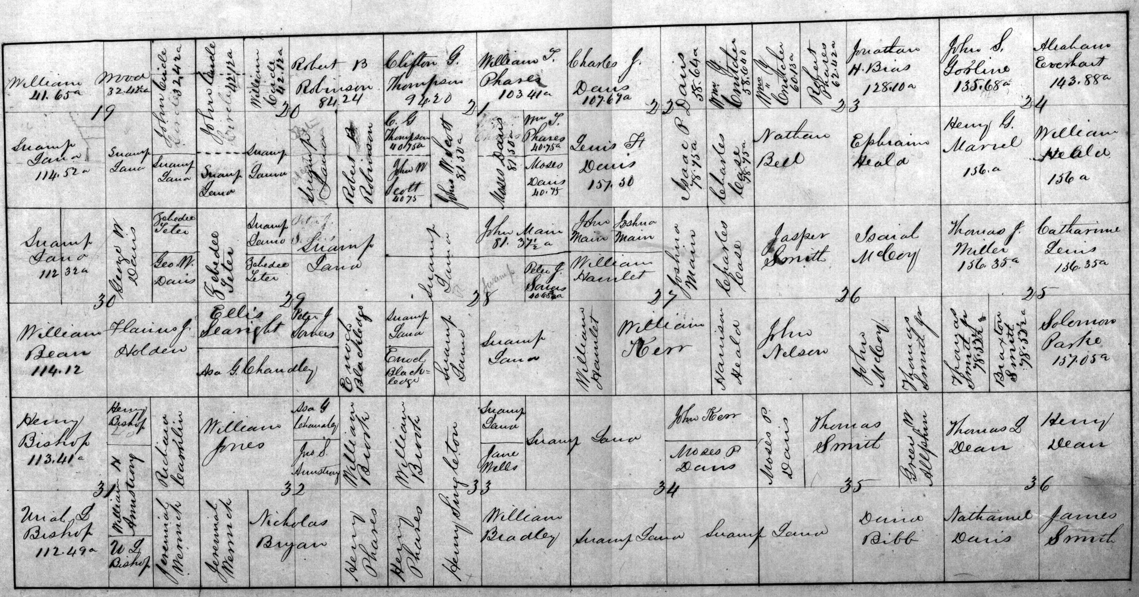
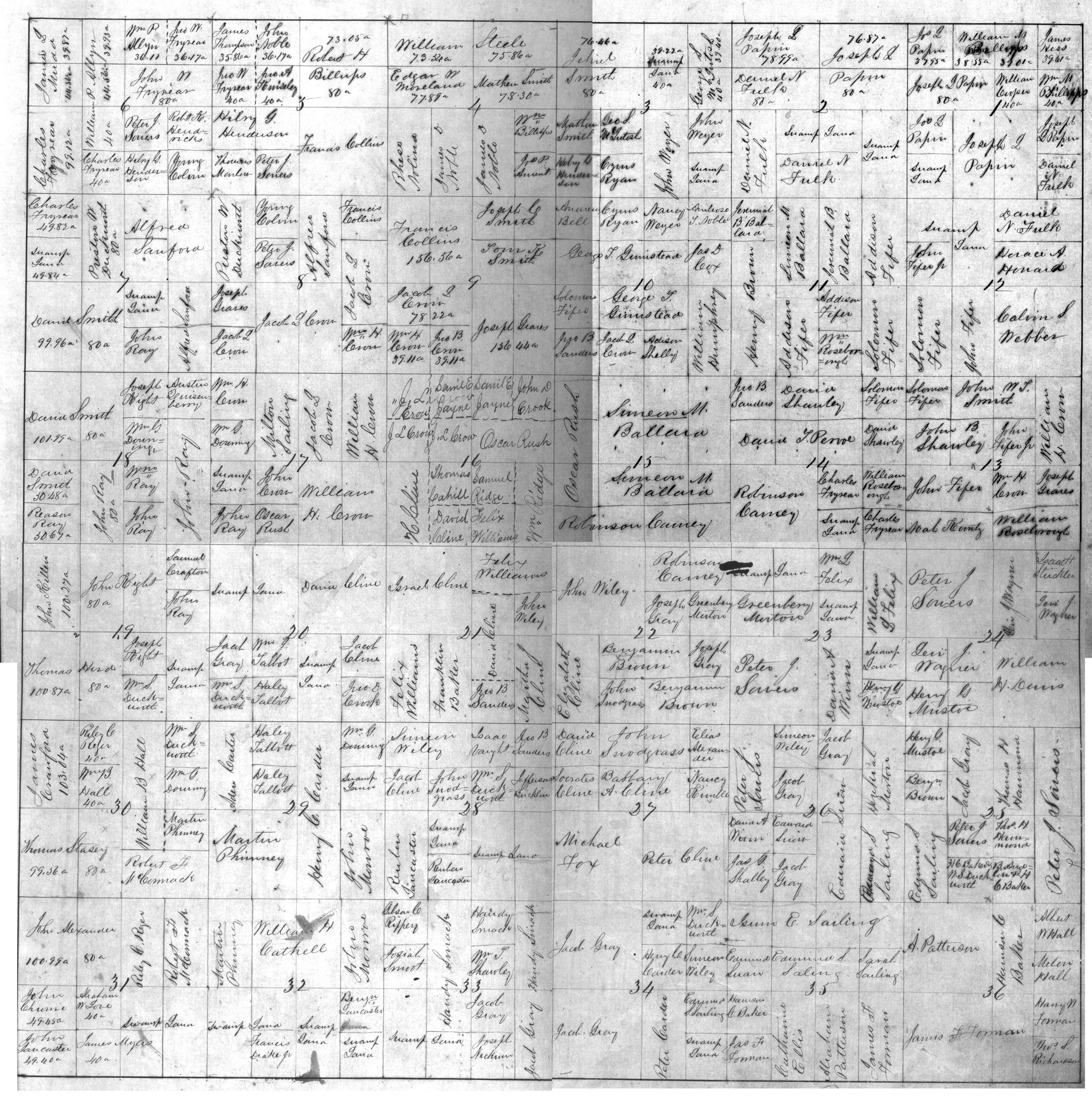
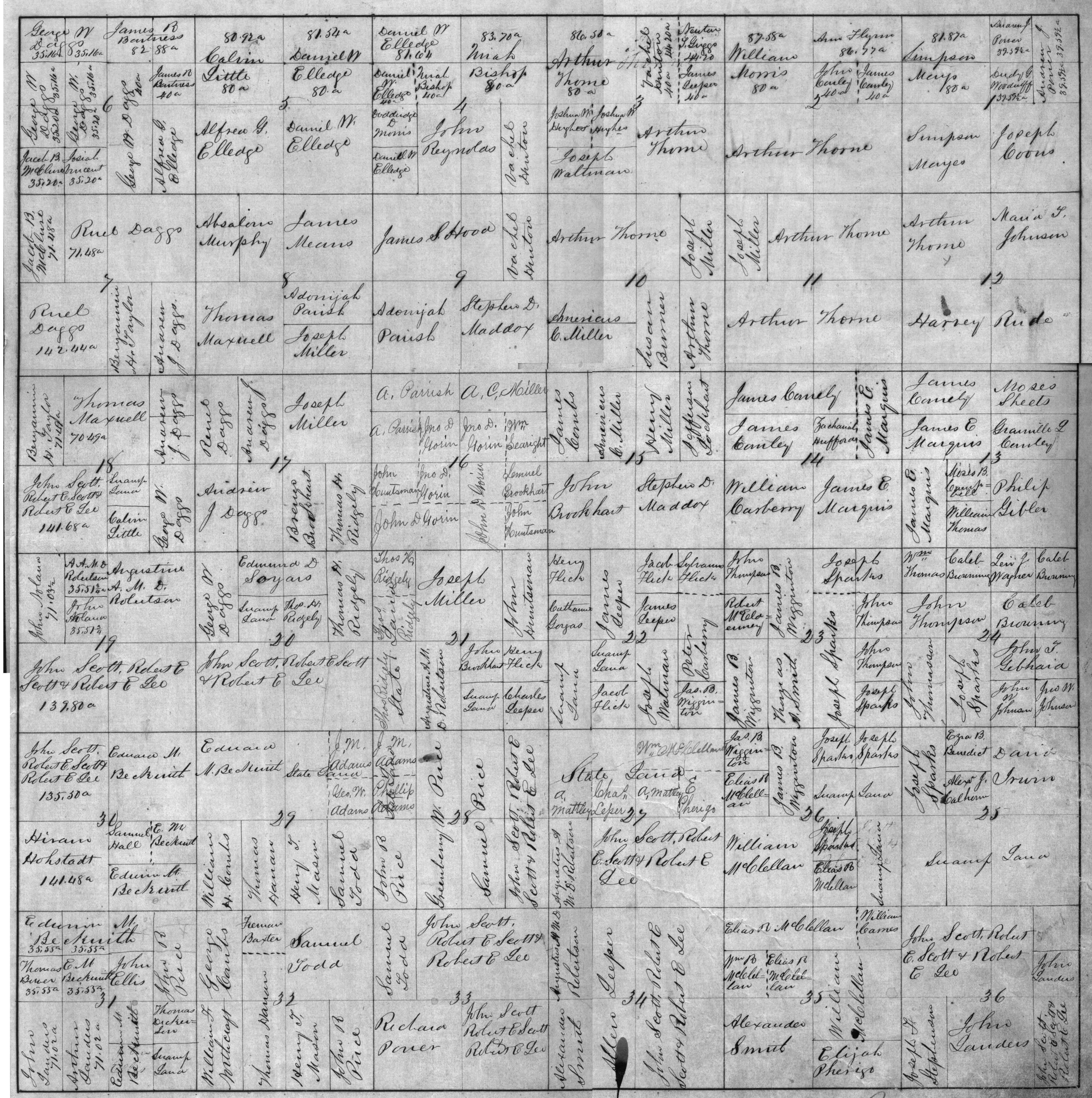
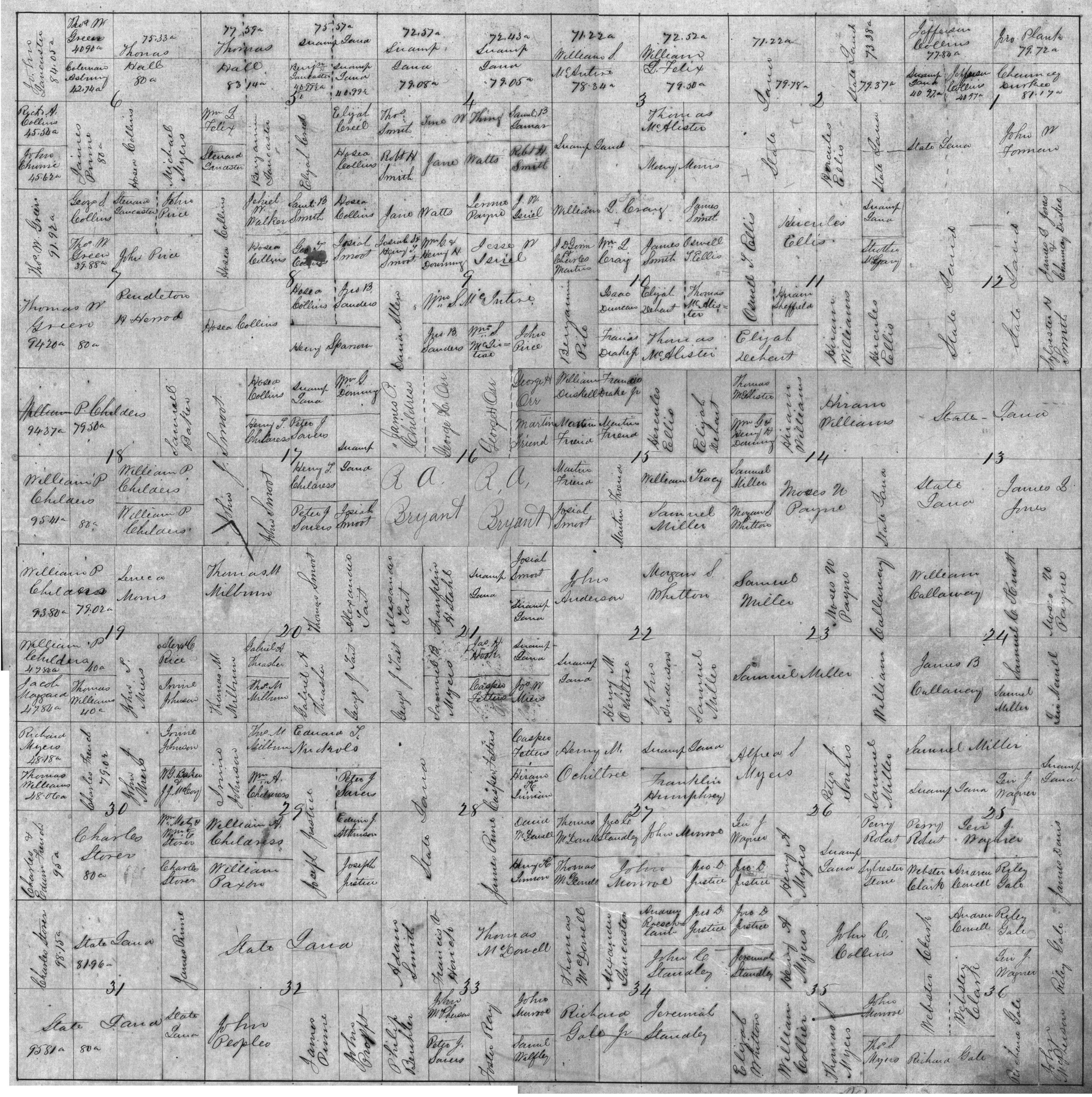
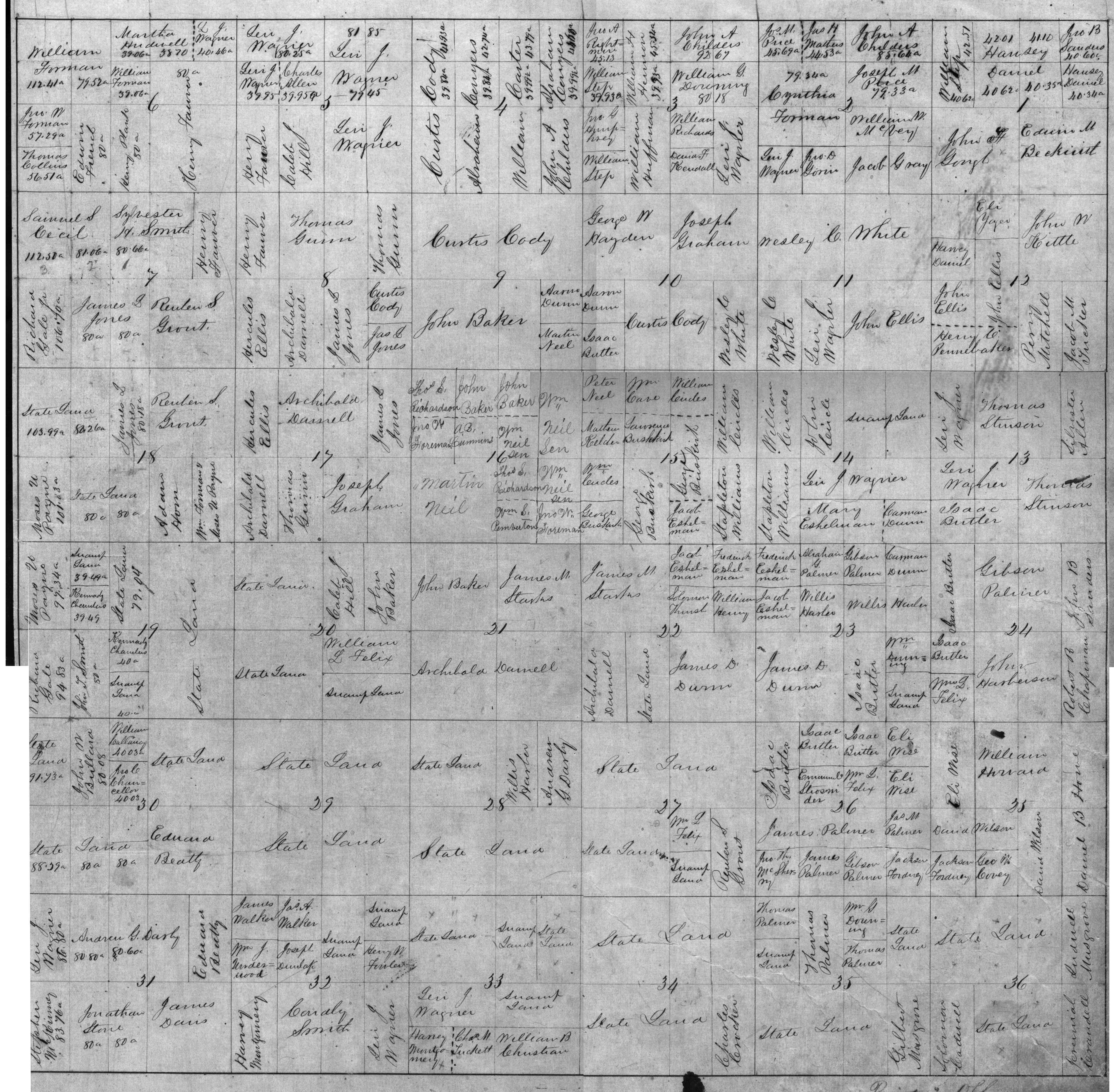
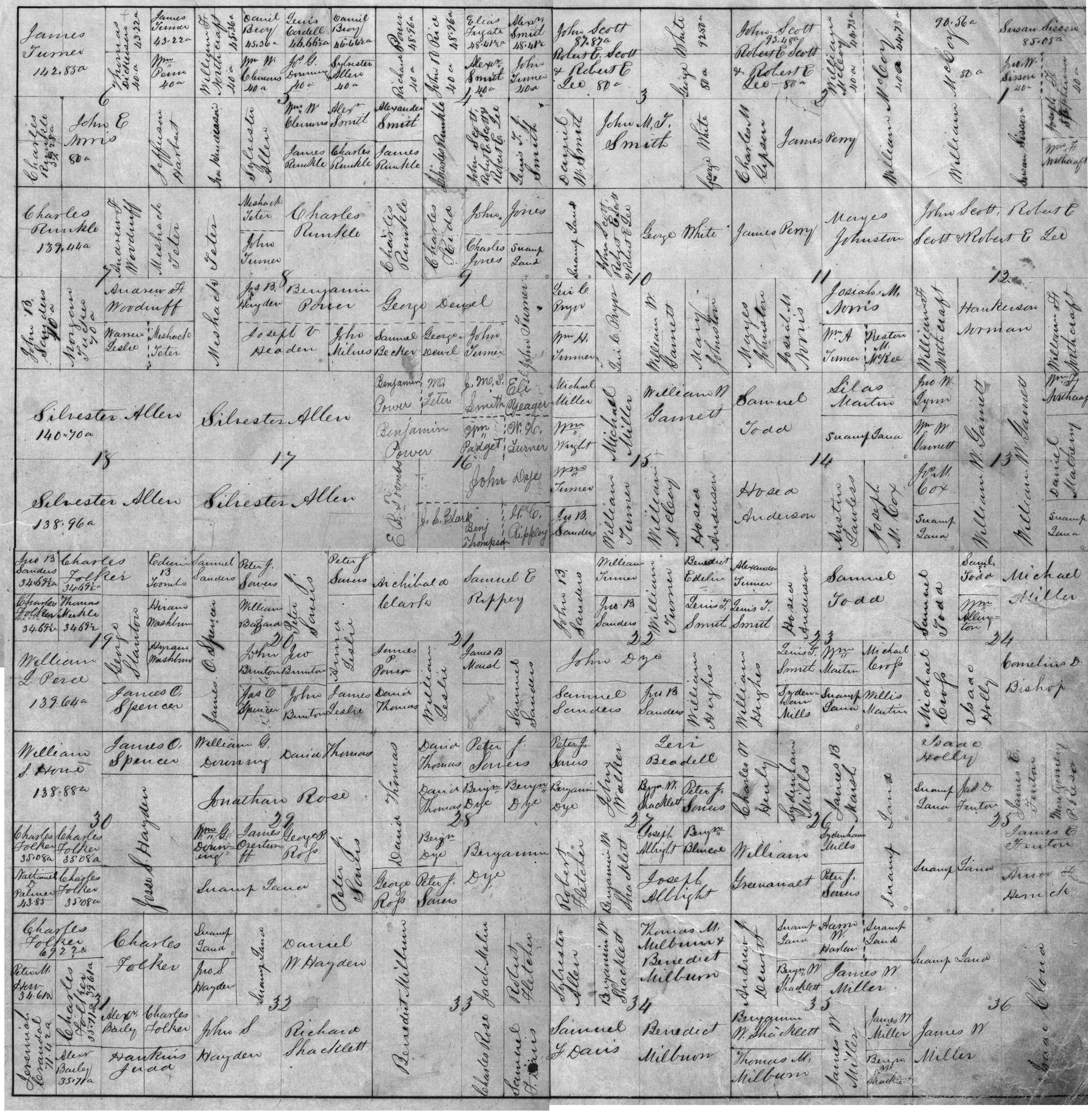
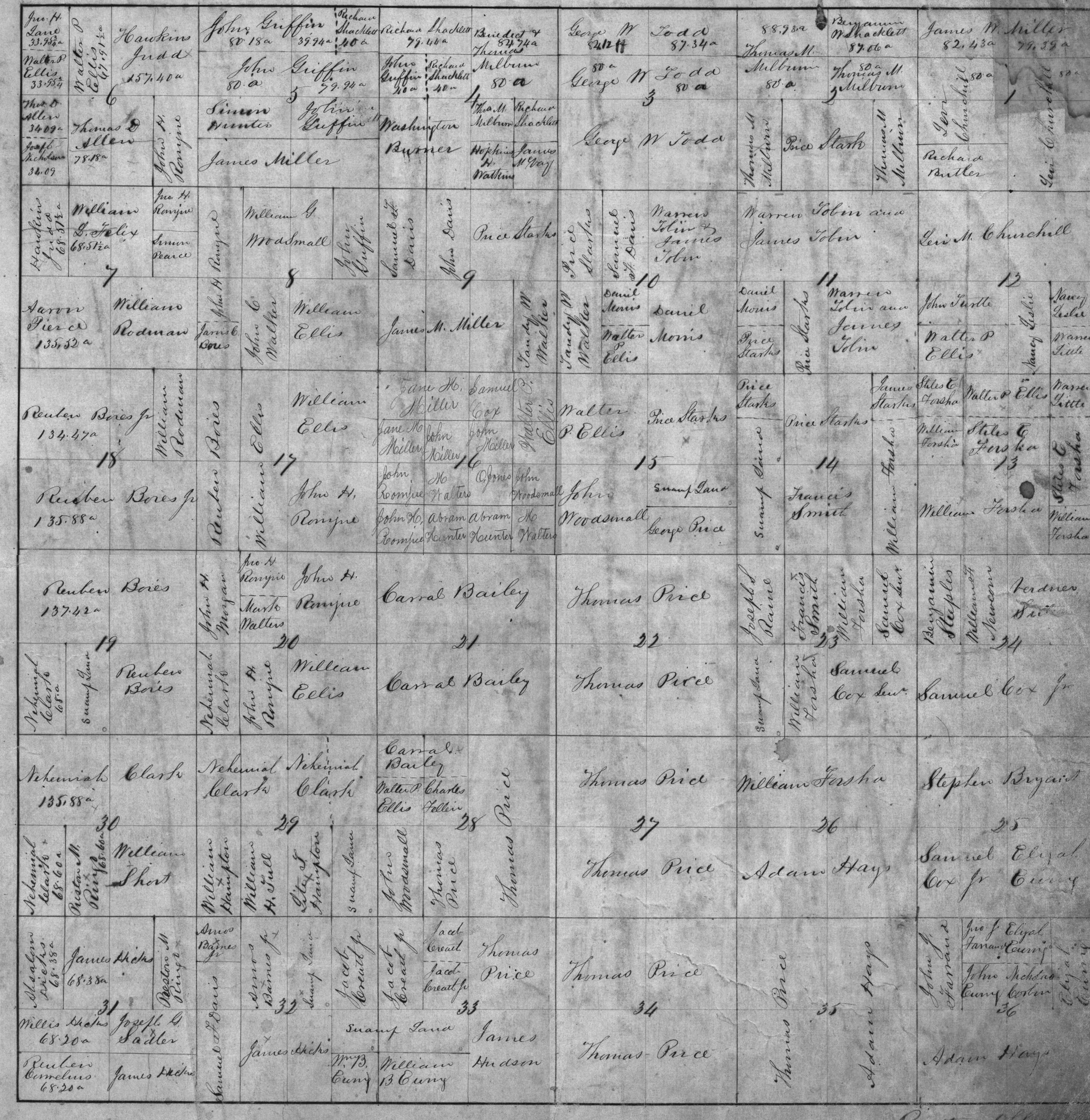
Plat maps show all the land of the county, as well as the owner of the land. It is assumed that this map was prepared about 1858 from the legal ownership of land as shown in the official real estate records for Scotland County, Missouri. Please note that these maps show who owned the land, not who lived there, if anyone. In many cases, the owner may have lived elsewhere and simply rented the land to someone else.
In your search for your ancestors, you may also want to check out the government site for Land Patents. Here is the link to that site. When land was first purchased from the United States government at a land office (in the case of Scotland County land, the land office was in Palmyra, Missouri), a Deed of Entry was issued. Then when the purchaser took possession of the land, a Land Patent was issued. The Patent is the official document that transferred title to the first owner. On the Land Patent site, you can see a copy of the original Patent. Title examiners, who knew what they were doing, would required the Patent to be recorded and shown of record in order to pass on the good title to the property when the first owner later sold it. (In some cases, the title examiner would make a requirement that the Patent be obtained and recorded years after the original purchase. Back when I was giving title opinions a few years ago, I was still running into cases where the Land Patent had not been filed) That's not to say that there aren't exceptions to this rule that the first owner will have a Patent, with homesteaders who simply showed up and squatted on the land or land speculators who bought the land but never lived there, or in some cases where the family just lived there and never bothered to get Patents when the land was passed from generation to generation. Moreover, it's certainly possible that your ancestor may have arrived soon after the county was formed, but wasn't the first owner, they may have bought the land from the first owner. A bigger exception concerns swamp land. This land was deemed unusable by the federal government and simply transferred to the state. On these plats that land is referred to as "Swamp Land" or "State Land". It almost alway refers to land that was on the river bottoms. Incidentally, that's now some of the most productive land in the county. In those cases the patent would be from the state not the federal government and those patents, at least to my knowledge, are not on the net.
For you history buffs, the land became productive when the rivers on the bottom land were channelized. For the most part, this happened a few years after the turn of the century. The bottom land was surveyed and the Army Corp of Engineers dug deep channels or canals from the headwaters of the rivers all the way to the Mississippi River. For example, some of the later plats show the canal that runs near Memphis as the "Victory Drainage Ditch" , rather than the Fabius River. That is a name that didn't survive. Now all the maps show the canal as the Fabius River, the orginal name. But it doesn't look much like the Fabius River that was there when the first landowners came to Scotland County. The landowners were taxed for these improvements. Unfortunately the depression caused many of these taxes to go unpaid and these liens were foreclosed during the depression.
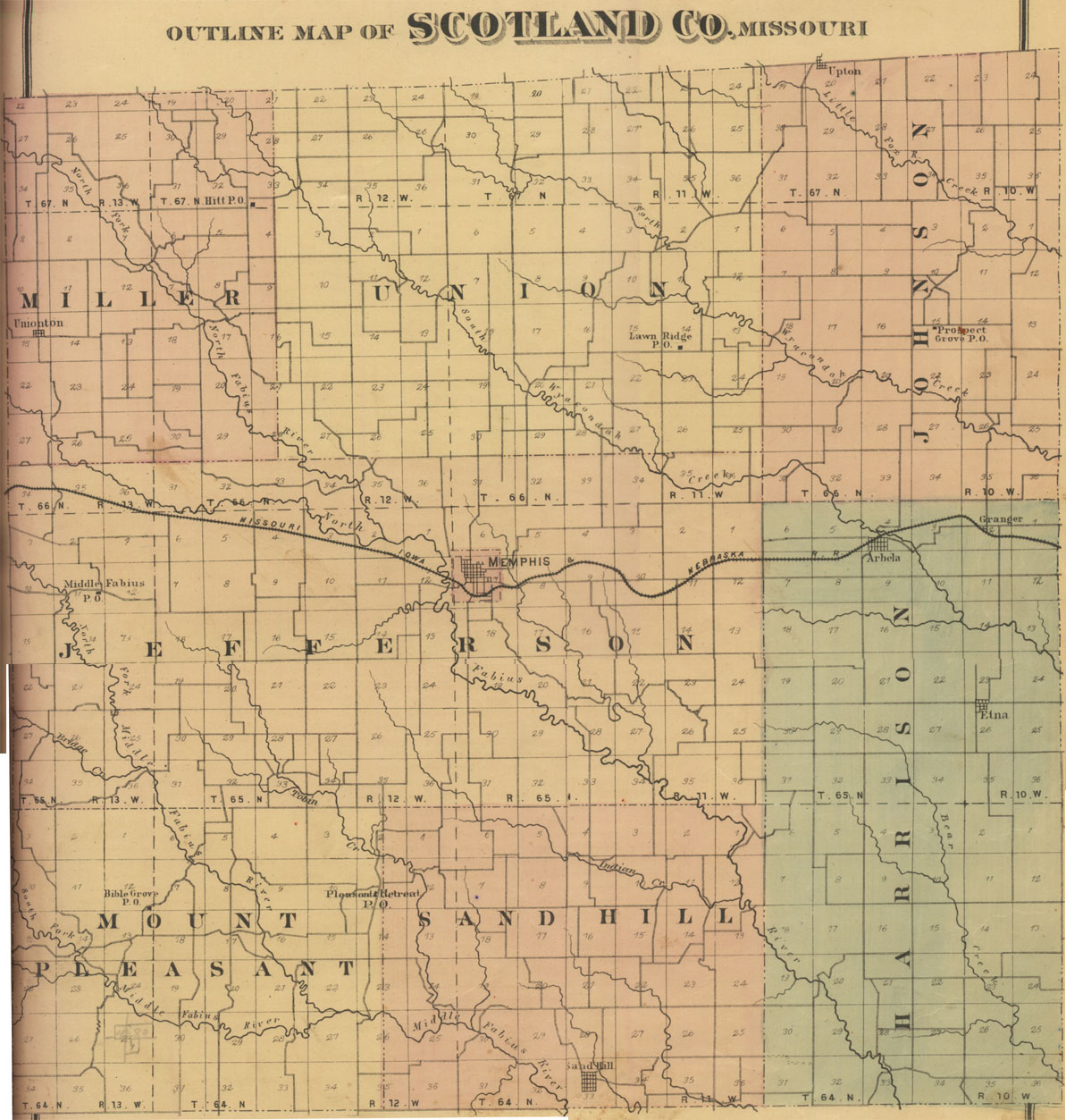
The thumbnail maps shown below are arranged so that, if put together, they would represent all of Scotland County, Missouri.
The top map is of the entire county. Feel free to browse all the maps, but if you know the part of the county where your ancestors lived, you may want to look at this map first. Locate the area you are interested in and then identify the township and range involved. You can then identify the numbered map, from the Township and Range lines shown on the county map. You should be advised, however, that the county-wide map is from the 1876 plat map set. I am including it to help you identify the individual map you should look at since it has the Townships and Ranges and the location of the towns. While the Townships and Ranges did not change, in some cases the towns may not have even existed in 1858.
The numbered maps which follow the county map are arranged such that the upper left hand map (Map 1), represents the northwest corner of the county, and the lower right map (Map 16), represents the southeast corner of the county. The Township and Range lines of each of the maps is listed as well. It's like a grid. Townships number up from the south with Townships 64, 65, 66 and 67 and the Ranges number from right to left, with Ranges 10, 11, 12 and 13.
Place your cursor over any one thumnail map and click, you will be taken to the corresponding full scale map. In addition, if you'd like to look at a map with even greatly detail, there is a link under the thumbnail map for a really big map. While the detail is much finer, the size of these maps is huge. Depending on your browser configuration, your computer may choke on these big maps.
Note: These maps are likely larger than your screen. I'm sorry about that, but when I tried to reduce them to screen size, they were simply not readable.
If you are interested in understanding how this survey stuff works, take a look at this page. I think it will help you understand plats.
A great Surname Index has been created by Jim Thomas and can be found by clicking on the index link directly below: Surname Index Here
Click here for BIG Map |
Click here for BIG Map |
Click here for BIG Map |
Click here for BIG Map |
Click here for BIG Map |
Click here for BIG Map |
Click here for BIG Map |
Click here for BIG Map |
Click here for BIG Map |
Click here for BIG Map |
Click here for BIG Map |
Click here for BIG Map |
Click here for BIG Map |
Click here for BIG Map |
Click here for BIG Map |
Click here for BIG Map |
Page last updated February 12, 2001


