|
The
source of the maps currently available on this web site is:
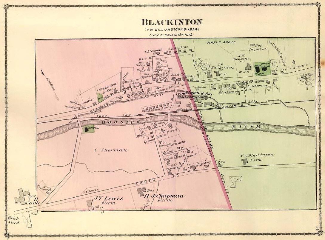
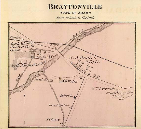
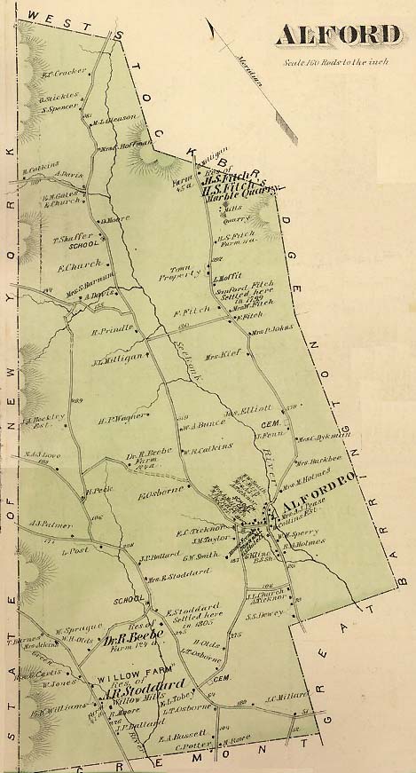
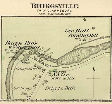
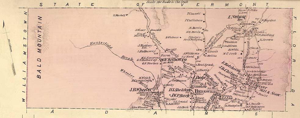
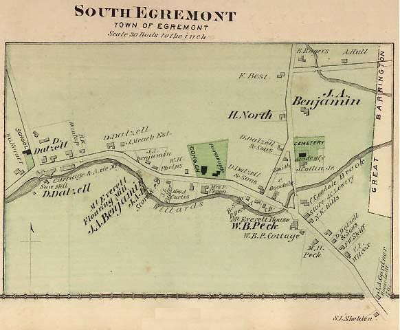
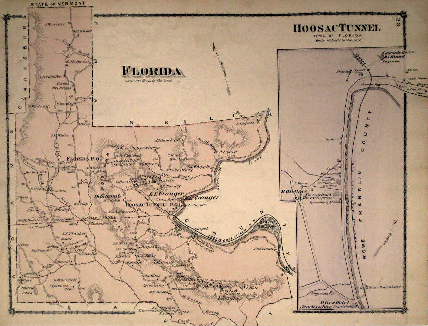
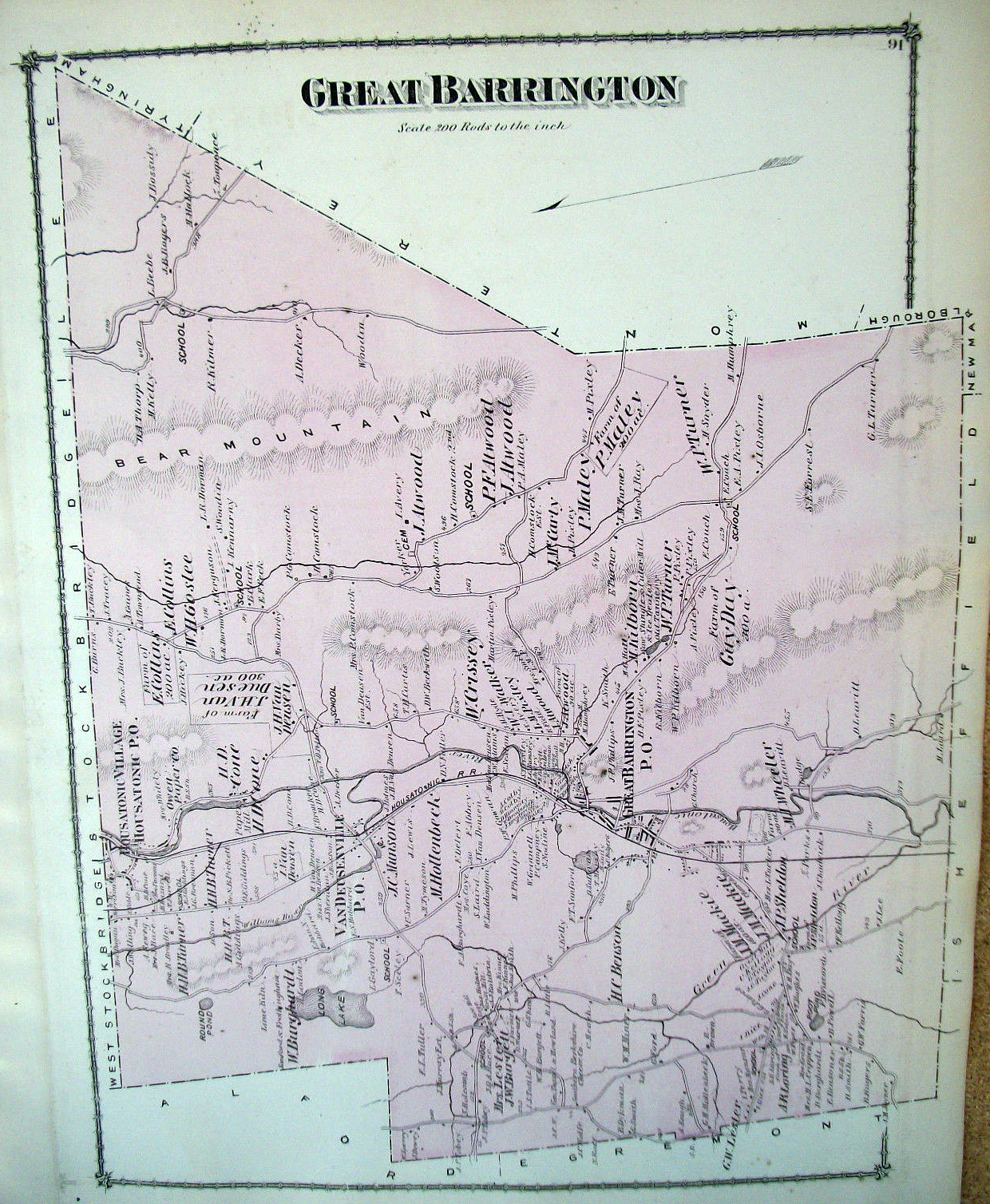
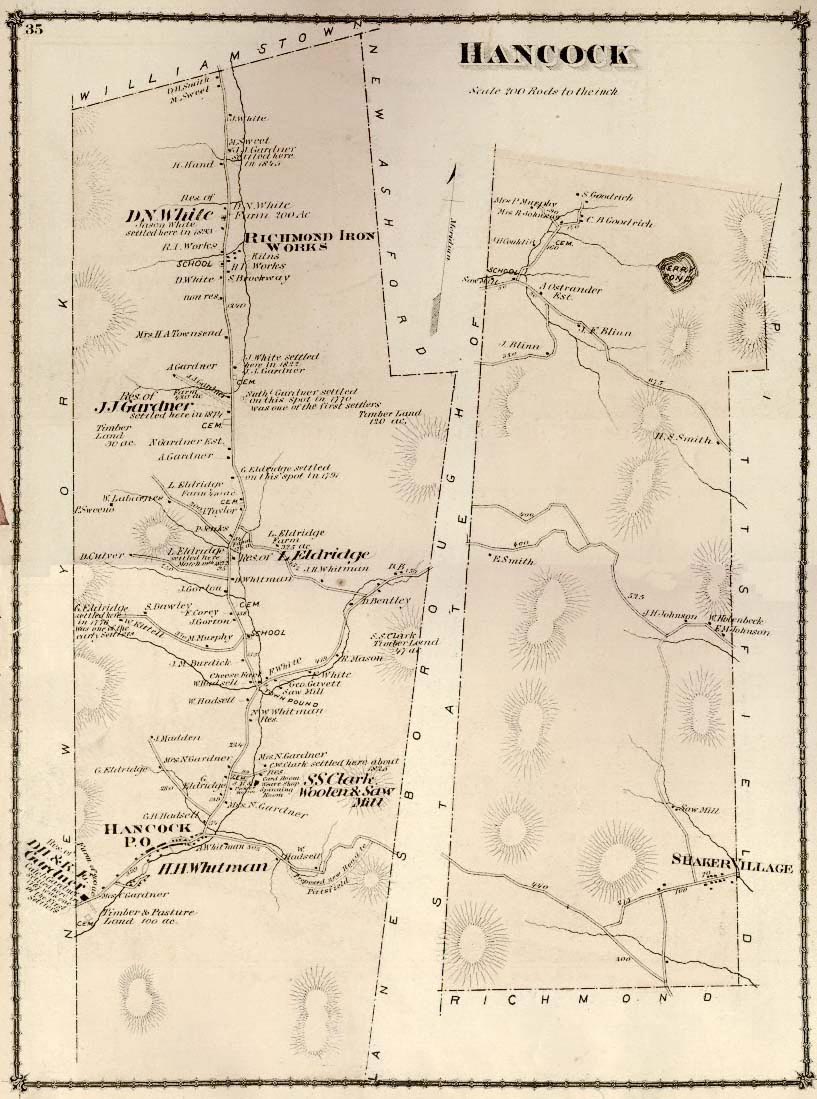
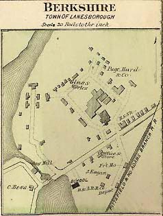
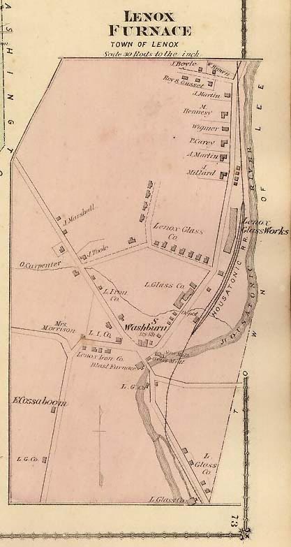
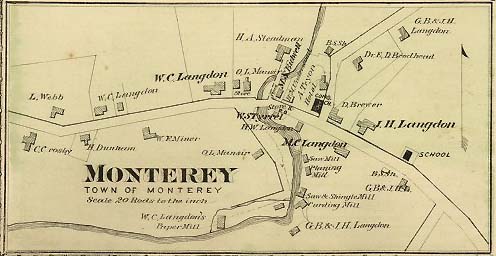
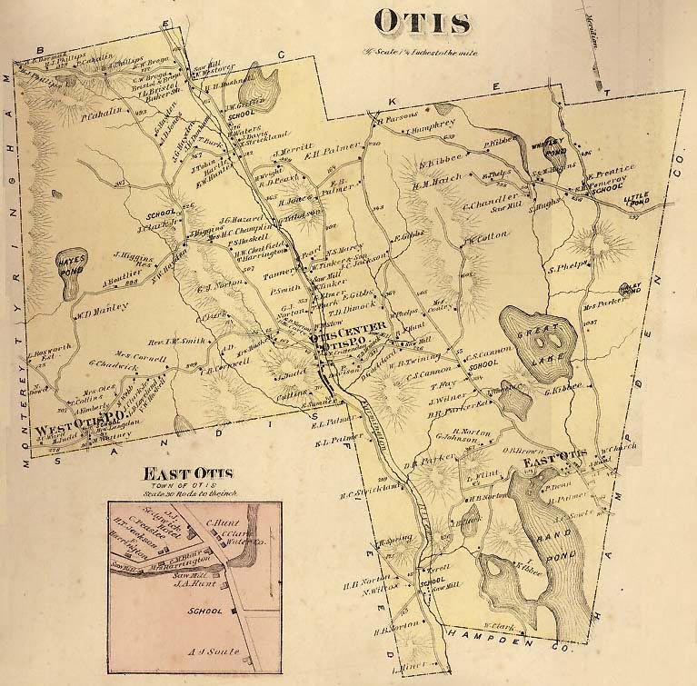
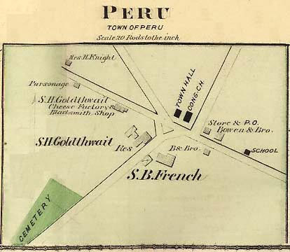
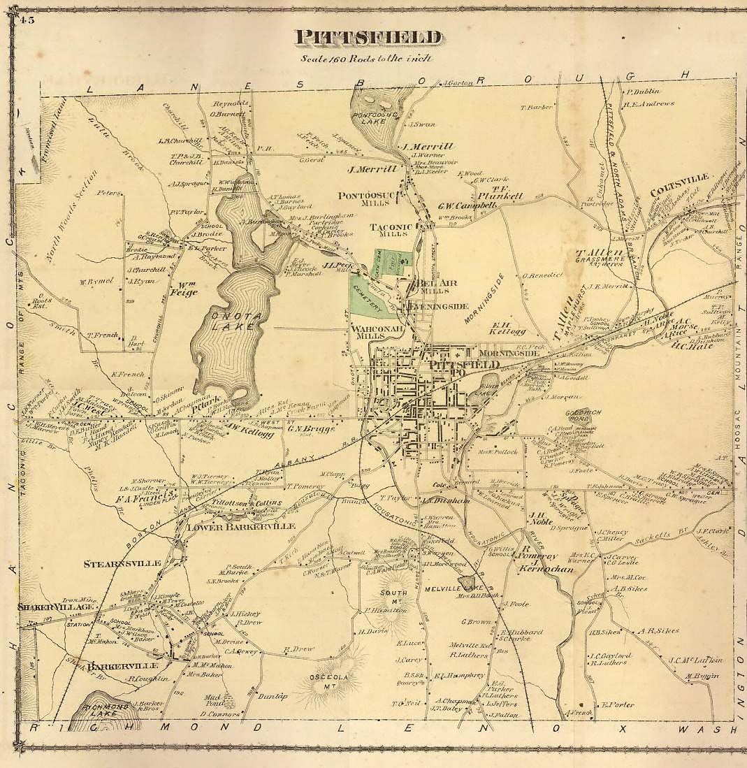
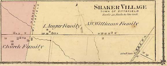
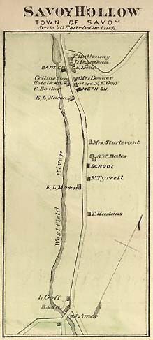
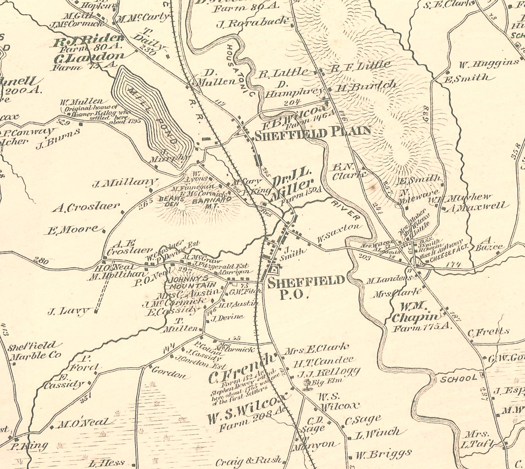
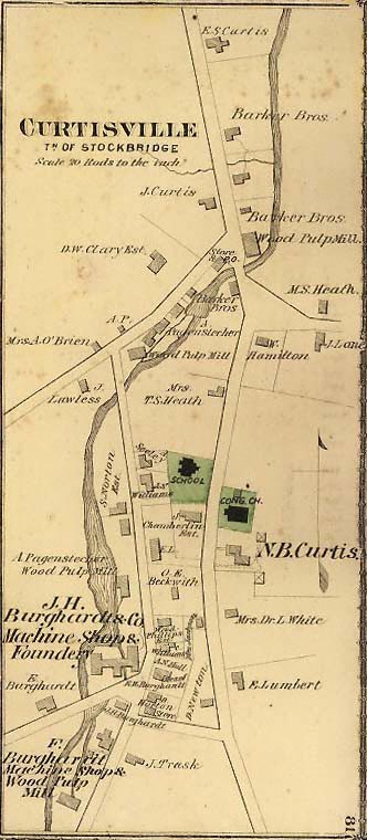
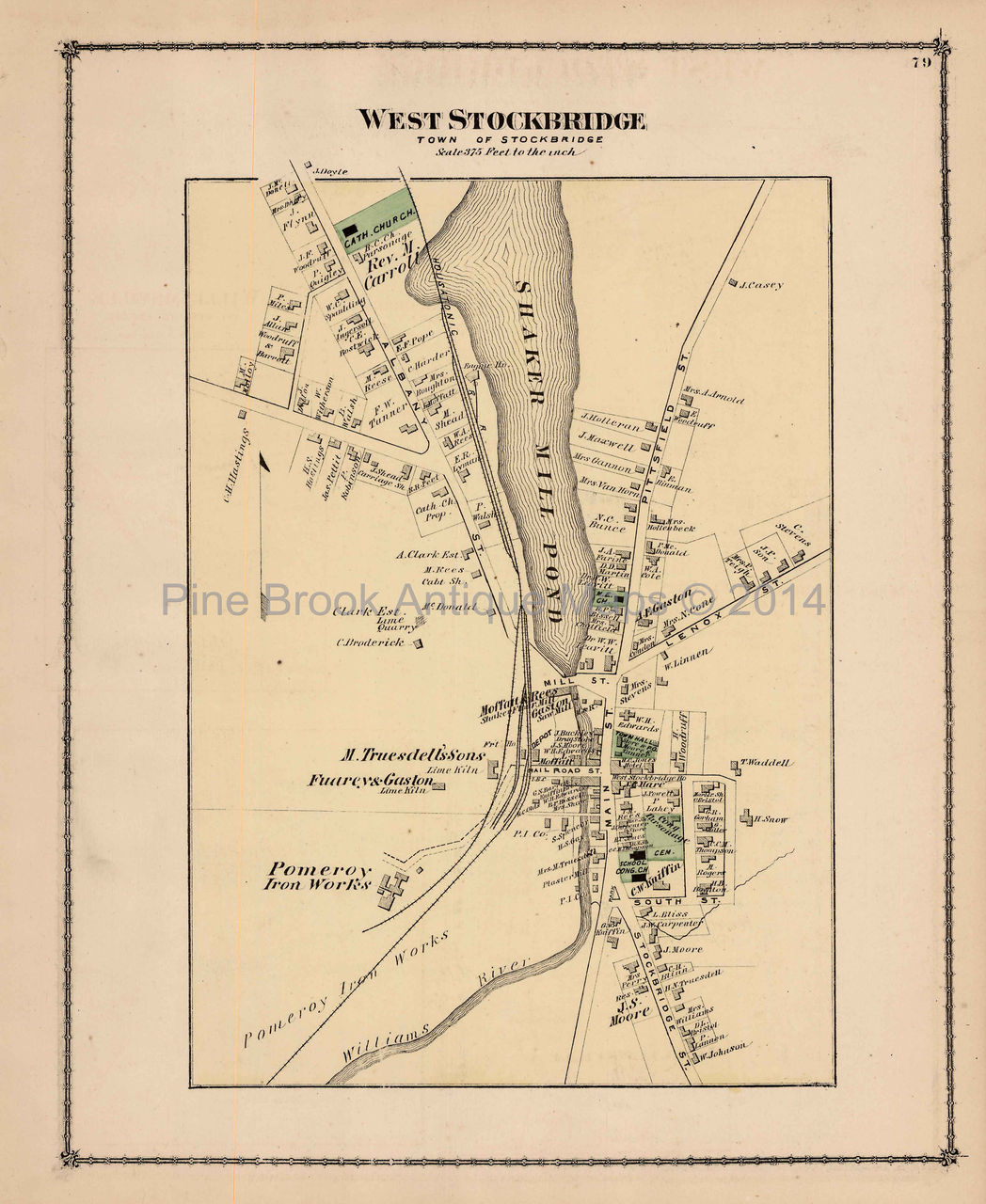
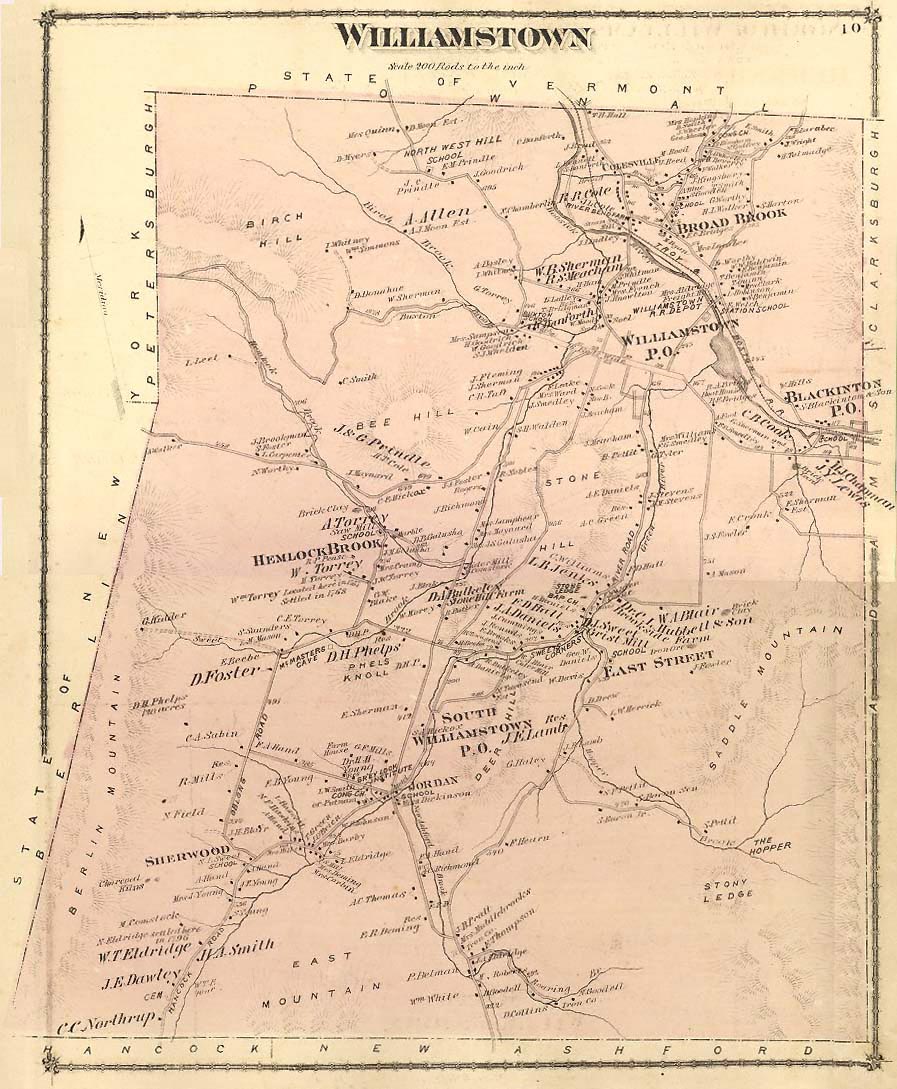
"County
Atlas of Berkshire, Massachusetts. From actual
survey by and under the Direction of F. W. Beers, Published by
R. T. White & Co., 36 Vesey Street, New York, 1876."
The
maps have not been resized, with some as small as four by six inches
and others as large as twelve by eighteen. Most maps show names
of industries and property owners. I have provided these
maps in both JPEG and Acrobat (PDF) format (file size for each listed).
The Adobe Acrobat format is well worth the free download
of the Acrobat Reader because
it allows you to zoom in on specific areas within the image.
This does not represent the complete atlas, more maps will be
added as time permits. Use the back button on your browser
to return to this page.
|