| Magoffin County Formation Maps |
|
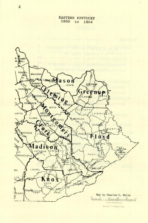
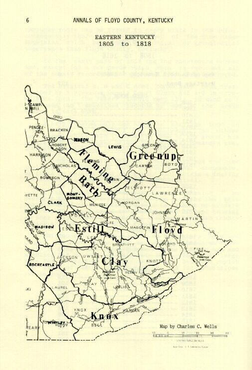
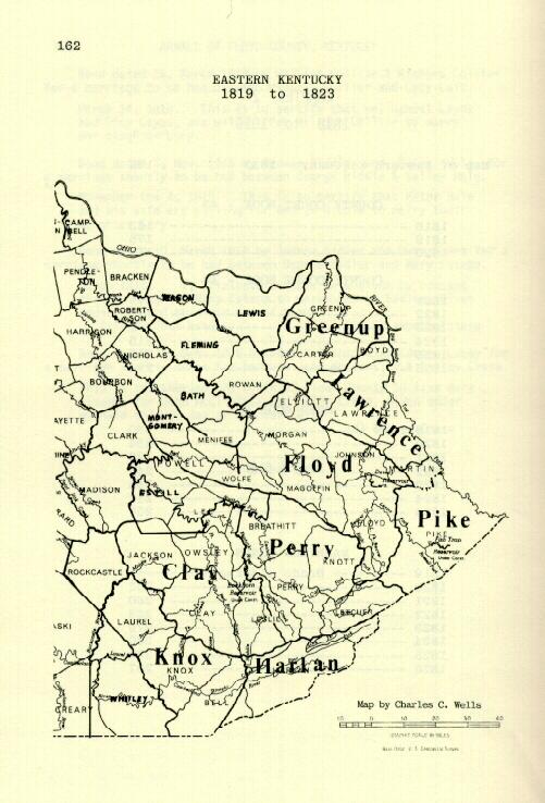
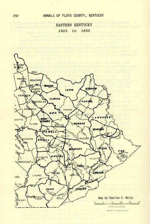
Use of the following maps of Eastern Kentucky Counties has been graciously permitted by Charles C. Wells from "Annals of Floyd County, Kentucky 1800-1826" & "Kentucky Archives Johnson County Vital Statistics 1843-1904." Both resources may be purchased from Mr. Wells by writing to him at P. O. Box 590, Paintsville, KY 41240. Cost for "Annals of Floyd County, Kentucky 1800-1826" is $26.95 postpaid; cost for "Kentucky Archives Johnson County Vital Statistics 1843-1904" is $24.95 postpaid. Many thanks to Mr. Wells for allowing us to use his maps! Source: http://www.usgwarchives.net/maps/kentucky/
|
|
Contacts
|
|


 Copyright © 2015 - Magoffin County, KYGenWeb site, and it's contributors. All rights reserved. This information may be used by libraries, genealogical societies and personal researchers; however, commercial use of this information is strictly prohibited without prior permission of the owners. When copied for non-commercial use, this copyright notice must appear with the information. |