Rice County Cemeteries
|
Cemetery |
Township |
Sect |
Twp
Map |
Location |
| Un-named Cemetery |
Center |
10 |
MAP |
SW of Lyons |
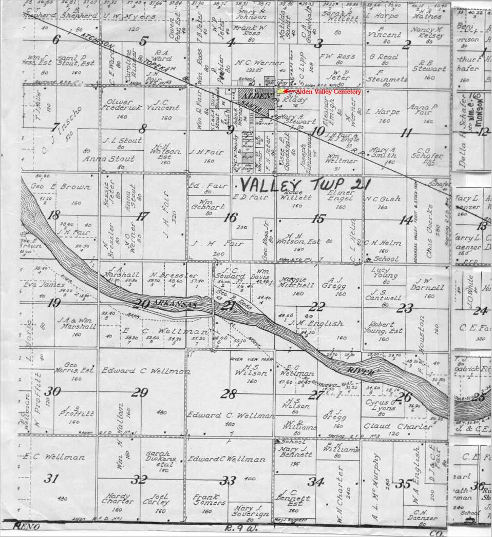
| Alden Valley |
Valley |
21 |
MAP |
Corner of Avenue T &
Klady St. Alden, KS |
| Bean |
Union |
8 |
MAP |
Corner of Ave I & 27th
Rd
Little River, KS |
| Bushton |
Farmer |
2 |
MAP |
Corner of Ave B & 6th Rd
Bushton, KS |
| Click |
|
|
|
Crawford |
| Ebenezer UM |
Lincoln |
24 |
MAP | NW of Lyons, KS |
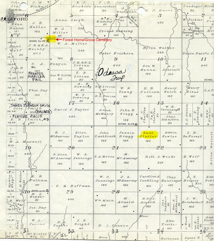
| Forest Home/Grove |
Odesa |
7 |
MAP | 7.5 miles north of Little River |
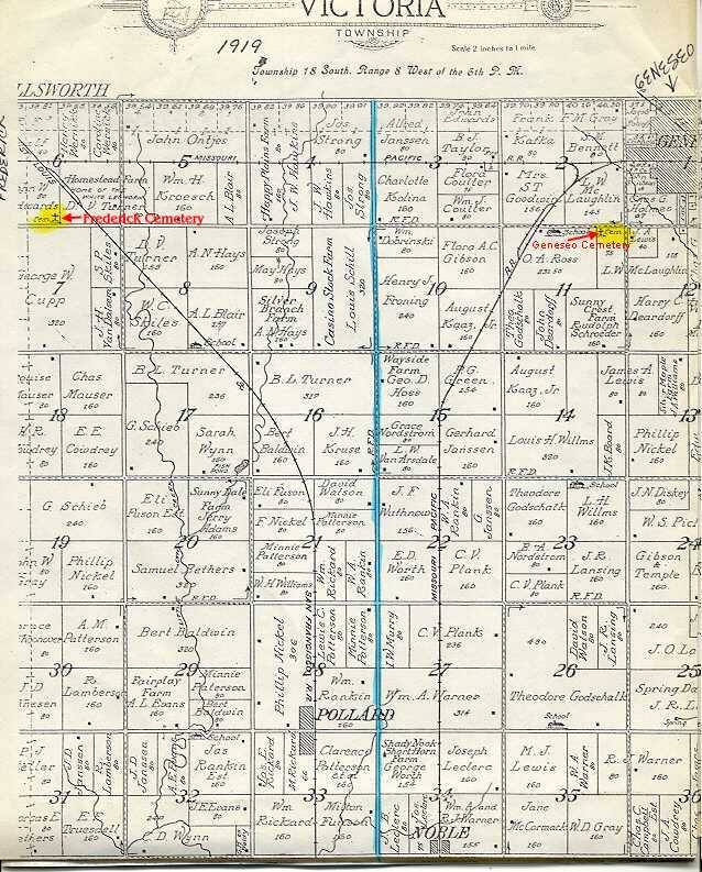
| Frederick |
Victoria |
6 |
MAP | East of Frederick |
| Geneseo |
Victoria |
11 |
MAP |
Geneseo |
| Hayes |
|
|
|
Little Salt Marsh |
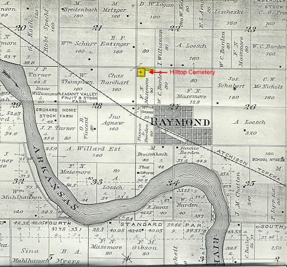
| Hilltop |
Raymond |
27 |
MAP |
Located 1/2 mile
west & 1/2 mile N of Raymond, KS |
| Immanuel |
|
|
|
Raymond |
| Kansas Center |
|
|
|
Geneseo |
| Lindell-Reiley |
Rockville |
11 |
MAP |
SE of Lyons |
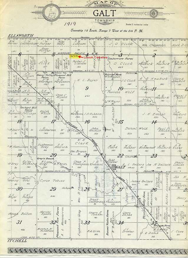
| Liscum |
Galt |
4 |
MAP |
Crawford |
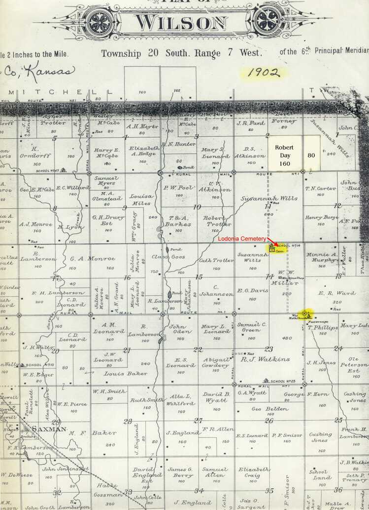
| Lodiana |
Wilson |
14 |
Map |
NE of Saxman, KS |
| Lyons Municipal/Graceland |
Harrison |
31 |
MAP |
North of Lyons, KS |
| McNames |
Lincoln |
22 |
MAP
|
NE of Chase |
| Old Cain City |
|
|
|
NW of Bushton |
| old church cemetery |
Farmer |
23 |
MAP |
SW of Bushton |
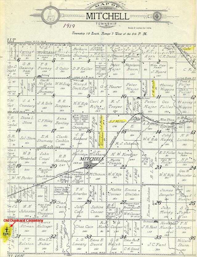
| Old Dunkard |
Mitchell |
31 |
MAP |
E of Lyons |
| Old Lutheran |
Pioneer |
28 |
|
NW of Chase |
| Rice County Poor Farm |
Atlanta |
6 |
MAP |
1 1/2 mi west of Lyons |
| Rockville |
Rockville |
11 |
MAP |
East of Lyons, KS |
| St. Mary's Catholic |
|
|
|
S edge of Chase, KS |
| Salem-Friedhof |
|
|
MAP |
Chase NW |
| Shumway |
Harrison |
20 |
MAP |
Lyons NW |
| Springdale |
Lincoln |
28 |
MAP | Chase |
| Sterling |
Sterling |
16 |
MAP |
NE edge of Sterling, KS |
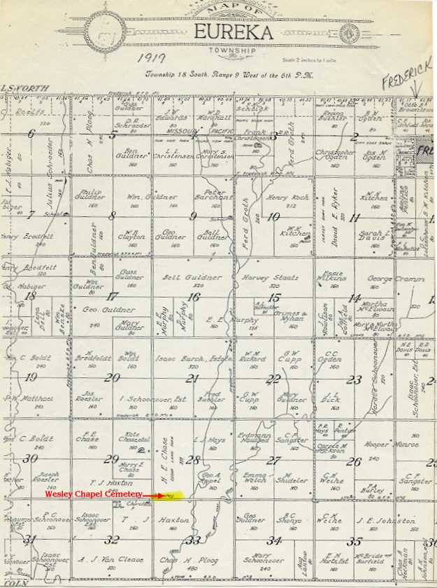
| Wesley Chapel |
Eureka |
29 |
MAP |
Located SW of Frederick, KS |
|

